![]()
![]()
![]()

Trip 184 - May 19, 2020 (Tuesday) & June 29, 2023 (Thursday)
Jones Lake WEST Forest Service Road
To Jones (Wahleach) Lake
Near Hope BC Canada
Page 2 of 2
Distance to Jones Lake WEST FSR From Vancouver: Approximately 137 kilometers via Highway 1 East, Laidlaw Road, and Jones Lake FSR. Take Exit 153 (Laidlaw Rd / Jones Lake), then drive for 1.1 kilometer to the start of the FSR.
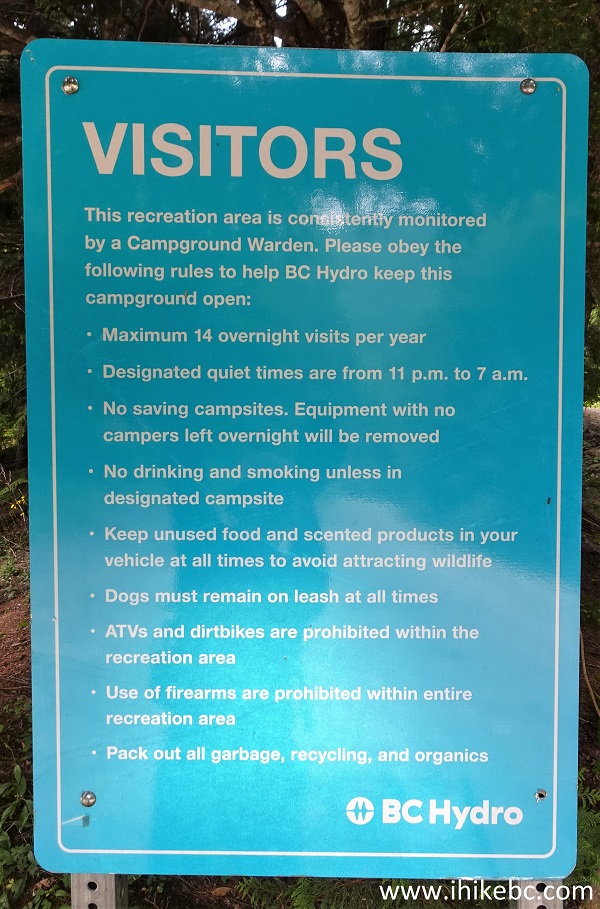
Liked: Good FSR condition (at least until the 3.16 km mark), Jones Lake views, BC Hydro campground (pit toilet, garbage can), mountain views, no bugs.
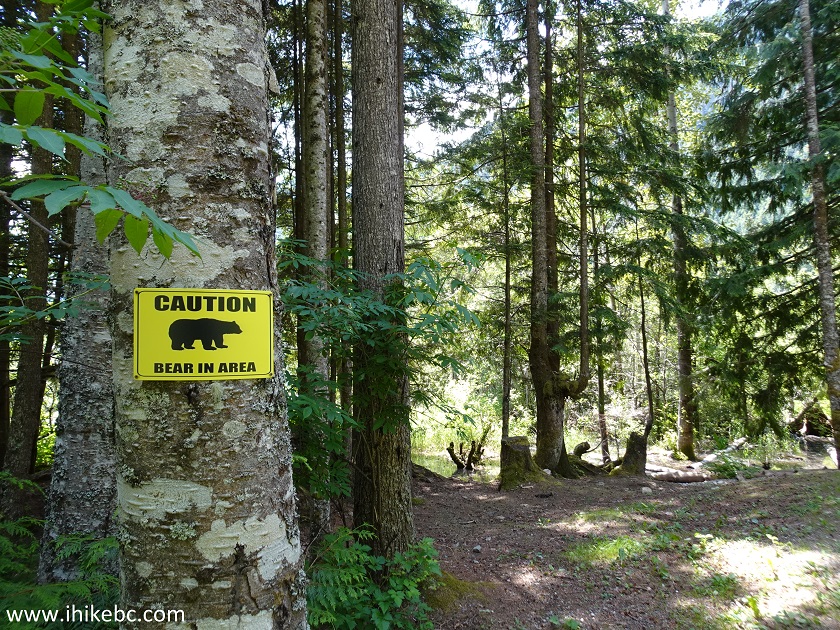
Of Note: BC Hydro Jones Lake campground is on a first come first served basis and is likely to be full in the summer more often than not. Bear presence likely in the area of the campground. Extensive logging activity on Jones Lake and Jones Lake West FSRs.
Vancouver, Coast & Mountains BC Backroad Mapbook (2nd edition)
FSR Coordinates: Page 5 (Chilliwack Lake) B1-C2-C3.
Related websites:
Wahleach (Jones) Lake - Wikipedia,
BC Hydro Jones Lake Recreation Areas.
Other Trips in Hope BC Area: Thacker Mountain Trail, Flat Iron Peak Trail, Needle Peak Trail, Sowerby Creek FSR Hike, Dog Mountain Trail, Yak Peak Trail, HBC Heritage Trail, Sowaqua Creek FSR, Zoa Peak Trail, Skagit River Trail, Skyline II Trail Hike, Silver Skagit Road, Mount Outram Trail, Othello Tunnels, Eaton Lake Trail, Mount Hope Lookout Trail, Town of Hope BC.
Other Forest Service Roads Trips: Chehalis (by Harrison Mills), Chilliwack Bench, Chilliwack Foley, Chilliwack Lake, Chuchinka-Colbourne (North of Prince George), Clear Creek (off Harrison East), Florence Lake (access to Stave Lake by Mission), Harrison East, Harrison East Second Trip, Harrison West, Lost Creek (by Mission), Lost Creek (by Mission), Mamquam River (by Squamish), Nahatlatch (near Boston Bar), Parsnip West (near Mackenzie), Scuzzy (by Boston Bar), Shovel Creek (off Harrison East), Sowaqua Creek (by Hope), Squamish River Main, Squamish River Ashlu, Squamish River E-Main, Squamish River FSR Washout, Windfall Creek (by Tumbler Ridge).
Follow @ihikebc Tweet
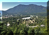
Jones Lake Forest Service Road is located close to the town of Hope, and leads to a picturesque Jones (Wahleach) Lake. There are two BC Hydro campgrounds by the lake (closed due to coronavirus COVID-19 during our visit), as well as several non-regulated camping spots right by the lake. The road is very rough, with numerous deep potholes. It is also fairly steep for the first 6.5 kilometers. It’s a good thing, in a way - otherwise, this place, so close to the Lower Mainland, would be simply overrun with people, while now only those brave enough to tackle this road can make it to the lake.
Aside from the BC Hydro campgrounds, there are also some residences near the lake. It takes 7.5 km to get to the first campground, and just over one kilometer more to get to the second one. After that, starting at about the 10 km mark, there are several good unregulated lake access points, with fine, if rocky, camping areas. Mountain views are all around. Some garbage may be present to taint an otherwise idyllic camping environment.
A washout at the 11.6 km mark of Jones Lake FSR is only passable in ATVs and short wheelbase high-clearance 4x4 vehicles, but more erosion is inevitable due to the active water flow. October 2023 Update: the washout has been fixed, and the road is now passable much further.
Zero your odometer at the Jones Lake FSR sign seen
in photo #5, if you want to follow the table of the points of interest.
There are good mileage markers too, but they are off by 200-400 meters
(too late).
| KM | Feature | Side |
| 0.7 | FSR | L |
| 1.5 | Gated Road | R |
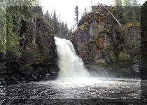
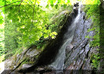
| 2.4 | Small waterfall (photo #10 below) | L |
| 2.6 | T-Junction: Lorenzeta FSR (L), Jones Lake FSR (R) | S |
| 3.7 | FSR | L |
| 4.0 | Small bridge | S |
| 5.9 | FSR | L |
| 6.3 | Small waterfall (mostly obstructed by vegetation) | L |
| 6.6 | FSR | L |
| 7.5 | Jones Lake West FSR & BC Hydro Recreation Area #1 (THIS PAGE) | R |
| 8.6 | FSR | L |
| 8.9 | BC Hydro Recreation Area #2 | R |
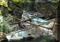
| 9.0 | Bridge | S |
| 9.1 | Jones Lake East FSR (gated) | L |
| 10.0 | Several unregulated lake access points begin | R |
| 10.6 | FSR | L |
| 11.6 | Washout | S |
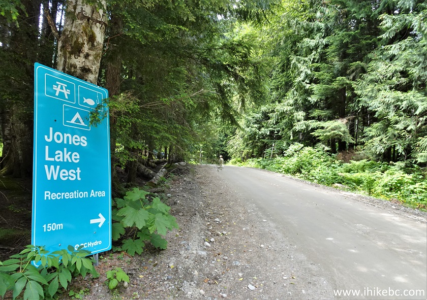
36. We are back on June 29, 2023, to check out now open Jones Lake West FSR and BC Hydro Campground (West Recreation Area). This split is at 7.5 km of Jones Lake FSR, and this is the same photo as #17b on the previous page.
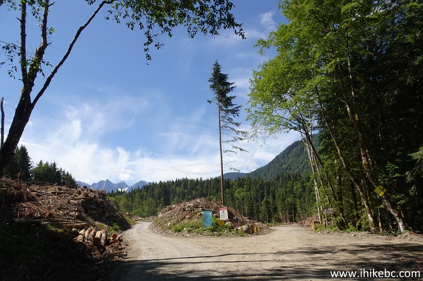
37. Jones Lake West Forest Service Road starts on the right side.
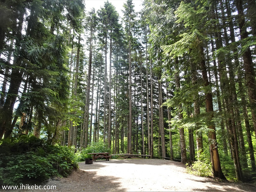
38. Jones Lake West FSR is in decent shape, with no steep hills. At 420 meters from the split here.
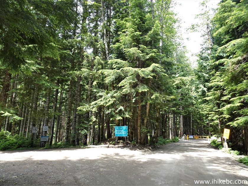
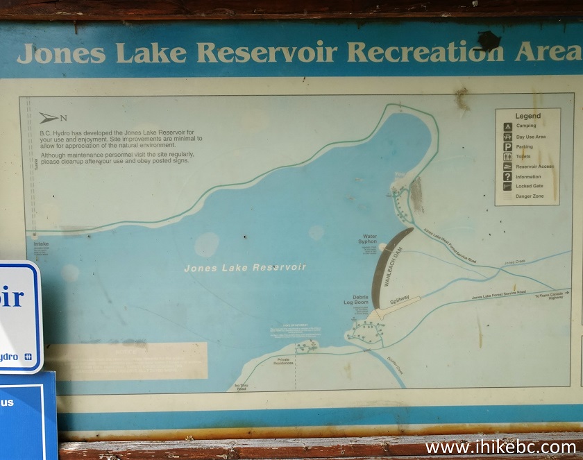
39. At 1.21 km, we are at another split. This is the beginning of BC Hydro Jones Lake West Recreation Area (campground).
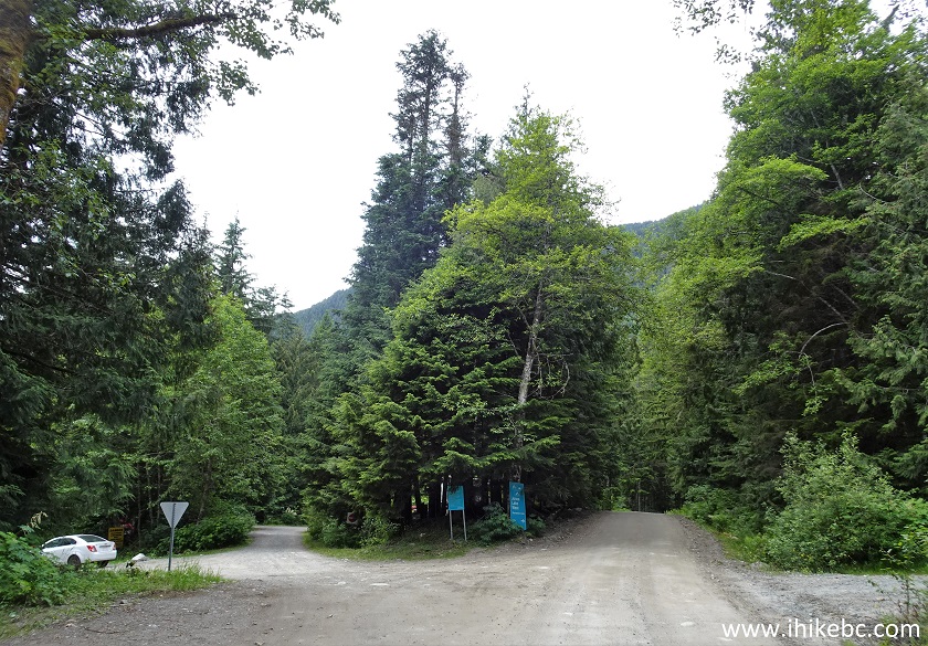
40. The rules of the place.
41. There is a spillway to the left of the split. It was closed during our visit.
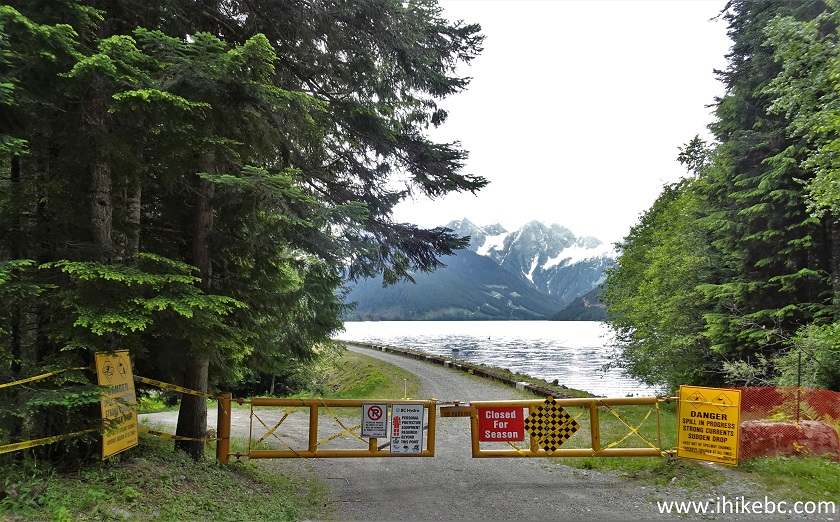
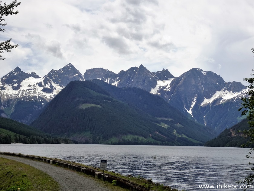
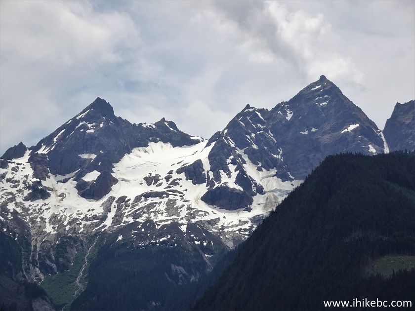
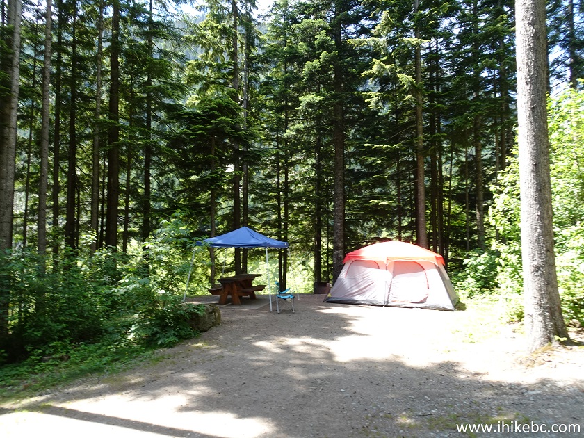
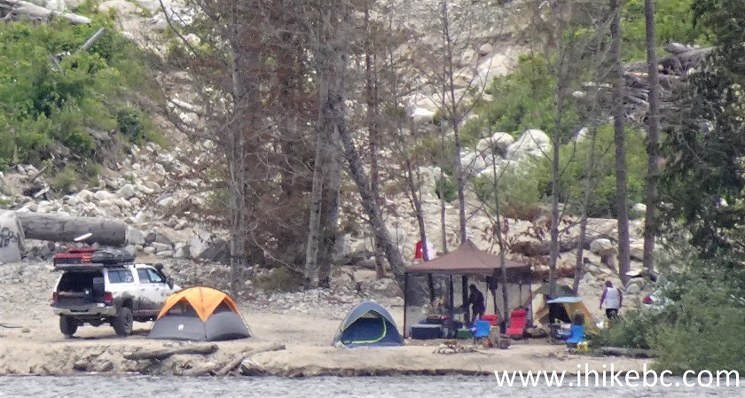
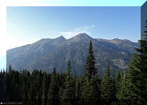
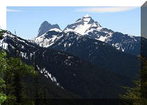
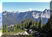
42-43. There is a fine mountain view behind the gate. A bit of a zoom followed by a lot.
44. A sign indicates that Jones Lake West Recreation Area is very close.
45. Here it is. Yet another split makes it possible to either hike (or bike) on Jones Lake West FSR past the locked gate, or make a left turn and reach camping spots and a boat launch area. Coordinates: N 49⁰15.208’ W 121⁰36.598’. Elevation: 680 meters.
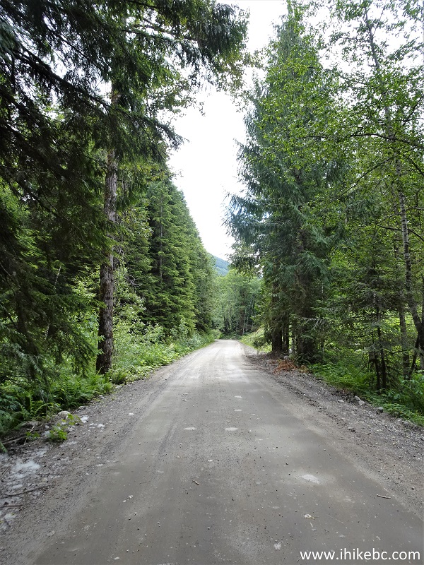
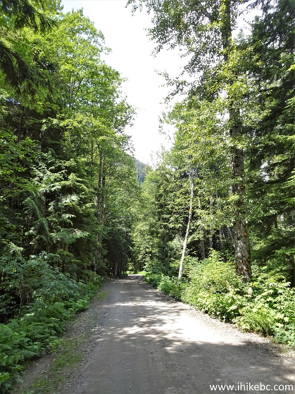
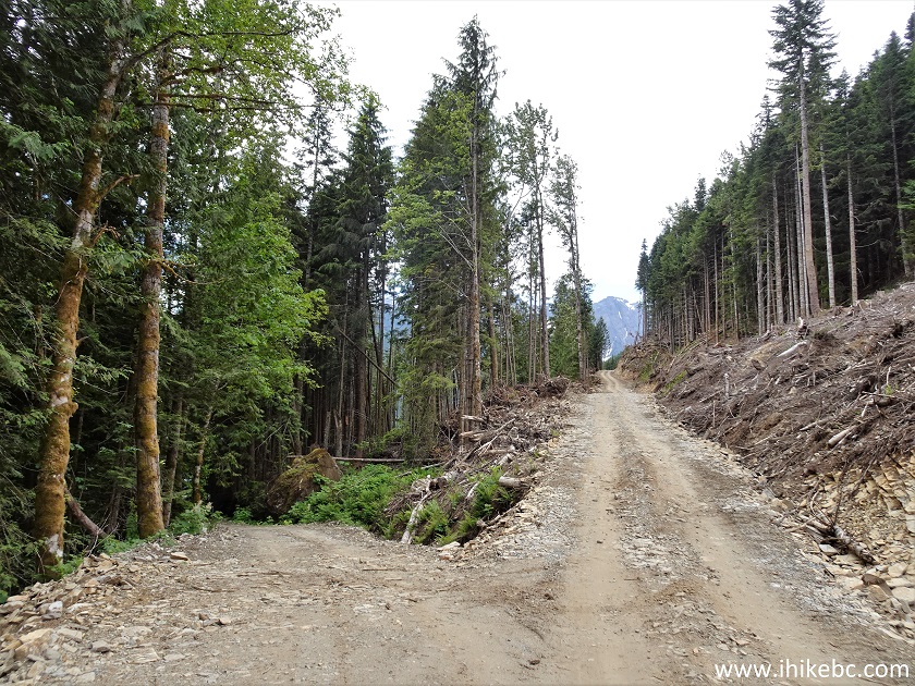
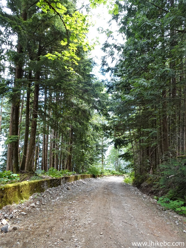
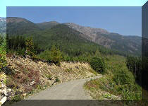
46. A camping spot across from the split. None of the spots appear to have a lake view. If you want to camp with a lake view, continue on Jones Lake FSR (taking a road on the left at the split seeing in photo #36), and you will get there.
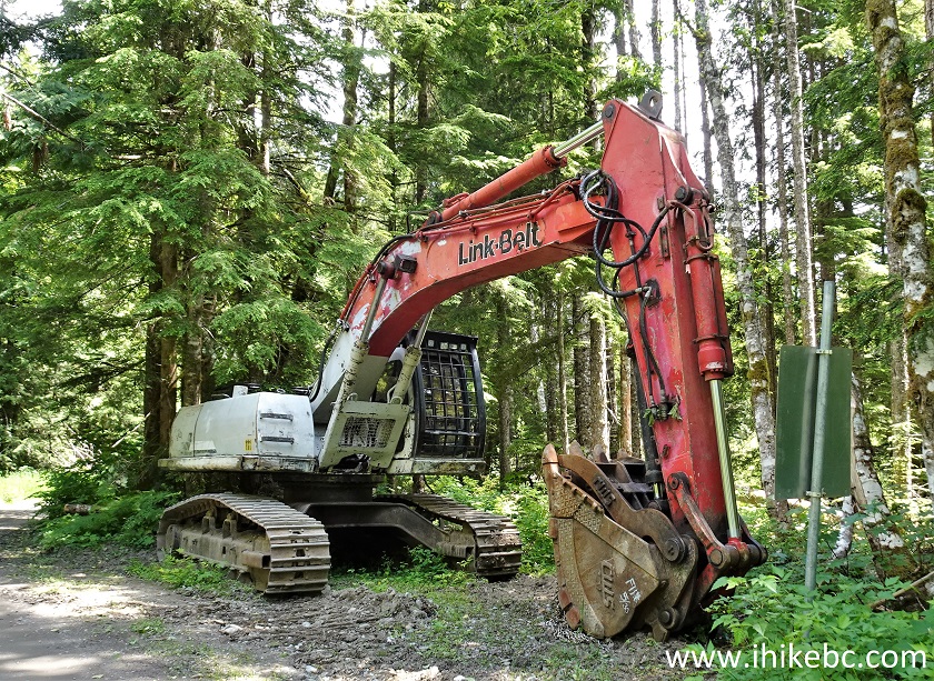
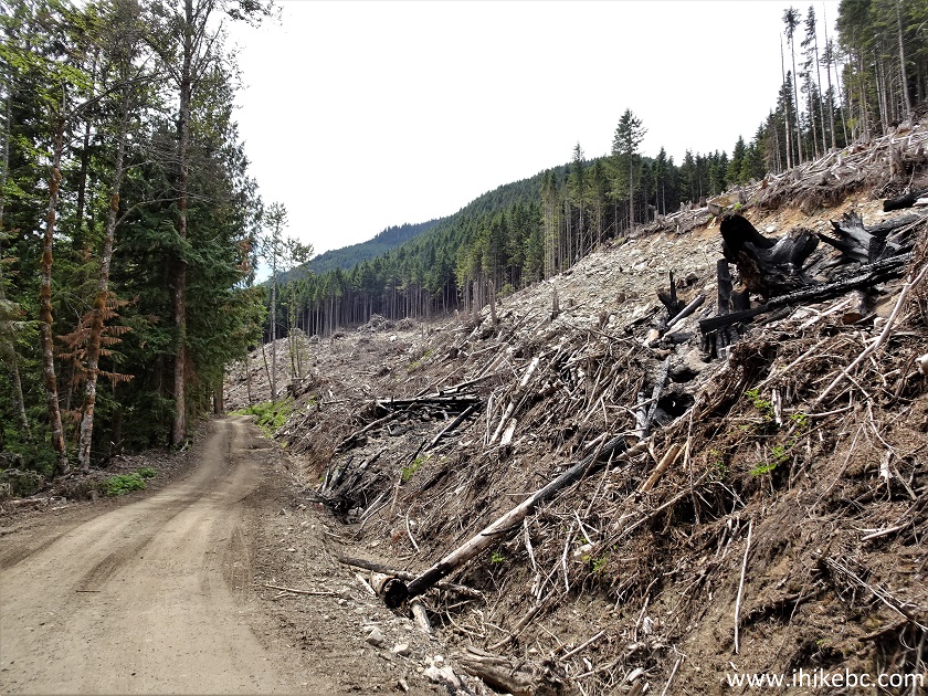
47-48. We made a left turn at first, and got to a boat launch area. There is an info stand there with a map. A pit toilet and a garbage can are located nearby.
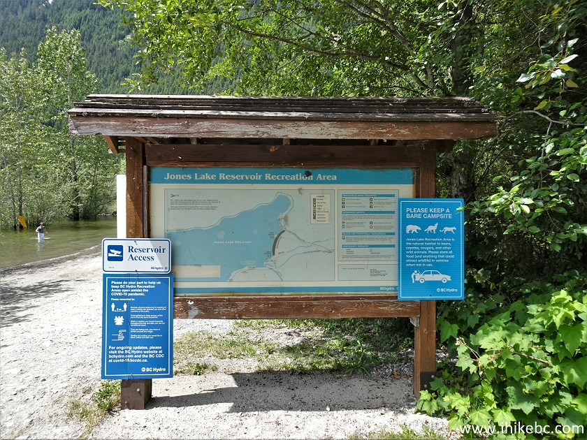
49. A boat launch is behind the info stand.
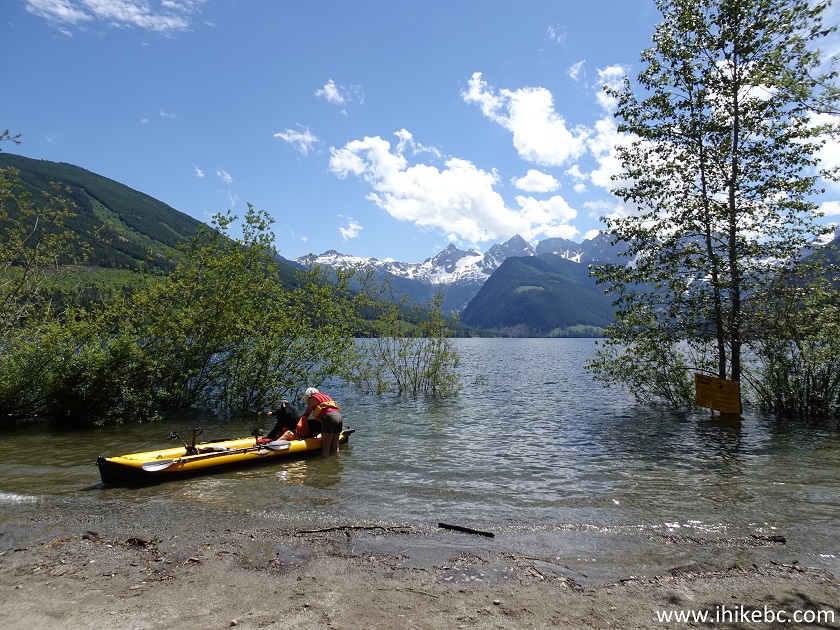
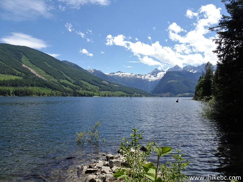
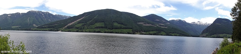
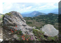
50. Campers like it here.
51. And so do bears.
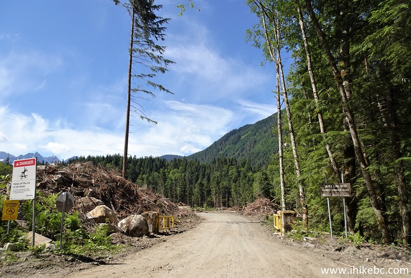
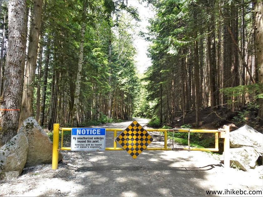
52. Now it's time to check out the rest of Jones Lake West FSR. It's 3.16 km from this locked gate (same gate as seeing on the right side in photo #45) until a note prohibiting further access without permission due to an active worksite. We did hear some worksite-related sounds and met a pickup truck with four workers, so something is definitely going on there. All the following distances are from this gate, are based on a GPS odometer, and are approximate.
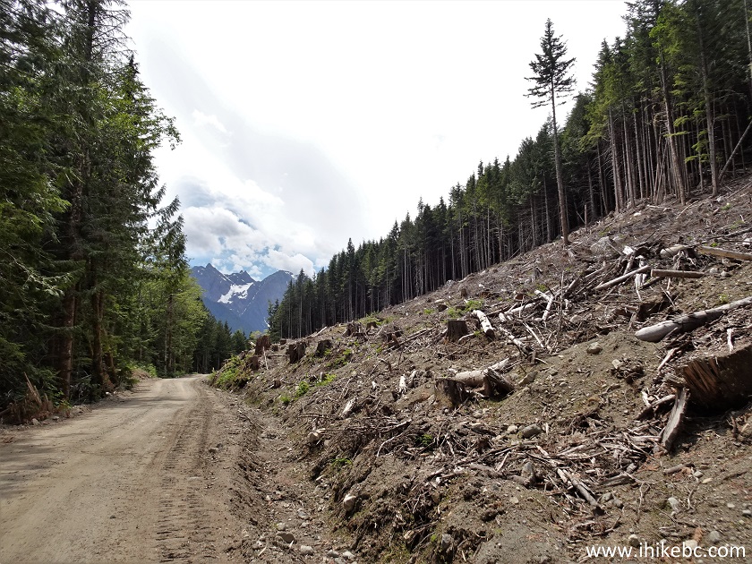
53. Jones Lake West Forest Service Road is just as good after the gate as before - rather smooth, with few potholes, and no steep stretches. Not even a cross ditch. At 190 meters from the gate here. We biked all the way.
54. There are many logged areas along Jones Lake West FSR, and a few pieces of equipment, such as this excavator.
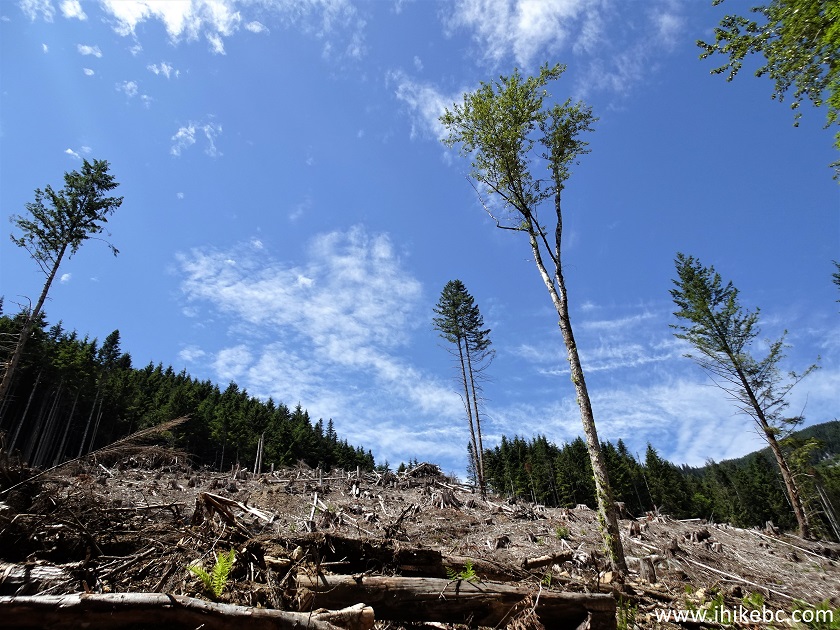
55. The road starts going by the lake at about 500 meters from the gate, and the first decent lake view appears at the 1.08 km mark.
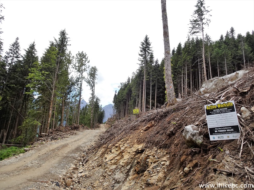
56-57. At 1.19 km, the view is quite open. Looking right, and then a panorama.
58. At 1.22 km from the gate.
59. Lots of logging here.
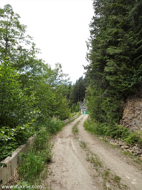
60. At 1.22 km, take a road on the left.
61. Another logged area at 2.85 km from the gate. There were two more gates after the first locked one, but they were open.
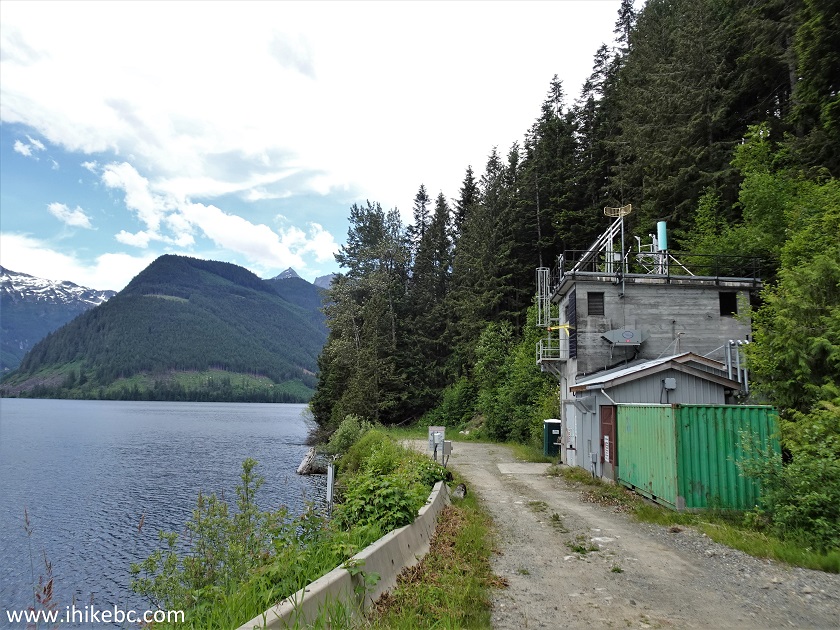
62. At 3.16 km, there is another split. Jones Lake West FSR continues straight ahead, but a notice states that permission is required to go further due to an active worksite.
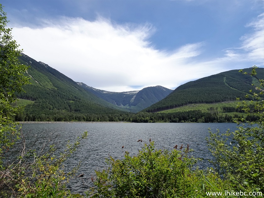
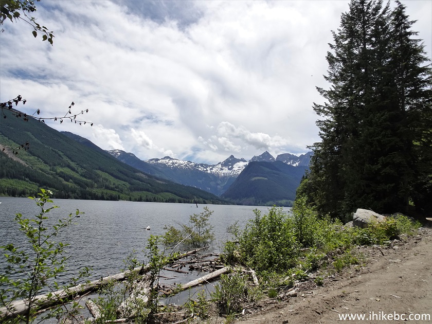
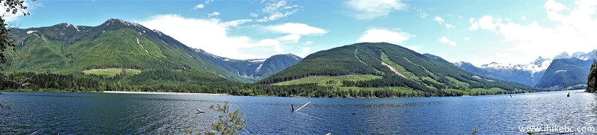
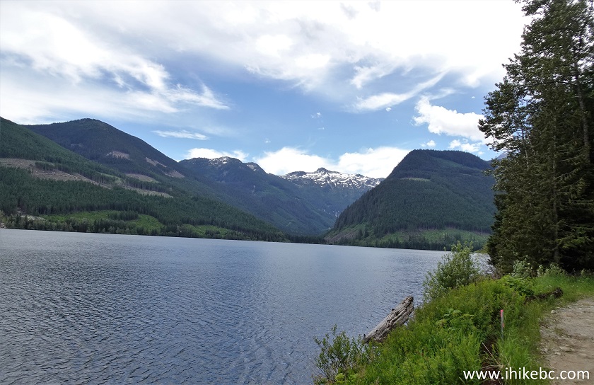
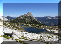
63. Here is the split, just to the left of the notice. Coordinates: N 49⁰14.008’ W 121⁰37.192’. Elevation: 655 meters.
64. How about these trees at the split.
65. We took the road on the left, and here it is at 75 meters, going down rather steeply.
66. This side road is quite short, and, at 150 meters, we are almost at the end.
67. At 250 meters, we can see the end of the road, as well as a BC Hydro facility. A porta potty is located nearby.
68-69. There is a fine view of Jones Lake from this location. Looking right followed by a panorama.
70. With much zoom, we see a wild camping spot by the lake. You would need to continue on Jones Lake FSR past Jones Lake West split to get there.
Just like Jones Lake FSR, Jones Lake West FSR leads to several good Jones Lake views, and also to a BC Hydro recreation area. Highly recommended.


|
 |
Other Trips in Hope BC Area:
|
|
|
|
|
|
|
|
|
|
|
|
|
|
|
|
|
|
|
 |
|
|
|
|
Other Trips:


![]()


ihikebc.com
Trip 184
- Jones Lake WEST Forest Service Road
(Near Hope BC)
Page 2 of 2
![]()
![]()
![]()
Follow @ihikebc
Tweet
![]()