![]()
![]()
![]()

Trip 262 - September 1, 2022 (Thursday)
Wokkpash Loop Trail (Partial)
Wokkpash Corridor Trailhead to First Waterfall (about 3.2 km out of 54 km total length)
North of Fort Nelson BC
/ Near Toad River BC
Liked: A mostly easy path, mountain and river valley views, waterfall, no bugs.
Of Note: Remote wilderness area, MacDonald Creek crossing at the beginning of the trail is required (wading, if biking or hiking). Uneven ground, rocks and roots, hiking poles and boots are recommended.
Northern BC Backroad Mapbook (3rd edition) Trailhead Coordinates: Page 80 (Steamboat) B5.
Wokkpash LOOP Trail is a 73 km-long remote Northern BC wilderness trail (19 km of it is access road to the trailhead), which begins and ends at Highway 97 (Alaska Highway). MacDonald Creek trailhead is about 150 km North of Fort Nelson, and Churchill Mine Road trailhead (via Wokkpash CORRIDOR Trail) is 7.5 km further North, closer to Toad River (which is about 34 km away, and has a gas station). It is thus possible to do a car shuttle, or 7.5 km would be added to the hike.
Today, we started at Churchill Mine Road turnoff from Highway 97, waded across MacDonald Creek 2 km later (which may not be possible in high water conditions), and then biked for another 15.5 km to Wokkpash LOOP trailhead. After that, we hiked for 3.2 km to a very fine view of Wokkpash Creek valley. There was also a cascading (if unspectacular) waterfall nearby.
Check out our previous trip report (Wokkpash CORRIDOR Trail) for directions from Highway 97 until Wokkpash LOOP trailhead, and to read the information about this trail on a board located by Highway 97.
*All trail distances are based on a GPS odometer and are approximate.
1. We are at the 15.5 km mark of Wokkpash CORRIDOR Trail counting from MacDonald Creek crossing (which itself is located 2 km from Highway 97), looking at the Wokkpash Loop parking/camping area, as well as the trailhead, located behind the information board. Coordinates: N 58°35.085’ W 124°58.568’. Elevation: 990 meters.
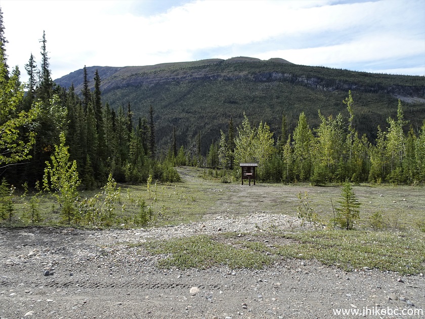
Wokkpash Loop Trail Parking Area
2. Here is the info board. A self-registration is available (though no one checks it regularly, so you are on your own).
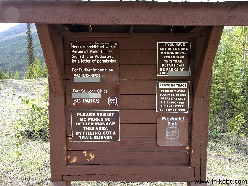
Wokkpash Loop Trail Information Board
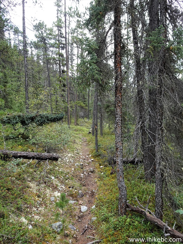
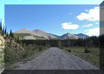
3. The hike begins. 25 meters from the trailhead.
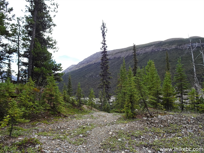
Wokkpash Loop Trail North of Fort Nelson BC Canada
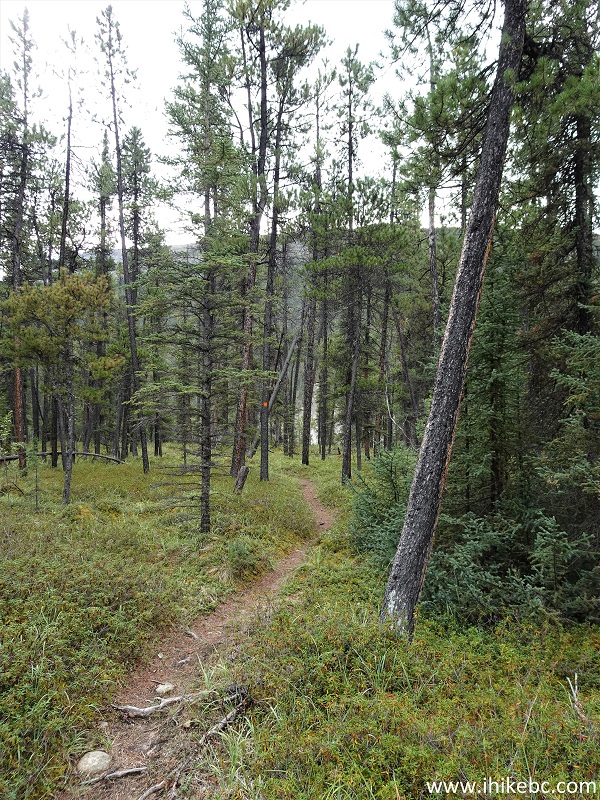
4. First, there is a rather substantial descent through the forest.
Northern British Columbia Hiking - Wokkpash Loop
Trail
5. Then, in about 100 meters, the path gets flat.
Wokkpash Loop Trail
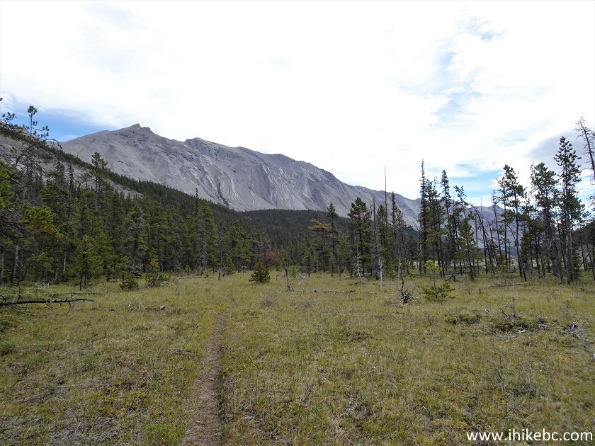
6. By 570 meters from the trailhead, we are hiking in the open.
Wokkpash Loop Trail - British Columbia Hiking
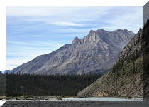
7. A fine mountain range appears on the left. At 940 meters.
Hiking in Toad River BC Area - Wokkpash Loop Trail
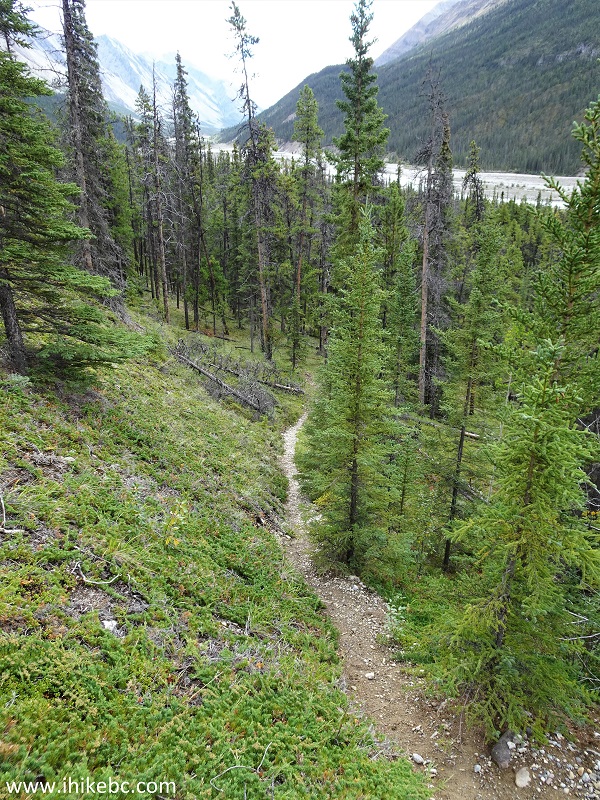
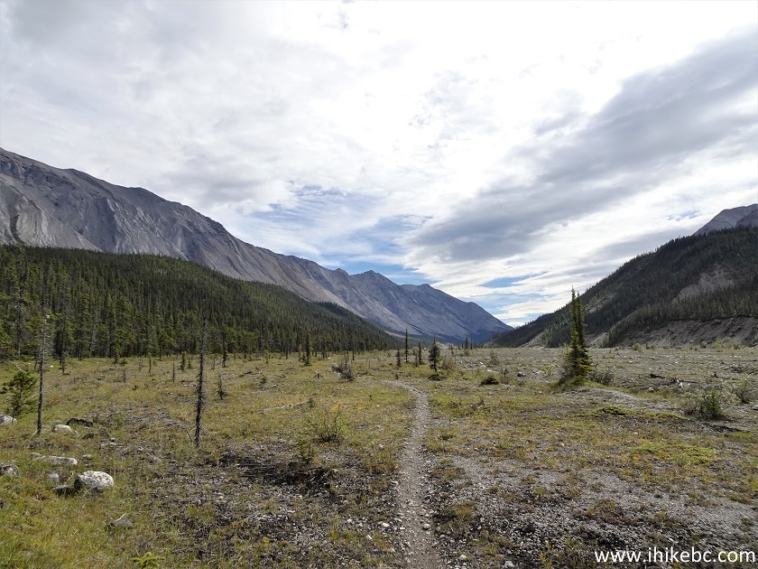
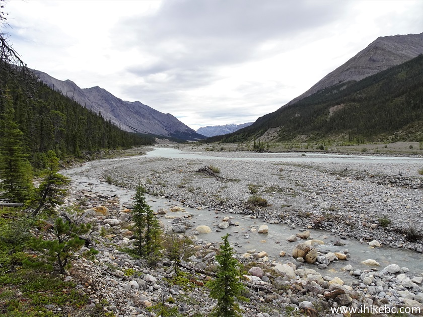
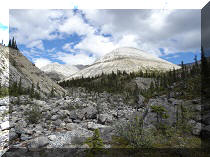
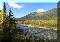
8. By about the 2 km mark, we are starting to hike along Wokkpash Creek.
Wokkpash Creek
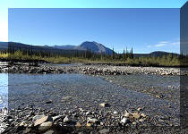
9. The trees are still here. At 2.83 km.
Wokkpash Loop Trail British Columbia Canada
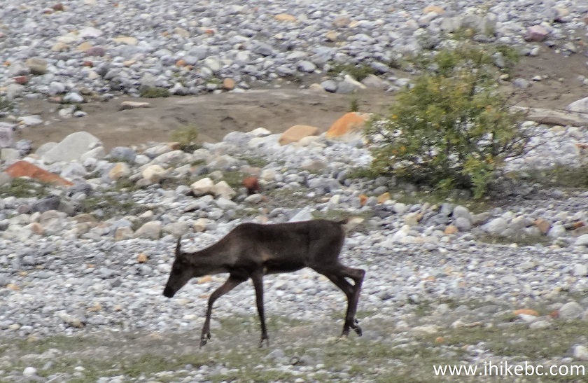
10. A caribou was jogging on the other side of Wokkpash Creek. Caribous are plentiful around here - check out the beauty we met on the way to the hike by Highway 97 - the first two photos of the previous trip report.
Caribou
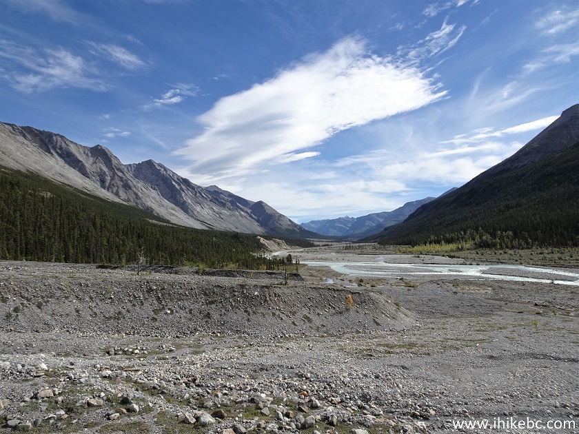
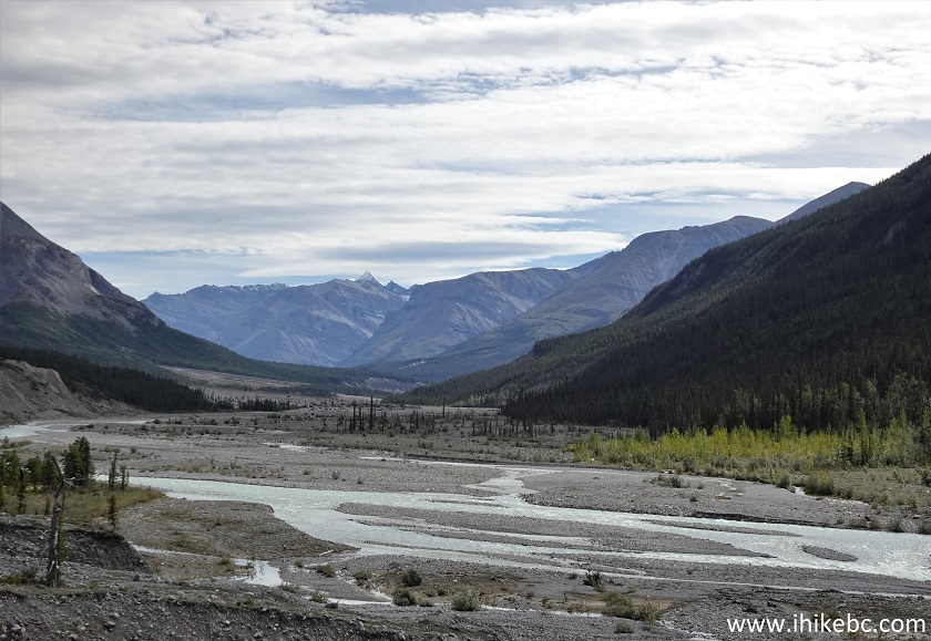
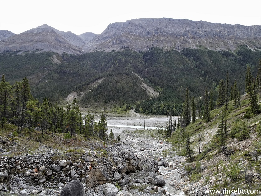
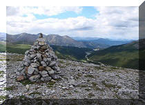
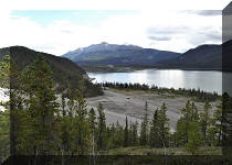
11. We decided to hike until the first impressive view, and it did not take long. Here is a very fine view of Wokkpash Creek valley at 3.2 km. Coordinates: N 58°33.768’ W 124°56.731’. Elevation: 1,010 meters.
Wokkpash Corridor
12. A bit to the left. The loop trail continues through those woods for 50+ more kilometers en route to Wokkpash Lake, and, eventually, back to Highway 97 at MacDonald Creek trailhead.
Wokkpash Loop Trail View
13-14. Zooming in.
Wokkpash Creek Valley
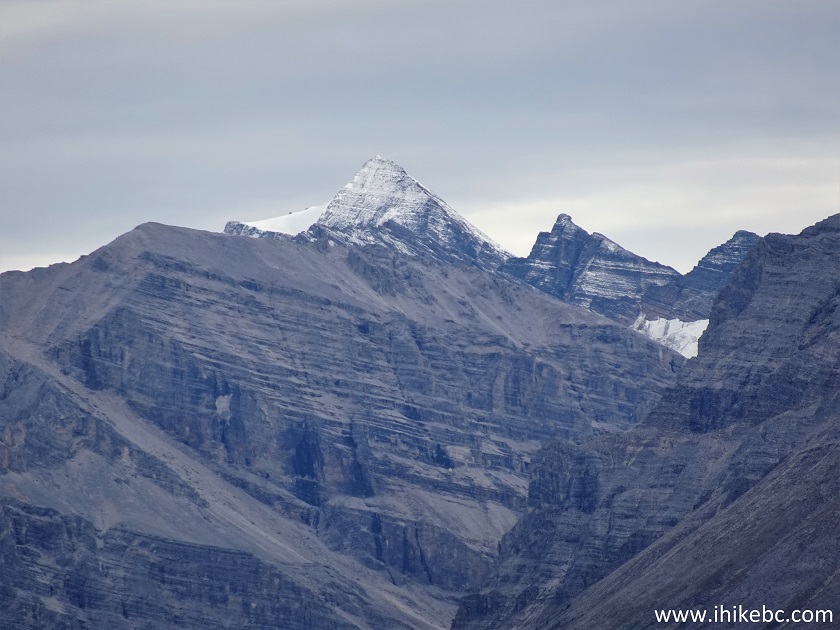
Mountains by Wokkpash Trail
15. Now a panorama.
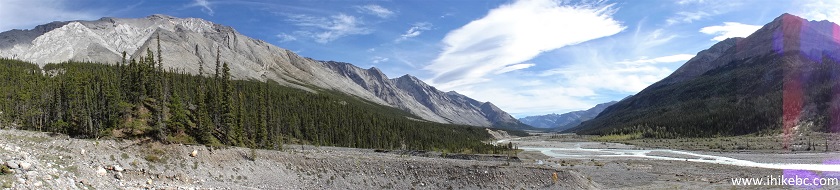
Wokkpash Creek Valley Panorama
Here is our video of the views from this location.
More ihikebc videos are on our YouTube Channel.
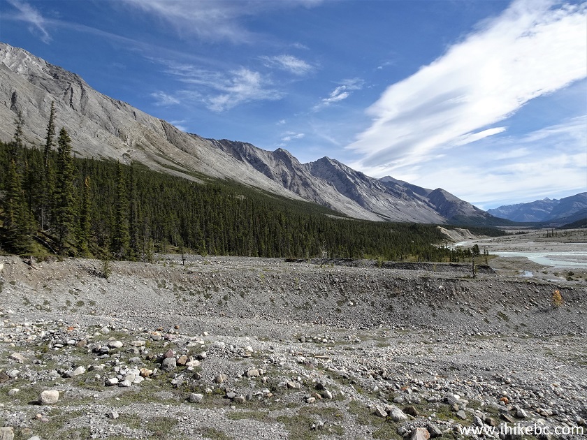
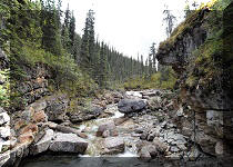
16. To the left (far in the corner) there is that cascading, if unspectacular, waterfall.
Wokkpash Loop Trail British Columbia Canada
17. That's the bottom of the falls, and there are 5-6 more such cascades, and you can hike up fairly easily to see them all.
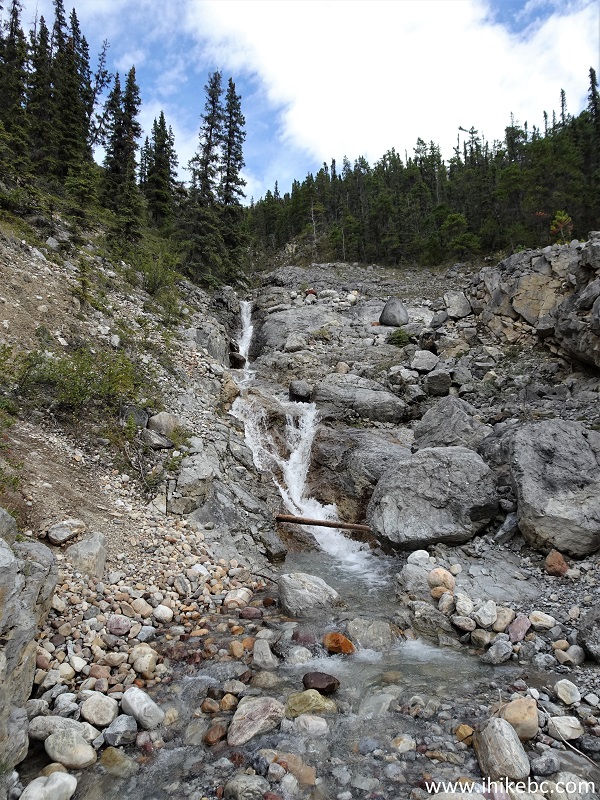
Waterfall by Wokkpash Trail
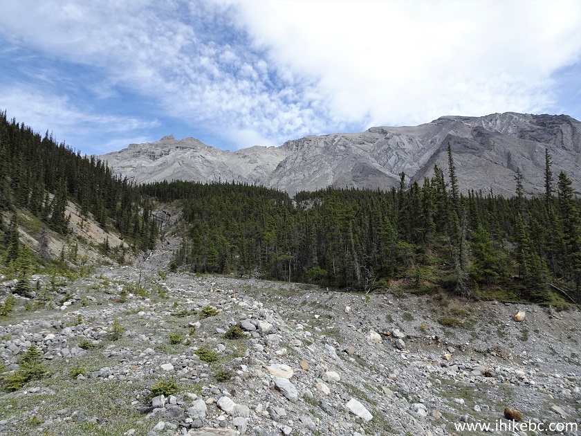
18. Looking back from the waterfall area.
Wokkpash Loop Trail Area
We have hiked for just over 3 km of the 54 km of Wokkpash LOOP
Trail, and, from what we have read, this is one impressive hike, but it would
definitely require at least 2 overnight stays to see it all. Highly recommended.


|
 |
Other Trips in Fort Nelson Area:
|
|
|
|
|
|
|
|
|
|
|
|
|
|
|
|


![]()
![]()
![]()
ihikebc.com Trip 262 - Wokkpash LOOP Hiking Trail (North of Fort Nelson BC)