![]()
![]()
![]()

Trip 168 - August 3, 2019 (Saturday)
Canim Falls Trail Hike
Wells Gray Provincial Park near
100 Mile House BC
Liked: Canim Falls views, short and easy trail, no bugs.
Of Note: Steep unbarricaded drop-off at the top of the waterfall. Optional trail to the bottom of the waterfall is steep, and requires stone-hopping. Hiking boots and poles are highly recommended for the optional trail to the bottom of Canim Falls. The trail is popular.
Cariboo Chilcotin Coast BC Backroad Mapbook (4th edition) Waterfall Location Coordinates:: Page 19 (Interlakes Highway) D1.
Related Website: Wells Gray Provincial Park - BC Parks Official Website.
Follow @ihikebc Tweet
Six kilometres prior to reaching Mahood Lake Campground (described in our previous trip report), Mahood Lake Road passes by a large parking area for Mahood and Canim Falls. Five hundred meters down a wide and easy path, and Mahood Falls is right in front of you. Alas, this waterfall view is so badly overgrown, that you can hardly see anything. However, Canim Falls, which is 500 meters further, more than compensates for the Mahood Falls' disappearance behind thick trees. Canim Falls are actually two impressive waterfalls right next to each other, coming from the same Canim River. It's possible to have a great view from the safety of the fenced-off observation area. Or, for more adventurous, a very short hike to the top of the Right Falls, or a substantially more complicated hike to the bottom of both falls are also possible.
1. We are on Mahood Lake Road, with the parking area for the waterfalls on the right side. This is the same photograph as photo #13 of the previous trip report. Check out our Mahood Lake Campground trip report for directions on getting up to this point from BC Highway 97 near 100 Mile House.
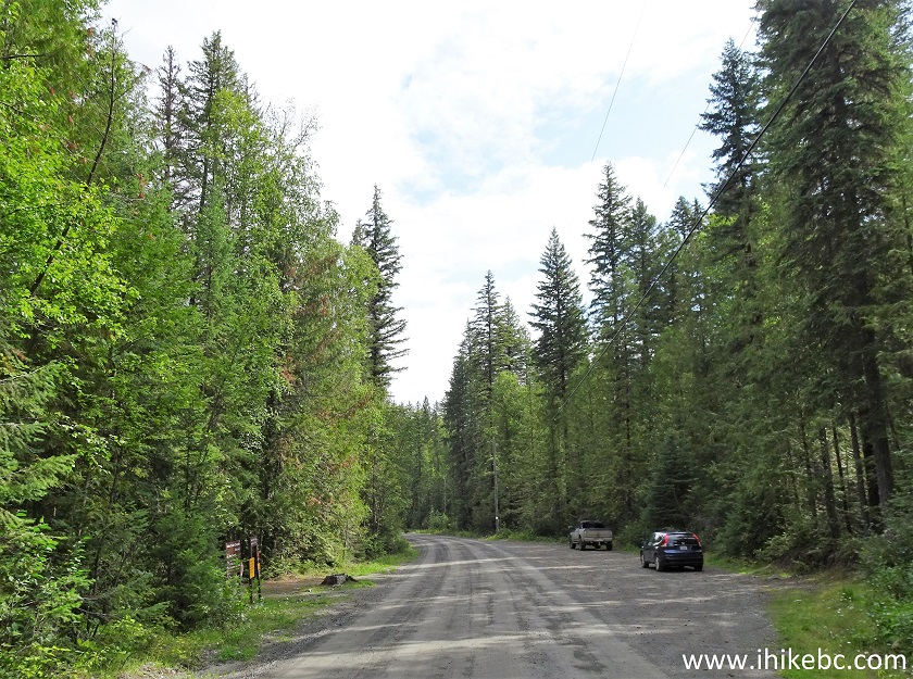
Mahood Lake Road near 100 Mile House BC
2. The trailhead is on the left side. Coordinates: N 51⁰51.903' W 120⁰34.844'. Elevation: 759 meters.
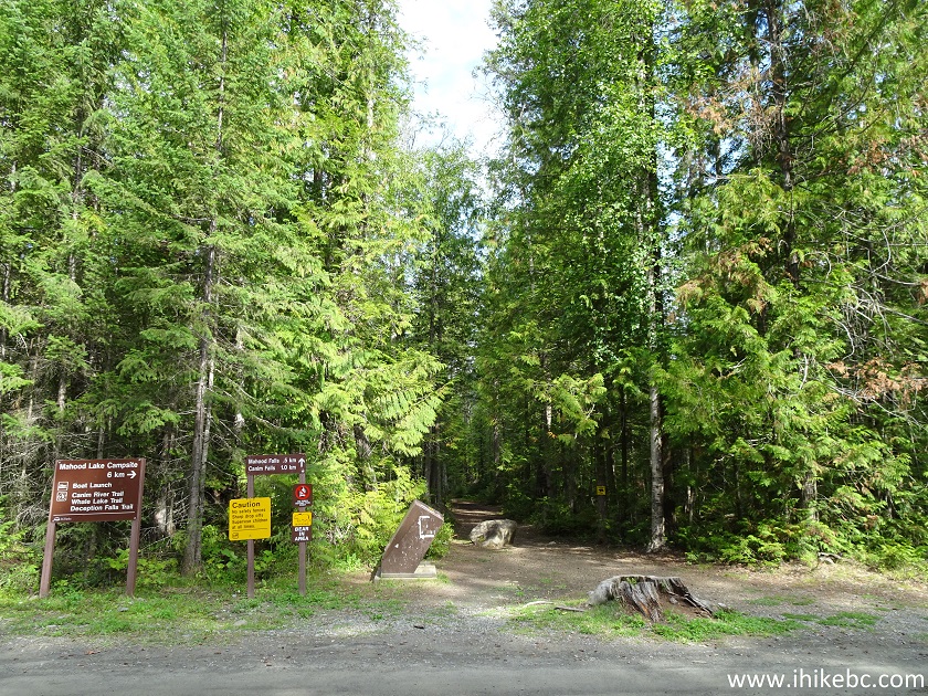
Canim Falls Trailhead
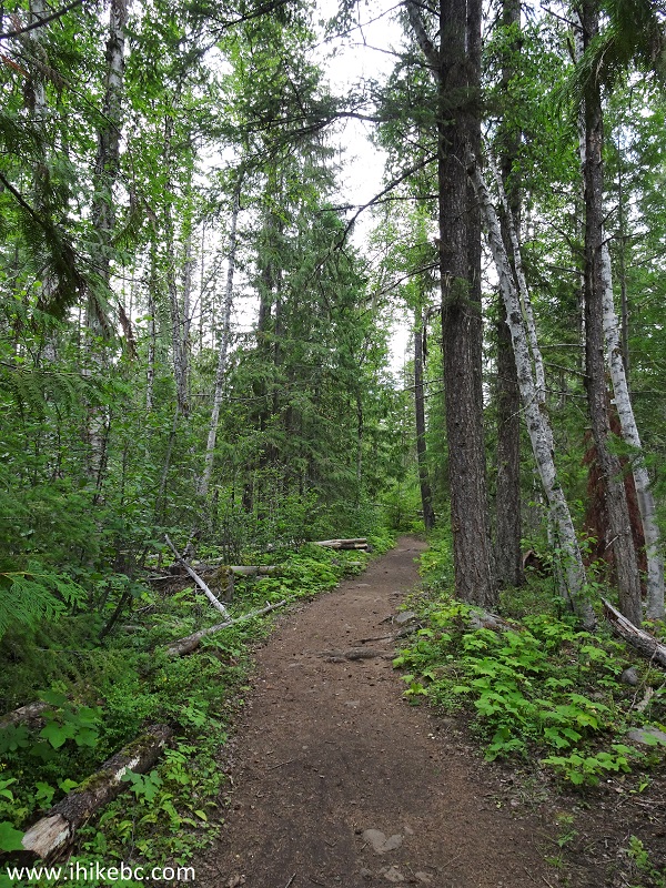
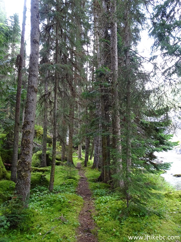
3. The path is short, wide, and easy. There were no bugs, and we have met about twenty people on the trail.
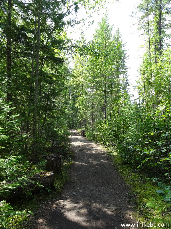
BC Hiking - Canim and Mahood Falls trail
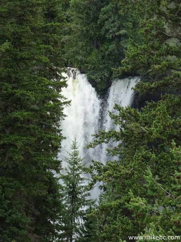
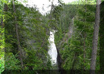
4. Mahood Falls arrives in half a kilometer. Unfortunately, it's badly overgrown, and there doesn't appear to be an easy way to get closer.
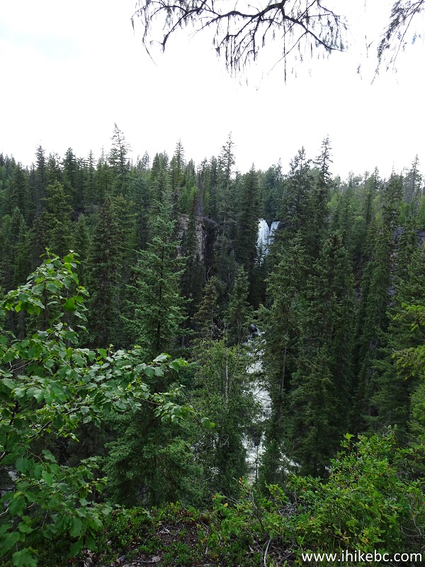
Mahood Falls Wells Gray Provincial Park British Columbia Canada
5. Zooming in.
Mahood Falls
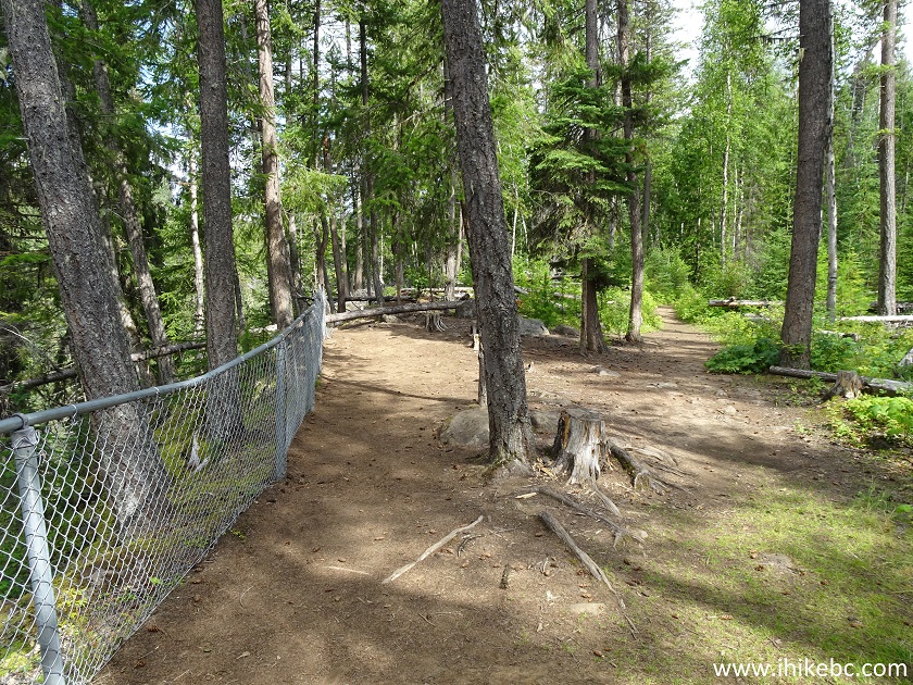
6. The path continues for another 500 meters.
Hiking in 100 Mile House Area - Canim Falls Trail
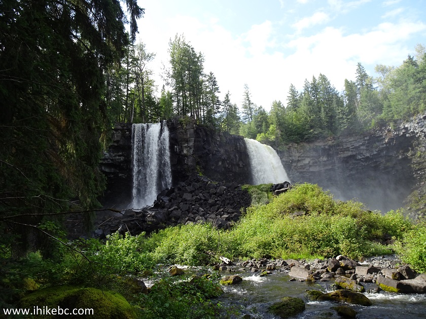
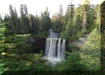
7. And here is the main Canim Falls observation area. Coordinates: N 51⁰51.950' W 120⁰35.563'. Elevation: 762 meters.
Canim Falls Observation Area - 100 Mile House Hiking
8. Quite a view.
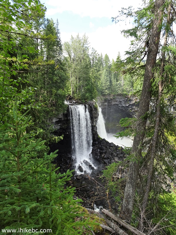
Canim Falls
9. The Left waterfall up close.
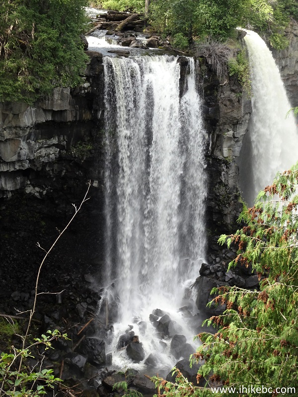
Canim Falls Wells Gray Provincial Park British Columbia Canada
10. Now the Right one.
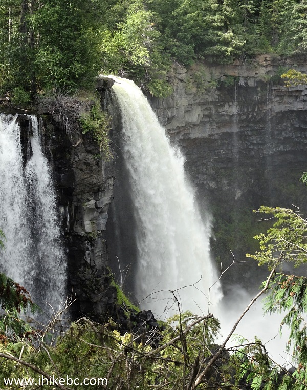
Canim Falls near 100 Mile House British Columbia Canada
Here is our video of Canim Falls from the observation area.
11. About a hundred meters more brings you to the top of the Left waterfall. Be very careful, as the drop-offs are huge, the ground may be slippery, and there is no fence there.
12. A bit closer...
13. Very neat!
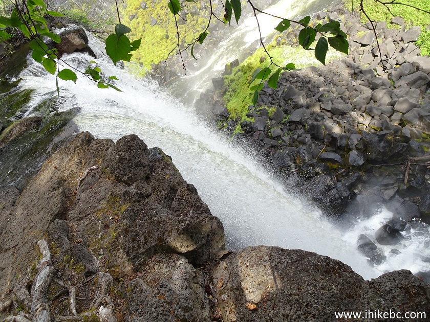
Top of Canim Falls
Here is our video of the Left Canim Falls from the top.
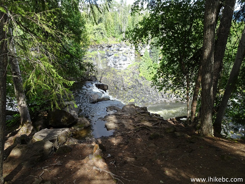
14. The view of the canyon and Canim River from this point.
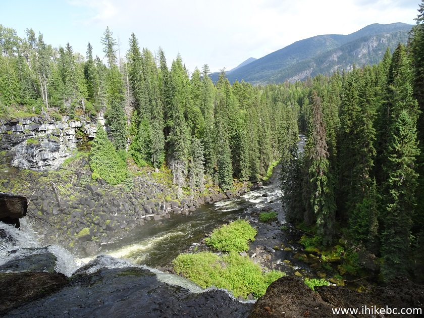
Canim River Canyon near Canim Falls by 100 Mile House BC Canada
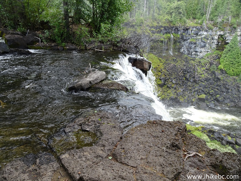
15. Looking back, we see Canim River on its way to the Left waterfall. The river splits at the top of the photo, and the rest of it goes to the Right waterfall.
Canim River
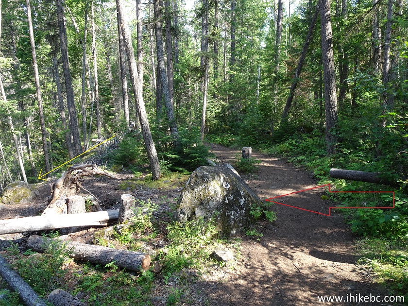
16. While checking out Canim Falls, we observed several young men at the bottom. So, we went looking for the path to get down, and, sure enough, there it was, about 250 meters before the fenced-off observation area. The path to get down is not at all obvious, so, as you are walking towards the observation area, look for the stone which is highlighted by the red arrow. The yellow arrow indicates the general location of the path to the bottom of the falls.
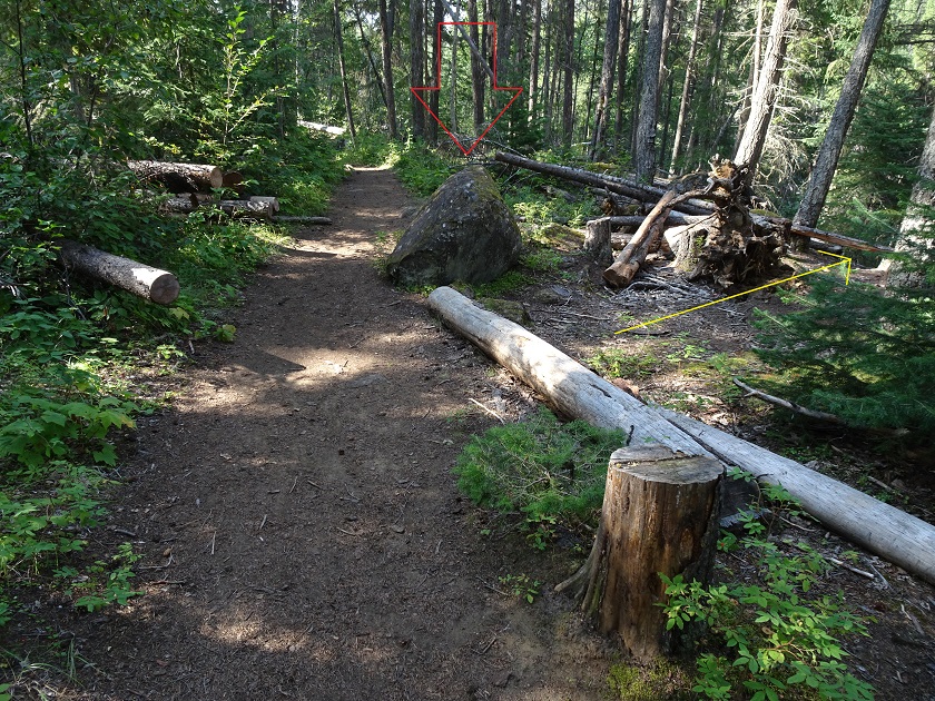
British Columbia Hiking - Canim Falls Trail
17. Looking at the same stone from the other side. Again, the yellow arrow points at the path to get down.
BC Hike - Canim Falls Trail
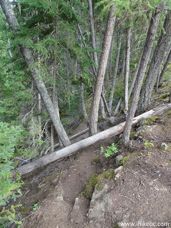
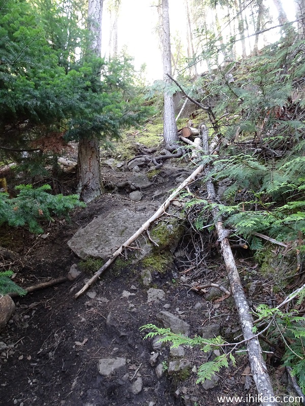
18. And here is the path. Coordinates: N 51⁰51.898' W 120⁰35.408'. Elevation: 760 meters. The steep part at the beginning is quite short (only about 100 meters), but is very challenging. Also, while by the river, some stone-hopping is required. Hiking poles and boots would come very handy here.
Path to the bottom of Canim Falls
19. Looking back at the path we have descended.
Hiking near Canim Falls in Wells-Gray Provincial Park
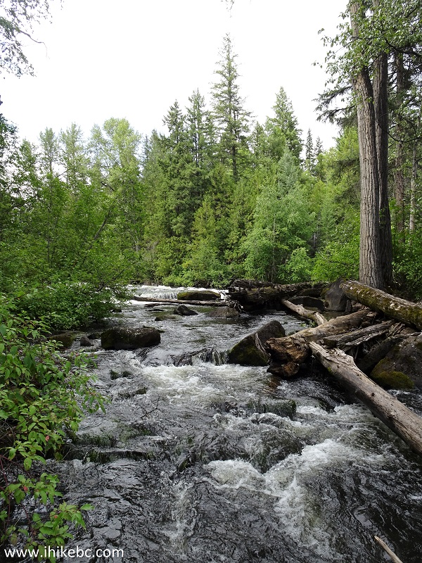
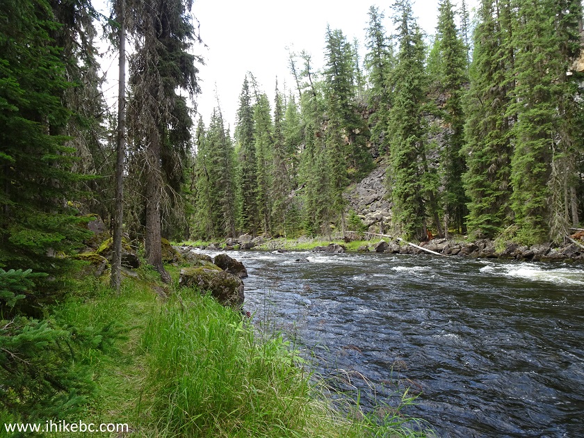
20. In a few minutes, we are by Canim River, and the waterfalls are just a few hundred meters away.
Canim River British Columbia Canada
21. The Right waterfall comes into view very shortly.
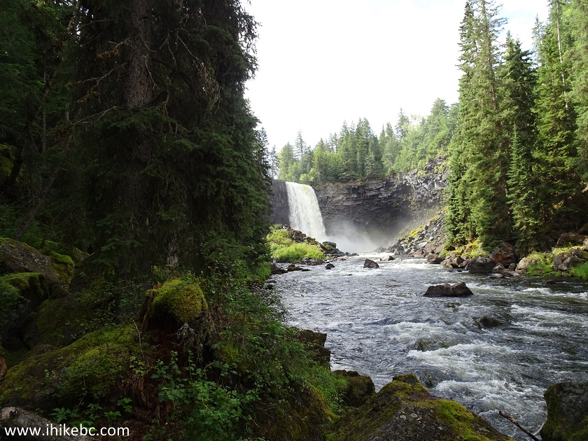
Wells-Gray Provincial Park Canim Falls near 100 Mile House British
Columbia Canada
22. Now with a zoom.
Canim Falls in Wells-Gray Provincial Park
Here is our video of the Right Canim Falls from the bottom path.
23. Then, walk through a small stand of trees...
Wells-Gray Hiking near Canim Falls
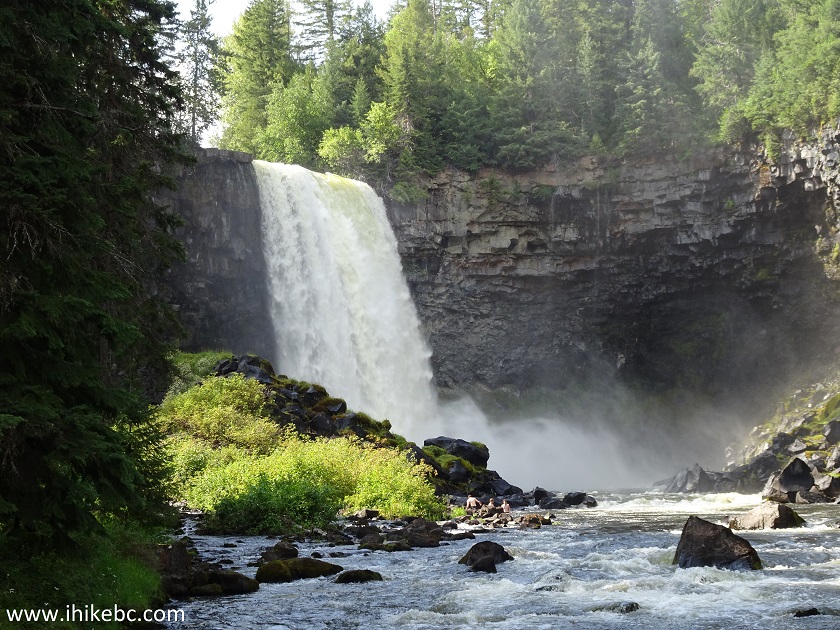
24...and get to meet Canim Falls up close and personal. The stones near the falls are going to be slippery like ice, so be aware. Also, to get to the Right Falls, river crossing would be required.
Canim Falls near 100 Mile House BC Canada
Here is our video of both Canim Falls from the bottom path.
More ihikebc videos are on our YouTube Channel.
Canim Falls are just as impressive as they are easily accessible. Highly recommended.


|
 |
Other Trips in 100 Mile House BC Area:
|
|
|
|
![]()
![]()
![]()
Follow @ihikebc Tweet
ihikebc.com Trip 168 - Canim Falls Trail Hike (Near 100 Mile House BC)