![]()
![]()
![]()

Trip 157 - June 15, 2019 (Saturday)
Viking Ridge Trail Hike
Sugarbowl - Grizzly Den Provincial Park
Near Prince George BC
Trailhead: Approximately 85 kilometers East of Prince
George, by Highway 16.
Liked: Viking Ridge view, Viking Ridge Lake view, mountain views from the top of Viking Ridge, shade in the forest.
Of Note: Relentless mosquito assault almost all trail long, snow at higher elevations, a few small creek crossings are required, a long stretch of the trail (through the meadows) is very wet and muddy, numerous fallen trees in the second half of the trail. Hiking boots and poles are highly recommended (to the lake) and are essential (beyond the lake).
Northern BC Backroad Mapbook (3rd edition) Trailhead Coordinates: Page 13 (Purden Lake) E4.
Related Website: Sugarbowl - Grizzly Den Provincial Park (official BC Parks website).
Another Trip in Sugarbowl - Grizzly Den Provincial Park: Grizzly Den Trail Hike.
Viking Ridge trailhead is very easy to get to. Just drive for about 85 kilometers East of Prince George on Highway 16, and there it is, right on the side of the highway. And that's where the easy part ends. The moment you start the hike, at first a few, then a few more, and then hordes of mosquitoes attack you all the way until the end of the trail, and then all the way back. We have never, ever experienced such a non-stop mosquito attack on any trail. And, as far as their number, only Mount Murray hike near Wells/Barkerville had more. The trail itself is quite steep for a long time through a forest, then very flat through wet and muddy meadows, and then gets steep again once you start climbing the actual ridge. As the trail begins at the elevation of close to 800 meters above the sea level, and then climbs for over 1,000 meters, it's no wonder that there was still a lot of snow. It's probably not until late July or early August that the snow would be mostly gone. The meadows, though, would likely remain wet and muddy. The ridge looks quite fine when you are still at the meadows, the lake looks pretty both at its shore and from above, and the mountains and valley views from the ridge are impressive. But those mosquitoes...
1. We are Eastbound on Highway 16, East of Prince George.
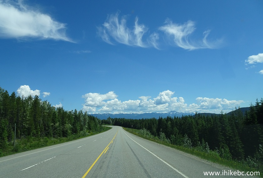
BC Highway 16 East of Prince George British Columbia Canada
2. Approaching parking area for Viking Ridge Trail - it's seen here on the left side, approximately 85 kilometers East of Prince George.
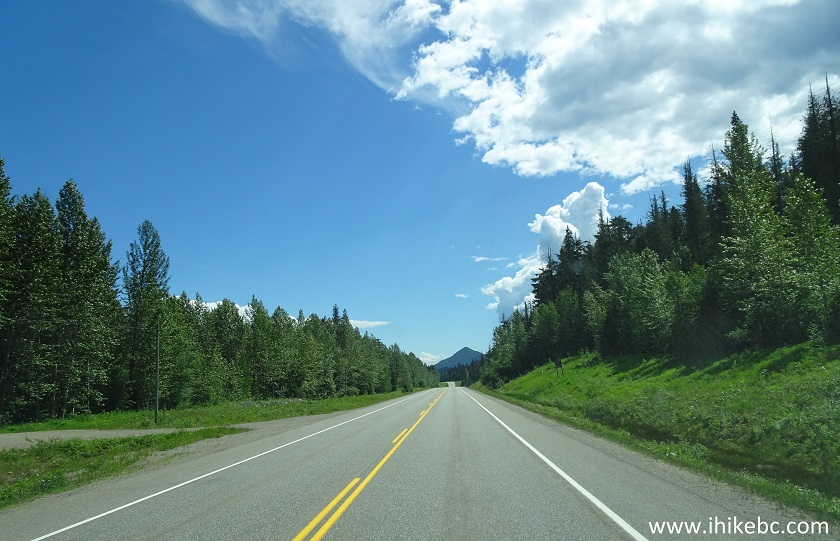
BC Highway 16 at Viking Ridge Trail Parking Area
3. Here is the parking area. Coordinates: N 53⁰52.338' W 121⁰34.924'. Elevation: 794 meters.
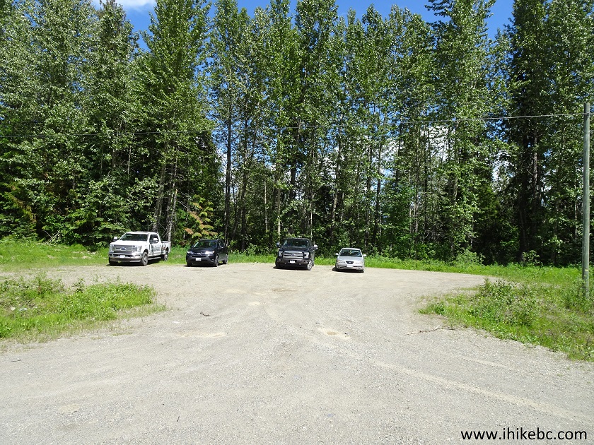
Viking Ridge Trailhead Parking Area
4. Viking Ridge trailhead is almost right across the highway, slightly more to the East.
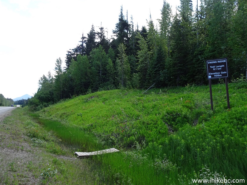
Viking Ridge Trailhead - Sugarbowl Grizzly Den Provincial Park
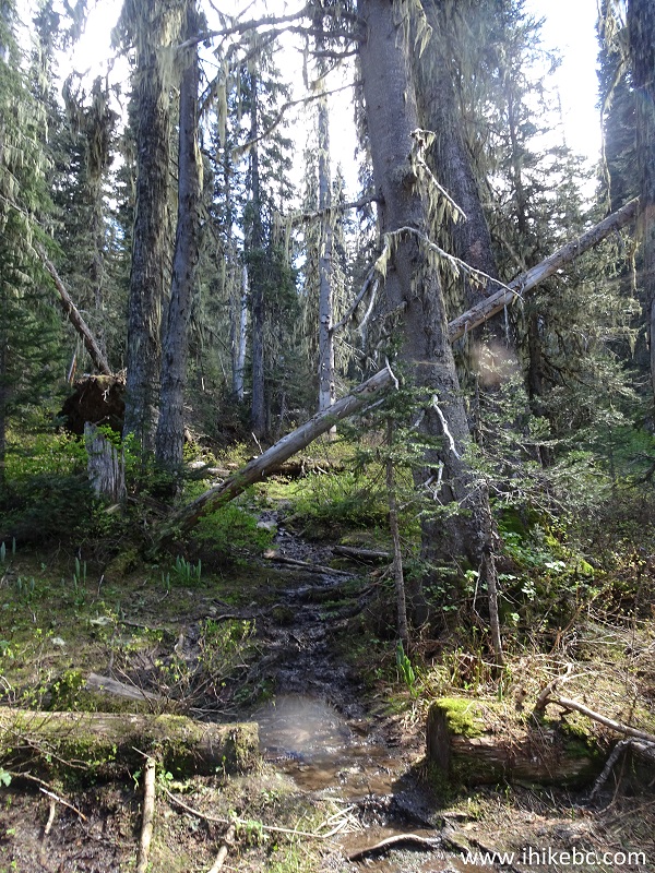
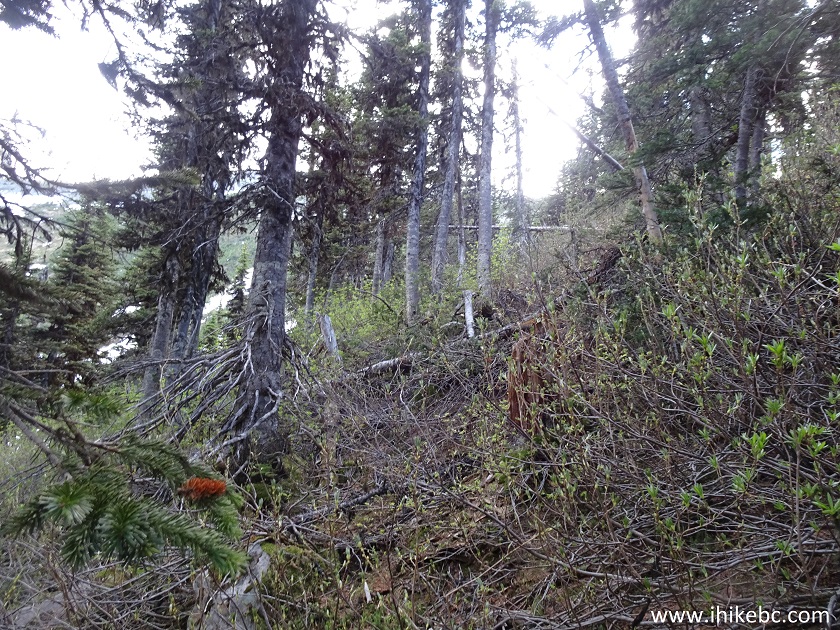
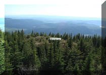
5. The steep climb begins right away, and it's a long climb at that. There is not much to see in the forest, with this photo showing one of the more interesting stretches.
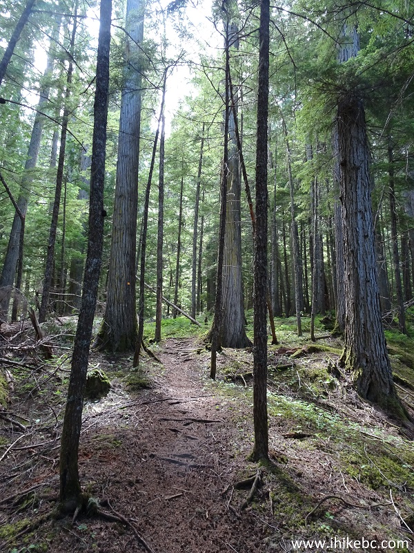
Viking Ridge Trail - Hiking in Prince George BC Canada Area
6. There are a few small creeks to cross.
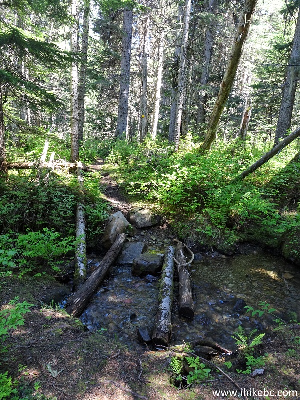
Prince George Hiking - Viking Ridge Trail
7. The shade is good to have on a hot day.
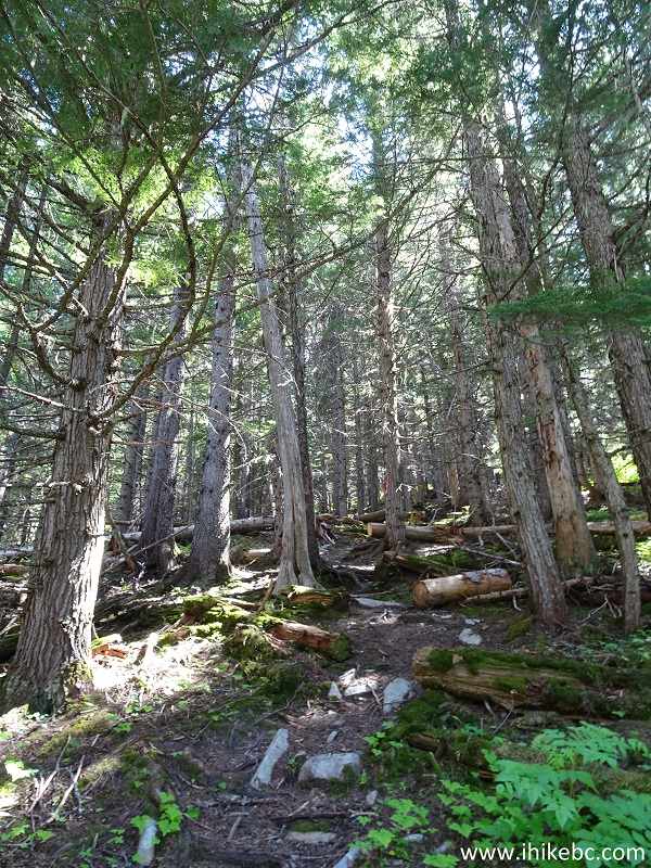
Viking Ridge Trail - Prince George Hike
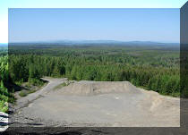
8. It took us close to 2 hours to get to the meadows. The trail became very flat, wet, and muddy. Coordinates: N 53⁰50.994' W 121⁰34.908'. Elevation: 1,398 meters.
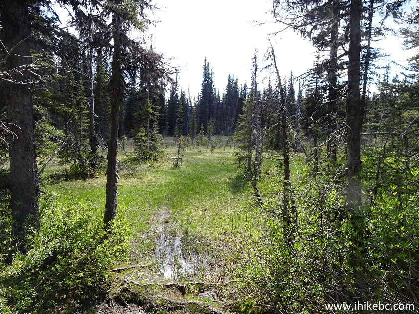
Viking Ridge Trail Meadows - Hike in Prince George Area
9. Those are neat meadows for sure. Mosquitoes are especially abundant here.
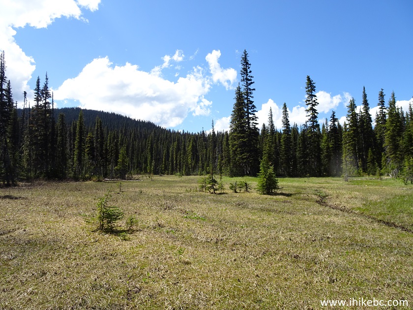
Meadows at Viking Ridge Trail near Prince George British Columbia Canada
10. We can now see Viking Ridge.
Viking Ridge - Trail in Prince George Area
11. We would climb the right side of the ridge. Here is a zoomed photo.
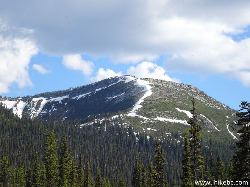
Sugarbowl - Grizzly Den Provincial Park Hiking near Prince George British
Columbia Canada
12. After the meadows, it's back into the forest. It's not as steep this time around, but steep enough. If you do not have waterproof footwear, the feet are bound to be wet after hiking through the meadows.
Prince George Area Hiking - Viking Ridge Trail
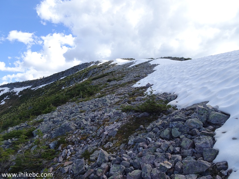
13. The snow appeared in earnest at the elevation of 1,580 meters, after almost 3 hours of hiking.
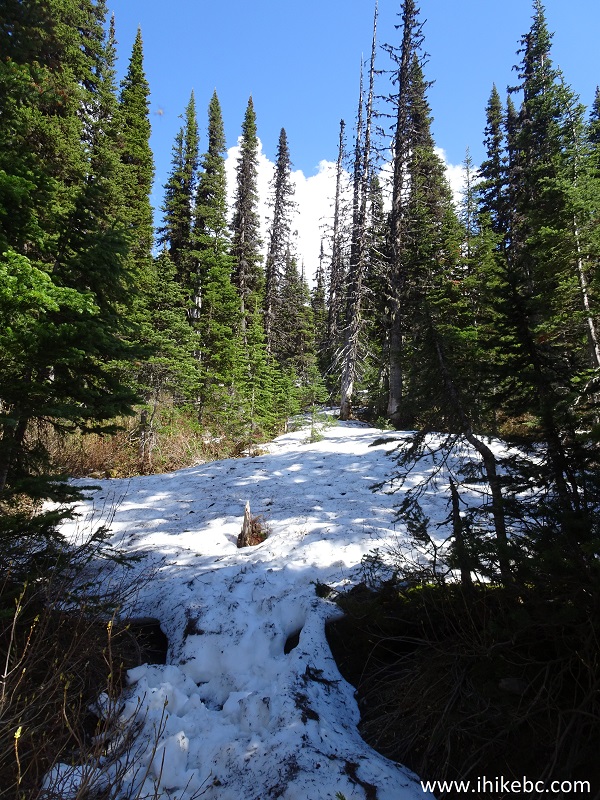
Viking Ridge Trail near Prince George BC Canada
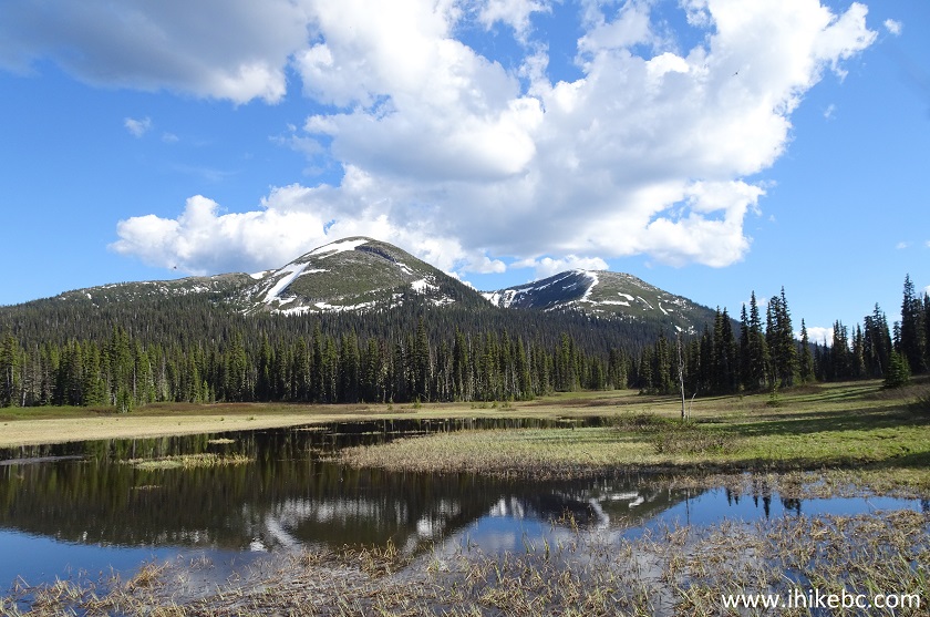
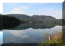
14. But the best part of the hike was about to begin. First, we reached the lake. Coordinates: N 53⁰49.933' W 121⁰34.928'. Elevation: 1,618 meters.
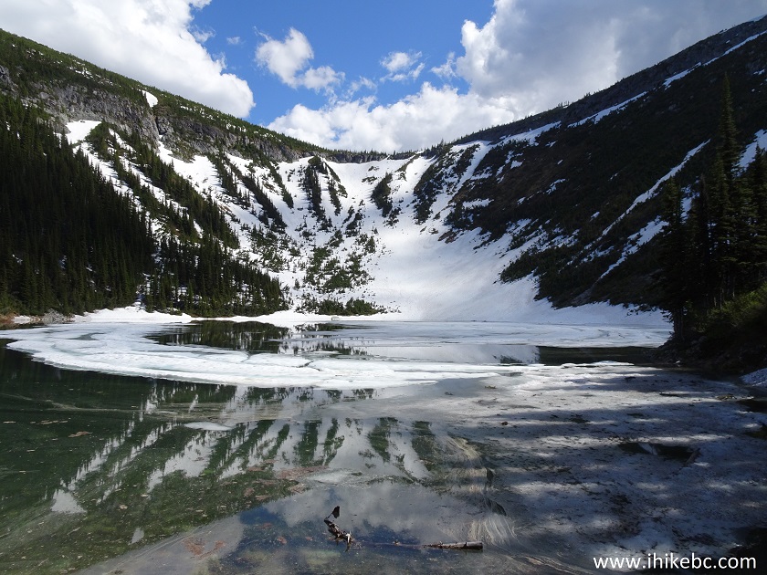
Viking Ridge Lake - Sugarbowl Grizzly Den Provincial Park
15. Looking to the left.
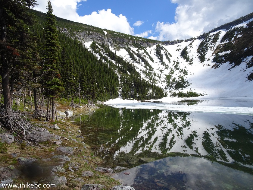
Hike in Prince George Area - Viking Ridge Trail
16. We figured the right side of the ridge would be easier to climb.
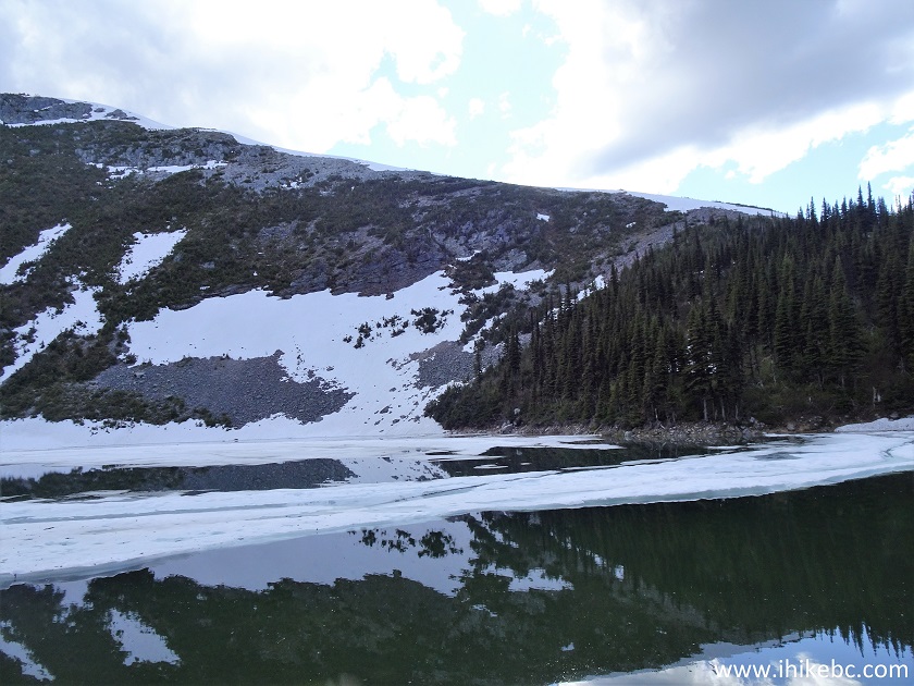
Sugarbowl - Grizzly Den Provincial Park near Prince George British
Columbia
17. However, at first, we had to get through some underbrush.
Hiking near Prince George in Sugarbowl - Grizzly Den Provincial Park
18. Then, there was a serious uphill climbing on loose stones. Hiking poles and boots would be essential here.
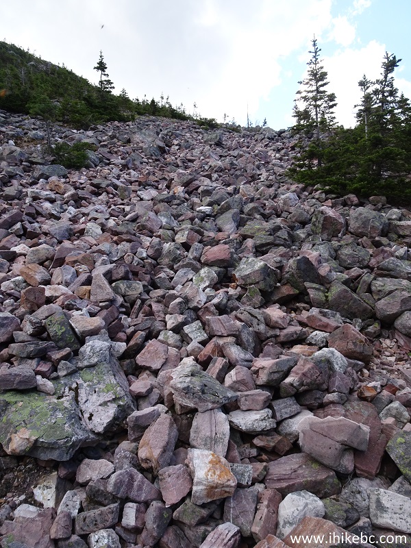
Viking Ridge Trail - Hiking Near Prince George BC
19. Now hiking on the actual ridge.
Viking Ridge Trail - Prince George Trail
20. The lake looks quite fine from above.
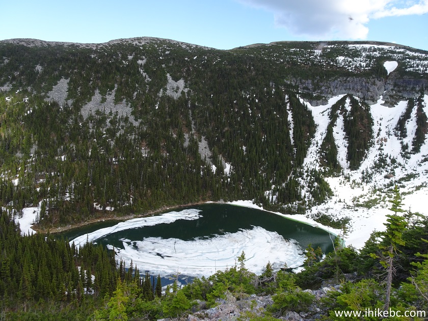
Sugarbowl Grizzly Den Provincial Park Hike - Viking Ridge Lake
21. There are some interesting stone formations on Viking Ridge, this being one of them.
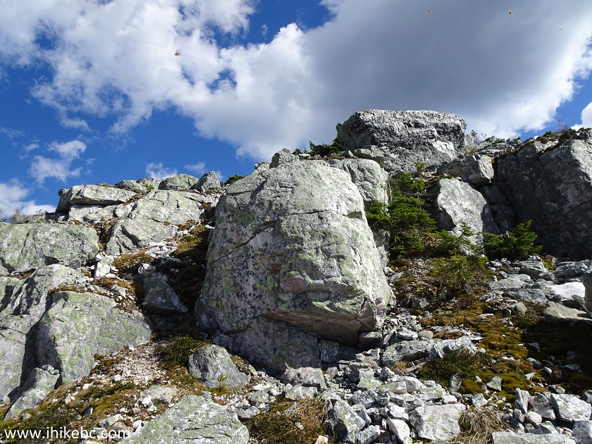
Sugarbowl - Grizzly Den Provincial Park near Prince George British
Columbia Canada
22. Looking back at the ridge we have climbed and the valley behind it.
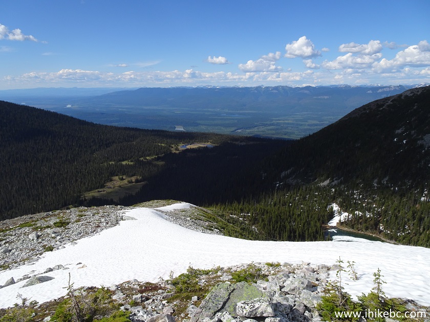
Viking Ridge Trail
23. Finally, a cairn on top of the ridge. Coordinates: 53⁰49.712' W 121⁰35.058'. Elevation: 1,816 meters (1,020 meters elevation gain from the start of the hike). It took us exactly 4 hours to get here, but with much meandering (GPS trip odometer showed 8.3 km, while the trip back took only 6.7 km, and less than 2.5 hours). The average grade for Viking Ridge Trail is about 17%, but that includes a long flat stretch through the meadows.
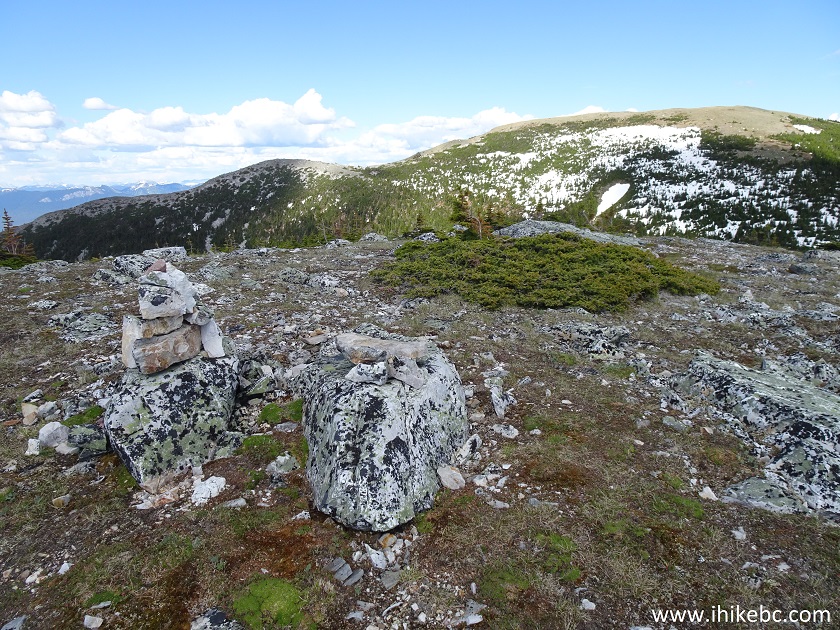
Top of Viking Ridge Trail near Prince George BC
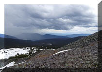
24-26. The mountain range as seen from the top of Viking Ridge. Looking left to right.
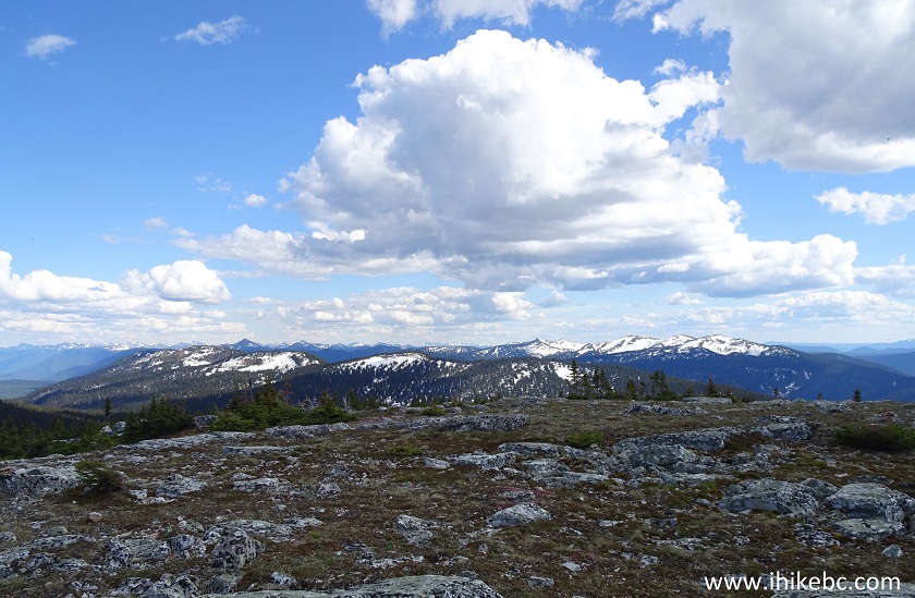
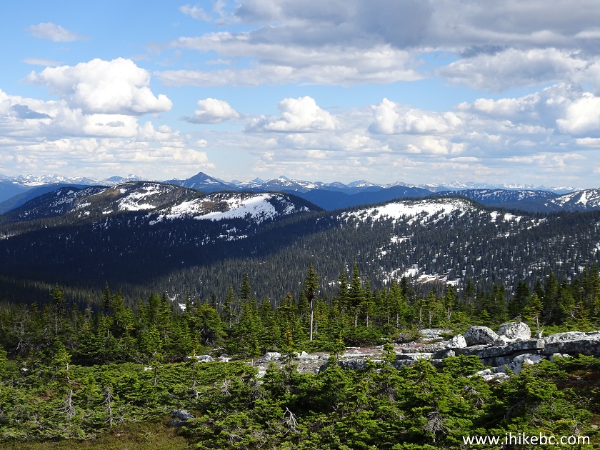
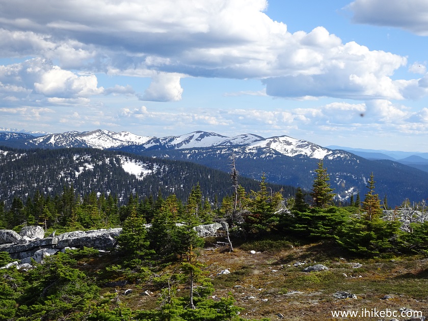
British Columbia Hiking
27. The lake view is quite impressive as well.
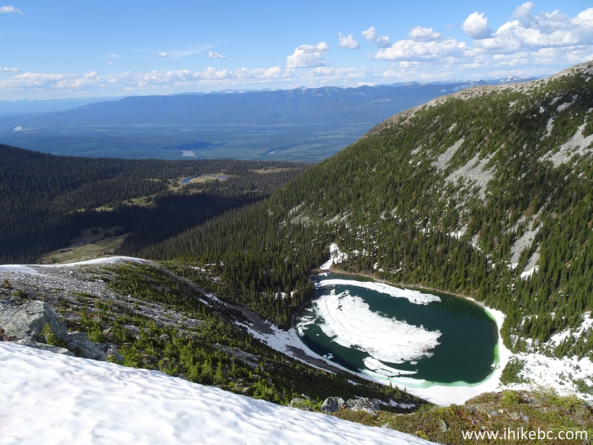
Viking Ridge Trail Lake
Here is our video of the views from the top of Viking Ridge
More ihikebc videos are on our YouTube Channel.
What's there to say. If you are prepared for the steepness, snow, wet and muddy meadows and, especially, the mosquitoes, this trail has some fine views at the end of it all. Recommended to the tough in spirit with a good mosquito net.


|
 |
Other Trips in Prince George BC Area:
|
|
|
|
|
|
|
|
|
|
|
|


![]()
![]()
![]()
ihikebc.com Trip 157 - Viking Ridge Trail Hike (near Prince George BC)