![]()
![]()
![]()

Trip 122 - September 12, 2016 (Monday)
Joffre Lakes Trail Hike
Joffre Lakes Provincial Park
Near Pemberton BC
Distance from Vancouver: Approximately 2.5 hours via Highway 1
West and then Highway 99
(Sea-to-Sky) past Squamish and Whistler. Drive for about half an hour
after Pemberton, and you will see the parking lot on the right side.
Liked: Beautiful lakes and glacier. Two waterfalls. Several fine forest scenes. No bugs.
Of note: Incredible number of people on the trail even on a workday in off-season. Parking could be a major issue. Hiking poles and boots are recommended to the Middle Lake, highly recommended to the Upper Lake, and are essential beyond the Upper Lake. Much of Highway 99 past Pemberton is narrow and winding, with a very steep hill prior to the Joffre Lakes Provincial Park.
August 2017 Trail Parking Update: there is now an information board with a message stating that parking on the highway shoulder is prohibited and will be strictly enforced. Which means that, if the main and a nearby overflow lots are full (which is very likely on a busy weekend), you would have to find parking at a pullout further down the highway, which might add several kilometers to your hike.
Vancouver, Coast & Mountains Backroad Mapbook (2010 edition) Trailhead Coordinates:
Page 37 (D'Arcy) A7.
103 Hikes in Southwestern British Columbia (2008 edition):
hike #10.Related Website: Joffre Lakes Provincial Park - BC Parks.
Joffre Lakes Provincial Park features three lakes, which are connected by one moderately difficult trail. The first (Lower) lake is only a five minute walk from the parking lot, and can be accessed by just about anyone. The Middle and Upper lakes require some hiking to be done. We wanted to hike this trail for a long time, and intentionally chose an off-season workday to enjoy a quiet and peaceful outing. It turned out a hundred (literally) other hikers had the same idea. And this is a fairly remote area too, though easily accessible via a major highway. What happens on this trail on a busy weekend in the Summer? Four hundred people? Five hundred? Then, we turned on the radio while driving from the hike, and there was a story on how Instagram ruins hiking (since many people apparently hike just for the sake of having their photo with an impressive backdrop posted on that social website), with Joffre Lakes Trail being used as an example in that radio story! Anyway, this hike is amazing, and, if you don't mind the crowds, certainly give it a shot.
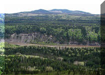
1. We are on Highway 99 Southbound, North of Pemberton, with Joffre Lakes Provincial Park parking lot turnoff seen on the left (it would be on the right side, if driving from Vancouver/Squamish/Whistler/Pemberton).
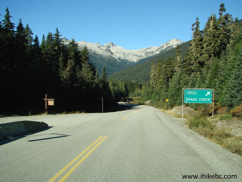
BC Highway 99 Near Joffre Lakes Provincial Park Entrance
2. Having made the left turn, here is the parking lot. It's around 9:30 AM. The lot would be packed by the time we came back. There is also a much smaller parking lot a few hundred meters further South by Highway 99, but prepare for a parking mayhem, should you come here on a Summer weekend day. Coordinates for this parking lot: N 50⁰22.184' W 122⁰29.959'. Elevation: 1,239 meters.
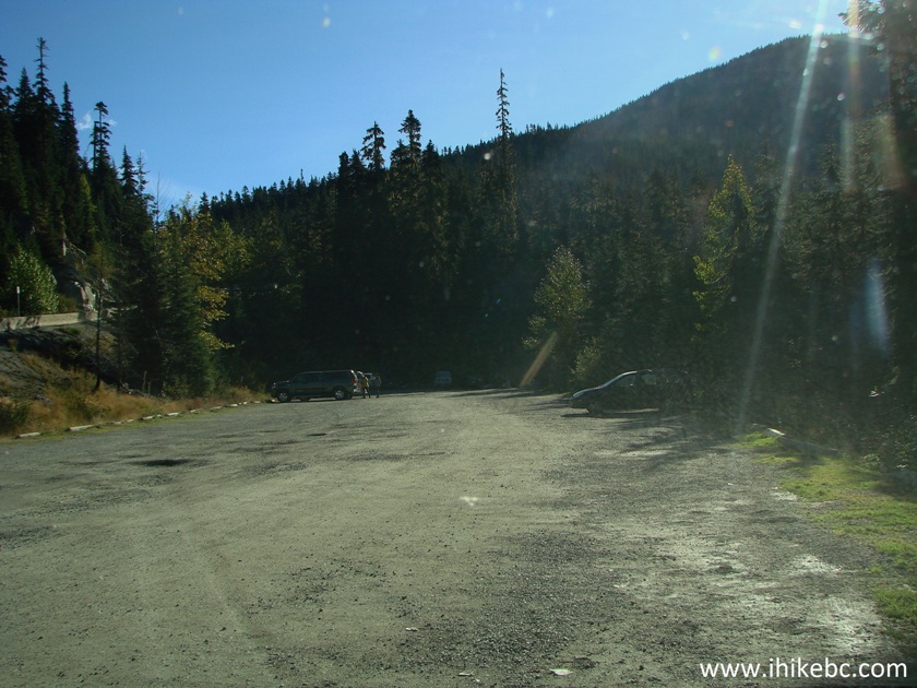
Joffre Lakes Provincial Park parking lot
3. At the far end of the parking lot, there is an information board, two pit toilets, two frequently overflowing garbage containers, and the trailhead to the right of the board.
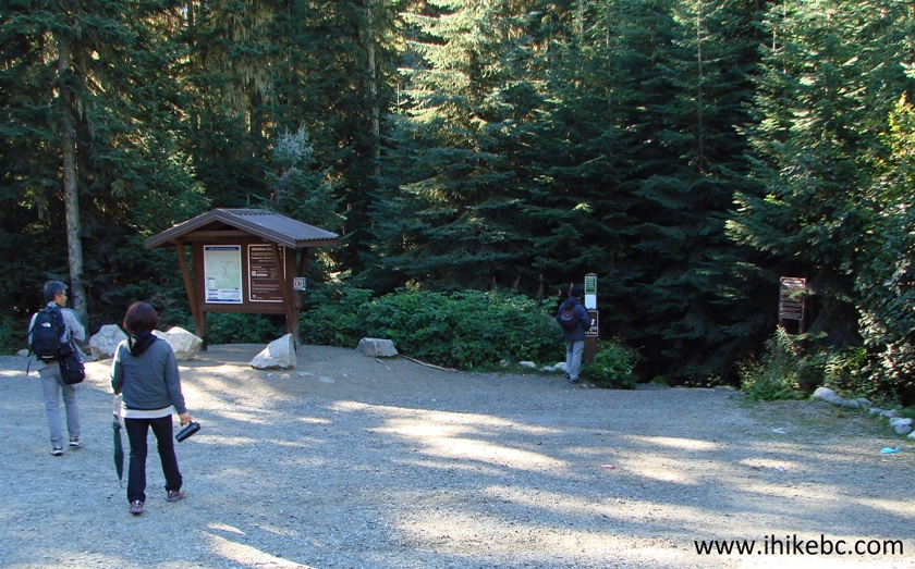
Joffre Lakes Provincial Park trailhead
4. Here is the map of the hiking trail. Ignore the "you are here" sign, as we took the photo of this map further up the trail near the large waterfall.
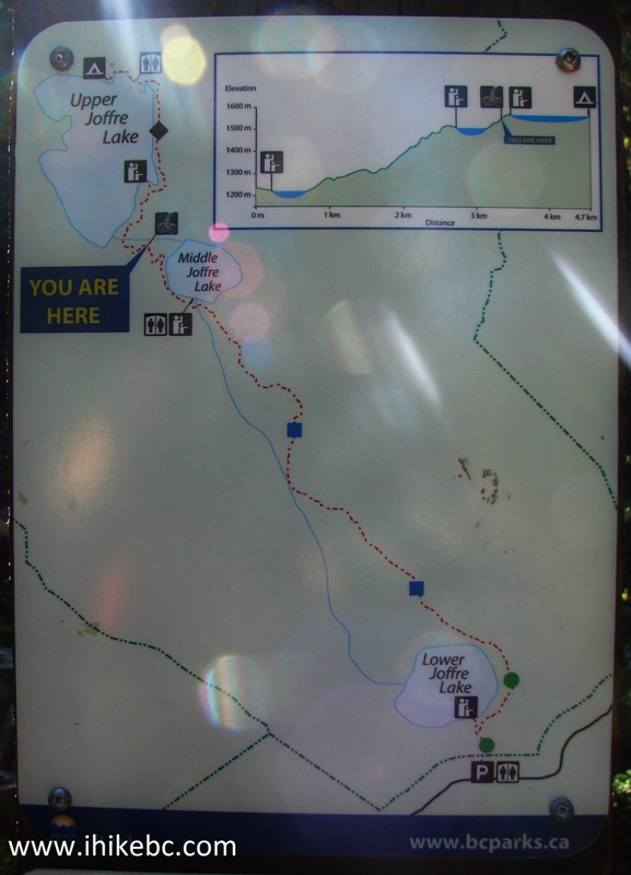
Joffre Lakes Provincial Park Map
5. Within several minutes after starting the hike, there is a split. Turning left would lead to the Lower Lake very shortly.
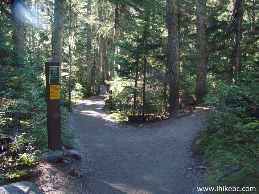
Joffre Lakes Trail Near Pemberton British Columbia Canada
6. Lower Joffre Lake. For the best views on a sunny day, it's better to come in the afternoon to avoid having the sun shine directly into your eyes, while you are looking at the glacier.
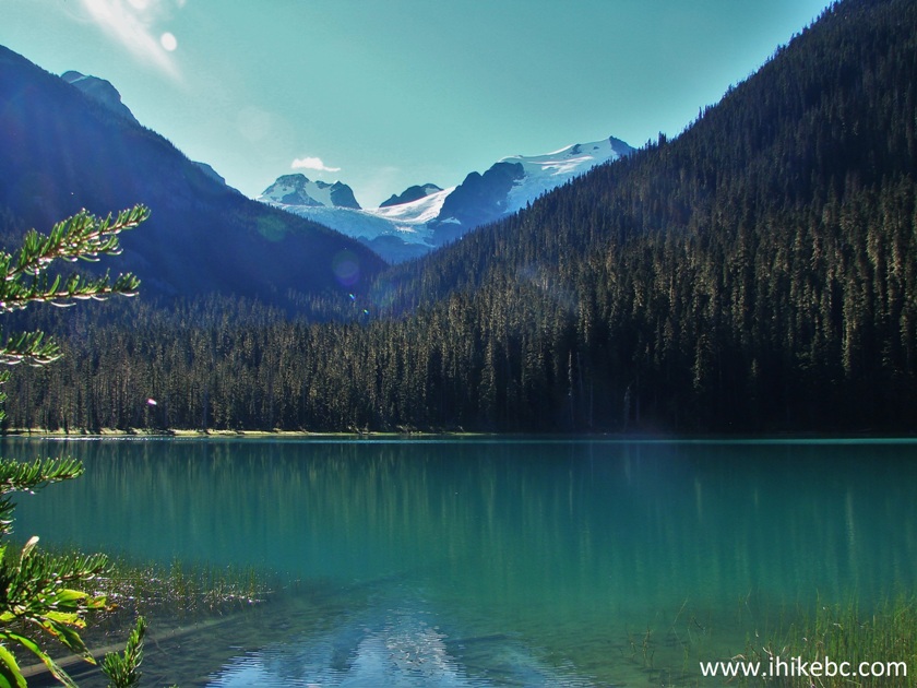
Lower Joffre Lake British Columbia Canada - Pemberton Trail
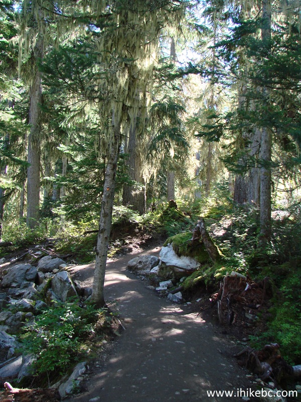
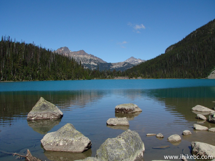
7. Moving on towards the Middle Joffre Lake.
Joffre Lakes Trail - Pemberton Hike
8. As mentioned above, we were hoping for a serene hiking experience. What happened, however, was as follows: we were hiking alone when a faster couple behind us started getting closer. We decided to take a break, let them pass, then wait for a few minutes and continue. But, wait, what's this? Another group of hikers? Ok, let them pass. Another? We'll wait a bit more. Another??? And another, and another, and another. In fifteen minutes or so, nine groups of hikers totalling about thirty people passed us by. It was quite something. Finally, with the idea of a serene hike long abandoned, we resumed hiking towards the Middle Joffre Lake.
Joffre Lakes Provincial Park British Columbia Canada - Pemberton Hiking
9. About an hour into the hike, we have reached the Middle Joffre Lake viewpoint, with close to twenty people admiring the view. There are twelve hikers in this photo.
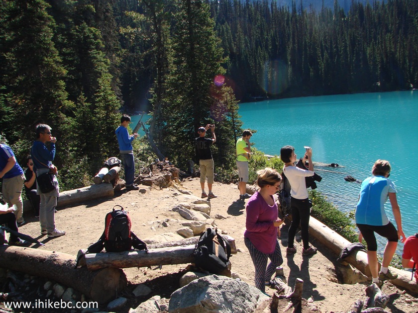
Hikers by Middle Joffre Lake - Hike in Pemberton Area
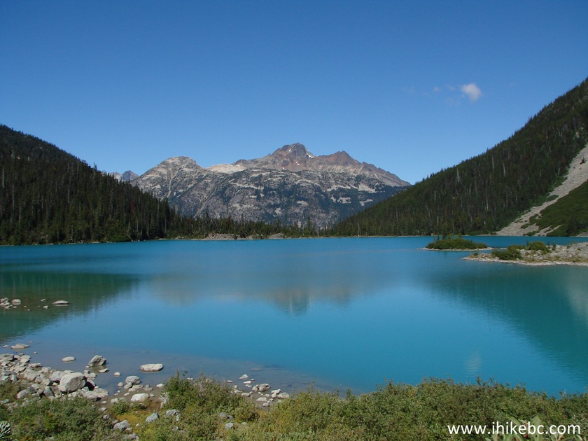
10. Nice view indeed.
Middle Joffre Lake British Columbia Canada - Hiking in Pemberton Area
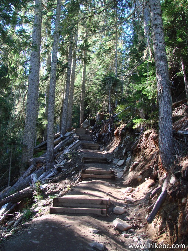
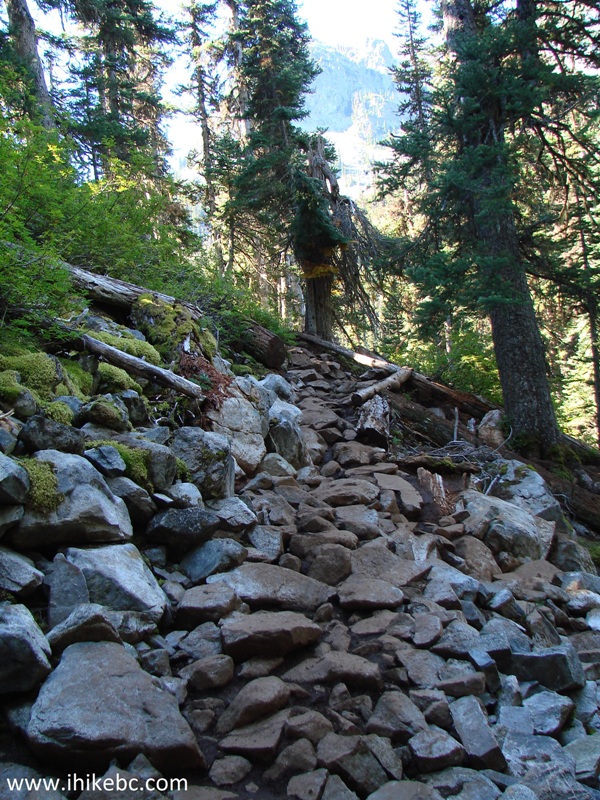
11. Continuing towards the Upper Lake. The path gets complicated.
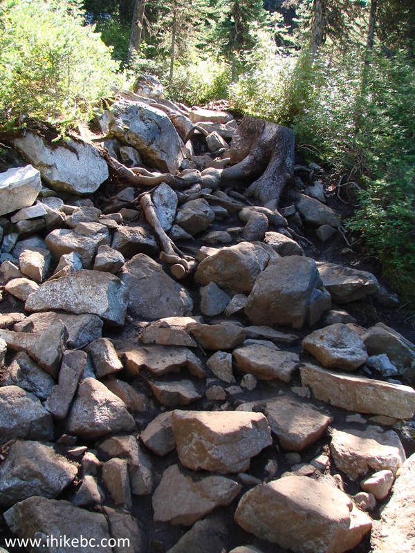
Trail to Upper Joffre Lake - Trail in Pemberton Area
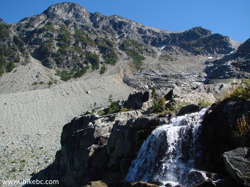
12. Soon, there is a waterfall by the side of the trail. We took this photo on the way back in the afternoon, when the sun was shining at the waterfall.
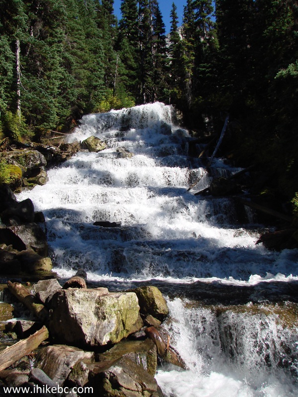
Waterfall by trail to Upper Joffre Lake - BC Hiking
Here is Our Video of the Waterfall:
13. Another challenging stretch.
Upper Joffre Lake Trail - British Columbia Hiking
14. Then, there is a bridge with a wooden dog statue nearby.
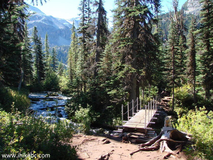
Bridge on Upper Joffre Lake Trail - BC Trail
15. In memory of Colette Titterton. Nicely done.
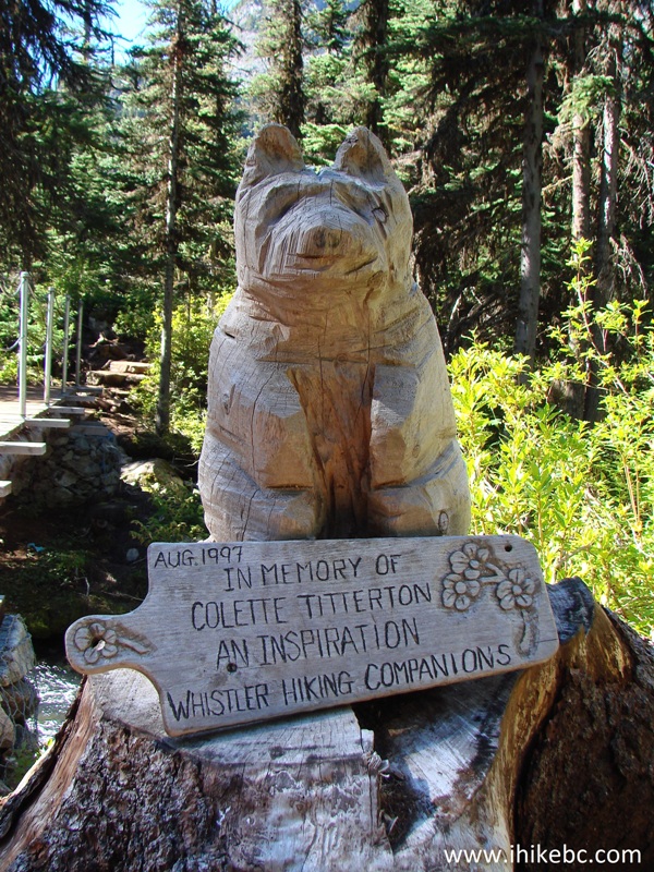
Wooden Dog Statue by Upper Joffre Lake Trail
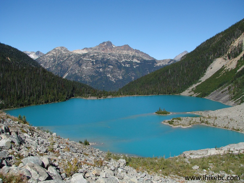
16. Twenty minutes past the Middle Lake, Upper Joffre Lake appears in all of its splendour.
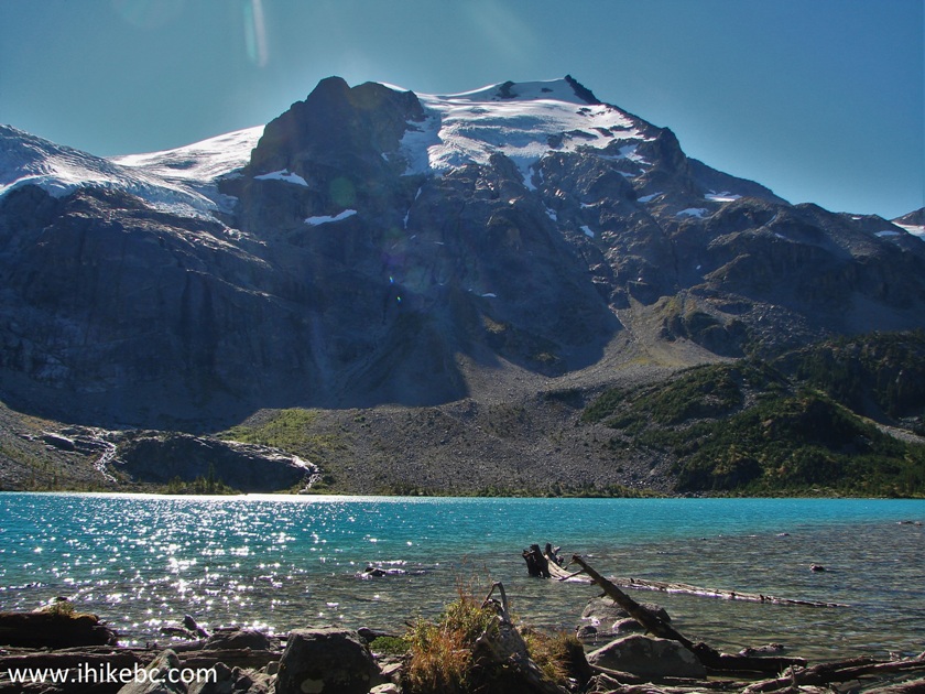
Upper Joffre Lake - Hike in British Columbia Canada
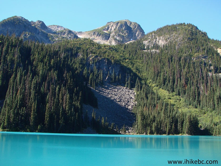
17. The trail then continues around the lake towards the campground, and you also get to see the glacier much closer than from the Lower Lake.
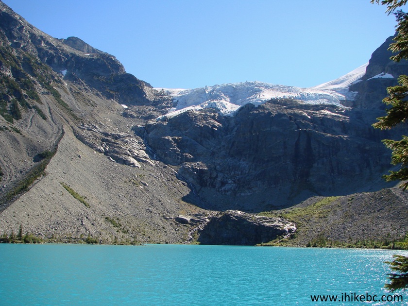
Joffre Lakes Provincial Park Hiking near Pemberton British Columbia Canada
18. Joffre Lakes Campground rules.
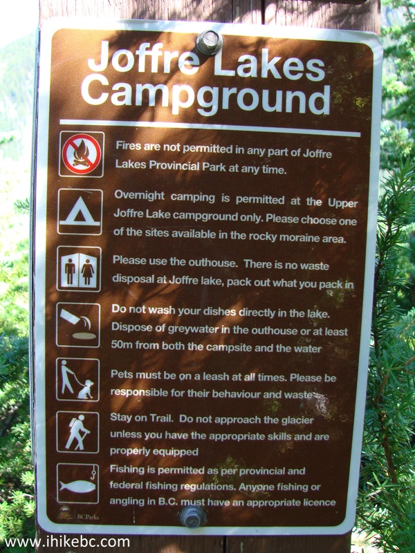
Joffre Lakes Campground Rules
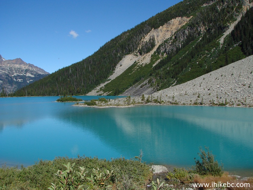
19. The views change as you walk around the Upper Lake, but, no matter which angle you look from, this is one beautiful body of water.
Upper Joffre Lake BC Canada Hiking
20. Just past the campground (which is, basically, a bunch of flat spots to pitch a tent on), there is this second waterfall. Much smaller, but quite picturesque.
Waterfall by Upper Joffre Lake
21. Another good view of Upper Joffre Lake.
Upper Joffre Lake
22. Looking right.
Joffre Lakes Provincial Park
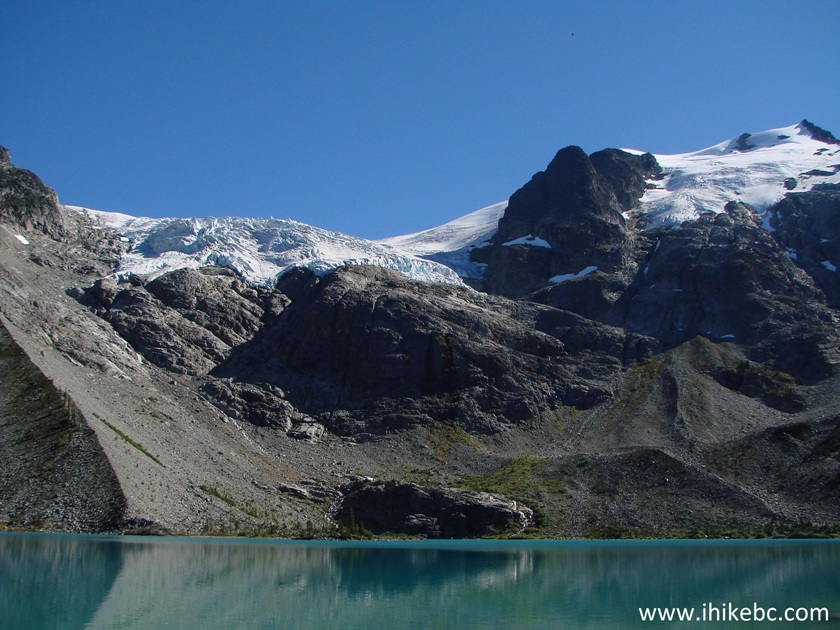
23. And now we have climbed up to get arguably the best shot of this lake. Coordinates for this viewpoint: N 50⁰20.531' W 122⁰28.451'. Elevation: 1,641 meters (402 meters elevation gain from the parking lot).
Upper Joffre Lake British Columbia Canada
Here is Our Video of the Upper Joffre Lake from this Viewpoint:
More ihikebc videos are on our YouTube Channel.
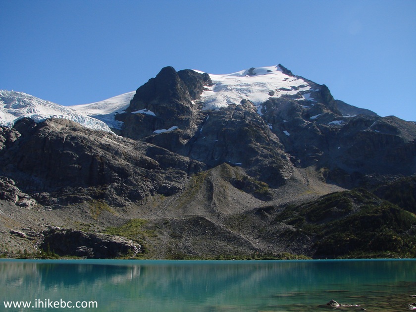
24. We then climbed even further up, and it's possible to explore the challenging terrain for quite some time, and get a better look at the glacier too (some zoom used).
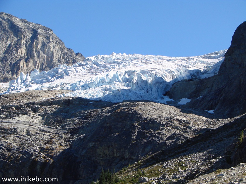
Glacier above Upper Joffre Lake
25. We have met a marmot when descending back towards the Upper Lake.
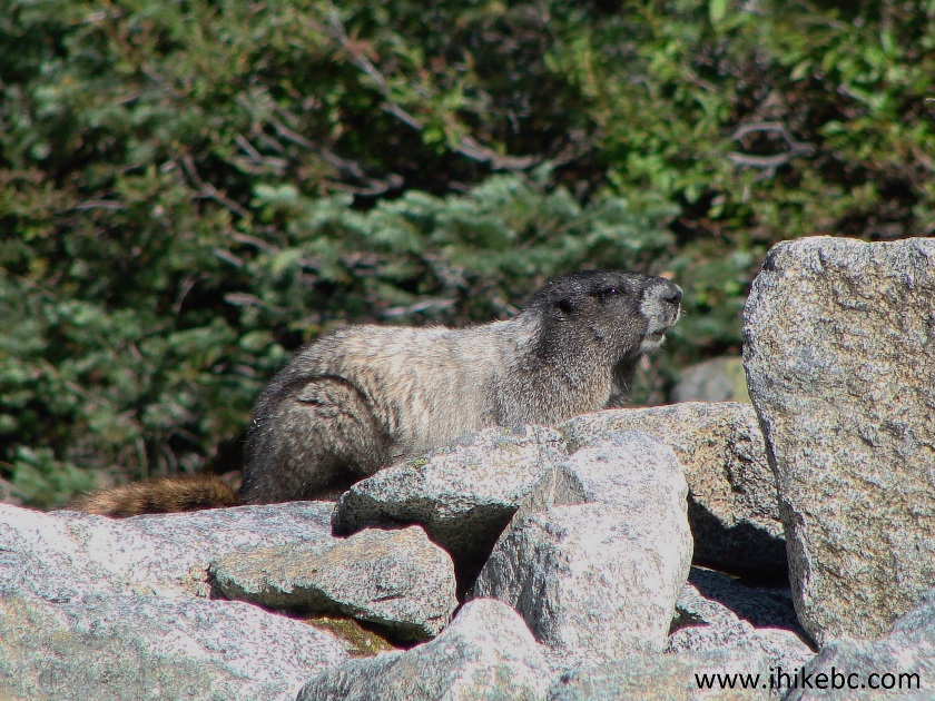
Marmot in Joffre Lakes Provincial Park British Columbia Canada
26. Finally, two more photos of the Upper Joffre Lake on the way back.
Upper Joffre Lake BC Canada
27...
Upper Joffre Lake British Columbia
Joffre Lakes Trail. Very beautiful. Very crowded. Highly recommended.


|
 |
![]()
![]()
![]()
ihikebc.com Trip 122 - Joffre Lakes Trail Hike (near Pemberton BC)