![]()
![]()
![]()

Trip 287 - July 31, 2023 (Monday)
Sowerby Creek FSR Hike
Near Hope, BC
Page 1 of 2
Liked: Several fine mountain views, colourful wild plants, a good creek view, no excessively steep sections.
Of Note: A rough FSR suitable for highly capable vehicles only (or hiking), numerous aggressive flies (mostly second half of the hike), limited shade, some parts of the FSR are getting overgrown, uneven ground, loose rocks, hiking poles and boots are highly recommended, as well as long pants, long-sleeve shirt and safety glasses.
Vancouver, Coast & Mountains Backroad Mapbook (2019 edition) Trailhead Coordinates: Page 5 (Chilliwack Lake) F1.
Other Trips in Hope BC Area: Thacker Mountain Trail, Flat Iron Peak Trail, Needle Peak Trail, Dog Mountain Trail, Jones Lake FSR Trip to Jones Lake, Yak Peak Trail, HBC Heritage Trail, Sowaqua Creek FSR, Zoa Peak Trail, Skagit River Trail, Skyline II Trail Hike, Silver Skagit Road, Mount Outram Trail, Othello Tunnels, Eaton Lake Trail, Mount Hope Lookout Trail, Town of Hope BC.
Other Forest Service Roads Trips: Chehalis (by Harrison Mills), Chilliwack Bench, Chilliwack Foley, Chilliwack Lake, Chuchinka-Colbourne (North of Prince George), Clear Creek (off Harrison East), Florence Lake (access to Stave Lake by Mission), Harrison East, Harrison East Second Trip, Harrison West, Lost Creek (by Mission), Lost Creek (by Mission), Mamquam River (by Squamish), Nahatlatch (near Boston Bar), Parsnip West (near Mackenzie), Scuzzy (by Boston Bar), Shovel Creek (off Harrison East), Sowaqua Creek (by Hope), Squamish River Main, Squamish River Ashlu, Squamish River E-Main, Squamish River FSR Washout, Windfall Creek (by Tumbler Ridge).
Follow @ihikebc TweetSowerby Creek Forest Service Road is located near Hope BC, by Highway 1 Exit 168 (Flood-Hope Road) and starts right at the gate of Silver Lake Provincial Park, which can be found in the vicinity of the 6.4 km mark of Silver Skagit Road. We were initially heading to Eaton Lake Trail further down Silver Skagit Road, but the road was closed until the Spring of 2024 (due to flooding damage) right at the spot where the right fork takes you across a bridge to Silver Lake Provincial Park, so we decided to hike Isolilllock Peak Trail instead, which is located off Sowerby Creek Forest Service Road.
As Sowerby Creek FSR is not suitable for anything but hiking or highly capable (at least one locker) short wheelbase narrow body 4x4s, we hiked to Isolilllock Peak trailhead from about the 800 meter mark of the FSR for 5.8 km, and realized that this unmarked route with 1,550 meters elevation gain would be way too much on a 30°C day. So, we hiked down Sowerby FSR a bit more, and made a 10.5 km (one way) hiking trip out of it all, counting from our parking spot at the 800 meter mark of the FSR. There were about 2-3 more kilometers left when we stopped, so there could be even more to see further down the road.
Sowerby Creek Forest Service Road has a decent hiking value, as the are no excessively steep stretches, no washouts or windfall, and the only three substantial challenges were a rather rough surface for much of the road, several sections of encroaching vegetation (skin and eyes scratching hazard), as well as dozens of aggressive flies in the second half of the FSR.
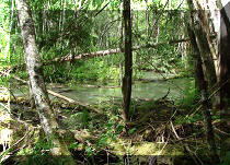
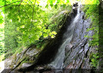
This hike has several very fine mountain views, numerous colourful wild plants, and one decent creek view as well.
* All hiking distances are based on a GPS odometer and are approximate.
1. Here is a Google Maps location of Silver Lake Provincial Park. Sowerby Creek FSR starts just at the entrance to Silver Creek Provincial Park, and can be seen in the map as an unnamed road heading down towards the bottom left of the map.
2. We are Eastbound on Trans-Canada Highway 1, about 152 km East of Vancouver, with Hope being another 5 km or so ahead, getting ready to take Exit 168 Flood-Hope Road.
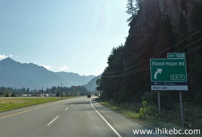
TransCanada Highway 1 at Exit 168 Flood-Hope Road near Hope BC
3. Taking Exit 168.
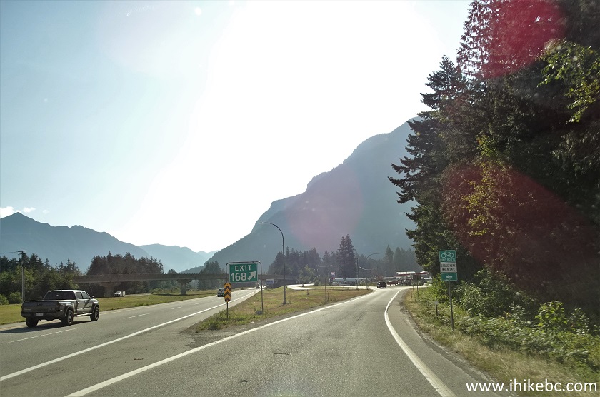
Exit 168 Flood-Hope Road TransCanada Highway 1 near Hope British
Columbia Canada
4-5. Upon taking Exit 168, keep going straight (where the red arrow is pointing). Making a right turn at the 3-way (pictured in photo #4) split after the exit (there is no entry to the road on the very left - it's for traffic from the opposite direction of Flood-Hope Road) would lead to Silver Creek Travel Centre, which has many useful things, including a gas station, a Tesla supercharger, and rather expensive showers.
![]()
![]()
6. The road would lead to a T-junction in a few hundred meters after the 3-way split. Make a right turn (towards Hope) onto Flood-Hope Road. Going straight would result re-entering Highway 1 East, and turning left would (eventually) lead to Highway 1 West, to Flying J Travel Centre, and also to that road on the very left seen in photo #4.
![]()
7. After making a right turn at the T-junction and driving for 300 meters on Flood-Hope Road, make another right turn onto Silver Skagit Road where a suspended in mid-air traffic light is flashing in the middle of the intersection.
Flood-Hope Road at Silver Skagit Road Hope BC
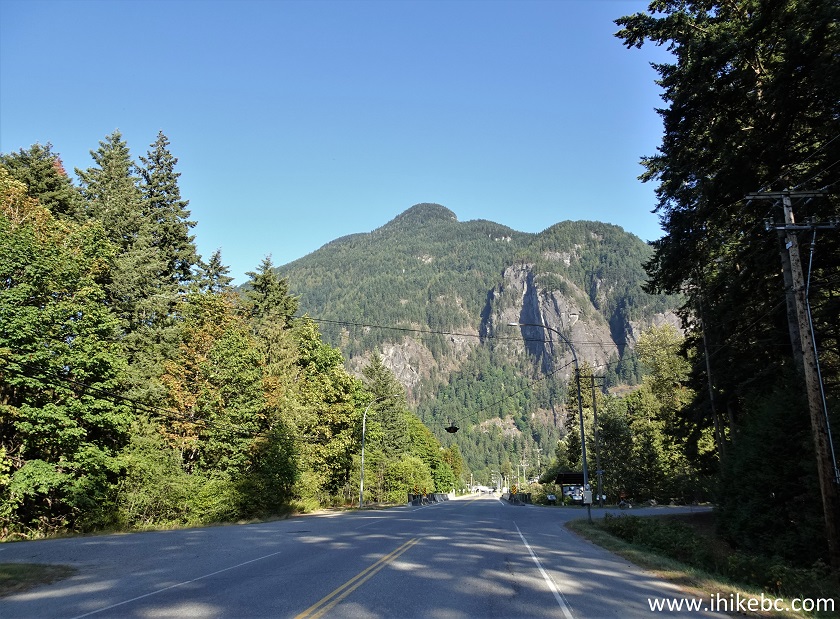
8. Here is the beginning of Silver Skagit Road, 800 meters after exiting from Highway 1.
The start of Silver Skagit Road in Hope British Columbia Canada
9. Proceed on Silver Skagit Road, which is in good shape and becomes packed gravel at some point, for 6.4 km. Upon reaching the turnoff to Silver Lake Provincial Park, make a right turn. Skagit River Road is closed past this point until next spring for road repairs.
Silver Skagit Road at Silver Lake Provincial Park access road turnoff
10. Make a left turn at the split 1.1 km later.
Silver Lake Provincial Park access road turnoff
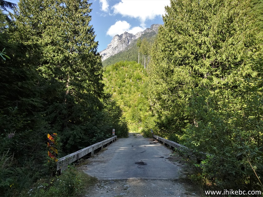
11. Within 200 meters, arrive to a bridge.
Silver Lake Provincial Park access road near Hope BC Canada
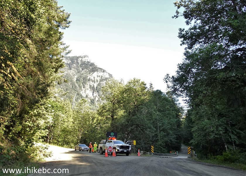
12. Right after the bridge, there is a gate leading to Silver Lake Provincial Park. Sowerby Creek Forest Service Road starts on the right side. There is no sign. This location is 8.5 km from TransCanada Highway 1 East Exit 168.
Silver Lake Provincial Park access road at Sowerby Creek FSR start
13. Now on Sowerby Creek FSR. There are no signs of any kind along this road, and no mileage markers. It is possible to drive in a regular vehicle for a few hundred meters.
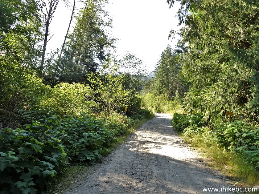
Sowerby Creek FSR
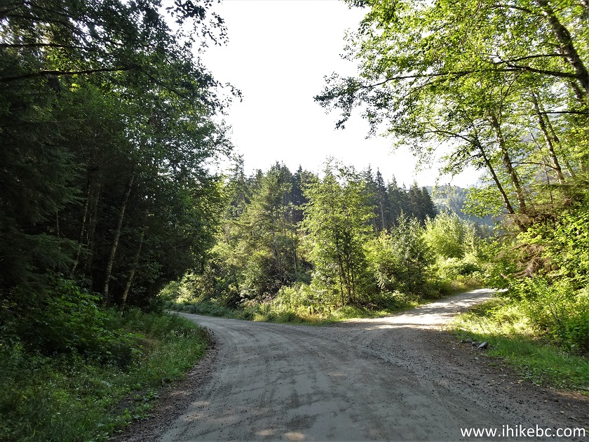
14. Go straight (right) at the split at 0.2 km of the FSR. This and all the subsequent distances are from the beginning of the road near Silver Lake Provincial Park gate.
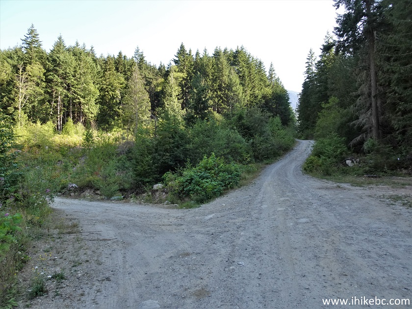
Sowerby Creek Forest Service Road near Hope British Columbia Canada
15. We parked at this sport, located at the 800 meter mark. Coordinates: N 49⁰15.645' W 121⁰36.267'. Elevation: 640 meters. There is a pretty deep cross-ditch right before it, however.

Sowerby Creek FSR near Hope BC
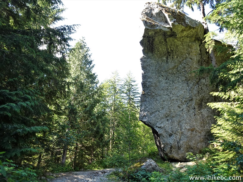
16. The reason we did not go further was this large stone 90 meters later. A narrow body vehicle might make it past the stone, but we did not want to risk a rollover due to a road drop-off on the left side. Sowerby Creek FSR becomes much rougher in places after that.
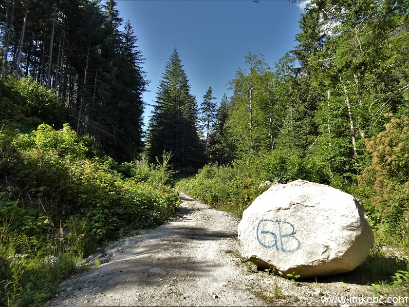
Boulder on Sowerby Creek FSR
17. So, we started hiking from the 800 meter mark of Sowerby Creek FSR. The first good view appeared at the 1.20 km mark.
Sowerby Creek Forest Service Road Hike
18. Forty meters later.
Hiking on Sowerby Creek FSR
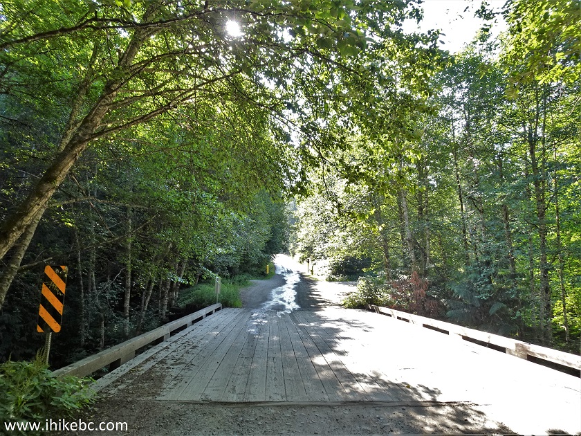
19. A small bridge at the 1.48 km mark.
Bridge on Sowerby Creek FSR
20. And, at 1.73 km, there was this unusual rock. Around this area we also encountered several large toads, which blend in very well with the gray colour of the road, so watch out if you are driving, lest you run them over.
Sowerby Creek FSR large rock
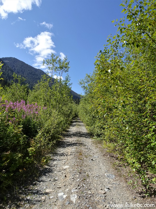
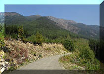
21. A good example of how rough Sowerby Creek FSR can be in places. At 2.00 km here. It gets worse.
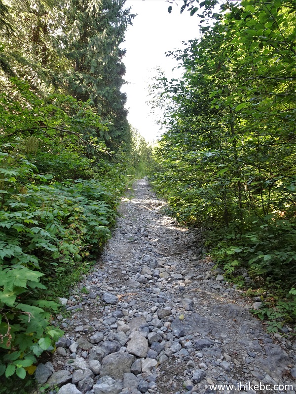
Rough Sowerby Creek FSR
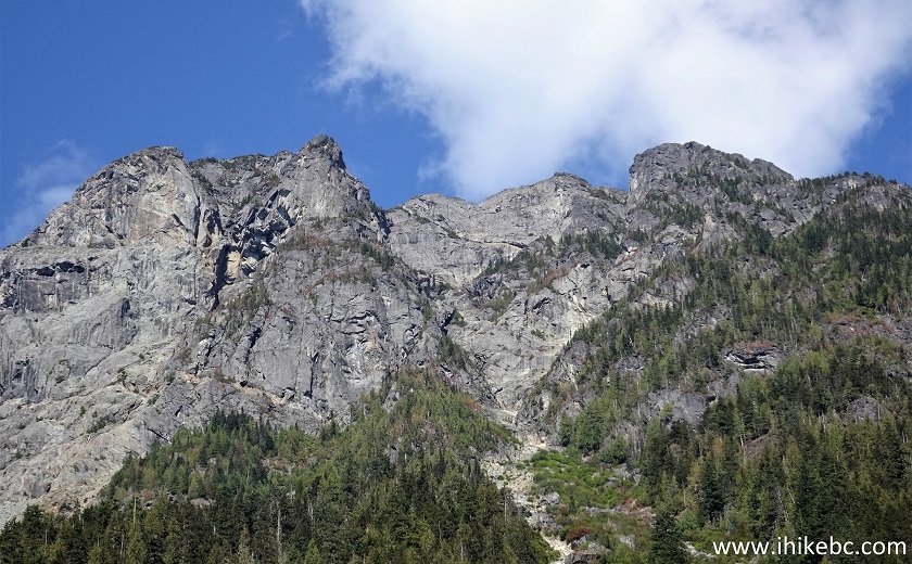
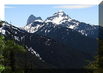
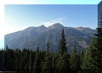
22-23. Another good mountain view at 2.12 km. Plain and zoomed.
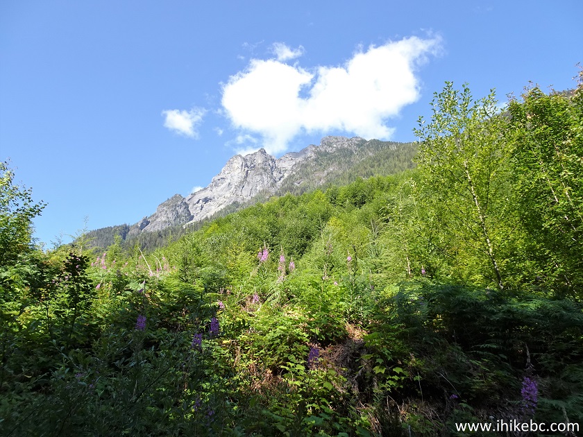
Mountain view from Sowerby Creek FSR
British Columbia Mountain
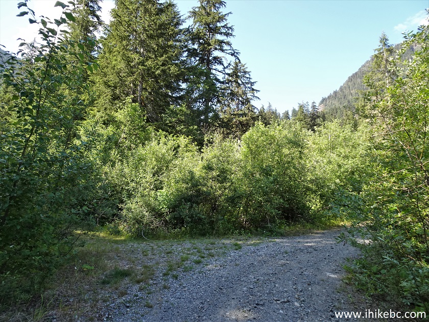
24. Sowerby Creek Forest Service Road at the 2.45 km mark.
Sowerby Creek FSR near Hope British Columbia Canada
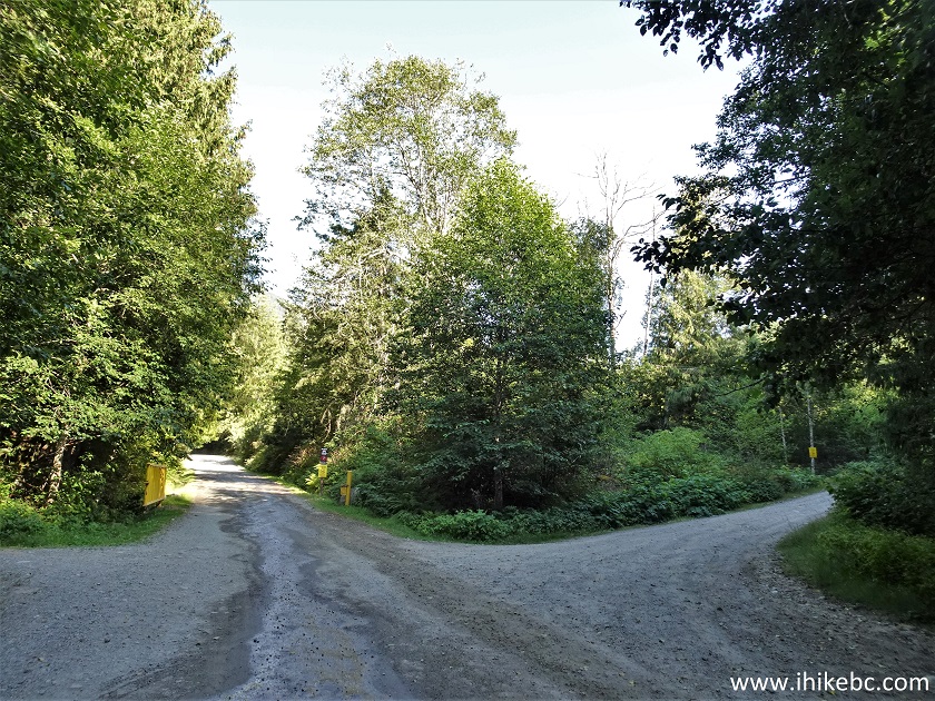
25. At 2.80 km, there is a split. On the left is a good large flat camping spot with a fire ring. FSR continues on the right.
Sowerby Creek FSR
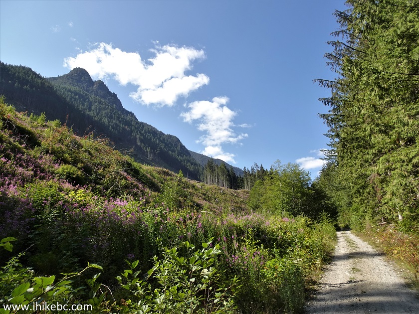
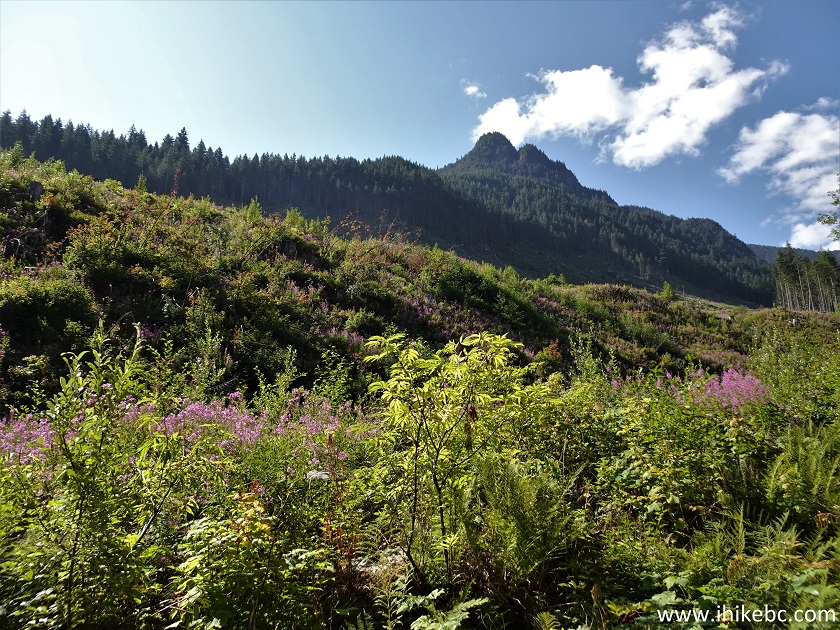
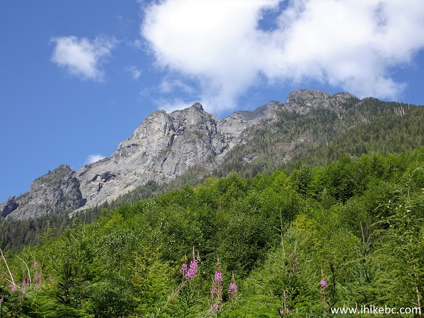
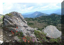
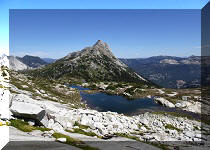
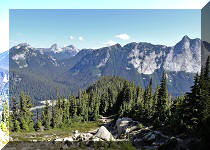
26-27. And a very fine mountain view arrives at the 2.85 km mark.
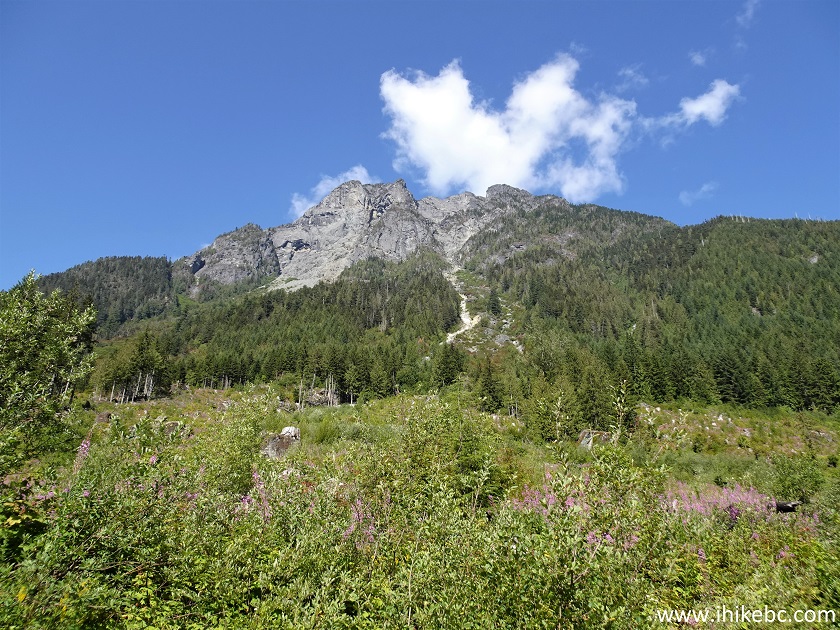
Sowerby Creek FSR mountain view
Mountain near Hope British Columbia
Our Sowerby Creek FSR Trip Report Continues on Page 2.


|
 |
Other Trips in Hope BC Area:
|
|
|
|
|
|
|
|
|
|
|
|
|
|
|
|
|
|
|
 |
|
|
|
|


![]()
![]()
![]()
ihikebc.com Trip 287 - Sowerby Creek FSR Hike (near Hope, BC) Page 1 of 2