![]()
![]()
![]()

Trip 132 - May 19, 2018 (Saturday)
M Gurr Lake Trail Hike
Near Bella Coola, BC
Distance From Vancouver to Bella Coola: (via Highways
1 East, 97 North, and 20 West): approximately
1,000 kilometers.
Liked: Mountain views, "fjord" views, winter scenes, shade on the forest service road leading to the trailhead.
Of note: A high-clearance 4x4 vehicle is required to get to the trailhead via Clayton FSR, or the hike will be 18 kilometers longer (one way). Dangerous hole in the ground at the 11 km mark of Clayton FSR. Snow on the ground likely stays until at least late July.
Cariboo Chilcotin Coast Backroad Mapbook (2015 edition) Coordinates: Page 22 (Bella Coola) C2.
M Gurr Lake Trail is located near Bella Coola, leads to some very fine mountain and water views, and is actually a nice and easy trail, provided: a) you have a high-clearance 4x4 vehicle to get to the trailhead, and b) the snow is gone. In our case, neither of the above conditions were present, so we pushed our bicycle all the way up Clayton Forest Service Road until the snow covered the ground at about the 15 km mark, then hiked in the snow for 3+ km until the trailhead, and then hiked the snow-covered trail itself.
1. To get to the trailhead, take Clayton FSR, the beginning of which is located 1.5 kilometers past the western end of BC Highway 20 near Bella Coola. Here is the beginning of Clayton FSR. Coordinates: N 52⁰22.218' W 126⁰48.660'. Elevation: 38 meters.
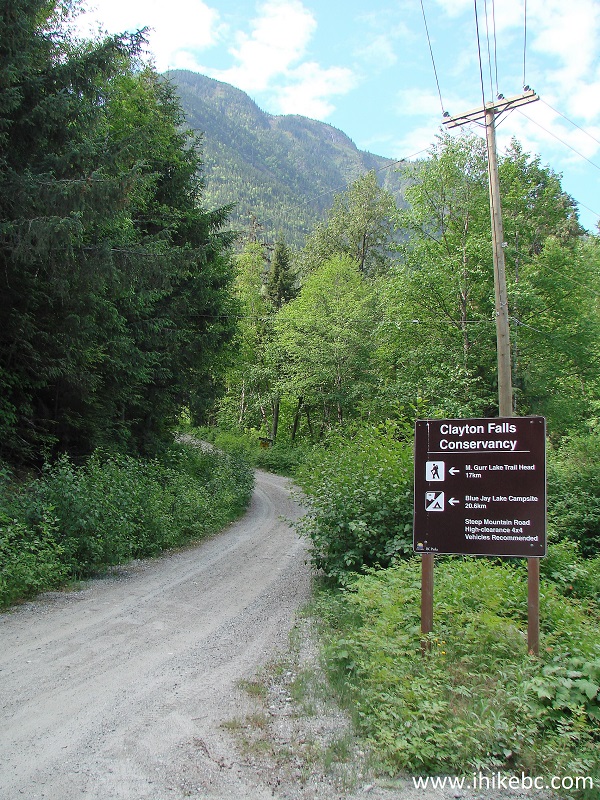
The Start of Clayton Forest Service Road near Bella Coola BC Canada
2. This road is quite smooth and relatively easy for the most part, except here and there it's fairly steep, with lots of loose stones, and there are a few cross-ditches too, so a high-clearance 4x4 is needed to get to the trailhead. Or, you can do what we did today - push a bicycle all the way up, and then ride it down and save a few hours.
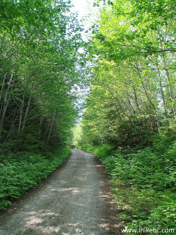
Clayton Forest Service Road near Bella Coola British Columbia
3. The first good view arrived at the 2.6 km mark (all mileage is based on our GPS trip odometer and is approximate).
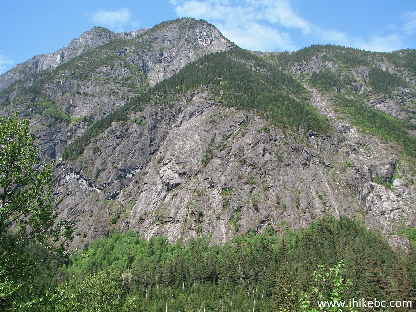
Mountain View from Clayton FSR near Bella Coola British Columbia
4. The second view came at the 9.0 km mark.
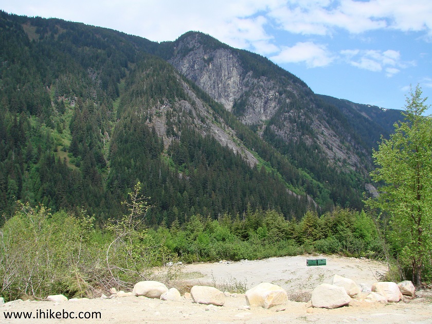
View from Clayton Forest Service Road by Bella Coola BC Canada
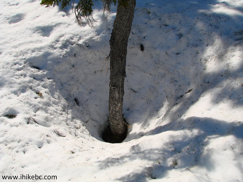
5. Then, there was this dangerous hole in the ground at the 11.0 km mark. It's flagged now, but the flagging tape may not stay there forever, so watch out.
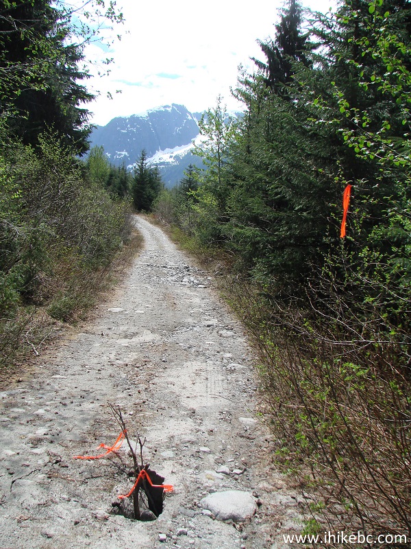
Hole in the ground on Clayton FSR near Bella Coola BC
6. Mount Fougner Recreation Site arrived at the 12.0 km mark, at the elevation of 720 meters. There are a few tables and a pit toilet there, as well as a decent mountain view behind you.
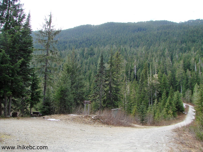
Mount Fougner Recreation Site on Clayton FSR near Bella Coola BC Canada
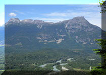
7. Fine mountain views started appearing in abundance shortly after the recreation site.
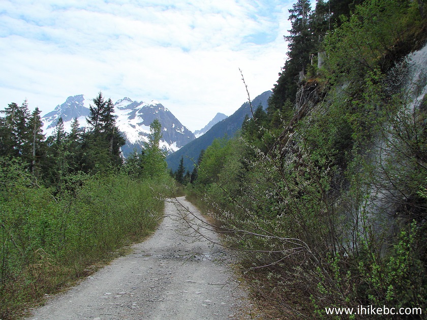
Clayton FSR near Bella Coola British Columbia Canada
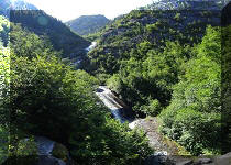
8. As well as this neat waterfall.
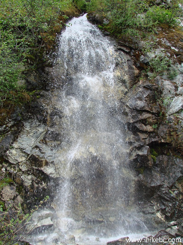
Waterfall by Clayton Forest Service Road near Bella Coola BC
9. It was all going well, until we started seeing snow in patches on the side of the road. Then, at the 14.8 km mark and at the elevation of 928 meters, the snow all but covered the entire road.
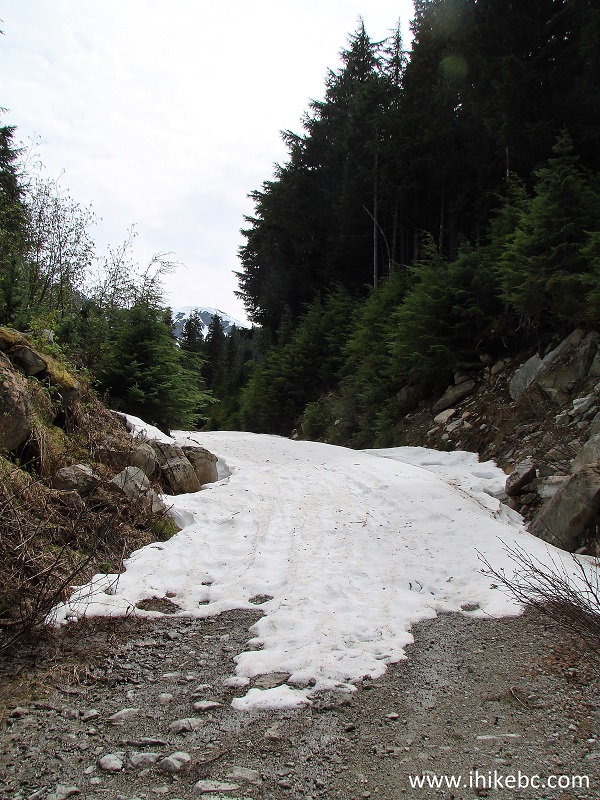
Snow on Clayton FSR near Bella Coola BC Canada
10. We went through this large patch while dragging our bicycle, and were able to take it with us a bit further, as there was a snow-free area on the edge of the road.
Clayton Forest Service Road British Columbia Canada
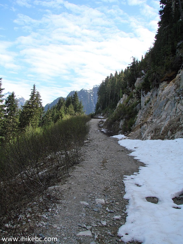
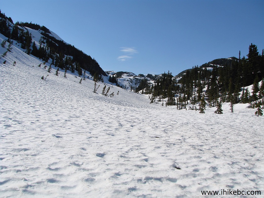
11. All good things come to an end, so we left the bicycle behind, and started hiking snowshoes-free on top of the snow-covered Clayton Forest Service Road. The snow wasn't too soft, so it was possible to hike fairly quickly. Behind us, the mountains began to appear in all of their splendour.
View from Clayton FSR near Bella Coola British Columbia Canada
12. We reached M Gurr Lake trailhead when the GPS odometer showed 18.21 km, moving time was 04:01 hrs, stopped time 01:51 hrs, average speed 4.5 km, maximum speed 28.6 km (bicycle!), and elevation 1,241 meters. The trail info stand indicated 1 km of "easy to moderate" hiking to the lake, and then 1.7 more km of "moderate" hiking to the viewpoint. Trailhead coordinates: N 52⁰17.075' W 126⁰53.405'.
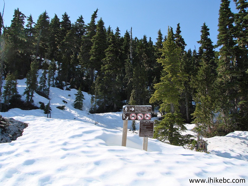
M Gurr Lake Trailhead - Bella Coola Hiking
13. Looking back at the forest service road and the surrounding mountains, before hiking the actual trail.
Clayton FSR near Bella Coola British Columbia Canada Hiking
14. And off we go. There were a few metal orange markers nailed to the trees at the beginning of the trail, but that was all we could find. The only reason we could finish this hike was because of Backroad Mapbook software in our GPS, which showed the trail location.
M Gurr Lake Trail - Bella Coola Trail
15. Check out the snow depth on M Gurr Lake Trail in late May...
Deep snow on M Gurr Lake trail by Bella Coola in the Province of British
Columbia
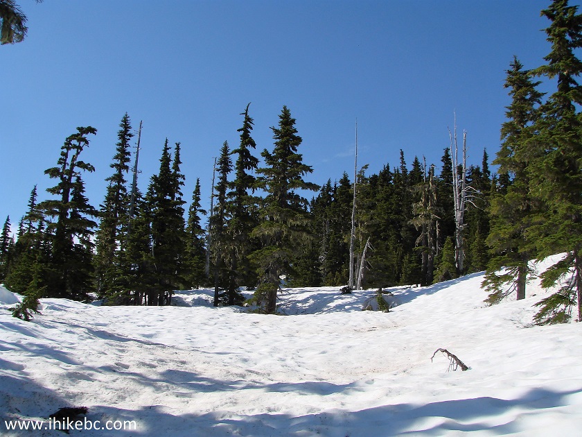
16. After walking through some trees, there was this opening.
M Gurr Lake Trail - Bella Coola Hike
17. The snow melt was in full force, so beware of that and stay off the edges, if you ever hike in the shoulder season. Looking back here.
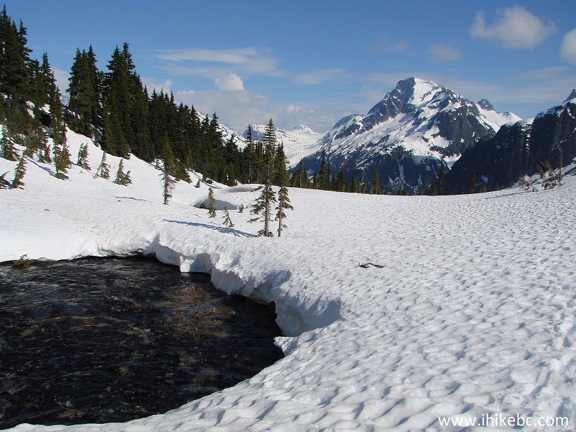
View from M Gurr Lake Trail - Trail in Bella Coola BC Canada Area
18. The opening seen in photo #16 narrowed down quickly.
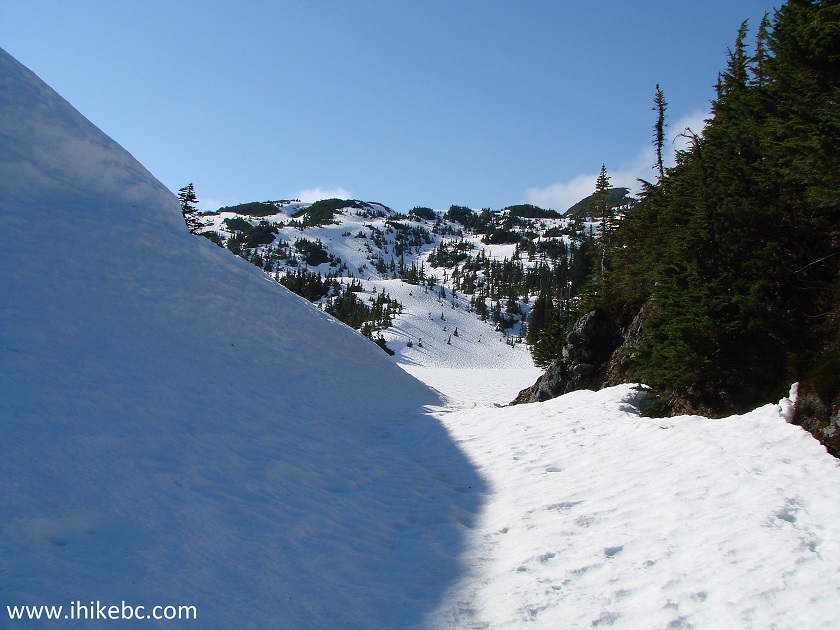
M Gurr Lake Trail - Hike in Bella Coola BC Canada Area
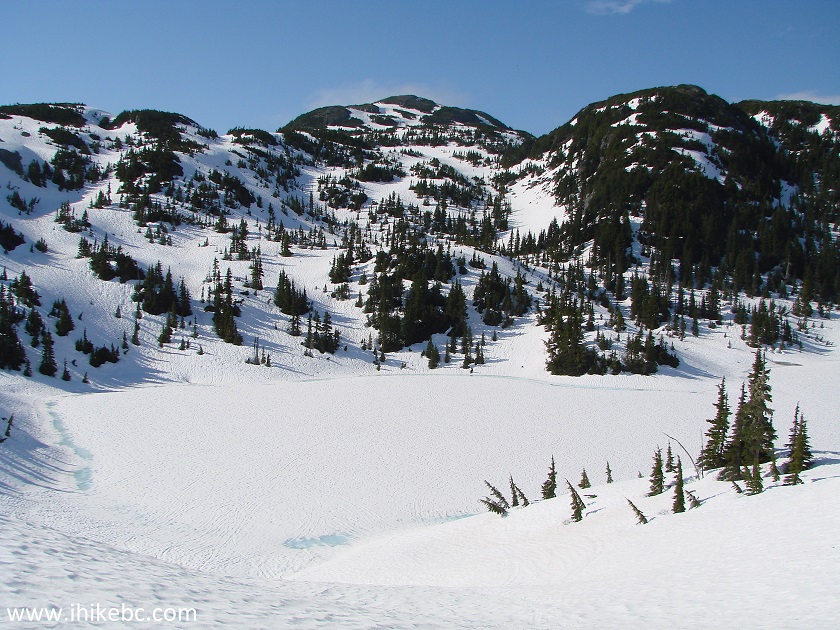
19. Just a few more meters, and here's (mostly) snow-covered M Gurr Lake.
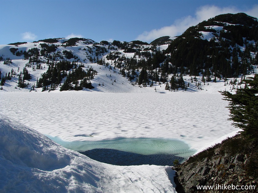
M Gurr Lake - Hiking in Bella Coola Area in the Province of British Columbia Canada
20. GPS trail map showed that the trail went around the lake on the right side. However, it was quicker to go on the left side, which may or may not be possible to do, once the snow is gone.
M Gurr Lake British Columbia Canada
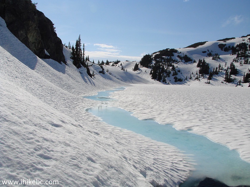
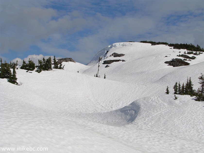
21. A view of M Gurr Lake from above.
M Gurr Lake near Bella Coola BC Canada
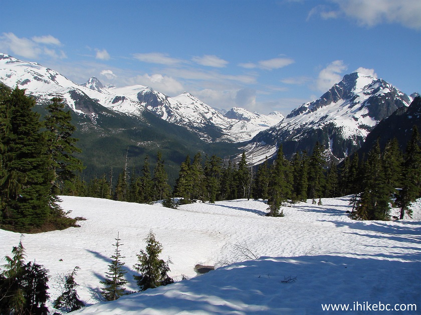
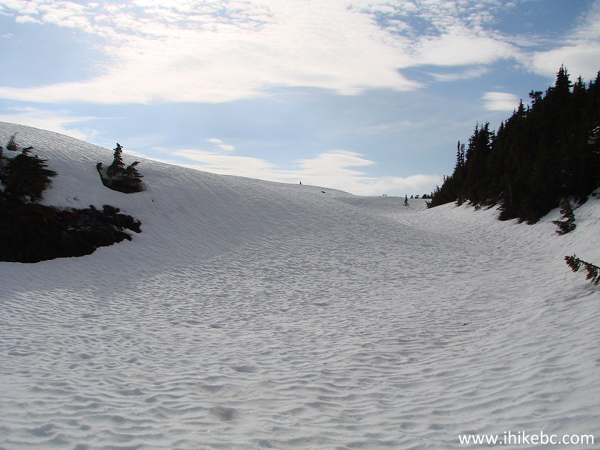
22. There were numerous fine winter scenes during this hike, this being one of them.
View from M Gurr Lake near Bella Coola British Columbia
23. Approaching the viewpoint.
M Gurr Lake Trail Covered in Snow - British Columbia Hiking
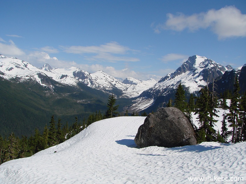
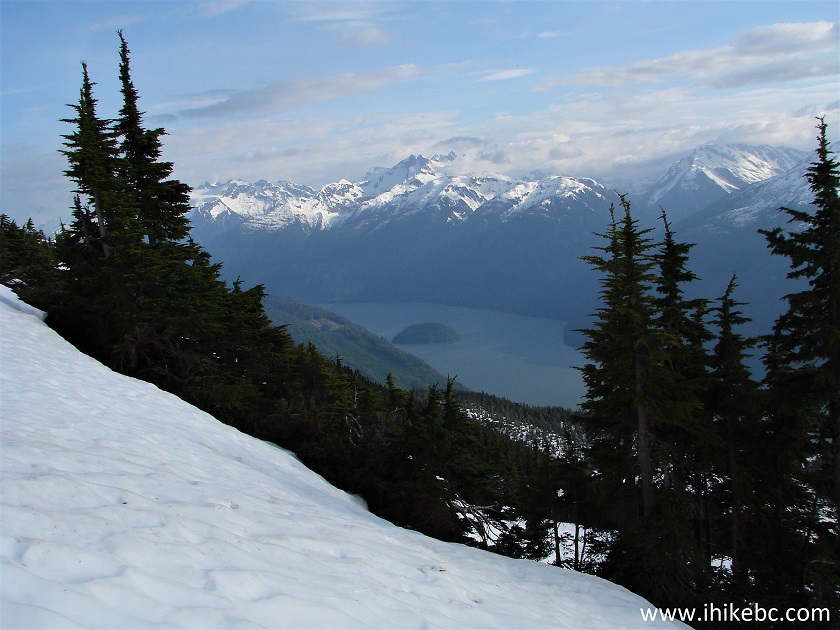
24. And here it is. The sun was not cooperating, but the view was still very good. If we read Backroad Mapbook correctly, this is looking down at Bentinck Arm right before it splits into North and South Arms on the foreground, with Menzies Point being a piece of the ground sticking out in the center-left of the photograph. This is not the end of the trail as per the GPS, and there was still about 150 meters of elevation remaining. So, it's likely the view would be even more impressive, should you reach the actual end of the trail. But, for us, this was it. Coordinates for this viewpoint: N 52⁰17.563' W 126⁰54.315'. Elevation: 1,329 meters.
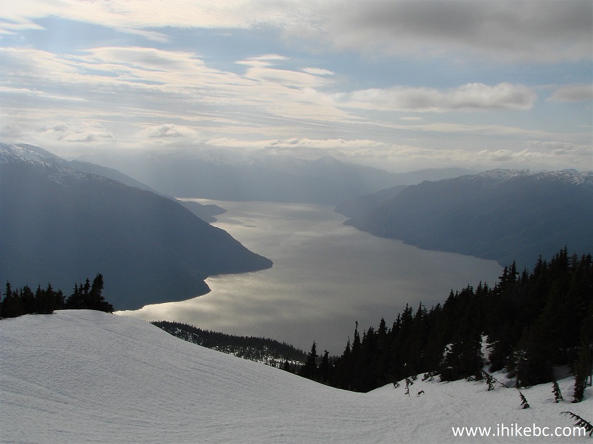
Bentinck Arm Seen from M Gurr Lake Trail near Bella Coola BC Canada
25. Slightly to the left of the viewpoint, we could see what is likely South Bentinck Arm and Bensins Island.
View from M Gurr Lake Trail - Canada hiking
M Gurr Lake Trail has some great views, and is certainly recommended.


|
 |
Other Trips in Bella Coola Area:
|
Schoolhouse
Falls East
|
|
|
|
|
|
|

![]()
![]()
![]()
ihikebc.com Trip 132 - M Gurr Lake Trail Like (Near Bella Coola BC)