
Trip 017 - April 12, 2010 (Monday)
Mount Hope Lookout Trail
Hope BC
Distance From Vancouver:
Liked:
Picturesque trail, views from the top.Of note:
The trail is popular, there is a constant noise from Highway 1, the terrain is moderately challenging. Hiking boots and poles are recommended.
Vancouver, Coast & Mountains Backroad Mapbook (2010 edition)
Coordinates:
Page 15 (Hope) F7.
Related Websites:
District of Hope,
Experience Hope.
Other Trips in Hope BC Area:
Thacker Mountain
Trail,
Flat Iron Peak Trail,
Needle Peak Trail,
Sowerby Creek FSR Hike,
Dog Mountain Trail,
Jones Lake FSR Trip to
Jones Lake, Yak Peak Trail,
HBC Heritage Trail,
Sowaqua Creek
FSR, Zoa Peak Trail,
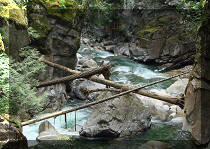
Skagit River Trail,
Skyline II Trail Hike,
Silver Skagit Road, Mount Outram Trail,
Othello Tunnels,
Eaton Lake Trail,
Town of Hope BC.
Mount Hope Lookout Trail is located in
Hope British Columbia, close to the Tourist Info Centre. This trail
is not to be confused with Mount Hope Trail off Highway 3, where a
forest service road has to be taken for the trailhead to be reached. The
trail we hiked today leads to a lookout from where you can see Mount
Hope in the distance.
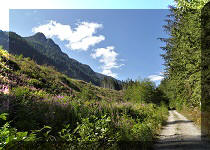
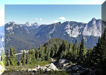
This is a pleasant, if short, hike, with excellent views of the town of
Hope, Fraser River, and the surrounding mountains awaiting at the top.
Good hiking boots and hiking poles would be helpful. There is
a small parking area by the trailhead, and there are separate trails for
hikers and bicycle riders. If all the parking spaces are taken, you can
park by the Tourist Info Centre 0.5 km away.
1. To find
Mount Hope Lookout Trail parking, get off Highway 1 East at the Hope
exit (#170), follow the signs to city center, and, within two minutes, you would arrive at the intersection below,
where you would turn right.
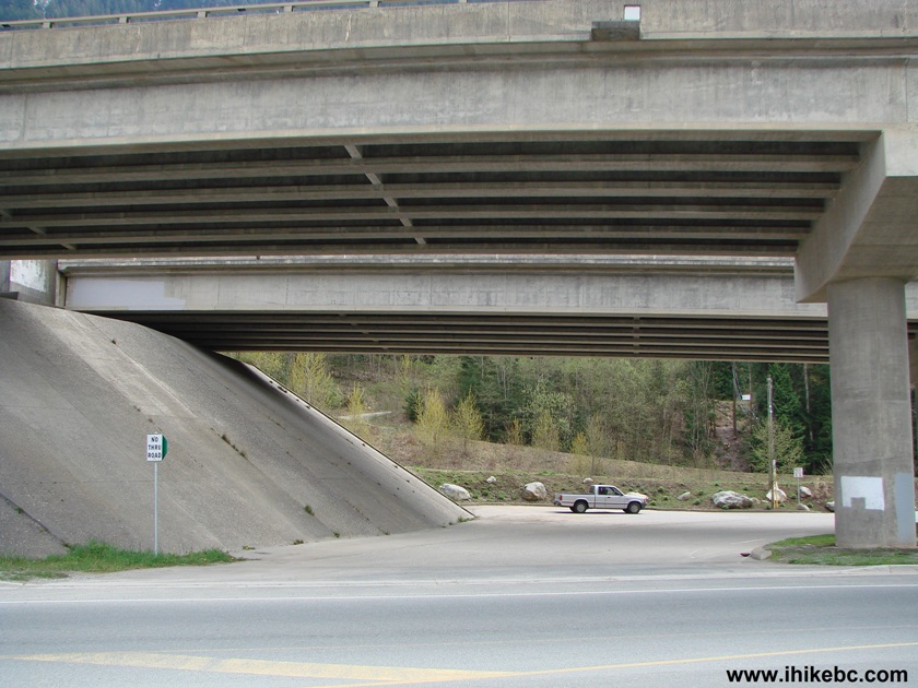
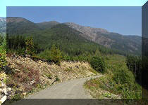
2. Literally within thirty meters of turning right, you
would make another right turn onto a road (seen in the photo below) which leads to a small parking
area in less than a minute. "No thru road" sign is your landmark. You
can park along this road too, though signs request to limit your stay to
4 hours.![]()
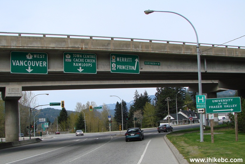
TransCanada Highway 1 East in Hope British Columbia
Hope BC Canada
3. Here is the small parking area next to the Mount Hope Lookout trailhead.
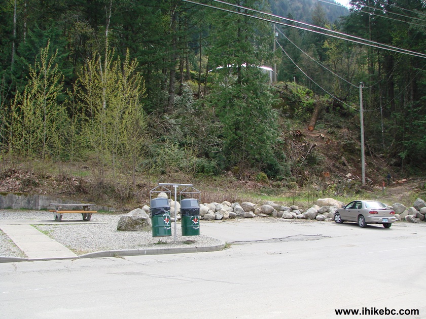
Parking near Mount Hope Lookout trail - Hope British Columbia Canada
4. And to the left of the photo above is a gate, beyond which the trail begins.
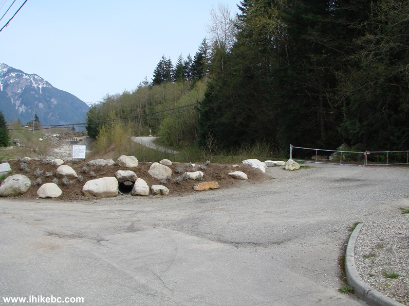
Mount Hope Lookout Trail start - Hope BC Canada
5. You go up, and soon the trail becomes separate for hikers and bikers.
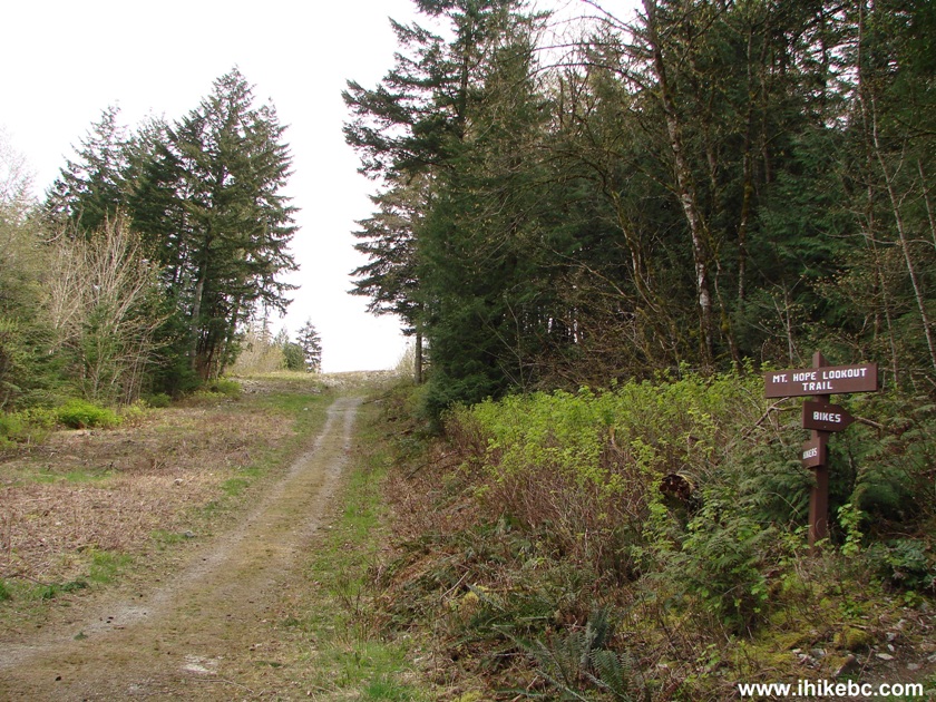
Mount Hope Lookout Trail separate bicycle and walking trails - Hope British
Columbia Canada
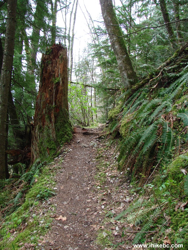
6. The last sign before Mount Hope Lookout Trail enters into the woods.
Mount Hope Lookout trail - Hiking in Hope Area of British Columbia Canada
7. The path is moderately challenging, with some stones, but mostly
it's a soft ground.
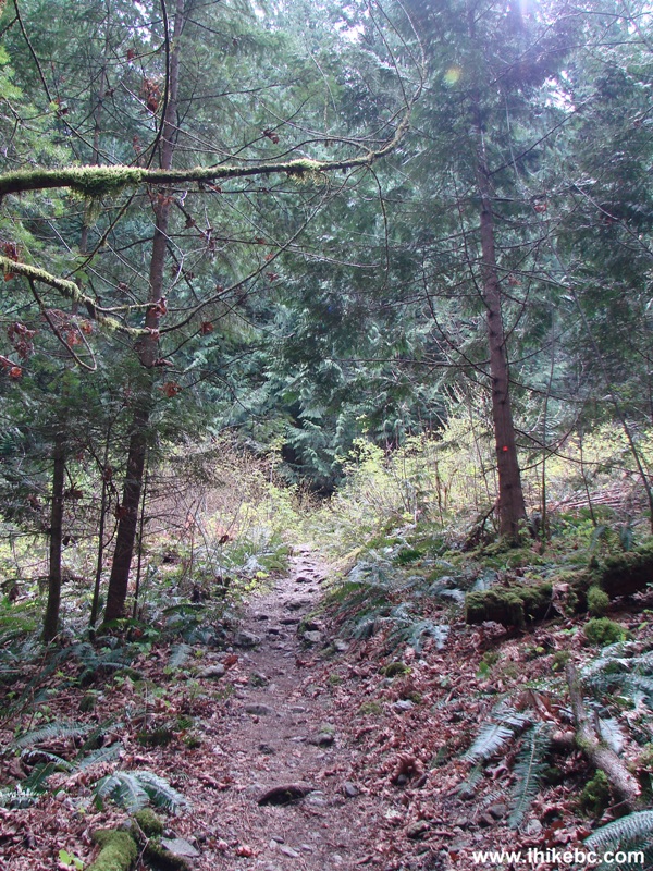
Mount Hope Lookout trail - Hope British Columbia Canada - BC Hiking
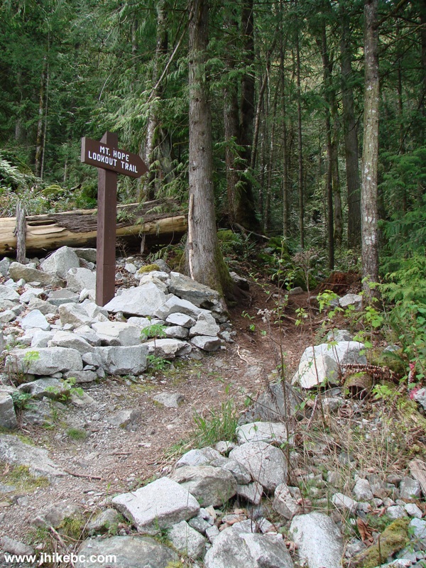
8. In ten minutes, there is an intersection with Joan Greenwood Loop Trail.
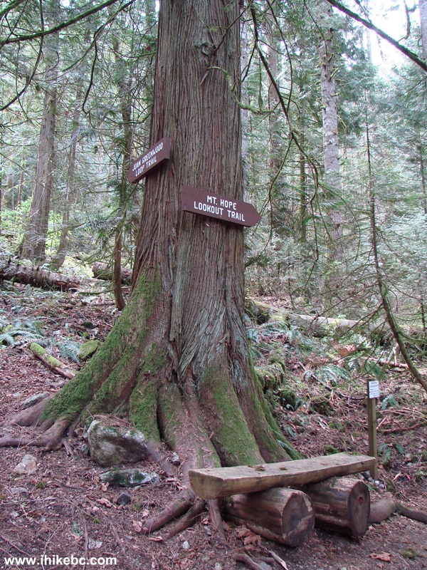
Mount Hope Lookout Trail intersection with Joan Greenwood Loop Trail
9. Mount Hope Lookout Trail features several ladders. They are so old that they
appear
to be a natural part of the landscape.
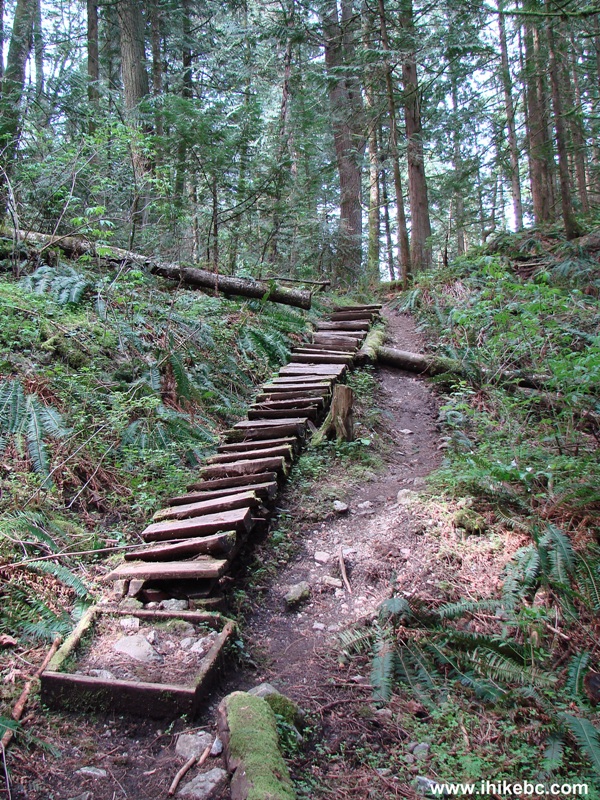
Photo of a ladder on Mount Hope Lookout Trail - Hope BC Canada
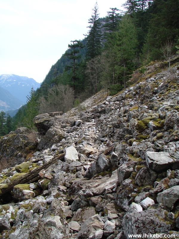
10. A few parts of the trail are steep and rocky.
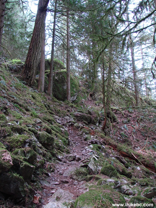
BC Hiking -
Mount Hope Lookout Trail
11. Another ladder.
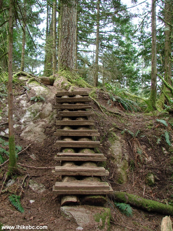
Mount Hope Lookout trail - Hope British Columbia Canada - Hiking in BC
12. And one more.
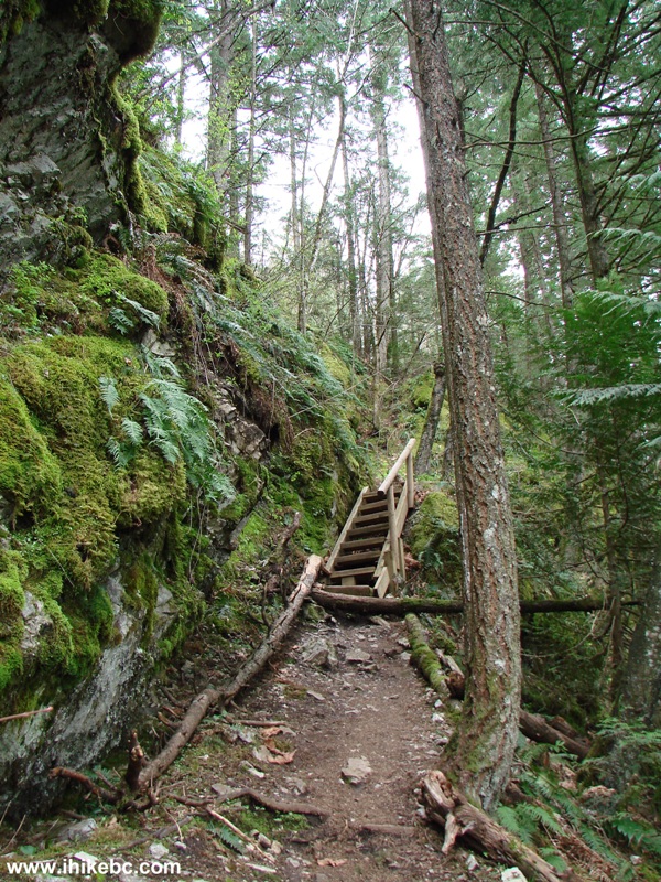
Hiking in British Columbia -
Mount Hope Lookout Trail
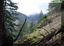
13. You also pass by moss-covered rocks, though the moss here is not as lush as
on Mount Lincoln.
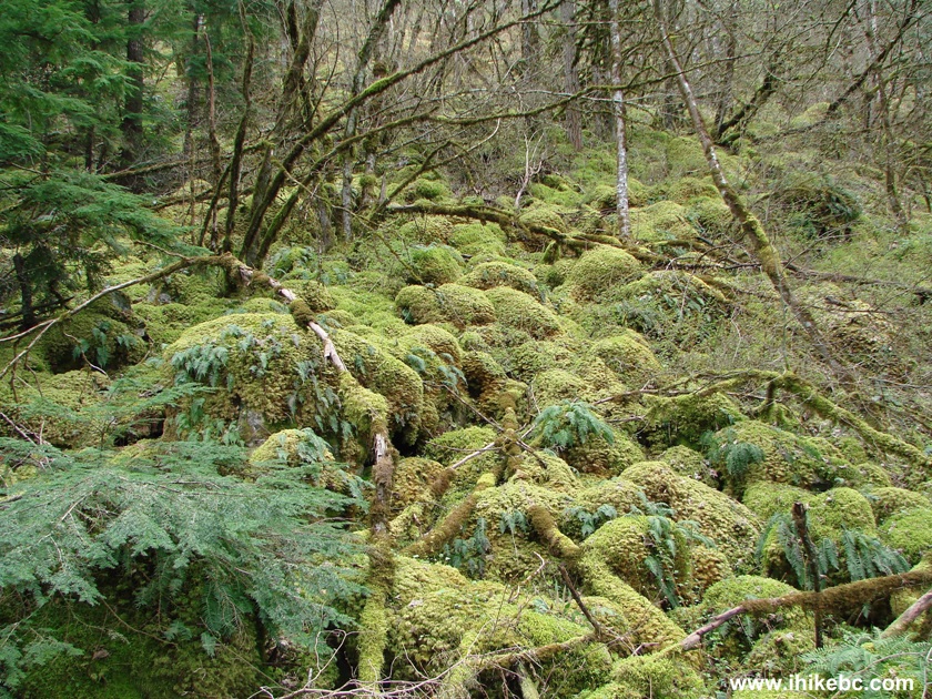
Moss-covered rocks on Mount Hope Lookout trail - Hope British Columbia Canada
14. Getting close to the top.
Mount Hope Lookout trail - Hope British Columbia Canada
15. And, then, a clearing. The final few steps are along a very rocky path.
16. Once you get out there, the views are to your left, and to the right would
be more stones. If you decide to climb higher, beware that the rocks are very
unsteady and would be slippery when wet. To get down would be even tougher due
to the steepness of the mountain at this point. Here we are looking to our
right.
The end of Mount Hope Lookout hiking trail - Hope BC Canada
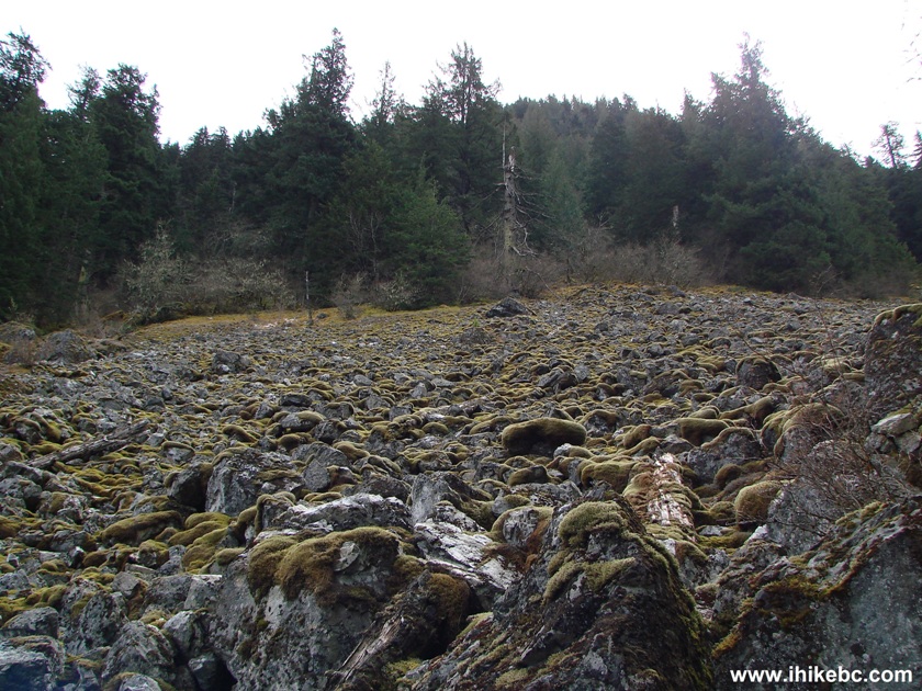
Stones on Mount Hope - British Columbia
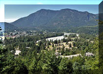
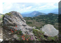
17. Time to see the views. Sunny days would be even better.
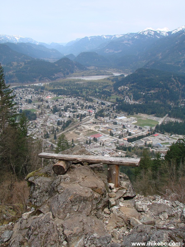
Town of Hope seen from Mount Hope Lookout trail - Hope British Columbia Canada
18. Zooming in to get a good look at Hope. The green building in the middle is
"Buy & Save Foods."
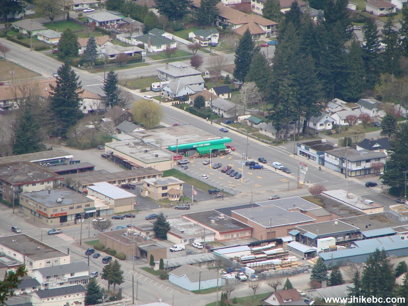
View of Hope BC from Mount Hope Lookout trail
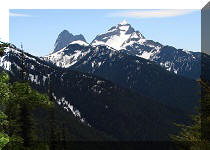
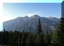
19. To the right we see a large mountain. Perhaps, this is Mount Hope we are looking out for?
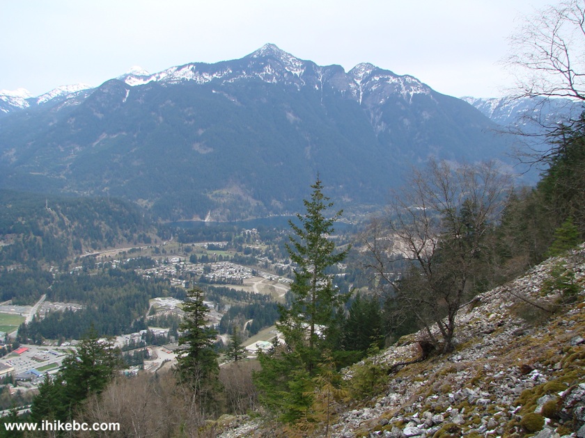
View from Mount Hope Lookout trail - Hope British Columbia Canada
20. It is possible to walk for another 30 meters down the rocky path to sit at the second
bench, and to have a better view of Fraser River on the left side.
Here is our video of the views from the top of the trail:
More ihikebc videos are on
our YouTube Channel.
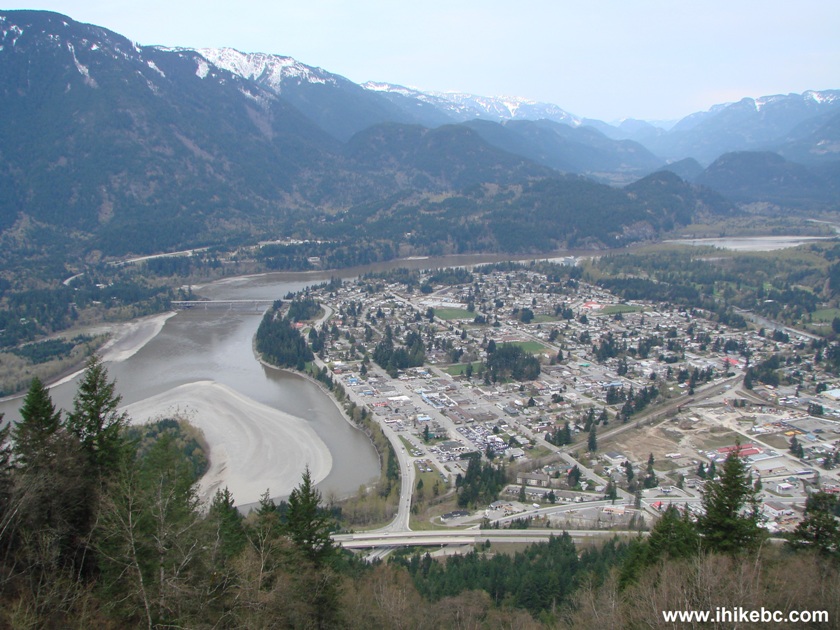
Fraser river seen from Mount Hope Lookout trail - Hope BC
Total time to the top - 50 minutes.


|
 |
Other Trips in Hope BC Area:
|
|
|
|
|
|
|
|
|
|
|
|
|
|
|
|
|
|
|
 |
|
|
|
|


![]()
![]()
![]()
ihikebc.com Trip 017 - Mount Hope Lookout Trail Hike (Hope BC)