![]()
![]()
![]()

Trip 041 - June 6-7, 2011 (Monday-Tuesday)
Chehalis Forest Service Road
Between Harrison Mills and Agassiz off BC Highway 7
Page 1 of 2
Distance From Vancouver:
100-120 km to
the beginning of the FSR
either via Highway 1 East, then via Highway 11 North and 7
East. Or via Highway 7 East (Broadway, turning into Lougheed Highway in Burnaby) directly from Vancouver. The FSR
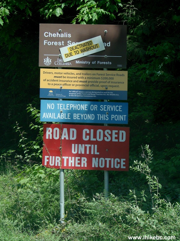
itself ends shortly after the 31 km mark in a small washout and then a massive
rockslide.
Liked: Natural views (especially great views of Chehalis Lake), peacefulness, fairly good gravel road with few potholes.
Of note: Chehalis FSR is suitable for 4x4 or high clearance 4x2 vehicles only, remote wilderness area, no cell phone signal, active logging area with frequent logging truck traffic. Chehalis FSR ends shortly after the 31st kilometre in a small washout followed shortly by an enormous rockslide.
Vancouver, Coast & Mountains Backroad Mapbook (2010 edition) Coordinates for the Beginning of the FSR: Page 4 (Chilliwack) C2.
Other Forest Service Roads Trips: Chilliwack Bench, Chilliwack Foley, Chilliwack Lake, Chuchinka-Colbourne (North of Prince George), Clear Creek (off Harrison East), Florence Lake (access to Stave Lake by Mission), Harrison East, Harrison East Second Trip, Harrison West, Jones Lake (near Hope), Lost Creek (by Mission), Mamquam River (by Squamish), Nahatlatch (near Boston Bar), Parsnip West (by Mackenzie), Scuzzy (by Boston Bar), Shovel Creek (off Harrison East), Sowaqua Creek (by Hope), Squamish River Main, Squamish River Ashlu, Squamish River E-Main, Squamish River FSR Washout, Windfall Creek (by Tumbler Ridge).
December of 2011 WARNING: The Provincial Government warns of a risk of a further landslide and resulting tsunami at Chehalis Lake. Reconsider your visit to the slide (starts at km 31 of Chehalis FSR and described in this trip report) and your use of any campsites by Chehalis Lake, including Skwellepil Campground described in this trip report.
The reason we visited Chehalis Forest Service Road was to get access to the Statlu Lake trailhead. We could not get to that hike due to a huge rockslide wiping off Chehalis FSR after the 31 km mark. However, the natural views en route to the trailhead made the trip worthwhile. As you are reading the trip report, note the danger presented by logging trucks. And, if you decide to visit the rockslide, be properly equipped and be extremely careful - it is a very dangerous area with high potential for serious injury. Also, if you plan on camping at Skwellepil Creek BC Forest Service Campground between km 30 and 31 of the Chehalis FSR, there are photos and a short description on Page 2 of this trip report. Do note that it is not a good idea to drive a 4x2 vehicle into Skwellepil Creek Campground - you may get stuck on a hill with loose surface on your way back.
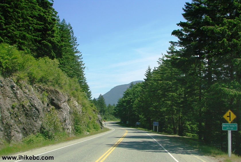
1. To get to Chehalis FSR, drive on Highway 1 East, then in Abbotsford take exit to Highway 11 North and drive all the way to Mission, and then take Highway 7 East from downtown Mission. Or take Highway 7 East all the way from Vancouver. Here we are on BC Highway 7 East, somewhere between Mission and Harrison Mills. The left turn from Highway 7 to Morris Valley Road en route to Chehalis FSR is 32 km from downtown Mission.

BC Highway 7
2. Upon seeing this sign shortly after Harrison Mills, get ready to take the next left turn onto Morris Valley Road.
Picture of Highway 7 British Columbia Canada
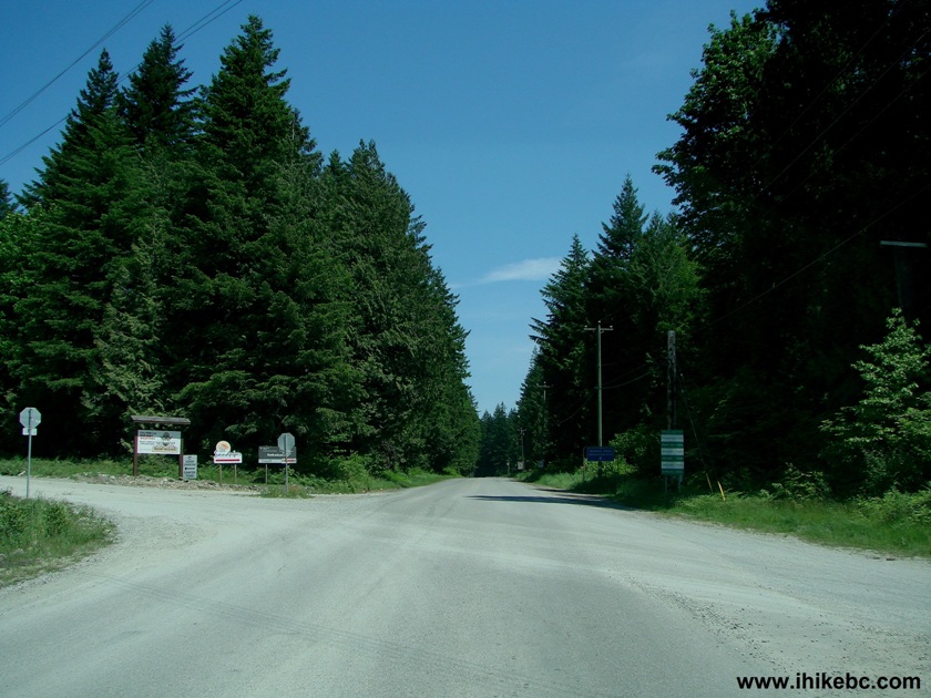
3. After turning onto Morris Valley Road, drive for less than a minute and arrive to a 4-way stop intersection, where you need to turn left onto Chehalis Forest Service Road.
Morris Valley Rd British Columbia Canada
4. After turning left, the following signs appear on the side of the road. Zero your trip odometer here, as you would be turning right at a fork 15.5 km later.
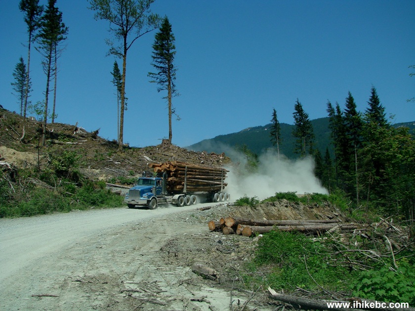
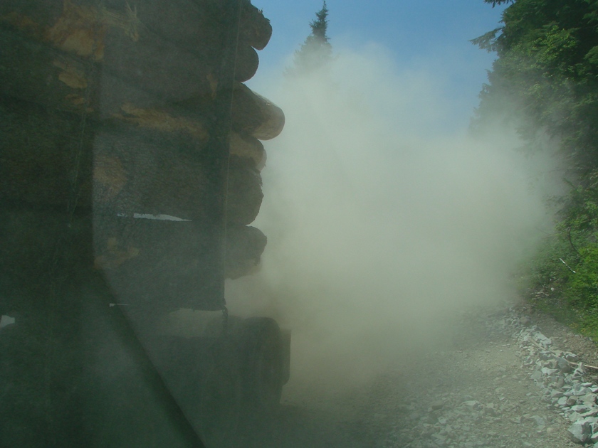
5. Chehalis FSR was very much open and activated. All the way to the 31st kilometer, no less. HOWEVER - Chehalis FSR is an active logging road. Our first logging truck appeared very shortly. If you do not have a radio containing Resource Roads channels (frequency is indicated on a sign on the side of the road) and can neither warn the logging truck drivers of your location nor hear their announcements as they are driving on the road, you are taking a substantial risk of colliding with one of these beasts, or being sideswiped. Logging trucks have a right of way, they are very long, wide and heavy, and some stretches of the road leave little space for you to pull over. You would need to drive slowly, and be ready to encounter a logging truck behind every blind corner. We have met five logging trucks through the first twenty kilometers of the road.

Logging Truck Photo on Chehalis Forest Service Road Province of BC
Canada
6. Within several minutes, we reached a small but picturesque Elbow Lake. There were about twenty vehicles parked on both sides of the road near the lake, and a whole bunch of people were camping there. It would be good to drive especially slowly in this area, not only to avoid running over a camper, but also to ensure that you do not raise a cloud of dust.
Elbow Lake Chehalis FSR
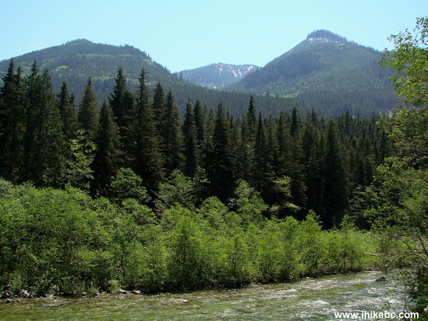
7. Chehalis FSR is a fairly picturesque road. Not quite as beautiful as Squamish River FSR, but definitely a quality drive. And, unlike Squamish River FSR, the potholes are few here.
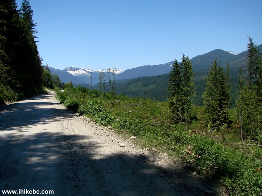
Chehalis Forest Service Road BC Canada
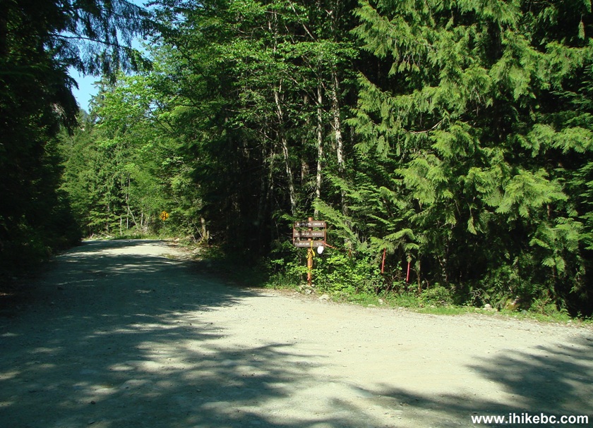
8. You would be crossing several bridges over photo-worthy creeks. This particular creek is 15.5 km from the start of the road, and it is remarkable because there is a road split right after the bridge, and the main road (Chehalis FSR South) continues on the right.
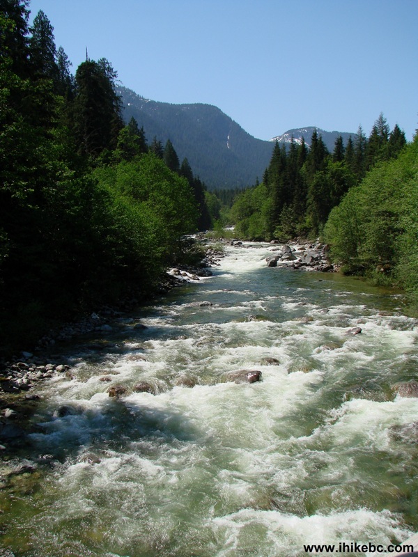
View of a creek from Chehalis FSR near Harrison Mills BC Canada
9. Here is the promised road split right after the bridge across the creek pictured above. Turn right.
Chehalis FSR by Harrison Mills British Columbia Canada
10. Chehalis FSR after we turned right. On the right side is Statlu Creek, if we are reading correctly the map in the "Vancouver, Coast BC & Mountains Backroad Mapbook." Don't know how and why, but Statlu Lake, to where we were going to hike, is way, way ahead, and is nowhere near Statlu Creek.
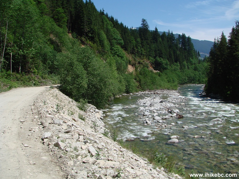
Chehalis Forest Service Road British Columbia Canada
11. Looking to our right we see mountains, and nature in general.
View from Chehalis FSR East of Mission BC
12. And here is another logging truck. This is the third one we've met. The second one came "out of nowhere," and we did not have time to take a picture. The road was narrow, and we pulled as close to the right as possible and stopped. The (second) logging truck then stopped next to our vehicle, the driver rolled the window down, and asked that we drive forward - he was probably concerned that otherwise the logs might scratch our ride. The (third) truck pictured below passed by us without any drama.
Logging Truck Chehalis FSR
13. A bit of a drama arrived a few minutes later. We were on a rather steep incline. Lo and behold, a logging truck surrounded by a wall of dust started heading down our way.
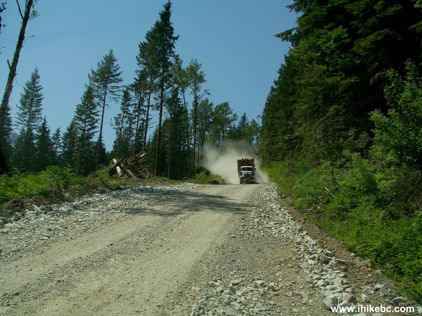
Chehalis Forest Service Road - logging truck
14. Repeat the exercise: pull to the right, stop, wait. Here it comes.
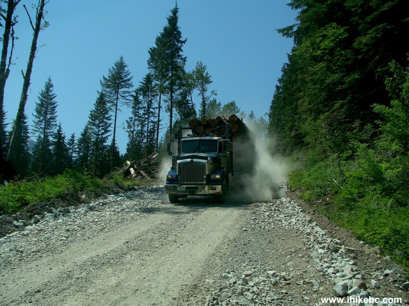
Logging truck on Chehalis FSR by Harrison Mills British Columbia Canada
15. It was close.
Close call with a logging truck on Chehalis FSR near Harrison Mills BC
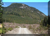
16. Moving on, we drove by a logged area.
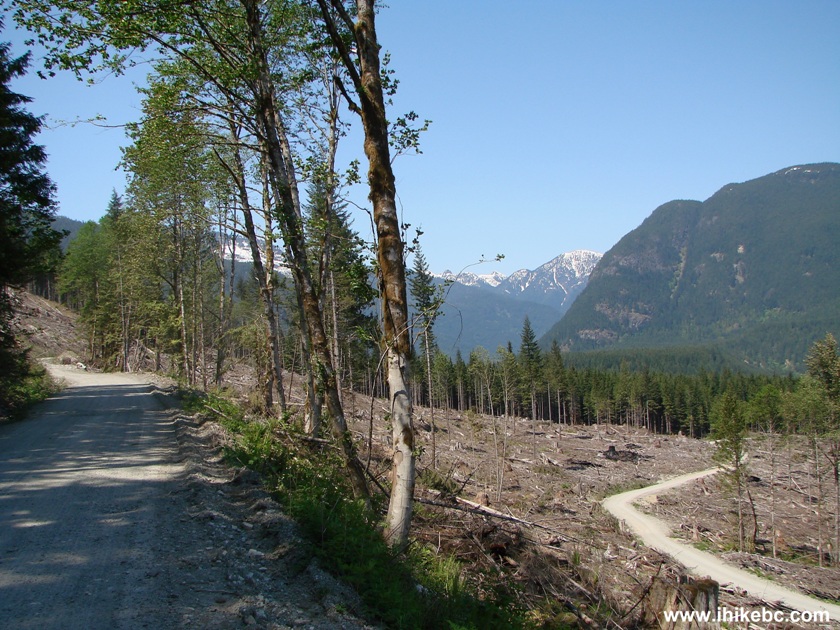
Photo of Chehalis FSR British Columbia Canada
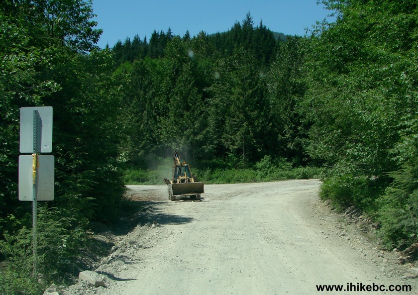
17. Then waited for a while, as the road was blocked by a "tanker" pickup, whose driver was fuelling up a piece of equipment.
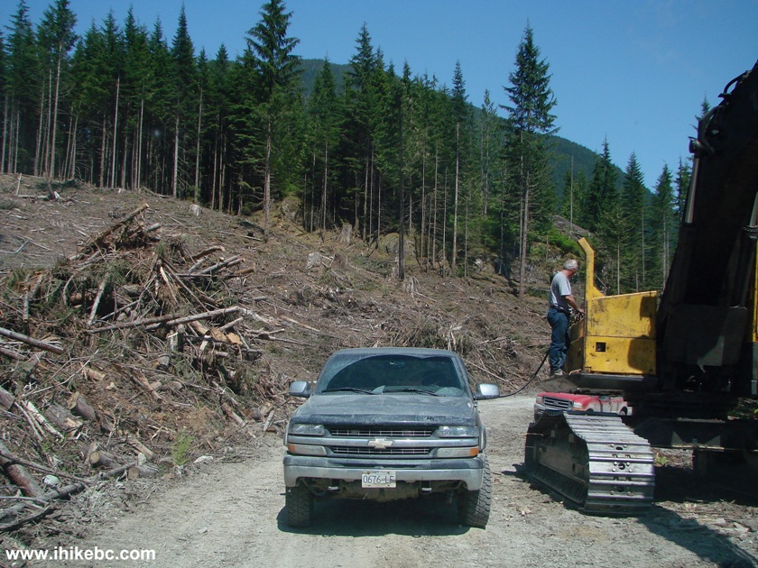
Logging equipment being fuelled up on Chehalis Forest Service Road
Province of BC Canada
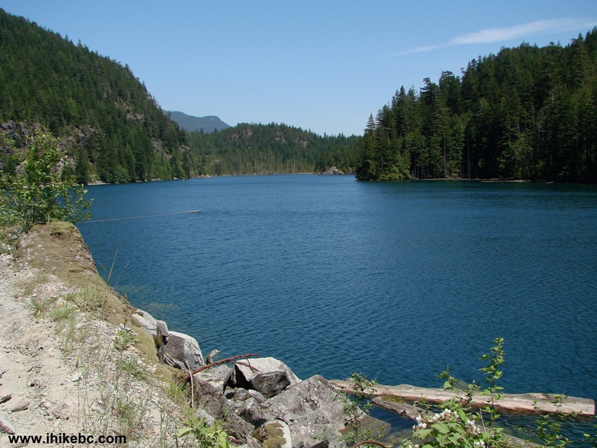
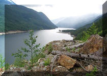
18. Around the 24 km mark or so (you would see yellow markers every kilometer), we have reached a nice-looking Chehalis Lake. It appeared absolutely deserted. Here is the view of the lake right after the 25 kilometer mark.
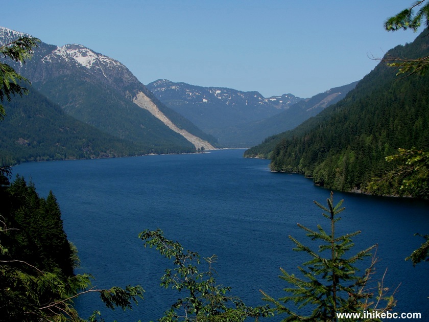
Chehalis Lake British Columbia Canada
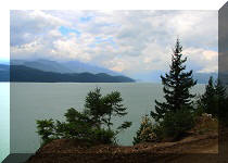
19. About 15 minutes later, between km 29 and 30, there is another great viewpoint, and this time there is enough space for a small picnic. Ashes in the area indicated the spot is popular with campers. However, there is space for but one vehicle there, though it is possible to drive forward for a few minutes and find more parking.
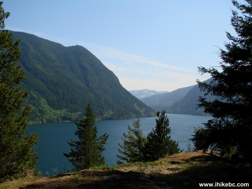
Chehalis Lake British Columbia Canada
20. Between km 30 and 31 of Chehalis FSR, on the right side there is an entrance to Skwellepil Creek BC Forest Service Campground. On the next page we will show the campground itself, the views from the campground, and also the photos from our trip to the rockslide blocking Chehalis FSR shortly after the 31 km mark. Note, that, unless you have a 4x4 vehicle, it would be a bad idea to enter the campground due to a hill with loose surface, which a 4x2 vehicle may not be able to tackle on the way out.
Chehalis FSR at Skwellepil Creek BC Forest Service
Campground
Our Chehalis FSR trip report Continues on Page 2.


|
 |
Other Trips in Harrison Hot Springs Area:
|
|
|
|
|
|
|
|
|
|
|
|


![]()
![]()
![]()
ihikebc.com Trip 041 - Chehalis Forest Service Road Visit (Off BC Highway 7) Page 1 of 2