![]()
![]()
![]()

Trip 078 - March 2-3, 2015 (Monday-Tuesday)
Lost Creek Forest Service Road
Visiting Salsbury Lake, Davis Lake, and McDonald Falls.
Page 1 of 2
Distance From Vancouver to the Beginning of Lost Creek FSR:
90-110km
either via Highway 1 (and then Highway 11), or via Highway 7 directly
from Vancouver. To be more precise, it's 22.7 km after the intersection
of Highway 7 and Highway 11 in
downtown Mission.
Liked: Several natural views, McDonald Falls, beautiful Salsbury Lake.
Of note: Wilderness area, no cell phone signal, logging trucks on the road. This FSR is very popular with recreational shooters, so you are quite likely to hear numerous gunshots during your visit. On top of that, ATVs have access to Davis Lake, so, chances are, you are not going to have a quiet picnic there.
Vancouver, Coast & Mountains Backroad Mapbook (2010 edition) Coordinates for the Beginning of the FSR: Page 3 (Abbotsford) F2.
Related Websites: Davis Lake Provincial Park - BC Parks Official Site, Chilliwack District FSR Conditions.
Other Forest Service Roads Trips: Chilliwack Bench, Chilliwack Foley, Chilliwack Lake, Chuchinka-Colbourne (North of Prince George), Clear Creek (off Harrison East), Harrison East, Harrison East Second Trip, Jones Lake (near Hope), Mamquam River (by Squamish), Nahatlatch (near Boston Bar), Parsnip West (near Mackenzie), Scuzzy (by Boston Bar), Shovel Creek (off Harrison East), Sowaqua Creek (by Hope), Squamish River Main, Squamish River Ashlu, Squamish River E-Main, Squamish River FSR Washout, Windfall Creek (by Tumbler Ridge).
Follow @ihikebc
Tweet
Lost Creek Forest Service Road is located close to the town of Mission,
and leads to several lakes, one waterfall, and at least one trailhead.
In our numerous travels on British Columbia's forest service roads, we
have not seen so many shooting targets placed along a forest
service road and its numerous spurs. If you have never been to a war zone and want to
get a feel for what a battlefield might sound like when there is an
exchange of gunfire, visit Lost Creek FSR, preferably on a
weekend. For those who want to do some
camping, this road may not
be so good. While you may drive rather far into the wilderness, the only
real attraction we have found was Salsbury Lake, and it has few access
points, which might be taken by other campers. Davis Lake Provincial
Park is located by this FSR, but, aside from a sign indicating you have
entered the Park, there are no other signs, and nothing to tell you how
to find the Davis Lake itself. If you would, eventually, find the lake,
the echo of gunshots and the roar of ATVs, which have lake access, would
likely make you want to leave just as soon as you arrive. That said, if
the sun is out, there is no wind, and you are able to get to Salsbury
Lake some time in the morning, you are in for a visual treat.
We first visited Lost Creek FSR in October of 2010, hoping to hike Mount
St. Benedict trail. However, we got to the trailhead too late in the
day, so there was no hike back then. This time, we have decided to see
Davis Lake, since there was a "Davis Lake Provincial Park" sign along
the FSR when we drove towards Mount St. Benedict Trailhead in October. The first
several photos are, thus, from October of 2014, showing the way to Lost
Creek FSR.
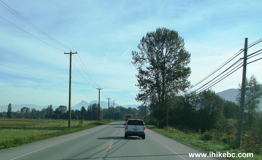
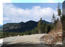
1. It's fairly easy to get to Lost Creek FSR. Get to Mission either via
Highway 1 (and then 11) or via Highway 7 straight from Vancouver, and
drive East on Highway 7 past Mission. This is Highway 7 East of Mission.
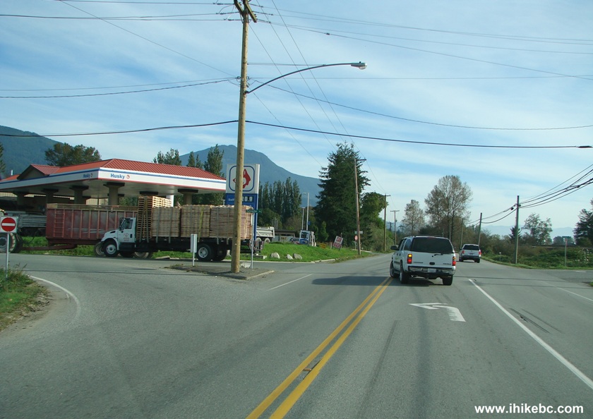
2. Just over seven kilometers past the intersection of Highways 7 and 11
in Mission, you would see a Husky gas station on your left. This is your
last chance to fill the tank. Make a left turn here onto Sylvester Road.
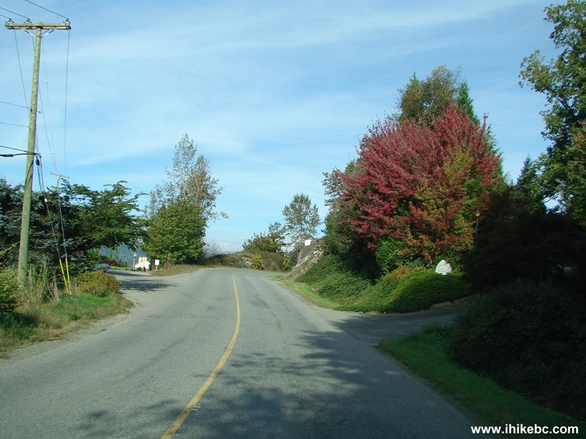
3. Drive on Sylvester Road for another 15+ kilometers.
4. If you have half an hour to spare (and IF it's open), visit
Cascades
Falls Regional Park. This sign indicates you need to turn right. The
park entrance is just several minutes away, and, from there, it is a 5-10
minute walk to a fairly impressive waterfall.
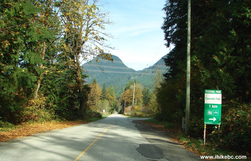
5. But, to get to Lost Creek Forest Service Road, keep going straight
for another 800 meters past the Cascades Falls turnoff. Here we are, at
the beginning of the FSR.
Coordinates: N 49⁰16.746' W 122⁰13.860'.
Elevation: 111 meters. The road surface is fairly decent by FSR
standards, and low-clearance 2WDs should do fine in dry conditions until
the 17.8 km point, where the road becomes passable in high-clearance 4WD
vehicles only. But, by then, you don't have much left to see on this
road, anyway.
6. Exactly one kilometer later, there is a sign indicating you are
entering Davis Lake Provincial Park. That's the first and last park-related sign
you will see. A few more signs further on indicate the names of various
side FSRs. There is no sign directing you to Davis Lake itself, and we
spent two days trying to find our way there.
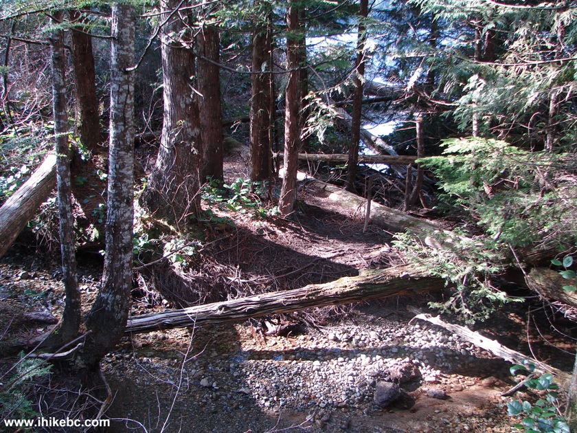
7. After another kilometer, there is this remarkable bridge. It's a
landmark for two reasons: several meters before the bridge, on
the right side, there is a barely noticeable (due to being covered by
vegetation) start of the Mount St. Benedict Trail, marked by a piece of
a flagging tape. And, on the left side past the bridge, there is a
path to McDonald Falls and to...stay tuned.
8. In October of 2014, we stopped by the bridge and went
back, as it was too late in the day to hike the Mount St. Benedict
trail. Now, in March of 2015, we went further down Lost Creek FSR. All the following photos are
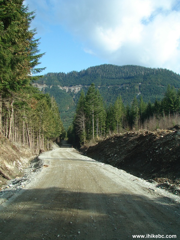
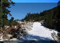
from the March trip. Lost Creek FSR is hard to call spectacular, but
there are still some decent views. Here is one.
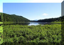
9. Soon, Davis Lake appeared on the left side. ![]()
BC Highway 7 East of Mission
Highway 7 at Sylvester Road British Columbia Canada
Sylvester Road Leading to Lost Creek FSR BC Canada
Sign to Cascades Falls Regional Park
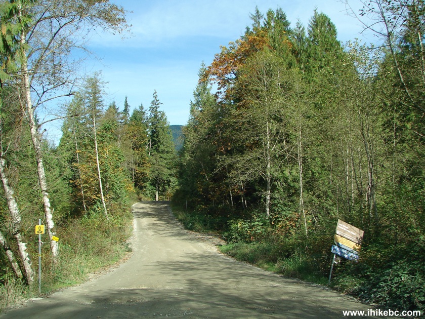
Beginning of Lost Creek FSR BC Canada
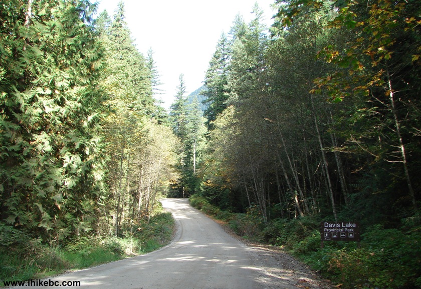
Entering Davis Lake Provincial Park British Columbia Canada
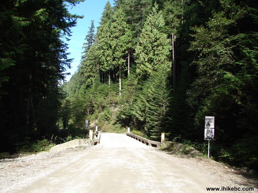
Bridge Lost Creek Forest Service Road BC Canada
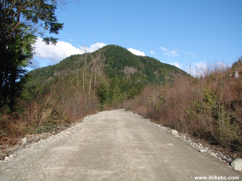
Photo of Lost Creek FSR British Columbia Canada
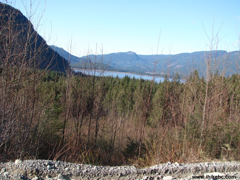
Davis Lake Seen From Lost Creek FSR BC Canada
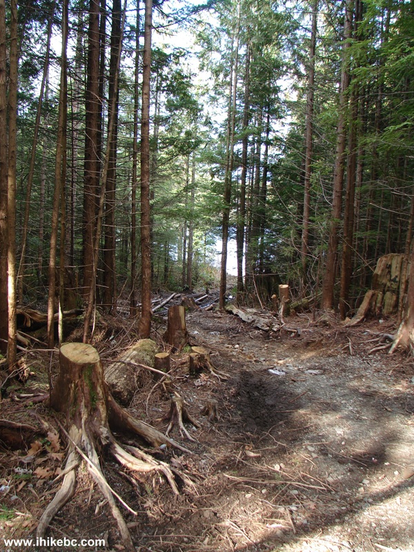
10. So, we started looking for a left turn to get us to Davis Lake. 4.1 km after the beginning of FSR, there is a side road, which apparently provides foot access to Davis Lake. That's what a pair of shooters told us when we asked them whether we could drive this road all the way to the lake. That's the view after you turn from the main road. You would need to park your vehicle somewhere around here and walk, if we understood them correctly.
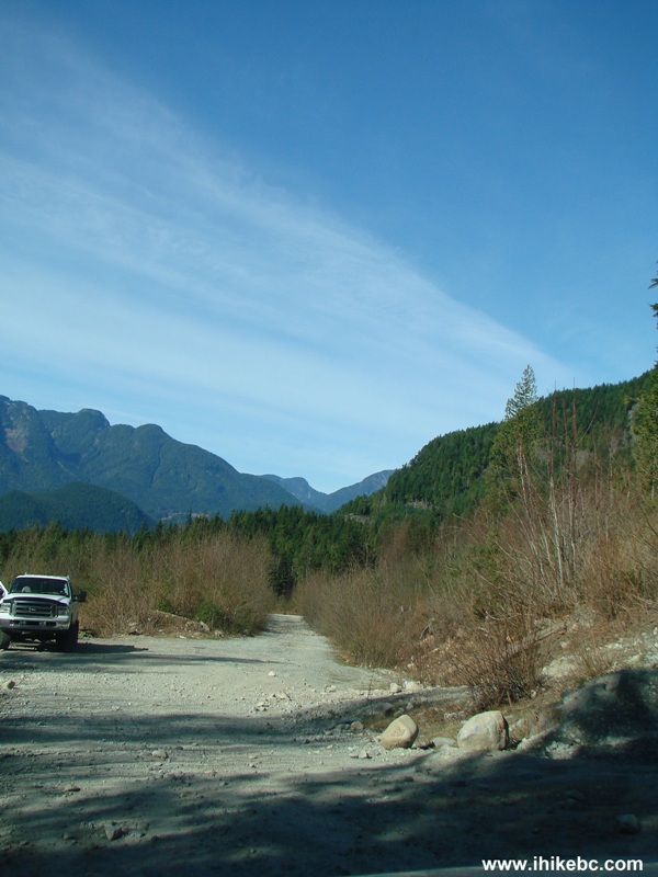
Possible Foot Access to Davis Lake BC Canada
11. Be aware of logging trucks driving on Lost Creek FSR and on at least one spur road (the spur road did have a warning sign).
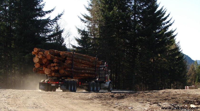
Logging Truck Lost Creek FSR BC Canada
12. The friendly shooters also said that there was a vehicular access to the lake further on, so we kept looking for it, taking a few left roads at splits such as this one.
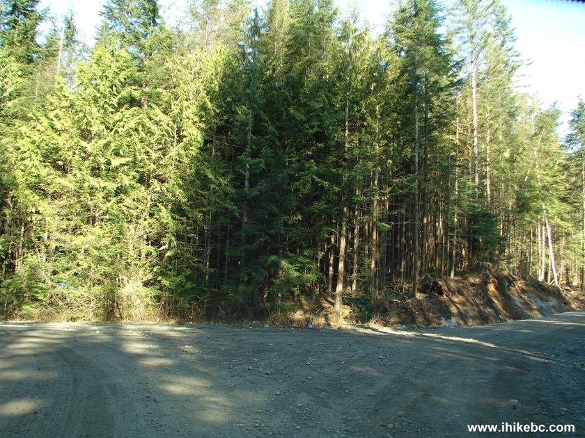
Lost Creek Forest Service Road British Columbia Canada
13. The main road was still in decent shape after the split pictured above.
Picture of Lost Creek FSR BC Canada
14. It became obvious that we drove way past Davis Lake without finding a way to get there. But what about Salsbury Lake, which the Backroad Mapbook indicated as being the next lake along the Lost Creek FSR? This looks like a possible foot access point. Coordinates: N 49⁰21.657' W 122⁰12.822'.
Access Point to Salsbury Lake BC Canada
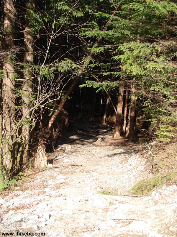
15. Two minutes walking along a slowly deteriorating path, which was likely used by ATVs, and then...
Path to Salsbury Lake BC
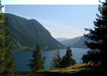
16...you see this...
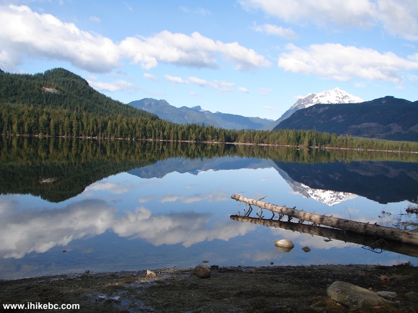
Salsbury Lake British Columbia Canada
17. It was rather cold but very quiet, with no gunshots or ATVs to spoil the moment.
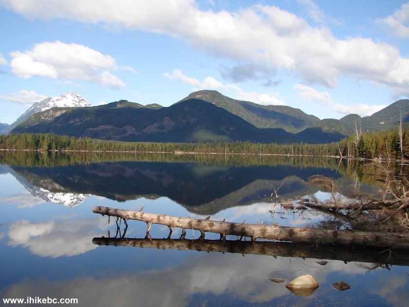
Salsbury Lake
18. Who would have thought that such a beauty was hiding just a few hundred feet away from an unremarkable forest service road? Then, there was this short path on the right side.
Path by Salsbury Lake
19. Leading to another good view of Salsbury Lake.
Salsbury Lake by Lost Creek FSR BC Canada
20. Zooming in.
Salsbury Lake BC Canada
Our Lost Creek Forest Service Road Trip Report
Continues on Page 2.
Other Trips in Mission BC Area:


![]()
![]()
![]()
![]()
ihikebc.com Trip 078 - Lost Creek Forest Service Road Trip (near Mission BC) Page 1 of 2