![]()
![]()
![]()

Trip 196 - July 27, 2020 (Monday)
Farwell Canyon Visit
Near Williams Lake BC
Farwell Canyon Location: Approximately 70 kilometers from Williams Lake via BC Highway 20 West and Farwell Canyon Road.
Liked: Canyon and river views. Several fine views from the access road. No bugs. The ability to drive to and from the canyon in a loop via two access points on Highway 20.
Of Note: Steep unbarricaded drop-offs at the canyon viewpoint. The access road is narrow and winding near the canyon, with frequent logging truck traffic. Much dust is raised by vehicles on the access road. The attraction is popular.
Cariboo Chilcotin Coast BC Backroad Mapbook (4th edition) Trailhead Coordinates: Page 16 (Gang Ranch) E2.
Farwell Canyon is an impressive natural attraction, where Chilcotin River makes several turns near a mountain face with numerous hoodoos. The canyon is located by Farwell Canyon Road, which starts off BC Highway 20 near Williams Lake, and it is possible to drive in a loop and see some fine roadside views, in addition to visiting the canyon. There were dozens of people at this location at the time of our visit, including many campers, some in tents. The access roads are packed dirt and/or gravel, and are in good shape - they are suitable for all regular vehicles. Beware of numerous logging trucks, though, as they raise lots of dust, and also can bust a windshield while throwing gravel from the side of their fenderless wheels. Also watch out for steep unbarricaded drop-offs at the canyon viewpoint.
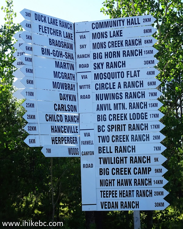
1. The shortest way to Farwell Canyon from Williams Lake is to drive for about 47 kilometers West on Highway 20, and to make a left turn onto Farwell Canyon Road. The canyon would be 22 kilometers later. Check out our BC Highway 20 Trip Report for more information on this highway. Here we are approaching the left turn to Farwell Canyon Road, with a sign indicating that Farwell Canyon is, indeed, in that direction, in addition to Big Creek and Gang Ranch.
If you proceed on Highway 20 for 600 more meters past Farwell Canyon Road, on the right side would be the beginning of Stack Valley Road, which leads to The Dome Trail.
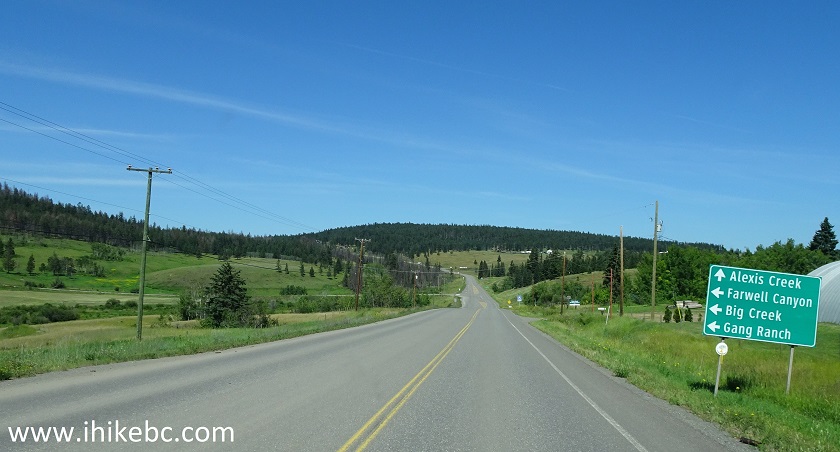
BC Highway 20 Westbound near Farwell Canyon Road Turnoff
2. Farwell Canyon Road immediately after turning from BC Highway 20. Proceed for about 22 kilometers to the canyon.
Farwell Canyon Road at BC Highway 20
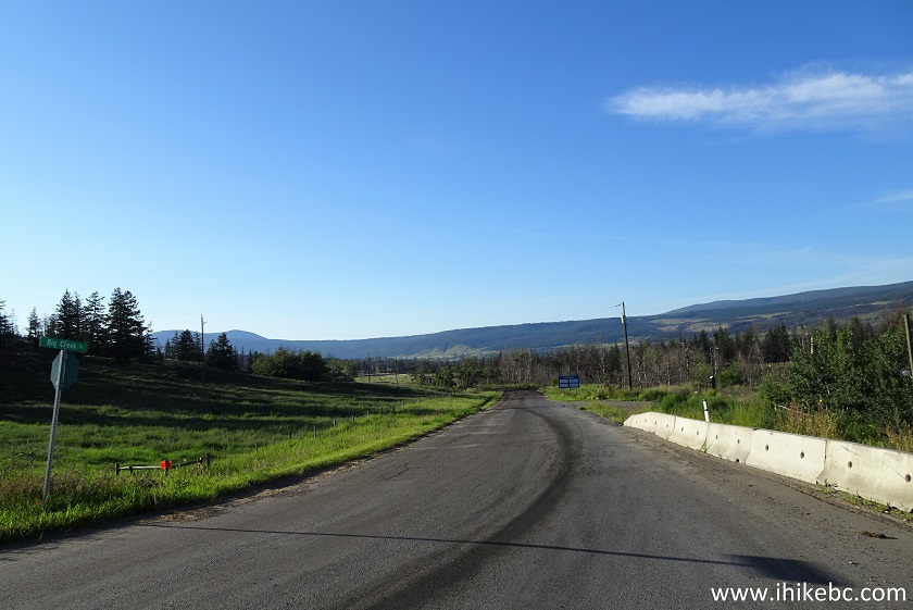
3. However, we started out trip to Farwell Canyon from the other side of the loop, which is located 50 kilometers further West, where Hanceville Cut Off Road starts at BC Highway 20. Here we are approaching Hanceville Cut Off Road while Westbound on Highway 20. A sign indicates that Fletcher Lake and Big Creek are located in that direction.
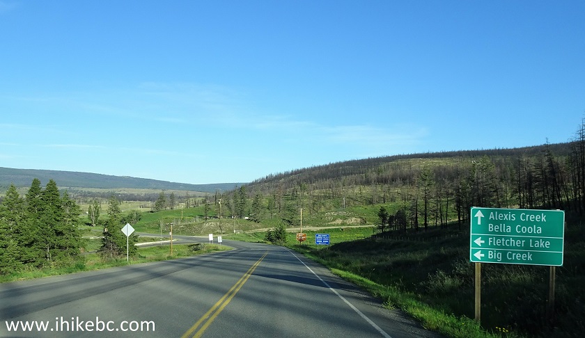
BC Highway 20 Westbound near Hanceville Cut Off Road
4. Here is the turnoff from BC Highway 20 West onto Hanceville Cut Off Road, located in the settlement of Hanceville (also known as Lee's Corner). Coordinates: N 51⁰56.516’ W 123⁰05.906’. Elevation: 734 meters.
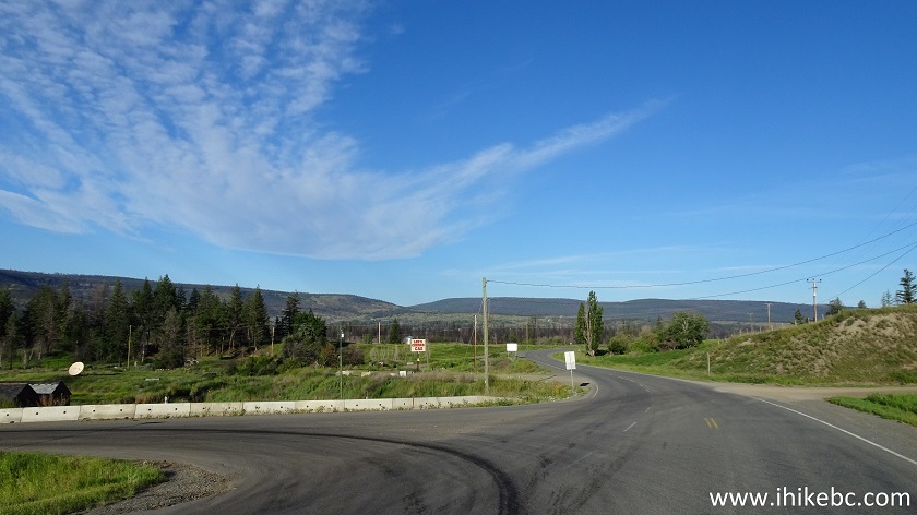
BC Highway 20 at Hanceville Cut Off Road British Columbia
5. Hanceville Cut Off Road immediately after turning from BC Highway 20. Zero your odometer here.
Hanceville Cut Off Road
6. Very shortly, Hanceville Cut Off Road goes left, but the main road is very obvious, and it is now called Big Creek Road. Here it is near the bridge across Chilcotin River (flowing on its way to Farwell Canyon). We are now 3.3 km past Highway 20.
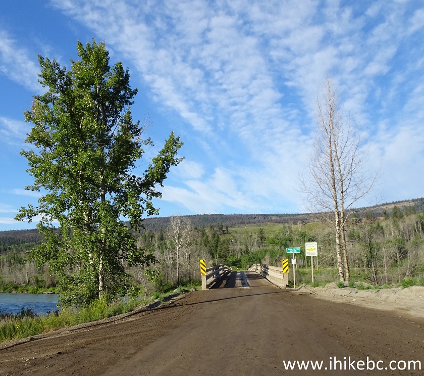
Big Creek Road near Hanceville BC Canada
7. A view of Chilcotin River from the bridge.
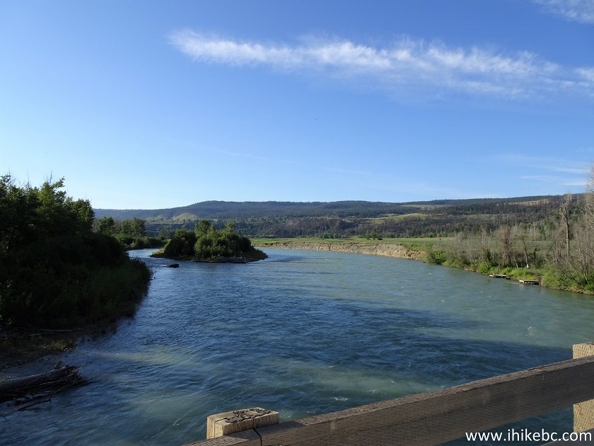
Chilcotin River Seen from Big Creek Road near Lee's Corner British Columbia
8-9. Shortly thereafter, Big Creek Road meets with Taseko Lake Road, which goes to Nemiah Valley. Make a left turn to stay on Big Creek Road.
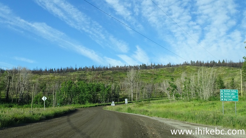
Big Creek Road at Taseko Lake Road
10. Continuing on Big Creek Road.
Big Creek Road near Hanceville BC Canada
11. At 29.2 km, a picturesque Rushes Lake is on the right side.
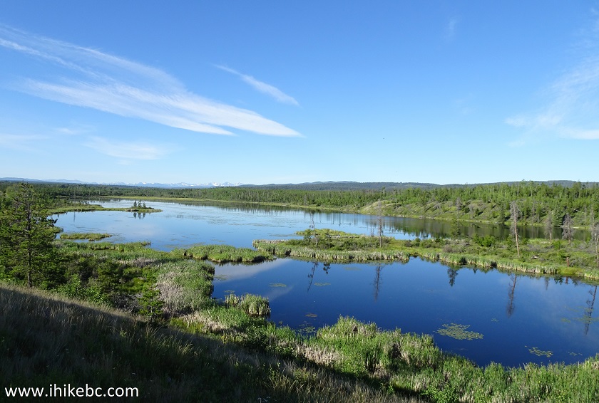
Rushes Lake near Hanceville British Columbia
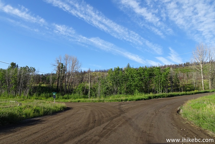
12. At 31.6 km, Big Creek Road ends at Farwell Canyon Road. There is a working pay phone within 50 meters of the intersection on the right side, but we need to turn left here.
Big Creek Road at Farwell Canyon Road
13. Big Creek residence listing.
Residence Listing Big Creek British Columbia
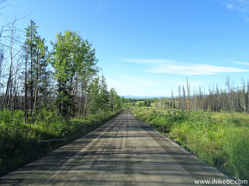
14. Having turned left, we are now on Farwell Canyon Road. Your automotive GPS may show "Fletcher Lake Road" for a few kilometers, but it's the same road. Logging trucks raising clouds of dust appeared about 29 km after turning from Big Creek Rd (60 km from Highway 20 in Hanceville).
Farwell Canyon Road
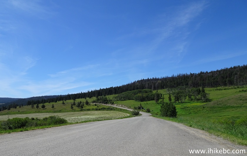
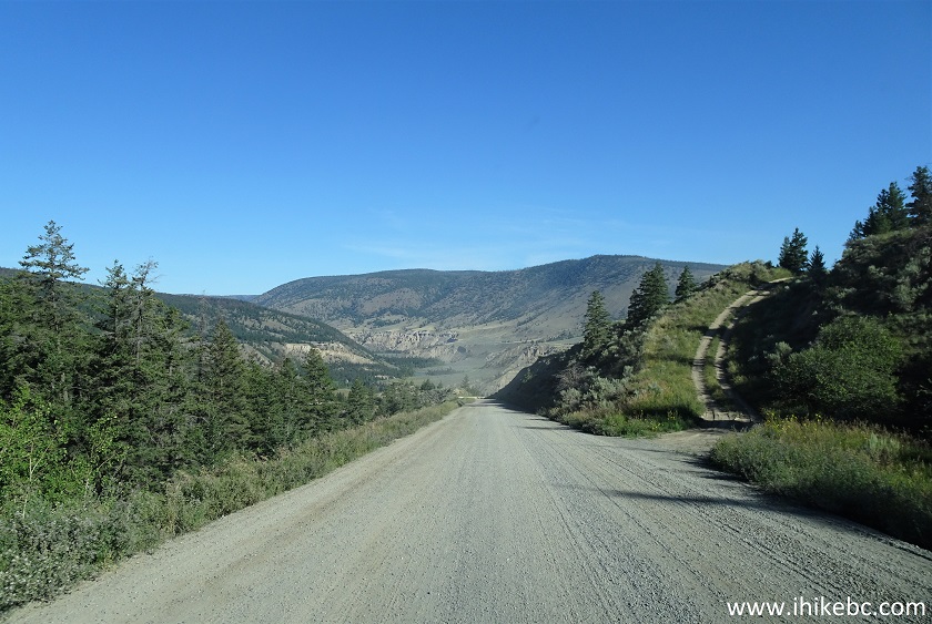
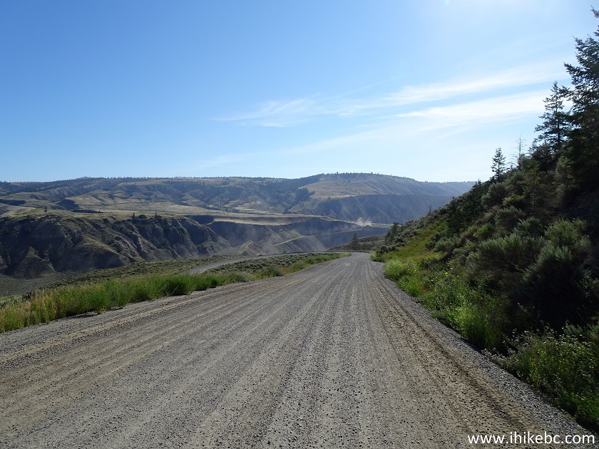
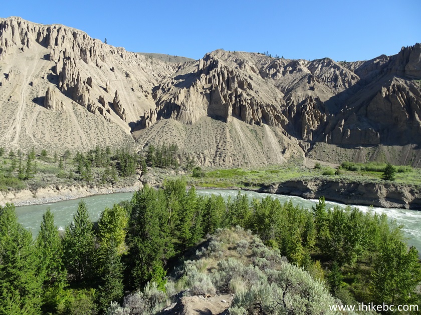
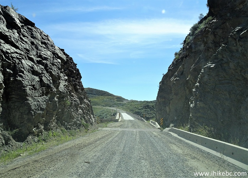
15-16. Farwell Canyon starts emerging about 70 kilometers after turning from Highway 20 in Hanceville. Left to right. The road becomes steep and winding while approaching and departing the canyon.
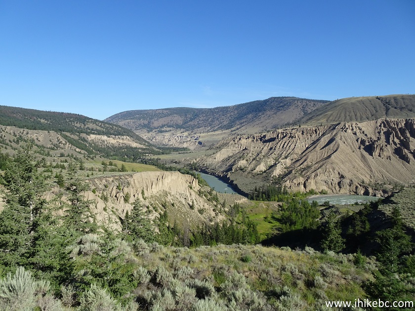
Farwell Canyon
Farwell Canyon seen from Farwell Canyon Road
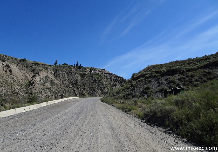
17. Farwell Canyon Road near Farwell Canyon.
Farwell Canyon Road near Williams Lake BC Canada
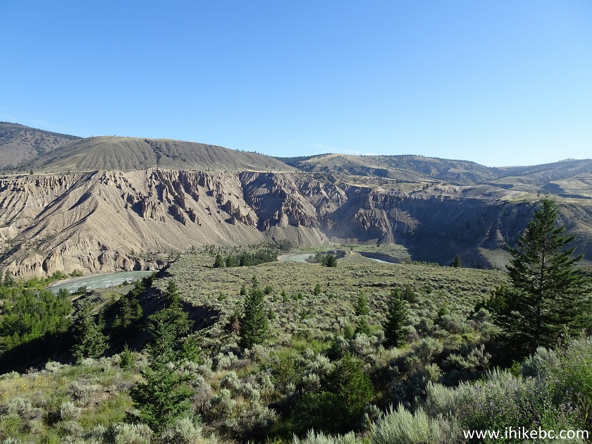
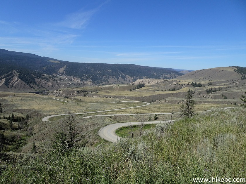
18-19. Another canyon view, about 700 meters past the one seen in photos #16-17. Left to right.
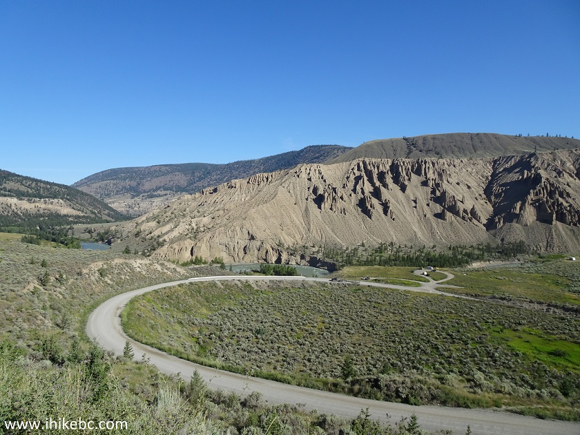
Farwell Canyon British Columbia
20. Here is one of the logging trucks raising clouds of dust. This one wasn't too bad, actually, because it was going uphill, with all the switchbacks, fairly slowly. The ones driving on straight stretches and downhill, however, is a totally different story.
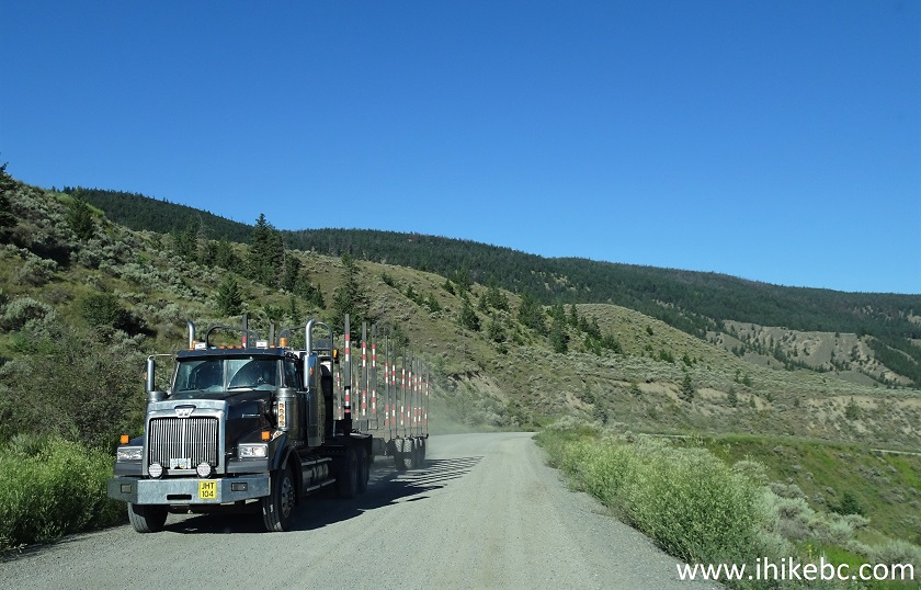
Logging Truck on Farwell Canyon Road
21. And here is a turnoff from Farwell Canyon Road onto Farwell Canyon observation area parking, approximately 72 kilometers from Highway 20 in Hanceville. Coordinates: N 51⁰49.750’ W 122⁰34.052’. Elevation: 487 Meters. It's 22 kilometers from here to the end of Farwell Canyon Road, also at Highway 20, but 50 kilometers closer to Williams Lake. Pit toilets and trash cans are located 600 meters further on Farwell Canyon Road, on the right side.
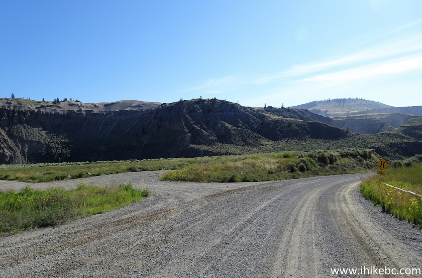
Farwell Canyon Road near Farwell Canyon
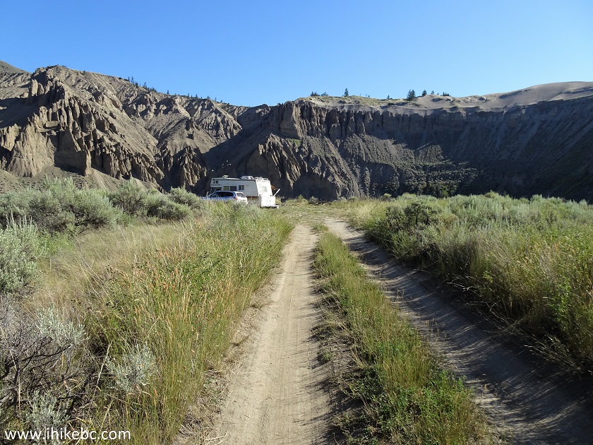
22. This is Farwell Canyon observation area parking. Several people were camping there, including in tents.
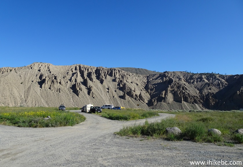
Farwell Canyon Parking Area
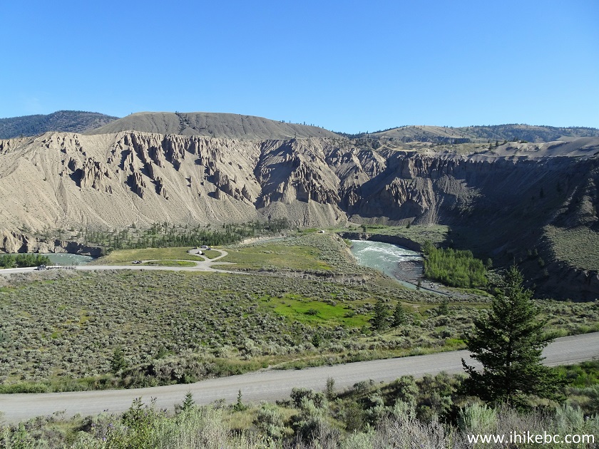
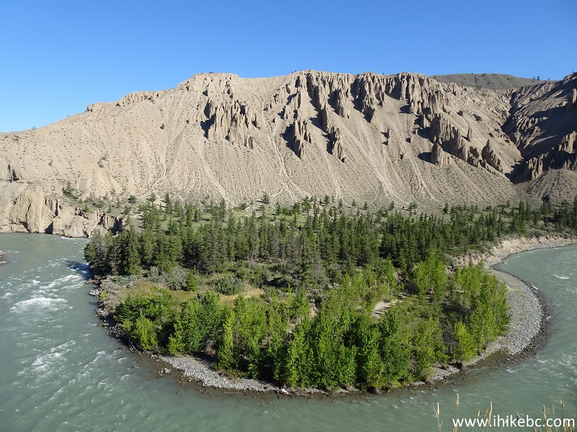
23-25. Walk for half a minute, and here it is, Farwell Canyon. Left to Right. It is possible to get down to the river, as there were several people camping and hanging out in the area covered by photo #24. There are several busted shacks there as well.
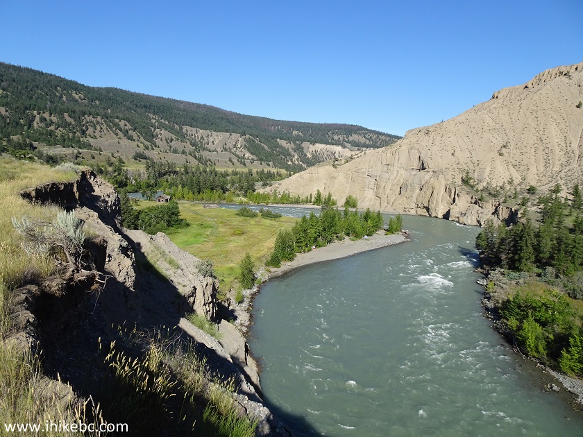
Chilcotin River
Chilcotin River in Farwell Canyon
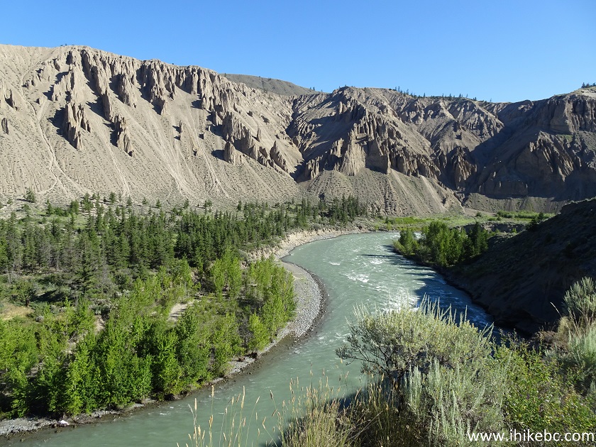
Farwell Canyon
Here is our video of Farwell Canyon.
More ihikebc videos are on our YouTube Channel.
26. On the right side of the observation area, there is a 100-meter-long dirt road to another small camping spot. That's where we went for another look at the canyon.
27. A short steep path leads to a good view.
Farwell Canyon near Williams Lake BC
28. Zooming in to check out the hoodoos up close.
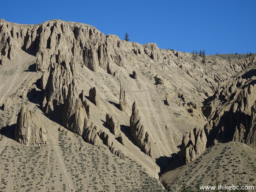
Farwell Canyon Hoodoos
29. We then continued on Farwell Canyon Road, en route to a point seen in photos #1 and #2.
Farwell Canyon Road British Columbia
30. Here are those pit toilets and garbage cans, on the right side, 600 meters past the canyon observation area.
Farwell Canyon Road near Williams Lake BC Canada
31. Farwell Canyon Road goes up from here, and the view gets better the higher you climb.
Farwell Canyon Road
32. In addition to tourists and logging trucks, Farwell Canyon Road is also used by ranchers.
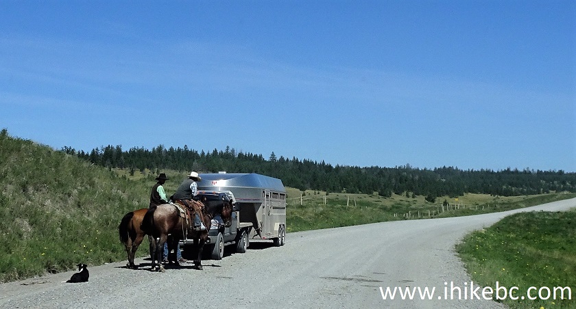
Ranchers on Farwell Canyon Road
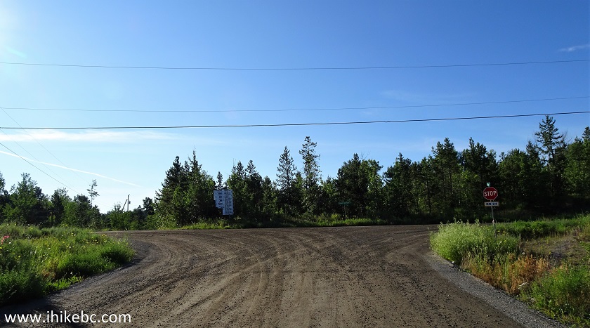
33. And we are now at BC Highway 20, nearly 22 kilometers past Farwell Canyon, at the same spot as seen in photo #2, but looking the other way (towards the highway). Turning right (East) would get you to Williams Lake in 47 kilometers.
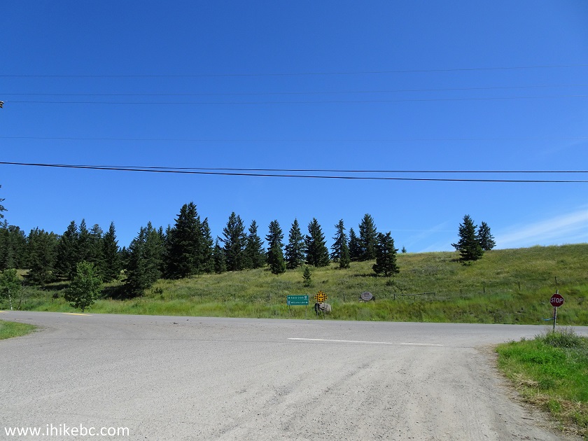
Farwell Canyon Road at BC Highway 20
Farwell Canyon is an impressive natural attraction, and the access road(s) have several fine views. Recommended.


|
 |
Other Trips in Williams Lake Area:
|
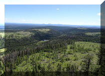
The Dome Trail Hike
|
|

![]()
![]()
![]()
ihikebc.com Trip 196 - Farwell Canyon Visit (Near Williams Lake BC)