![]()
![]()
![]()

Trip 211 - May 24, 2021 (Monday)
Camelsfoot Peak Trail Hike
Off West Pavilion FSR Near Lillooet BC
Liked: A short and fairly easy trail to a great panoramic mountains/valley/river view from the observation point. Numerous fine canyon and river views while driving towards the trail on West Pavilion FSR. No bugs.
Of Note: West Pavilion FSR is winding, narrow, with steep unbarricaded drop-offs. Much of the trail has no shade. Steep unbarricaded drop-offs at the main viewpoint. Uneven ground and loose stones on the trail. Hiking poles and boots are recommended.
Vancouver, Coast & Mountains Backroad Mapbook (5th edition) Trailhead Coordinates: Page 53 (Lillooet) D5.
Camelsfoot Peak Trail is located about 20 kilometers from the town of Lillooet, and is an easy-to-moderately difficult, just under 3-km long trail, which leads to an amazing "under your feet" panoramic view of mountains, valley, and Fraser River. To get to the trail from Lillooet, take Highway 40, and then West Pavilion FSR, which has its own share of fine views en route to Camelsfoot Peak trailhead. The trail has a very gentle elevation change all the way to the top, and would make a decent mountain biking destination as well.
Watch for steep unbarricaded drop-offs on West Pavilion FSR, and at the main trail viewpoint. Considering the view, this trail is as easy as they get.
1. Camelsfoot Peak Trail is found off West Pavilion Forest Service Road, near Lillooet BC. Here we are driving from Lillooet on BC Highway 40, and are approaching West Pavilion FSR turnoff on the right side. Coordinates:
N 50⁰45.316' W 121⁰56.217'. Elevation: 228 meters. For directions on getting up to this point from Lillooet, check out our BC Highway 40 Trip Report. This is the same photo as photo #15 of that trip report.
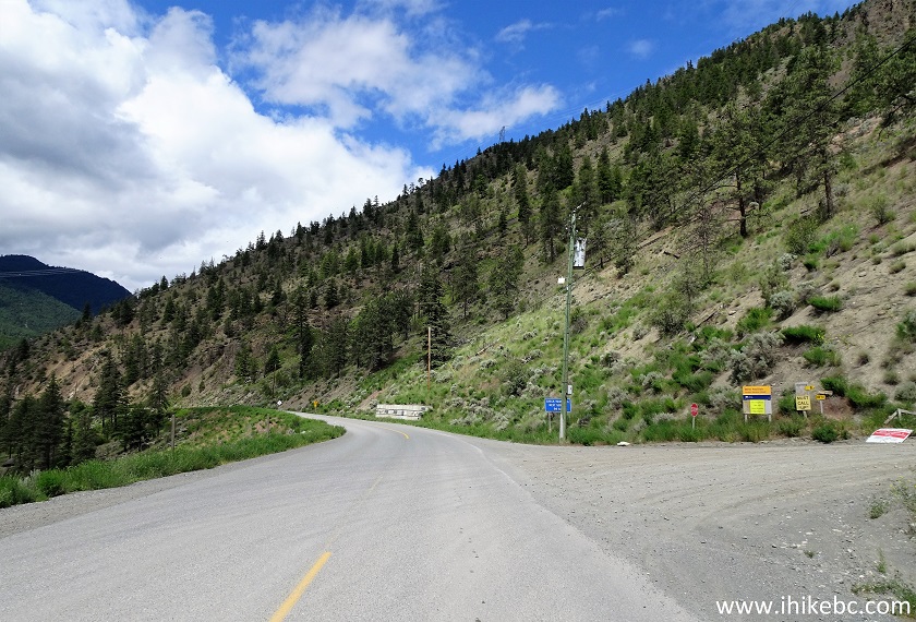
BC Highway 40 at West Pavilion FSR Turnoff near Lillooet BC Canada
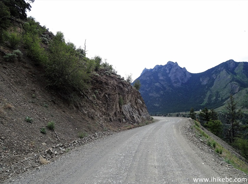
2. It's just under 12 kilometers from Highway 40 to the trailhead. The mileage markers on West Pavilion FSR indicate distance from Lillooet, so they are off by about 10 km. West Pavilion Forest Service Road is in a very good shape and is suitable for all vehicles. It is, however, narrow and winding, and has numerous steep unbarricaded drop-offs.
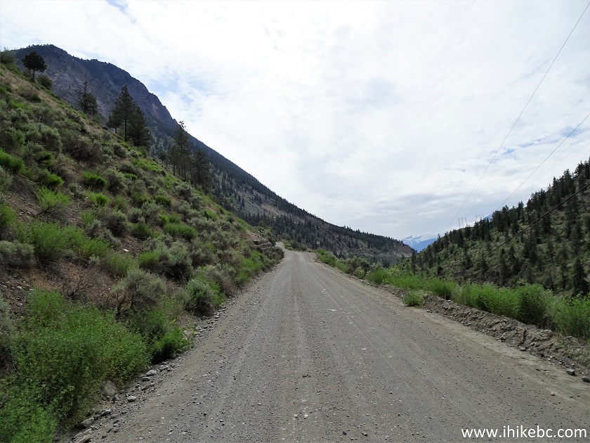
West Pavilion FSR
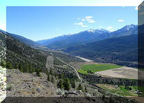
3. West Pavilion FSR also has many fine views, this one being at 0.3 km of the FSR, right by the sign indicating whether Big Bar ferry (small vehicles only) is open or not. We will not need the ferry to get to Camelsfoot Peak trailhead. Here is a view of Bridge River (on the right) ending its run by joining Fraser River (on the left).
Bridge River Flowing into Fraser River near Lillooet BC Canada
4. Just a hundred meters further up West Pavilion FSR, we see Fraser River all by itself just before it meets Bridge River.
Fraser River
5. West Pavilion Forest Service Road at 4.1 km.
West Pavilion Forest Service Road
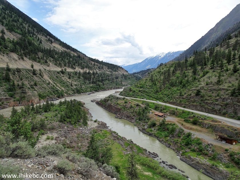
6-8. The view at 5.0 km is good from left to right.
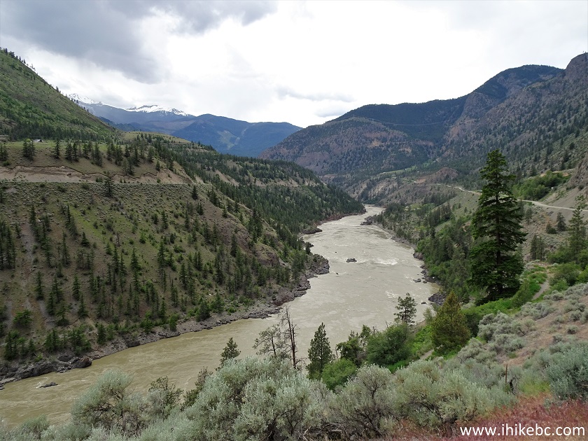
Fraser River View from West Pavilion FSR British Columbia Canada
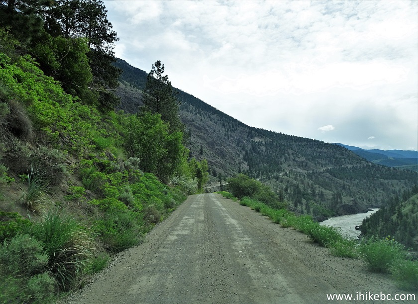
9. West Pavilion FSR at 5.6 km.
West Pavilion FSR near Lillooet BC
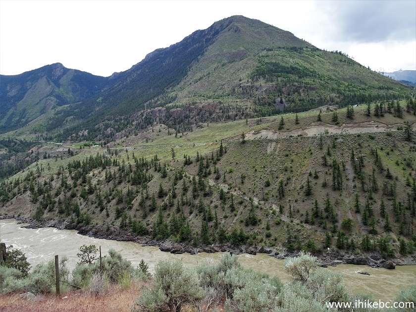
10. Fraser River and a background mountain at 5.7 km of West Pavilion Forest Service Road.
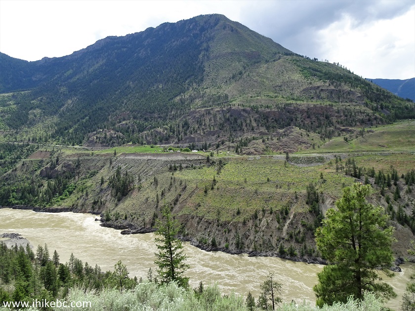
Fraser River British Columbia Canada
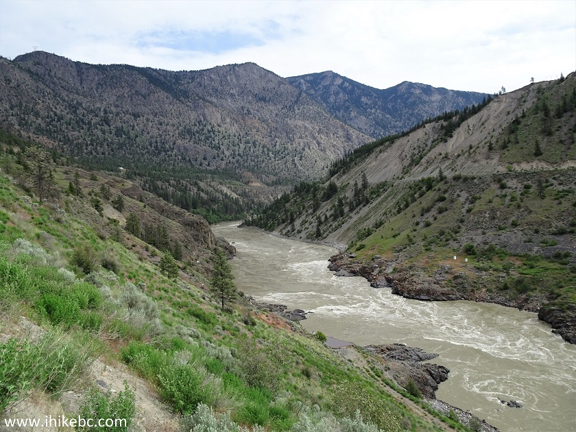
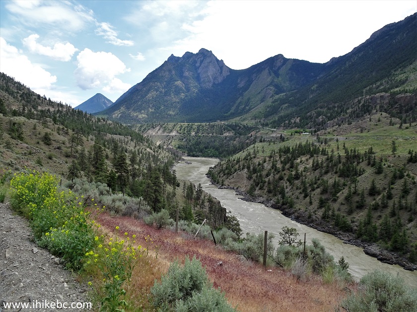
11. Fraser River again, now at the 7.7 km mark.
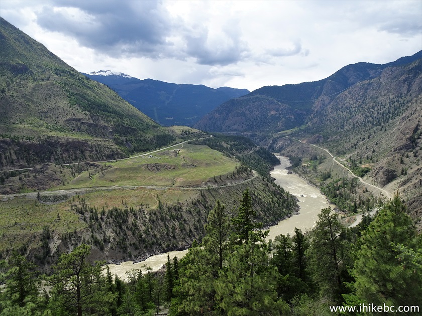
Fraser River Seen from West Pavilion Forest Service Road
12. Twisting Fountain Valley Road is seen across Fraser River starting off Highway 99. We are now at 8.7 km of West Pavilion FSR.
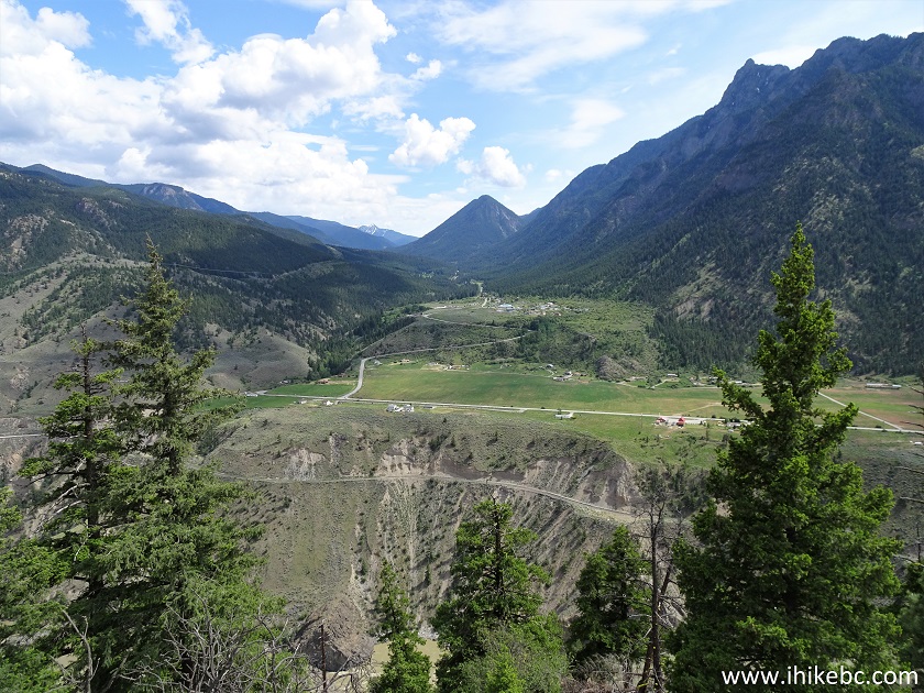
Fountain Valley Road seen from West Pavilion FSR
13. At the 11.7 km mark of West Pavilion FSR, there is a cattle guard, followed by a pullout. The mileage marker by the cattle guard says "21" - it's the distance from Lillooet. This is a good place to park for Camelsfoot Peak Trail, which starts just before the cattle guard, on the left side.
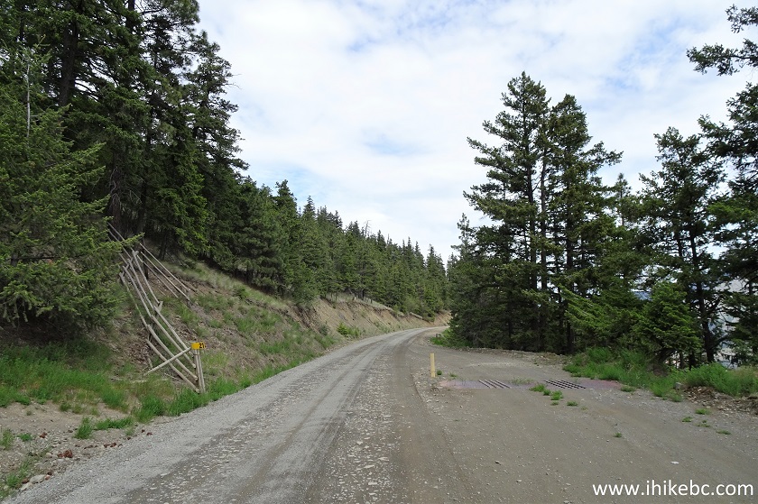
West Pavilion FSR at Camelsfoot Peak Trailhead
14. Looking back, we see the trailhead (now on the right side). There are no signs or flagging tape, so it looks just like another forest service road. Coordinates: N 50⁰46.184' W 121⁰52.001'. Elevation: 790 meters.
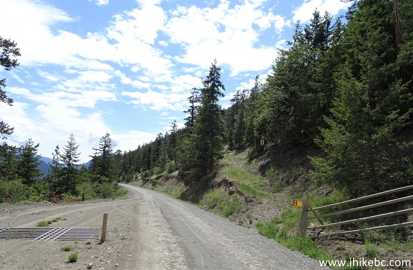
Camelsfoot Peak Trailhead near Lillooet British Columbia
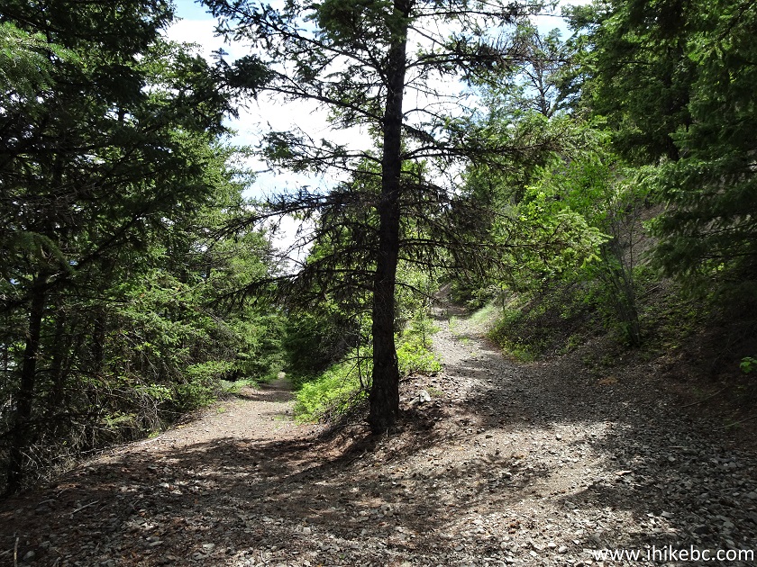
15. Now on Camelsfoot Peak Trail. It's a steady elevation gain all the way to the viewpoint.
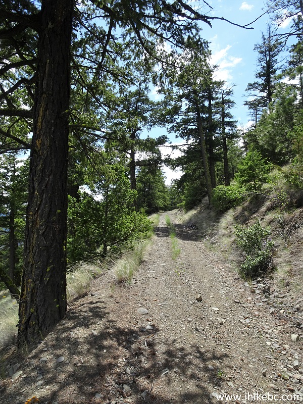
Lillooet Hiking - Camelsfoot Peak Trail
16. Most of the trail has no shade.
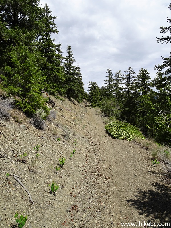
Hiking in Lillooet Area - Camelsfoot Peak Trail
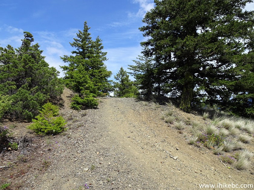
17. There are are several switchbacks, such as this one at the 2.4 km mark of the trail.
Lillooet Trail - Camelsfoot Peak Trail
18. There is a somewhat obstructed viewpoint at 2.85 km, 50 meters before the main viewpoint.

View from Camelsfoot Peak Trail in Lillooet BC Area
19. However, just 50 meters later...
Hike in Lillooet - Camelsfoot Peak Trail
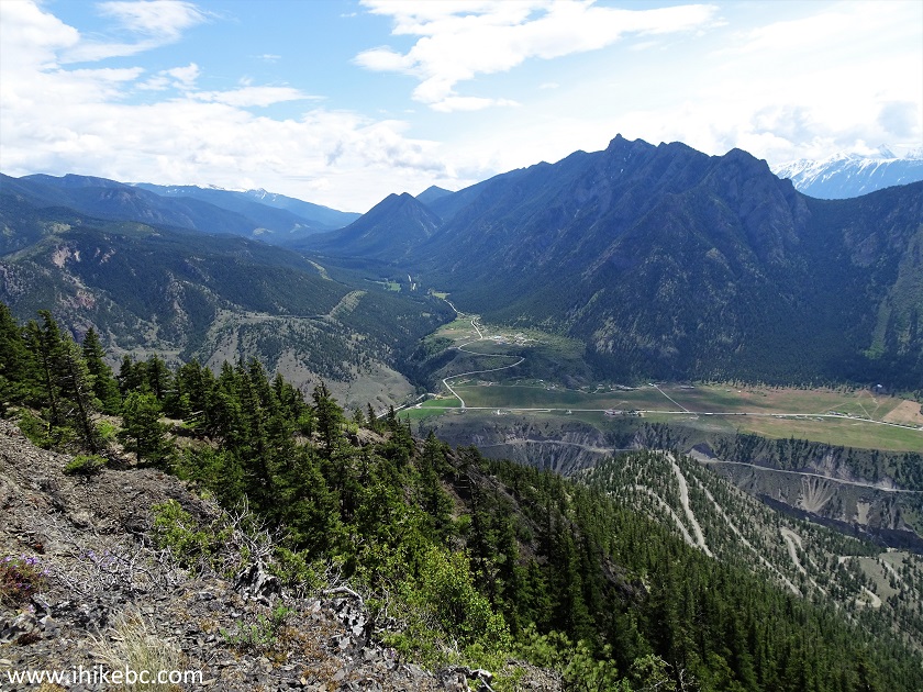
20. ...there is a viewpoint which is going to impress. Coordinates: N 50⁰45.864' W 121⁰52.319'. Elevation: 1,121 meters (331 meters elevation gain from the trailhead, for an average grade of about 11%).
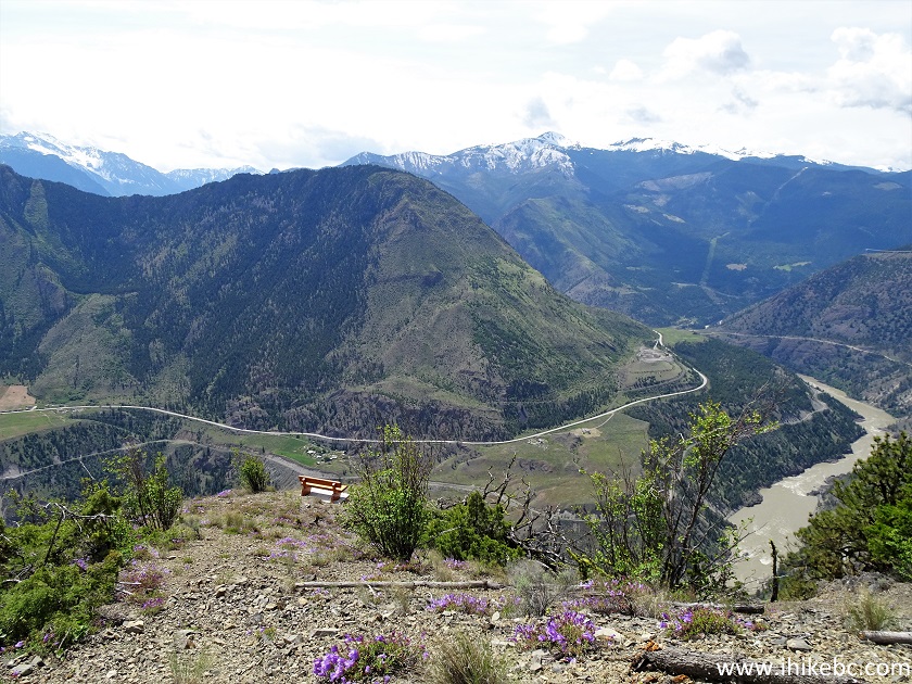
View from Camelsfoot Peak Trail near Lillooet British Columbia Canada
21. The bench is dedicated to the memory of Lois Corinne Johnson (1965-2009).
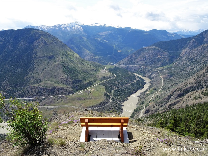
22-25. So, yes, the view is quite something. Left to right.

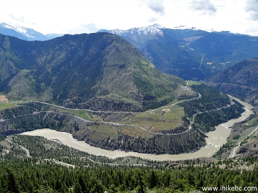
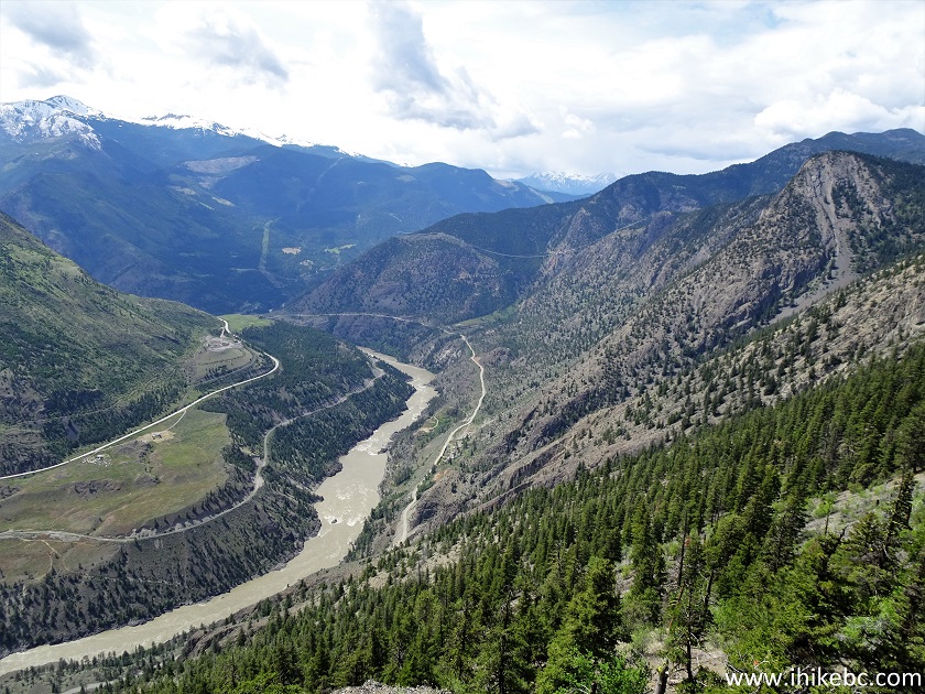
Fraser River seen from Camelsfoot Peak Trail
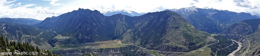
26. Here is a panorama.
And here is our video of the views from this location.
More ihikebc videos are on our YouTube Channel.
27. To wrap things up, a bit about hiking safety. We have hurt ourselves while hiking in many different ways over the course of the years, but never had to deal with ticks before. So, today was the first - found this fella crawling on the back of our neck after this hike. It was the size of a mosquito, and was all but impossible to squash - had to zap it with a "tennis racket" zapper. This is a Rocky Mountain Wood tick - not the most dangerous one, but, nonetheless. Stay safe, and happy hiking!
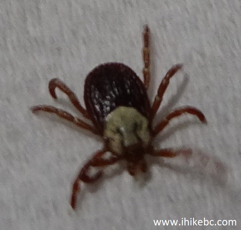
Rocky Mountain Wood Tick
Camelsfoot Peak Trail is fairly short, relatively easy, and leads to a fantastic view. Highly recommended.


|
 |
Other Trips in Lillooet Area:
|
|
|


|
|
McGillivray
Creek Trail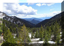 |
|
![]()
![]()
![]()
ihikebc.com Trip 211 - Camelsfoot Peak Trail Hike (Near Lillooet BC)