![]()
![]()
![]()

Trip 047 - July 5, 2011 (Tuesday)
Harrison West Forest Service Road
Trip to Kilometer 55 (end of 2wd road)
Note: Harrison West FSR is now called Sts'ailes FSR.
Distance From Vancouver:
115-135 km in total to the beginning of Harrison West FSR.
You can get there either via Highway 1 East, then via Highway 11 North
(to Mission) and 7 East (from downtown Mission). Or via Highway 7 East
(Broadway, which turns into Lougheed Highway in Burnaby) directly from
Vancouver. Once on Highway 7, turn left to Morris Valley Road 32 km East
of where Highway 11 splits with Highway 7 in Mission, and then drive for
another 16 km to the beginning of Harrison West Forest Service Road.
Liked: Fairly smooth road (by FSR standards) with some potholes and rough sections. Lake and mountain views (mostly from campgrounds).
Of note: Remote area with no cell phone coverage, limited views (unless from a campground), ferocious mosquitoes at campgrounds, winding road, logging trucks on the road, the road is rather popular even on weekdays - watch for other traffic, including motorcycles and ATVs. Near km 55 there is a steep loose-surfaced hill, which 2WD vehicles likely wouldn't make.
Vancouver, Coast & Mountains Backroad Mapbook (2010 edition) Coordinates for the Beginning of the FSR: Page 4 (Chilliwack) E1.
Related Website: Chilliwack District FSR Conditions.
Other trips in Mission Area: Lost Creek Forest Service Road, Chehalis Forest Service Road, Downtown Mission BC.
Other Forest Service Roads Trips: Chehalis (by Harrison Mills), Chilliwack Bench, Chilliwack Foley, Chilliwack Lake, Chuchinka-Colbourne (North of Prince George), Florence Lake (access to Stave Lake by Mission), Jones Lake (near Hope), Lost Creek (by Mission), Nahatlatch (near Boston Bar), Parsnip West (by Mackenzie), Shovel Creek (off Harrison East), Sowaqua Creek (by Hope), Squamish River Main, Squamish River Ashlu, Squamish River E-Main, Squamish River FSR Washout, Windfall Creek (by Tumbler Ridge).
Harrison West Forest Service Road runs along the Western edge of the enormous Harrison Lake, located East of Mission, BC. Despite proximity of the FSR to Harrison Lake, the views of the lake are limited. For the best views, you would need to visit one of the several campgrounds on the side of the Harrison West FSR.
We drove on Harrison West for about 55 kilometers, where the road became too much for our 2WD vehicle. There is a nice camping spot in that place too.
Beware of mosquitoes, as they are numerous and ferocious along Harrison West FSR, especially at campgrounds, probably owing to a wet and cold Spring we had this year.
On July 21, 2011 we have visited a substantially more impressive Harrison East FSR.
Here is the table of points of interest along Harrison West FSR. Zero your odometer at the sign seen in photo #3 below. Please, note, that the yellow mileage markers on the road do not exactly correspond to the mileage in the table, the difference usually being around 300-500 meters.
| KM | Feature | Side |
| 1.3 | Very rough road (for 500 meters) | Straight |
| 6.3 | Hemlock Valley FSR (blocked off) | Left (L) |
| 15.3 | Simms Creek FSR | L |
| 15.4 | Possibly a Campground (didn't check) | Right (R) |
| 17.1 | Wilian Creek FSR | L |
| 19.0 | Wood Lake Recreation Site | R |
| 23.7 | Hale Creek FSR | L |
| 24.9 | Road (FSR?) | R |
| 29.2 | Chehalis-Mystery FSR (to Statlu Lake Trail) | L |
| 32.6 | A road to the left and a road to the right | L + R |
| 34.1 | 20 Mile Bay Recreation Site (photo below) | R |
| 41.3 | Unregulated Campground (photo below) | R |
| 48.3 | Unregulated Campground (photo below) | R |
| 49.0 | Creek eroding the road surface | Straight |
| 55.5 | End of 2WD Road | Straight |
| 55.5 | Good picnic/camping spot by the lake | Right |
1. We are on BC Highway 7 East of Mission, en route to Morris Valley Road, located 32 kilometers East of Mission. You can check out Chehalis FSR Trip Report and Weaver Lake Trail Trip Report for more detailed directions.
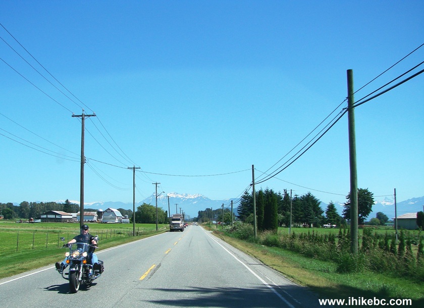
Highway 7 East of Mission BC Canada
2. After turning left onto Morris Valley Road, go straight at the 4-way stop intersection several hundred meters later, and then keep driving straight. The last chance to fill up your gas tank comes 6.8 kilometers after turning onto Morris Valley Road at this United Petroleum gas station ran by the Chehalis Band. It is open 7 AM to 9 PM, and also has a convenience store attached to it.
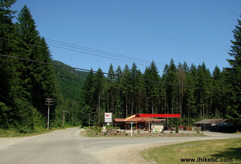
United Petroleum Gas Station Morris Valley Road British Columbia Canada
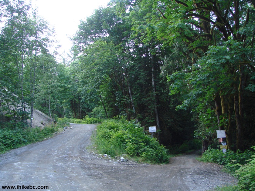
3. 16 kilometers after turning onto Morris Valley Road from Highway 7, you reach the split where turning left leads you to Weaver Lake, while straight ahead is Harrison West Forest Service Road. Zero your odometer at the FSR sign, if you want to follow the mileage markers in the table above.
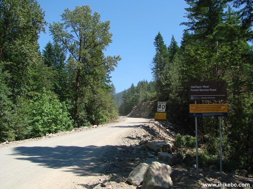
The Start of Harrison West FSR West of Harrison Hot Springs BC Canada
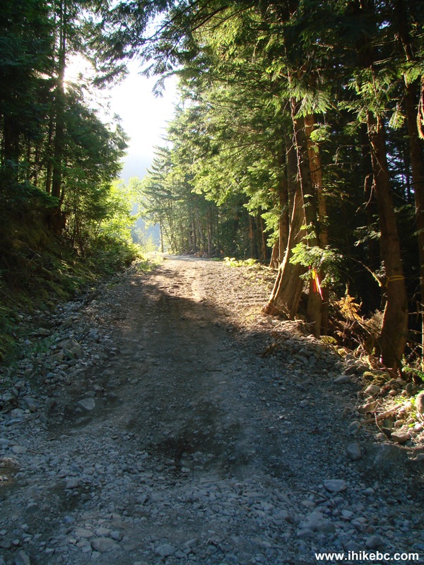
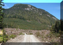
4. Harrison West FSR is the least impressive views-wise of the major FSRs that we have traveled (Squamish, Chehalis, and Nahatlatch). You get an occasional glimpse of Harrison Lake, but mostly enjoy the views of transmission towers and numerous trees.
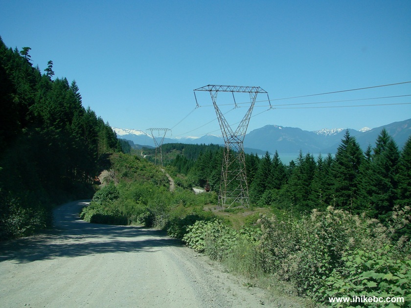
Photo of Harrison West Forest Service Road Province of British Columbia
Canada
5. Harrison West FSR also had the most traffic of all the FSRs that we have seen. It's not anywhere near Vancouver traffic during rush hour, but, by wilderness standards, it was a lot, and included all kinds of vehicles, ATVs and motorcycles. Logging trucks were there too.
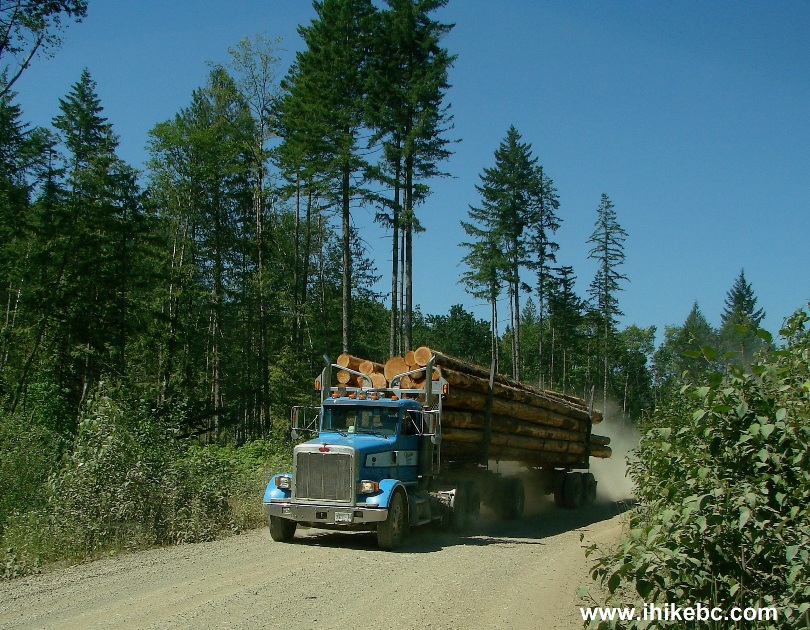
Logging Truck on Harrison West FSR
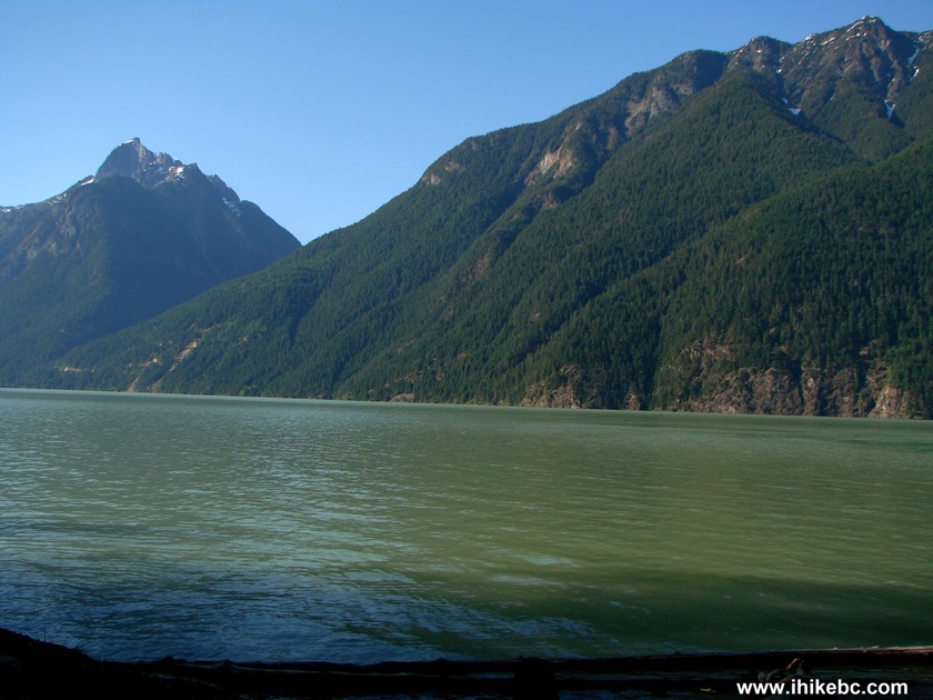
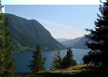
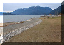
6. One of the few very nice lake views from Harrison West FSR.
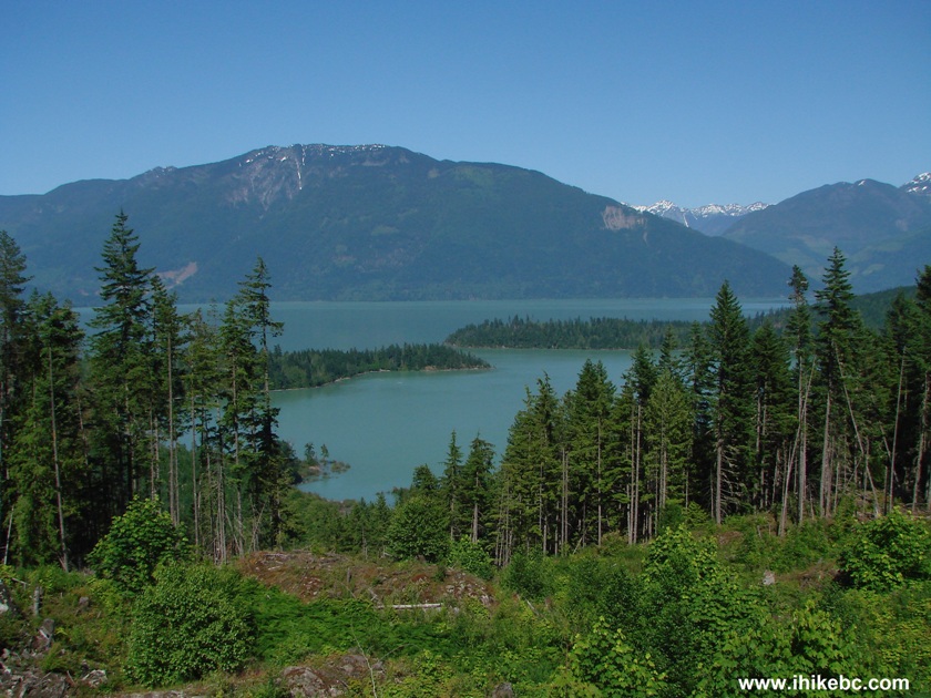
Harrison Lake Seen from Harrison West FSR BC Canada
7. There are some good mountain views every now and then as well.
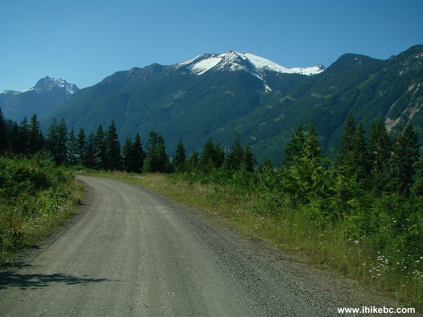
Picture of Harrison West Forest Service Road Province of BC Canada
8. For the best views, you need to visit a campground, of which there are a few along this road. Here is one where you have to pay a fee (probably around $15 per night) to camp, but get a clean environment with pit toilets, picnic tables, firewood for sale, and a host. It is called 20 Mile Bay Campground, and is located 34.1 km from the start of the road.
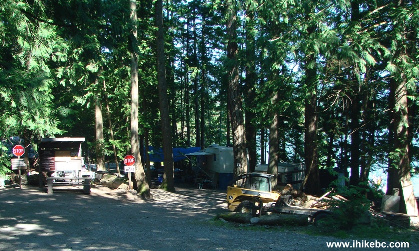
20 Mile Bay Campground Harrison West FSR British Columbia Canada
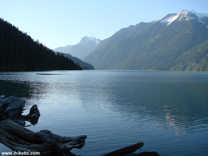
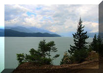
9. Nice lake view from the 20 Mile Bay Campground.
Harrison Lake FSR Seen from 20 Mile Bay Campground
10. If you do not want to pay a fee, or prefer a more solitary camping experience, there is an unregulated campground at the 41.3 km mark. The turnoff is seen in the photo below.
Harrison West Forest Service Road British Columbia Canada
11. This campground is large enough for 150 people to camp.
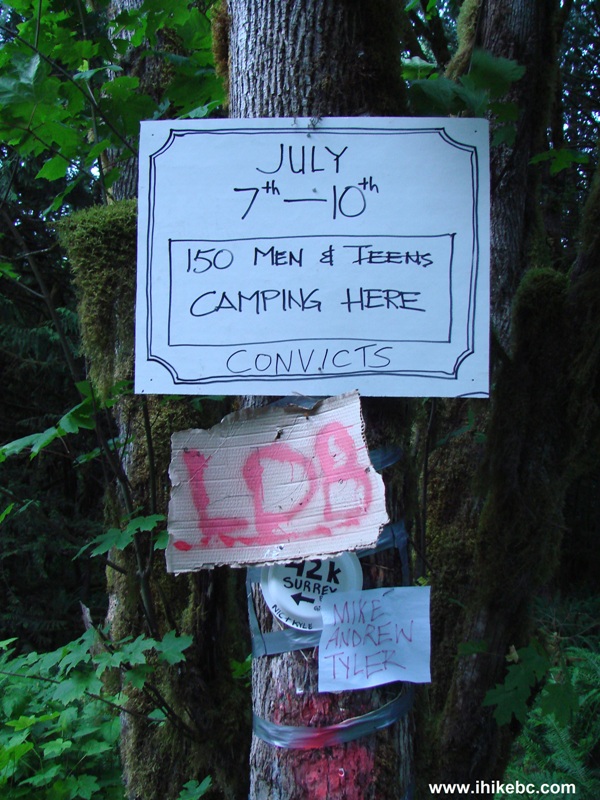
12. Plenty of space to park vehicles.
Unregulated Campground at 41.3 km of Harrison West FSR
13. Nice views for you to enjoy...
Harrison Lake View from 41.3 km Campground on Harrison West FSR
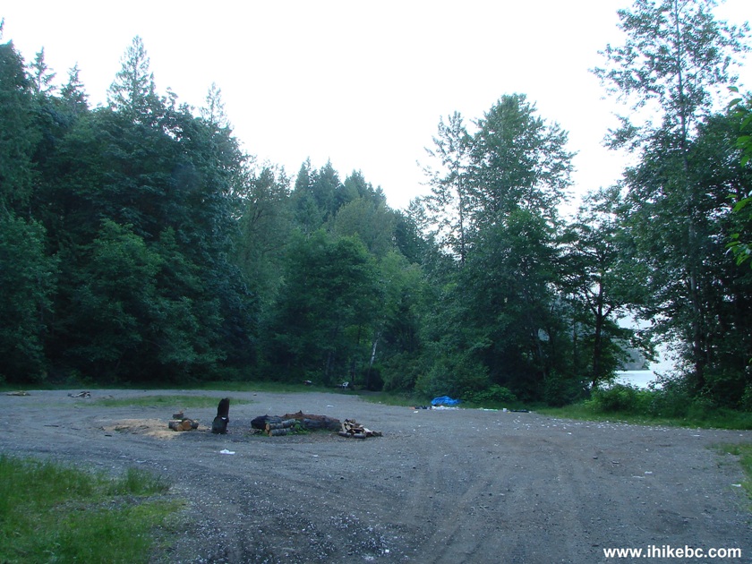
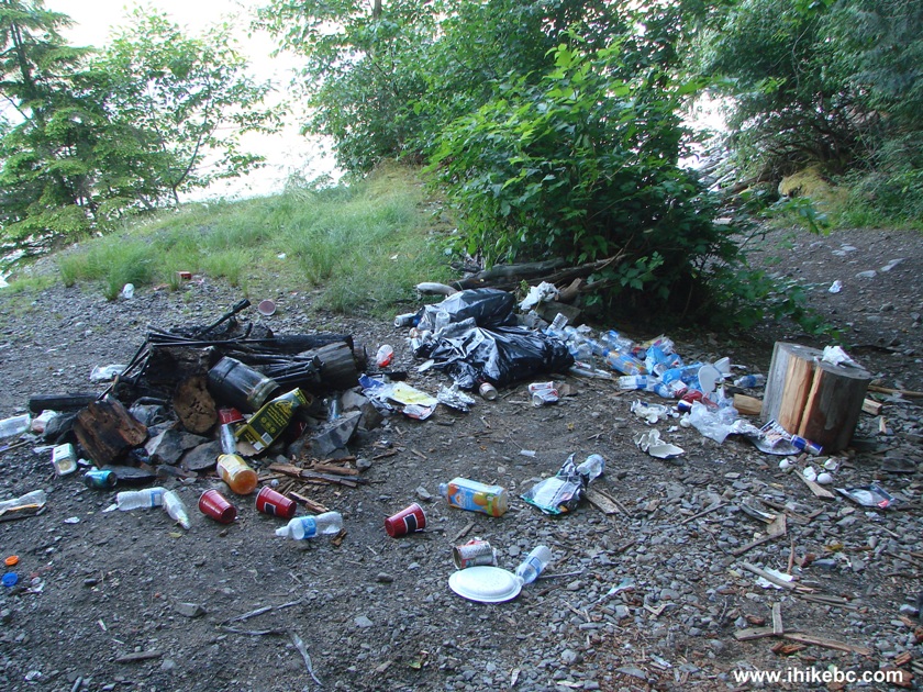
14. ...and a whole lot of garbage left behind by previous campers. There were two other equally large garbage dumps at that campground.
15. If you want a cosier campground with no garbage as of the time of writing, drive to km 48.3 and turn right. The view you would get is similar to the other unregulated campground, but the crowds would likely be smaller simply because there is space for not more than 20-25 vehicles at the 48.3 km campsite.
16. Km 49 features a creek eroding the road surface. This spot may become impassable, depending on how bad of a damage the creek will inflict.
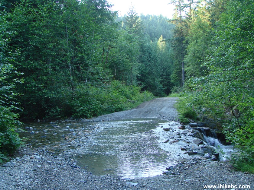
Creek Eroding Harrison West FSR Province of BC Canada
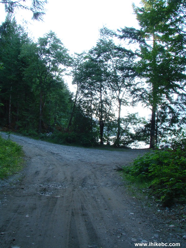
17. At the 55 km mark, there is a nice camping spot right by the lake, suitable for two vehicles at most. The photo below shows the turnoff to that spot. This is also a good place to turn around, if you have a 2WD vehicle, since right after the turnoff there is a steep loose-surfaced hill.
Harrison West Forest Service Road near Km 55
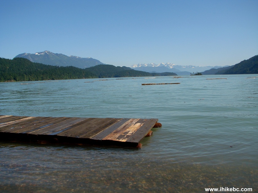
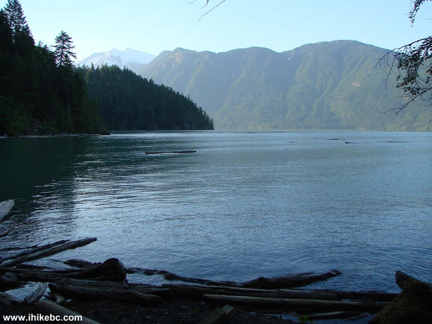
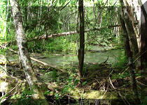
18. The camping spot by the lake. Note the bag full of garbage left behind.
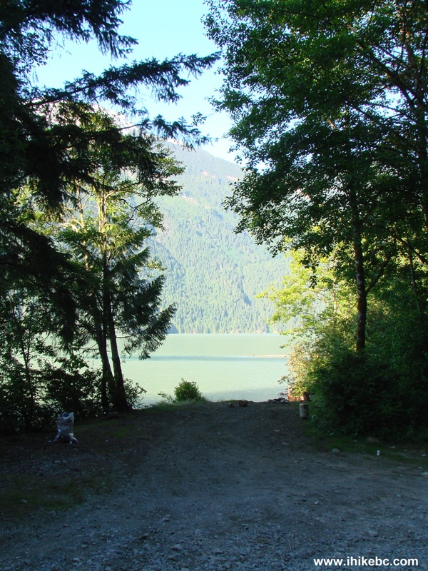
19. But, hey, the spot is flat, there is a fire ring, and the view is great too.
20. And here is that steep loose hill mentioned above. It is worse than it looks.
Harrison West Forest Service Road Steep Hill
We walked for about 500 meters
further down the road, then turned around and went back. Harrison West
FSR is hard to recommend as a scenic drive. But, if you want to camp
near the lake, this could be a good destination. Just beware of the
mosquitoes and fairly heavy traffic for such a remote location.
Other Trips in Harrison Hot Springs Area:
ihikebc.com
Trip 047 - Harrison West FSR Trip (near
Mission and Harrison Hot Springs, BC)


![]()


![]()
![]()
![]()
![]()