Trip 332 - May 19, 2025 (Monday)
Sunshine Coast Trail Hike from Sarah Point for 5 km
Near Lund, British Columbia, Canada
Page 2 of 3
Liked: Sarah Point Hut, several fine forest and ocean views, shade in the forest, no bugs.
Of Note: Uneven ground, rocks and roots, several moderately difficult sections, hiking poles and boots are highly recommended.Vancouver, Coast & Mountains Backroad Mapbook (2019 edition) trailhead location:
Page 28 (Lund) A6.Related Websites: Sunshine Coast Trail - Official Website, Sunshine Coast Shuttle.
Follow @ihikebc TweetSunshine Coast Trail is a monumental 180 km-long wilderness hike on Sunshine Coast of British Columbia. It stretches from near Lund, BC (the northern trailhead) to Saltery Bay Ferry Terminal South of Powell River, BC. Logistically, it is easier to hike this trail North to South, as the northern end is fairly difficult to get to, whereas the southern end is right by the ferry terminal. So, quite a few people, if they choose to hike the entire Sunshine Coast Trail at once, get a shuttle (in a 4x4 SUV) from Powell River to Sarah Point Hut, and then hike to Saltery Bay, where they can catch a ferry right after finishing their hike.
Sunshine Coast Trail is Sunshine Coast's answer to Vancouver Island's Juan De Fuca Trail (here is our trip report), with one substantial difference - Sunshine Coast Trail is four times longer. Other than that, it's the same general concept - easy to moderately difficult hiking through the woods with ocean views here and there, and with numerous camping opportunities (overnight stays require paying a small fee). And there is also a possibility of doing several day hikes, as opposed to hiking the whole thing, as there are numerous access roads to various parts of the trail. And that is exactly what we did today - hiked for just over 5 km from Sarah Point Hut, which is the northern end of Sunshine Coast Trail.
To get from Lund to Sarah Point Hut, you need to go via Finn Bay Road - Baggi Road - Sarah Point Road - Malaspina FSR for a total of 15.2 km. The last 3 km or so is for 4x4 vehicles only due to steep grades with loose surface. Up until that point, 2WD vehicles with regular clearance would be sufficient.
*All trail distances are based on a GPS odometer and are approximate.
34. We are standing next to Sarah Point Hut at the northern end of Sunshine Coast Trail near Lund, British Columbia, Canada.
35. Tent pads by the hut.
36. The front of Sarah Point Hut.
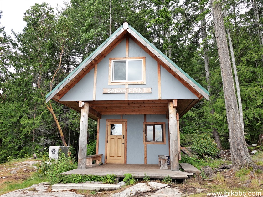
37. The entrance.

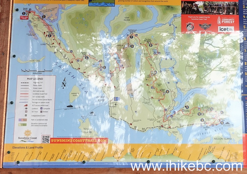
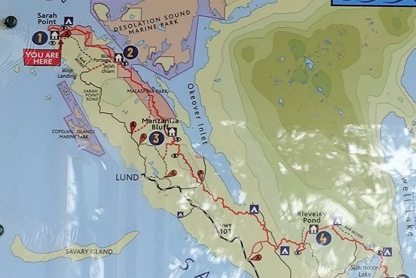
38-40. A map of Sunshine Coast Trail by the entrance.
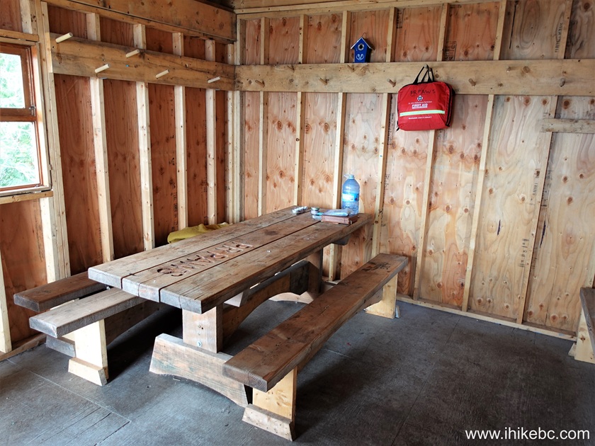
41. Let's go in.
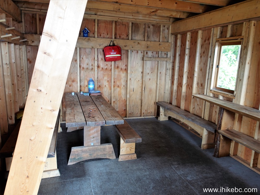
42. Looking from the other side.
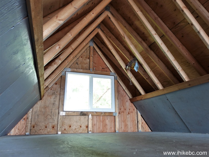
43. Time to check out the attic.
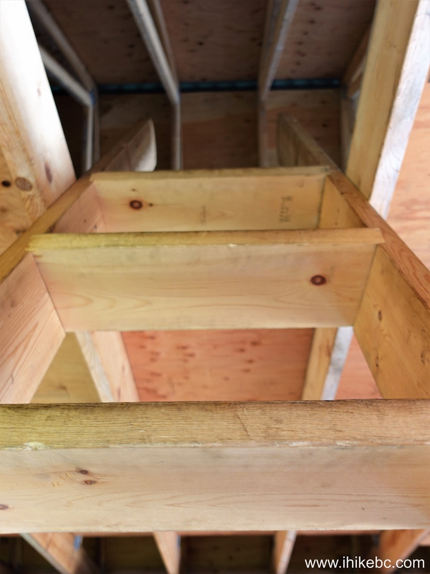
44. Plenty of space to sleep.
45-46. And outside there is this most exquisite pit toilet approach we have ever seen.

Here is Our Video of
inside and outside of Sarah Point Hut.
More ihikebc videos are on
our YouTube Channel.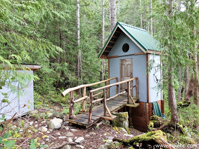
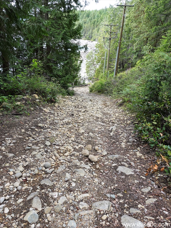
47. Time to head to Sunshine Coast trailhead. Here were are 15 meters past the parking lot by Sarah Point Hut, heading down.
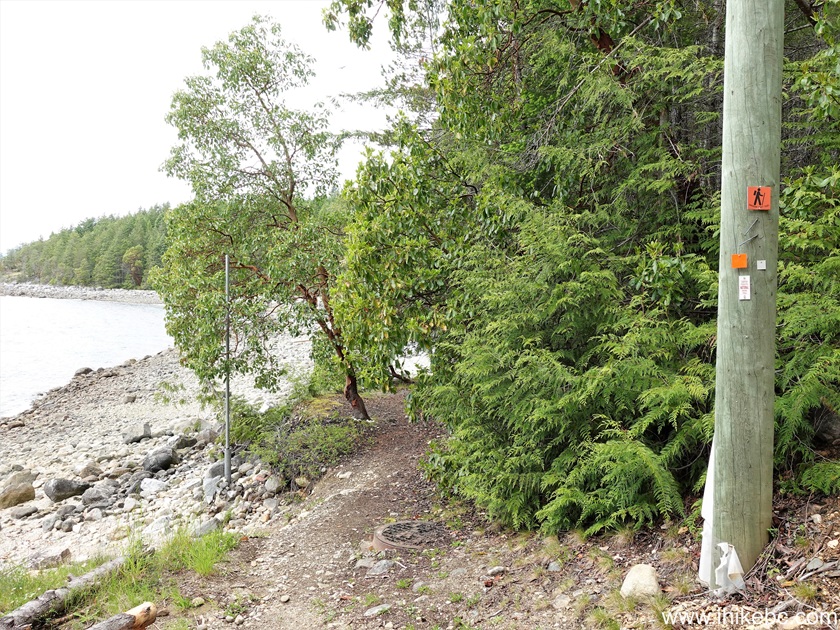
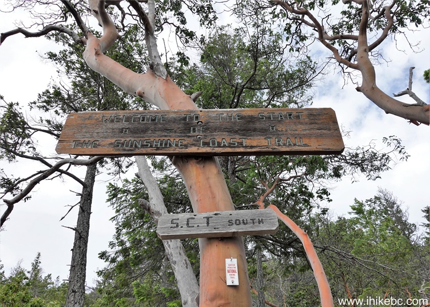
48-49. The trailhead is at the bottom of the hill, 70 meters from the parking lot. Sunshine Coast Hike begins here, and ends by Saltery Bay Ferry Terminal South of Powell River. Several day hikes are available as well as various points of the trail.
50. At 40 meters from the trailhead.
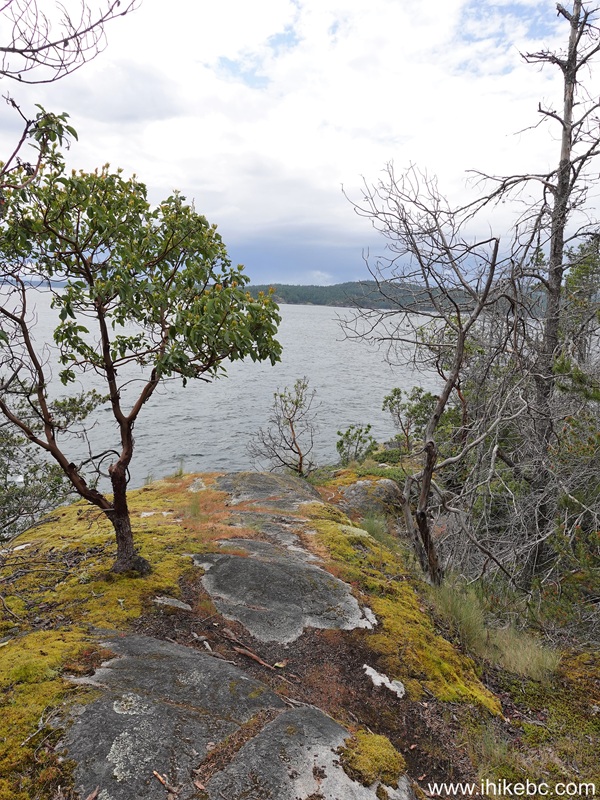
51. At the 165 meter mark. Easy, pleasant hiking in the forest along the shoreline.

52. At 310 meters of Sunshine Coast Trail.

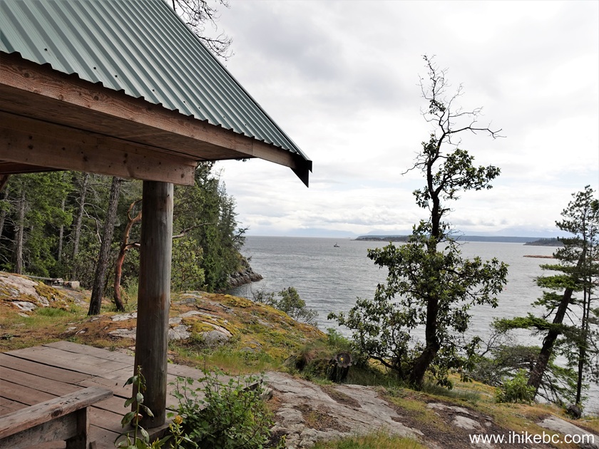
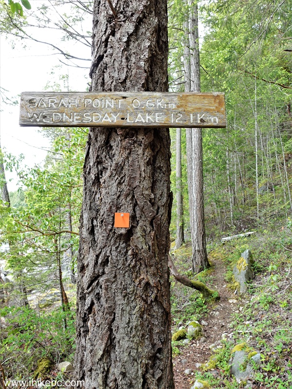
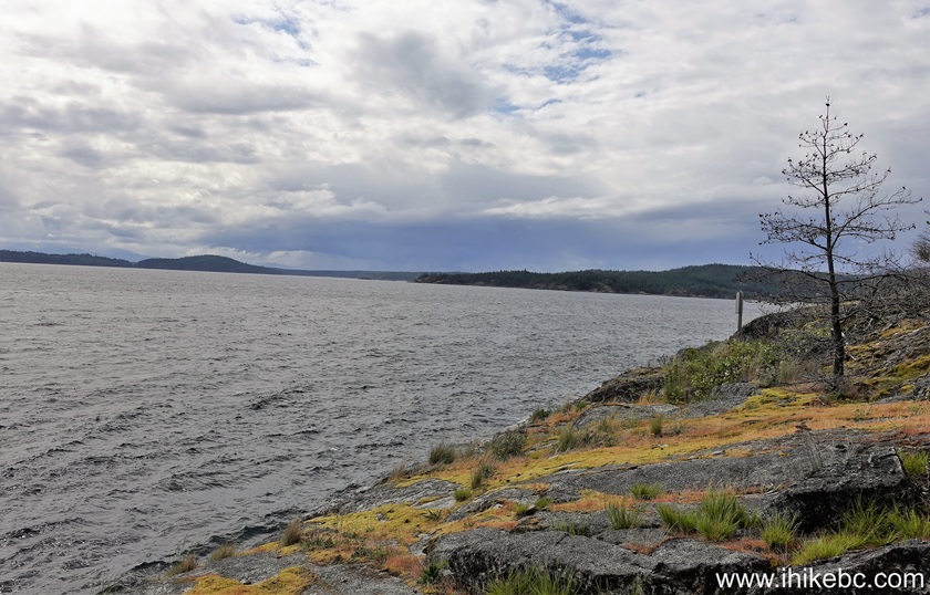
53. At the 520 meter mark, we have arrived to Sarah Point.
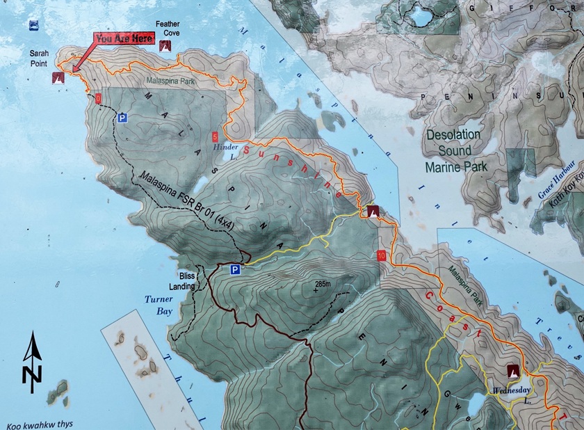
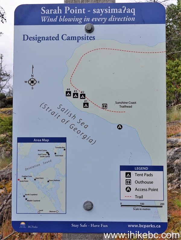
54-55. A map of the trail and this particular area.

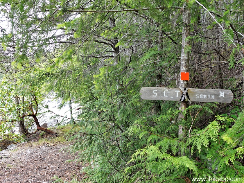
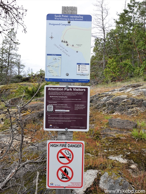
56-57. A few signs.

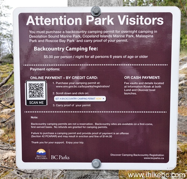
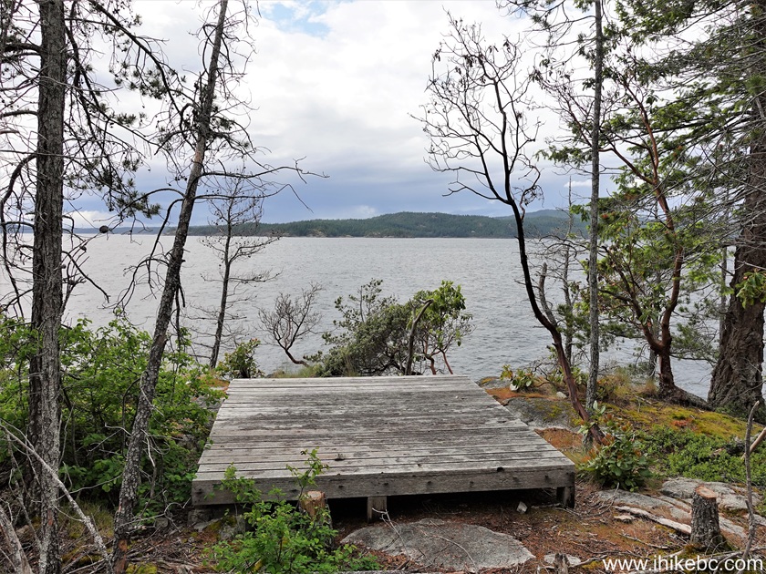
58-60. Camping fee information, and a map of the tent pad locations at Sarah Point.
61. Sunshine Coast Trail at 625 meters from the trailhead by Sarah Point Hut.
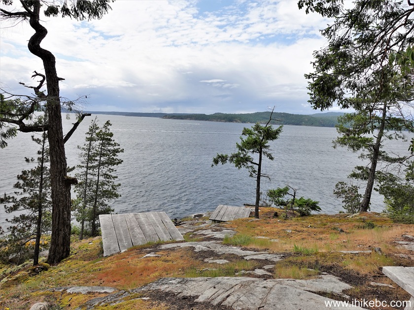
62. One of the tent pads at Sarah Point.
63. After Sarah Point, the trail makes a sharp right turn and starts getting away from the ocean. At 1.74 km here.

Our Sunshine Coast Trail Hike Trip Report Continues on Page 3.


|
 |
Other Trips:


![]()


![]()
![]()
![]()
ihikebc.com Trip 332 - Sunshine Coast Trail Hike from Sarah Point for 5 km (Near Lund BC)
Page 2 of 3