![]()
![]()
![]()

Trip 180 - September 6, 2019 (Friday)
Wapta Falls Trail Hike
Yoho National Park
Near Golden BC Canada
Location: Eastern British Columbia, off TransCanada Highway 1, in Yoho National Park, approximately 35 kilometers East of the town of Golden.
Liked: Wapta Falls views, short and easy trail, no bugs.
Of Note: Yoho National Park visitor fee payment is required (credit or debit only - no cash). The trail is very popular. Parking could be an issue in busy season. The ground is slippery near the waterfall. Hiking poles and boots are recommended. A rain coat is recommended for a close approach to the waterfall.
Kootenay Rockies BC Backroad Mapbook (7th Edition) Trailhead Coordinates: Page 43 (Golden) G7.
Related Website: Yoho National Park - Parks Canada Official Site.
Another Trip in Golden BC Area: Paget Lookout Trail Hike.
>>> British Columbia Waterfalls Visits.
Wapta Falls is one of many trails in very impressive Yoho National Park, located in Eastern British Columbia along Highway 1 near the town of Golden. This particular trail is very popular, and for a good reason, as it is short, easy, and leads to a huge waterfall. Parking could be an issue, as even today, an off-season weekday, the parking lot was packed closer to the middle of the day. You may have to park along the access road and extend your hike accordingly.
Note, that there is no sign for this trail for Westbound traffic, as there is no left turn lane - continue to the nearest turnaround about 3 km later, come back and enter Wapta Falls access road via Eastbound right turn lane.
1. We are Eastbound on TransCanada Highway #1, passing by the town of Golden. If you are interested in taking a shower, a nearby Husky Service Center has one for a fee.

TransCanada Highway 1 Eastbound near Golden British Columbia
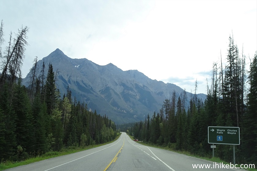
2. Somber mountains surround the highway all the way to Yoho National Park.

TransCanada Highway 1 near Golden BC
3. It's a picturesque drive for sure.

Highway 1 near Golden British Columbia Canada
4. Entering Yoho National Park, approximately 25 kilometers East of Golden.
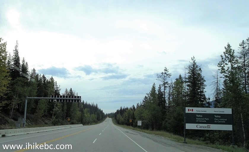
Yoho National Park Entrance TransCanada Highway 1 Eastbound near Golden BC
5. This is now Canadian federal jurisdiction, and, unlike in BC provincial parks, one has to pay for parking in Yoho National Park. And not just per car, but per person (adults are $9.80). And cash is NOT accepted - credit or debit only. The day pass we purchased was valid until 4 PM the next day. For detailed information on the fees, visit https://www.pc.gc.ca/en/pn-np/bc/yoho/visit/tarifs-fees. This is a fee-collecting shack.

Yoho National Park - fee-payment shack
6-7. About 35 kilometers East of Golden, make a right turn onto Wapta Falls access road.

Highway 1 at Wapta Falls Access Road Turnoff in Yoho National Park
8. Wapta Falls Trail access road immediately after turning from Highway 1. Coordinates: N 51⁰13.071' W 116⁰35.552'. Elevation: 1,097 meters.

Start of Wapta Falls Access Road near Golden British Columbia Canada
9. The road to the Wapta Falls trailhead parking lot is 2 kilometers long, has many potholes, but should present no major challenge for most vehicles with regular clearance.

Wapta Falls access road in Yoho National Park British Columbia Canada
10. Arriving to Wapta Falls trailhead parking lot. It filled up quickly, even on an off-season weekday. During the busy season, one would most likely have to park along the access road, and extend the hike accordingly.

Wapta Falls Parking
11. The trail begins. Coordinates: N 51⁰12.245' W 116⁰35.106'. Elevation: 1,100 meters.

Golden Hiking - Wapta Falls trailhead
12. It's a short, easy, and very popular trail.

Hiking in Golden BC Area - Wapta Falls Trail in Yoho National Park
13. The main observation platform arrives 2 kilometers after the start of the trail.

Wapta Falls Main Observation Platform - Hiking in Yoho National Park near Golden
BC Canada
14. The view is quite impressive.

Wapta Falls Yoho National Park near Golden BC Canada
Here is our video of the views from this location.
15. The trail then continues to the bottom of the waterfall. Less than a hundred meters later, turning left would lead to the second observation platform en route to the bottom of the waterfall (via a somewhat steep trail), while going straight would lead to the bottom of the waterfall without going through the second observation platform. It is thus possible to hike the last part of the trail as a loop.

Golden Hike - Wapta Falls Trail in Yoho National Park
16. The view of the split from the other side.

Wapta Falls Trail - Hike in Golden Area
17. We went straight ahead, and visited the second observation platform on the way back.

Golden Trail - Wapta Falls Trail in Yoho National Park
18. Arriving to the bottom of Wapta Falls, 500 meters from the main observation platform, and 2.5 kilometers from the trailhead. Coordinates: N 51⁰11.202' W 116⁰34.646'. Elevation: 1,027 meters (73 meters elevation loss from the start of the trail).

Wapta Falls in Yoho National Park British Columbia Canada
19. Very neat. There is a lot of spray from the waterfall, so a rain coat would be useful for a close approach.

Wapta Falls near Golden BC Canada
Here is our video of the views from this location.
20. The path to complete the loop is on the left side closer to the waterfall. The loop trail is appreciably steeper than the main trail, if for a few hundred meters. Also on the left side is a steep hill (wet and slippery too!), allowing for a cool waterfall view from the side.
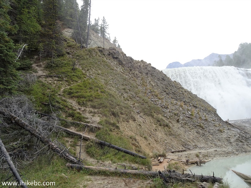
Wapta Falls British Columbia
21. A cool waterfall view from the side. Wapta Falls resembles War Falls near McLeod Lake in Northern British Columbia.

Wapta Falls
Here is our video of the views from this location.
22. Now looking back and to the right.
Yoho National Park
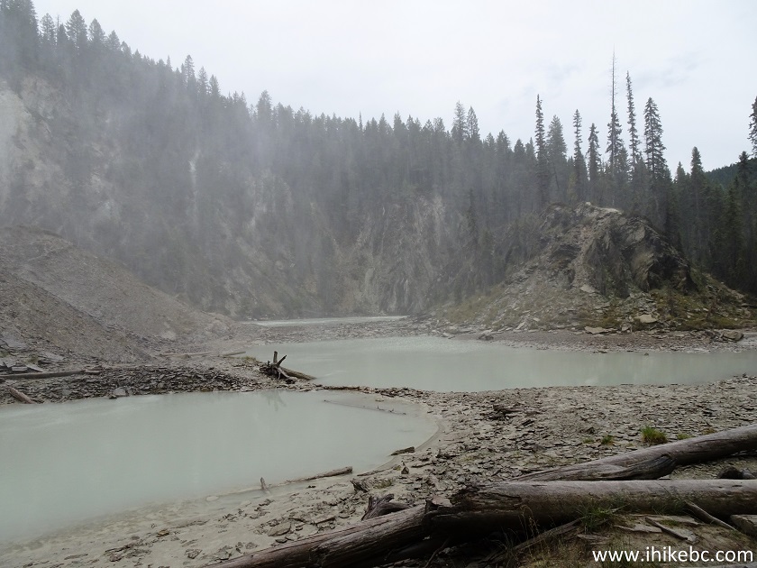
23. Having descended from the hill to the left of the waterfall, we are looking at Wapta Falls straight up.

Yoho National Park Wapta Falls
24-25. We then climbed the hill in front of Wapta Falls, and took the following photographs left to right.

Wapta Falls near Golden BC Canada

Wapta Falls near Golden British Columbia
26. After that, we took the loop trail to the second observation platform.

Trail on Golden BC Area - Wapta Falls Trail
27. View of Wapta Falls from the second observation platform.

Yoho National Park Wapta Falls - hiking in Golden British Columbia Canada area
Here is our video of the views from this location.
More ihikebc videos are on our YouTube Channel.
We kept hiking the loop trail for a few hundred meters until the split seen in photos #15 and #16, turned right, and went back the same way we came in. Wapta Falls is a very impressive waterfall, and it takes all of 30 minutes of easy hiking to get there from the parking lot. Highly recommended.


|
 |
Other Trips:


![]()


![]()
![]()
![]()
ihikebc.com Trip 180 - Wapta Falls Trail Hike (Yoho National Park near Golden BC)