![]()
![]()
![]()

Trip 270 - September 10, 2022 (Saturday)
Sluice Box Trail Hike
Near Stewart BC
Liked: A small waterfall before the split, a larger waterfall at the end of the Barney's Gulch spur trail, several fine forest scenes, picnic table at the end of the trail, shade in the forest, no bugs.
Of Note: Several small creek crossings, several large fallen trees, a muddy stretch of about 50 meters, stepping on rather large slippery stones by the first waterfall is required, uneven ground, rocks and roots – hiking poles and boots are highly recommended. Steep unbarricaded drop-offs at the Barney's Gulch spur trail waterfall viewing area, Sluice Box trail end view overgrown. Do not park by the trailhead in order to not be locked out when Stewart Transfer Station closes for the day.
Northern BC Backroad Mapbook (3rd edition) Coordinates: Page 61 (Stewart) A5.
Another Trip in Stewart BC Area: Ore Mountain Trail Hike.
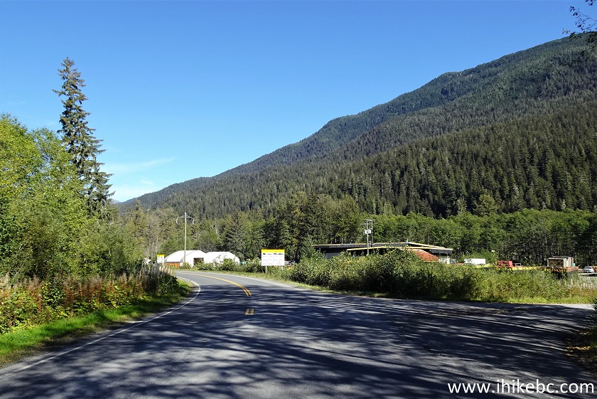
The town of Stewart is a small settlement in the West of British Columbia, very far from any major town. A long and mostly featureless Highway 37 goes North-South from near the Yukon border to Highway 16 by Kitwanga, located between Terrace to the West and Smithers to the East. Mezadin Junction, found 150 km North of Kitwanga, is where a very picturesque Highway 37A starts off Highway 37, goes past several glaciers (including Bear Glacier) and reaches Stewart in about 60 kilometers.
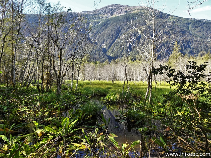
Sluice Box Trail begins about one kilometer East of Stewart. It is easy-to-moderately challenging trail, which is rather short. It starts off Sluice Box Road near Stewart Transfer Station, and goes through a forest past a small waterfall to a T-junction about 900 meters from the start. At the junction, a right turn leads in 260 meters to a picnic table with a badly overgrown viewpoint, while a left turn reaches a rather impressive waterfall (with a VERY dangerous viewing area) in about 820 meters via a path actually called "Barney's Gulch Trail" in our GPS with Backroad Mapbook software.
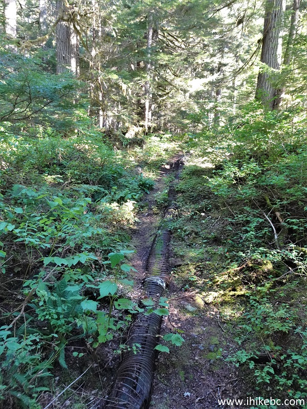
In a few locations the path goes by a bunch of pipes, which, likely, gave the trail its name.
*All trail distances are based on a GPS odometer and are approximate.
1. Here are Google Maps directions from the town of Stewart to Sluice Box trailhead.
2. We are going to count the distance from the "Welcome to Stewart" sign, so here we are heading East on Highway 37A 200 meters from that sign.

BC Highway 37A Near Stewart BC Canada
3. At 500 meters, turn right onto Sluice Box Road.
BC Highway 37A at Sluice Box Road
4. Proceed on Sluice Box Road for 100 meters.

Sluice Box Road Stewart British Columbia Canada
5-6. Park right by the sign which says "Sluice Box Recreation Trail Parking". DO NOT cross the bridge seen in photo #7 with your vehicle, as it gets roped off once the transfer station closes, and your ride would be stuck until they reopen the next business day.


Sluice Box Recreational Trail Parking
8. Hike across the bridge and take the left path at the split by the transfer station.

Stewart BC Area
9. Enjoy a green alley leading to the trailhead.

Sluice Box & Barney's Gulch Trailhead Access Road
10. Arrive to the trailhead (to the left of the sign) 250 meters from the parking area. Coordinates: N 55°57.197’ W 129°57.991’. Elevation: 30 meters.

Sluice Box Trailhead & Barney's Gulch Trailhead
11. Sluice Box Trail begins. At 60 meters here.

Stewart Hiking - Sluice Box Trail
12. A fine view on the right at 250 meters of the trail.
View from Sluice Box Trail near Stewart British Columbia Canada
13. It's a very easy and pleasant hike through the forest at first.

British Columbia Hiking - Sluice Box Trail
14. A short steep stretch at the 360 meter mark.

Hike in Stewart BC Area - Sluice Box Trail
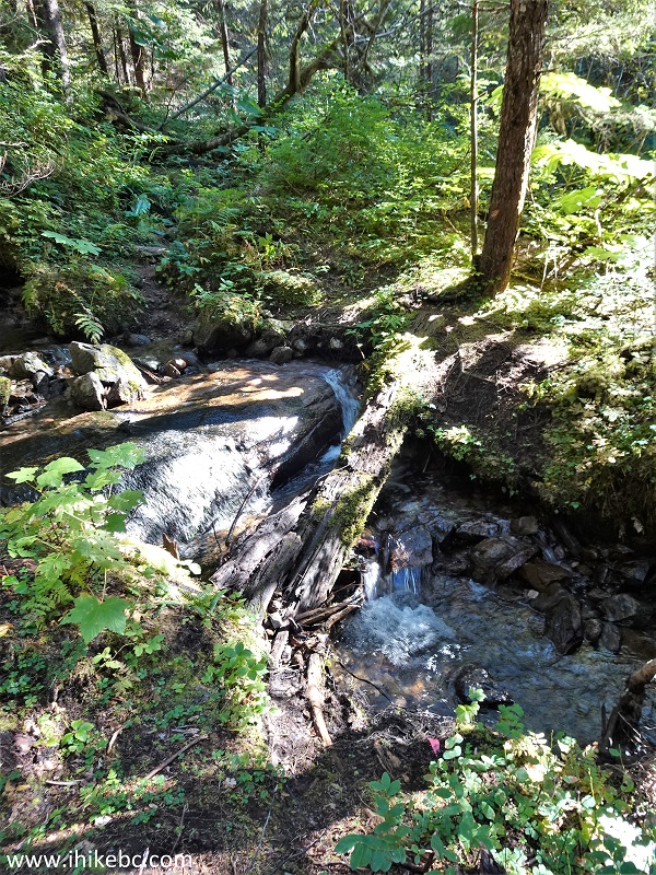
15. Approaching the first waterfall.

Sluice Box Trail Hike in British Columbia Canada
16-17. The first waterfall arrives at 530 meters of Sluice Box Trail. Plain and zoomed views. The trail by the waterfall is composed of slippery stones.

Sluice Box Trail Waterfall

Sluice Box Trail Falls
Here is our video of the views from this location.
18. Sluice Box Trail after the first waterfall. At 600 meters here.

Sluice Box Trail near Stewart British Columbia
19-20. At 700 meters, a reminder of the past industrial activity in this area. Plain and zoomed views.

Pipes on Sluice Box Trail near Stewart British Columbia

Sluice Box Trail Pipes
21. A fairly tough tree to climb over arrives at 830 meters of Sluice Box Trail.

Stewart BC Trail - Sluice Box Trail
22. There is a T-junction at the 900 meter mark. Coordinates: N 55°57.196’ W 129°57.677’. Elevation: 135 meters. To the right is a 260 meter trail to a picnic table and a badly overgrown viewpoint. To the right is a "Barney's Gulch" spur of just over 800 meters long to a rather impressive waterfall.

Sluice Box Trail and Barney's Gulch Trail Split
23. We went to the right at first. At 120 meters from the T-junction here.

Sluice Box Trail
24-26. This spur ends at 240 meters with a picnic table and a badly overgrown view of, apparently, Portland Canal. Coordinates: N 55°57.109’ W 129°57.818’. Elevation: 100 meters.

Sluice Box Trail Picnic Table


Sluice Box Trail Obstructed Trail End View
27. We are back at the T-junction, heading straight to the main waterfall via the Barney's Gulch spur.

Barney's Gulch Trail and Sluice Box Trail Split
28. Hiking along a pipe at 430 meters of the spur.
Barney's Gulch Trail Stewart BC Canada
29. A short slippery stretch at the 750 meter mark. Prior to that, there is a 50 meter-long muddy stretch starting at the about 680 meter mark.
Hiking in Stewart BC Area - Barney's Gulch Trail
30. Arriving to the waterfall at the end of the spur 820 meters from the T-junction. Coordinates: N 55°57.127’ W 129°57.161’. Elevation: 250 meters.

Barney's Gulch Trail
31-33. Here is the waterfall.
WARNING - DANGEROUS AREA.
Steep unbarricaded drop-offs, slippery ground, be extremely careful here, as the best views require getting close to the edge.
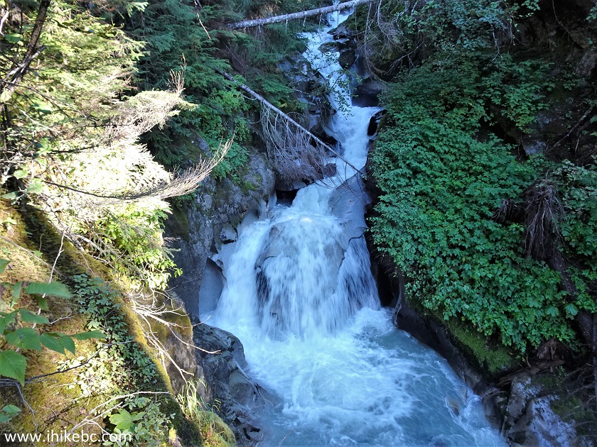
Barney's Gulch Falls

Barney's Gulch Waterfall
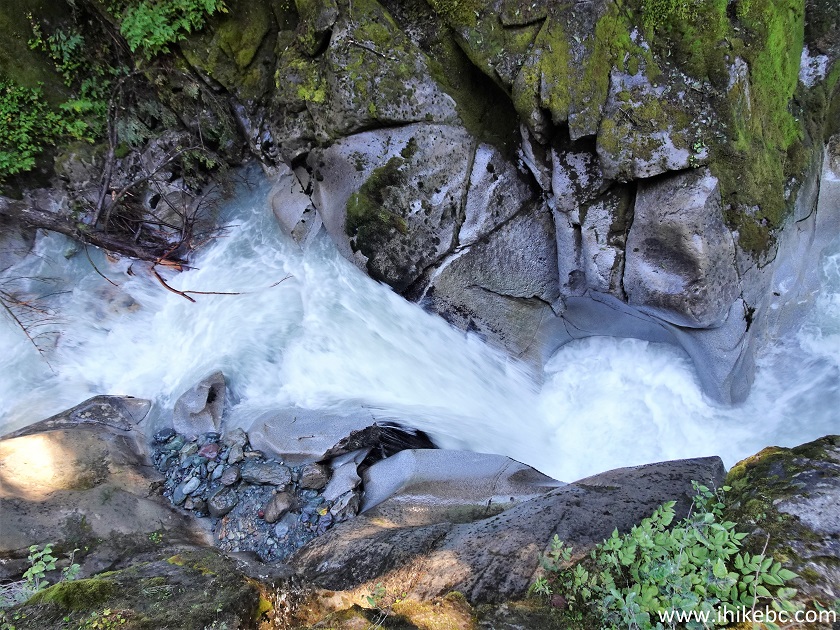
Stewart BC Waterfall at the end of
Barney's Gulch Trail
Here is our video of the waterfall.
More ihikebc videos are on our YouTube Channel.
Sluice Box Trail is rather short and relatively easy, and leads to a picnic
table and a fine waterfall. Recommended.


|
 |
Other Trips:


![]()
![]()
![]()
ihikebc.com Trip 270 - Sluice Box Trail Hike (Near Stewart BC)