![]()
![]()
![]()

Trip 217 - June 21, 2021 (Monday)
Florence Lake FSR Visit
(to Stave Lake boat launch and beyond)
Near Mission BC
Page 1 of 2
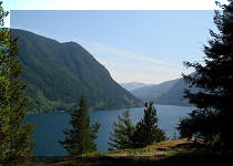
Liked: Stave Lake and Alouette Lake views, fairly decent road conditions to 20.3 km, access to Stave Lake boat launch and several recreation sites, an unregulated camping spot by Stave Lake, very few bugs.
Of Note: Florence Lake
FSR is very popular up to the point of entry to the last recreation site at 12.8 km, logging trucks are present, dust from passing vehicles, the road past 20.3 km is very rough – 4WD high-clearance vehicles only. Alouette Lake views from the FSR past 20.3 km are getting overgrown. Noise from boats on Stave Lake while hiking to a BC Hydro facility.Vancouver, Coast & Mountains Backroad Mapbook (5th edition) FSR Coordinates: Page 3 (Abbotsford) C2-D1, Page 13 (Stave Lake) D7-D6.
Other Forest Service Roads Trips: Chilliwack Bench, Chilliwack Foley, Chilliwack Lake, Chuchinka-Colbourne (North of Prince George), Clear Creek (off Harrison East), Harrison East, Harrison East Second Trip, Jones Lake (near Hope), Lost Creek (by Mission), Mamquam River (by Squamish), Nahatlatch (near Boston Bar), Parsnip West (by Mackenzie), Scuzzy (by Boston Bar), Shovel Creek (off Harrison East), Sowaqua Creek (by Hope), Squamish River Main, Squamish River Ashlu, Squamish River E-Main, Squamish River FSR Washout, Windfall Creek (by Tumbler Ridge).
Florence Lake Forest Service Road starts at Dewdney Trunk Road between Mission and Maple Ridge. It goes for just over 24 kilometers past Stave Lake boat launch, and several recreation sites. At 20.3 km there is a large unregulated camping spot, and regular 2WD vehicles with good tires would be able to make it this far. Immediately after the camping spot there is a split. To the right is a 1.8 km-long gated road to a neat old BC Hydro facility, as well as a very fine view of Stave Lake. To the left is a continuation of Florence Lake FSR, but it is so rough, that only high-clearance 4WD vehicles might be able to tackle this stretch of the road.
We ended up driving to the 20.3 km camping spot, and then biked/hiked both to the BC Hydro facility via the road on the right, and to the end of the Florence Lake FSR via the left spur. Several very good views of Alouette Lake await those who would proceed on Florence Lake FSR via the left spur past the 20.3 km camping spot. Alas, these views are starting to get overgrown, and may be completely gone in 5-10 years.
From what we understood, all recreation sites on this road have Stave Lake access, are fee-based and are hosted. There is a very fine unregulated camping spot at the 10.3 km mark, but that's the only one we could find right by the lake. Considering the popularity of this road, the spot is likely occupied more often than not during the busy season. However, as the spot is quite large, it may accommodate dozens of people.
As for comfortable speeds on Florence Lake FSR, 40-50 km/h is doable up to the Zayac Ranch at 8.4 km, 30-40 km/h is realistic to Rocky Point Recreation Site at 10.7 km, and 20-30 km/h is more like it up to the camping spot at 20.3 km. Beyond that, get ready to crawl much, and to use that diff lock.
Zero your odometer at the intersection of Burma Rd / Florence Lake FSR and Dewdney Trunk Road, if you want to follow our odometer mileage markers in the table below. There are pretty accurate mileage markers along the road too, with a few of them being off by 200-300 meters.
All bridges on Florence Lake FSR are one-lane and are located at km: 2.6, 3.8, 6.6, 7.3, 9.0, 12.6, 13.1, 13.4, and 13.5.
*all distances past the 20.3 km split are based on GPS odometer and are approximate.
| KM | Feature | Side |
| 0.4 | Asphalt ends, gravel starts | Straight (S) |
| 0.8 | Stave Lake boat launch | Right (R) |
| 1.5 | Stave Lake group campground & lodge | R |
| 2.6 | Rolley Falls Trail | L |
| 4.8 | 2 pit toilets | R |
| 6.8 | Gated road - Mount Crickmer Trail access | Left (L) |
| 7.4 | Rock Creek Recreation Site | R |
| 8.4 | Zayac Ranch | R |
| 8.9 | Kearsley Creek Recreation Site | R |
| 9.8 | Stave Lake appears on the side of the road | R |
| 10.3 | Large unregulated camping spot | R |
| 8.4 | Zayac ranch | R |
| 8.9 | Kearsley Creek Recreation Site | R |
| 9.8 | Stave Lake appears on the side of the road | R |
| 10.3 | Large unregulated camping spot | R |
| 10.7 | Rocky Point Recreation Site | R |
| 12.8 | Sayers Lake Recreation Site | R |
| 18.8 | FSR | L |
| 20.0 | FSR - gated 200m later | L |
| 20.3 | Unregulated Camping Spot (end of 2WD road) | R |
| 20.3 | 1.8 km-long gated road to Stave Lake view & BC Hydro Facility | R |
| 20.3 | Continuation of Florence Lake FSR (high clearance 4WD only) | L |
| 21.8* | Alouette Lake view | L |
| 23.3* | Alouette Lake view | L |
| 23.65* | Split - take the road on left | L |
| 23.9* | Alouette Lake view | L |
| 24.1* | Florence Lake FSR end | S |
1-2
. Florence Lake Forest Service Road starts right at Dewdney Trunk Road, between Maple Ridge and Mission. There are many ways to get onto Dewdney Trunk Road, and today we went via Lougheed Highway and 287th Street (Wilson Street). Here we are Eastbound on Lougheed Highway, with downtown Maple Ridge about 15 kilometers behind us, getting ready to turn left onto 287th Street.


Lougheed Highway at 287th Street
3. 287th Street 200 meters after the turn. Soon, 287th Street becomes Wilson Street, after Maple Ridge meets Mission, from what we understood, but it's the same road.

287th Street Maple Ridge BC Canada
4. We proceeded on 287th Street / Wilson Street for 6.2 km, and reached Dewdney Trunk Road, where we turned right.

Wilson Street at Dewdney Trunk Road Mission British Columbia
5. Now on Dewdney Trunk Road, with a sign indicating a left turn is required to reach Stave Lake.

Dewdney Trunk Road near Stave Lake and Hayward Lake Turnoffs
6-7. 4.1 km after turning onto Dewdney Trunk Road, just past the crosswalk, we are making a left turn onto Burma Road, which is the beginning of Florence Lake FSR. Coordinates: N 49⁰13.788' W 122⁰21.465'. Elevation: 95 meters. Zero your odometer after the turn, if you want to follow the mileage markers in the table of points of interest above.

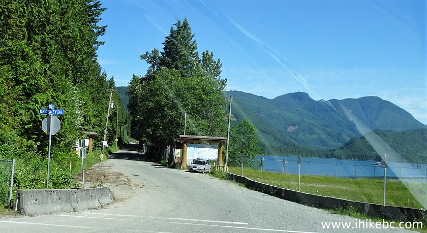
Dewdney Trunk Road at Burma Road / Florence Lake FSR
8. The sign for Florence Lake FSR is 100 meters past the turn from Dewdney Trunk Road. Radio frequency is RR-6. Watch our for logging trucks and other industrial traffic.

Florence Lake Forest Service Road Start
9. Stave Lake Boat Launch is located at 0.8 km of Florence Lake FSR.

Florence Lake FSR near Stave Lake Boat Launch
10. The boat launch entrance. Open 9-9 today. There is a smaller parking lot to the left of the gate, and a much larger one right by the launch ramp.
Stave Lake Boat Launch Entrance off Florence Lake FSR
12. Descending to the main boat launch parking lot.

Road to Stave Lake Boat Launch
13. Here it is. Very large indeed.

Stave Lake Boat Launch Parking Lot
14. Stave Lake boat launch ramp.

Stave Lake Boat Launch Ramp
15. A view from the ramp.
Stave Lake view from Stave Lake Boat Launch Ramp
16. Looking back from the ramp towards the shore.

Stave Lake Boat Launch Ramp near Mission BC Canada
17. A picnic area next to Stave Lake boat launch ramp.

Stave Lake Boat Launch Picnic Area
18. We are back on Florence Lake Forest Service Road. At 1.6 km here.
Florence Lake Forest Service Road
19. There is a bridge at 2.6 km, and right before and right after the bridge are the entrances (indicated by arrows) to Rolley Falls Trail. It's a loop trail, which also connects with Rolley Lake Provincial Park.

Florence Lake FSR at Rolley Falls Trailhead
20. Another bridge is at 6.6 km. All bridges on this FSR are single-lane.

Florence Lake FSR near Mission BC Canada
21. 200 meters past the 6.6 km bridge, a gated road on the left leads to Mount Crickmer Trail. The gate was open today, and a sign said no trail access until further notice due to active logging.

Florence Lake FSR at Mount Crickmer Trail Access Road Turnoff
22. Lots of logging trucks on Florence Lake FSR.

Logging Truck on Florence Lake FSR
23. Zayac Ranch entrance is at 8.4 km of the FSR, on the right side. The road deteriorates after that, but is still passable in a regular vehicle.

Florence Lake FSR at Zayac Ranch Access Road
24. At 8.9 km, Kearsley Creek Recreation Site is also on the right side.

Florence Lake Forest Service Road at Kearsley Creek Recreation Site
25. If all the recreation sites are full, or you do not feel like paying for camping, there is one neat unregulated camping spot at 10.3 km.

Unregulated Camping Spot at Florence Lake FSR
26. Quite a large spot too, with several fire rings.
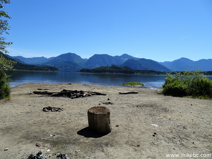
Stave Lake Camping Spot by Florence Lake FSR
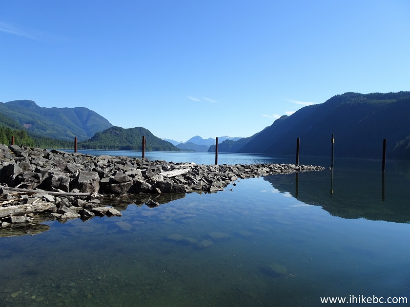
27-30. The view of Stave Lake from the camping spot. Left to right.

Stave Lake by Florence Lake FSR

Stave Lake near Mission BC Canada

Stave Lake near Mission British Columbia

Camping by Stave Lake
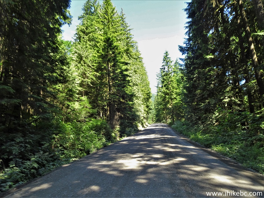
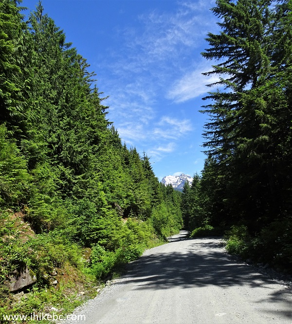
31. We are continuing on Florence Lake FSR. Now at 15.3 km.
Florence Lake FSR
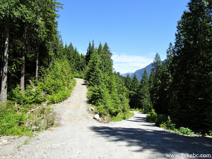
32. One of the few ungated side roads arrives at 18.8 km. There could be a gate further on, though. Keep right.

Florence Lake Forest Service Road
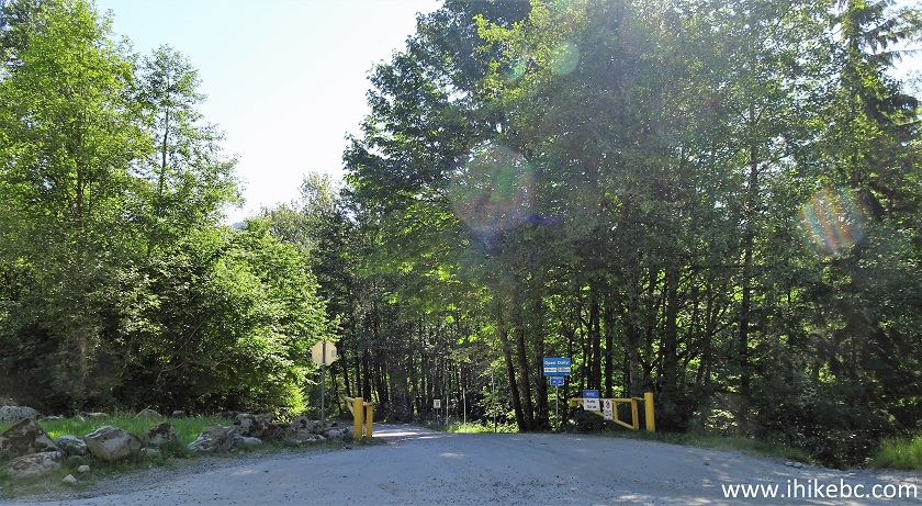
33. Another split is at 20.0 km. Keep right again. The road on the left is gated in 200 meters.

Florence Lake FSR near Mission British Columbia Canada
34. At 20.3 km, 2WD road ends. Coordinates: N 49⁰22.268' W 122⁰19.167'. Elevation: 361 meters. There is a camping spot on the right side, pictured below (no lake access) and a split. To the right is a 1.8 km-long twice-gated road to a BC Hydro facility and to a fine Stave Lake view. To the left is a very rough continuation of Florence Lake FSR, suitable for high-clearance 4WD vehicles only.

Florence Lake FSR Camping Spot
35. Here is the split. We first took the road on the right, and then on the left. Those trips are covered on the next page.
Florence Lake Forest Service Road British Columbia
Our Florence Lake FSR trip report Continues on Page 2.


|
 |
Other Trips in Mission BC Area:
|
|
|
|
|
|
|
|
|
|

Other Trips:


![]()


![]()
![]()
![]()
ihikebc.com Trip 217 - Florence Lake FSR Trip (near Mission BC) Page 1 of 2