![]()
![]()
![]()

Trip 145 - August 20, 2018 (Monday)
Twin Falls Trail Hike
Near Smithers, BC
Location: Off BC Highway 16, near the town of Smithers.
Liked: Easy access to the trailhead, Left waterfall view.
Of Note: If you decide to hike to the base of the waterfall, a tricky rock climbing section might be a serious obstacle for some people. Hiking poles and boots are recommended.
Northern BC Backroad Mapbook (3rd edition) Twin Falls Recreation Site Coordinates: Page 35 (Moricetown) G5.
>>> British Columbia Waterfalls Visits.
Twin Falls Recreation Site features four camping spots, two pit toilets, a garbage bin, and an information board. It is also where the trailhead for both Glacier Gulch Trail and Twin Falls Trail is located. We have covered Glacier Gulch Trail in our previous trip report, and that's where you can find the directions on getting to Twin Falls Recreation Site. Twin Falls Trail is not nearly as tough or as long as Glacier Gulch. In fact, you can get away without hiking poles and boots, if all you want is to get to the waterfalls observation platform, located within five minutes from the start of the trail. Granted, the path is a bit rough, but not complicated at all. However, should you wish to proceed to the bottom of a very impressive Left waterfall, there is a short but very tricky rock climbing section there, which would require a certain level of dexterity to navigate successfully.
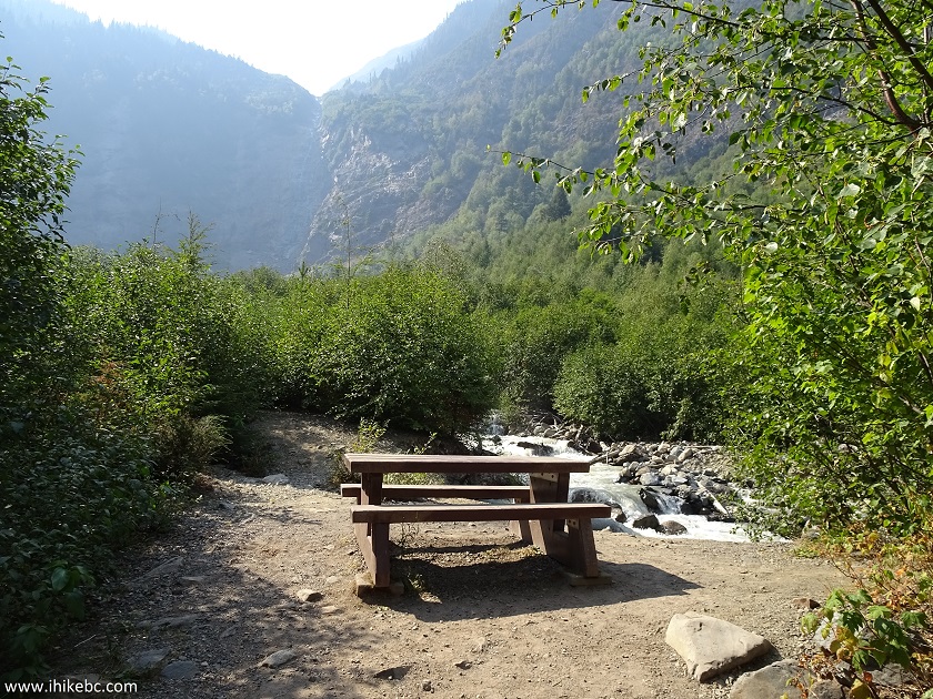
1. We are at Twin Falls Recreation Site. This is the same photo as photo #5 of Glacier Gulch Trip Report.
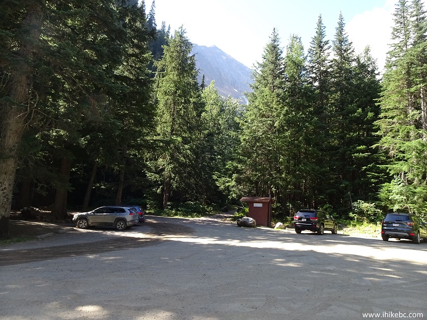
Twin Falls Recreation Site near Smithers BC Canada
2. A look at one of the camping spot to the left of where we took the photo above.
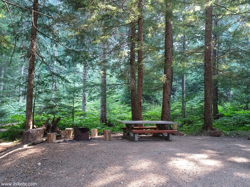
Camping Spot at Twin Falls Recreation Site near Smithers British Columbia
3. Here is a map of Twin Falls Trail. The tricky climbing section is located just after the bench symbol near the top of the map.
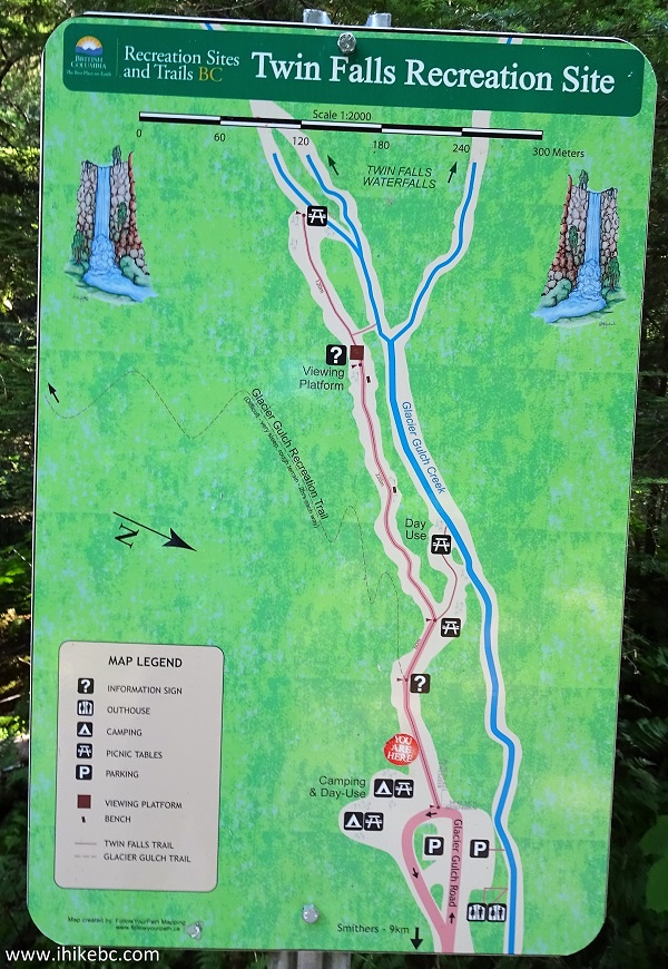
Map of Twin Falls Recreation Site and Trail near Smithers BC
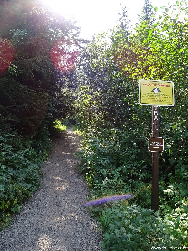
4. After keeping right at the split where a left turn would lead to the beginning of Glacier Gulch Trail, we have reached another split, seen below. To the left is a short trail to the observation platform. And, to the right, is an even shorter trail to the river (which comes from the Left waterfall), and to a spot where you can take a good look at the Right waterfall, which barely trickled on this day.
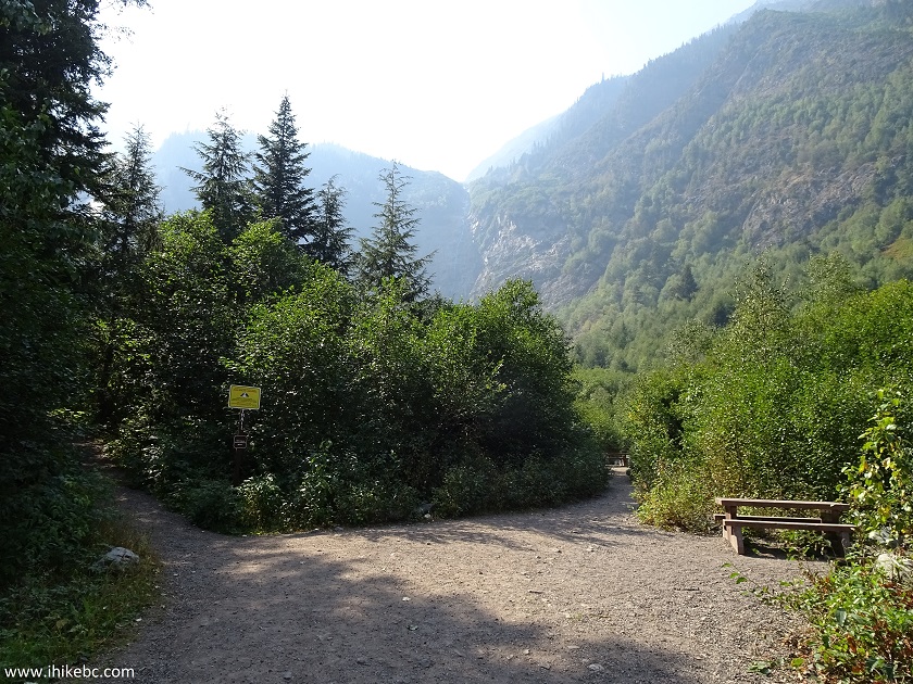
Twin Falls trail near Smithers British Columbia Canada
5. There is another table at that observation spot, but there wasn't much to see - the Right waterfall barely existed.
Bench at the Right waterfall viewpoint - Twin Falls trail near Smithers
BC
6. So, we returned to the split seen in photo #4, and took the path on the left.
Twin Falls trail to the observation platform
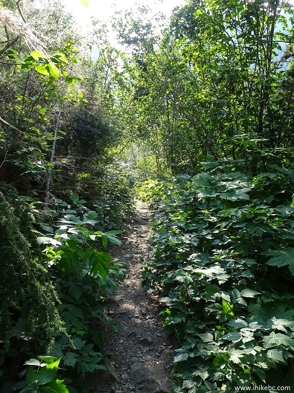
7. The path to the observation platform.
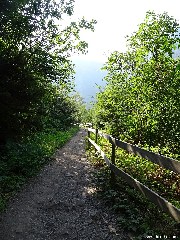
Twin Falls trail near Smithers BC Canada
8. Approaching the platform.
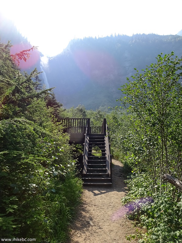
Twin Falls trail observation platform
9. A view from the observation platform. The sun is shining at you for most of the day, and affects the view. The Left waterfall looked fine, while the Right one wasn't doing too well.
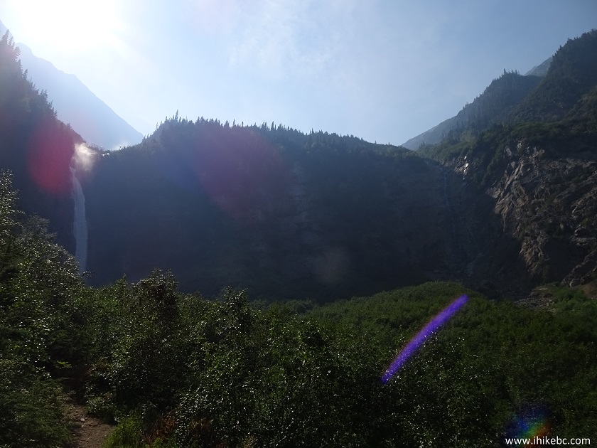
View of Twin Falls from observation platform - near Smithers BC
10. A view of the Right waterfall from the Twin Falls observation platform.
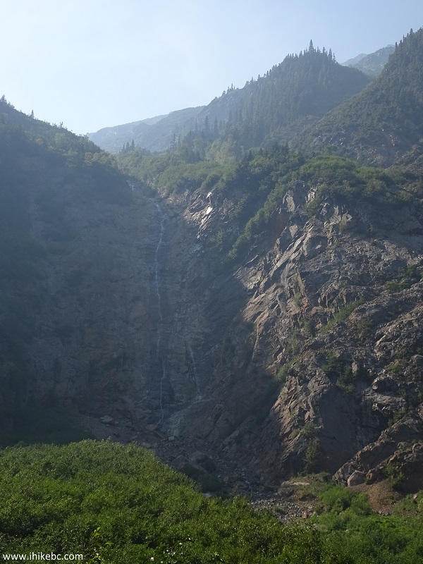
Right waterfall seen from Twin Falls observation platform near Smithers
BC
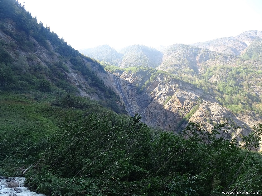
11. Looking back from the observation platform.
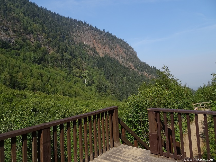
Looking back from Twin Falls observation platform near Smithers BC
Canada
12. Most people turn around and go back at this point, but the path continues past the observation platform towards the bottom of the Left waterfall.
Path to the Left waterfall - Twin Falls trail near Smithers British
Columbia
13. Within a few minutes, this table signals the end of the easy stuff.
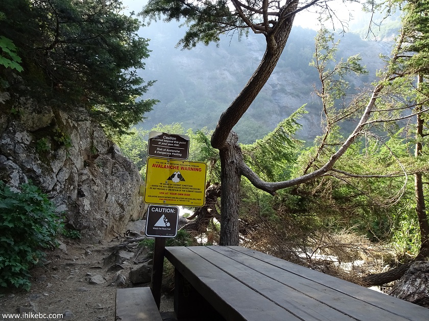
Table at the Twin Falls trail near Smithers British Columbia Canada
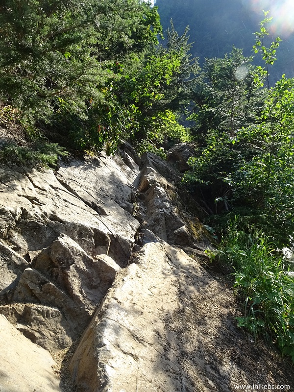
14. Just beyond the table, there is that tricky stretch we were talking about.
Tough stretch of Twin Falls trail near Smithers BC Canada
15. One wrong move, and things would go South in a hurry.
Dangerous part of Twin Falls trail near Smithers BC Canada
16. There are steps in the rock face, but a certain level of dexterity is required for a safe passage.
Twin Falls trail near Smithers BC
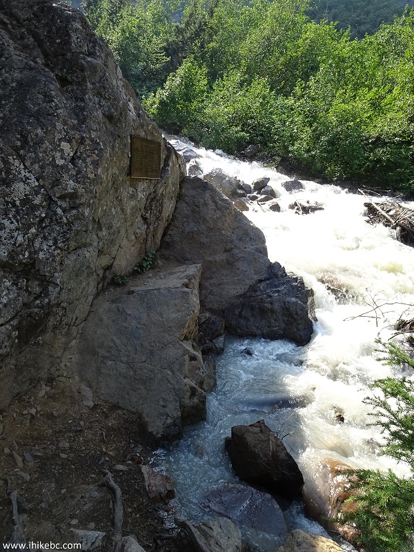
16. Past this stretch, the path is just a touch more complicated that the path to the observation platform. The biggest danger is getting wet from the mist coming from the Left waterfall. One last look at the Right waterfall before the main attraction of this short hike would appear in all of its glory.
View of Right waterfall from Twin Falls trail near Smithers British
Columbia
17. And here it is, the Left waterfall. We stopped about fifty meters before the waterfall to avoid getting drenched.
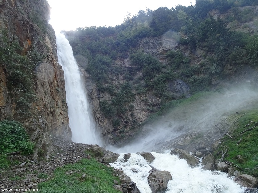
Left waterfall - Twin Falls trail - near Smithers British Columbia
Canada
Here is Our Video of the Left Waterfall:
More ihikebc videos are on our YouTube Channel.
Twin Falls Trail is very short, and leads to a good view from the observation platform, and an even better view from the bottom of the Left waterfall, though the latter requires going past a fairly dangerous stretch of the trail.


|
 |
Other Trips in Smithers BC Area:
|
|
|
|
|
|
|
|
|
|
|
|
|
Fletcher-Gardiner Trail  |
Other Trips:


![]()


![]()
![]()
![]()
ihikebc.com Trip 145 - Twin Falls Trail Hike (near Smithers BC)