![]()
![]()
![]()

Trip 178 - September 3, 2019 (Tuesday)
Ripple Ridge Trail Hike
Near Salmo BC Canada
Location: Southern British Columbia, off Highway 3, approximately 37 kilometers East of the town of Salmo.
Liked: Mountain views, a fairly easy trail, no bugs, two fine cabins nearby, observing a wolf.
Of Note: Some steep sections, some stone-hopping required, hiking poles and boots are highly recommended, steep unbarricaded drop-offs by trail end, noise from Highway 3 for much of the trail, a wolf in the area.
Kootenay Rockies BC Backroad Mapbook (7th Edition) Trailhead Coordinates: Page 4 (Stagleap Provincial Park) A6.
Ripple Ridge Trail is located near BC Highway 3 between Salmo and Creston, and starts at Kootenay Pass, a high elevation mountain pass frequently walloped by huge snowstorms in the winter. But, in early September, it's a fine hiking destination. The trail is fairly short and easy, the views are very fine, and there are two cabins less than a kilometer from the trail, which can be booked for overnight stay, or visited for some time during the daytime hours. We checked out the cabins on the way back from the hike, and saw a wolf in the distance for the first time ever.
1. We are Eastbound on BC Highway 3, approaching Kootenay Pass, with the town of Salmo about 37 kilometers further ahead. Creston is approximately 45 kilometer behind us. Kootenay Pass is impossible to miss, as there are large brake checks / rest areas on both sides of the highway, a lake on the North side, and highway closure gates (seen in the photo below) immediately before the Pass. To get to Ripple Ridge Trail, turn right immediately after the highway closure gate.
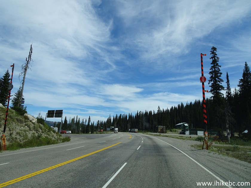
BC Highway 3 Eastbound at Kootenay Pass
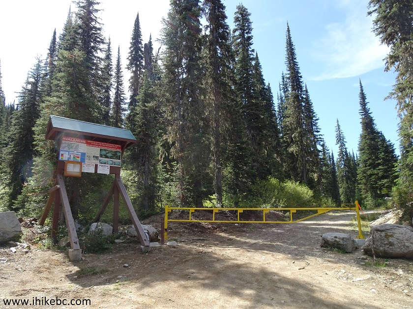
2. We have turned right immediately after the highway closure gate. This is the beginning of Monk Creek Forest Service Road. Coordinates: N 49⁰03.490' W 117⁰02.456'. Elevation: 1,747 meters.

Monk Creek FSR at Kootenay Pass
3. Ample parking is available at Kootenay Pass, but there is also a parking area for 5-7 vehicles just to the left of Monk Creek FSR once you start driving on it, and before you reach a vehicle-blocking gate 100 meters later. A note requests to avoid parking in this snow study area, but, since there was no snow to study, we parked right here.

Parking for Ripple Ridge Trail Hike near Salmo British Columbia Canada
4. As mentioned above, 100 meters after turning from Highway 3, there is a gate which prevents further vehicular access.
Monk Creek Forest Service Road by Kootenay Pass near Salmo BC Canada
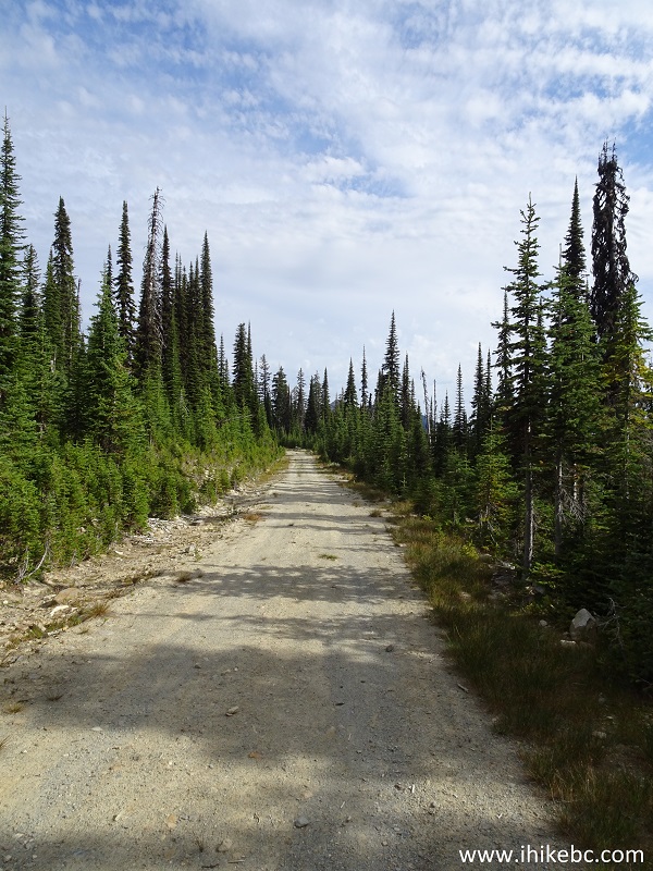
5. Monk Creek Forest Service Road continues after the gate.
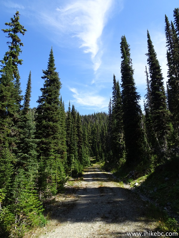
Monk Creek FSR - Kootenay Pass Hike British Columbia Canada
6. After 2.25 km of steady elevation gain, this row of stones signals a split. Coordinates: N 49⁰02.803' W 117⁰02.345'. Elevation: 1,952 meters. Straight ahead is the continuation of the FSR, leading to Lightning Strike and Ripple Ridge cabins in 800 meters. And, to the right, is the continuation (or start, depending on how you count) of Ripple Ridge Trail.

Monk Creek FSR - Hike in Kootenay Pass Area
7. A view of Ripple Ridge Trail immediately after turning right.

Salmo Hiking - Ripple Ridge Trail near Salmo
8. It's mostly an easy hike, with some moderately challenging stretches.

Hiking in Salmo Area - Ripple Ridge Trail by Kootenay Pass
9. Passing by a stone field at the 2.6 km mark (counting from the gate by Highway 3). All distances are based on a GPS odometer and are approximate.

Ripple Ridge Trail - Hike in Salmo area
10. Ripple Ridge seen ahead on the left side.

Salmo Hiking - Ripple Ridge Trail British Columbia Canada
11. The trail opens up closer to the end.

Ripple Ridge Trail - Trail in Salmo Area British Columbia
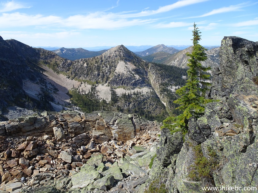
12. The further you hike, the better are the mountain views, especially on the right side.
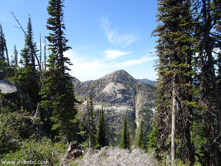
View from Ripple Ridge Trail in Salmo Area - British Columbia Hiking
13. Now with a zoom.

Mountain by Kootenay Pass Province of British Columbia
14. Getting closer to the end of the hike.

Ripple Ridge Trail British Columbia
15. Another fine mountain view, this time on the left side.

View from Ripple Ridge Trail Hike near Salmo BC and Kootenay Pass
16. Very neat.

Mountain near Kootenay Pass British Columbia Canada
17. The cairn at the end of the Ripple Ridge Trail, 4.6 km after the start. Coordinates: N 49⁰02.269' W 117⁰03.518'. Elevation: 2,174 meters (427 meters elevation gain from the start of the trail).

End of Ripple Ridge Trail - Salmo Hiking
18-20. Great views await near the cairn. Left to right.
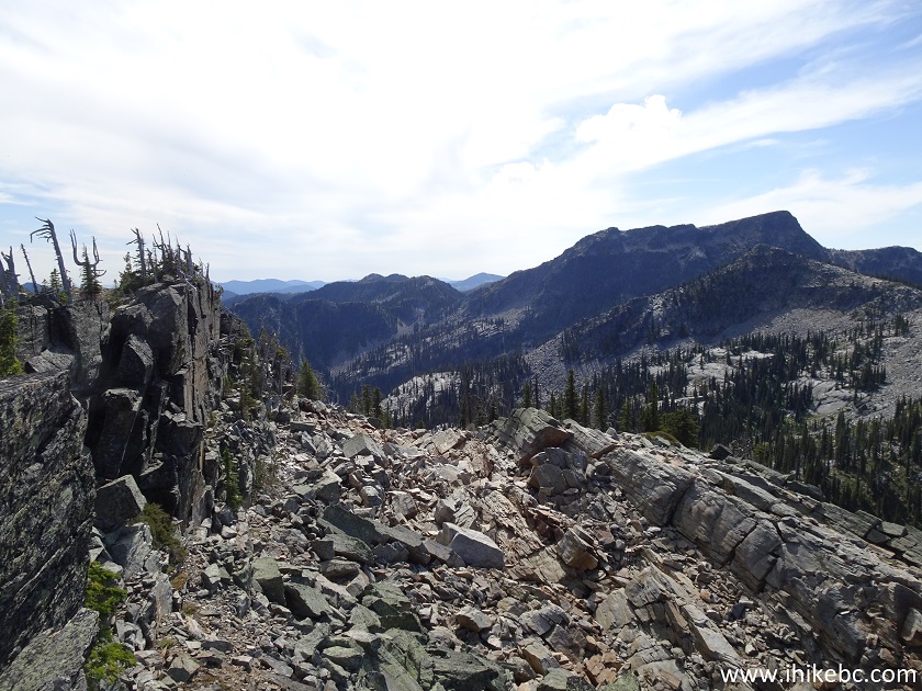

View from the end of Ripple Ridge Trail Hike British Columbia Canada
Here is our video of the views from this location.
More ihikebc videos are on our YouTube Channel.
21. We then returned to the split seen in photo #6, and proceeded further on Monk Creek FSR, towards the cabins located about 800 meters from the split.
Monk Creek FSR near Salmo British Columbia
22. Make a right turn at the T-junction.

Monk Creek Forest Service Road by Kootenay Pass
23. Arriving to the cabins / Ripple Ridge recreation site. Coordinates: N 49⁰02.465' W 117⁰02.017'. Elevation: 1,953 meters. Reservations are required to use the cabins overnight. For more information: https://www.rippleridge.ca.

Ripple Ridge Recreation Site Entrance near Kootenay Pass by Salmo BC
24. Lightning Strike cabin is the newer of the two.
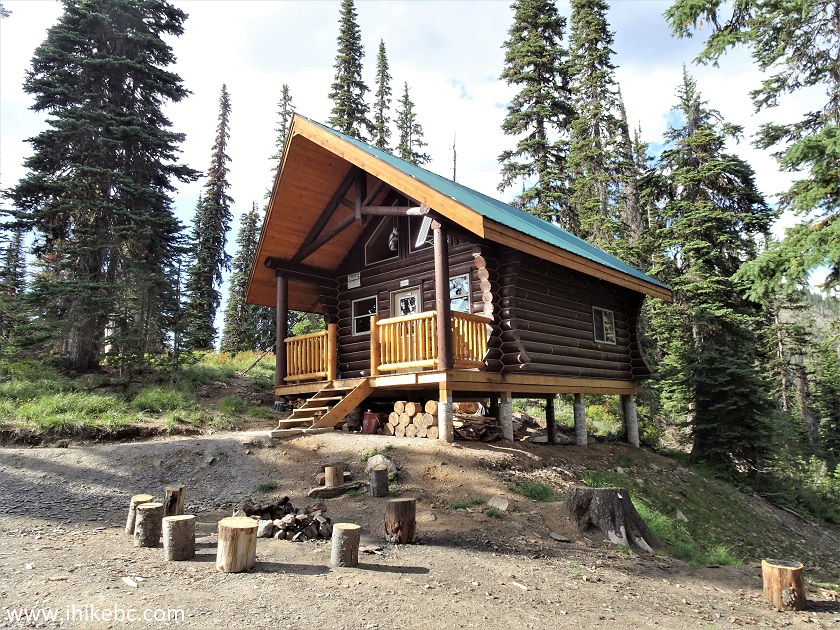
Lightning Strike Cabin - Ripple Ridge Recreation Site
24. It looks quite neat inside, and even has electric lighting, courtesy of a solar panel.

Lightning Strike Cabin by Kootenay Pass
25. Lightning Strike cabin, looking right.
Lightning Strike Cabin near Salmo BC Canada
26. Looking left.

Lightning Strike Cabin
27. Ripple Ridge cabin is substantially older, though still in a very good shape, and also has electric lighting.

Ripple Ridge Cabin by Kootenay Pass
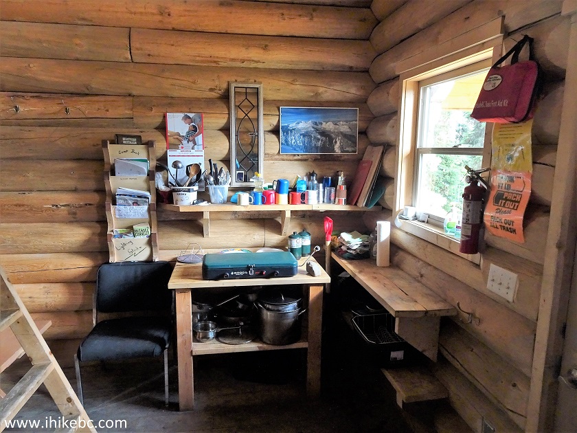
28. Inside Ripple Ridge cabin.

Ripple Ridge Cabin near Salmo British Columbia Canada
29. Looking back. Those tables can be converted into beds.

Ripple Ridge Cabin
And, on the way back, for the first time ever, we saw a wolf. We were hiking on Monk Creek FSR towards the split seen in photo #6, and noticed what, at first, we thought was a deer crossing the road about 100 meters ahead - a stocky animal of the same sandy brown colour. However, this animal was much shorter than a deer...and with lots of messy fur...a wolf! And a very large one at that. Alas, it took all of three seconds for the wolf to cross the road and disappear into the woods, so we had no chance to take a photo.
Ripple Ridge Trail is fairly easy, and leads to several very impressive views, while the two nearby cabins are a cool place to visit. Highly recommended.


|
 |
Other Trips:


![]()


![]()
![]()
![]()
ihikebc.com Trip 178 - Ripple Ridge Trail Hike (Near Salmo BC)