![]()
![]()
![]()

Trip 167 - August 3, 2019 (Saturday)
Mahood Lake Campground Visit
Wells Gray Provincial Park near
100 Mile House BC
Liked: Mahood Lake views.
Of Note: Much of the Canim Lake South Road is narrow and winding. Some potholes after asphalt ends approximately 30 kilometers before the campground.
Cariboo Chilcotin Coast BC Backroad Mapbook (4th edition) Mahood Lake Campground Coordinates: Page 19 (Interlakes Highway) E1.
Related Website: Wells Gray Provincial Park - BC Parks Official Website.
We visited Mahood Lake Campground in Wells Gray Provincial Park en route to hiking to Canim Falls, and also to Deception Falls, described in our following trip reports. However, visiting Mahood Lake Campground even for a few minutes proved to be time well-spent, as there are some fine lake views available at that location. This trip report also serves to show the route for accessing Canim Falls trailhead, as well as much of the way to Deception Falls trailhead.
1. We are Northbound on BC Highway 97, with 100 Mile House approximately 2 kilometers behind us. The sign shows that turning right would lead to the community of Forest Grove, as well as to Canim and Hendrix Lakes. There is also a sign a few meters behind us indicating that this is the way to Mahood Lake - follow that sign, as it appears at all key intersections.
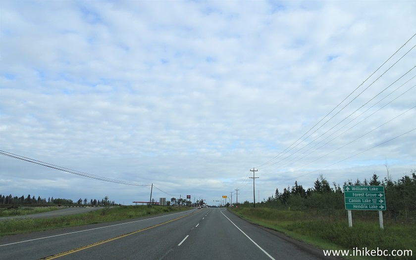
BC Highway 97 Northbound near 100 Mile House
2. Making the right turn from Highway 97 onto Canim-Hendrix Lake Road. Coordinates: N 51⁰39.879' W 121⁰17.337'. Elevation: 739 meters. Zero your odometer here.

BC Highway 97 Northbound at Canim-Hendrix Lake Road turnoff
3. Canim-Hendrix Road. Residences on both sides.

Canim-Hendrix Road
4. Arriving at Forest Grove general store (on the right side) at the 21.0 km mark. This is your last chance to fuel up.

Forest Grove British Columbia
5. And ahead is an intersection, where Eagle Creek Road is straight ahead, but we need to turn right.

Canim-Hendrix Lake Road at Eagle Creek Road
6. Continuing on Canim-Hendrix Lake Road after making the right turn in Forest Grove.

Canim-Hendrix Lake Road near Forest Grove BC Canada
7-8. At the 34.0 km mark, make a right turn onto Canim Lake South Road. Driving straight at this intersection would eventually lead to Hendrix Creek Falls.


Canim-Hendrix Lake Road at Canim Lake South Road turnoff
9. Canim Lake Resort arrives at the 36.6 km mark.

Canim Lake South Road by Canim Lake Resort near 100 Mile House British
Columbia Canada
10. There are resorts and residences all along Canim Lake, so getting to the shore is not an option, and one has to be content with observing Canim Lake mostly through the trees.

Canim Lake near 100 Mile House BC
11. At the 43.4 km mark, turning right onto McDonald-Takagi Forest Service Road would lead to Howard Lake Recreation Site (fee applies) within 4 km. But we are going straight. This is where the asphalt ends, and dirt road with some potholes begins.

Canim Lake South Road at McDonald-Takagi FSR turnoff
12. At the 58.9 km mark, turn left onto Mahood Lake Road.

Canim Lake South Road at Mahood Lake Road T-junction
13. At the 69.5 km mark, there is a parking area and trailhead for Canim Falls Trail, which we will cover in the next trip report.

Mahood Lake Road at Canim Falls trailhead parking area
14. Make a left turn at the T-junction shortly before the campground.

Mahood Lake Road near 100 Mile House British Columbia Canada
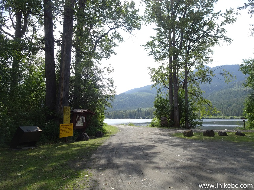
15. Arriving at Mahood Lake Campground (Wells Gray Provincial Park) 74 kilometers after turning from Highway 97. To the left is Mahood Lake North Road leading to Deception Falls Trail. The campground and the lake are to the right.

Mahood Lake Campground Entrance - Wells-Gray Provincial Park British
Columbia
16. Mahood Lake Campground information.
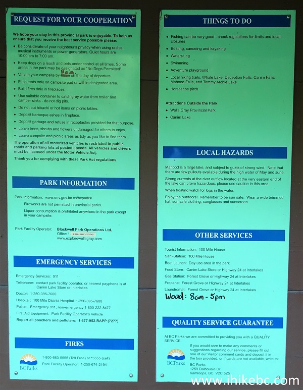
Mahood Lake Campground Information
17. Mahood Lake Campground rules and daily camping fee.
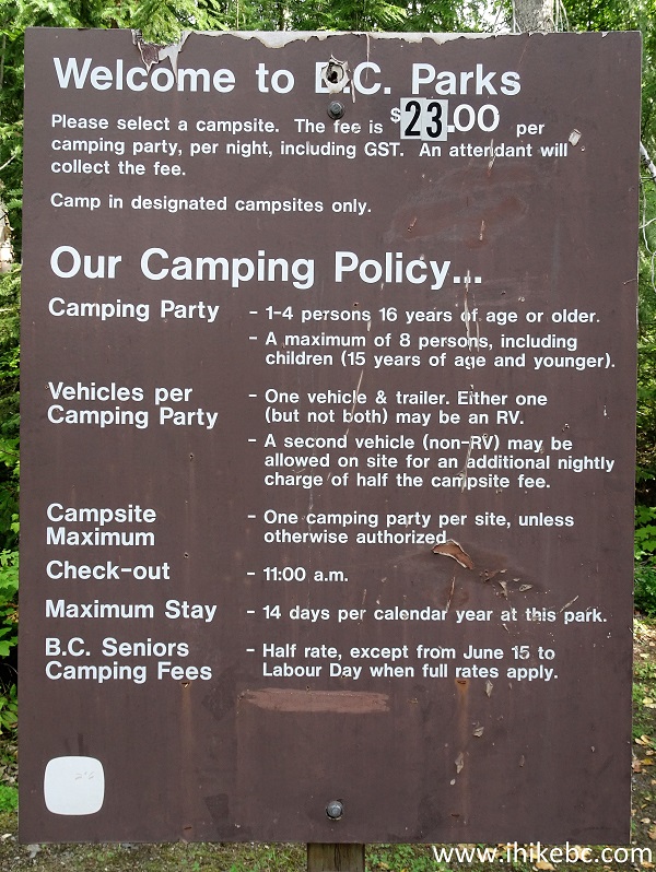
Mahood Lake Campground Rules
18. Mahood Lake Campground group camping area.

British Columbia Wells-Gray Provincial Park Mahood Lake Campground
19. Mahood Lake Campground solo camping spot.
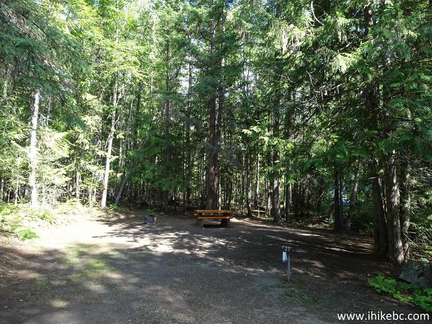
Wells-Gray Provincial Park British Columbia Canada
20. Mahood Lake itself.

Mahood Lake British Columbia Canada
21. A bit to the left.
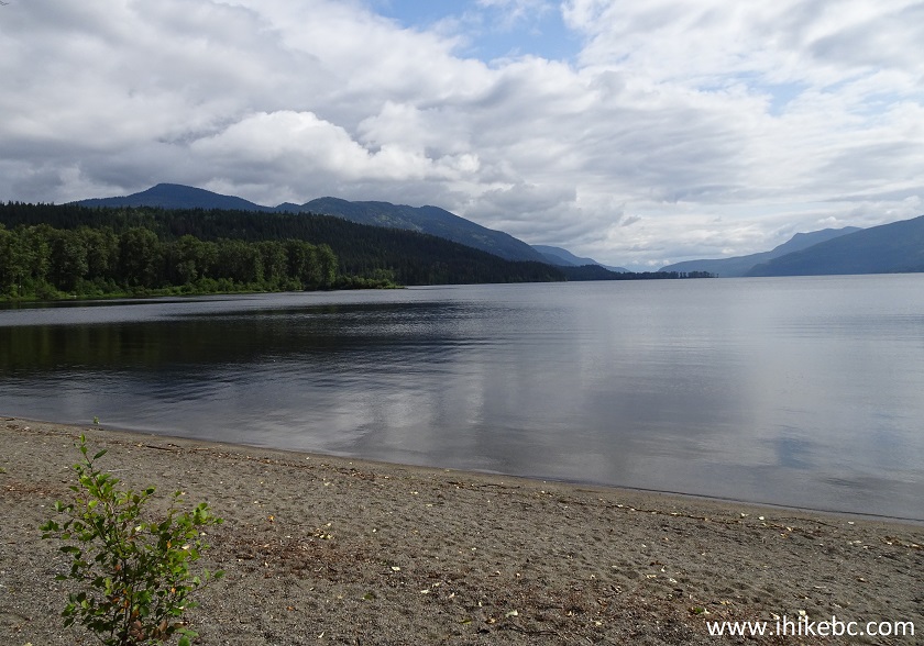
Mahood Lake near 100 Mile House BC
22. Isn't it idyllic.

Mahood Lake
23. Mahood Lake Campground boat launch area.
Wells-Gray Provincial Park British Columbia Canada
24. A view from the boat launch.

Mahood Lake seen from Boat Launch Area
Mahood Lake Campground was quite busy on this long weekend, and certainly appears to be popular. The lake views are very good, so consider this as a fine camping spot, as well as a base for exploring nearby trails, some of which we will cover in the following trip reports.


|
 |
Other Trips in 100 Mile House BC Area:
|
|
|
|
Other Trips:


![]()


![]()
![]()
![]()
ihikebc.com Trip 167 - Mahood Lake Campground Visit (Near 100 Mile House BC)