Trip 332 - May 19, 2025 (Monday)
Sunshine Coast Trail Hike from Sarah Point for 5 km
Near Lund, British Columbia, Canada
Page 1 of 3
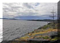
Liked: Sarah Point Hut, several fine forest and ocean views, shade in the forest, no bugs.
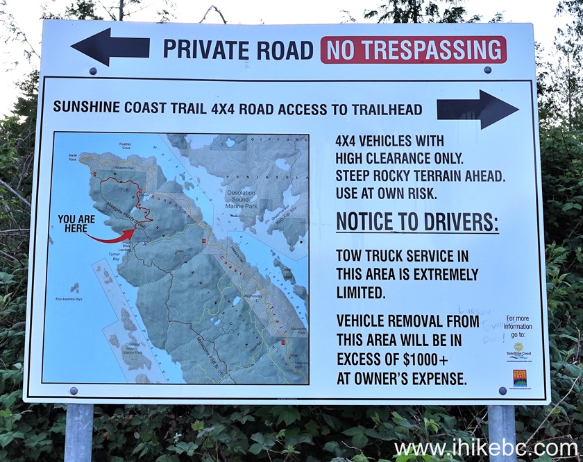
Of Note: Uneven ground, rocks and roots, several moderately difficult sections, hiking poles and boots are highly recommended.Vancouver, Coast & Mountains Backroad Mapbook (2019 edition) trailhead location:
Page 28 (Lund) A6.Related Websites: Sunshine Coast Trail - Official Website, Sunshine Coast Shuttle.
Follow @ihikebc TweetSunshine Coast Trail is a monumental 180 km-long wilderness hike on Sunshine Coast of British Columbia. It stretches from near Lund, BC (the northern trailhead) to Saltery Bay Ferry Terminal South of Powell River, BC. Logistically, it is easier to hike this trail North to South, as the northern end is fairly difficult to get to, whereas the southern end is right by the ferry terminal. So, quite a few people, if they choose to hike the entire Sunshine Coast Trail at once, get a shuttle (in a 4x4 SUV) from Powell River to Sarah Point Hut, and then hike to Saltery Bay, where they can catch a ferry right after finishing their hike.
Sunshine Coast Trail is Sunshine Coast's answer to Vancouver Island's Juan De Fuca Trail (here is our trip report), with one substantial difference - Sunshine Coast Trail is four times longer. Other than that, it's the same general concept - easy to moderately difficult hiking through the woods with ocean views here and there, and with numerous camping opportunities (overnight stays require paying a small fee). And there is also a possibility of doing several day hikes, as opposed to hiking the whole thing, as there are numerous access roads to various parts of the trail. And that is exactly what we did today - hiked for just over 5 km from Sarah Point Hut, which is the northern end of Sunshine Coast Trail.
To get from Lund to Sarah Point Hut, you need to go via Finn Bay Road - Baggi Road - Sarah Point Road - Malaspina FSR for a total of 15.2 km. The last 3 km or so is for 4x4 vehicles only due to steep grades with loose surface. Up until that point, 2WD vehicles with regular clearance would be sufficient.
*All trail distances are based on a GPS odometer and are approximate.
1. Here are Google Maps directions from Lund, BC to Sarah Point Hut.
2. We are at the end of BC Highway 101 (Sunshine Coast Highway) in Lund, BC. Make a right turn onto Finn Bay Road (where a blue info sign is seen ahead).

Lund BC Canada
3. In 500 meters, Klah Ah Men Lund Gazebo Regional Park is on the right side. The last chance to use a porta-potty and a garbage can. No such things are located further ahead.

Klah Ah Men Lund Gazebo Regional Park
4-5. Just 100 meters later (600 meters from the end of Hwy 101) turn Right onto Baggi Road. A Sunshine Coast Trail sign is pointing in that direction.
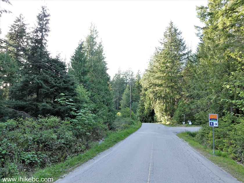
Finn Bay Road in Lund British Columbia Canada
Finn Bay Road at Baggi Road
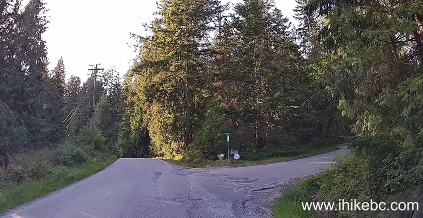
6-7. At 1.0 km, turn Left from Baggi Road onto Sarah Point Road. The road is gravel now. A bit rough, but nothing major. 2WD vehicles with regular clearance - OK.

Baggi Road at Sarah Point Road
8. Sarah Point Road 1.9 km from the end of BC Highway 101 in Lund.

Sarah Point Road - Lund BC Canada
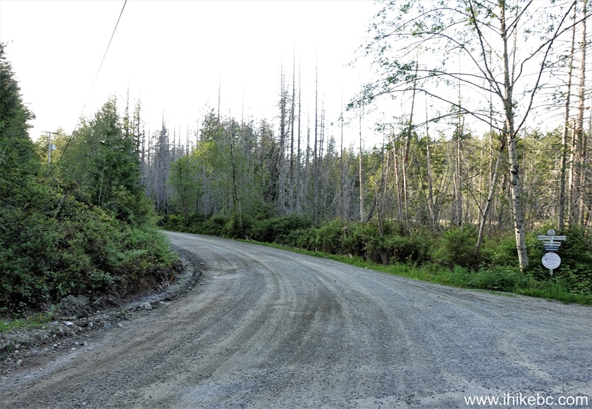
9. At 2.3 km, Sarah Point Road turns into Malaspina Forest Service Road.
Malaspina FSR Start near Lund BC Canada
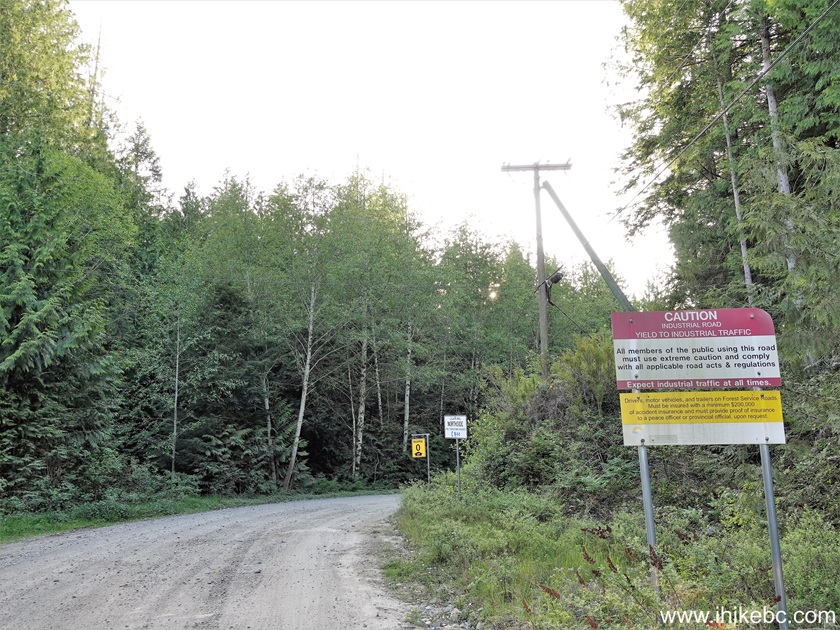
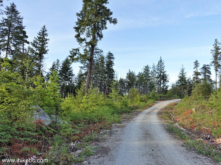
10. Malaspina FSR 4.0 km from the end of BC Highway 101.
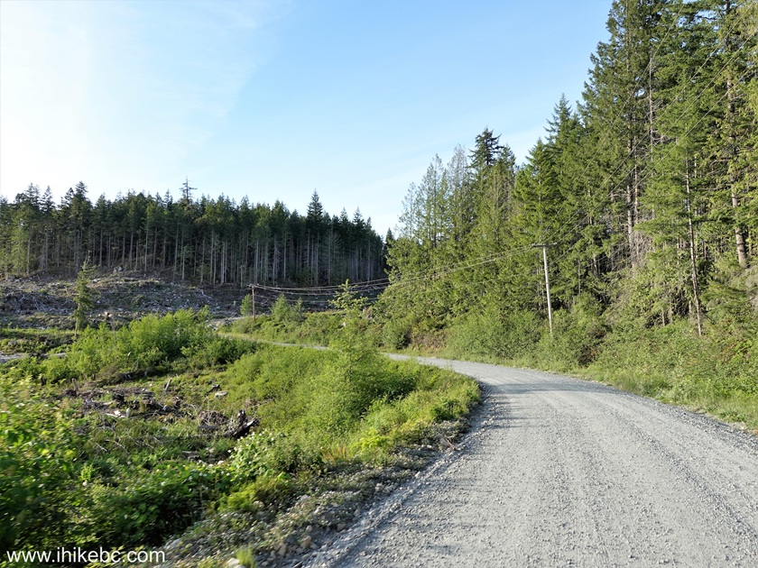
Malaspina Forest Service Road
11. At 9.5 km, Bliss Landing private road is on the Left. Stay Right.

Malaspina FSR at Bliss Landing Road near Lund BC Canada
12-14. At 10.1 km, Bliss Portage forest trail is on the right. This would make a good (if long-ish) day hike loop trail - just park here, continue to Sarah Point Hut Sunshine Coast Trailhead, start hiking the SCT, and, at some point, you would come to a junction where making a Right turn would bring you back to this spot. This would be a hike of, give-or-take, 20 km-long (albeit over a fairly easy terrain).
Bliss Portage Trail near Lund BC
Malaspina FSR
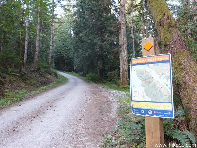
Malaspina FSR and Sunshine Coast Trail (British Columbia, Canada)
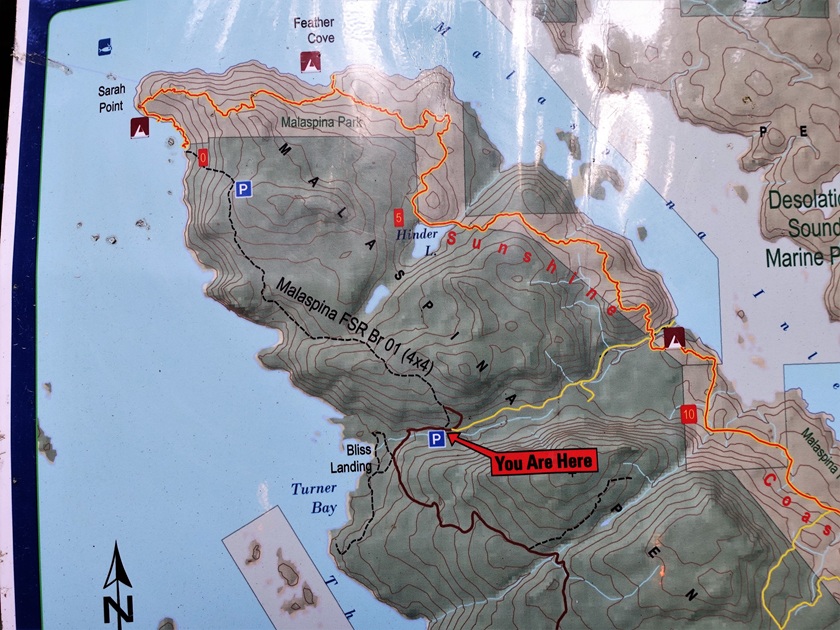
partial map
15-17. At 11.0 km, arrive to a junction where 2WD vehicles with regular clearance would need to be parked, and moderate-to-high clearance 2WD vehicles may proceed further (to the Right) for about 1.5 km more.


18. The road after the Right turn. There are several cross-ditches in the next 400 meters.
Malaspina Forest Service Road
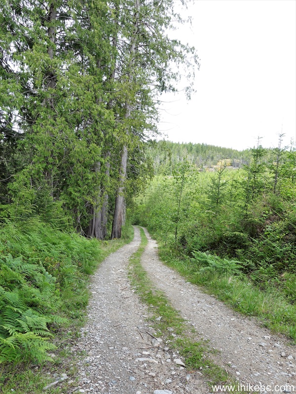
19. At 11.4 km, there is a good camping spot on the Left (partially visible in the photo below). This is a good place to camp, and we started our hike from here.

Malaspina Forest Service Road near Lund British Columbia Canada
Here is Our Video of driving from Lund up to this location.
More ihikebc videos are on our YouTube Channel.
20. The camping spot above is where we zeroed out GPS odometer, and all subsequent distances are approximate. Here we are 15 meters from the camping spot.

Malaspina Forest Service Road
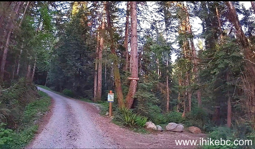
21. The first intersection arrives at the 280 meter mark. Turn Left.
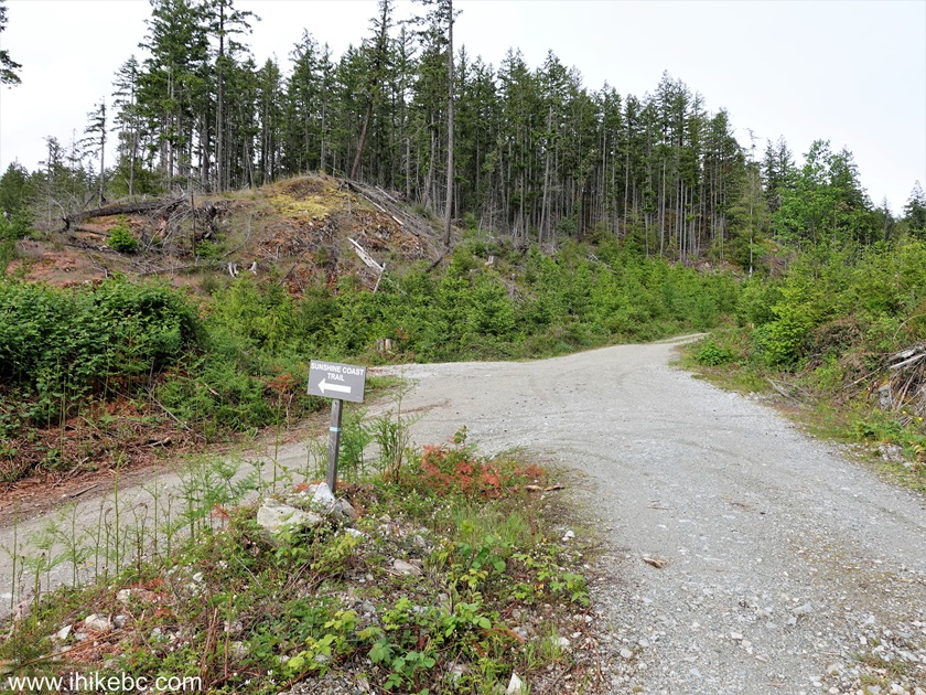
22. Sunshine Coast Trail access road at 1.2 km.

Sunshine Coast Trail Access Road near Lund BC
23. At 1.36 km from the parking spot, this is as far as a 2WD vehicle should go. There is a very steep loose-surfaced hill ahead. No 4x2 vehicle would make it back without a tow, whether by another hiker or that $1,000+ tow truck.

Sunshine Coast Trail Access Road to Sarah Point
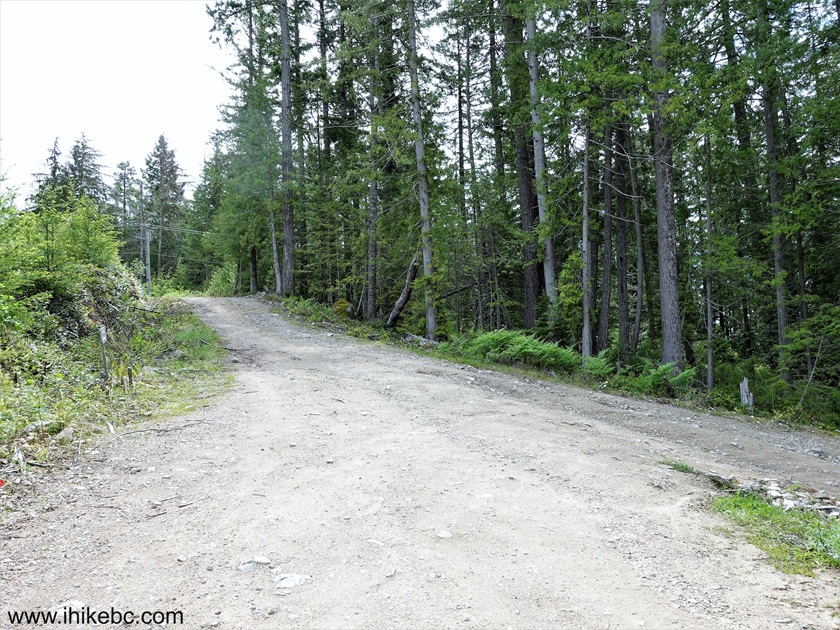
24. Sunshine Coast Trail access road at 2.23 km from the camping spot.

Malaspina FSR - Sunshine Coast Trail Access Road
25-26. At 3.55 km, an arrow invites you to make a sharp Right turn. The road then starts descending.

27. At 3.58 km.
Road to Sarah Point of Sunshine Coast Trail in British Columbia, Canada
28-29. At 3.75 km, Larsen Towing placed an ad for those who would overestimate the ability of their 4x4 vehicle to tackle what's about to come.


Larsen Towing Advertisement on Malaspina FSR
30. Here it is, at the 3.95 km mark. VERY steep, and VERY loose. It is MUCH steeper than it looks. You would need at least one locker to have a chance to avoid a bill from Mr. Larsen.

Steep Sunshine Coast Access Road
31. Besides, why bother driving down - the parking area for Sarah Point Hut is literally at the bottom of this hill, at 4.15 km from the camping spot.

Sarah Point Hut parking area - Sunshine Coast Trail near Lund BC
32-33. The trailhead is 70 meters further - down another steep hill the start of which can be seen on the right side of the photo above. For the time being, let's check out Sarah Point Hut.
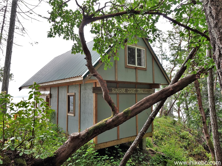
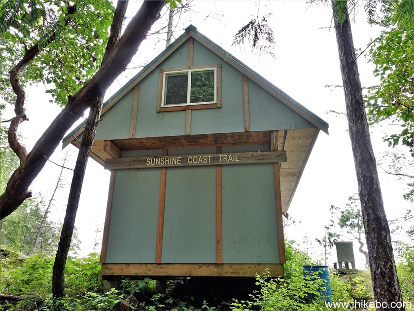
Sarah Point Hut - Sunshine Coast Trail
Our Sunshine Coast Trail Hike (for 5 km from Sarah Point Hut) trip report Continues on Page 2.


|
 |
Other Trips:


![]()


![]()
![]()
![]()
ihikebc.com Trip 332 - Sunshine Coast Trail Hike from Sarah Point for 5 km (Near Lund BC)
Page 1 of 3