![]()
![]()
![]()

Trip 171 - August 9, 2019 (Friday)
Browntop Mountain Trail Hike
Near Likely BC
Trailhead Location: South-Central British Columbia, about 34 km from Likely via Keithley Creek Road (for 22.8 km), Cariboo River FSR (for 700 meters), Cariboo Lake Road (for 3.1 km), and trailhead access road (for 7.2 km).
Liked: A fairly short trail to sub-alpine, several fine mountain views, lake view, shade in the forest, finding a weather station, very few bugs.
Of Note: Browntop Mountain access road (7.2 km off Cariboo Lake Road) is very rough and narrow - high-clearance vehicles only (2WD may be ok). The last two kilometers of the access road are brushed in - your vehicle would be scratched. Some loose stone fields in sub-alpine - hiking poles and boots are highly recommended.
Cariboo Chilcotin Coast BC Backroad Mapbook (4th edition) Trailhead Location Coordinates: Page 44 (Likely) B5.
Browntop Mountain Trail is located near the settlement of Likely in South-Central British Columbia. The nearest more-or-less large town is Williams Lake, approximately 100 kilometers to the West. It's a moderately challenging and short trail, leading to a pleasant, if not spectacular, alpine area. However, it's possible to hike there for much longer and, perhaps, discover some better views. The challenging part is getting to the trailhead. While Keithley Creek Road, Cariboo River FSR, and Cariboo Lake Road got some potholes, it's all manageable. But the trailhead access road from Cariboo Lake Road is very rough, and requires a high-clearance vehicle. We made it all the way to the trailhead in our 2WD rig, but a 4x4 may be needed, depending on the road conditions. Another major bummer is that the access road is, mostly, very narrow, and the pullouts are few and far in between. So, if two vehicles were to meet, someone would have to back up for up to 1.5 kilometers, with brushed-in conditions to boot.
1. We are on Likely Road, approaching the bridge across Quesnel River. The settlement of Likely begins on the other side. Check out our Quesnel Forks Historic Site trip report for directions on getting from BC Highway 97 (near 150 Mile House) up to this point. This is the same location as seen in photo #7 of that trip report. Zero your odometer before entering the bridge.
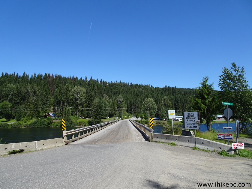
Quesnel River bridge in Likely BC Canada
2. A view of Quesnel River and Likely from the bridge.
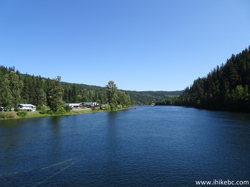
Quesnel River
3. After the bridge, the road is called Keithley Creek Road. Stay on it for the next 22.8 km.
Keithley Creek Road Likely British Columbia
4. At 2.9 km - stay left on Keithley Creek Road. To the right is Spanish Creek FSR - not to be confused with Spanish Creek FSR found by 100 Mile House, and discussed in our previous trip report.
Keithley Creek Road at Spanish Creek FSR
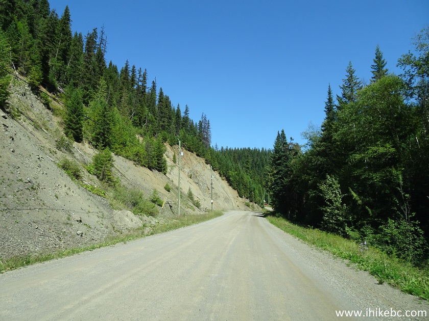
5. Keithley Creek Road has many deep potholes - watch out. But, at least, it's somewhat of a scenic drive in a few places.
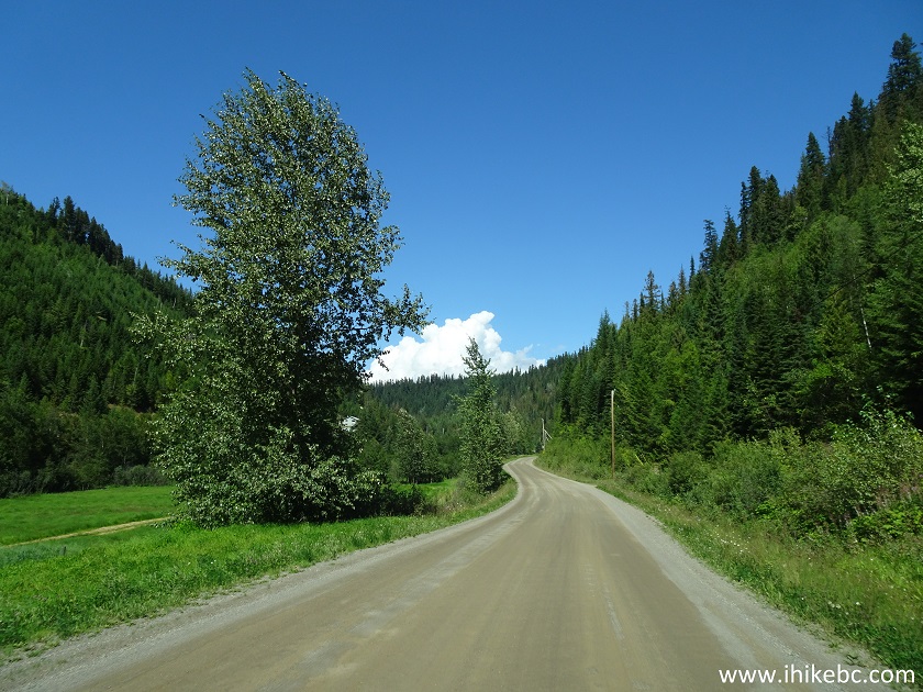
Keithley Creek Road near Likely BC Canada
6. 22.8 km from the beginning of the bridge across Quesnel River, turn right onto Cariboo River Forest Service Road. It's a very prominent intersection - there is a large information board about Barkerville and Likely there, as this road connects the two communities (144 km in total, some very rough sections).
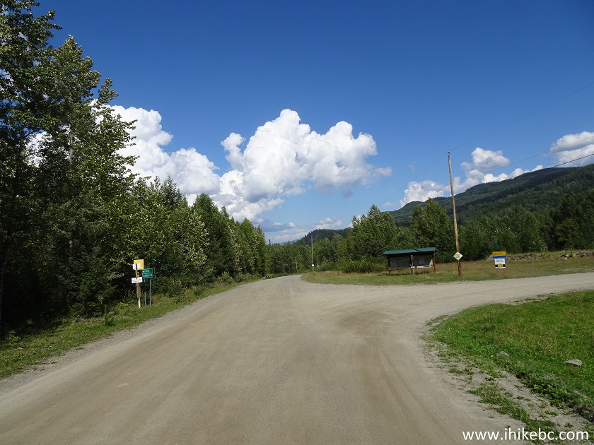
Keithley Creek Road at Cariboo River FSR turnoff
7. Cariboo River FSR is very short (just 700 meters), but it does have a bridge across Cariboo River.
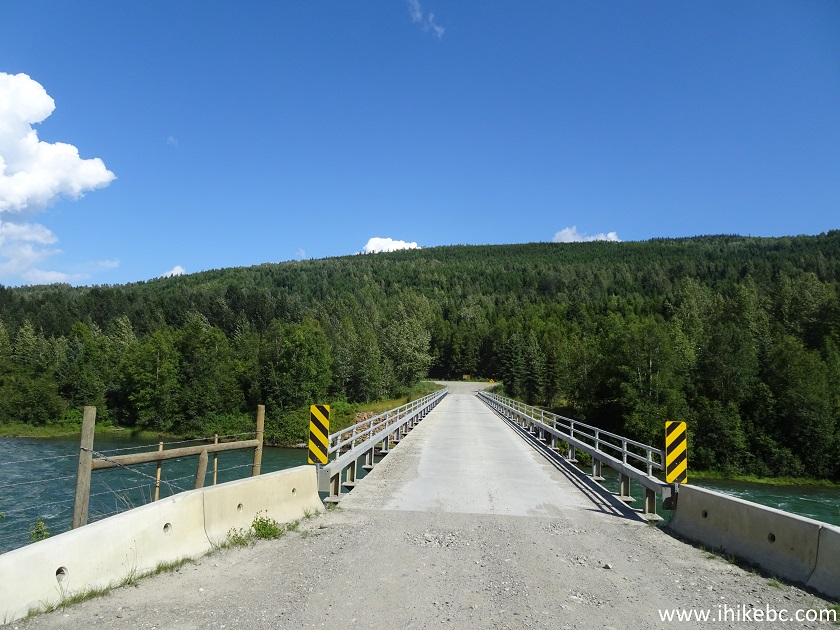
Cariboo River FSR near Likely British Columbia
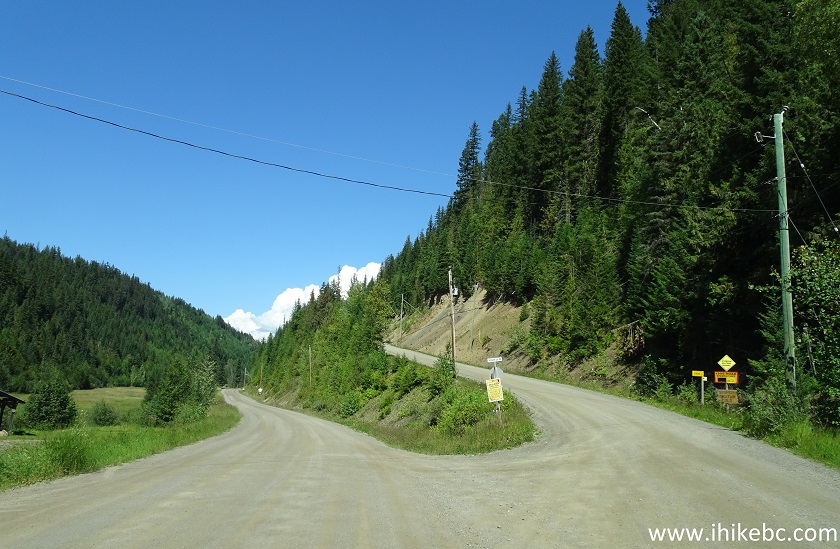
8. At 23.5 km mark, turn left from Cariboo River FSR onto Cariboo Lake Road.
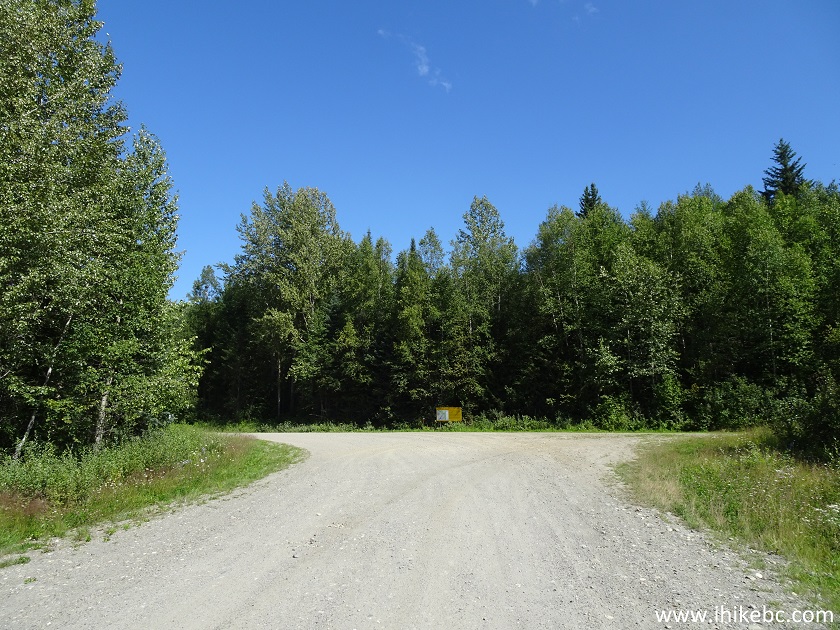
Cariboo River FSR at Cariboo Lake Road turnoff
9. Proceed on Cariboo Lake Road for 3.1 km - the rough and narrow Browntop Mountain trailhead access road would be on the right side.
Cariboo Lake Road at Browntop Mountain Trailhead Access Road turnoff
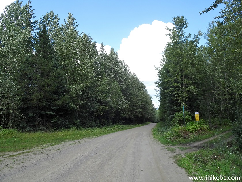
10. Here is the beginning of Browntop Mountain trailhead access road. Coordinates: N 52⁰44.271' W 121⁰24.914'. Elevation: 959 meters.
Start of Browntop Mountain Trailhead Access road near Likely BC
11. It's very narrow road, rutted and rough in general, with numerous potholes. Maintaining the speed of above 15 km/h would be complicated.
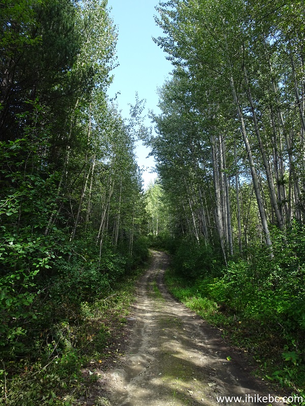
Browntop Mountain Trailhead Access Road British Columbia Canada
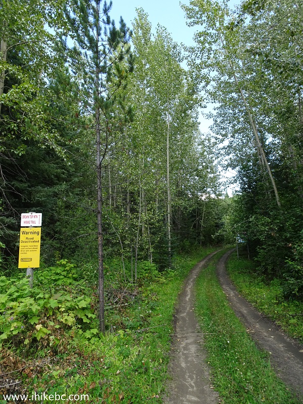
12. And the last two kilometers are very brushed-in.
Browntop Mountain Trailhead Access Road
13. Finally, we are at the trailhead, 7.2 km from Cariboo Lake Road turnoff. About 60 meters further is a large pullout, sufficient to park 5-7 vehicles.
Browntop Mountain trail access road at Browntop Mountain trailhead near
Likely British Columbia
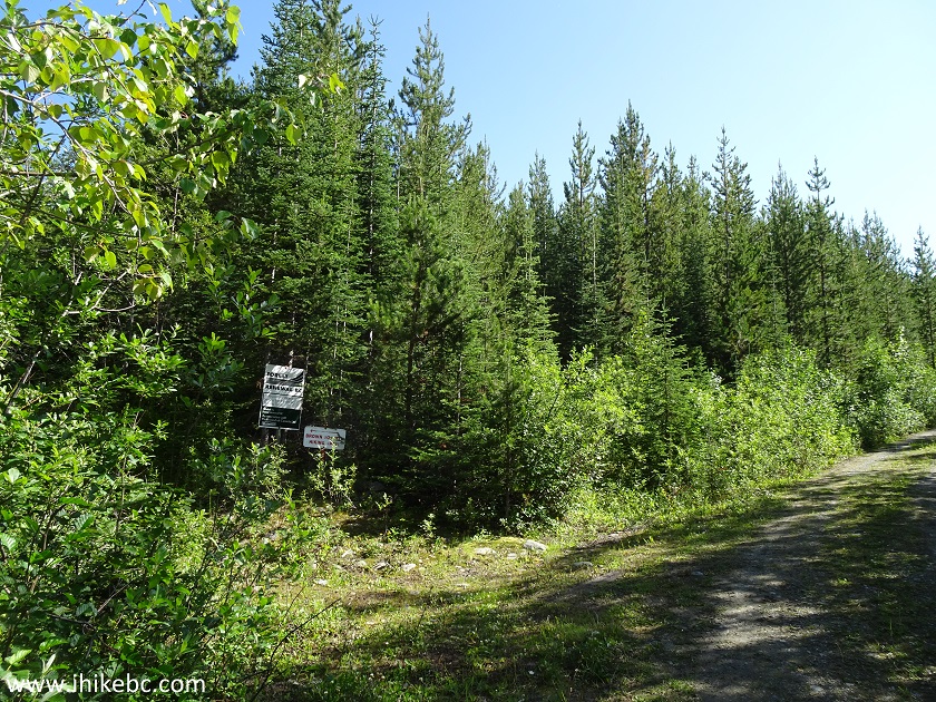
14. Browntop Mountain trailhead. Coordinates: N 52⁰42.290' W 121⁰22.484'. Elevation: 1,430 meters.
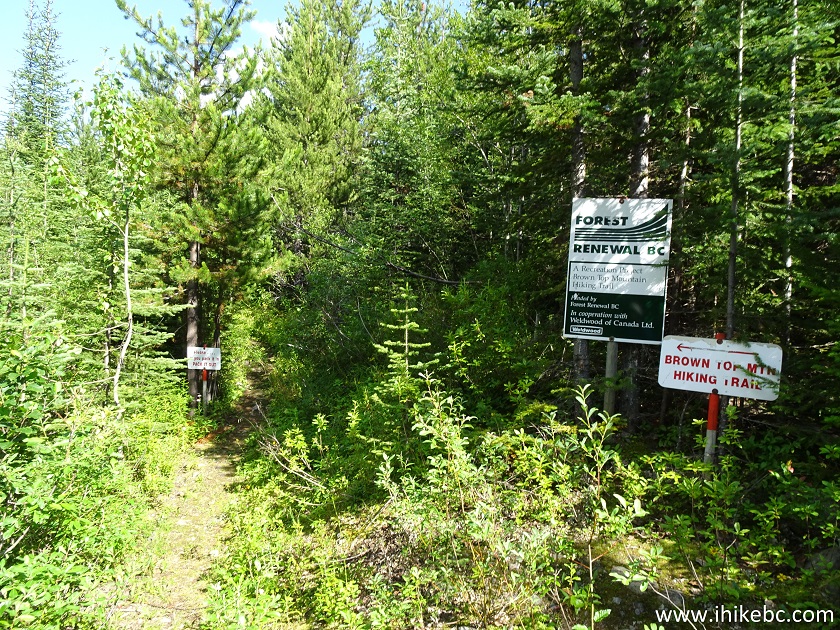
Browntop Mountain Trailhead near Likely BC Canada
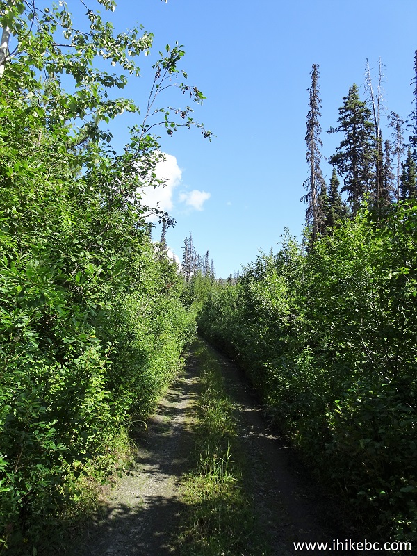
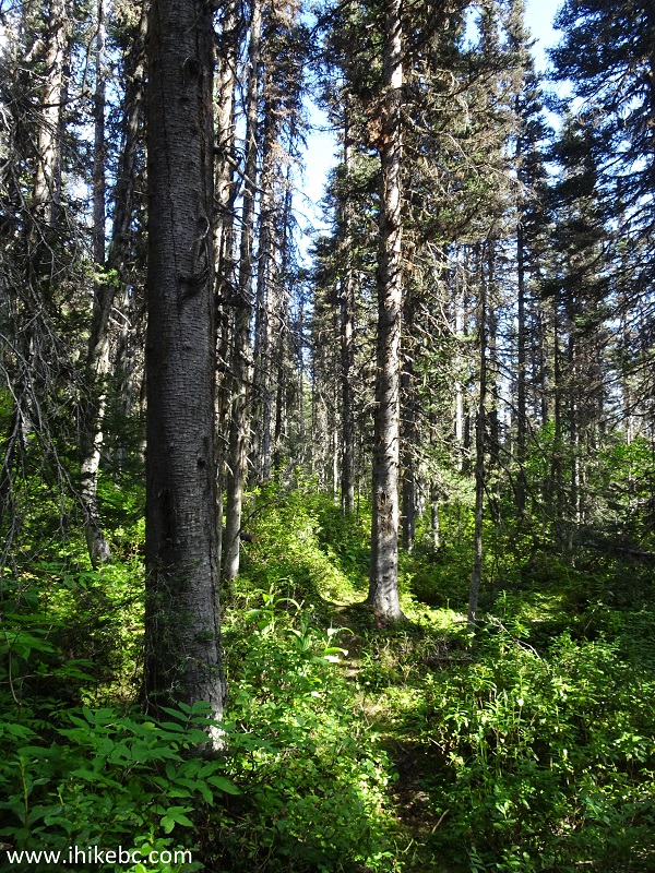
15. The trail through the forest is moderately challenging, with some steep sections, but nothing too extreme.
Browntop Mountain Trail - Likely Trail BC Canada
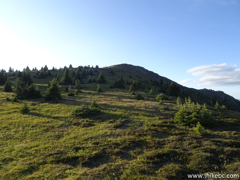
16. In less than three kilometers, the forest starts to open up.
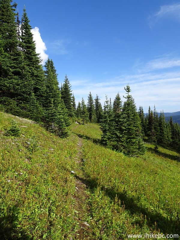
Likely Hiking - Browntop Mountain Trail
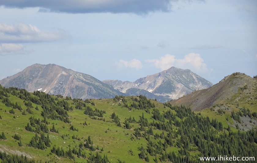
17. The sub-alpine has some neat views.
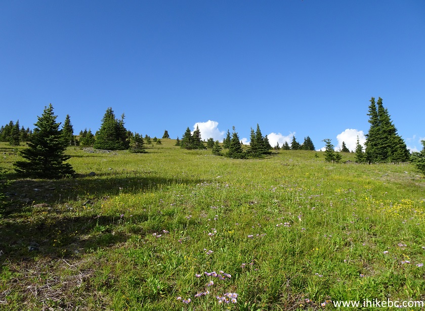
Hiking in Likely Area - View from Browntop Mountain Hike
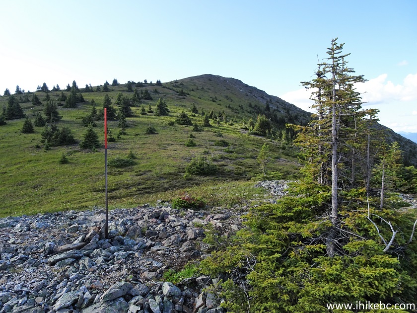
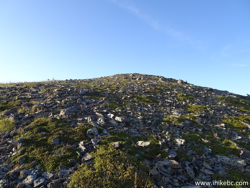
18. Shortly, we are approaching the cairn marking the end of the trail. After you leave the forest, there is some flagging tape to guide you, as well as a few metal poles, painted red closer to the top - this was likely done for winter hiking guidance.
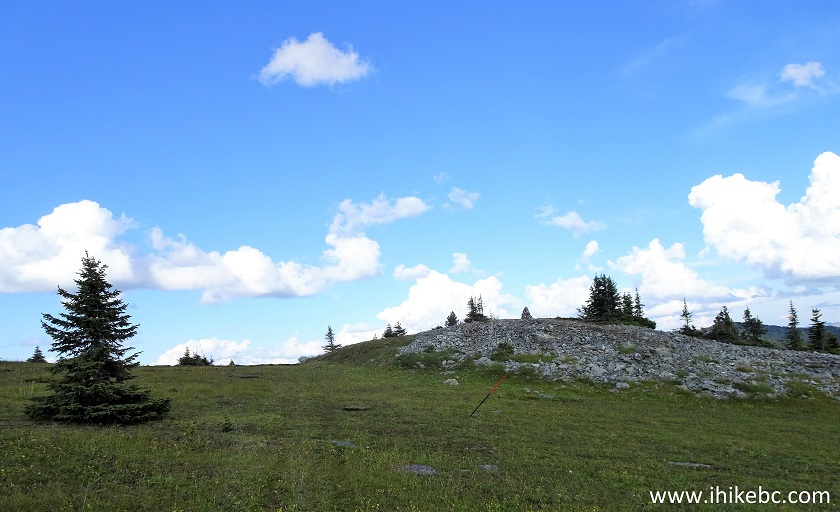
BC Hiking - Browntop Mountain Trail near Likely
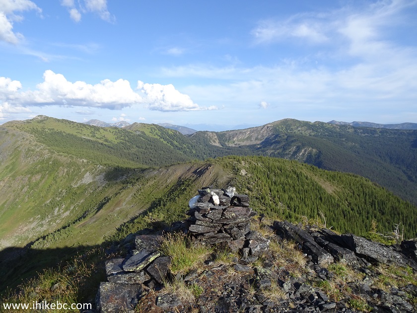
19. And here is a cairn marking the end of the trail, 3.7 km after the trailhead. It took us 1.5 hours of hiking. Coordinates: N 52⁰42.306' W 121⁰19.914'. Elevation: 1,952 meters (522 meters elevation gain from the start of the trail).
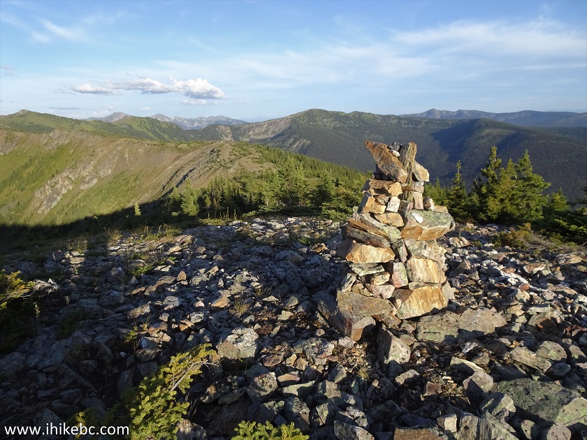
Browntop Mountain Area near Likely British Columbia
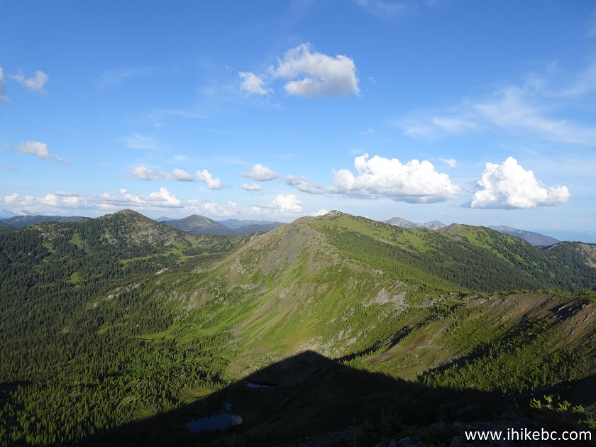
20. A fine view from the cairn area.
View from Browntop Mountain Area - Hiking in British Columbia
Here is our video of the views from the cairn at the end of the trail.
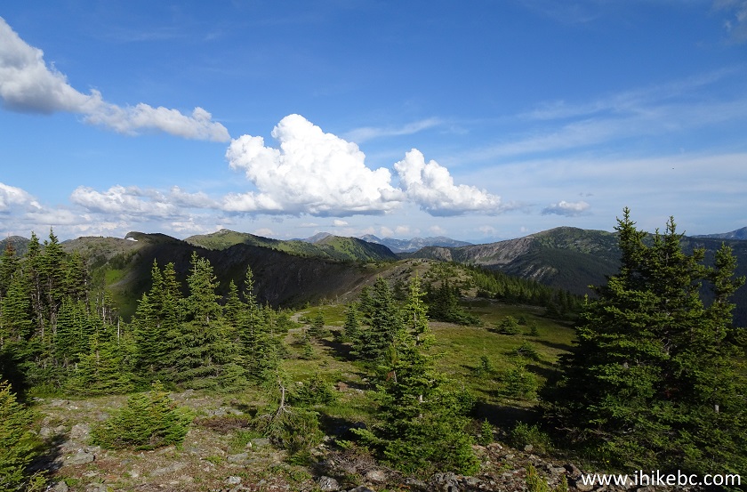
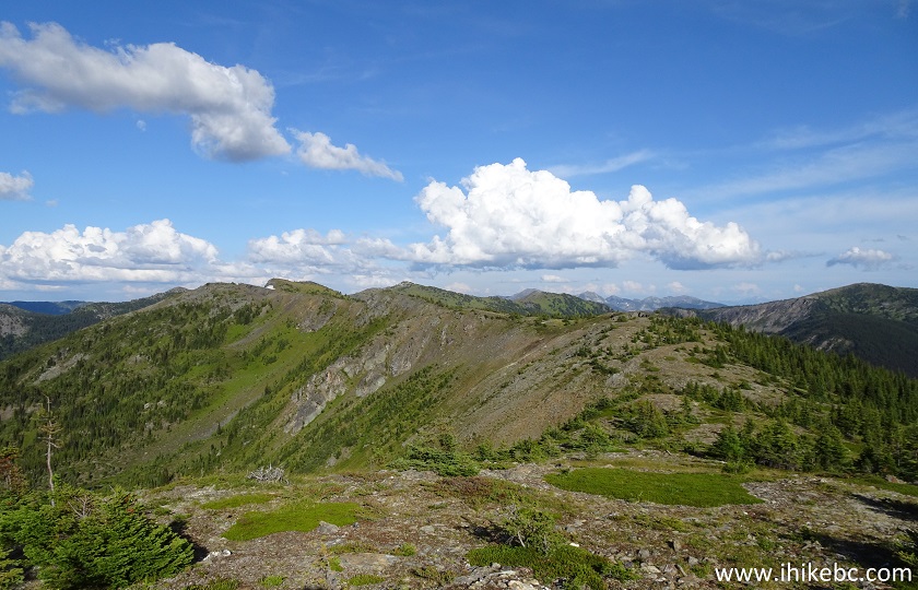
21. Also, there are two prominent ridges in the vicinity, and we visited both of them. Here is a ridge to the left. Also shown is one of those directional metal poles mentioned above.
BC Hike
22. And here is a ridge to the right, which we hiked first.
Hike in BC
23. While proceeding to the ridge on the right, we found this fine mountain lake on the left side.
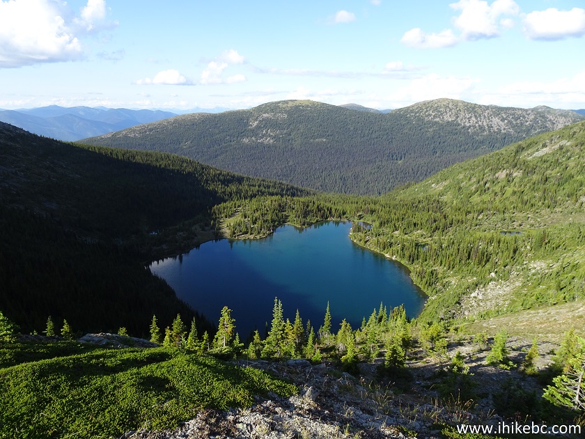
Lake by Browntop Mountain near Likely BC Canada
24. Getting closer to the end of the ridge.
British Columbia Hiking near Likely BC
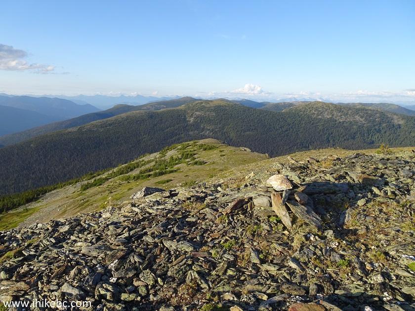
25. And another cairn marks the end of the ridge on the right. Coordinates: N 52⁰42.308' W 121⁰18.858'. Elevation: 1,975 meters. The distance from the first cairn at the end of the trail is about 1.5 km.
Hike in British Columbia
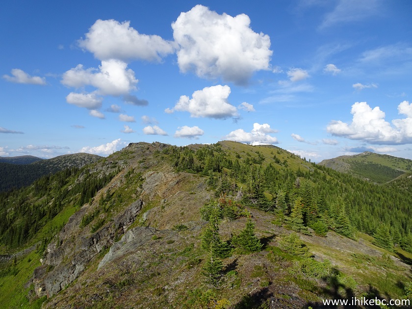
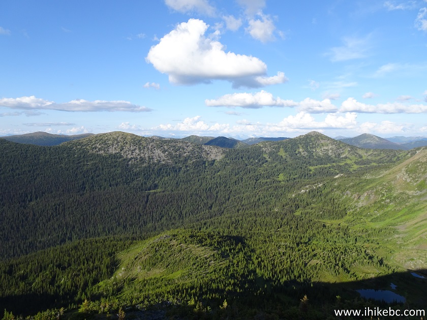
26. There are lots of further hiking possibilities here, including yet another ridge straight ahead.
Hiking in British Columbia
27. Looking a bit to the left.
Hiking near Likely BC Canada
28. There are also some very prominent peaks in the distance. Much zoom used.
Canada Hiking
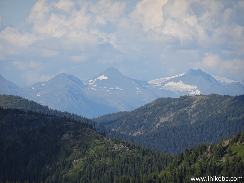
29. Another set of peaks, also with lots of zoom.
Hike in Canada
Here is our video of the views from the cairn on the ridge to the right.
More ihikebc videos are on our YouTube Channel.
30. We then climbed the ridge to the left of the first cairn.
Hike in Likely BC area
31. It was a challenging, if short, climb.
Hike in Canada
32. At the top, we found a large alpine area, with some decent views. Coordinates: N 52⁰42.464' W 121⁰20.042'. Elevation: 2,024 meters.
British Columbia Hiking near Likely BC Canada
33. Also at the top, was this pleasant discovery - a weather station set up by the University of Northern British Columbia, located in Prince George, which is nowhere near Browntop Mountain. An attached note requests not to disturb the station, and directs all inquiries to Stephen Dery (250) 960-5193 or sdery@unbc.ca.
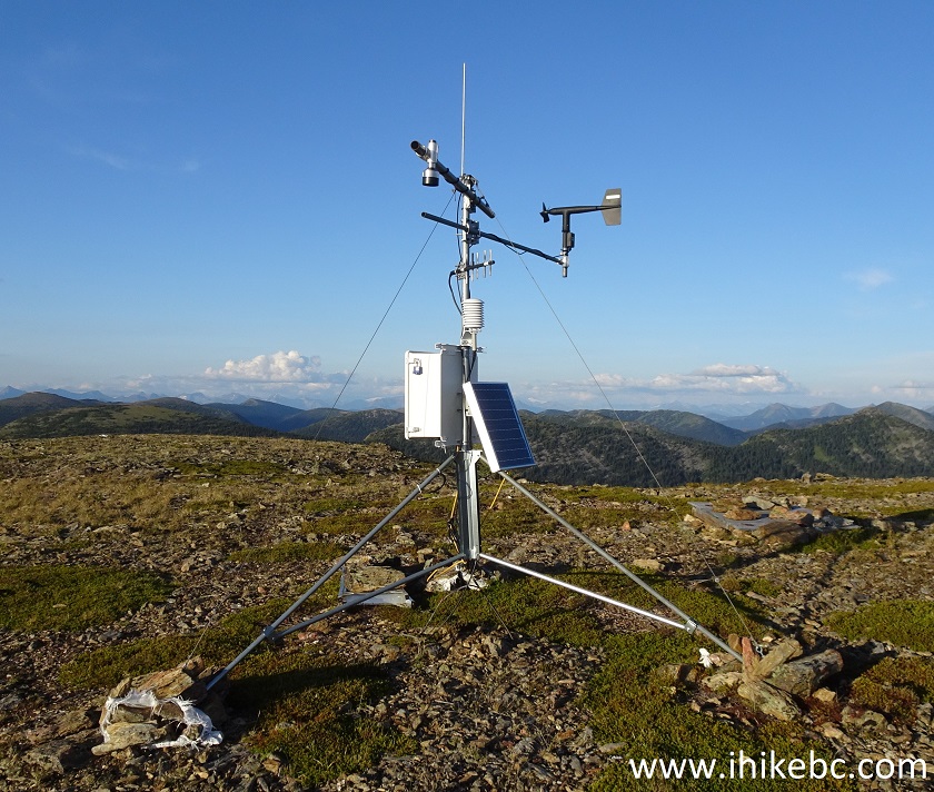
UNBC Weather Station on Browntop Mountain near Likely BC
There are certainly much more spectacular (sub)-alpine areas out there, and the trailhead access road is anything but a breeze. That said, Browntop Mountain trail offers several good views, as well as a possibility to hike much further, and, perhaps, discover something even better. Recommended.


|
 |
Other Trips in Likely BC Area:
|
Quesnel Forks
Visit
|
 |
Other Trips:


![]()


![]()
![]()
![]()
ihikebc.com Trip 171 - Browntop Mountain Trail Hike (Near Likely BC)