Trip 331 - May 12, 2025 (Monday)
Mount Pocahontas Trail Hike
Texada Island, British Columbia, Canada
Page 1 of 2
Liked: Decent views from two main viewpoints, shade in the forest, no bugs, a rather short and mostly easy trail with several moderately difficult sections.
Of Note: Steep unbarricaded dropoffs at both viewpoints. Uneven ground, rocks and roots, some windfall. Hiking poles and boots are recommended.Vancouver, Coast & Mountains Backroad Mapbook (2019 edition) trailhead location:
Page 19 (Saltery Bay) B6. Follow @ihikebc TweetMount Pocahontas Trail is located on Texada Island, which is a Gulf Island found between Sunshine Coast and Vancouver Island, pretty much across from Powell River.
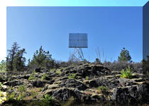
This easy-to-moderately-difficult trail mostly runs along a forest service road, which can be tackled by capable 4x4 vehicles, and then becomes a hike-only trail with two paths at the end - the first leads to a viewpoint at the former location of the first ever Canadian fire lookout, and the second is near an unusual reflection screen tower. Both viewpoints feature island and water views.
To get to the trailhead from Gillies Bay, drive on Gillies Bay Road, turn left onto Shelter Point Road, left onto Central (High) Road, then right onto Pocahontas Main Forest Service Road. Or, if driving from Van Anda, take Central (High) Road, and then turn left onto Pocahontas Main FSR. A 4x4 would allow you to drive the first 2 km of the trail, and then it's a 410 meter-hike to the first viewpoint, return to the main trail, and hike another 1.1 km to the second viewpoint (minor windfall on the trail there).
*All trail distances are based on a GPS odometer and are approximate.
1. Here is a Google Maps location of Mount Pocahontas on Texada Island, BC.
2. We start at Gillies Bay General Store, located 11.9 km from Blubber Bay Ferry Terminal via Blubber Bay Road and Gillies Bay Road. For directions on getting up to this point from the ferry terminal, check out our Vancouver to Texada Island trip report.

Texada Island General Store in Gillies Bay
3. Gillies Bay Road ends 3.0 km later at Shelter Point Road. Turn left. Turning right would lead to Shelter Point Regional Park.
Gillies Bay Road Texada Island British Columbia Canada
4. Shelter Point Road ends 4.2 km later (7.2 km from Gilles Bay General Store). Make a left turn onto Central (High) Road.
-Rd-7.2km.JPG)
Gillies Bay Road at Central (High) Road - Texada Island BC
5. Central (High) Road 1.2 km later.

Central (High) Road - Texada Island, British Columbia
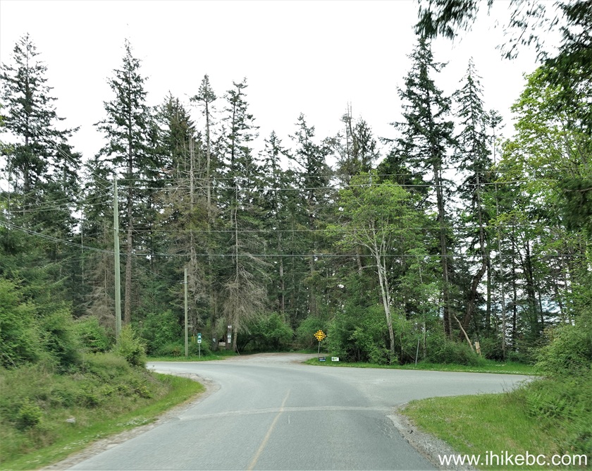
6. After driving for 6.6 km on Central (High) Road, make a right turn onto Pocahontas Main Forest Service Road. Coordinates: N 49⁰42.412' W 124⁰28.059'. Elevation: 230 meters. You can also arrive to this point from the other side, as Central (High) Road goes all the way to Van Anda, near Blubber Bay Ferry Terminal.
Central (High) Road at Pocahontas Main Forest Service Road
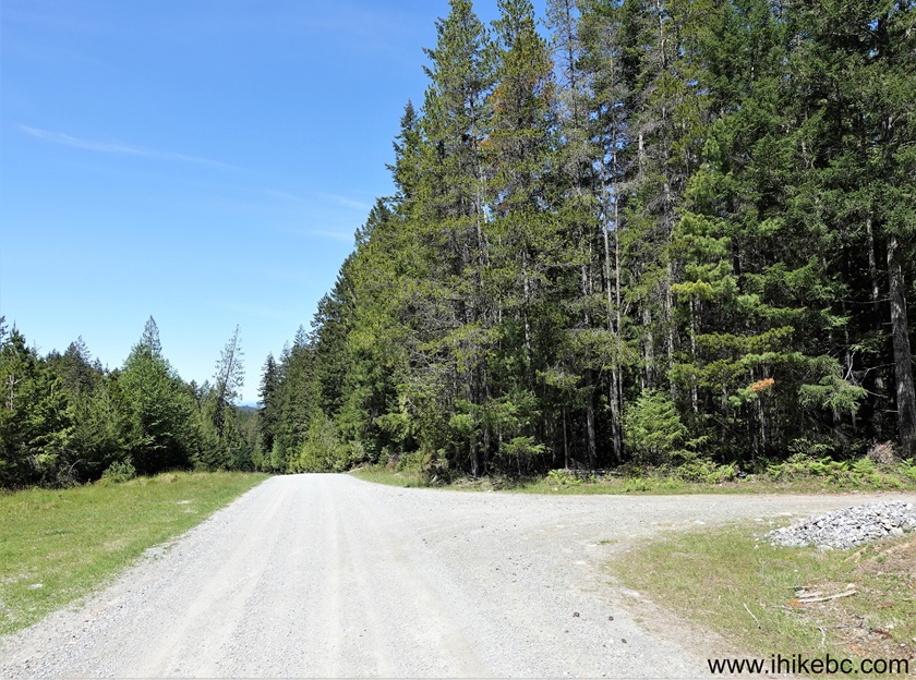
7. Pocahontas Main FSR 200 meters after the turn.

Pocahontas Main FSR - Texada Island BC
8-9. Arrive to Mount Pocahontas trailhead on the right side 800 meters from Central (High) Road. Coordinates: N 49⁰42.637' W 124⁰28.017'. Elevation: 210 meters. A 2WD vehicle with regular clearance should be able to make it up to this point. It's 4x4 after that, or start a hike.

Mount Pocahontas Trailhead - Texada Island BC Canada
Mount Pocahontas Trail on Texada Island BC
Here is Our Video of Driving from Gillies Bay General Store to Mount Pocahontas Trailhead.
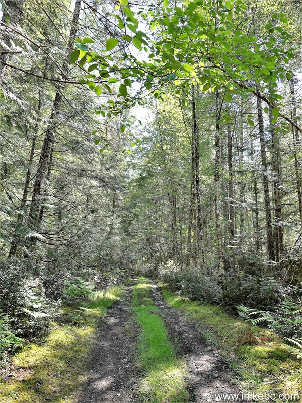
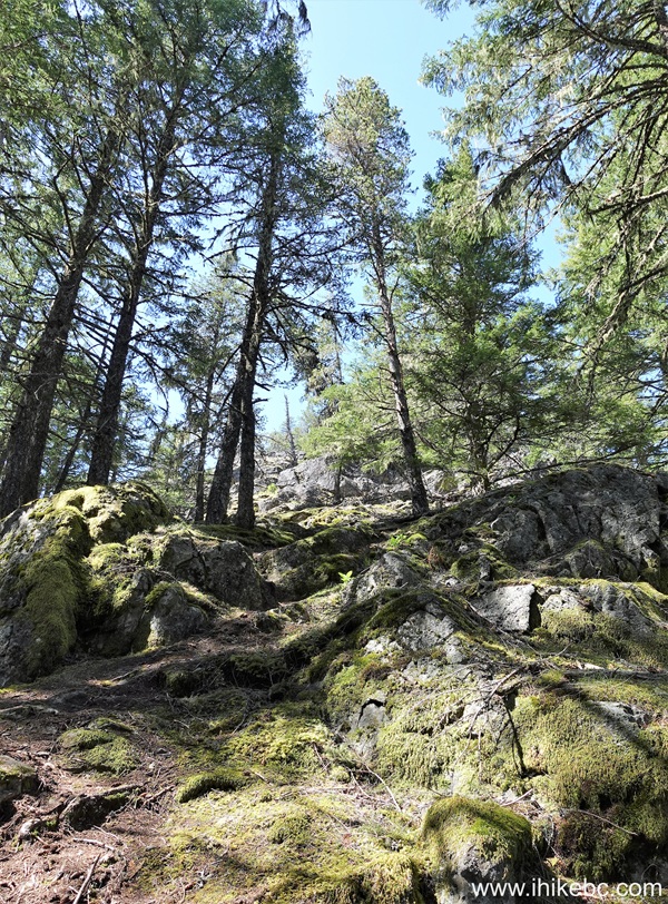
10. Mount Pocahontas Trail on Texada Island, British Columbia, Canada. At 180 meters from the trailhead. It is steeper than it looks.
Texada Island Hiking - Mount Pocahontas Trail
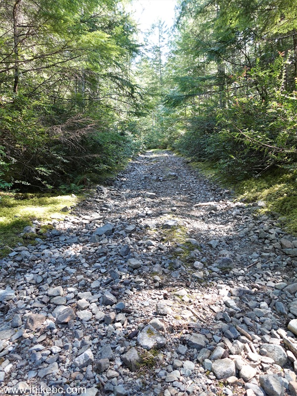
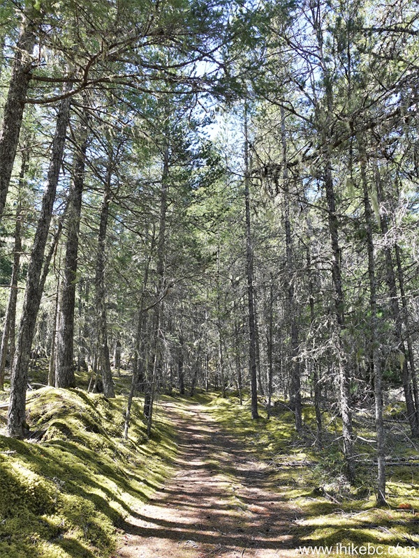
11. Now at the 1.5 km mark. Not much to see, just a steady elevation gain on a forest service road.

British Columbia Hiking on Texada Island - Mount Pocahontas Trail
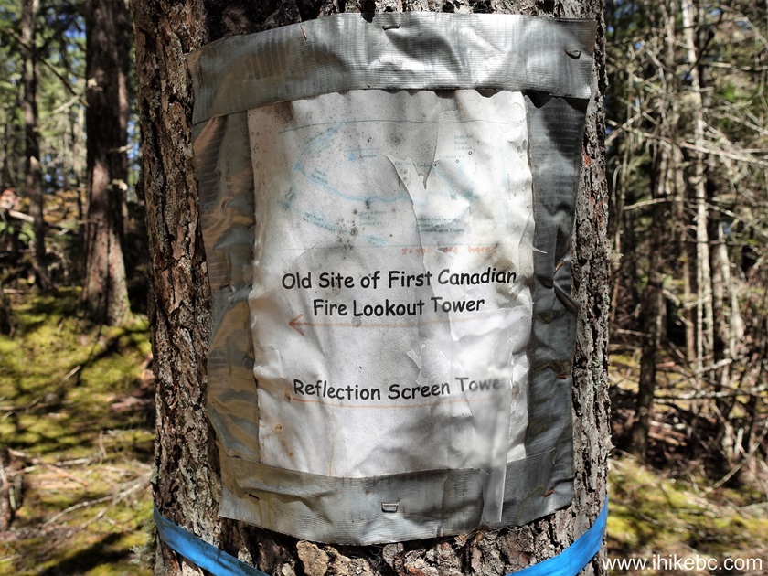
12-13. At 2.06 km, there is a split. Coordinates: N 49⁰42.391' W 124⁰26.568'. Elevation: 370 meters. To the left is a 410 meters-long trail to a viewpoint at the location of a former first Canadian fire lookout tower. Straight ahead is a path to the second viewpoint by a reflection screen tower.
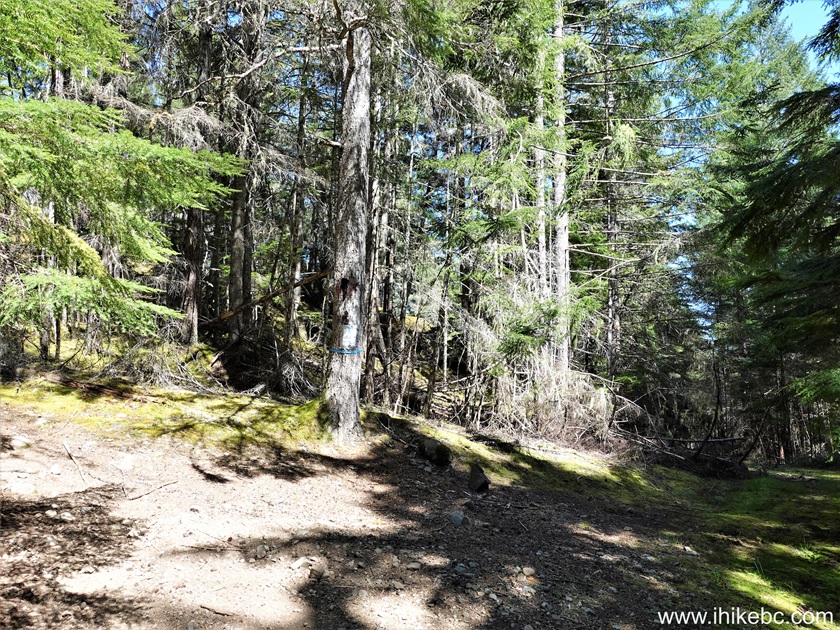
14. We went left first, and here's a view immediately after that turn.
Hiking on Texada Island, BC, Canada - Mount Pocahontas Trail
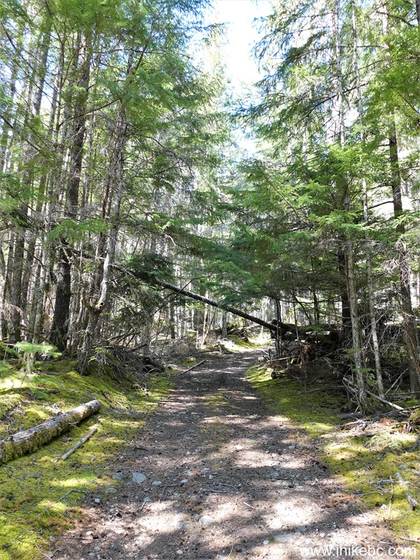
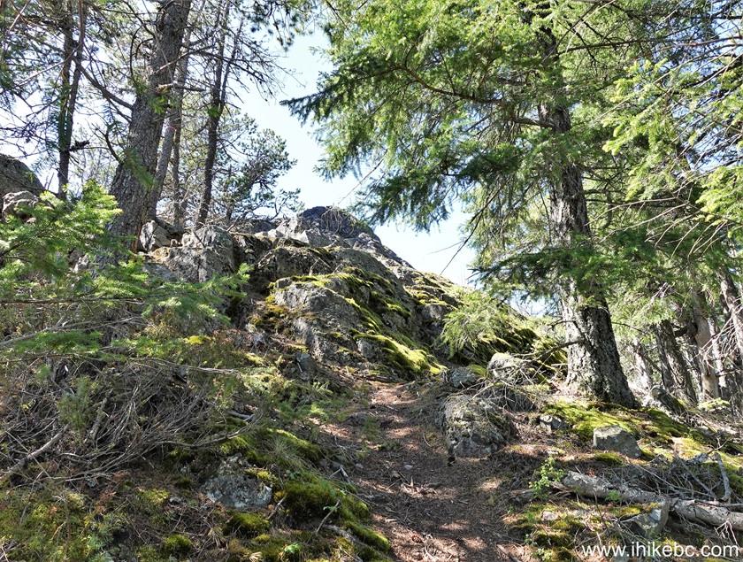
15. At 190 meters after the turn. A pleasant hike in a forest.
Hike on Texada Island - Mount Pocahontas
16. At 320 meters, we are getting close to the first viewpoint. The last 100 meters or so are fairly steep.
Hiking Mount Pocahontas Trail on Texada Island BC
17. 60 meters later, we are almost there.
Mount Pocahontas, Texada Island BC
18. A few more steps...
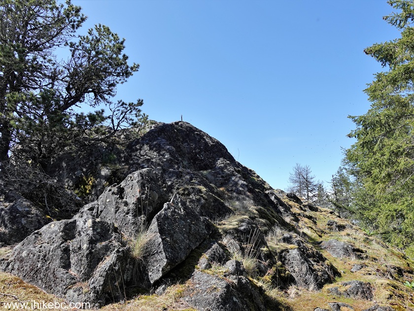
Hiking on Mount Pocahontas in British Columbia Canada
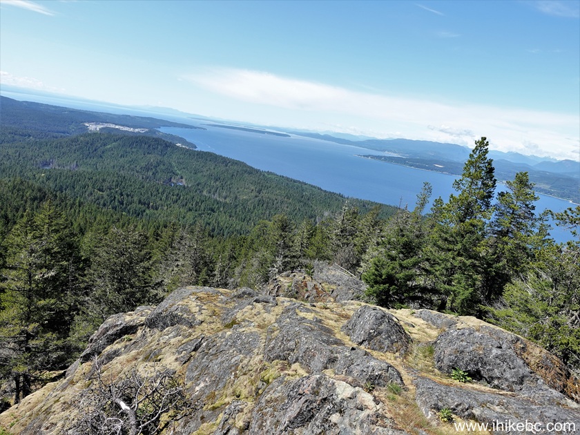
19...and we are at the location of the first Canadian fire lookout tower, right here on Mount Pocahontas on Texada Island, BC. Coordinates: N 49⁰42.563' W 124⁰26.705'. Elevation: 430 meters. It's 410 meters from the split, and 2.47 km from the trailhead.
Texada Island view from Mount Pocahontas
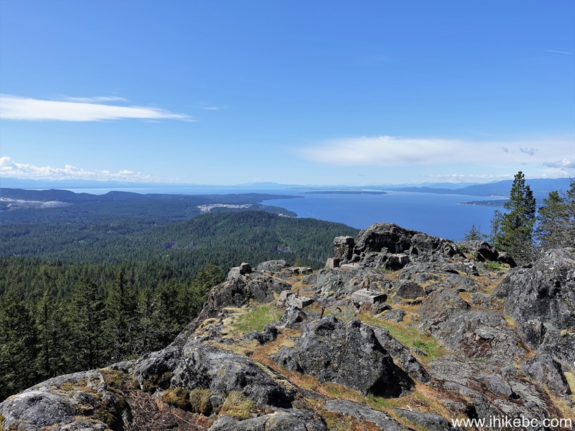
20-24. Here are the views from this location. Left to right followed by a panorama. Watch out for steep unbarricaded dropoffs at this location.
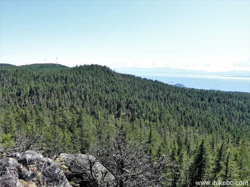
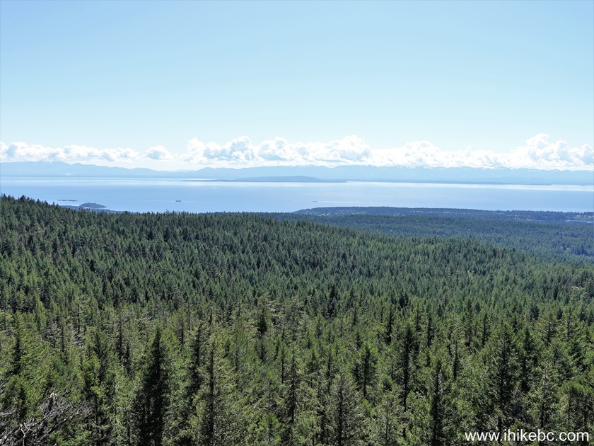
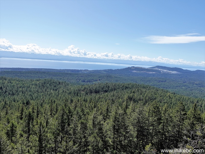
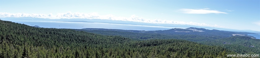
25. A zoomed view of the ocean.

Ocean view from the top of Mount Pocahontas on
Texada Island
Here is Our Video of the views from this location.
More ihikebc videos are on our YouTube Channel.
Our Mount Pocahontas trip report Continues on Page 2.


|
 |
Other Trips:


![]()


![]()
![]()
![]()
ihikebc.com Trip 331 - Mount Pocahontas Trail Hike (Texada Island BC)
Page 1 of 2