Trip 330 - May 9, 2025 (Friday)
Shelter Point Regional Park Visit
Texada Island, British Columbia, Canada
Liked: Pleasant natural views, various recreational opportunities, available seasonal concession stand, coin shower (available to everyone).
Vancouver, Coast & Mountains Backroad Mapbook (2019 edition) park location:
Page 8 (Texada Island) A1.Related Websites: Texada Island - Wiki, Shelter Point Regional Park & Campground.
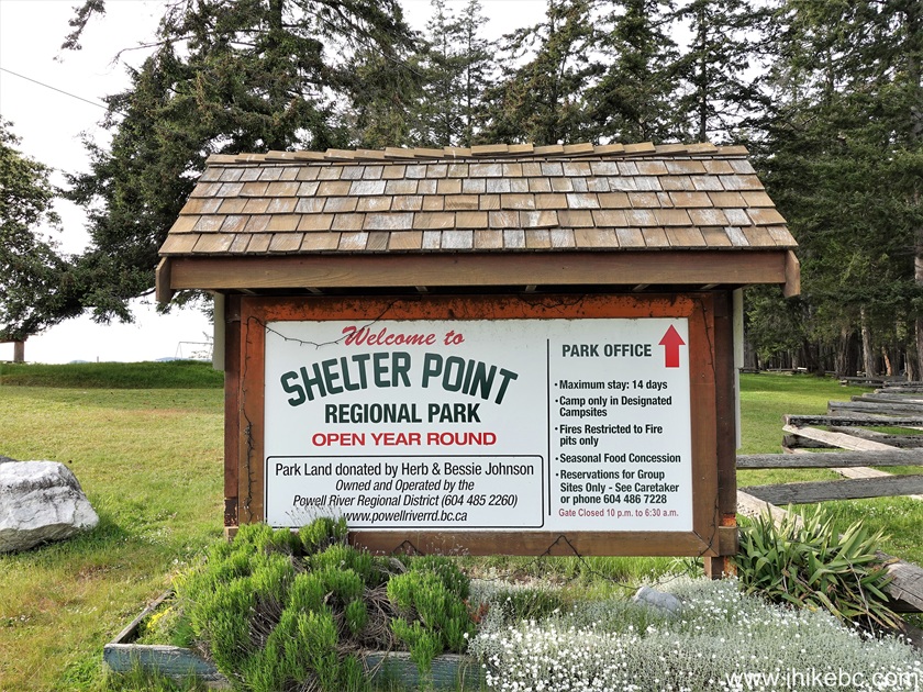
Follow @ihikebc TweetShelter Point Regional Park & Campground is open all year long, and is located on the West coast of Texada Island, 3.2 kilometers from Gillies Bay general store, and 15.1 km from Blubber Bay Ferry Terminal (service to Powell River) via Blubber Bay Road, Gillies Bay Road, and Shelter Point Road. It is a fine and peaceful location in a pleasant natural setting, with good sea views and trees all around. There is camping, easy hiking, picnicking, volleyball playing, a swing set, a gazebo, a boat launch and, so important, a coin shower, available to anyone with two loonies (as of the time of writing) for 4 minutes.
The campground gate closes overnight, so, if you need to leave early, choose one of the several camping spots outside the gate. If you prefer wild camping, proceed further into Texada Island and use camping spots along one of the Texada forest service roads. Also, if you are going to use a coin shower, bring additional coins, as the water flow stops without a warning after 4 minutes, and it would be rather unfortunate to be stuck there with soap all over you and no coins.
1. Here is a Google Maps location of Shelter Point Regional Park & Campground on Texada Island.
2. We start at Gillies Bay general store, located 11.9 km from Blubber Bay Ferry Terminal via Blubber Bay Road and Gillies Bay Road. For directions on getting up to this point from the ferry terminal, check out our Vancouver to Texada Island trip report.

Gillies Bay General Store on Texada Island, British Columbia, Canada
3-5. The road from the store to Shelter Point Regional Park is unremarkable except for this dinosaur at the entrance to one of the residences along Gillies Bay Road.

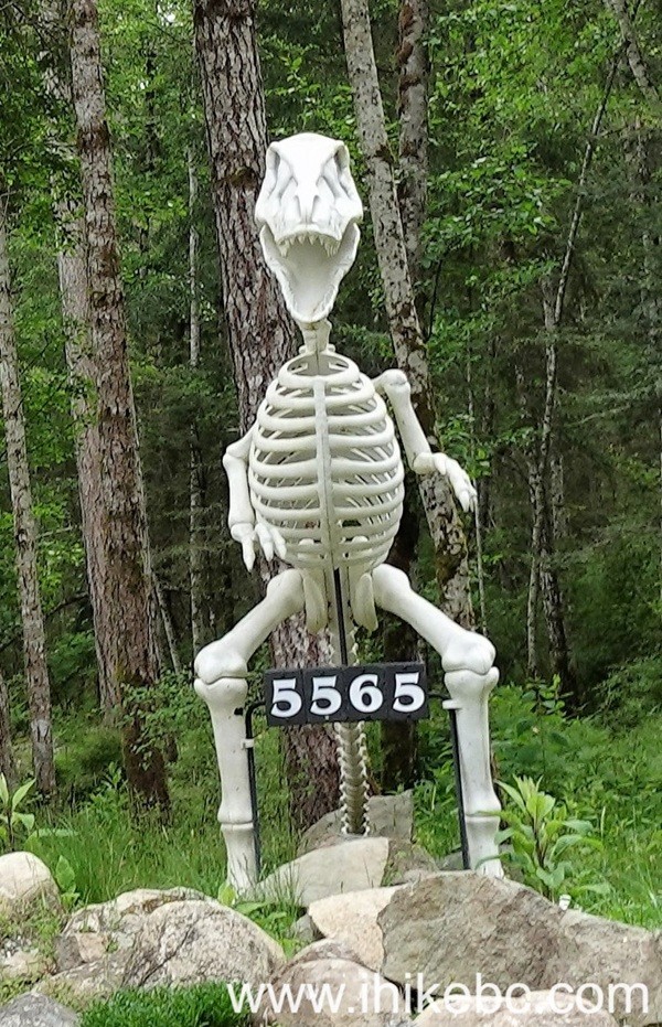

Dinosaur Skeleton Statue on Texada Island BC
6. Gillies Bay Road ends at Shelter Point Road 3.0 kilometers from Gillies Bay general store. To the right is the park and campground. To the left is a road further into Texada Island, towards several hikes, as well as Anderson Bay Provincial Park (trip report).
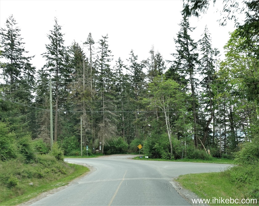
Gillies Bay Road at Shelter Point Road
7. We turned right.

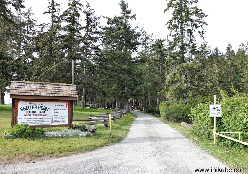
Shelter Point Park Sign - Texada Island - British Columbia - Canada
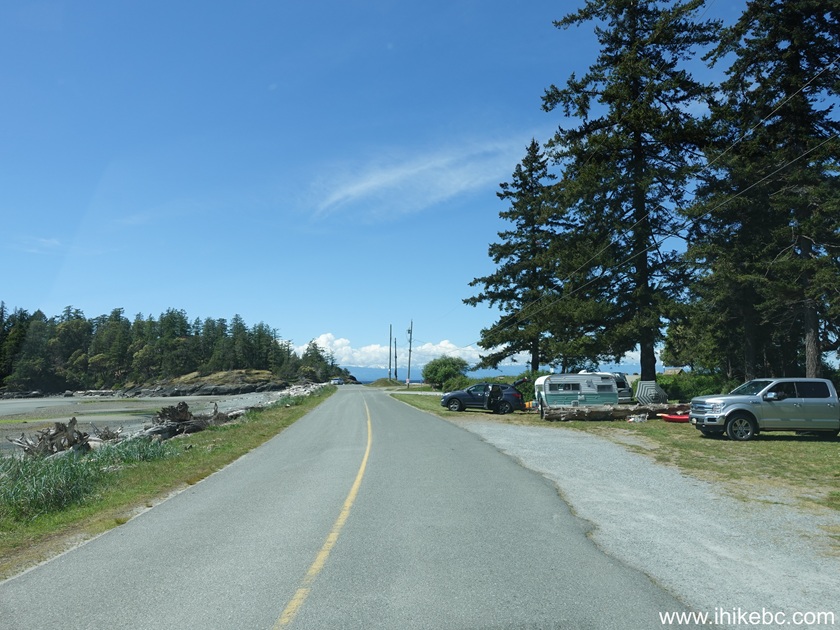
8a. Shelter Point Road after the turn. The day use parking area is straight ahead, 200 meters further, at the end of the road. Before that, on the right side, are several camping spots outside the campground gate.
Shelter Point Road, Texada Island, British Columbia, Canada
8b. A bit closer to the day use parking lot - May 12th photo. Note campers on the right side - camp here if you want to leave early, when the campground gate would still be closed.
Texada Island BC - Shelter Point Road
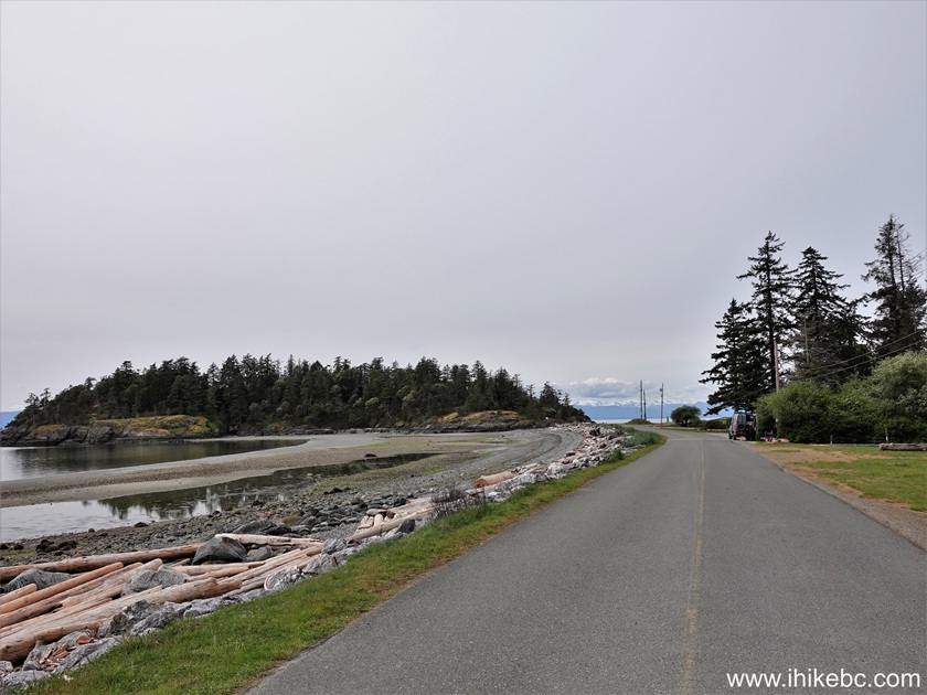
9a. Looking left, across from the camping spots located outside the campground gate.

Straight of Georgia view from Texada Island
9b. Looks much better with the sun out - May 12th photo.

Texada Island BC - Shelter Point Park
10. A boat launch at the end of Shelter Point Road, next to the day use parking area.
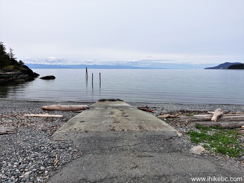
Shelter Point Regional Park Boat Launch on Texada Island, British
Columbia, Canada
11. Another boat launch is located to the left of the first one.
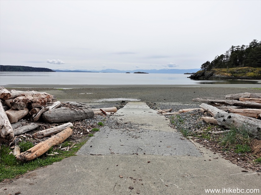
Boat Launch at Shelter Point Regional Park on Texada Island
BC
Here is Our Video of Driving from Gillies Bay General Store to Shelter Point Regional Park.
More ihikebc videos are on our YouTube Channel.
12. And, to the right of the first boat launch, is a stony beach area, which runs along the campground.

Shelter Point Regional Park
13-14. A bit behind (and also to the right) is Shelter Point Campground gate, which is closed overnight (caretakers are available to open it in case of an emergency).
Shelter Point Regional Park Campground Gate
Shelter Point Regional Park Information Stand
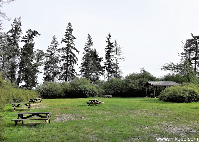
15-16. Just to the right of the day use parking lot is a large picnic area with a gazebo.


Shelter Point Regional Park picnic gazebo
17-19. As seen in the photo above, a washroom (with a coin shower) is behind the gazebo.

Shelter Point Regional Park Washroom and Shower Building
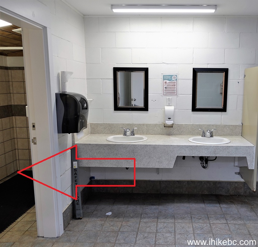
Texada Island - Shelter Point Regional Park - Washroom Interior

Texada Island Shower in Shelter Point Regional Park
20. Volleyball playing area is to the left of the gazebo.

Shelter Point Regional Park Volleyball Playing Area
21. Adjacent to that is a swing set.

Swing Set at Shelter Point Regional Park on Texada Island BC
22. And, just a bit further, close to that stony beach, is a picnic tables area.

Picnic Area Shelter Point Regional Park
23. To the right of that is a seasonal concession building.

Seasonal Concession Building at Shelter Point Regional Park on Texada
Island, BC, Canada
24-27. Yet more to the right is a Shelter Point Campground registration stand.
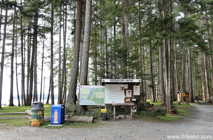


Shelter Point Regional Park Campground Map
28. Set up in an unoccupied site, then report to self-registration.
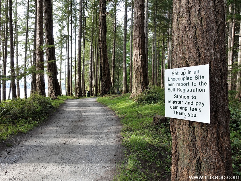
Shelter Point Regional Park British Columbia Canada
29. One of the camping spots.

Shelter Point Regional Park Camping Spot
30. One more.

Shelter Point Regional Park Camping Area
31. Group camping area.
Shelter Point Regional Park Group Camping Area
32. Campers chilling on a bench by a stony beach.

Shelter Point Regional Park - Texada Island BC
Shelter Point Regional Park & Campground on Texada Island is located in a pleasant natural setting, and has several fine recreational opportunities. Recommended.


|
 |
Other Trips:


![]()


![]()
![]()
![]()
ihikebc.com Trip 330 - Shelter Point Regional Park Visit (Texada Island BC)