Trip 327 - May 6, 2025 (Tuesday) to May 14, 2025 (Wednesday)
Texada Island BC Visit
Liked: Anderson Bay Provincial Park, hiking Mount Pocahontas / Mount Grant trails, Shelter Point Regional Park (coin shower!), Gillies Bay General Store, lack of crowds.
Vancouver, Coast & Mountains Backroad Mapbook (2019 edition) Texada Island location:
Page 8, 18, and 19.Related Website: Texada Island - Wiki.
Other British Columbia Islands We Have Visited: Bowen Island, Galiano Island, Gambier Island, Mayne Island, Newcastle Island, Pender Island, Quadra Island, Salt Spring Island, Saturna Island, Sidney Island.
Follow @ihikebc TweetTexada Island is a very large island (approximately 50 km long and 10 km wide) located between Sunshine Coast of BC and Vancouver Island. It is home to about 1,200 people and a whole lot of deer, as there are no natural predators on Texada Island. A ferry from Powell River (Westview Ferry Terminal) takes 40 minutes to reach the Northern tip of Texada Island (Blubber Bay Ferry Terminal). Two more ferries (Horseshoe Bay to Langdale and Earl's Cove to Saltery Bay) are required to reach Powell River from Greater Vancouver. One can also get to Powell River via a ferry from Comox on Vancouver Island.
We have visited Texada Island between May 6 and May 14, 2025. We have hiked several trails, visited Anderson Bay Provincial Park and Shelter Point Provincial Park, checked out the only two settlements on Texada Island (Van Anda and Gillies Bay), and looked around in general. Despite being so large, Texada Island is not nearly as popular as Southern Gulf Islands we have already visited: Salt Spring, Galiano, Pender, Saturna, and Mayne. Some of it probably has to do with a relatively remote location of Texada Island, but also there isn't as much developed infrastructure or natural attractions as on the other islands we have already visited. Thus, fewer residents and fewer visitors, but also a more serene and less crowded experience, especially during the busy season.
This trip report contains information on our trips which do not have separate trip reports, as well as a brief reference to the trips which have trip reports of their own.
Our visit to Texada Island went as follows:
May 6th (Tuesday) - ferry ride from Vancouver to Langdale, then another one from Earl's Cove to Saltery Bay, and the last one from Powell River (Westview Terminal) to Texada Island (Blubber Bay Terminal). Trip report is here.
May 7th (Wednesday) - trip to Anderson Bay Provincial Park (trip report).
May 8th (Thursday) - Mount Davis and Bloody Mountain hike (trip report).
May 9th (Friday) - Shelter Point Regional Park visit (trip report).
May 10th (Saturday) - Flicker Mountain hike, followed by Mount Grant hike.
May 12th (Monday) - Mount Pocahontas hike (trip report).
May 14th (Wednesday) - trip to the coastline via Texada FSR Branch 03. Then, a ferry back to Powell River.
* All trail distances are based on a GPS odometer and are approximate.
1. Here is a Google Maps location of Texada Island, British Columbia.
May 6, 2025 (Tuesday)
2. We have departed Vancouver, BC, and reached Texada Island the same day via 3 ferries. Our Vancouver to Texada Island trip report is here.
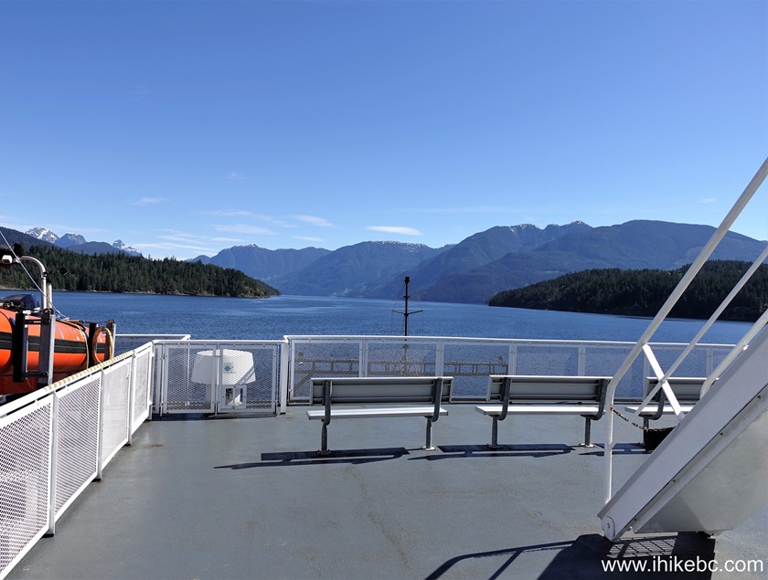
On board BC Ferry "Malaspina Sky"
May 7, 2025 (Wednesday)
3. The next day, May 7th,
we have visited Anderson Bay Provincial Park via a bike ride and
some hiking. Saw fine bay views and observed (and heard) a group of
about ten sea lions sunbathing on a rock in the bay.
May 8, 2025 (Thursday)
4. Today was a hike to Mount Davies and connected Bloody Mountain (our
trip report is here). It's a fairly short and rather easy hike
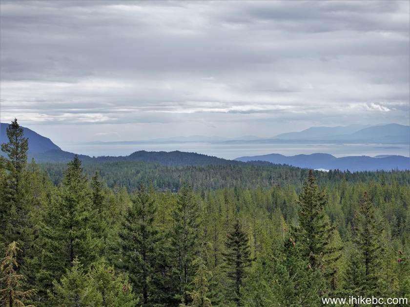
through a pleasant forest, leading to a few panoramic, if unspectacular,
views of Texada Island, ocean, and a few nearby islands.
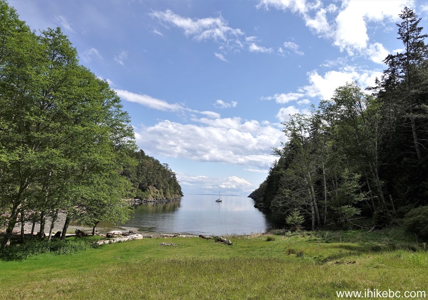
Anderson Bay Provincial Park
May 9, 2025 (Friday)
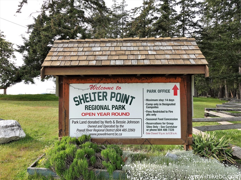
5. Visited Shelter Point Regional Park (trip
report is here).
May 10, 2025 (Saturday)
6. Hiked Flicker Mountain Trail. All of 880 meters return trip. The
trailhead is off Texada FSR Branch 03, 3.4 km past its split with Texada
BC Hydro substation access road, and 19.7 past Gillies Bay general store.
For directions on getting to Texada FSR Branch 03 split with substation
access road,
check out our Anderson Bay Provincial Park trip report. Here is that
split - the same photo as photo #8a of Anderson Bay Provincial Park Trip
report. Coordinates:
N 49⁰37.238'
W 124⁰19.710'.
Elevation: 490 meters.
Go left. 7. 900 meters later, stay left at yet another split.

Texada Island
8. 300 meters after that, you would pass Mount Grant trailhead, and 2.3 km later yet would be at the Flicker Mountain trailhead on the left side.
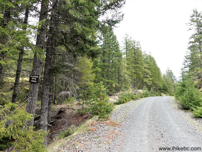
Flicker Mountain Trailhead on Texada Island BC
9. There is a good pullout shortly before the trailhead, and this is what it looks like from the road.
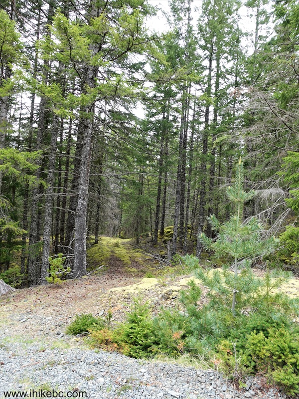
Texada Island BC
10. Go for 100 meters before making a sharp right turn to start climbing. Here we are at 60 meters from the trailhead.
Flicker Mountain Hike on Texada Island
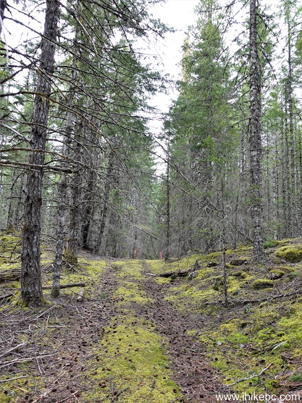
11. At 100 meters, turn right. It's easy to miss this turn, as it is very unremarkable. Coordinates: N 49⁰36.466' W 124⁰17.417'. Elevation: 660 meters. There is some flagging tape there at the present.
Hiking on Texada Island - Flicker Mountain Trail
12. This is what it looks like immediately after turning right. Hard to tell if there is a trail there, but a flagging tape helps to keep going.

Flicker Mountain Trail on Texada Island BC
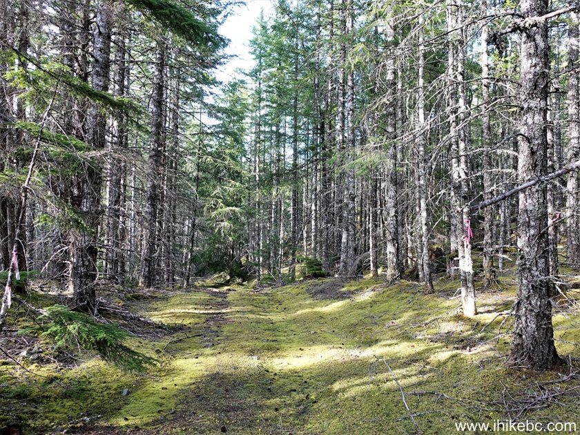
13. There is a steady climb through a forest for about 200 meters, and then the forest opens up a bit. At 300 meters from the trailhead.

Flicker Mountain Hike in British Columbia on Texada Island
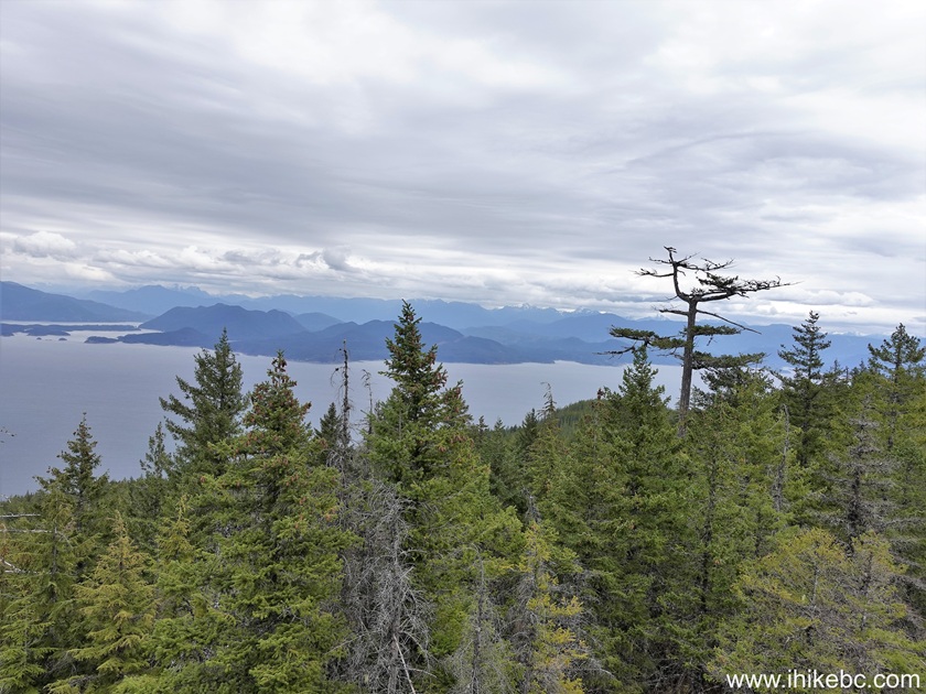
14. And, 440 meters from the start at Texada FSR Branch 03, we have reached the end of the trail at this viewpoint. Coordinates: N 49⁰36.446' W 124⁰17.218'. Elevation: 745 meters. Hiking poles and boots are recommended for this trail.

View from Flicker Mountain on Texada Island BC
15. We then hiked Mount Grant Trail. Its trailhead is located on the left side 2.3 km before Flicker Mountain Trail. A good pullout is about 70 meters ahead. Coordinates: N 49⁰36.846' W 124⁰18.958'. Elevation: 530 meters.
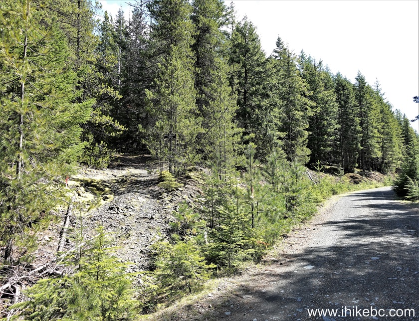
Mount Grant Trailhead on Texada Island BC
16. Now at 90 meters of Mount Grant hike.
Hiking on Texada Island - Mount Grant Trail
17-18. At 170 meters, loop trail begins. If you go clockwise, there would be a short rather steep climb at some point (for about 250 meters), and the descent on the way back would be long-ish and gradual. Or, if you go counter-clockwise, which is what we did, then the climb would be long-ish, but the descent short and somewhat steep.

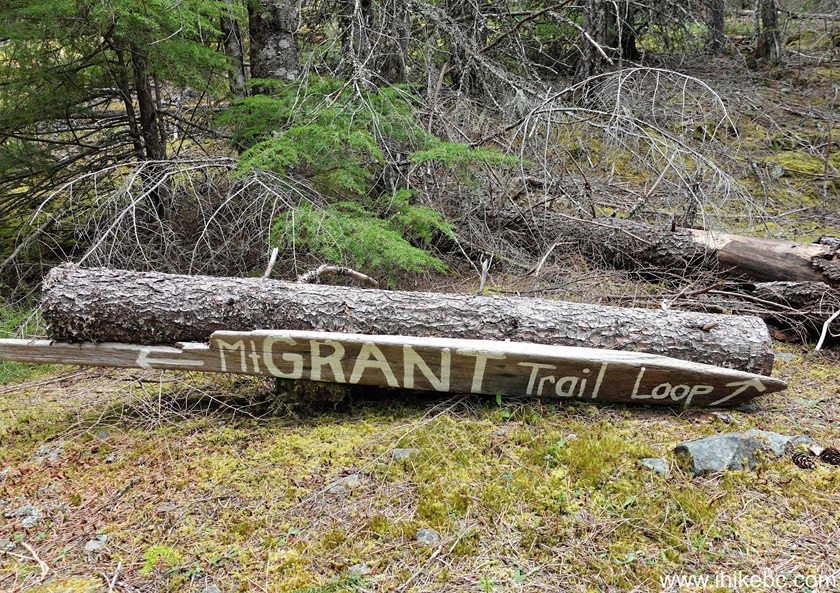
British Columbia Hiking - Mount Grant Trail - Texada Island
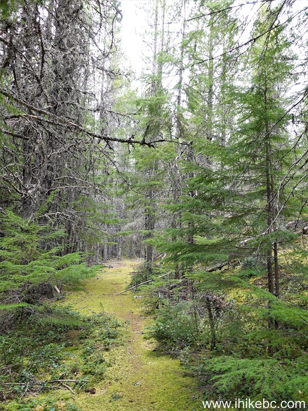
19. At 260 meters of Mount Grant Trail on Texada Island, BC.

Texada Island Hike - Mount Grant Trail
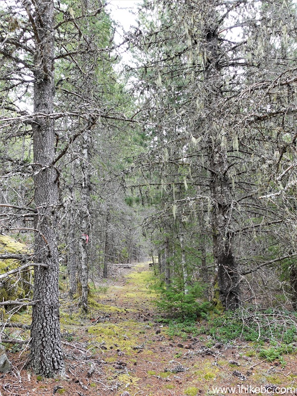
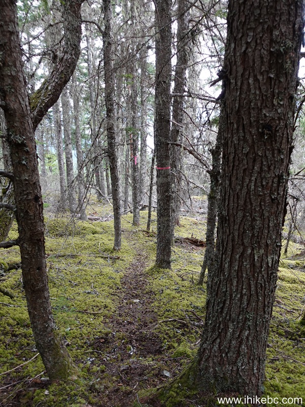
20. At 850 meters, the trail along what was an old moss-covered forest service road ends, and a much narrower trail in the forest begins.

Mount Grant Trail on Texada Island, BC, Canada
21. At 1.09 km of Mount Grant Trail.
Hiking on Mount Grant - Texada Island, BC
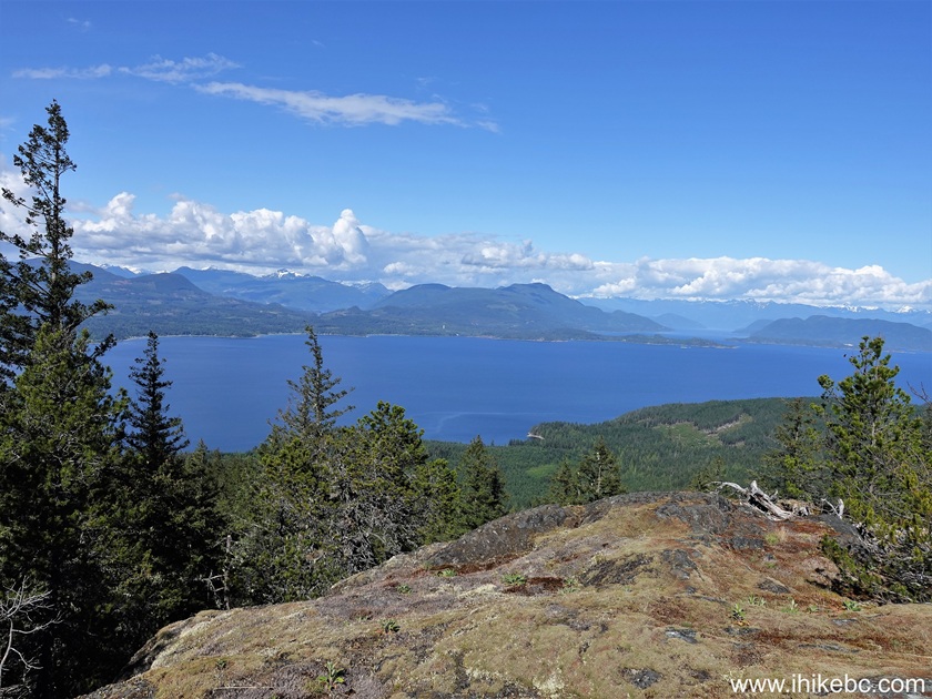
22. A fine view on the left side at 1.71 km. A more obstructed view arrives just over a hundred meters later - watch out for steep unbarricaded dropoff there.
View from Mount Grant on Texada Island
23. Now at 1.95 km of Mount Grant Trail.

Mount Grant Hike British Columbia Canada
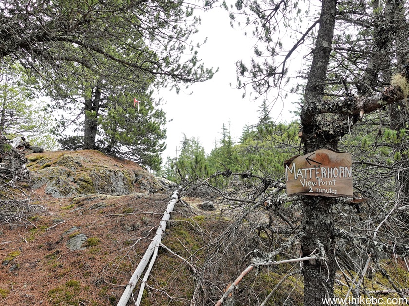
24. At 2.07 km, a 200 meter-long spur leads to Matterhorn Viewpoint, with the best views of the hike.
Mount Grant Trail on Texada Island - Matterhorn Viewpoint Spur
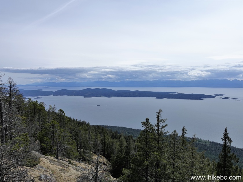
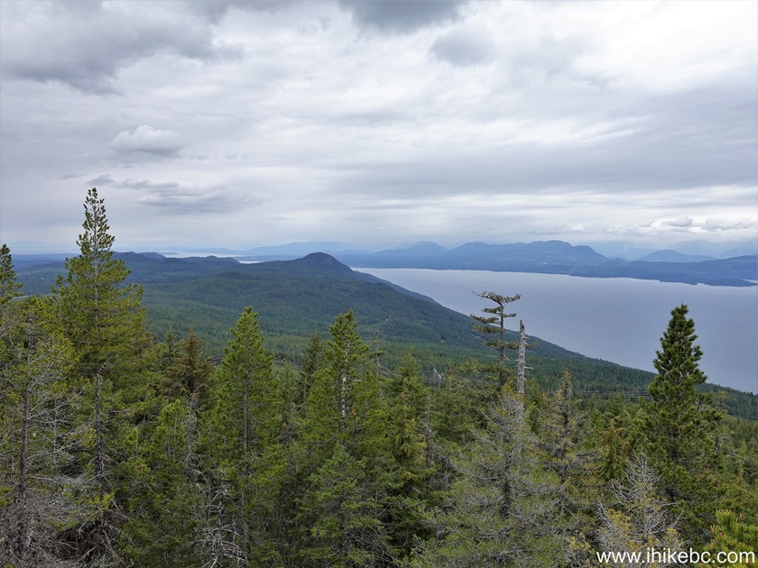
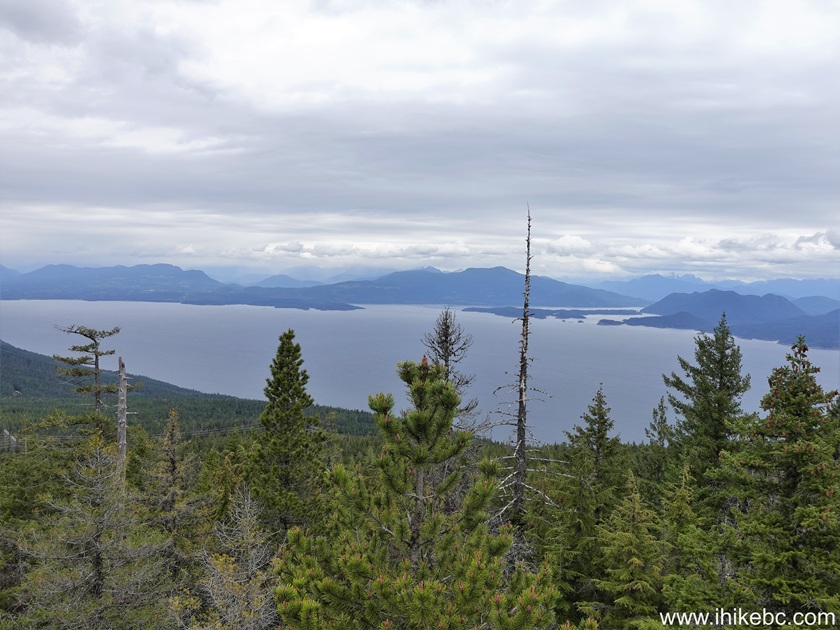
25-28. Here is Matterhorn Viewpoint. Coordinates: N 49⁰36.890' W 124⁰18.328'. Elevation: 730 meters. Left to right followed by a panorama.
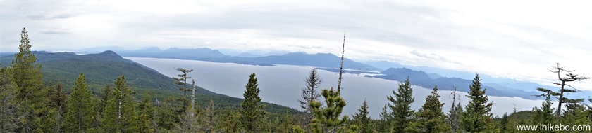
Here is Our Video of the Views from Matterhorn Viewpoint on Mount Grant.
More ihikebc videos are on our YouTube Channel.
29. Then, return the same way you came, or keep going around the loop for another 1.04 km back to the trailhead, which is what we did. Mount Grant Trail is short and mostly easy, and has a few interesting views. Recommended.
Mount Grant Trail on Texada Island
May 12, 2025 (Monday)
30. Hiked Mount Pocahontas Trail (trip report).
Mount Pocahontas - Texada Island - British Columbia - Canada
May 14, 2025 (Wednesday)
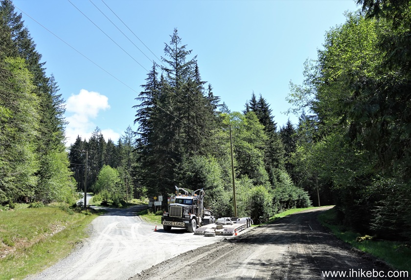
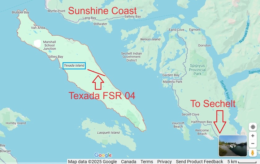
31. May 13th was rainy, so no trips. Then, on May 14th, went to the end of Texada FSR Branch 04, as it appeared to go all the way to the ocean on the map. Which is exactly what happened - 7.3 km of a decent gravel road until it ended at a BC Hydro substation, and then 200 meters walking to a stony beach, which featured a neat large seal-shaped stone, while actual seals were swimming just offshore. Here we are at the end of Bell Road, where going right is the beginning of Texada Branch 03 FSR (to Flicker Mountain, Mount Grant, Bob's Lake, Anderson Bay Provincial Park), and, to the left, is the start of Texada Branch 04 FSR. This is the same spot as photo #6 of Anderson Bay Provincial Park trip report, so check it out for directions on getting up to here from Gillies Bay Provincial Park.
Bell Road at Texada FSR Branch 03 and Branch 0432-33. Here are Google Maps screenshots where we indicated the location of Texada FSR Branch 04.
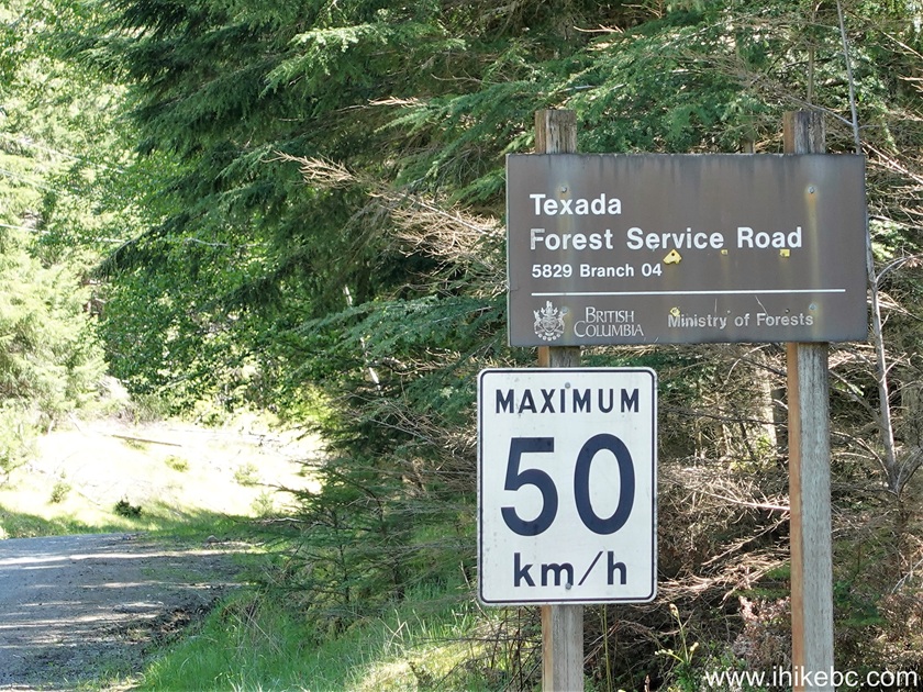
34. Texada FSR Branch 04 sign at the beginning of the road. There is a split right after that - stay right.
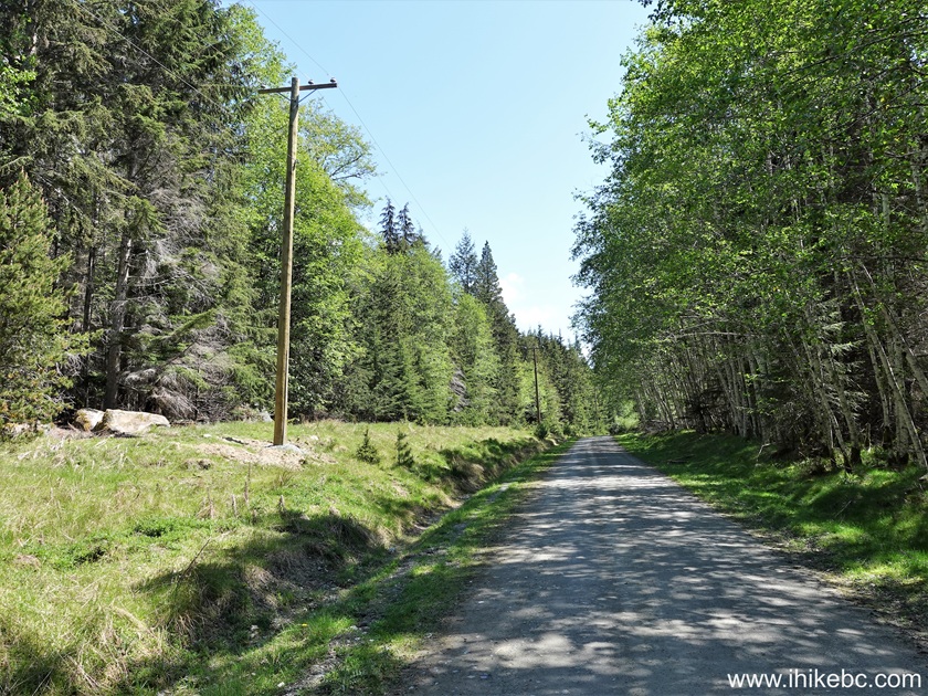
Texada Forest Service Road Branch 04 Start35. At 300 meters of Texada FSR Branch 04. It's a gravel road in a very good shape. Regular clearance 2WD vehicles - ok.
Texada FSR Branch 04 on Texada Island, British Columbia, Canada36. There isn't much to see along the road. Here it is at the 4.3 km mark.
Texada Forest Service Road Branch 0437. After 7.3 km, arriving to the end of Texada FSR Brach 04 Road. Coordinates: N 49⁰37.833' W 124⁰17.153'. Elevation: 45 meters. BC Hydro "Texada East" substation ahead.
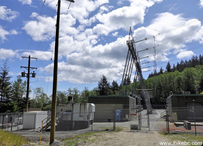
BC Hydro "Texada East" substation at the end of Texada FSR Branch 04Here is Our Video of driving the entirety of Texada FSR Branch 04
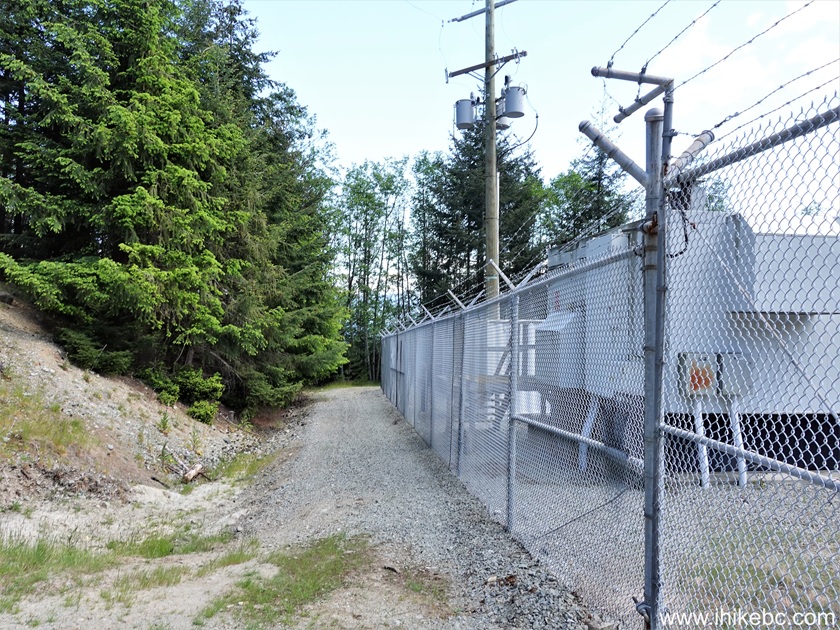
38. Proceed along the fence on the left side to reach the beach in about 200 meters.
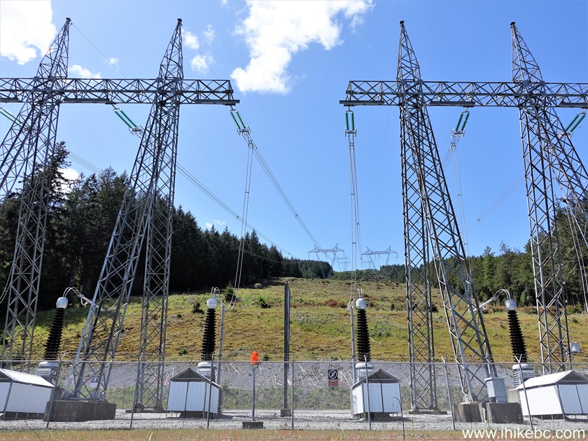
BC Hydro Substation on Texada Island, BC39. A fine view of the substation after we turned around the corner.
BC Hydro Power Lines on Texada Island40. Beach access is down the hill.
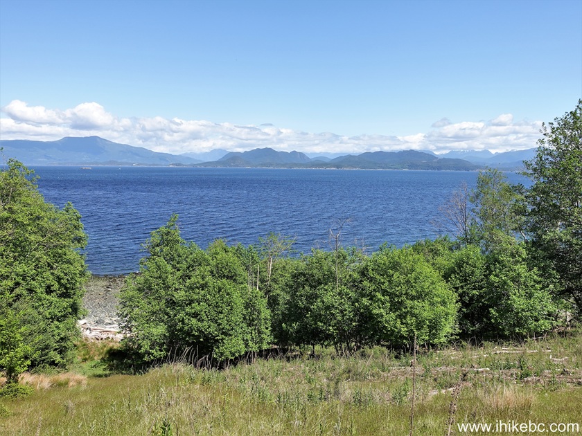
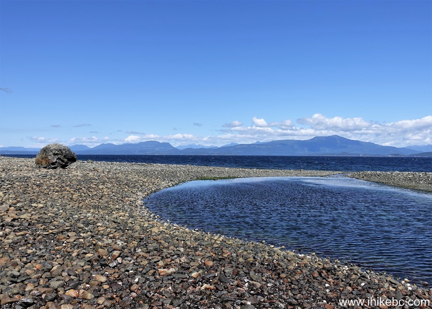
Texada Island - British Columbia - Canada41. It appears to be possible to go for a long distance in either direction once you reach the ocean. We turned right and hiked for about 700 meters. There were several fine views, including this one, at about 280 meters of the actual beach hike.
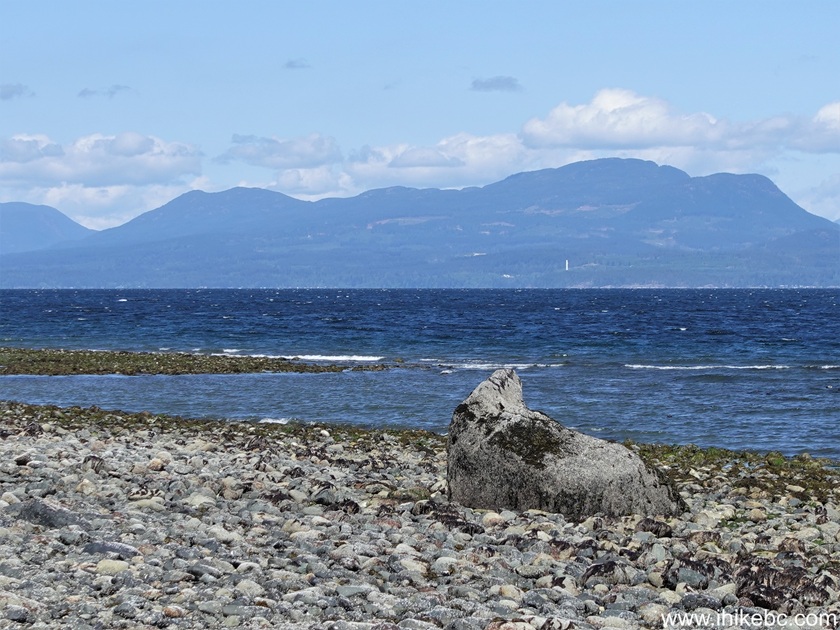
Texada Island42-43. A very neat seal-shaped stone is located about 200 meters further. Coordinates: N 49⁰37.705' W 124⁰16.772'. Elevation: sea level.
Texada Island BC
Seal-shaped stone44. Real seals were nearby, checking us out with much curiosity.
Here is Our Video of the views from this location.
More ihikebc videos are on our YouTube Channel.
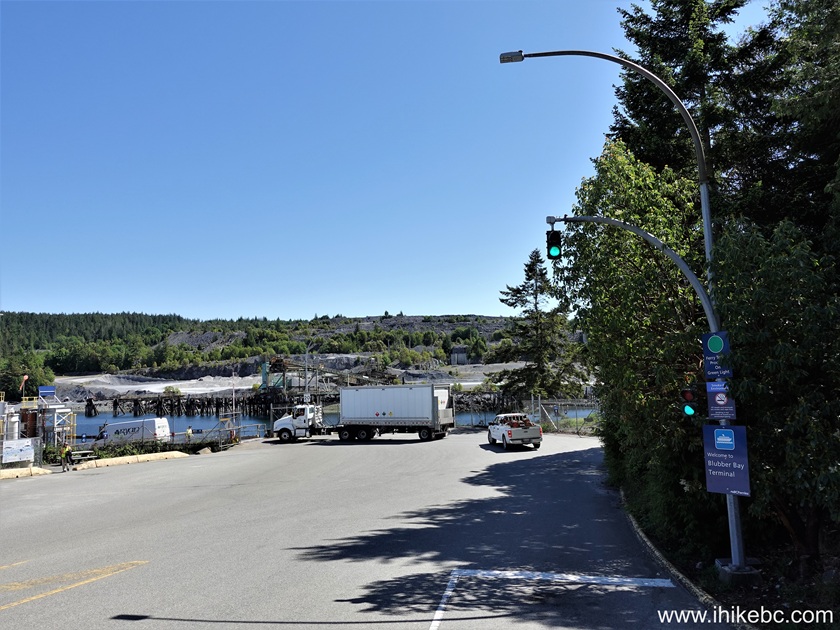
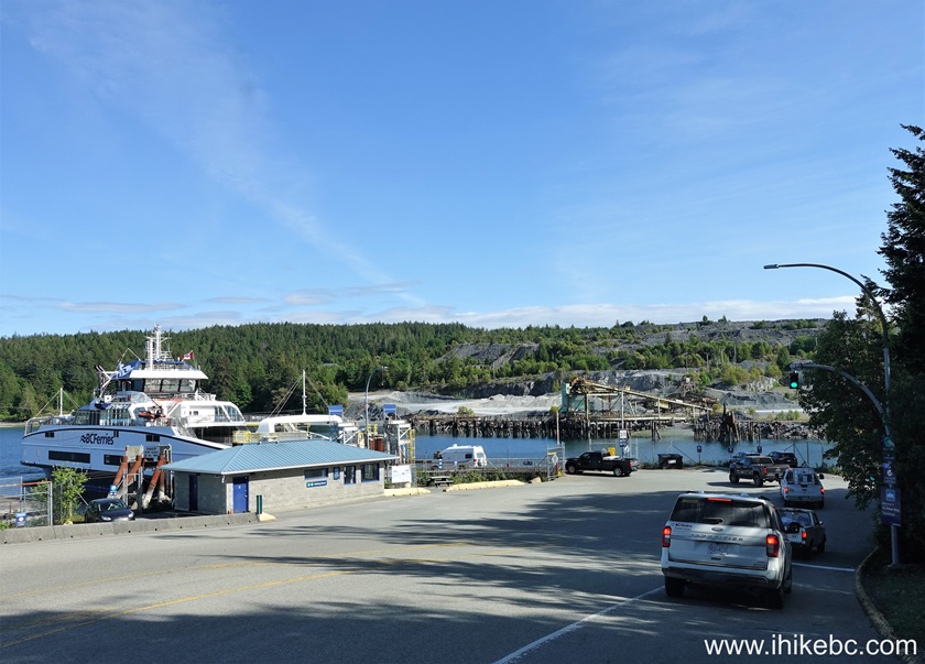
45. After that, it was time to say good-bye to Texada Island. Here we are back at the Blubber Bay Ferry Terminal.
Blubber Bay Ferry Terminal, Texada Island BC46. Happened to arrive when only vehicles carrying dangerous goods were allowed to board...
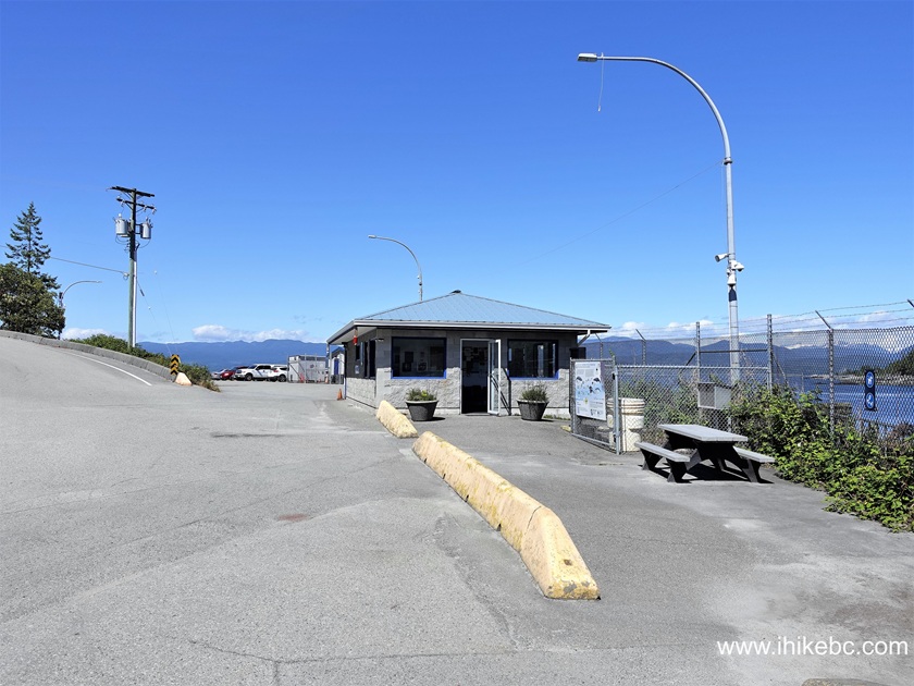
BC Ferries Information Sign on Texada Island47...but that gave us time to check out the parking lot and the passenger lounge. Here is the parking lot.
Texada Island BC - Blubber Bay Ferry Terminal Parking Lot48-49. And here is the passenger lounge.
Blubber Bay Ferry Terminal Passenger Lounge50. A whale information sign by the lounge.
Whale sign on Texada Island NC51. Inside Blubber Bay Ferry Terminal passenger lounge.
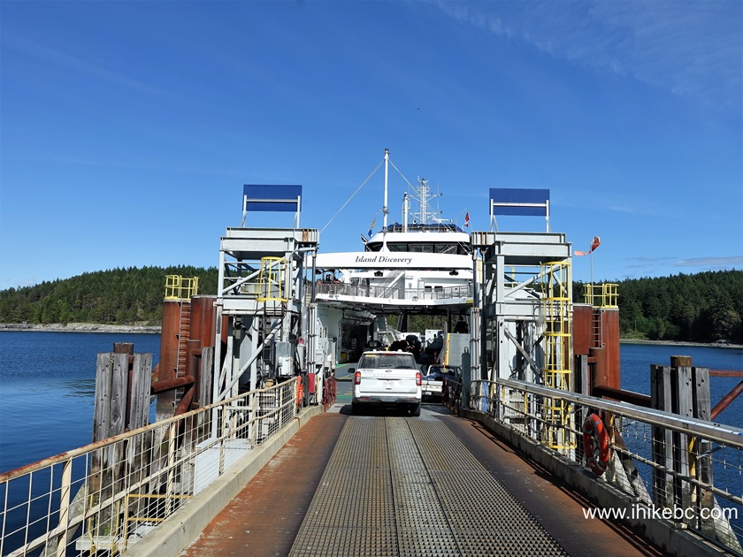
Texada Island BC - Blubber Bay Ferry Terminal Lounge Interior52-53. Here comes Island Discovery.
BC Ferry "Island Discovery"54. BC Ferry Island Discovery docked at Blubber Bay Terminal on Texada Island.
Blubber Bay Ferry Terminal lineup55. Time to board the ferry.
Boarding BC Ferry "Island Discovery" at Blubber Bay Ferry Terminal on Texada IslandHere is our video of boarding BC Ferry Island Discovery.
More ihikebc videos are on our YouTube Channel.
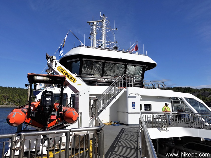
56. Island Discovery bridge.
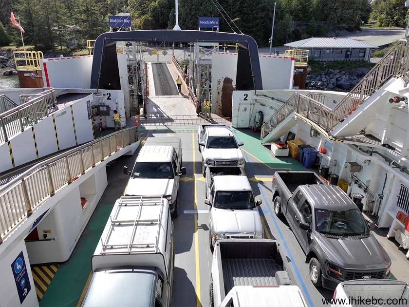
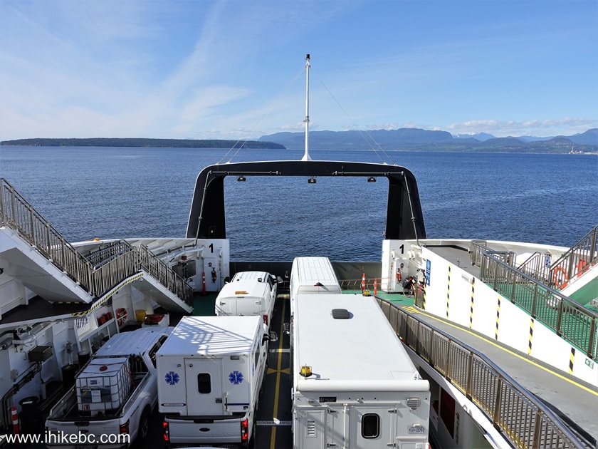
Bridge of BC Ferry "Island Discovery"57. Vehicles on board of Island Discovery.
Vehicles on board of BC Ferry "Island Discovery"58. En route to Powell River - a 50-minute or so ride.
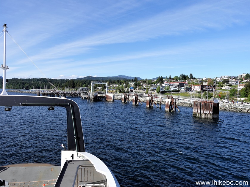
Onboard BC Ferry "Island Discovery"59. Approaching Westview Terminal in Powell River.
Approaching Westview Ferry Terminal in Powell River, BC60. Docking at Westview Ferry Terminal.
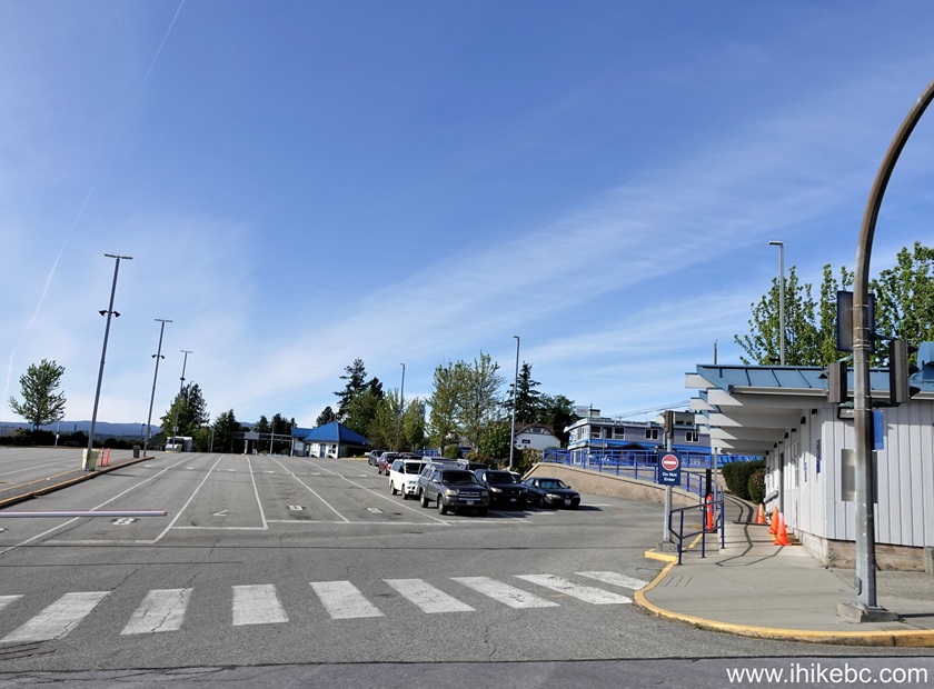
Docking at Westview Terminal (Powell River, British Columbia, Canada)61. Driving by the vehicle waiting area at Westview Terminal.
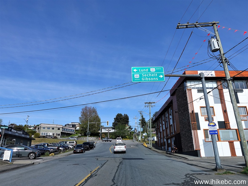
Vehicle line up at Westview BC Ferries Terminal62. Exiting Westview Terminal access road (Wharf Street) and approaching Marine Drive intersection.
Powell River, BCIt has been a good visit to Texada Island. Recommended.


Other Trips:


Follow @ihikebc Tweet


ihikebc.com Trip 327 - Texada Island BC Visit