![]()
![]()
![]()

Trip 307 - May 8, 2024 (Wednesday)
Rim Trail Hike
Mount Maxwell Provincial Park
Salt Spring Island, BC
Liked: A short and easy hike to an observation platform with an amazing panoramic view of Salt Spring Island, Vancouver Island, and lots of water. A picnic table is available.
Vancouver Island, Victoria & Gulf Islands Backroad Mapbook (9th edition) Trailhead Coordinates: Page 11 (Duncan) D3.
Follow @ihikebc Tweet
Mount Maxwell Provincial Park is located on Salt
Spring Island, which is found just off southern Vancouver Island, and is
accessible via a 35 minute ferry ride from Swartz Bay terminal near
Victoria. There are several
ways to reach the main Mount Maxwell observation point with, arguably,
the best view of all the hikes on major Gulf Islands (Galiano, Pender,
Mayne, Saturna, and Salt Spring). The shortest way is to drive all the
way to the parking lot near the observation platform. However, due to a
terrible washboard stretch of about 100 meters long, followed by a
busted 30 meter-long spot, only 4x4 vehicles with decent clearance would
make it all the way to the parking lot. That said, it is possible to get
to within several kilometers of that lot even in a regular vehicle, and
then hike the rest of the way.
The hike is very easy, and can be done either by
hiking on Mount Maxwell Road (there is almost no traffic), or by taking
a parallel Rim Trail, which is what we did.
There is a viewpoint on Rim Trail, and then a main
observation area by the parking lot. There is no fence on Rim Trail,
and, while fence is present by the parking lot, it is easy to go around
it. Beware of enormous drop-offs at both locations!
* All hiking distances are based on a GPS odometer and are approximate.
1. Here is a Google Maps location of Mount Maxwell Provincial Park on Salt Spring Island, BC.
2. We are Southbound on Fulford-Ganges Road, making a right turn onto Cranberry Road. From here, it's about 8.5 km to the parking lot of Mount Maxwell observation area.
Fulford-Ganges Road at Cranberry Road - Salt Spring Island - British
Columbia - Canada
3. At 3.2 km of Cranberry Road.

Cranberry Road Salt Spring Island BC
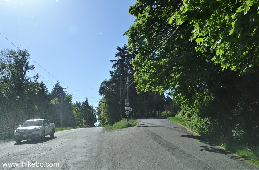
4. At 3.6 km, we are making a left turn from Cranberry Road onto Mount Maxwell Road.

Cranberry Road at Mount Maxwell Road Salt Spring Island British Columbia
5. After the turn. There are several warning signs in regards to rough road conditions ahead.

Mount Maxwell Road Salt Spring Island British Columbia
6. Yet another warning sign at 4.2 km from Fulford-Ganges Road.
Salt Spring Island - Mount Maxwell Road
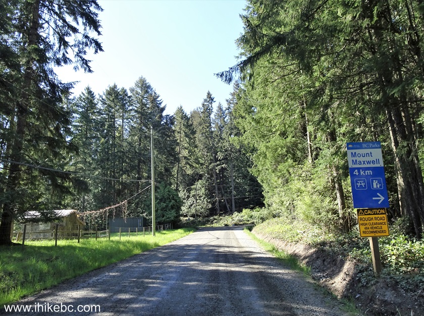
7. One more sign at 5.9 km warns of rough road ahead. There is a pullout right in front of it - a good place to park if you have a regular vehicle.
Salt Spring Island British Columbia - Mount Maxwell Road - Rough Road
Ahead Warning
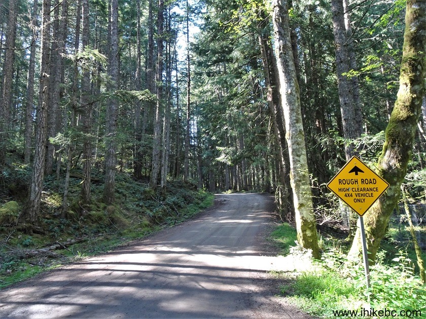
8. At 6.3 km there is a very rough washboard stretch for 100 meters. If you can make it, park by the gate at 6.5 km, seen on the left side in the photo below. Coordinates: N 48⁰48.978' W 123⁰31.852'. Elevation: 345 meters. Otherwise, park at a pullout seen in photo #7. Unless you have a 4x4 with decent clearance, which then would allow you to go through the last road challenge 150 meters later.

Mount Maxwell Road Rough Stretch
9. And here is a rough stretch of about 30 meters long approximately 150 meters past the gate seen in the photo above. It's worse than it looks - we could not make it in our 4x2 medium clearance vehicle, and went back to park by the gate.

Rough Stretch of Mount Maxwell Road on Salt Spring Island BC
Here is our video of driving from Ganges up to this point.
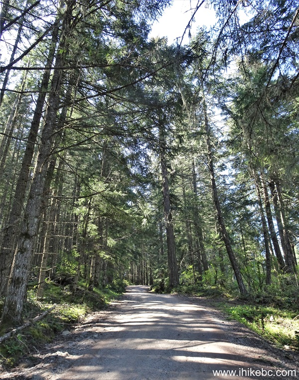
10. We then went hiking. At 260 meters from the gate in photo #8. Mount Maxwell Road is in very decent shape all the way to the parking lot past the challenging spot in photo #9.
Hiking on Mount Maxwell Road Salt Spring Island BC Canada
11. At 590 meters, a sign indicates 1.8 km to the parking lot. See the fence on the right side? The is where Rim Trail begins - it parallels Mount Maxwell Road, but does meander a bit. Trailhead coordinates: N 48⁰48.652' W 123⁰31.850'. Elevation: 495 meters.

Mt. Maxwell Provincial Park Sign
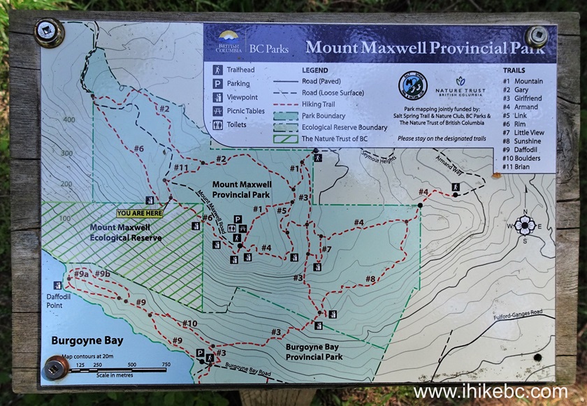
12. There is a map of Mount Maxwell Trails by the fence, and "you are here" in the upper left corner is where we are at the Rim Trail trailhead. You can see Mount Maxwell Road as a black dotted line between trails #2 above it (Gary Trail) and trail #6 below it (Rim Trail). The map also shows that it is possible to get to Mount Maxwell observation area, which we indicated with a red arrow, from Burgoyne Bay Provincial Park via a much longer hike. Or, if you have two vehicles, it is possible to do a car shuttle for a one way hike. There are also other trailheads, as seen in the map below.

Mount Maxwell Provincial Park Trail Map
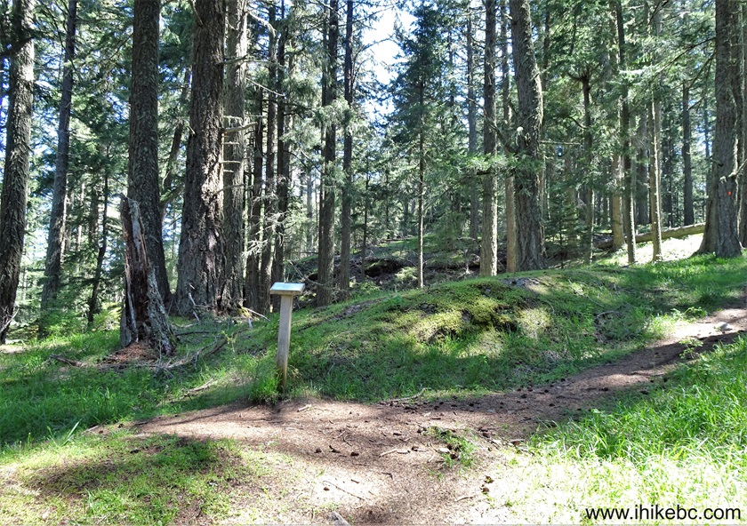
13. At 700 meters of Rim Trail in Mount Maxwell Provincial Park on Salt Spring Island, BC. It's an easy and pleasant hike in the forest.

Rim Trail Hike on Salt Spring Island BC
14. A much obstructed view at the 980 meter mark, a harbinger of much better views to come.

View from Rim Trail in Mount Maxwell Provincial Park on Salt Spring
Island British Columbia Canada
15. Trail number markers make it easy not to get lost, especially once trails start intersecting.
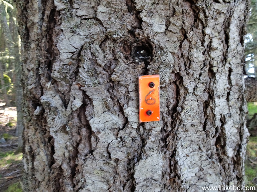
Trail number 6 (Rim Trail) - Mount Maxwell Provincial Park
16. At 1.02 km of Rim Trail.

Hike on Salt Spring Island - Rim Trail
17-18. At 1.12 km, there is a junction. Brian Trail (#11) is to the left, and Rim Trail (#6) continues on the right side.
Salt Spring Island BC - Mount Maxwell Provincial Park - Rim Trail at
Brian Trail
Map of Trails in Mount Maxwell Provincial Park
19-21. Another rather overgrown view is at the 1.43 km mark. Plain and zoomed. Coordinates: N 48⁰48.203' W 123⁰31.227'. Elevation: 575 meters. Watch out for the drop-off!


22. Rim Trail continues. At 1.51 km from the trailhead now.

Hiking on Salt Spring Island in Mount Maxwell Provincial Park
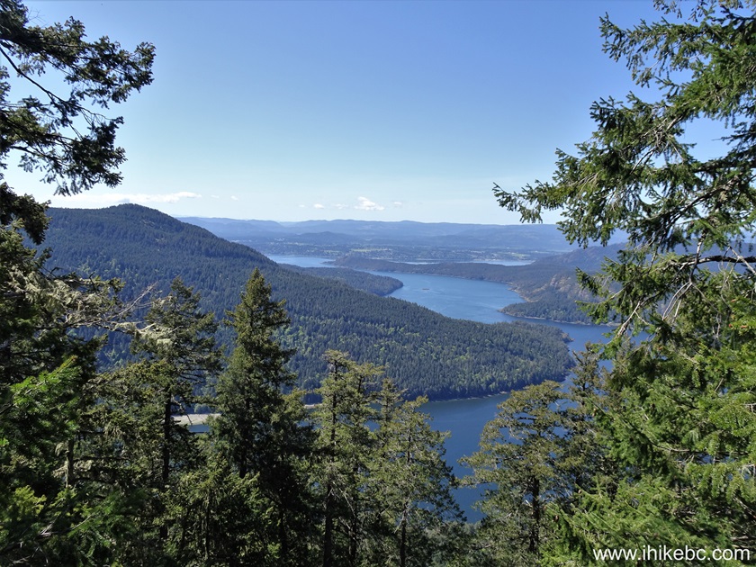
23. At 1.60 km, an amazing Rim Trail viewpoint has arrived.
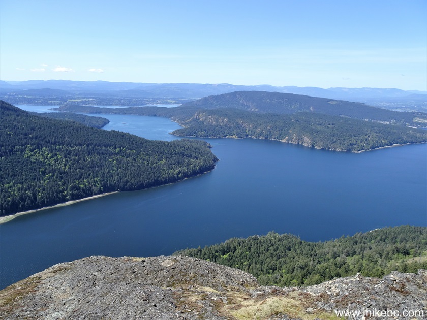
View from Salt Spring Island (Mount Maxwell Provincial Park)
24-28. Left to right, followed by a panorama. Mount Maxwell observation area (fenced off) can be seen in photo #24 in the far upper-left. Burgoyne Bay is in photo #25. This is where Burgoyne Bay Provincial Park is located, with an alternative trailhead to Mount Maxwell observation area. Vancouver Island is in the background in photos #26 and #27.


Here is our video of the views from this location.
29. WARNING - DANGEROUS AREA! While looking at all this beauty, do watch your step - it's a 200+ meter vertical drop at this point.

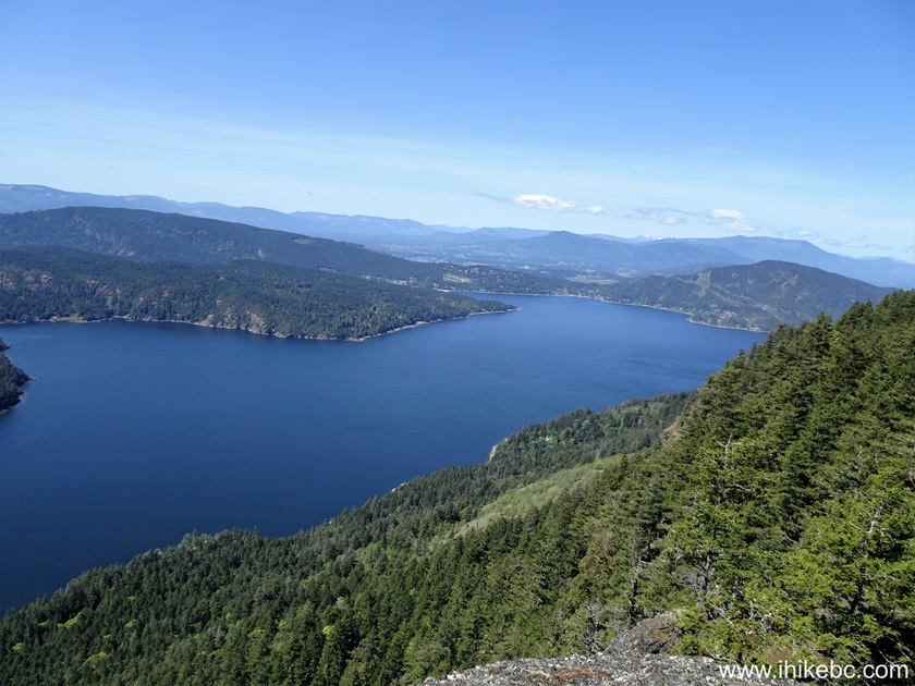
30. We hiked for another 120 meters, and reached Mount Maxwell observation area.

31. The views here are (almost) the same, but you gain more of a view to the left (towards Fulford Harbour) and lose a bit of a view to the right.

32. A bit further. That's Fulford Harbour (with a ferry terminal - service to Swartz Bay on Vancouver Island) far ahead.

Salt Spring Island, British Columbia, Canada
33. A panorama from this location.

Panoramic View from Rim Trail on Salt Spring Island, BC
Here is our video of the views from Mount Maxwell observation area.
More ihikebc videos are on our YouTube Channel.
34. There is a picnic table by the observation area.

Picnic Table in Mount Maxwell Provincial Park British Columbia Canada
35. And here is a parking lot at the end of Mount Maxwell Road, accessible by capable 4x4 vehicles with decent clearance. Coordinates: N 48⁰48.102' W 123⁰31.018'. Elevation: 585 meters. A pit toilet is located by the parking lot.
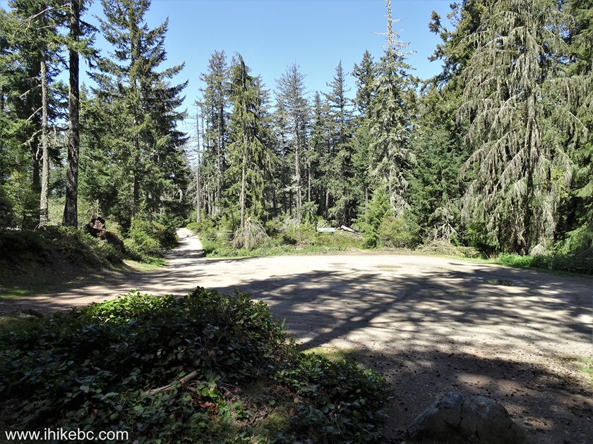
Parking lot for Mount Maxwell Provincial Park on Salt Spring Island
Rim Trail in Mount Maxwell Provincial Park on Salt Spring Island is short, easy, and leads to amazing views. Highly recommended.


|
 |
Other Trips:


![]()
![]()
![]()
ihikebc.com Trip 307 - Rim Trail Hike (Salt Spring Island, BC)