![]()
![]()
![]()

Trip 306 - May 6, 2024 (Monday)
Coastline Trail Hike
Ruckle Provincial Park
Salt Spring Island, BC
Page 2 of 2
Liked: Several fine coastline/ocean views, fairly easy trail, shade in the forest, no bugs.
Of Note: Uneven ground, rocks and roots, several unbarricaded drop-offs, a few moderately steep sections – hiking poles and boots are recommended.
Vancouver Island, Victoria & Gulf Islands Backroad Mapbook (9th edition) Trailhead Coordinates: Page 11 (Duncan) G3.
Follow @ihikebc TweetCoastline Trail is a fairly easy hike of about 5.3 km one way along the coast of Salt Spring Island. You get to see pretty coves, passing BC ferries, and ocean vistas while walking through a forest from one viewpoint to another. Ruckle Provincial Park has a few other trails, which go into the depth of the park away from the coast, so there are more hiking opportunities. As well, there is a campground for campers among us.
The drive from Fulford Harbour ferry terminal (service to Swartz Bay on Vancouver Island) to Ruckle Provincial Park - Coastline Trail is just under 10 km-long one way, and is very easy. There is plenty of parking by the trailhead. Note that there are two other ferry terminals on Salt Spring Island, with service from other locations, so you will take a bit longer to get to the trailhead, if you arrive to this island via a different ferry terminal.
The trail starts about 70 meters from the parking lot and goes along Swanson Channel to Cusheon Cove. Keep making right turns at all the splits to stay close to the coast. There are trail maps with your current location at some junctions too.
* All hiking distances are based on a GPS odometer and are approximate.
29. At 1.39 km, Coastline Trail goes through an open gate.
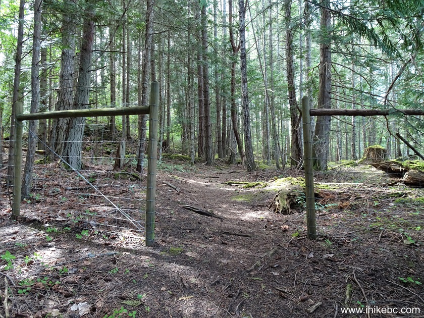
Coastline Trail in Ruckle Provincial Park on Salt
Spring Island British Columbia Canada
30. 40 meters later.
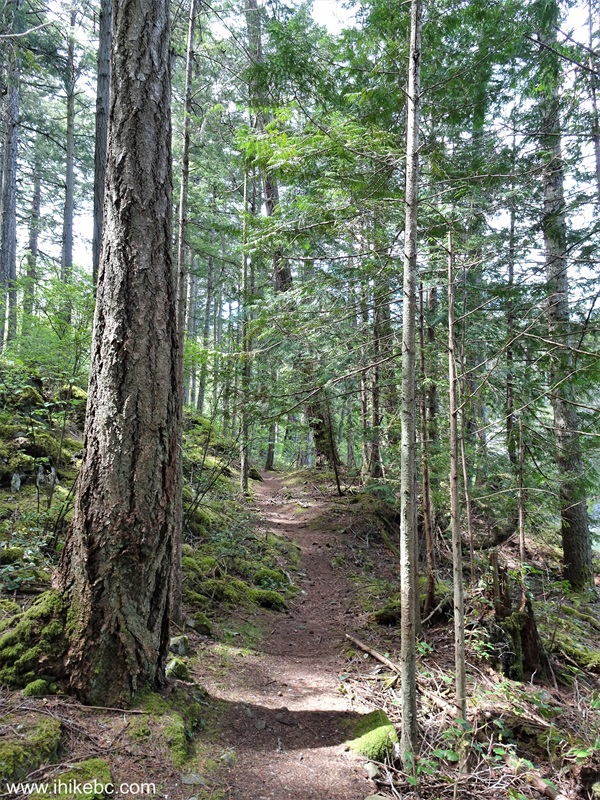
Hike on Salt Spring Island - Coastline Trail
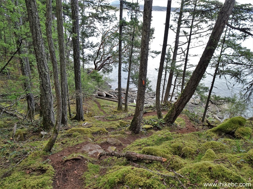
31. At 1.56 km, a sign advises that the stretch of Coastline Trail in Ruckle Provincial Park between Bear Point and Kings Cove is rugged. Admittedly, the trail ahead is a bit rougher than prior to the sign, but nothing too complicated.
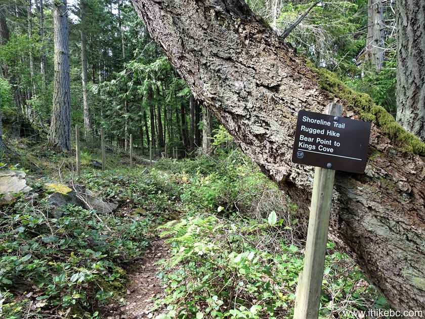
Ruckle Provincial Park Hiking Coastline Trail
32. At 1.65 km from the trailhead.
Hiking in Canada - Coastline Trail on Salt Spring
Island BC
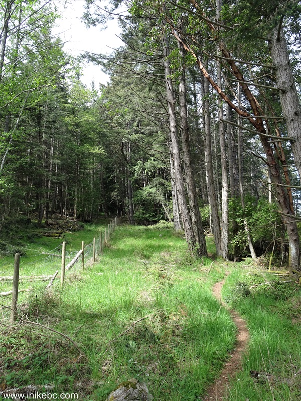
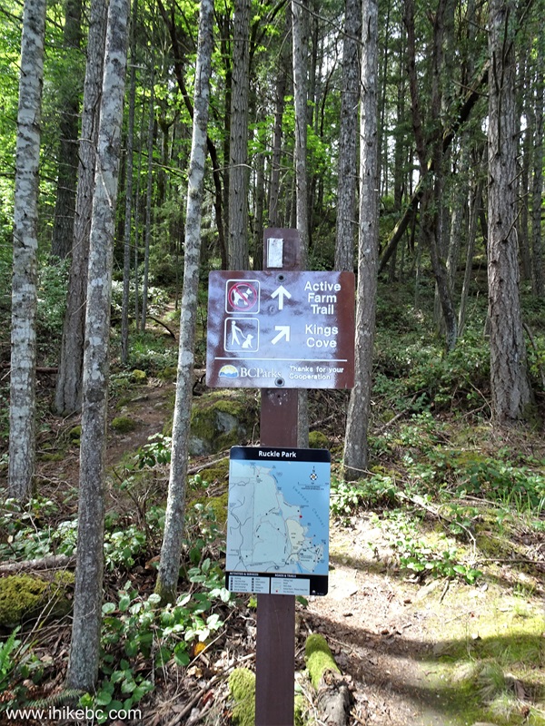
33-35. At 1.70 km, there is a split with Active Farm Trail heading deep into Ruckle Provincial Park. Keep right to remain on Coastline Trail.
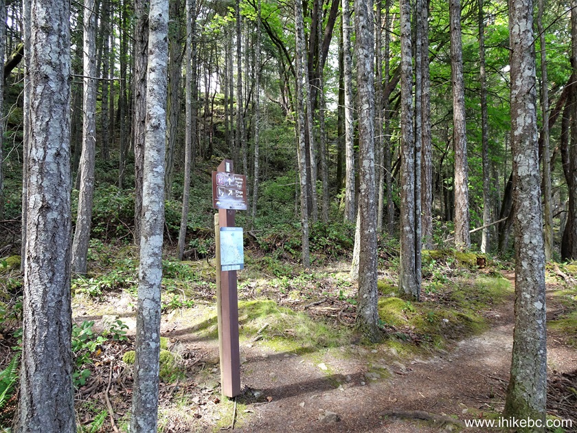
Coastline Trail at Active Farm Trail in Ruckle
Provincial Park
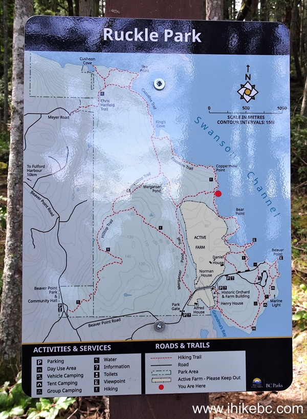
Ruckle Park Trail Map
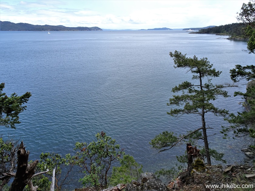
36. A good view 100 meters later.

View from Coastline Trail on Salt Spring Island, BC
37. And a very fine observation point at 1.98 km of Coastline Trail. It was neat to seat on a mossy log and watch the ocean with a ferry passing by.
View from Coastline Trail on Salt Spring Island BC
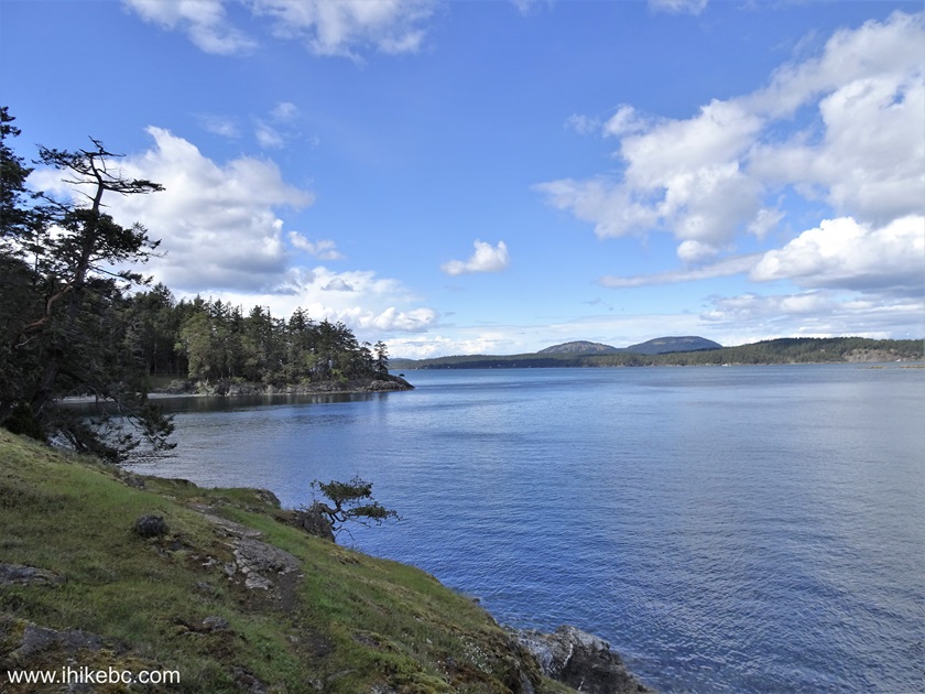
38. Another good view at the 2.39 km mark.

Salt Spring Island BC Canada
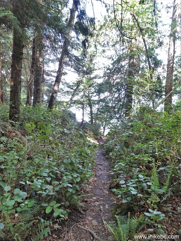
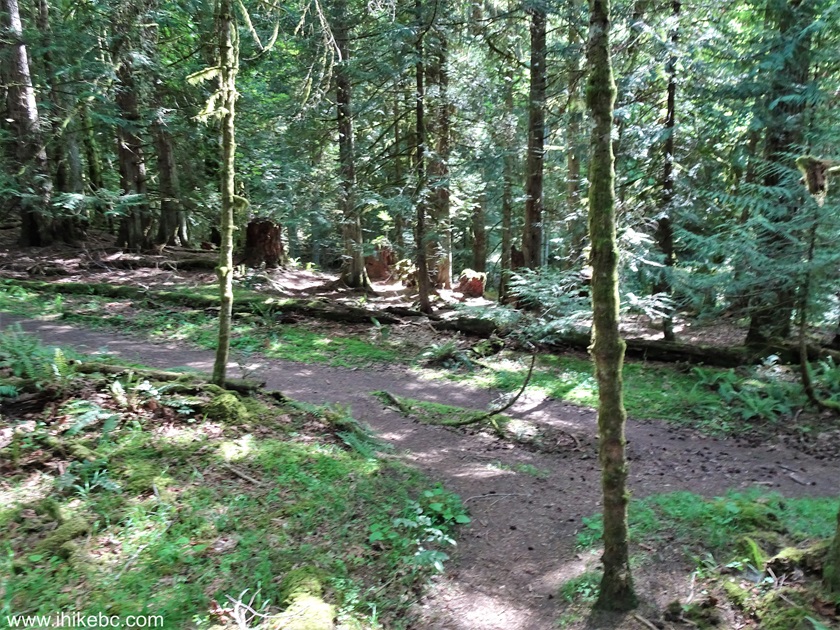
39. More forest hiking at 3.06 km of Coastline Trail in Rucker Provincial Park on Salt Spring Island, BC.
Hike on Salt Spring Island - Coastline Trail
40. A small bridge at the 3.35 km mark.
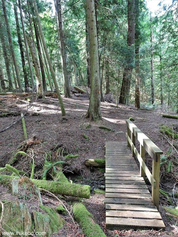
Coastline Trail Hike on Salt Spring Island BC Canada
41. At 3.41 km, we have reached a junction with Hilltop Trail near King's Cove.
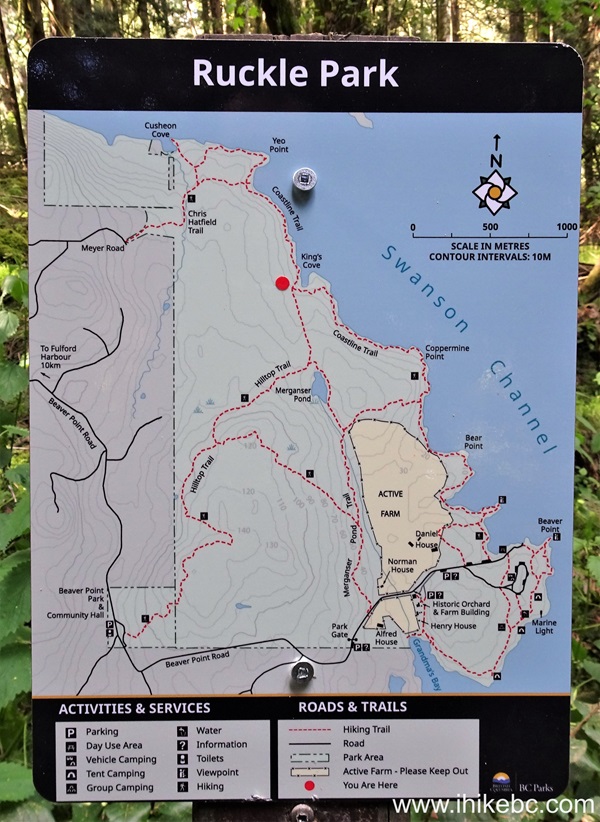
Map of Ruckle Park on Salt Spring Island
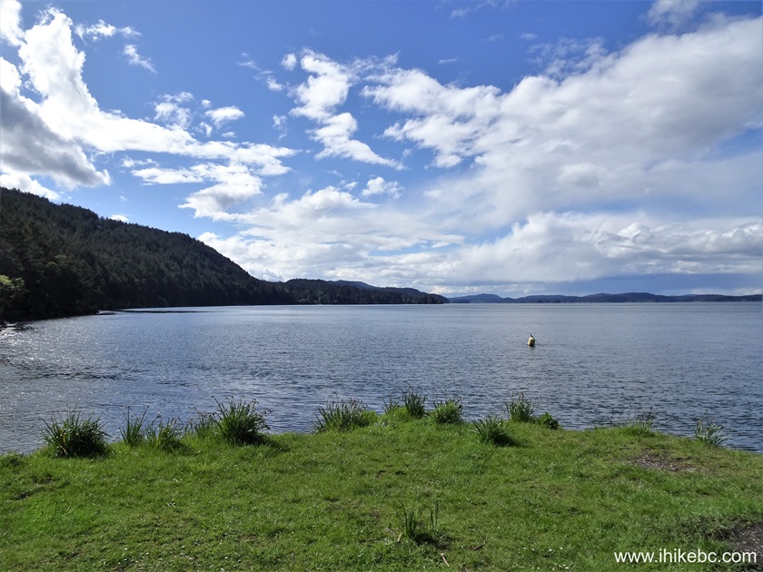
42. A view at 3.83 km of Coastline Trail.
Salt Spring Island BC Canada
43. Now at the 3.97 km mark.
View from Ruckle Provincial Park on Salt Spring
Island BC
44. Coastline Trail in Rucker Provincial Park at the 4.25 km mark.
Hike in British Columbia on Salt Spring Island -
Coastline Trail
45. A neat view at 4.37 km of the trail.

View from Ruckle Provincial Park on Salt Spring
Island, BC
46. A bit more hiking in the forest...

Coastline Trail on Salt Spring Island
47. ...and we have reached Yeo Point, where the trail used to end at the 4.48 km mark. Coordinates: N 48⁰47.814' W 123⁰23.515'. Elevation: approximately sea level.
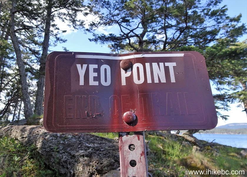
Yeo Point - Ruckle Provincial Park - Salt Spring
Island BC
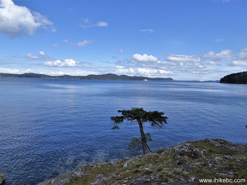
48. The view from Yeo Point.
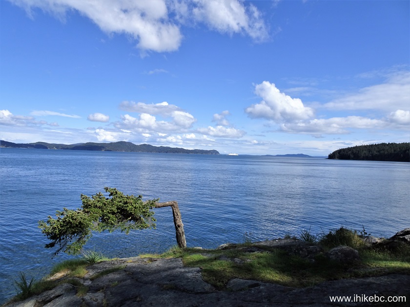
View from Yeo Point on Salt Spring Island BC
Here is our video of the views from Yeo Point.
More ihikebc videos are on our YouTube Channel.
49. There is then a bit more of hiking in the forest. Turn right at the junction at 5.07 km of Coastline Trail.
Hiking on Salt Spring Island
50. The new trail end comes at 5.30 km in Cusheon Cove. Coordinates: N 48⁰47.873' W 123⁰23.998'. Elevation: 5 meters.
Salt Spring Island BC - Ruckle Provincial Park
Coastline Trail in Rucker Provincial Park is fairly easy and leads to many pleasant views. Highly recommended.


|
 |
Other Trips:


![]()
![]()
![]()
ihikebc.com Trip 306 - Coastline Trail Hike (Salt Spring Island, BC) -
Page 2 of 2