Trip 333 - May 20, 2025 (Tuesday)
Sunshine Coast Trail Hike To Gibraltar Viewpoint
Between Lund and Powell River, British Columbia, Canada
Liked: Gibraltar Viewpoint, several fine forest scenes, a picturesque creek crossing, shade in the forest, no bugs.
Of Note: Industrial traffic possible on access road, steep unbarricaded dropoffs at Gibraltar Viewpoint, easy to moderately difficult trail with rocks and roots, hiking poles and boots are recommended.Vancouver, Coast & Mountains Backroad Mapbook (2019 edition) trailhead location:
Page 18 (Powell River) E2.Related Website: Sunshine Coast Trail - Official Website.
Follow @ihikebc TweetSunshine Coast Trail is a monumental 180 km-long wilderness hike on Sunshine Coast of British Columbia. It stretches from near Lund, BC (the northern trailhead) to Saltery Bay Ferry Terminal South of Powell River, BC. Logistically, it is easier to hike this trail North to South, as the northern end is fairly difficult to get to, whereas the southern end is right by the ferry terminal. So, quite a few people, if they choose to hike the entire Sunshine Coast Trail at once, get a shuttle (in a 4x4 SUV) from Powell River to Sarah Point Hut, and then hike to Saltery Bay, where they can catch a ferry right after finishing their hike.
Sunshine Coast Trail is Sunshine Coast's answer to Vancouver Island's Juan De Fuca Trail (here is our trip report), with one substantial difference - Sunshine Coast Trail is four times longer. Other than that, it's the same general concept - easy to moderately difficult hiking through the woods with ocean views here and there, and with numerous camping opportunities (overnight stays require paying a small fee). And there is also a possibility of doing several day hikes, as opposed to hiking the whole thing, as there are numerous access roads to various parts of the trail.
After hiking yesterday the first 5 km of Sunshine Coast Trail from its northern end at Sarah Point, today we hiked for just under 5 km (round trip) to Gibraltar Viewpoint.
*All trail distances are based on a GPS odometer and are approximate.
1. Here is a Google Maps location of Trinket Trail trailhead. This is actually Sunshine Coast Trail to Gibraltar Viewpoint (going Right), and to Toquenachfalls Bridge (going Left). Trinket Trail does branch off Sunshine Coast Trail, runs parallel, and then joins back in. It is so called because people used to leave trinkets along the trail, but now there is, apparently, a "no plastics" policy in effect, so few trinkets are still there. We haven't visited Trinkets Trail, but do indicate in the trip report where it begins and ends off Sunshine Coast Trail to Gibraltar Viewpoint.
2. We are southbound on Sunshine Coast Highway between Lund (12.5 km behind us) and Powell River (15 km ahead), getting ready to turn Left onto Southview Road.
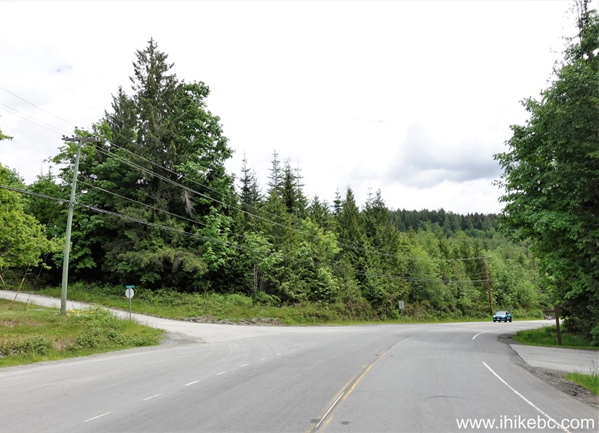
3. Southview Road immediately after the turn.
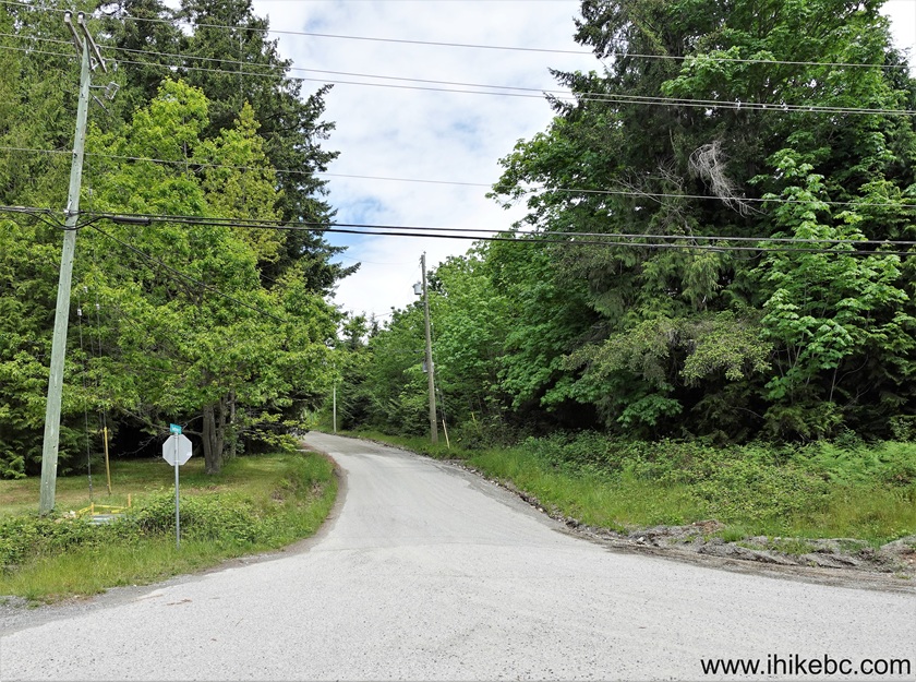
4. Southview Road 300 meters after the turn. Watch for industrial traffic.
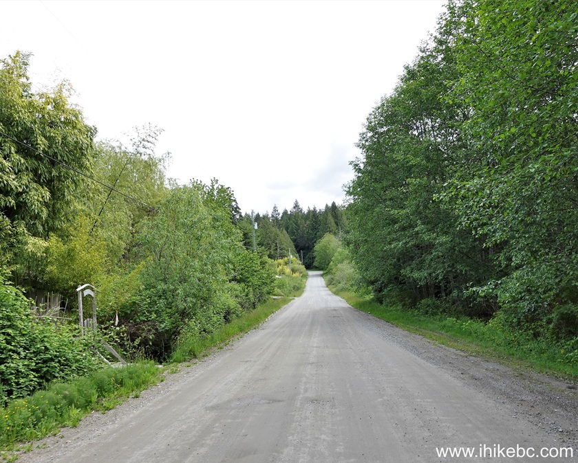
5. Southview Road ends, and Theodosia FSR Branch 2 begins 1.5 km after the turn.
6. Theodosia FSR 2.8 km after the turn.
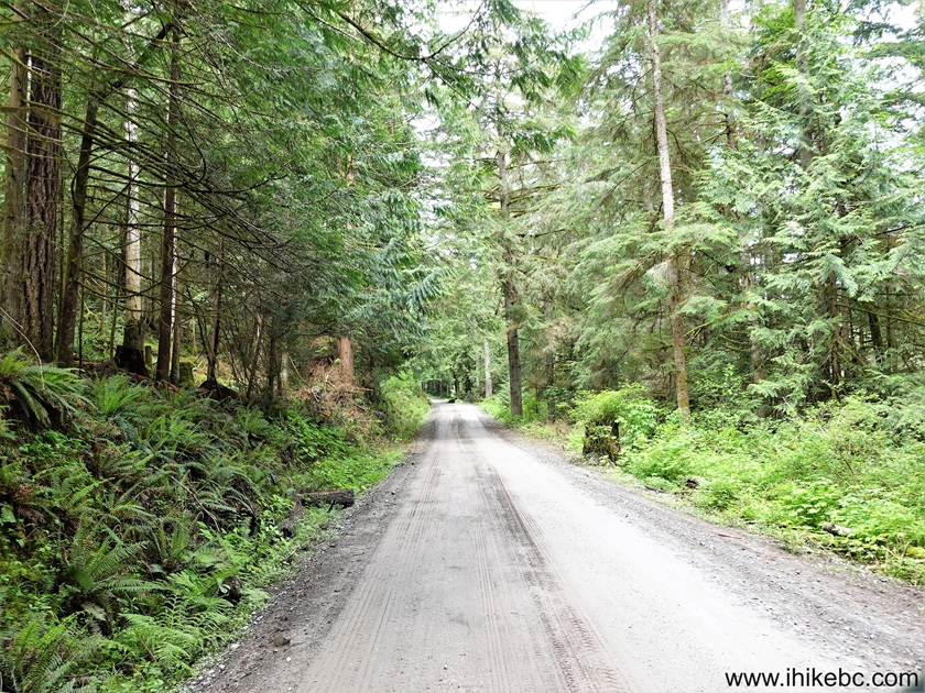
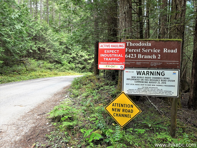
7. Arriving to Sunshine Coast Trail 3.4 km after turning from Sunshine Coast Highway onto Southview Road. The road is in decent shape.
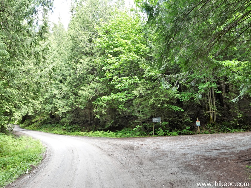
8-9. Here is a close-up of a map seen in the middle-right of the photo above. The trailhead to Gibraltar Viewpoint is just to the right of the map. The northbound hike is across the road on the left side.


10. Homestead Creek Recreation Site is also on the right side, about 50 meters past the trailhead. Go across a small bridge...

11...and the recreation site is right there. A pit toilet is present (but no garbage cans).

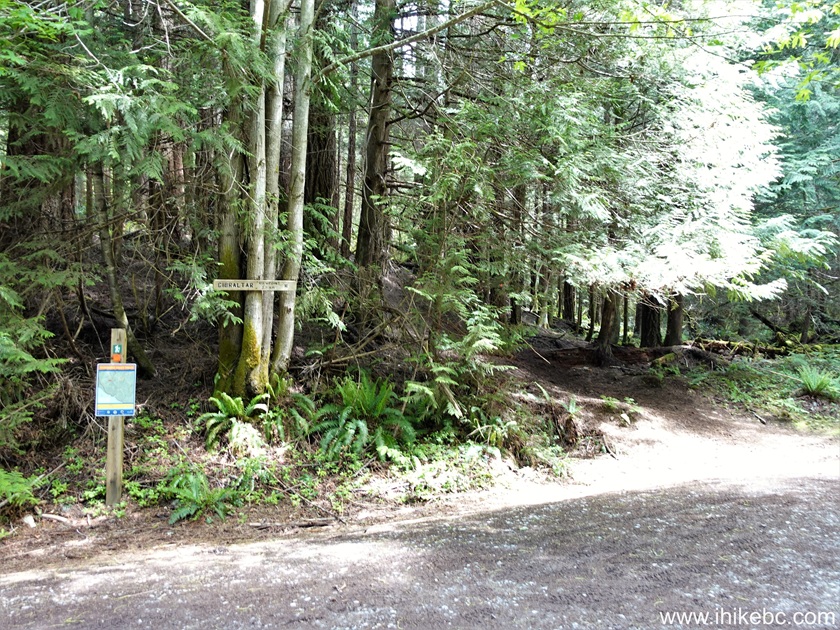
12. We are back at the trailhead of Gibraltar Viewpoint Hike. Coordinates: N 49⁰56.441' W 124⁰38.856'. Elevation: 130 meters. It's about 2.4 km one way, whereas the entire Sunshine Coast Trail is 180 km from Lund to Saltery Bay (South of Powell River).
13. The hike begins. 45 meters from the trailhead.

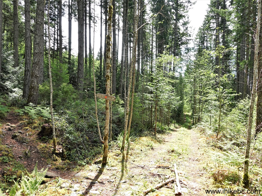
14. Trinket Trail (parallel to Sunshine Coast Trail) begins on the Left side at the 580 meters mark.

15. At 630 meters of Gibraltar Viewpoint Hike. The trail generally descends to the bridge seen ahead, and then starts climbing up.

16. Here is that bridge.

17. Now at 830 meters of Sunshine Coast Trail - Gibraltar Viewpoint hike.
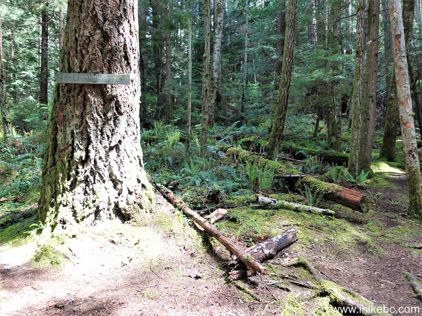
18-19. At 1.19 km, the trail crosses a road of some kind.

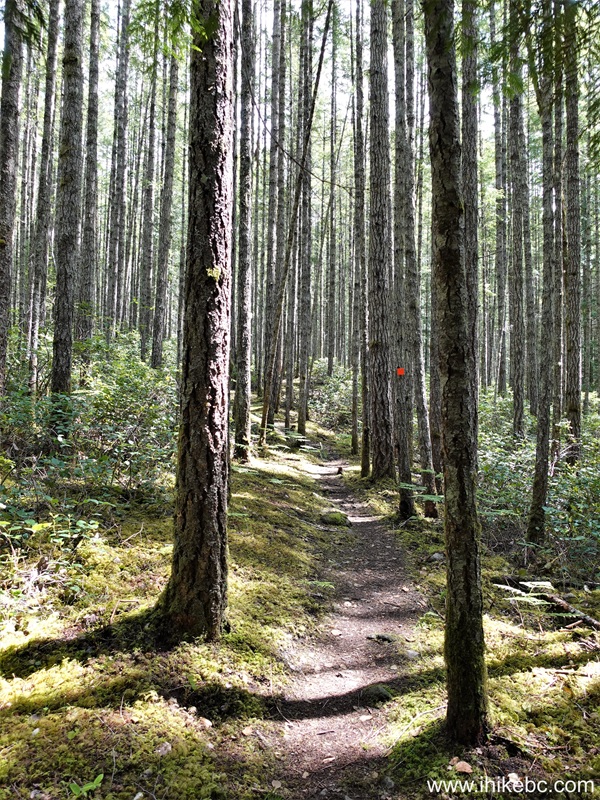
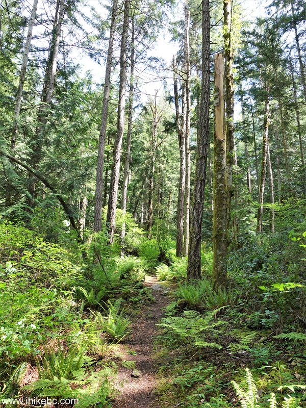
20. At 1.26 km. Fine forest hiking.
21. At 1.39 km, Trinket Trail rejoins us from the Left side.
22. At the 1.76 km mark of Gibraltar Viewpoint hike of Sunshine Coast Trail (southbound).

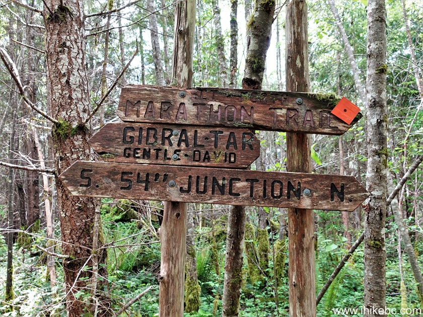
23-24. At 2.08 km, we are at a split. Coordinates: N 49⁰56'527 W 124⁰37.806'. Elevation: 350 meters. Sunshine Coast Trail continues on the Left side, while Gibraltar Viewpoint Trail is on the Right. Marathon Trail signs here and there refer to a local running event.

25. Trail to Gibraltar Viewpoint 200 meters after the junction.

26. At 360 meters, we are almost there.
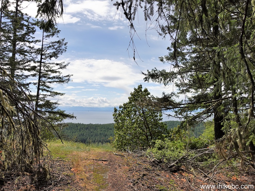
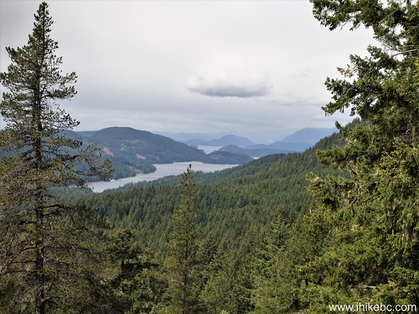
27-31. And here is Gibraltar Viewpoint. Left to right, followed by a panorama. A small island off the coast straight ahead is called Ahgykson Island. Watch your step due to steep unbarricaded dropoffs.
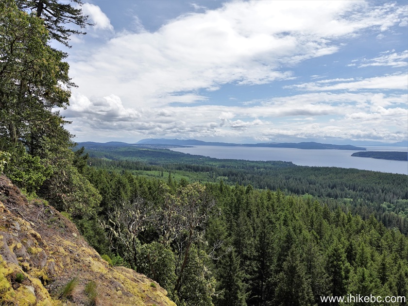
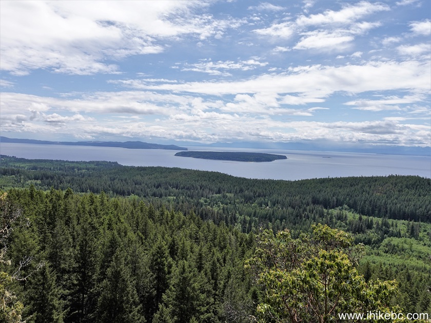
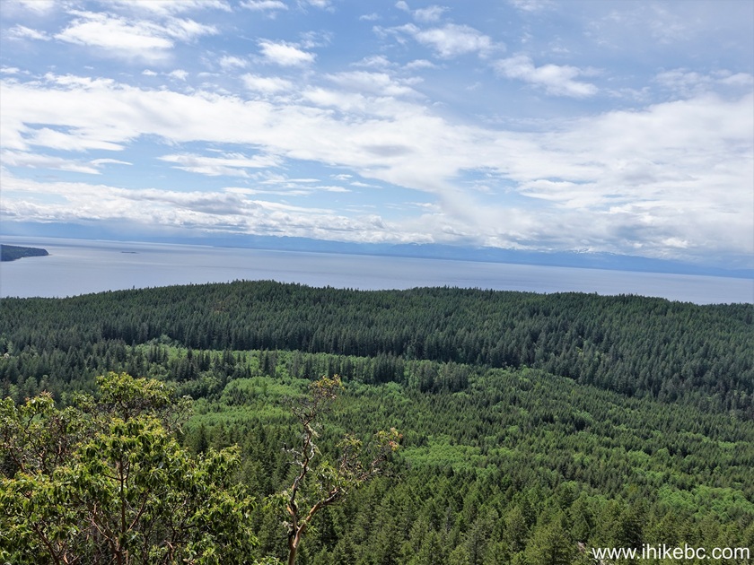

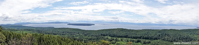
32-34. There are two benches and two picnic tables at the viewpoint, which is fairly large. 50 meters to the right there is another viewpoint of small islands in the distance.

Here is Our Video of
the Views from Gibraltar
Viewpoint.
More ihikebc videos are on
our YouTube Channel.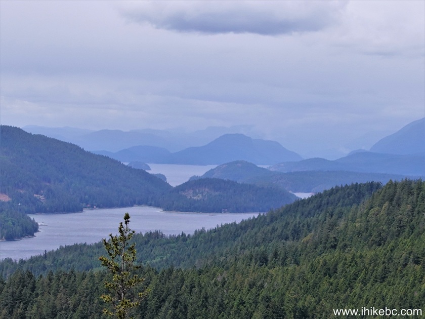
Gibraltar Viewpoint Hike of Sunshine Coast Trail is fairly short and easy, and features good views from the viewpoint. Recommended.


|
 |
Other Trips:


![]()


![]()
![]()
![]()
ihikebc.com Trip 333 - Sunshine Coast Trail Hike To Gibraltar Viewpoint (Between Lund and Powell River BC)