![]()
![]()
![]()

Trip 321 - September 13, 2024 (Friday)
South Chilcotin Mountains Provincial Park Visit
Near Gold Bridge, BC
Page 2 of 3
Liked: Numerous great mountain and valley views, shade in the forest on the access road, not terribly difficult trails, no bugs.
Vancouver, Coast & Mountains Backroad Mapbook (2019 edition) Park Coordinates : Page 51 (Gold Bridge) B1.
Related Website: South Chilcotin Mountains Provincial Park - BC Parks Official Website.
Follow @ihikebc TweetSouth Chilcotin Mountains Provincial Park is a huge remote park located near the settlement of Gold Bridge, closer to the end of BC Highway 40, which starts 90+ km earlier in Lillooet. There are numerous long trails in the park, and we hiked a small portion of those in the south-eastern corner. To see much more than that one would have to prepare to spend at least one night camping, while we did a day trip, which consisted of hiking a part of High Trail, then Camel Pass Trail, and, finally, Ridge-O-Rama trail to complete the loop.
There were panoramic mountain views everywhere, looking impressive even despite a cloudy day. With the sun out, it would be even more impressive. What was surprising were several motorcycle tracks along our entire route, even where it was rather dangerous. We later learned that this area is popular with mountain bikers, but those tracks were certainly from a motorcycle. So, watch out while hiking in this mountainous area, lest you be run over by a motorcycle! Please, note that only hikers, horse riders, and bicycle riders are allowed in the park.
There are several access point to South Chilcotin Mountains Provincial Park, and we used the one off Tyaughton Lake Road, which begins off BC Highway 40 about 12 kilometers East of Gold Bridge. There are no signs leading to the park, and several not-so-obvious turns, so check out our photo directions, as well as a video of the drive from Highway 40 to Cinnabar Mining Road, which leads to High Trail trailhead.
* All trail distances are based on a GPS odometer and are approximate.
34. Camel Pass Trail at the 320 meter mark.
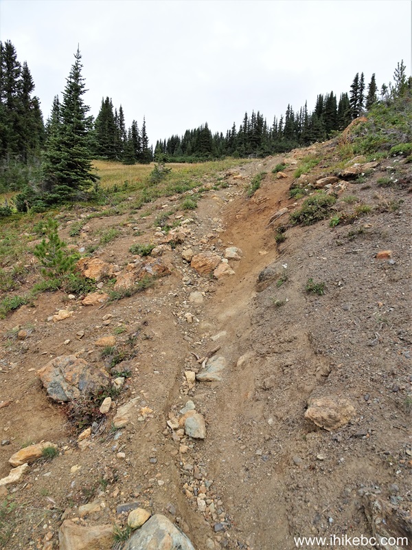
Camel Pass Trail - South Chilcotin Mountains Provincial Park - near Gold
Bridge BC Canada
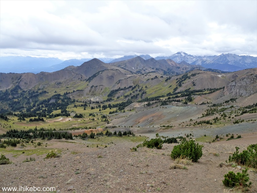
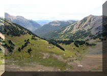
35. A fine view to the left 40 meters later.
South Chilcotin Mountains Provincial Park British Columbia Canada
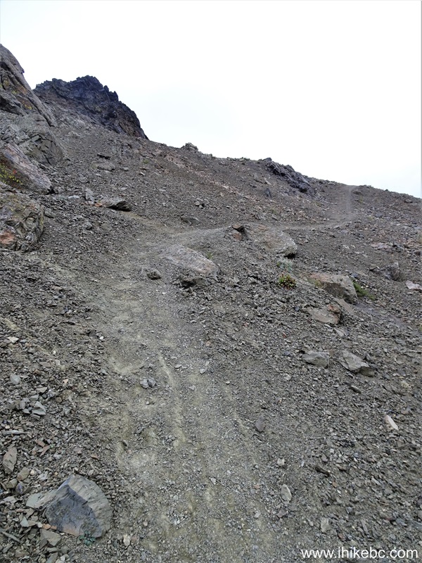
36. At 420 meters of Camel Pass Trail in South Chilcotin Mountains Provincial Park, British Columbia, Canada.

Camel Pass Trail
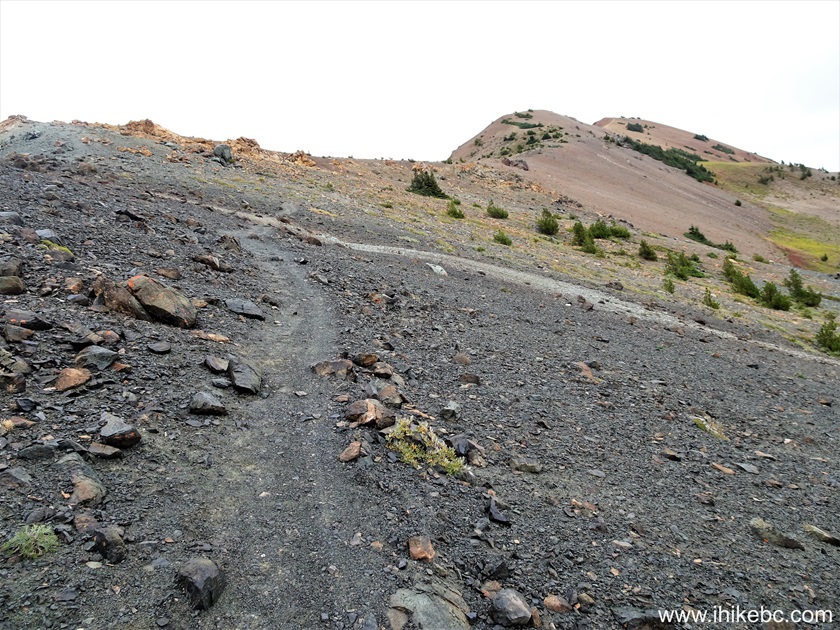
37. Looking back at the 660 meter mark.
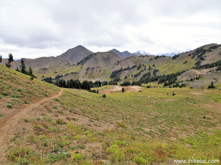
Hike in Gold Bridge BC Area - Camel Pass Trail in South Chilcotin
Mountains Provincial Park
38. Now looking forward 60 meters later.
British Columbia Hiking in South Chilcotin Mountains Provincial Park
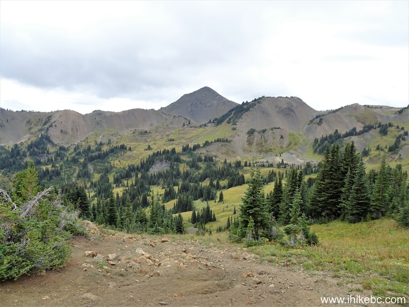
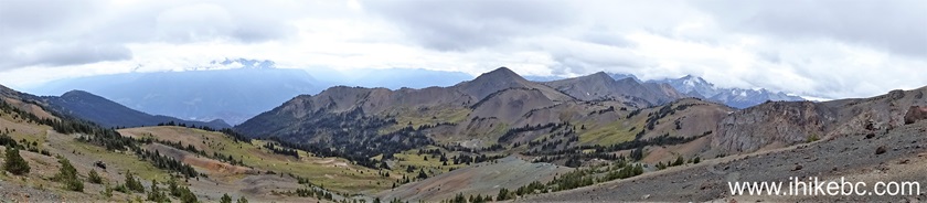
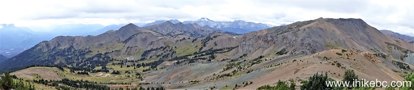
39-40. There is a fine panoramic view from this location, and here are two panoramas, left to right.
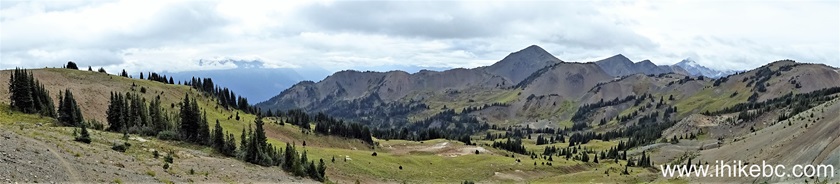
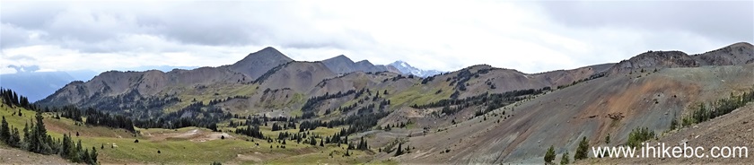
Panoramic View South Chilcotin Mountains Provincial Park
Here is our video of the views from this location.
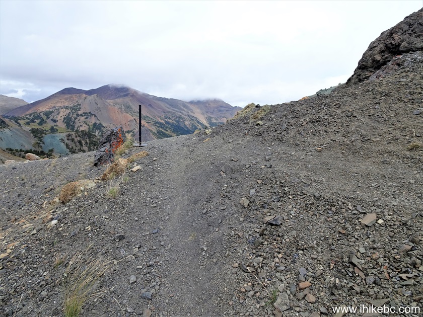
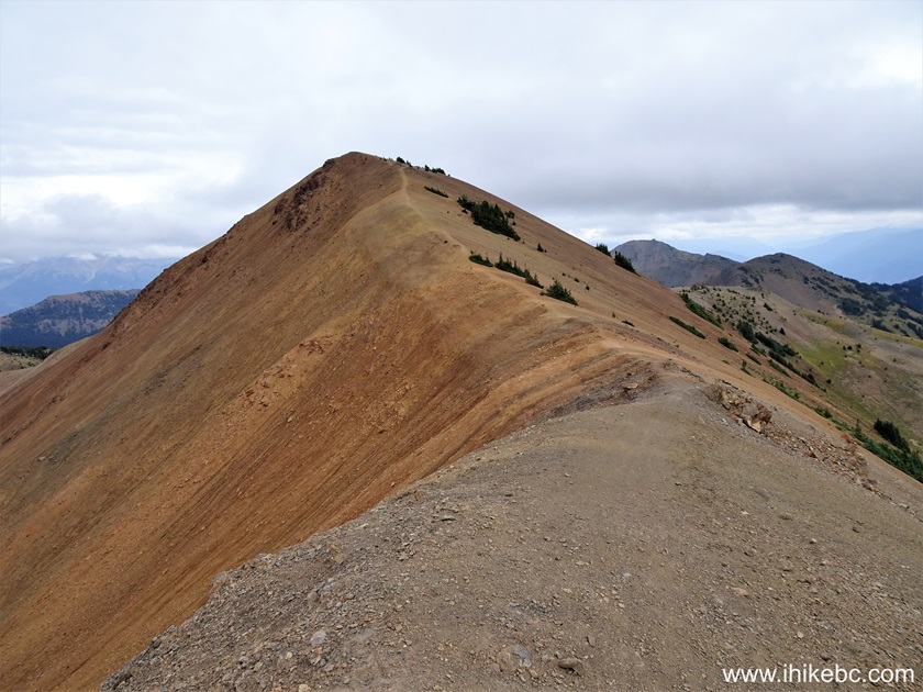
41. At 1.10 km, we are approaching The Camel Pass.
Camel Pass Trail Hike in South Chilcotin Mountains Provincial Park near
Gold Bridge BC Canada
42-43. Now at 1.12 km with some and then lots of zoom. Sure looks like a camel!
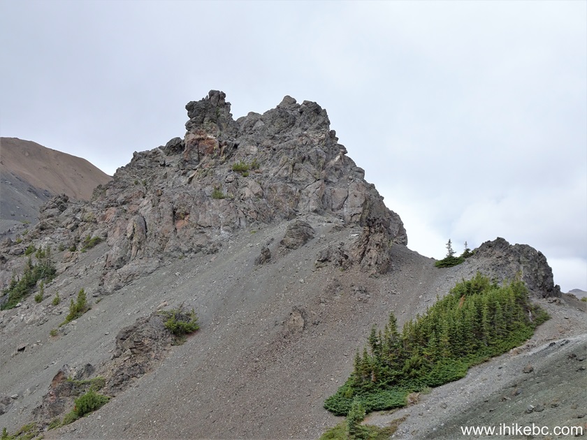
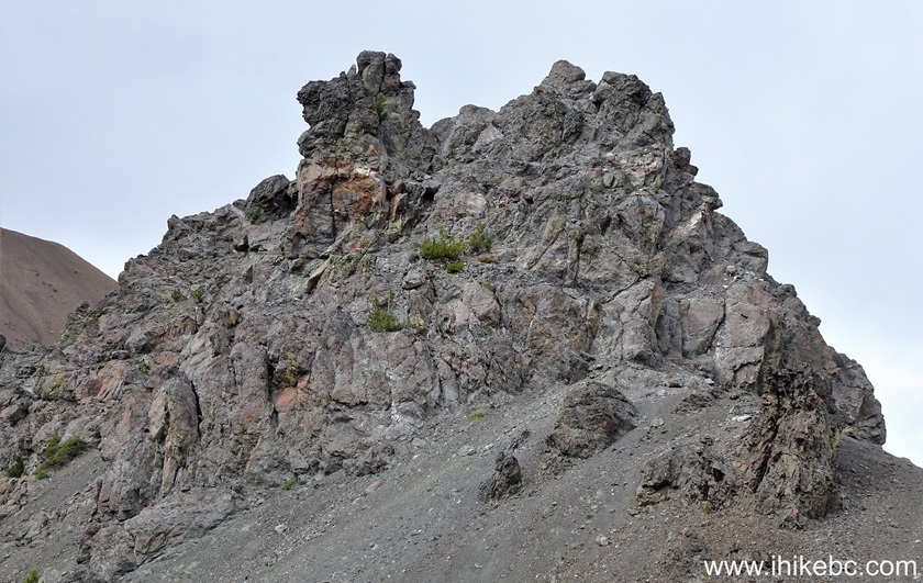
Camel Rock in South Chilcotin Mountains Provincial Park
44-45. At 1.16 km, we have reached The Camel Pass. Coordinates: N 50⁰58.361' W 122⁰51.595'. Elevation: 2,150 meters. If we understand correctly, The Camel Pass trail ends here, Harris Ridge Trail begins ahead, and Ridge-O-Rama Trail, which is a part of the loop we hiked today, begins on the right side.
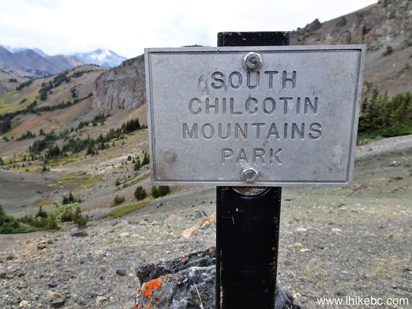
South Chilcotin Mountains Provincial Park Sign
46. Looking back, we see The Camel Pass Trail, which we have just hiked, on the right side. On the left is Ridge-O-Rama Trail.
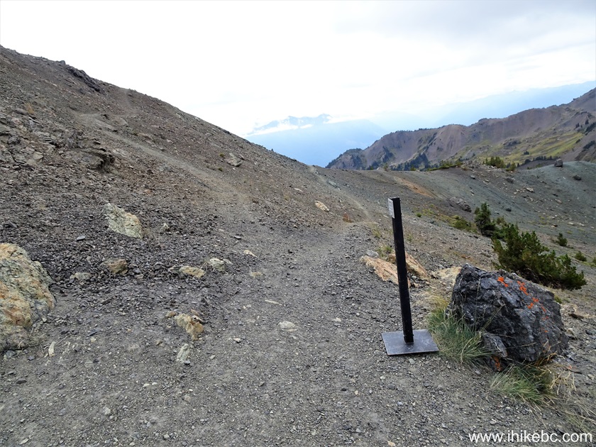
Here is our video of the views from this location.
47. Starting Ridge-O-Rama Trail hike.
48. At the 75 meter mark of Ridge-O-Rama Trail in South Chilcotin Mountains Provincial Park.
49. Looking back at the 115 meter mark.
South Chilcotin Mountains Provincial Park British Columbia Canada
50. At 225 meters of Ridge-O-Rama Trail, we see the ridges ahead. It's not a very complicated hike, and motorcycles mentioned above made it here too. That said, motorized vehicles are not permitted in this park, and several stretches looked rather treacherous for motorized traffic.
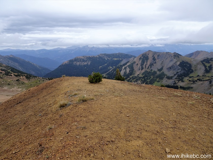
51. Looking right at 340 meters from the trailhead.
52. A panorama from the same spot.
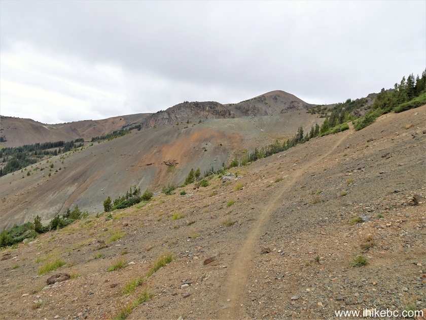
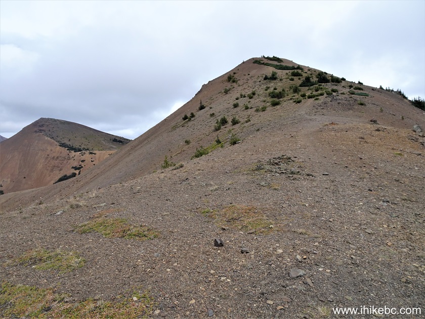
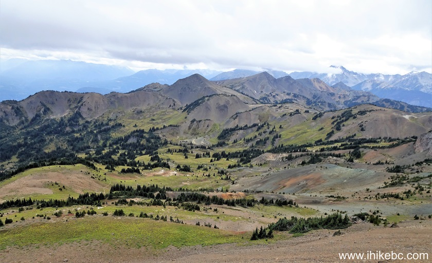
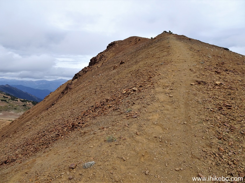
53. At 450 meters, the first ridge is here.
South Chilcotin Mountains Provincial Park - Ridge-O-Rama Trail
54. Looking right from this location.
British Columbia Mountains
55-56. Looking forward at the 620 meter mark of Ridge-O-Rama Trail, then looking back.
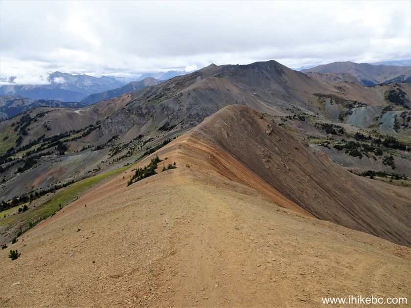
South Chilcotin Mountains Provincial Park near Gold Bridge British
Columbia Canada
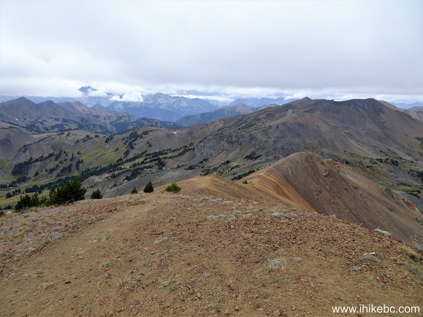
57. At the 700 meter mark, we have reached the top of the mountain. Coordinates: N 50⁰58.416' W 122⁰51.076'. Elevation: 2,260 meters. Fine views all around.
Hiking in British Columbia
58. Looking back from the top.
Here is our video of the views from this location.
More ihikebc videos are on our YouTube Channel.
59. Time to go down. At 840 meters now.

Our South Chilcotin Mountains Provincial Park Visit trip report Concludes on Page 3.


|
 |
Other Trips:


![]()
![]()
![]()
ihikebc.com Trip 321 - South Chilcotin Mountains Provincial Park Visit
(near Gold Bridge, BC) Page 2 of 3