![]()
![]()
![]()

Trip 311 - May 15, 2024 (Wednesday)
Ridge Trail Hike
Gowlland Tod Provincial
Park (Caleb Pike access point) near Victoria, BC
Liked: Saanich Inlet - Finlayson Arm views, hills views, remote mountains, numerous arbutus trees, shade in the forest, no bugs.
Vancouver Island, Victoria & Gulf Islands Backroad Mapbook (9th edition) Trailhead Coordinates: Page 4 (Sooke) E2.
Follow @ihikebc TweetGowlland Tod Provincial Park is located on Vancouver Island, Saanich Peninsula, about 20 km Northwest of the City of Victoria. This park is situated on the bank of Saanich Inlet, and has a trail which goes South-North from Caleb Pike access point to McKenzie Bight access point. If you have two cars, it is possible to make it a one way hike via a car shuttle. Otherwise, it's a rather long-ish round trip hike of about 19 km long.
Today, we started at the Caleb Pike access point, hiked to Jocelyn Hill lookout for just over 4.2 km one way, and went back. The next day, we began at the McKenzie Bight access point, hiked to Malahat viewpoint and Squally Reach viewpoint, and returned to McKenzie Bight. We thus did not hike a few kilometers between Jocelyn Hill and Squally Reach viewpoints, but, from what we understand, there isn't much to see there.
While this is, technically, one trail all the way from Caleb Pike to McKenzie Bight (with several parallel/loop trails), it is broken into several trails for naming purposes. Thus, at the beginning of Caleb Pike access the trail is called Holmes Peak Trail, then it becomes Ridge Trail, then Jocelyn Hill Trail, then Timberman Trail, and then Cascade Trail which ends at McKenzie Bight. For the sake of simplicity, we named the whole thing "Ridge Trail Hike" from Caleb Pike access point to Jocelyn Hill, and the next trip report (where we hiked from McKenzie Bight to Squally Reach and Malahat Viewpoint) is called "Timberman Trail Hike", which takes 3.3 km to Malahat Viewpoint (it's a spur trail), and 3.5 km to Squally Reach.
If you can do only one of these two hikes, definitely go with the Caleb Pike access point hike, as it has much better views.
*All trail distances are based on a GPS odometer and are approximate.
1. Here is a Google Maps location of Gowlland Tod Provincial Park - Caleb Pike access point.
2. We are on Caleb Pike Road, as the entrance to Gowlland Tod Provincial Park - Caleb Pike access point.

Caleb Pike Road near Victoria BC
3. There is a very large and long parking lot.

Parking lot for Gowlland Tod Provincial Park - Caleb
Pike access point
Here is our video of driving on Caleb Pike Road and arriving to this parking lot.
4. An information board is located at the far end of the parking lot.

Caleb Pike access for Gowlland Tod Provincial Park
near Victoria British Columbia Canada
5. Just behind it is a trail sign. Coordinates: N 48⁰30.529' W 123⁰31.962'. Elevation: 230 meters. If you want to do a Roundtree Loop, head straight ahead. But we turned right to hike Ridge Trail.

Trail sign at Gowlland Tod Provincial Park - Caleb
Pike access point
6. Here is a trail map under the sign. Ridge Trail goes North (via Homes Peak Trail).
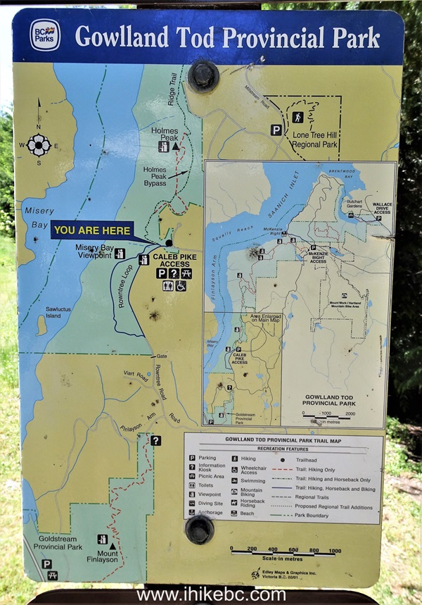
Gowlland Tod Provincial Park Trail Map
7. The hike begins. As mentioned at the beginning of the trip report, even thought it's one trail, it has different names for its parts. At first, it's Holmes Peak Trail, then Ridge Trail, then Jocelyn Hill Trail, but we will count it as one Ridge Trail. At 15 meters here.
-
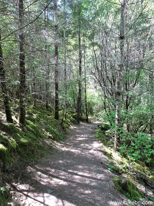
Holmes Peak Trail in Gowlland Tod Provincial Park Vancouver Island, BC
8-9. At 105 meters, another Roundtree Loop intersection. We are heading to Holmes Peak.
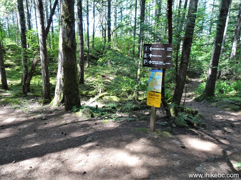

Gowlland Tod Provincial Park Holmes Peak Trail at
Roundtree Loop Intersection
10. At 185 meters now. It's a fairly easy trail, with a few moderately challenging short stretches.

Hiking in Victoria BC area - Holmes Peak Trail -
Gowlland Tod Provincial Park
11. Now at 390 meters from the trailhead.

Holmes Peak Trail Hike near Victoria British Columbia
Canada
12. At 780 meters of the trail.

Holmes Peak Trail
13. At the 1.00 km mark, Holmes Peak bypass is on the right side. We kept left.
Holmes Peak Trail Hike on Vancouver Island BC Canada

Trail Map for Gowlland Tod Provincial Park British
Columbia
14. At 1.28 km, we are getting close to Holmes Peak.

Gowlland Tod Provincial Park
15. Here it is. The view is much obstructed, but it appeared most hikers (we've met about twenty people in 5-6 different groups) stopped here and went back, while the best view is still ahead.
View from Holmes Peak in Gowlland Tod Provincial Park
16. Looking the other way.

Holmes Peak in Gowlland Tod Peak Provincial Park
17. Here is Gowlland Tod Park trail map showing our current location at Holmes Peak. This is where the actual Ridge Trail begins.

Holmes Peak Map Location in Gowlland Tod Provincial Park
18. Ridge Trail in Gowlland Tod Provincial Park - 2.68 km from the trailhead.

Ridge Trail - Gowlland Tod Provincial Park -
Vancouver Island
19. At 2.91 km, we are almost at the best view of the hike.
Gowlland Tod Provincial Park on Vancouver Island BC
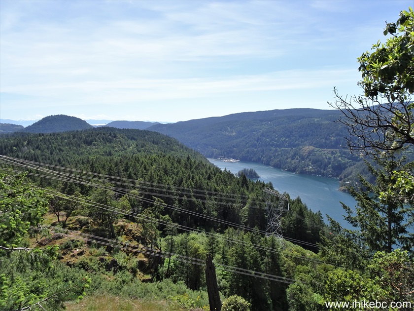
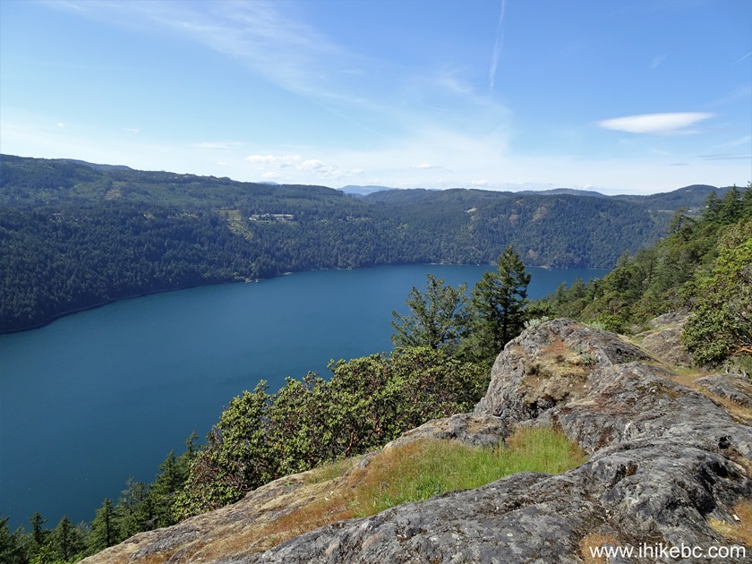
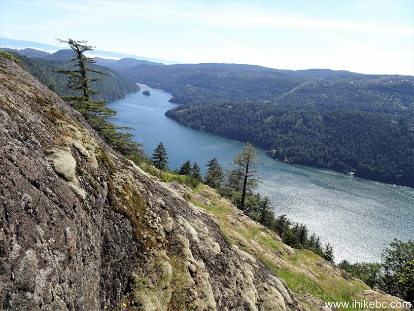
20. And here is the best view of Ridge Trail in Gowlland Tod Provincial Park, at 2.94 km of the hike. Finlayson Arm of Saanich Inlet is below us. Coordinates: N 48⁰31.688' W 123⁰31.767'. Elevation: 335 meters.
Saanich Inlet - Finlayson Arm - view from Ridge Trail
in Gowlland Tod Provincial Park
Here is our video of the views from from this location.
21. So neat. At 3.01 km of Ridge Trail.

Ridge Trail Hike near Victoria British Columbia
Canada
22. 30 meters later.

Hiking in Victoria BC area - Gowlland Tod Park -
Ridge Trail
23. At 3.14 km of Ridge Trail.
Hiking in British Columbia Canada - Ridge Trail on
Vancouver Island
24. Saanich Inlet view 20 meters later.
Saanich Inlet
25. Hiking through a forest again at the 3.54 km mark.
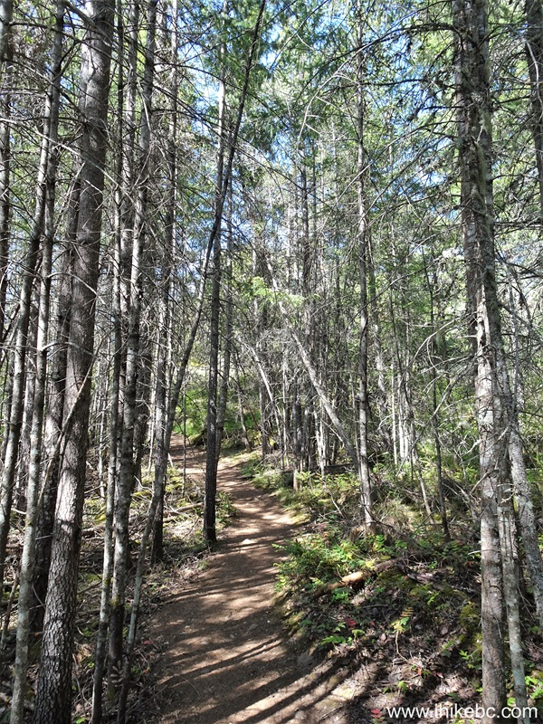
Gowlland Tod Provincial Park - Ridge Trail - British
Columbia Canada
26. Hiking in the open at 3.61 km.
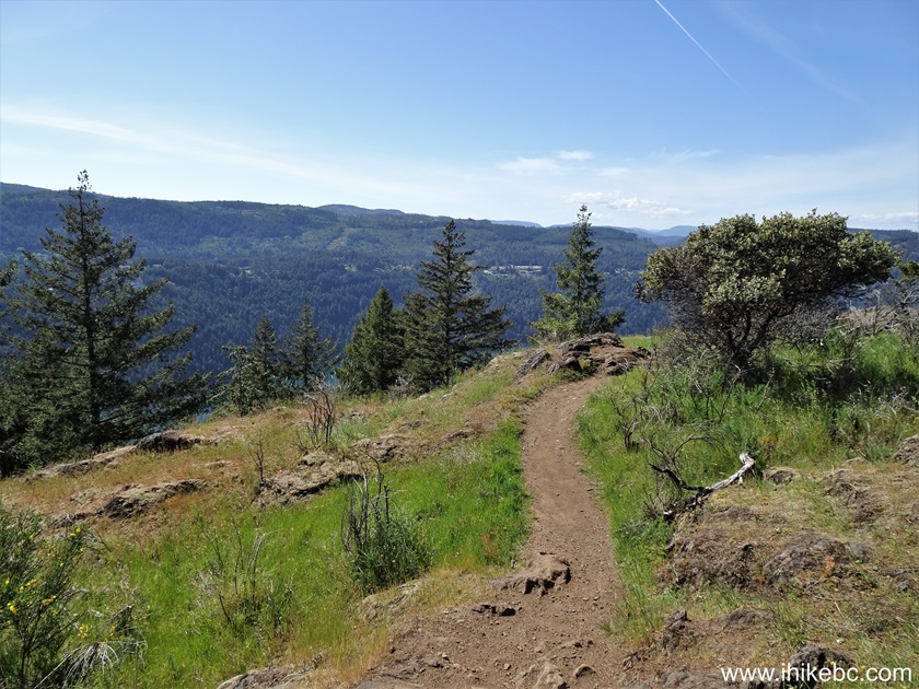
Ridge Trail - Gowlland Tod Provincial Park
27. Just a bit further, another Saanich Inlet view.

View of Saanich Inlet from Ridge Trail in Gowlland
Tod Provincial Park
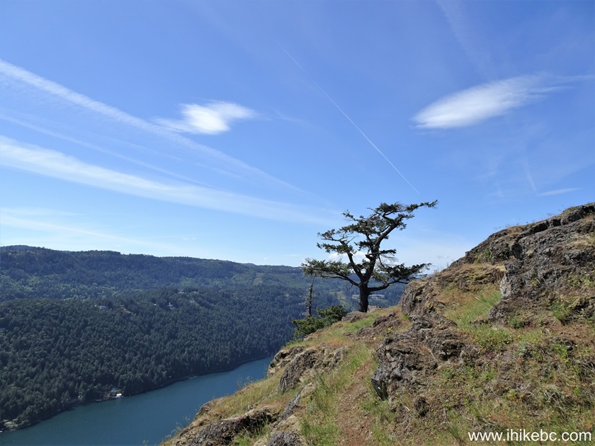
28. A tree by the trail at 3.65 km.

Canada Hiking - Gowlland Tod Park - Vancouver Island
29. Looking back at the 3.68 km mark of the hike.
Gowlland Tod Park British Columbia
30. Ridge Trail has many arbutus trees.

Arbutus Tree - Vancouver Island - British Columbia
31. A fine view at the 3.82 km mark.
Saanich Inlet - Vancouver Island BC
32. At 4.20 km of Ridge Trail, which is, technically, Jocelyn Hill Trail at this point.

Jocelyn Hill Trail
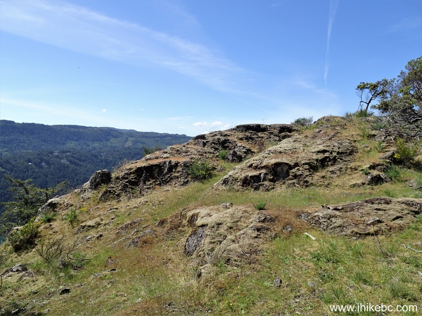
33. At 4.22 km, we have reached the end of today's hike at Jocelyn Hill. The trail continues for another 5 km or so to McKenzie Bight access point of Gowlland Tod Provincial Park.
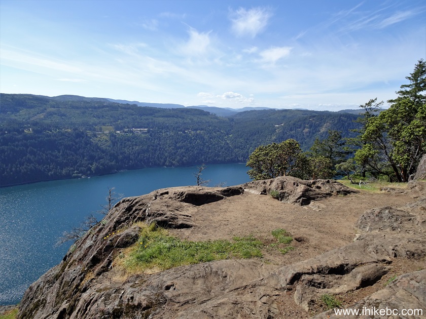
Jocelyn Hill in Gowlland Tod Provincial Park near
Victoria British Columbia Canada
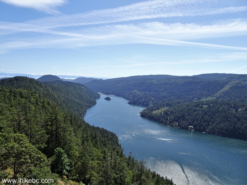
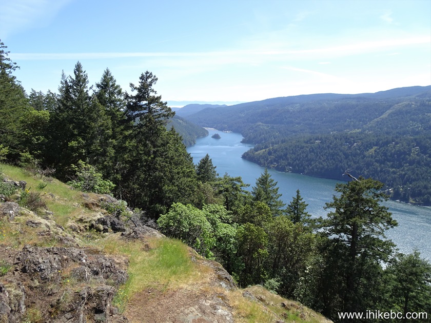
34. Looking back from Jocelyn Hill, here is another look at Finlayson Arm of Saanich Inlet. Coordinates: N 48⁰32.224' W 123⁰31.824'. Elevation: 420 meters (190 meters elevation gain from the trailhead for an average grade of 4.5%).

Saanich Inlet Finlayson Arm
Here is our video of the views from this location.
More ihikebc videos are on our YouTube Channel.
Ridge Trail of Gowlland Tod Provincial Park is fairly easy and leads to several very fine views. Highly recommended.


|
 |
Other Trips in Victoria BC Area:
|
|
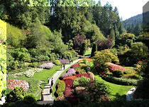
Mount Tolmie
Park
|
|
|
|
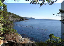
Coast Trail Hike
|
|
|
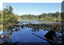
Timberland Trail Hike
|
|
|
|
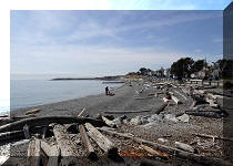
Mount Finlayson Hike
|
|


Other Trips:


![]()
![]()
![]()
ihikebc.com Trip 311 - Ridge Trail Hike
(Gowlland Tod Provincial Park near Victoria, BC)