![]()
![]()
![]()

Trip 223 - July 14, 2021 (Wednesday)
Jack's Peak Trail Hike
Near Port Alberni BC
Page 2 of 2
Liked: Three
waterfalls, impressive mountain views (mostly at the end of trail), shade in the forest, very few bugs in the first half of the trail.Of Note: Remote wilderness area. From the trailhead to mini-dam/first waterfall – copious amounts of bear scat and numerous raspberry bushes. Bear scat is present all the way to the trail end. The trail is steep and challenging beyond the first waterfall, with several short scrambling sections, some overgrown parts, occasional navigational difficulties, and is suitable for experienced, well-equipped hikers only. Hiking poles and boots are recommended to the first waterfall, and are essential beyond that. A GPS containing the trail, and long pants are highly recommended. Creek crossing (by the dam) may be required, or a semi-dangerous crossing on a log above the dam. Some bugs in the second half of the trail.
Vancouver Island Backroad Mapbook (9th edition) Trailhead Coordinates: Page 15 (Kennedy Lake) F2.
Other Trips in Port Alberni Area: Cold Creek Falls Trail, City of Port Alberni Visit.
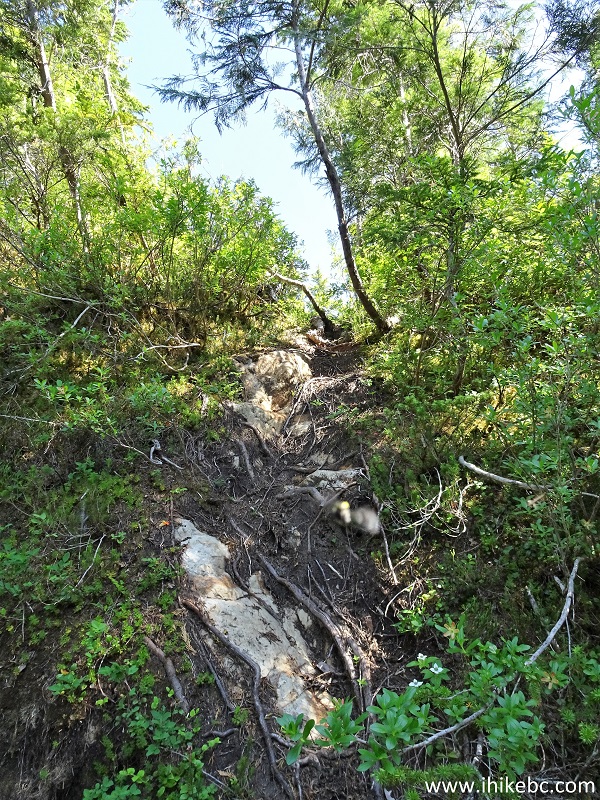
31. Another short scramble awaits 1.80 km from the mini-dam/first waterfall.
Jack's Peak Trail in Port Alberni BC Area
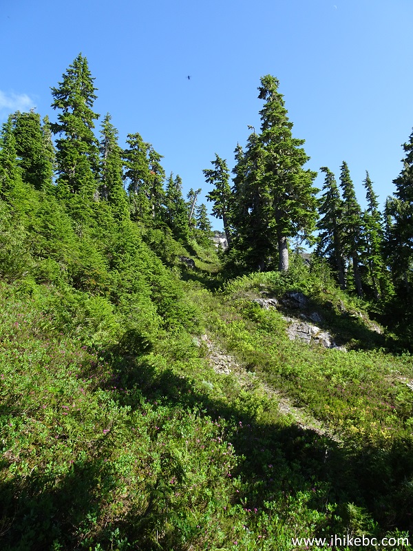
32. Jack's Peak Trail at 2.33 km.

Jack's Peak Trail Hike in Port Alberni British Columbia Area
33. Just a bit further.

Jack's Peak Trail - Hiking in Port Alberni BC Area
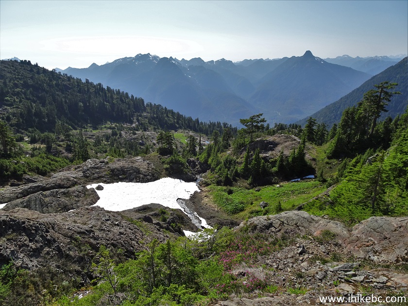
34. At 2.60 km after the mini-dam (5.80 km from the trailhead), we have reached a small cairn with a decent view. Coordinates:
N 49⁰13.882' W 125⁰18.281'. Elevation: 1,133 meters.

Jack's Peak Trail - Port Alberni Trail
35-36. The view without and with zoom. Somewhat spoiled by the sun shining at us from that direction.

View from Jack's Peak Trail - Port Alberni Hike

37. After the cairn, the path all but disappears, and so does the flagging tape. The trail ribbon in GPS is still there, though. But, even without the mapped trail, just head towards the wall straight ahead, choosing the path of least resistance, as it's a fairly challenging sub-alpine.

Jack's Peak Trail - Port Alberni Hiking
38. Here is that path of least resistance.
Jack's Peak Trail - British Columbia Hiking
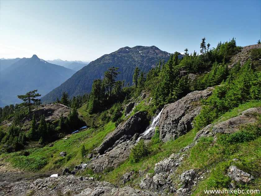
39. The terrain opens up a bit. At some point, you will see waterfall #3, so heads towards it.

Vancouver Island Hiking - Jack's Peak Trail
40. Approaching Jack's Peak Trail waterfall #3.

Jack's Peak Hiking on Vancouver Island British Columbia
41. Here it is, 700 meters from the cairn, and 3.3 km from the mini-dam. Coordinates:
N 49⁰13.776' W 125⁰17.930'. Elevation: 1,217 meters.

Jack's Peak Trail Waterfall #3 in Port Alberni BC Area
Here is our video of Waterfall #3.
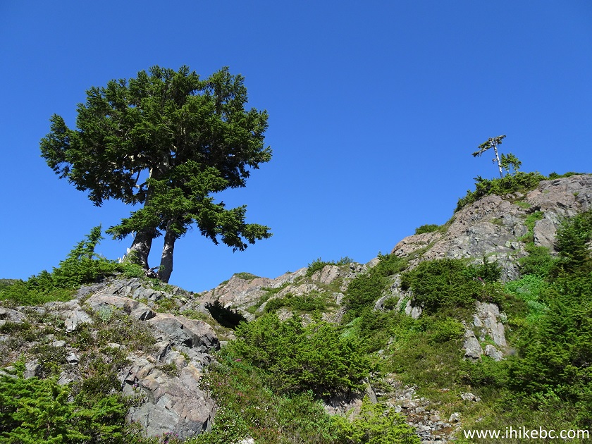
42-43. Going forward, aim at this prominent tree above the waterfall.


Jack's Peak Trail Hike in British Columbia Canada
44. Looking back from near that tree, we see waterfall #3 on the right side, and some remote mountains.
Jack's Peak Trail View
45. Right by the tree now.
Hike on Vancouver Island - Jack's Peak Trail
46. Another look back. The snow was still present, but wasn't much of an obstacle. Could be a different situation, if the path before the cairn would be covered by snow.
View from Jack's Peak Trail on Vancouver Island BC
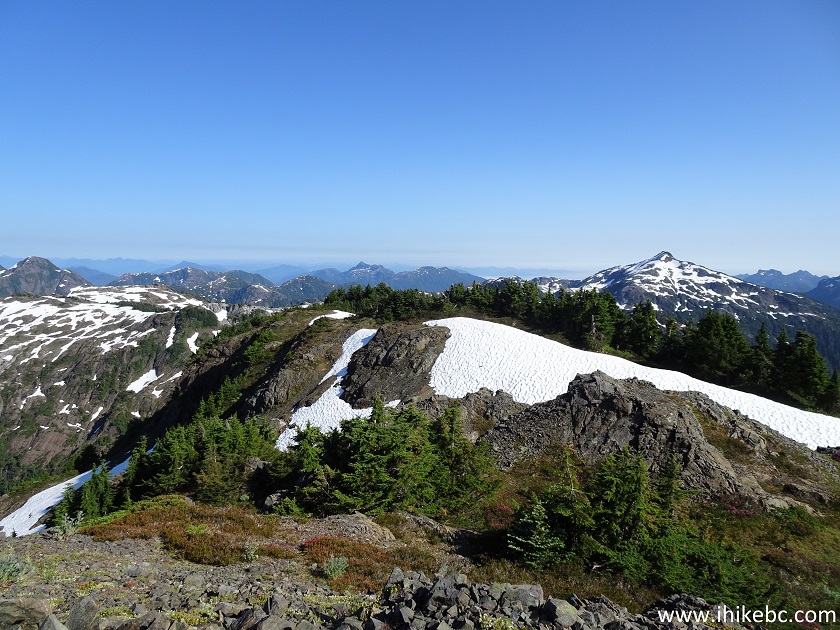
47-48. Then, there are several "false peaks", where it appears you are about to get to the top, only to see that there is still some way to go.


Jack's Peak Hike near Port Alberni BC Canada
49. Looking back after a false peak, we see Louise Goetting Lake far below.

Louise Goetting Lake seen from Jack's Peak Trail near Port Alberni BC
Canada
50. Almost there...

Hiking Jack's Peak Trail in British Columbia Canada
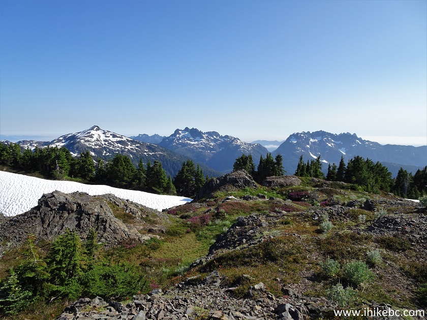
51. And here we are, at the second cairn, 3.90 km from the mini-dam, and 7.20 km from the trailhead. Coordinates:
N 49⁰13.635' W 125⁰17.579'. Elevation: 1,471 meters (1,191 meters elevation gain from the trailhead). The average grade for the entire trail is about 16%, and 21% for the part from the mini-dam to the trail end.The actual Jack's Peak, according to our GPS, is a slightly higher bump about 100 meters to the left of that (seen in photo #53), but the views appear to be the same, if not better, from this location.

Jack's Peak Trail End
52-57. The views from Jack's Peak, left to right.


View from the end of Jack's Peak Trail near Port Alberni BC
58. Now a panorama.
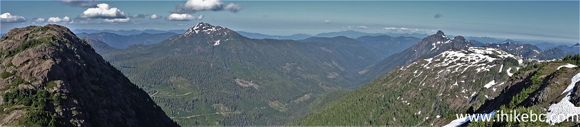
Jack's Peak Trail End Panorama
59-60. And a few zoomed views of the peaks seen in the photos above.


Here is our video of the views from the end of Jack's Peak Trail.
More ihikebc videos are on our YouTube Channel.
Jack's Peak Trail is relatively easy to the mini-dam/first waterfall, which could be a good destination. Beyond that, the trail is suitable for experienced, well-equipped hikers only, and leads to impressive mountain views. Highly recommended.


|
 |
Other Trips:


![]()
![]()
![]()
ihikebc.com Trip 223 - Jack's Peak Trail Hike (Near Port Alberni BC) Page 2 of 2