![]()
![]()
![]()

Trip 163 - July 20, 2019 (Saturday)
Schoolhouse Falls WEST Trail Hike
Near Bella Coola / Hagensborg British Columbia
Liked: The waterfall, valley and mountain view, very few bugs.
Of Note: WARNING - DANGEROUS AREA near the waterfall - high slip-and-fall hazard. Stay away from the slippery area near the waterfall. Highway noise for much of the trail. The trail has several splits, one unmarked. Some steep sections. Hiking poles and boots are recommended.
Cariboo Chilcotin Coast BC Backroad Mapbook (4th edition) Trailhead Coordinates: Page 22 (Bella Coola) F1.
Related Trip Report: Schoolhouse Falls EAST Trail Hike.
>>> British Columbia Waterfalls Visits.
There are two waterfalls on the mountain behind several schools in the settlement of Hagensborg, near Bella Coola. Two separate trails lead to those waterfalls, but they share one trailhead, and split shortly thereafter. The East trail is substantially more difficult than the West trail, and has better waterfall and valley/mountain views. That said, there are excellent valley and mountain views from both trails. Despite the fact that it was fairly easy to get to the West falls, we ended up sliding on our side down the mountain right next to the waterfall for 30 meters feet first, and slamming into some large stones, which prevented us from going over and falling even further down. The unfortunate turn of events was due to an extremely slippery and steep terrain near the waterfall. We ended up suffering no serious injury, but it certainly was quite a ride down that mountain, with quickly approaching stones promising nothing but trouble.
This trip report describes our hike to Schoolhouse West Falls, and the next trip report will describe the trip to the neighbouring East waterfall.
1. We are Eastbound on BC Highway 20, in Hagensborg, about 17 kilometers East of Bella Coola. Approaching a right turn onto the school grounds, where the trailhead is located for both East and West Schoolhouse Falls. Coordinates: N 52⁰23.406' W 126⁰32.395'. Elevation: 40 meters. The nearest cross street is Olsen Rd.
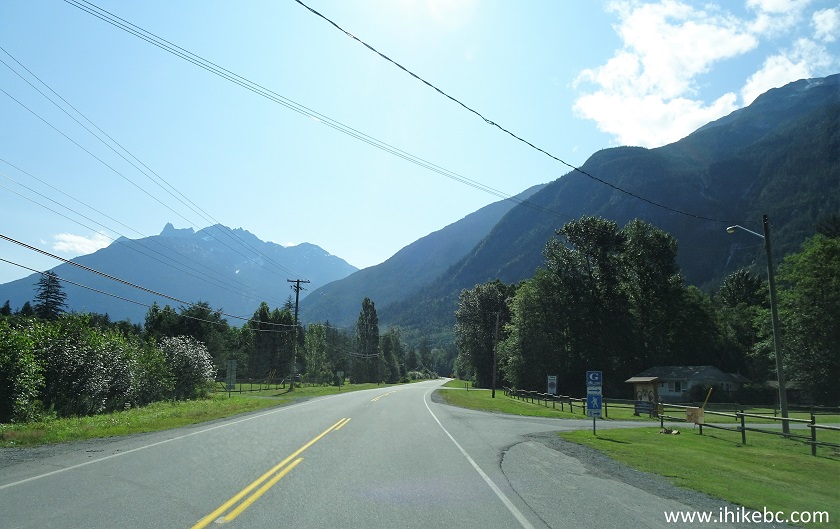
British Columbia Highway 20 in Hagensborg BC
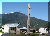
2. Having made the right turn, we see a sign indicating that Nusatsum Elementary School, Sir Alexander Mackenzie School, and School District #49 Board Office are all found at this location.

Entrance to Nusatsum Elementary, Sir Alexander
Mackenzie School, and SD 49 Board Office in Hagensborg BC Canada
3. A few hundred meters later, there is a lot of parking in front of the elementary school (to the left) and Sir Alexander Mackenzie school (to the right). The school was out, but, chances are, no one would mind you parking during a school day too. In any case, there were no signs restricting parking on the grounds. The trailhead is located 250 meters away - go between the two schools towards the mountain, and you will see it.
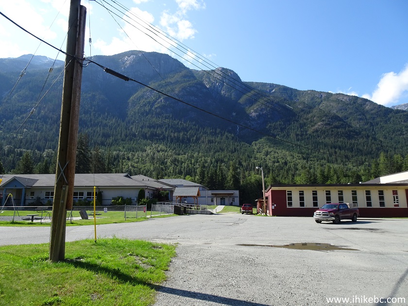
Nusatsum Elementary and Sir Alexander Mackenzie
Schools in Hagensborg British Columbia
4. Heading towards the trailhead. There is a sports field behind the schools, and the trailhead is located across the field seen below. From this spot, you can also observe both the East waterfall (to the left) and the West waterfall, the subject of this trip report.
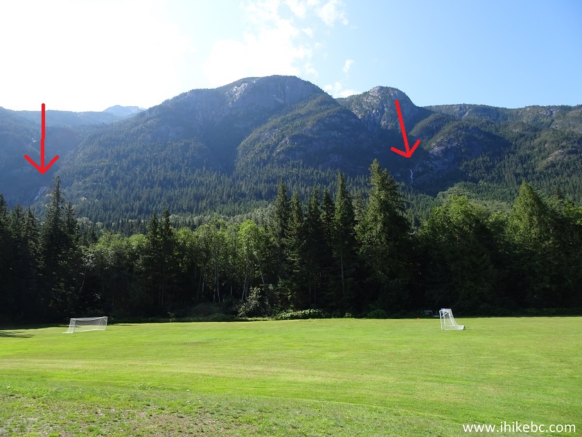
School sports field Hagensborg BC Canada
5. The close-up of the West waterfall.

Schoolhouse Falls WEST Waterfall Hagensborg BC
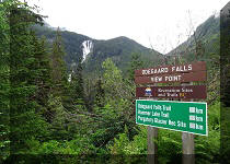
6. The trailhead for both waterfall trails. Coordinates: N 52⁰23.231' W 126⁰32.348'. Elevation: 52 meters. Other than two signs on Highway 20 (one for each direction of travel) with a lone silhouette of a hiker and an arrow pointing where to turn onto the school grounds, nothing indicates that there is a trail here, until you get to the trailhead.
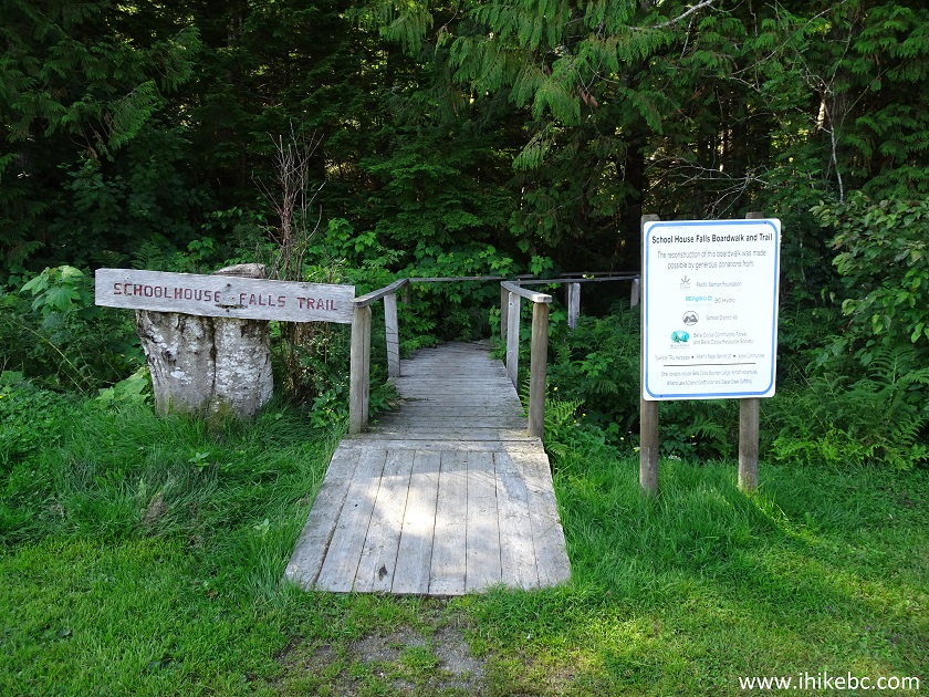
Schoolhouse Falls East and Schoolhouse Falls West
trailhead Hagensborg BC Canada
7. The trail starts with a very long boardwalk.

Schoolhouse Falls West and Schoolhouse Falls East
trail start
8. The boardwalk is about 270 meters long. However, make a right turn 250 meters after the start of the trail, as seen below, to get to the easier West Falls. Going straight and making a left turn at the end of the boardwalk would lead to the East waterfall.
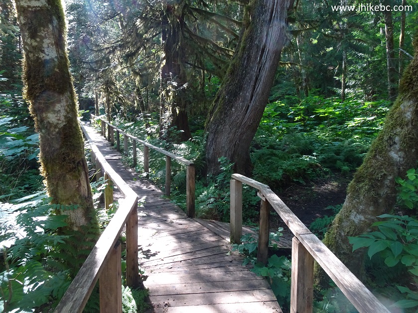
Boardwalk - Hiking in Hagensborg BC Canada -
Schoolhouse Falls Trails
9. Schoolhouse Falls WEST Trail after the boardwalk.
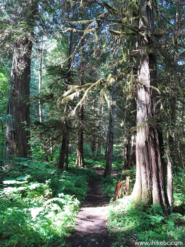
Bella Coola Hiking - Schoolhouse Falls West Trail
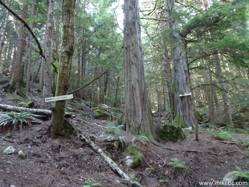
10. Approximately 430 meters after the start of the trail, make a left turn at this unmarked split. It's easy to remember this spot due to the busted tree in the middle of the split.

Hiking in Bella Coola Area - Schoolhouse Falls West
Trail
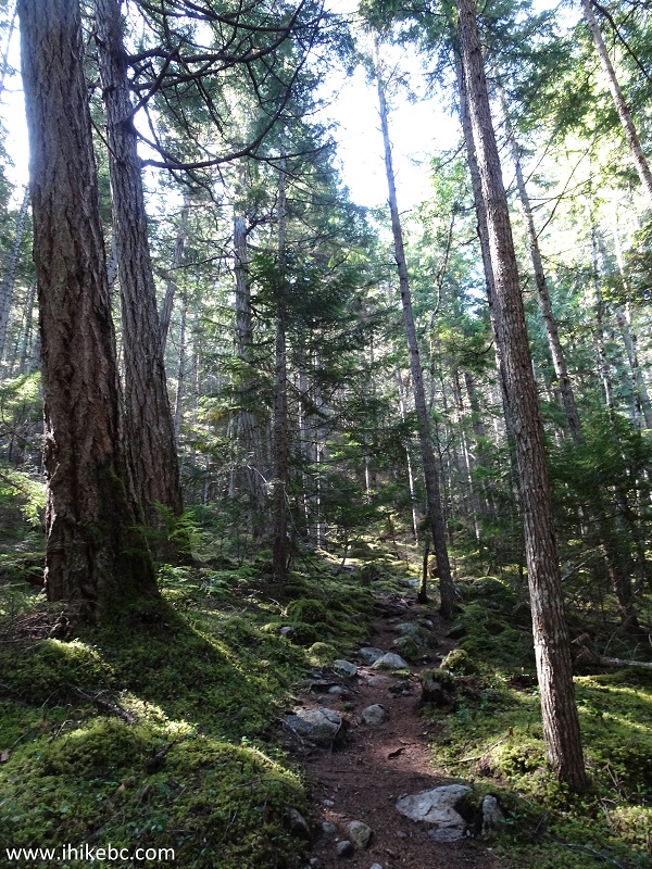
11. The trail after the first split.

Hagensborg Hiking - Schoolhouse Falls West trail
12. A foot bridge on the trail.
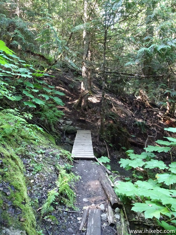
Hiking in Hagensborg Area - Schoolhouse Falls West
Trail
13. The next split arrives at 0.7 km of the trail. This time, there is a sign. To the right is an "under construction" mountain bike trail, and our trail is, again, to the left.
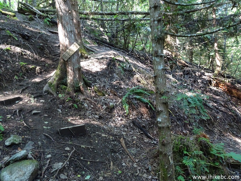
BC Hiking - Schoolhouse Falls West Trail in
Hagensborg BC (Bella Coola Area)
14. Yet another split is at about 850 meters. Take a left turn once again. To the right is Hagensborg Loop Trail.
Hiking in BC - Schoolhouse Falls West Trail in Bella
Coola Area
15. Soon after the split, things get steep for a bit.
British Columbia Hiking - Schoolhouse Falls West
trail near Hagensborg / Bella Coola
16. Very steep. But not for long.
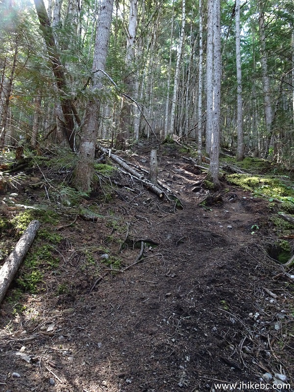
Hiking in British Columbia - Schoolhouse Falls West
Trail near Bella Coola and Hagensborg
17. A neat large stone on the side of the trail.

Schoolhouse Falls West Hiking Trail near Hagensborg
British Columbia Canada
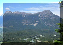
18. All it took to reach the Schoolhouse WEST Waterfall was about 1.3 km of hiking. A cool valley and mountain view awaits at the end of the trail. Coordinates: N 52⁰22.670' W 126⁰32.340'. Elevation: 313 meters (261 meters elevation gain from the start of the trail).
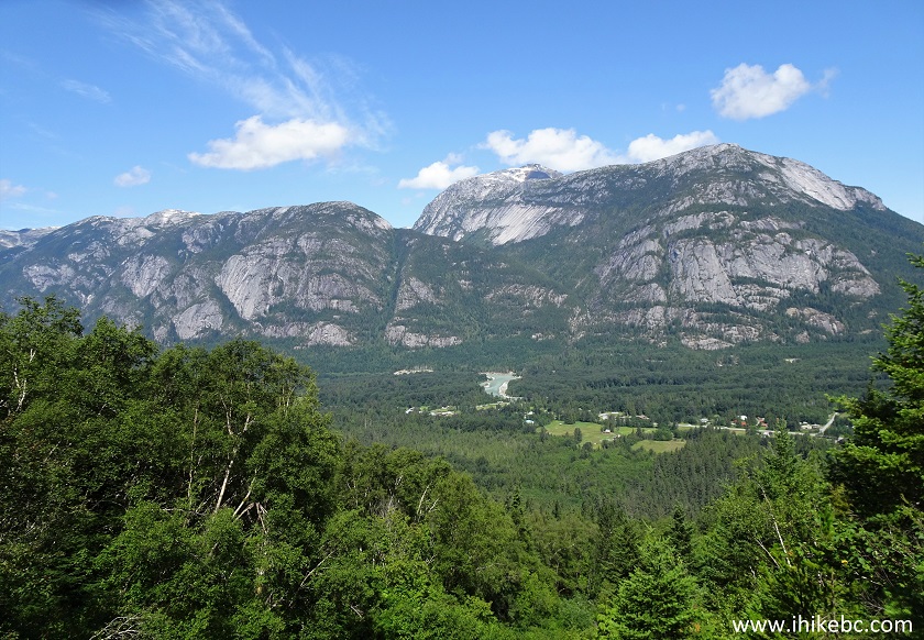
Bella Coola Valley seen from Schoolhouse Falls West
Trail
19. The waterfall wasn't bad either, though no match to Odegaard Falls we saw the day before.
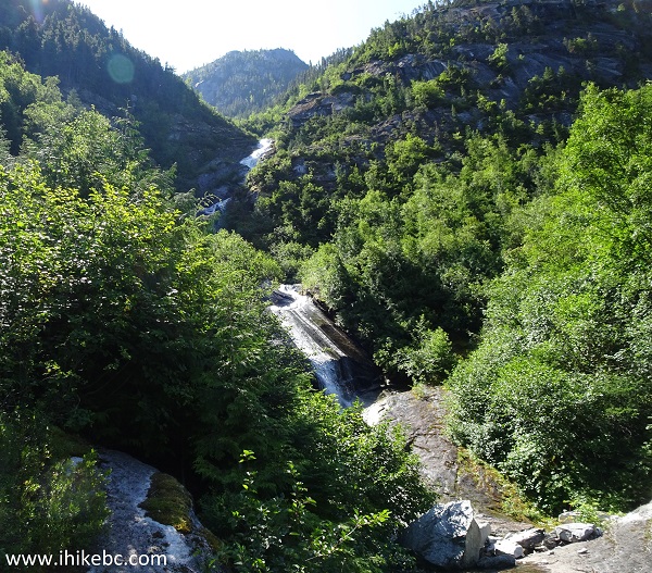
Schoolhouse Falls West near Hagensborg BC
Here is our video of Schoolhouse Falls WEST.
WARNING - DANGEROUS AREA
20. So, how did we end up almost breaking both legs, if nothing else? Here is where we came out of the forest. The waterfall is on the left side. Cool, lets walk forward for a better look...

21. And here is where things went South (literally!) in a split second. The top arrow shows where we stepped onto a super slick surface next to the waterfall, and the bottom arrow indicates where we ended up several seconds later. Yes, we prayed all the way down, while sliding on our side, rapidly gaining speed, and losing some skin on the upper leg in the process. Neither hiking boots nor poles were of any use to prevent the accident from happening, or to slow things down once we fell - it was like sliding on ice with nothing to stop us except those quickly approaching stones 30 meters later.

22. This photo shows where we slammed into the stones feet first. It's a good thing those stones were there to begin with, as otherwise we could have gone for a much longer ride down the mountain. We ended up with wet feet, and lost a water bottle, which fell out of the backpack's side pocket and swam away. Other than a 30 cm by 10 cm abrasion on the upper leg, there were no other injuries. Stay safe.
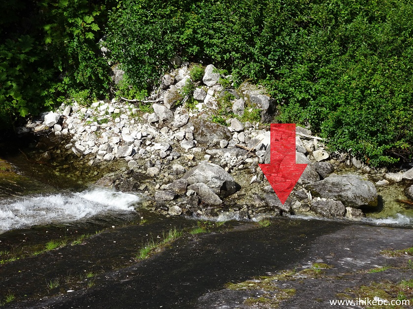
Here is a video of the accident area.
More ihikebc videos are on our YouTube Channel.
Schoolhouse Falls WEST is a rather easy trail, with fine views of the valley and mountains. The waterfall is not bad either. Just stay away from the slippery area next to the waterfall. You can get decent views by hiking uphill for a minute or two after coming out of the forest. Recommended.


|
 |
Other Trips in Bella Coola Area:
|
|
Schoolhouse
Falls East
|

|
|
 |
|
Odegaard Falls Trail |
Other Trips:


![]()


![]()
![]()
![]()
ihikebc.com Trip 163 - Schoolhouse Falls WEST Trail Hike (Near Bella Coola / Hagensborg BC)