![]()
![]()
![]()

Trip 301 - September 7 (Thursday), 9 (Saturday), 11 (Monday) and 15 (Friday), 2023.
Juan De Fuca Trail Hike
Juan De Fuca Provincial Park
Near Sooke, BC (West of Victoria)
Page 1 of 8
China Beach to Bear
Beach (km 0 to 9) and back
1) China Beach (easternmost) - about 37 km west of Sooke BC via Hwy 14, 75 km west of Victoria.
2) Sombrio Beach - about 58 km west of Sooke BC via Hwy 14.
3) Parkinson Creek - about 68 km west of Sooke BC via Hwy 14.
4) Botanical Beach (westernmost) - about 76 km west of Sooke BC via Hwy 14, in Port Renfrew.
Liked in General:
Shoreline views, tidal pools, grottos, waterfalls, three suspension bridges, several fine forest scenes, shade in the forest, no bugs.1) China Beach to Bear Beach (this page and page 2) - Pete Wolfe Creek suspension bridge, Mystic Beach and Bear Beach shoreline views and grottos, Mystic Beach waterfall, meeting Brandt's cormorants.
2) Sombrio Beach to Chin Beach - garbage cans at Sombrio Beach parking lot, some sand at Sombrio Beach, a few tidal pools at Chin Beach, excellent grottos (with natural ceiling art) at Chin Beach, meeting a passing seal at Chin Beach.
3) Parkinson Creek to Sombrio Beach - Minute Creek suspension bridge, waterfall view from the suspension bridge, Sombrio Beach.
4) Botanical Beach to km 39 (2 km east of Parkinson Creek) - excellent tidal pools near Botanical Beach, several fine shoreline views.
Of Note in General: Camping and overnight parking fees required, high tides may cut off beach/trail access, numerous mud stretches, frequently damaged infrastructure (ladders, bridges, boardwalks), bear scat, the trail is popular, uneven ground, rocks and roots, stones of all sizes on the beach, very slippery stones in grottos and on the beach, hiking poles and boots are highly recommended. Very limited /nonexistent cell phone coverage along the trail - it might be possible to get a signal from a USA carrier (beware of roaming charges!). The entire trail is in the tsunami hazard area - head to higher ground or inland in case of an earthquake.
1) China Beach to Bear Beach (this page and page 2) - log bridge at 6.3 km is missing railing on one side, steep ladder on approach to Bear Beach.
2) Sombrio Beach to Chin Beach - Sombrio Beach location is very popular, and the parking lot is small - may have to park along the access road during busy times. Steep unbarricaded drop-off at the first waterfall viewpoint. Very slippery stones at the top of the waterfall - extreme fall hazard, do not approach.
3) Parkinson Creek to Sombrio Beach - not much to see on this stretch of Juan De Fuca Trail.
4) Botanical Beach to km 39 (2 km east of Parkinson Creek) - overnight camping is not allowed on Botanical Beach parking lot, a whole lot of bear scat (much more than on the rest of the trail combined), tricky Yauh Creek log crossing, rogue waves hazard near Botanical Beach.
Vancouver Island, Victoria & Gulf Islands Backroad Mapbook (9th edition) Coordinates: Page 4 (Jordan River) C4-B4-A4 and Page 3 (Port Renfrew) G4-F3-E3-D3-C3.
Related Website: Juan De Fuca Provincial Park - BC Parks Official Website.
Follow @ihikebc TweetJuan De Fuca Marine Trail is a multi-day 47 km-long hike on Vancouver Island along Salish Sea between China Beach (East of Sooke BC) and Botanical Beach in Port Renfrew, BC. Both trailheads are easily accessible by vehicles via Highway 14 (West Coast Road), allowing for a one-way hike via a shuttle. Also, because there are two other vehicle-accessible locations along the trail (Sombrio Beach and Parkinson Creek), it is possible to hike Juan De Fuca Trail in series of one day hikes, which is exactly what we did. On Day 1, we hiked from China Beach to Bear Beach (km 0 to 9) and back. On Day 2, we went from Sombrio Beach to Chin Beach (not to be confused with China Beach! - km 29 to 21) and back. On Day 3, our hike was Parkinson Creek to Sombrio Beach (km 37 to 29) and back. And, on Day 4, we went from Botanical Beach to km 39 (2 km West of Parkinson Creek) and back.
Thus, we hiked the entire Juan De Fuca Trail except the part from Bear Beach to Chin Beach (km 9 to 21) and a small part between km 37 and 39. The Bear Beach to Chin Beach part was not possible to do in a day hike, and the part between km 37 and 39 was all in the forest (like the most of Juan De Fuca Trail, by the way), and we wanted to save time to explore Botanical Beach area, arguably the best part of this entire hike.
The main attractions of Juan De Fuca Trail are: three long suspension bridges, fine shoreline views at beaches and (sometimes) from the trail in the woods, wonderful tidal pools at Botanical Beach (and a few much smaller ones at other beaches), very interesting grottos at some beaches, several waterfalls, and a few interesting forest scenes. Campers would certainly enjoy spending time at the beaches (mostly made of stones, small and large), and will likely have a whole lot of other people nearby at all times aside from, perhaps, the coldest and wettest months of the year.
What surprised us is that, despite being a marine trail, the vast majority of hiking has to be done in the woods. There are no major elevation changes, so it's a fairly easy trail to hike from that perspective, but the biggest challenge comes from numerous slippery sections and rather frequently worn-out wooden infrastructure (ladders, bridges and boardwalks), presenting somewhat complicated and, sometimes, fairly dangerous conditions in many parts of the trail.
Also of note, while there are pit toilers at all the parking lots and some campsites along Juan De Fuca Trail, the garbage cans can only be found at the Sombrio Beach parking lot! There are no garbage cans at the Botanical Beach lot (there is a free public dump in Port Renfrew, open during business hours only), and none at China Beach lot either (however, there are garbage cans at China Beach campground, about 1 km east of the lot). Overnight parking and backcountry camping requires a fee. Parking around Port Renfrew is complicated. No overnight camping is allowed at the Botanical Beach lot, and there is a forest service road fairly close by (just east of Port Renfrew), but it does not have a good level spot for parking, unless you manage to find one.
Furthermore, there will likely be a whole lot of mud on this trail if you hike it at any time aside from, perhaps, late Summer and early Fall. But hiking during the drier season also means that the waterfalls along Juan De Fuca Trail (there are a few) would not be as impressive due to a much smaller volume of water.
Finally, there are no fresh water taps anywhere along the trail. Be prepared to have your water boiled or treated, especially if you plan on having a multi-day hike.
* All trail distances are based on a GPS odometer and are approximate.
1. Here is a Google Maps location of Juan De Fuca Trail - China Beach Trailhead.
2. Please be aware - the entire Juan De Fuca Trail is in the tsunami hazard area. Head to higher ground or inland in case of an earthquake.
Source: Regional District of Nanaimo.
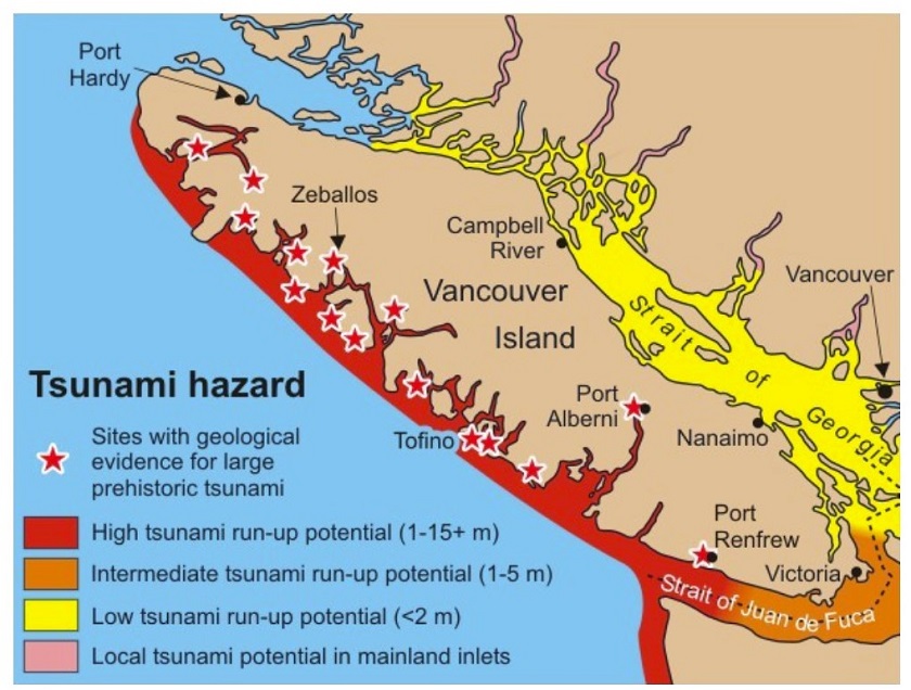
Vancouver Island Tsunami Hazard areas
3. Today is September 7th, 2023 (Thursday), and we are westbound on BC Highway 14 on Vancouver Island, about 37 km west of Sooke and 75 km west of Victoria, with China Beach trailhead access road ahead on the left side.
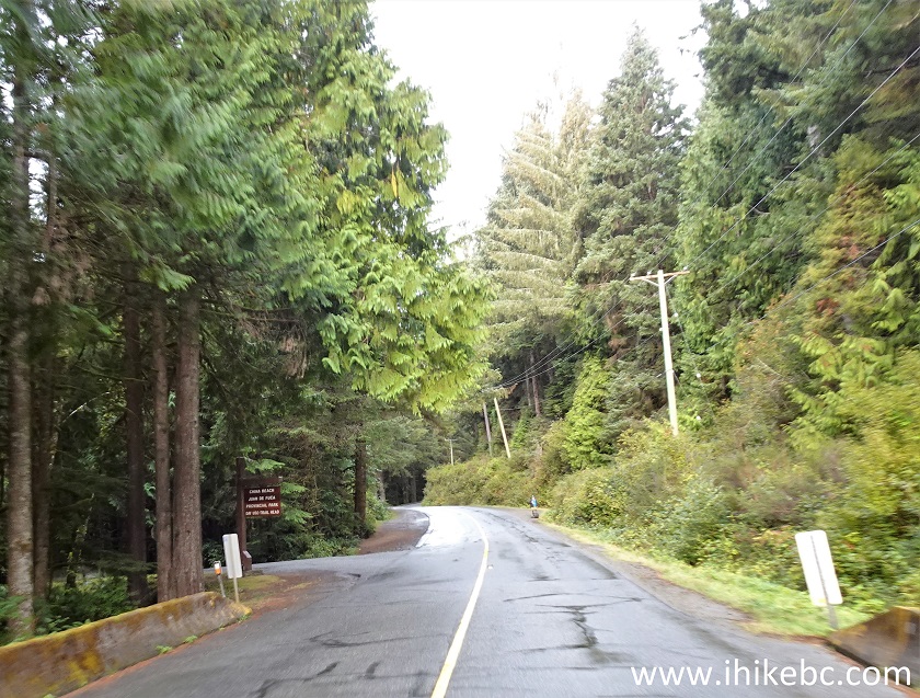
Vancouver Island BC Highway 14 at China Beach trailhead access road
4. Access road after the turn.
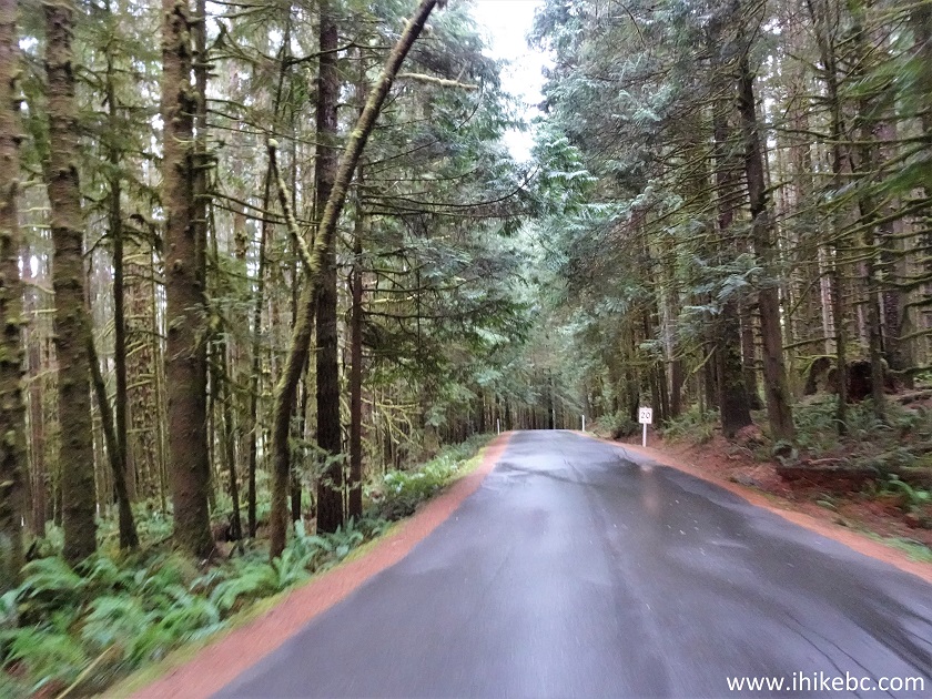
China Beach trailhead access road
5. Arriving to the trailhead several hundred meters later. To the right is a fairly small multi-day parking lot (good for about 40-50 vehicles). To the left is a much larger day use parking lot, where people leave their vehicles to head to China Beach and Mystic Beach, or for a day hike, which is what we did today.
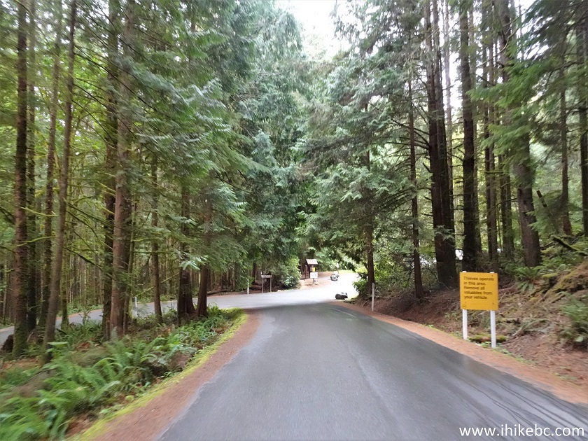
Access road to China Beach parking lot - Juan De Fuca Provincial Park
6. Here is a multi-day parking lot. Coordinates: N 48⁰26.255’ W 124⁰05.501’. Elevation: 70 meters. If you have a second car, drive it to any other trailhead parking lot (depending on the length of your hike). There is also an option of taking a commercial shuttle bus (limited operation) to drop you off at another trailhead, so you can hike back to your vehicle parked here.
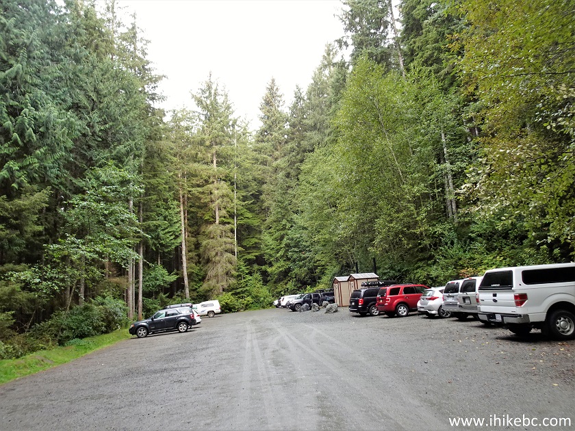
China Beach multi-day parking lot in Juan De Fuca Regional Park
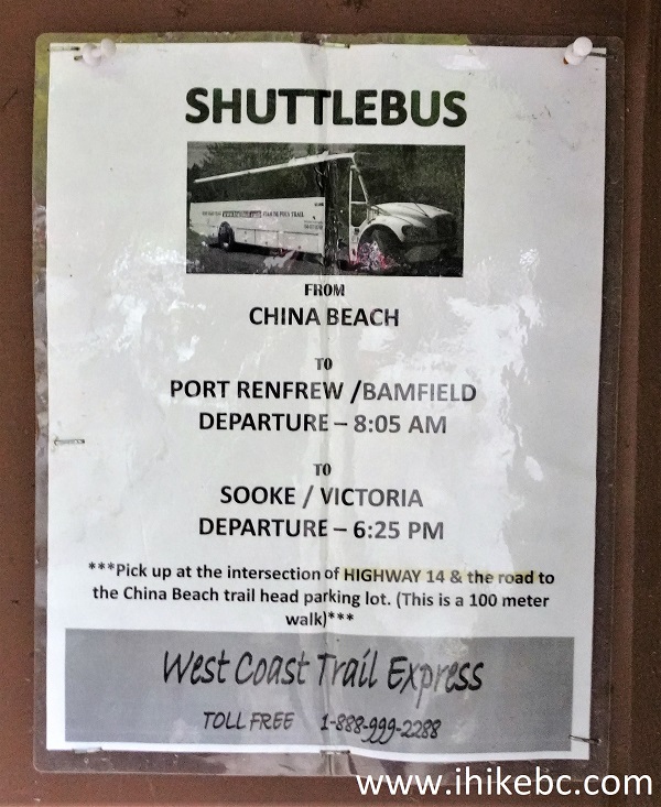
7. And here is that commercial shuttle bus info poster. Bamfield is the western end of the famous West Coast Trail, so looks like this bus can get you there as well, but do call them for all the details.
Port Renfrew/Bamfield to Sooke/Victoria bus advertisement
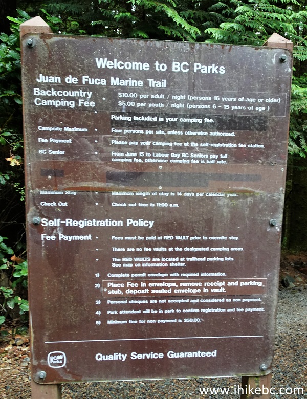
8. A sign with the rules of the place. $10 per adult and $5 per child per day to camp (parking included). You need to deposit the fee at the parking lot, as it's not possible to do it elsewhere.
Juan De Fuca Marine Trail backcountry camping rules
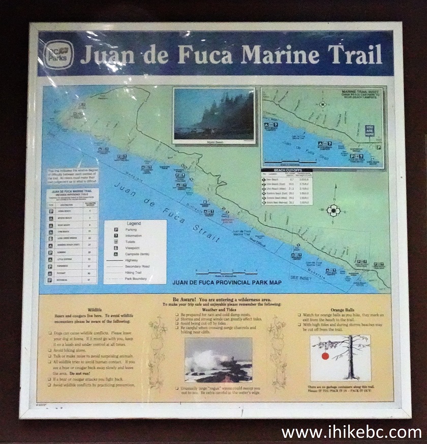
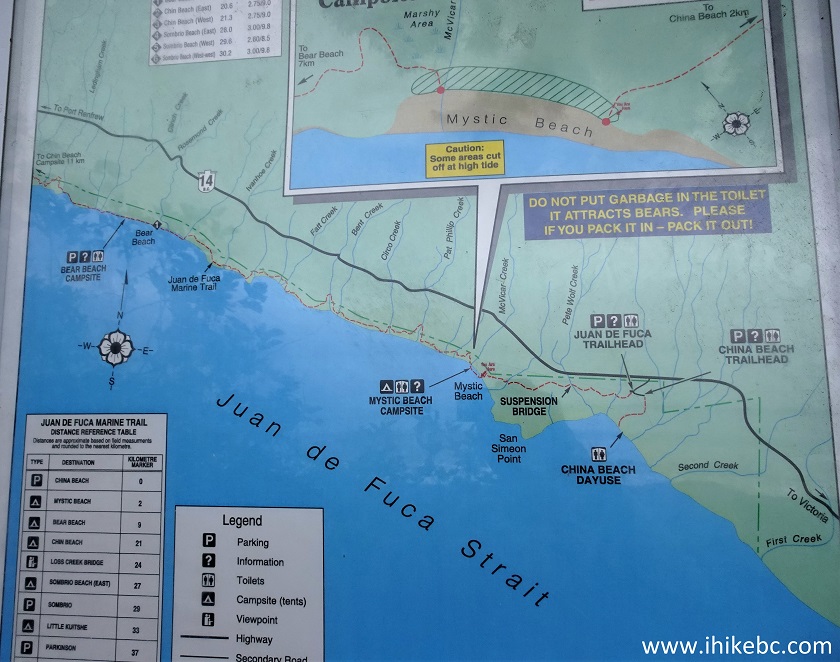
9. Here is a general map of Juan De Fuca Marine Trail. Note the red ball (buoy) which indicate trail entrances from the beaches. Watch out for rouge waves lest you get an unplanned shower or worse.
Juan De Fuca Marine Trail information sign
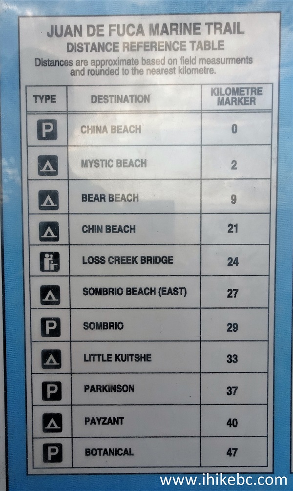
10. This is Juan De Fuca Trail Distance Reference Table posted at the China Beach information board, just like the map of the trail in the photo above and the information in the following two photos. On Day 1, we hiked from China Beach to Bear Beach (km 0 to 9) and back. On Day 2, we went from Sombrio Beach to Chin Beach (not to be confused with China Beach! - km 29 to 21) and back. On Day 3, our hike was Parkinson Creek to Sombrio Beach (km 37 to 29) and back. And, on Day 4, we went from Botanical Beach to km 39 (2 km West of Parkinson Creek) and back.
Juan De Fuca Trail distance reference chart
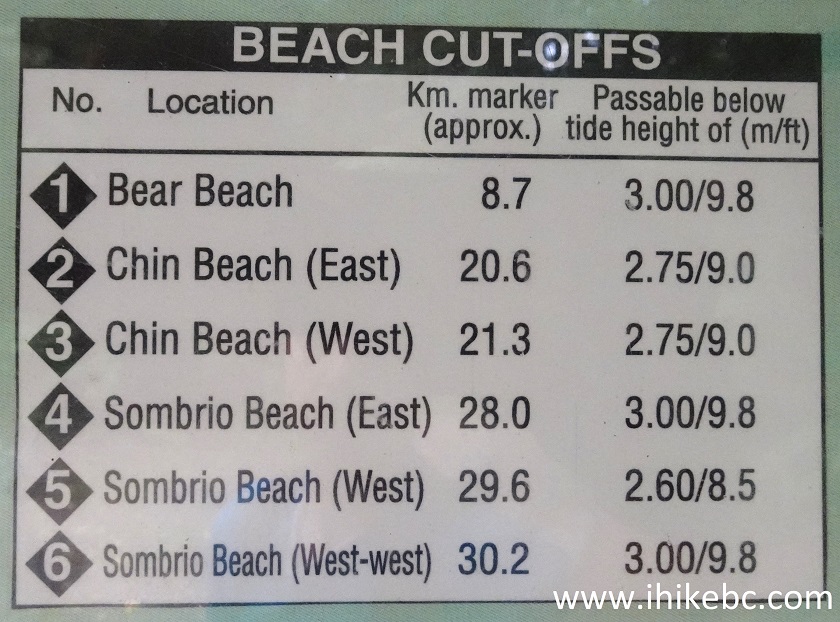
11. Juan De Fuca Trail beach cutoffs. Tidal information is posted at the trailheads, and can also be found at the Government of Canada website - use Sooke tidal predictions for the eastern half of Juan De Fuca Trail, and Port Renfrew predictions for the western half.
Juan De Fuca Trail beach cut-offs
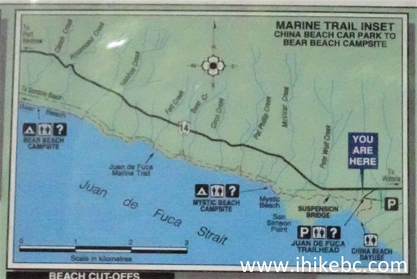
12. And here is a map of Juan De Fuca Trail from China Beach to Bear Beach (0 to 9 km), which we hiked today for a total of 18 km return trip.
Juan De Fuca Provincial Park China Beach to Bear Beach trail map
13. Juan De Fuca Trail hike begins at km 0 (China Beach trailhead).
Juan De Fuca Trail trailhead at China Beach
14. Not even a 100 meters later, a first structure of the trail. There will be many more to come, and not all of them are in as good of a shape.
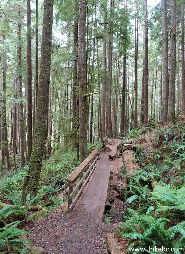
Hiking in Sooke BC area - Juan De Fuca Trail
15. The first suspension bridge of Juan De Fuca Marine Trail also did not take long to arrive. Here we are at the 770 meter mark, getting ready to cross this bridge across Pete Wolfe Creek.
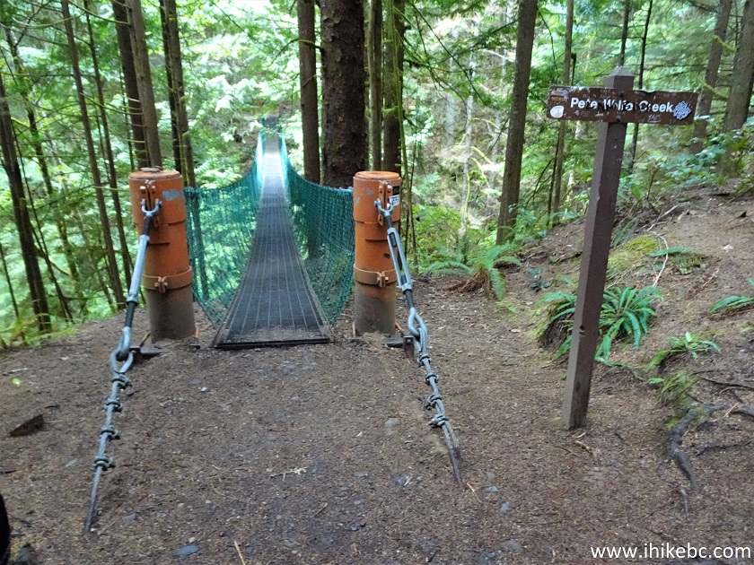
Pete Wolfe Creek suspension bridge
16. Pete Wolfe Creek suspension bridge. It's about 50 meters long.
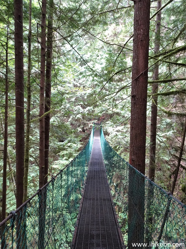
Juan De Fuca Provincial Park Pete Wolfe Creek suspension bridge
Here is our video of
the suspension bridge.
More ihikebc videos are on our YouTube Channel.
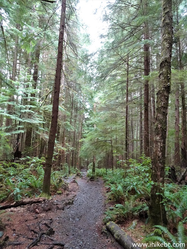
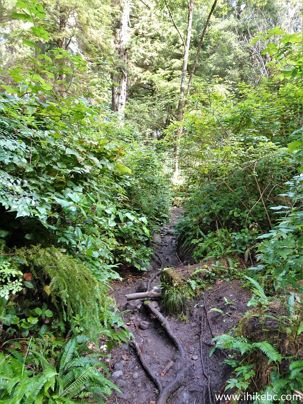
17. Continuing towards Mystic Beach. At 1.14 km here. A pleasant walk in a forest.
China Beach to Bear Beach hike in Juan De Fuca Provincial Park
18-19. A long staircase and a boardwalk at 1.94 km and 1.98 km.
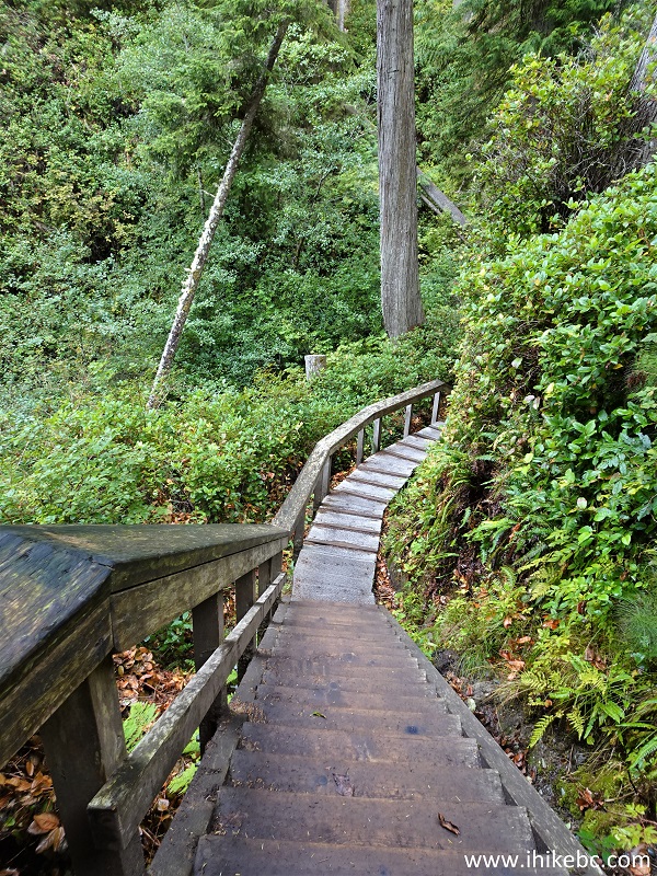
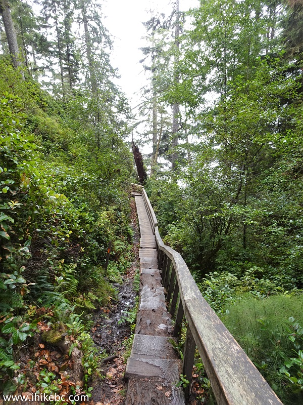
Boardwalk in Juan De Fuca Provincial Park
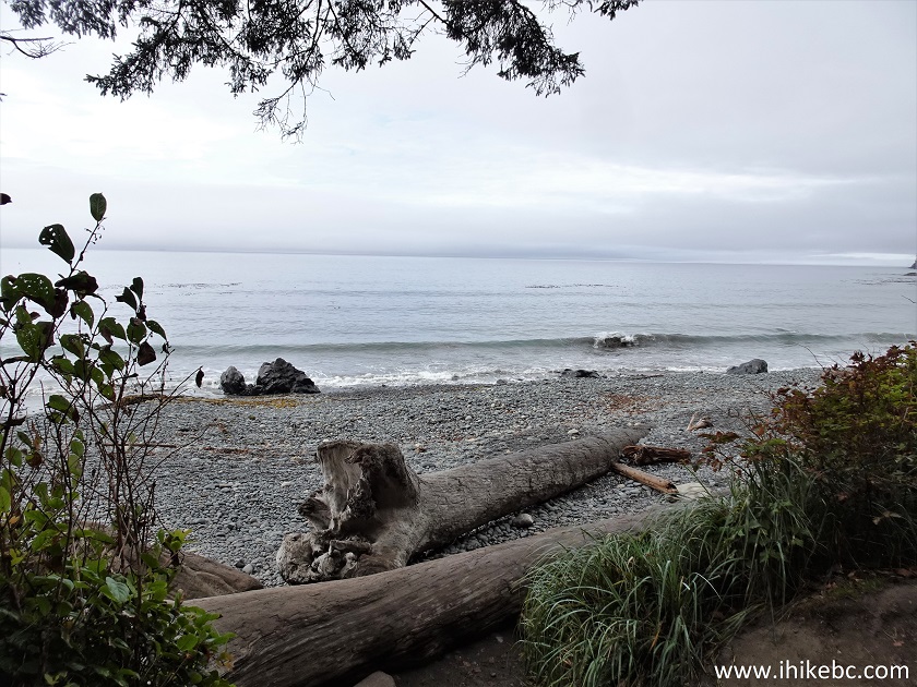
20. Arriving to Mystic Beach at the 2.11 km mark. There are 9 tent pads here and a waterfall (to the left), as well as a few neat grottos. We turned right upon entering the beach. Look for tent pads for the continuation of the trail - you need to go THROUGH them and keep to the left while doing so, as the trail re-enters the forest past the pads, and it's not very obvious - we spent quite a bit of time trying to find the way.
Mystic Beach
21. The map shows where we are.
Map of Mystic Beach location in Juan De Fuca Provincial Park British
Columbia Canada
22. Not much of a beach, just a whole lot of stones. Like almost all Juan De Fuca Trail beaches, save for Sombrio Beach, which does have some sandy spots.
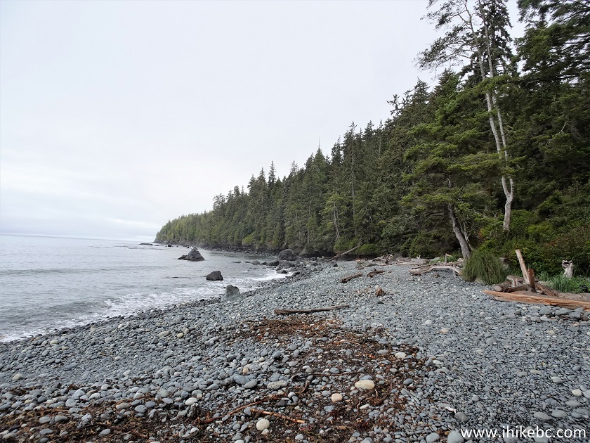
Juan De Fuca Provincial Park Mystic Beach
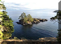
23. A fine view, though. Should be even better with the sun out.
Mystic Beach - Juan De Fuca Provincial Park - Vancouver Island BC
24. Looking back. Not bad either. We are past the tent pads now, but it's not a very large beach - several hundred meters at most.
Vancouver Island - Mystic Beach - Juan De Fuca Provincial Park
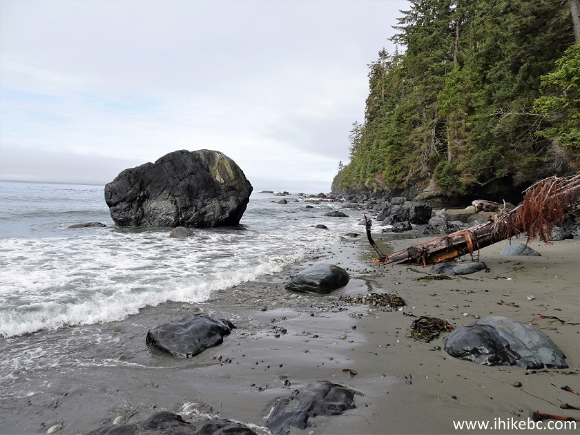
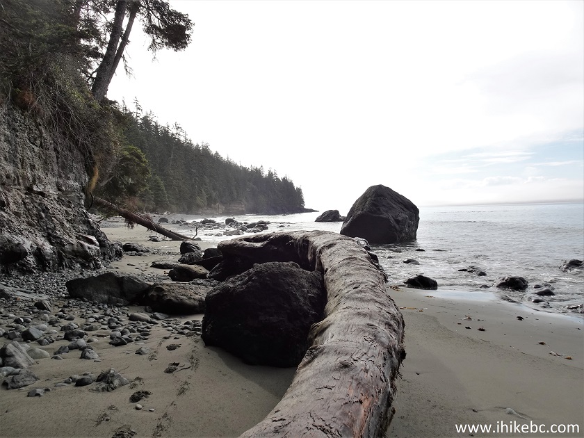
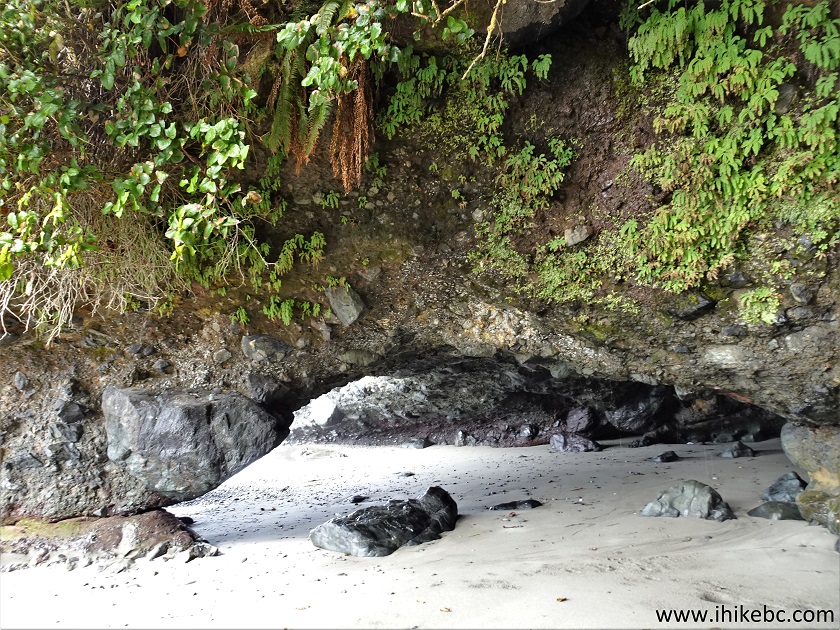
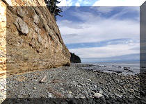
25-27. Going all the way to the right resulted in reaching these fine grottos. If you are willing to wade, you can go even further along the coast and may find something even better.
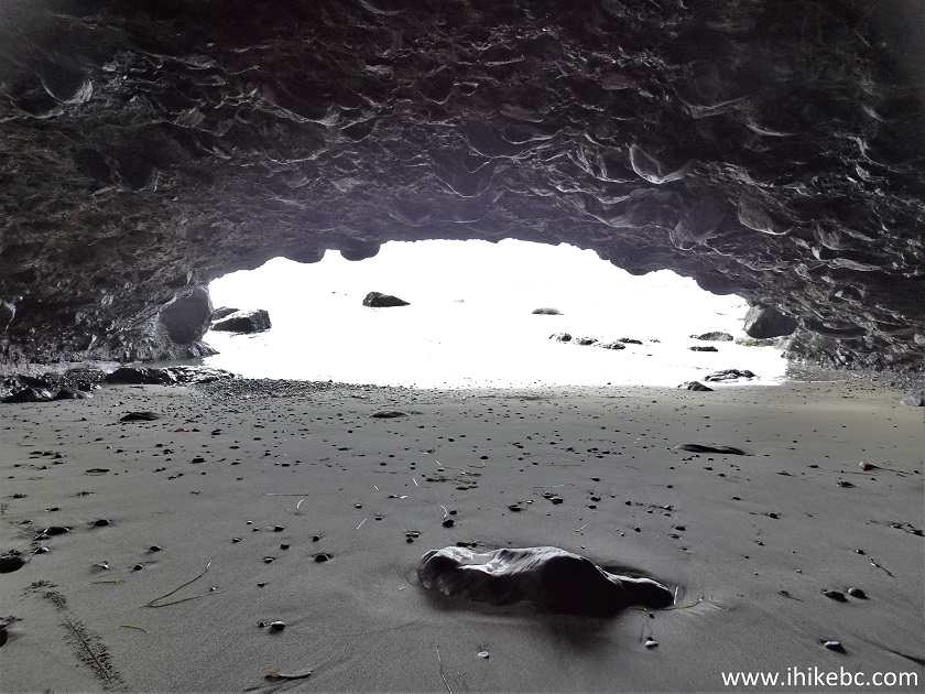
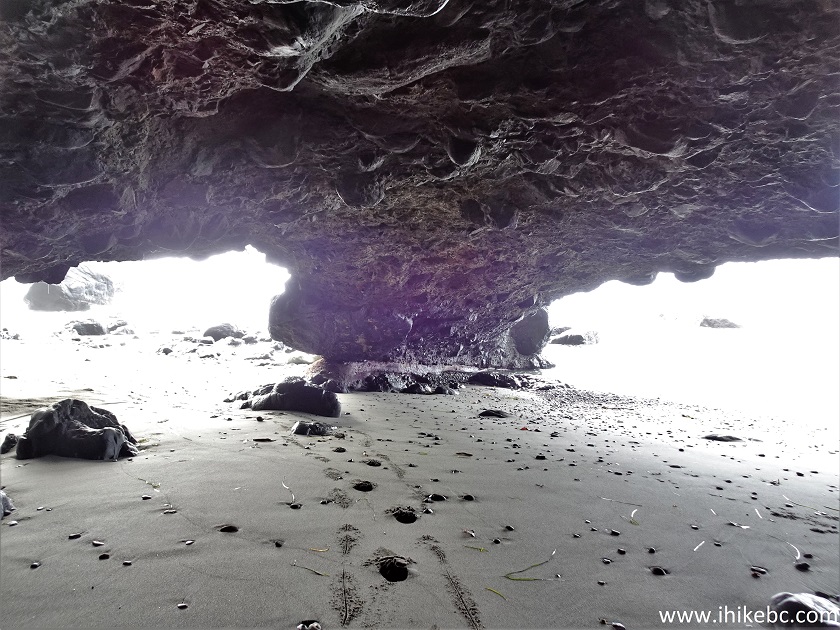
Juan De Fuca Provincial Park grotto
28. We then returned to the tent pads. This sign is located right by those pads.
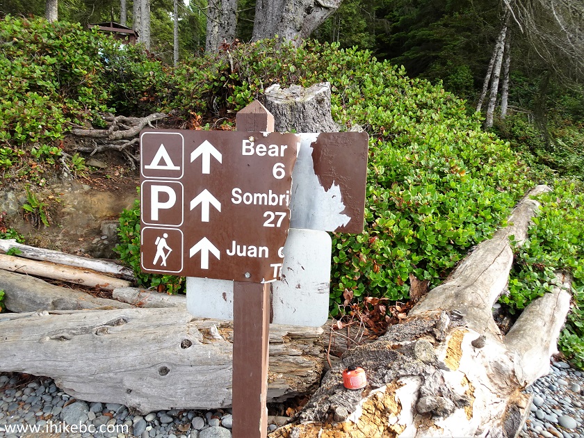
Juan De Fuca Provincial Park British Columbia Canada
29. One of the tent pads at Mystic Beach.
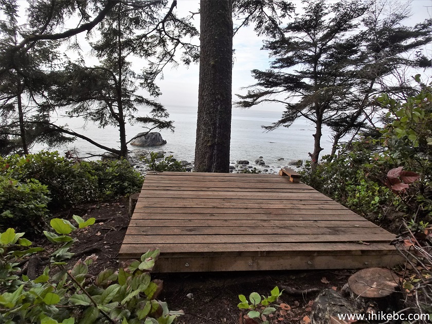
Mystic Beach tent pad
30. So, yes, get into the pads area, and go through them keeping to the left. The trail continues past the pads. At 2.37 km here.
Mystic Beach to Bear Beach hike in Juan De Fuca Provincial Park British
Columbia Canada
Our Juan De Fuca Marine Trail Hike trip report Continues on Page 2.


|
 |
![]()
![]()
![]()
ihikebc.com Trip 301 - Juan De Fuca Trail Hike (near Sooke, BC)
Page 1 of 8