![]()
![]()
![]()

Trip 300 - September 5-6, 2023 (Tuesday-Wednesday)
Coast Trail Hike
East Sooke Regional Park
Near Victoria, BC
Page 4 of 4
Liked:
Numerous fine views of the rugged coastline, many interesting arbutus trees, shade in the forest, no bugs, the ability to hike one way (with a car shuttle).Of Note: The trail is popular (especially to Beech Head), occasional noise from passing boats, steep unbarricaded drop-offs here and there, uneven ground, rocks and roots, a few short steep stretches – hiking poles and boots are highly recommended.
Vancouver Island, Victoria & Gulf Islands Backroad Mapbook (9th edition) Coordinates: Page 4 (Sooke) C5-C6.
Related Website: East Sooke Regional Park - CRD Official Website.
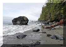
Follow @ihikebc TweetEast Sooke Regional Park is a very large regional park located on Vancouver Island, about 35 kilometers West of Victoria. There are numerous trails in the park, mostly going through the woods, but the most scenic aptly named Coast Trail runs along the coast of Salish Sea for over 10 kilometers. There are trailheads at both end of Coast Trail, thus making it possible to hike it one way with the help of a car shuttle. Doing a return trip of about 21 kilometers is possible as well, though the terrain, despite not being terribly complicated, is still challenging enough and is not very conducive to fast hiking, with several large moderately challenging hills.
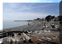
A pleasant bonus was observing seals swimming along the coast at various parts of the trail. We even saw a seal enjoying a sun bath while chilling on a rock, but it heard us and took off before we could take a photo.
There is a Trap Shack close to the middle point of Coast Trail, so on September 5th we hiked West from Aylard Farm parking lot to the shack and back. The next day we hiked from the other end of the trail (off Silver Spray Drive) to the same spot and back, thus hiking the entire trail.
Please, note that there is a private real estate development in progress at the end of Silver Spray Drive, and access can be closed at any time. In this case, use Pike Road entrance, which would extend access to the western end of Coast Trail by about one kilometer one way.
The first two pages of this trip report are dedicated to the September 5th hike from Aylard Farm parking lot west to a Trap Shack and back (5.4 km one way), and the last two pages describe the hike east and back (5.22 km one way) which we had the following day. There are definitely more people heading west from Aylard Farm parking lot, and the trail would likely be quite busy during the main hiking season, so come off-season (elevation above sea level is minimal, and hiking should be possible for much of the year), or start from the western end and turn around at the Trap Shack to avoid the crowds.
* All trail distances are based on a GPS odometer and are approximate.
86. There are several splits along the way, as there are numerous other trails in East Sooke Regional Park.
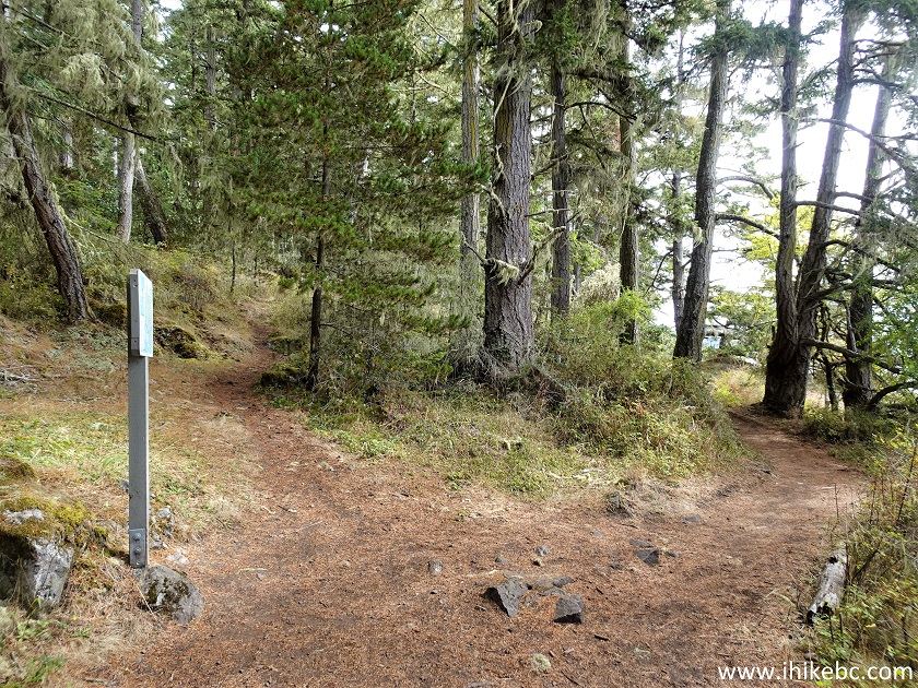
Hiking in Victoria BC area - Coast Trail in East Sooke Regional Park
87. A very fine view at 300 meters from the trailhead.
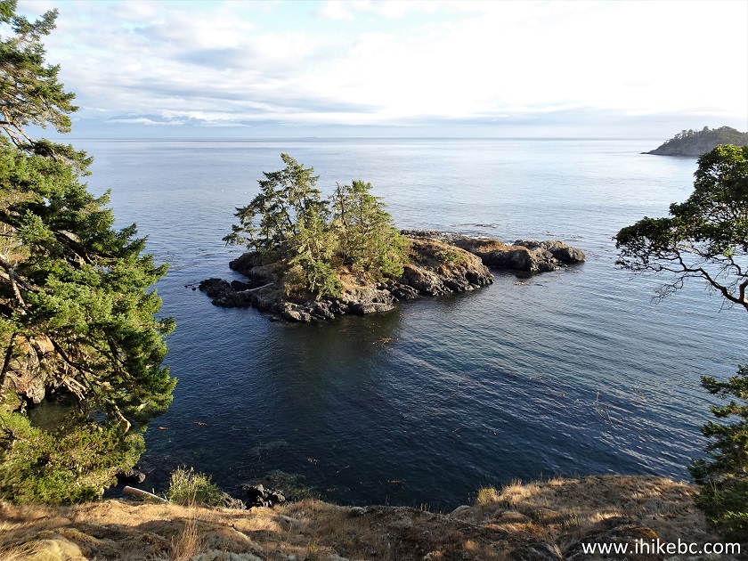
Coast Trail view
88. The western part of Coast Trail is more challenging than the eastern part, and features four rather large moderately difficult hills, such as the one in the photo below, 390 meters from the trailhead.
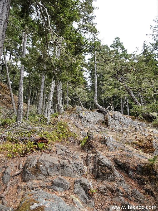
Challenging stretch of Coast Trail near Victoria BC Canada
89. Going through a forest at 960 meters of the trail.
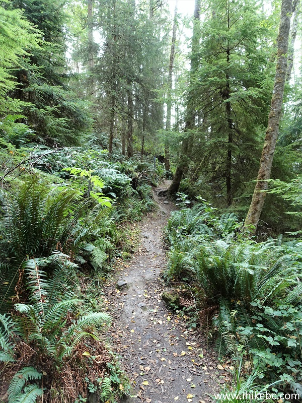
Hiking in Canada - Coast Trail on Vancouver Island BC
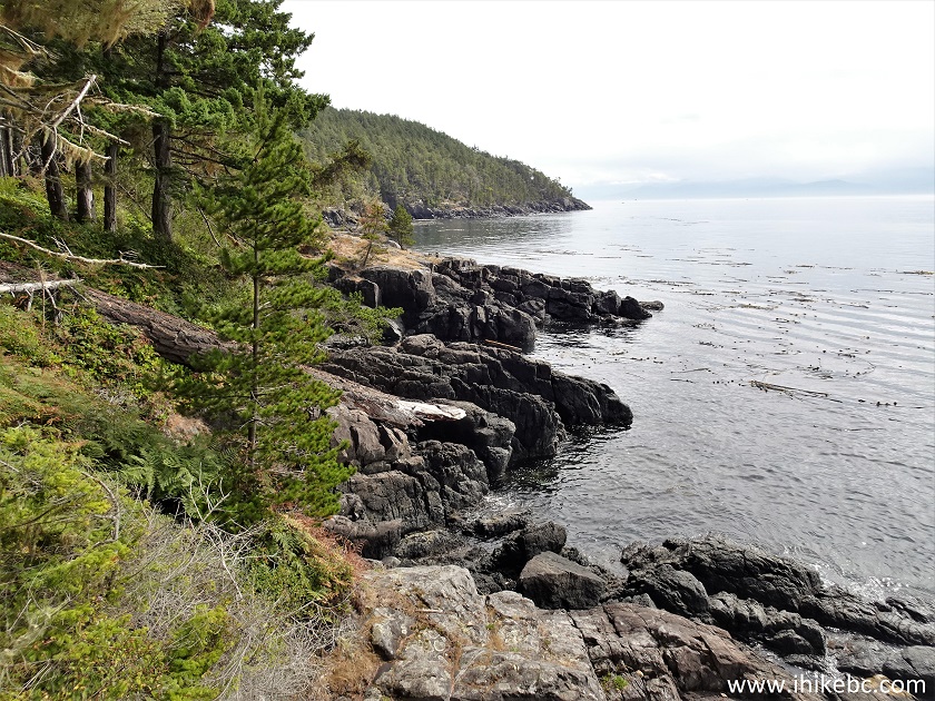
90. Looking back at 1.43 km.
Vancouver Island coastline - East Sooke Regional Park - Coast Trail
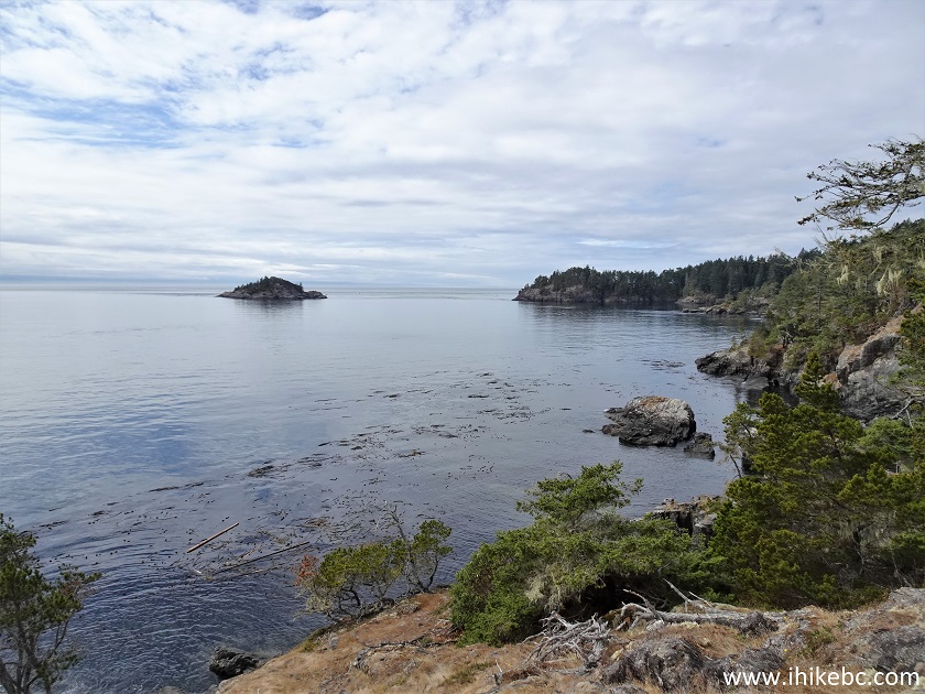
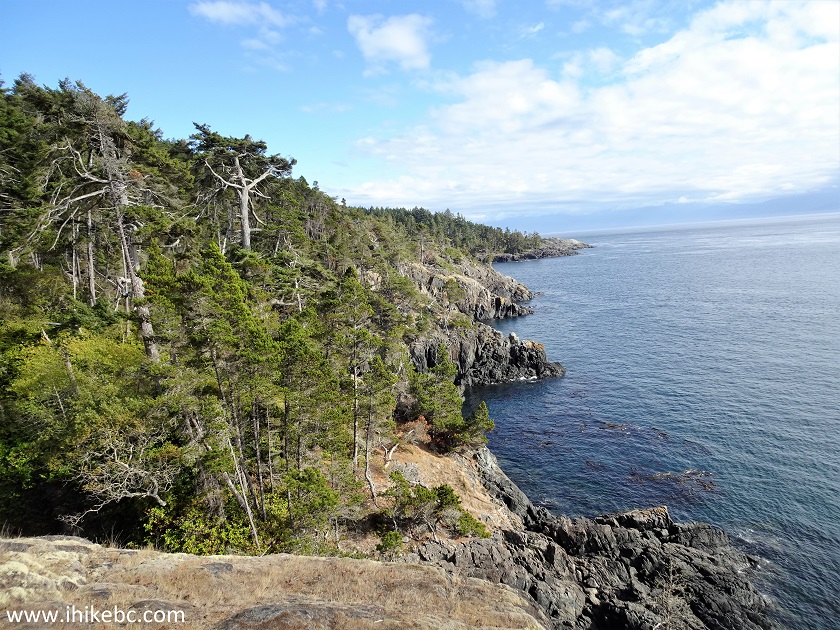
91. Vancouver Island coastline at the 1.87 km mark of Coast Trail in East Sooke Regional Park.
View from Coast Trail near Victoria British Columbia Canada
92. A small bridge at 2.19 km.
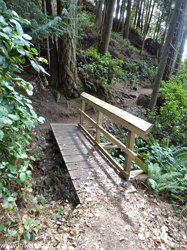
Hiking Coast Trail - East Sooke Regional Park near Victoria BC
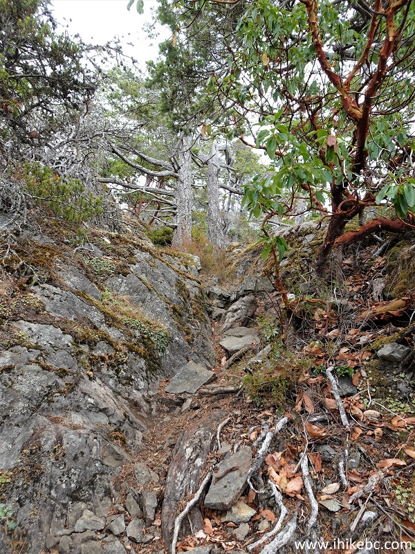
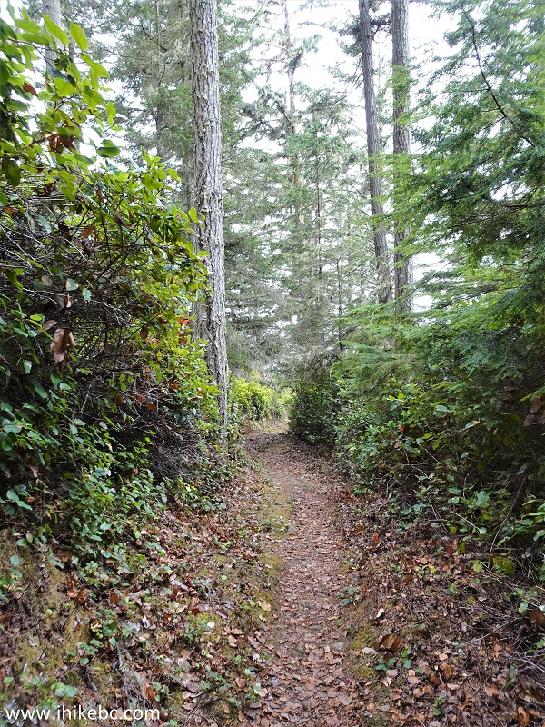
93. The path in the forest 90 meters later.
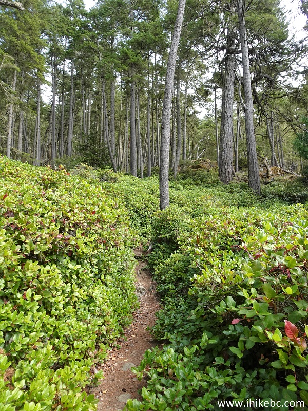
Coast Trail hiking through forest
94. Another hill to climb at the 2.95 km mark of Coast Trail.
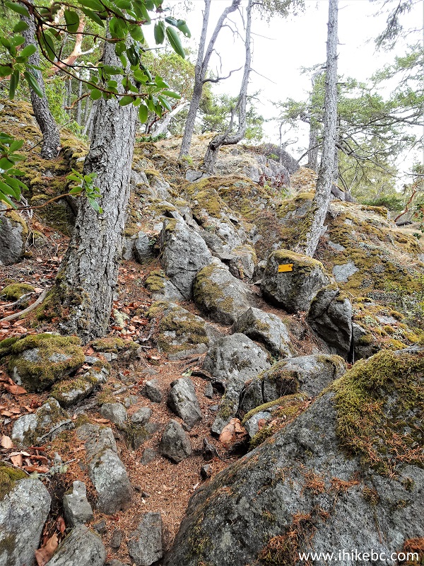
Steep stretch of Coast Trail in East Sooke Regional Park
95. Yet one more at 3.64 km.
Coast Trail
96. Coast Trail has many arbutus trees, like this one at 3.67 km from the trailhead.
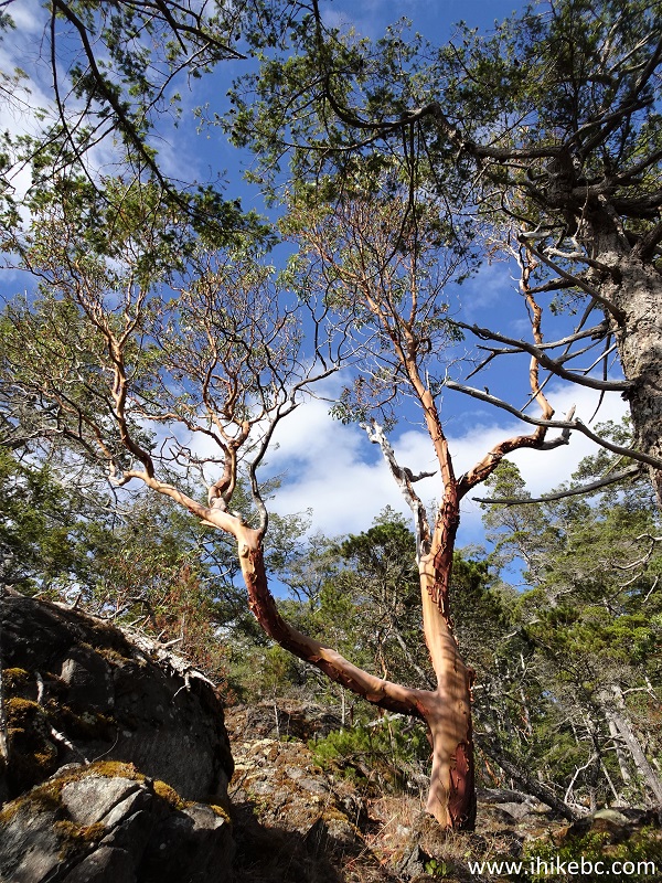
Arbutus Tree Vancouver Island BC
97. More climbing to do - at 3.90 km here.
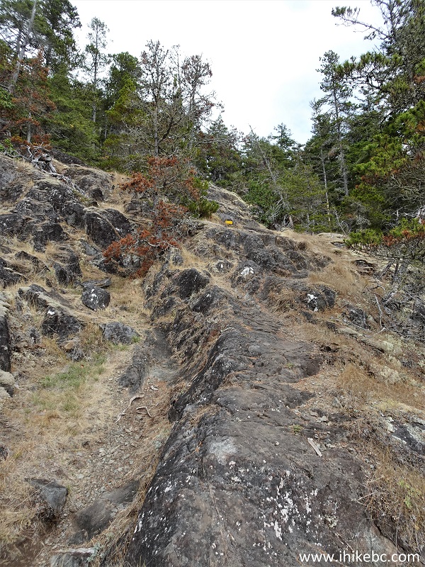
East Coast Regional Park
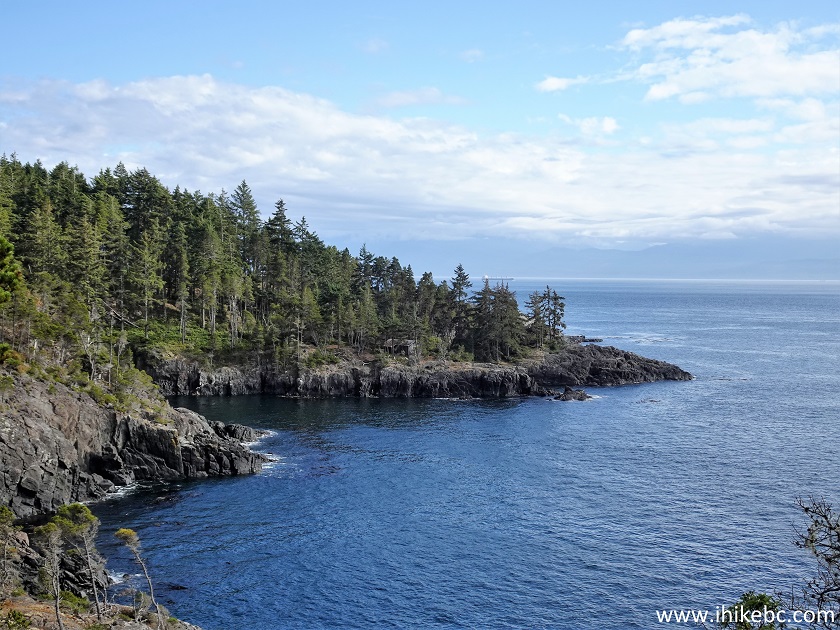
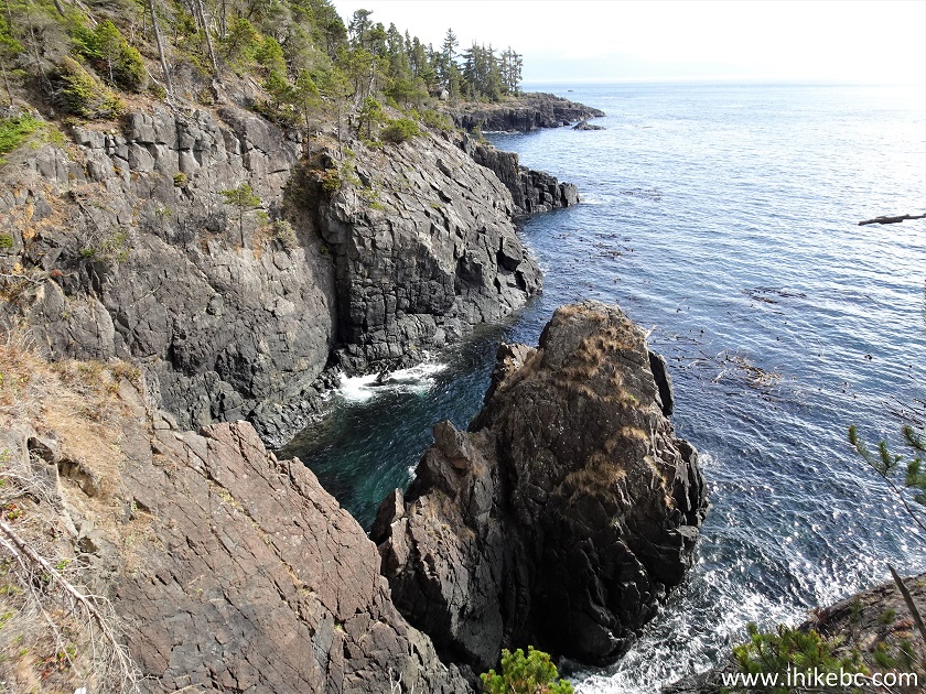
98. Another impressive view comes at the 4.14 km mark of Coast Trail.
View from Coast Trail - East Sooke Regional Park - Vancouver Island BC
Canada
99-100. Looking back at 4.31 km.
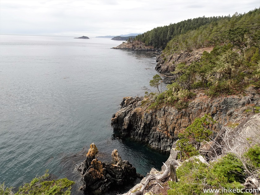
East Sooke Regional Park rock view
101. At 4.44 km, we can already see the Trap Shack far ahead.
View from Coast Trail
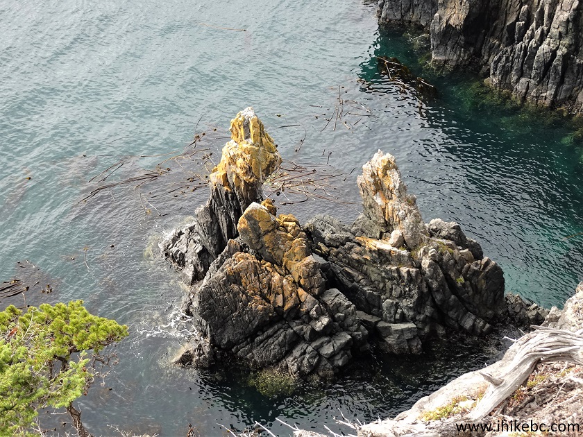
102. Cool.
Great view - Coast Trail - East Sooke Regional Park
Here is our video of
the views from this location.
More ihikebc videos are on our YouTube Channel.
103. Almost there.
Hiking Coast Trail
104. And we are back at the Trap Shack 5.22 km from the western trailhead. We then turned around and headed back, thus completing Coast Trail in two days.
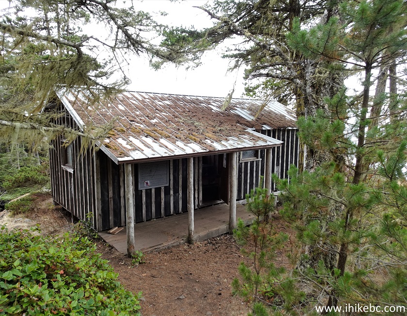
Coast Trail Trap Shack
Coast Trail in East Sooke Regional Park is relatively easy to hike and has numerous impressive views. Highly recommended.


|
 |
Other Trips in Victoria BC Area:
|
|
|
|
|
|
|
|
|
|
|
|

![]()
![]()
![]()
ihikebc.com Trip 300 - Coast Trail in East Sooke Regional Park (near Victoria, BC)
Page 4 of 4