![]()
![]()
![]()

Trip 301 - September 7 (Thursday), 9 (Saturday), 11 (Monday) and 15 (Friday), 2023.
Juan De Fuca Trail Hike
Juan De Fuca Provincial Park
Near Sooke, BC (West of Victoria)
Page 8 of 8
Botanical Beach to (near) Parkinson Creek (km
47 to 39) and back
1) China Beach (easternmost) - about 37 km west of Sooke BC via Hwy 14, 75 km west of Victoria.
2) Sombrio Beach - about 58 km west of Sooke BC via Hwy 14.
3) Parkinson Creek - about 68 km west of Sooke BC via Hwy 14.
4) Botanical Beach (westernmost) - about 76 km west of Sooke BC via Hwy 14, in Port Renfrew.
Liked in General:
Shoreline views, tidal pools, grottos, waterfalls, three suspension bridges, several fine forest scenes, shade in the forest, no bugs.1) China Beach to Bear Beach - Pete Wolfe Creek suspension bridge, Mystic Beach and Bear Beach shoreline views and grottos, Mystic Beach waterfall, meeting Brandt's cormorants.
2) Sombrio Beach to Chin Beach - garbage cans at Sombrio Beach parking lot, some sand at Sombrio Beach, a few tidal pools at Chin Beach, excellent grottos (with natural ceiling art) at Chin Beach, meeting a passing seal at Chin Beach.
3) Parkinson Creek to Sombrio Beach - Minute Creek suspension bridge, waterfall view from the suspension bridge, Sombrio Beach.
4) Botanical Beach to km 39 (2 km east of Parkinson Creek) page 7 and this page - excellent tidal pools near Botanical Beach, several fine shoreline views.
Of Note in General: Camping and overnight parking fees required, high tides may cut off beach/trail access, numerous mud stretches, frequently damaged infrastructure (ladders, bridges, boardwalks), bear scat, the trail is popular, uneven ground, rocks and roots, stones of all sizes on the beach, very slippery stones in grottos and on the beach, hiking poles and boots are highly recommended. Very limited /nonexistent cell phone coverage along the trail - it might be possible to get a signal from a USA carrier (beware of roaming charges!). The entire trail is in the tsunami hazard area - head to higher ground or inland in case of an earthquake.
1) China Beach to Bear Beach - log bridge at 6.3 km is missing railing on one side, steep ladder on approach to Bear Beach.
2) Sombrio Beach to Chin Beach - Sombrio Beach location is very popular, and the parking lot is small - may have to park along the access road during busy times. Steep unbarricaded drop-off at the first waterfall viewpoint. Very slippery stones at the top of the waterfall - extreme fall hazard, do not approach.
3) Parkinson Creek to Sombrio Beach - not much to see on this stretch of Juan De Fuca Trail.
4) Botanical Beach to km 39 (2 km east of Parkinson Creek) page 7 and this page - overnight camping is not allowed on Botanical Beach parking lot, a whole lot of bear scat (much more than on the rest of the trail combined), tricky Yauh Creek log crossing, rogue waves hazard near Botanical Beach.
Vancouver Island, Victoria & Gulf Islands Backroad Mapbook (9th edition) Coordinates: Page 4 (Jordan River) C4-B4-A4 and Page 3 (Port Renfrew) G4-F3-E3-D3-C3.
Related Website: Juan De Fuca Provincial Park - BC Parks Official Website.
Follow @ihikebc TweetJuan De Fuca Marine Trail is a multi-day 47 km-long hike on Vancouver Island along Salish Sea between China Beach (East of Sooke BC) and Botanical Beach in Port Renfrew, BC. Both trailheads are easily accessible by vehicles via Highway 14 (West Coast Road), allowing for a one-way hike via a shuttle. Also, because there are two other vehicle-accessible locations along the trail (Sombrio Beach and Parkinson Creek), it is possible to hike Juan De Fuca Trail in series of one day hikes, which is exactly what we did. On Day 1, we hiked from China Beach to Bear Beach (km 0 to 9) and back. On Day 2, we went from Sombrio Beach to Chin Beach (not to be confused with China Beach! - km 29 to 21) and back. On Day 3, our hike was Parkinson Creek to Sombrio Beach (km 37 to 29) and back. And, on Day 4, we went from Botanical Beach to km 39 (2 km West of Parkinson Creek) and back.
Thus, we hiked the entire Juan De Fuca Trail except the part from Bear Beach to Chin Beach (km 9 to 21) and a small part between km 37 and 39. The Bear Beach to Chin Beach part was not possible to do in a day hike, and the part between km 37 and 39 was all in the forest (like the most of Juan De Fuca Trail, by the way), and we wanted to save time to explore Botanical Beach area, arguably the best part of this entire hike.
The main attractions of Juan De Fuca Trail are: three long suspension bridges, fine shoreline views at beaches and (sometimes) from the trail in the woods, wonderful tidal pools at Botanical Beach (and a few much smaller ones at other beaches), very interesting grottos at some beaches, several waterfalls, and a few interesting forest scenes. Campers would certainly enjoy spending time at the beaches (mostly made of stones, small and large), and will likely have a whole lot of other people nearby at all times aside from, perhaps, the coldest and wettest months of the year.
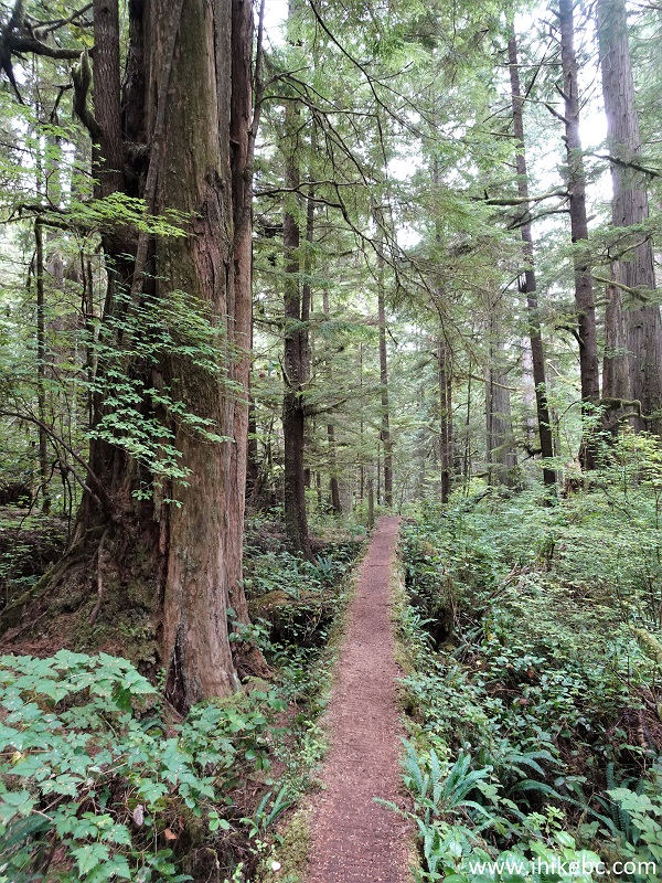
What surprised us is that, despite being a marine trail, the vast majority of hiking has to be done in the woods. There are no major elevation changes, so it's a fairly easy trail to hike from that perspective, but the biggest challenge comes from numerous slippery sections and rather frequently worn-out wooden infrastructure (ladders, bridges and boardwalks), presenting somewhat complicated and, sometimes, fairly dangerous conditions in many parts of the trail.
Also of note, while there are pit toilers at all the parking lots and some campsites along Juan De Fuca Trail, the garbage cans can only be found at the Sombrio Beach parking lot! There are no garbage cans at the Botanical Beach lot (there is a free public dump in Port Renfrew, open during business hours only), and none at China Beach lot either (however, there are garbage cans at China Beach campground, about 1 km east of the lot). Overnight parking and backcountry camping requires a fee. Parking around Port Renfrew is complicated. No overnight camping is allowed at the Botanical Beach lot, and there is a forest service road fairly close by (just east of Port Renfrew), but it does not have a good level spot for parking, unless you manage to find one.
Furthermore, there will likely be a whole lot of mud on this trail if you hike it at any time aside from, perhaps, late Summer and early Fall. But hiking during the drier season also means that the waterfalls along Juan De Fuca Trail (there are a few) would not be as impressive due to a much smaller volume of water.
Finally, there are no fresh water taps anywhere along the trail. Be prepared to have your water boiled or treated, especially if you plan on having a multi-day hike.
* All trail distances are based on a GPS odometer and are approximate.
209. Now at 210 meter mark between km 45 and 44 of Juan De Fuca Trail.

Juan De Fuca Hike
210. A fine view 150 meters later.

View from Juan De Fuca Trail
211. Another boardwalk halfway between km 45 and 44.

Juan De Fuca Provincial Park
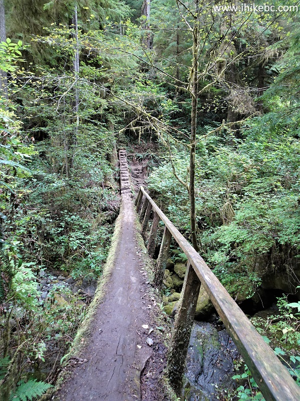
212. Now a bridge 910 meters between km 44 and 43 of Juan De Fuca Trail.
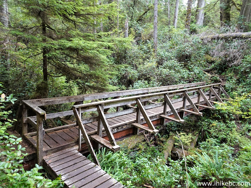
Hiking in Port Renfrew area - Juan De Fuca Marine Trail
213. More forest hiking at 215 meters between km 43 and 42. A whole lot of bear scat on this stretch of Juan De Fuca Trail (Botanical Beach to Parkinson Creek).

British Columbia hiking - Juan De Fuca Trail
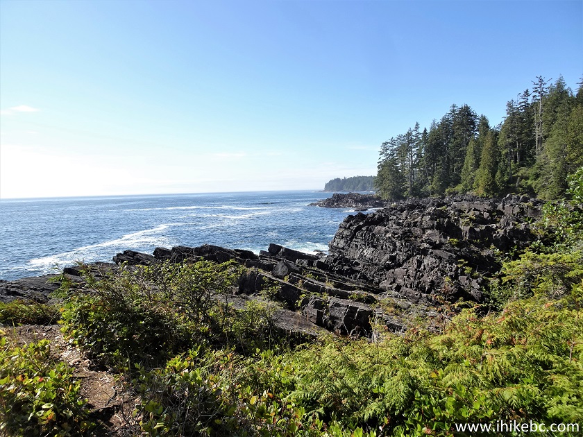
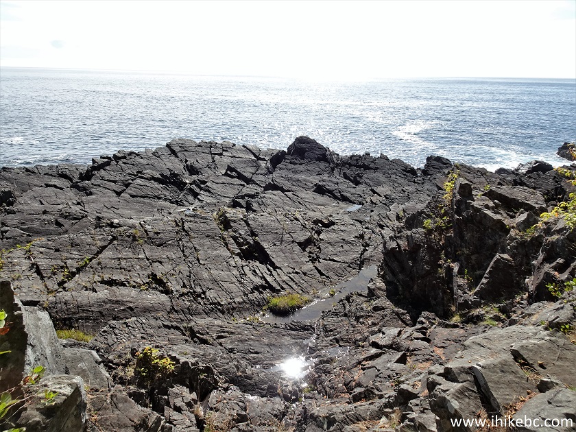
214-215. A shoreline view at 335 meters between km 43 and 42.

Vancouver Island shoreline in Juan De Fuca Provincial Park
216. Another fine boardwalk 325 meters later.
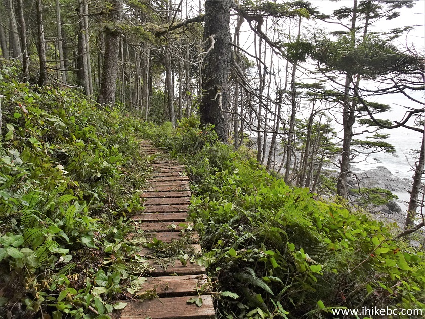
Juan De Fuca Trail boardwalk
217. Looking back (west) from the above location.

View from Juan De Fuca Hike near Port Renfrew BC Canada
218. Now at 950 meters between km 43 and 42.

British Columbia hiking in Juan De Fuca Provincial Park
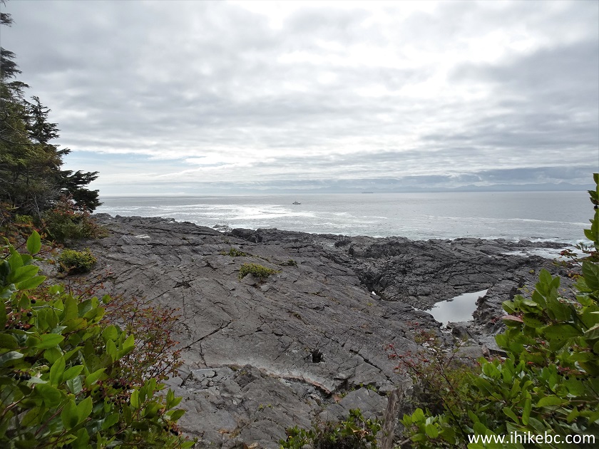
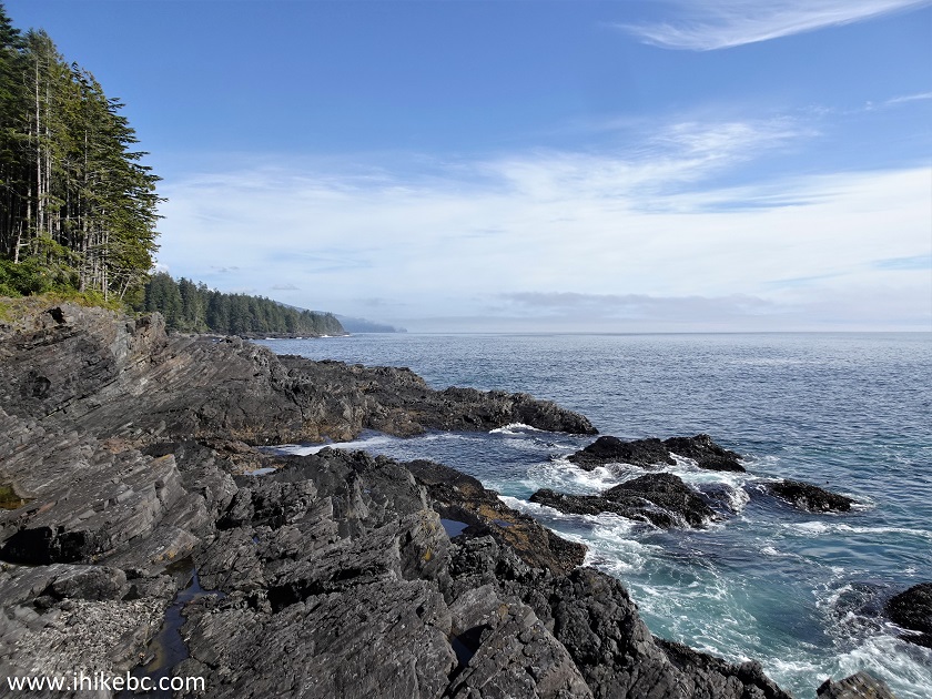
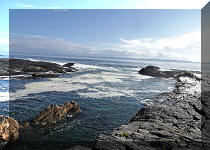
219. At 420 meters between km 42 and 41 of Juan De Fuca Trail. Looking back (west) towards Botanical Beach.
View from Juan De Fuca Marine Trail on Vancouver Island British Columbia
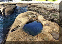
220-224. 80 meters later, there is a good access for some neat shoreline views. Coordinates: N 48⁰31.113’ W 124⁰24.462’. Elevation: 15 meters. Red buoys indicate trail entrances, and are helpful when you are hiking on a beach.


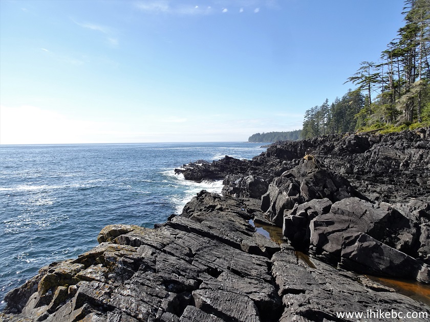
Juan De Fuca Provincial Park
Here is our video of
the views from this location.
More ihikebc videos are on our YouTube Channel.
225. Back on the trail. At 690 meters between km 42 and 41.

Canada Hiking
226. At 180 meters between km 41 and 40, there is Providence Cove turnoff. Coordinates: N 48⁰31.355’ W 124⁰24.056’. Elevation: 35 meters.

Hiking in British Columbia
227-228. It's a short hike to the cove - under 200 meters. Could be quite overgrown.


Providence Cove access path in Juan De Fuca Provincial Park
229. Providence Cove is hardly picturesque, and camping is not allowed. But it could be a nice place for a break on a long hike.
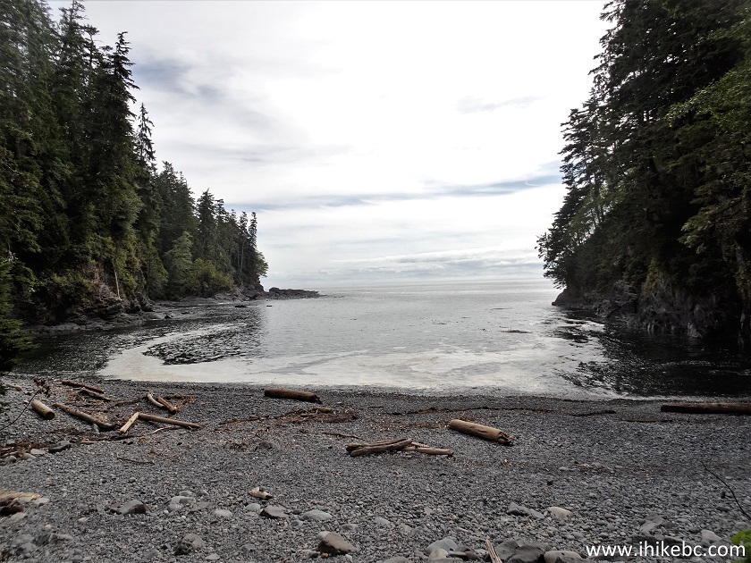
Juan De Fuca Provincial Park Providence Cove
230. Continuing on Juan De Fuca Trail, we are at the 270 meter mark between km 41 and 40.

Juan De Fuca Marine Trail Hike in British Columbia
231. 50 meters later, we have approached one of the most treacherous crossings of Juan De Fuca Trail - Yauh Creek log bridge.

Yauh Creek crossing on Juan De Fuca Trail
232. The log could be slippery, and there is no railing on the left side. The railing on the right side is leaning downwards. If you are relying on that railing and it gives way, the fall would be quite nasty.
Juan De Fuca Trail dangerous log crossing
233. The stairs after the bridge.

Hiking in Juan De Fuca Provincial Park in British Columbia Canada
234. Looking back, we see how much of a lean there is.
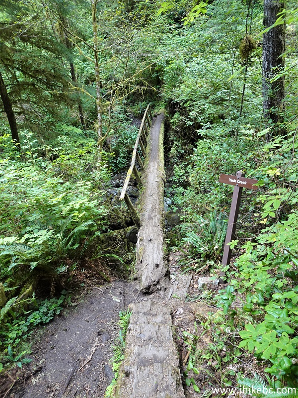
Juan De Fuca Trail Yauh Creek log crossing
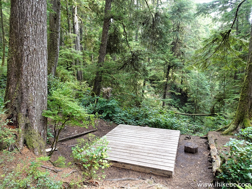
235. Payzant Camp comes at 40 km of Juan De Fuca Trail. There is a pit toilet and one tent pad. No views.
Payzant Camp - Juan De Fuca Trail near Port Renfrew BC Canada
236. Now at 330 meters between km 40 and 39.
Hike in Canada - Juan De Fuca Marine Trail
237. 80 meters later.

Juan De Fuca Provincial Park bridge
238. Log stairs at the end of the bridge.

Hiking in Port Renfrew BC area - Juan De Fuca Trail
239. A good view at 820 meters between km 40 and 39.

View from Juan De Fuca Trail
240. And here we are at the 39 km mark of Juan De Fuca Trail. Parkinson Creek is two kilometers further east from here, but we looked at the GPS map and it showed more forest hiking. As we were eager to get back to tidal pools, we turned around at this point and headed back, thus concluding our Juan De Fuca Trail hike over four separate days.
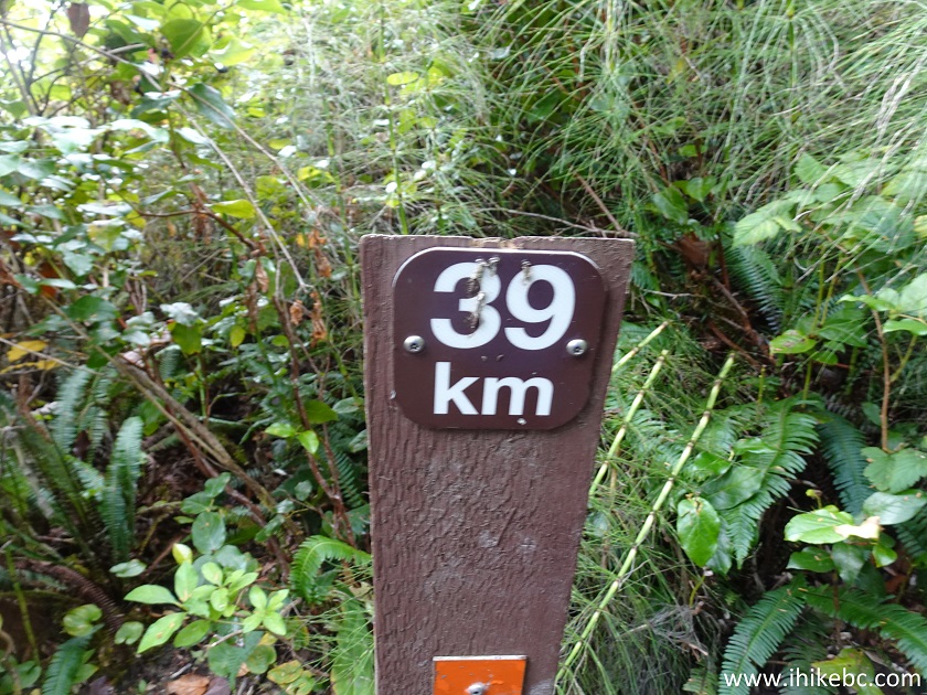
Juan De Fuca Trail 39 kilometer marker
Juan De Fuca Marine Trail has a lot to offer both to day hikers, beach campers, and folks interested in a multi-day adventure. Highly recommended.


|
 |
![]()
![]()
![]()
ihikebc.com Trip 301 - Juan De Fuca Trail Hike (near Sooke, BC)
Page 8 of 8