![]()
![]()
![]()

Trip 294 - August 30, 2023 (Wednesday)
Sidney Island Visit
Off Vancouver Island, BC
Page 1 of 3
Liked: Numerous fine shoreline views at the spit and the lagoon, many herons at the lagoon, shade in the forest, no bugs, interesting random mini-geysers at the spit (but see Of Note).
Of Note: Ferry service to Sidney Island (Sidney Spit) is seasonal, no fresh water on the island, noise from airplanes taking off from Victoria airport, from single engine aircraft, and from passing boats; random mini-geysers all over the place shooting up from the ground up to 1 meter high at the spit and occasionally hitting unsuspecting hikers, no shade at the spit. Lots of dirt and loose stones at the spit – hiking poles are recommended, and hiking boots are highly recommended (hiking boots are essential, if hiking through the mud by the lagoon).
Vancouver Island, Victoria & Gulf Islands Backroad Mapbook (9th edition) Town of Sidney Coordinates: Page 12 (Saturna Island) B6-B7.
Related Websites: Sidney Spit Ferry - Official Website, Sidney Spit Campground - Parks Canada.
Other Trips in Sidney BC Area: Town of Sidney Visit, Island View Beach Park visit.
Follow @ihikebc TweetSidney Island is a camping and hiking destination located just east of Vancouver Island, across from the town of Sidney, BC. A small passengers-only (48 persons capacity) ferry Sallas takes 15 minutes and $25 per an adult round trip (online booking required both ways) to get from Port Sidney Marina in Sidney to Sidney Island, AKA Sidney Spit. The Spit is actually one part of the island's public access, and the other part is a 800 meter-long trail in the woods to a rustic campground, run by Parks Canada (reservations required).
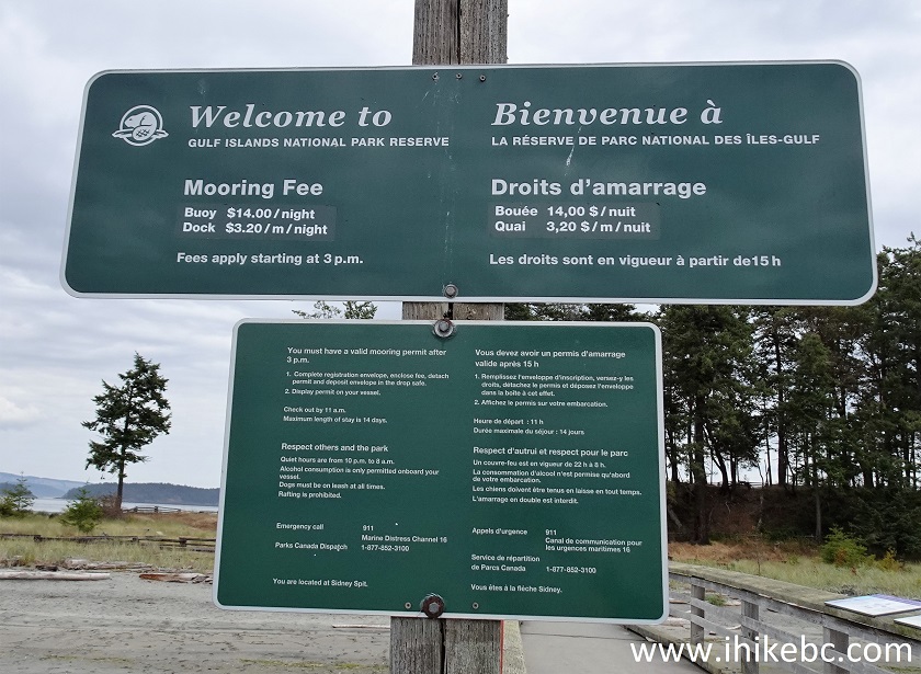
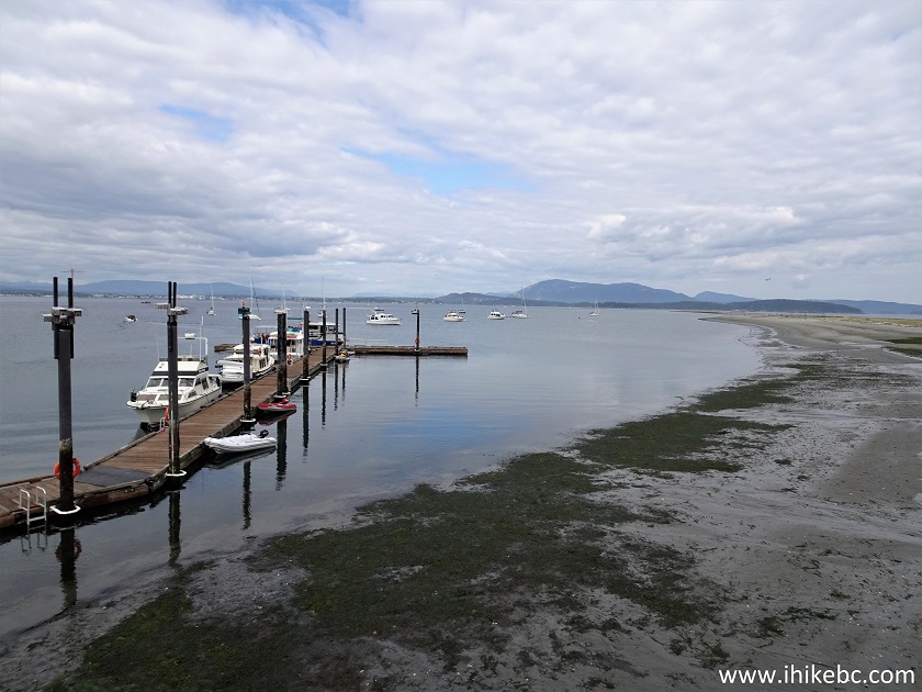
About 1/3 of Sidney Island is open to the public, and the other 2/3 is fenced-off private property. There are buoys near the public dock where you can moor your boat for a daily fee, or you can also use the public dock itself. Fees for both the dock and the buoys apply after 3 PM.
There is no fresh water on Sidney Island, so bring your own. If you miss the last ferry, which leaves mid-afternoon, or do not have a booking and the last ferry is full, you would be stuck, so plan accordingly.
Hiking on The Spit is fun, as there many fine shoreline views, and the other fun part is guessing if you would get hit by the next burst from a mini-geyser which shoot up from the ground for up to 1 meter. We could not figure out what caused this phenomenon - living creatures or some underground water pressure issues, but this sure was unexpected and perplexing. The Spit is about 1.8 km long and is North (left) of the dock. The path to the campground is South (right) of the dock, and the nearest pit toilet is in that direction, about 150 meters away.
For the campers with a lot of belongings (water!) there are wheelbarrows near the dock which can be used to take your stuff for 800 meters to the campground. The path then goes beyond the campground and goes through the woods for about 1.6 km, hits the fence which indicates the end of public property, and then goes along the fence for another 300 meters or so until you reach the other side of the island, where you can hike for a few more kilometers to the Northern tip of the lagoon across from the public dock.
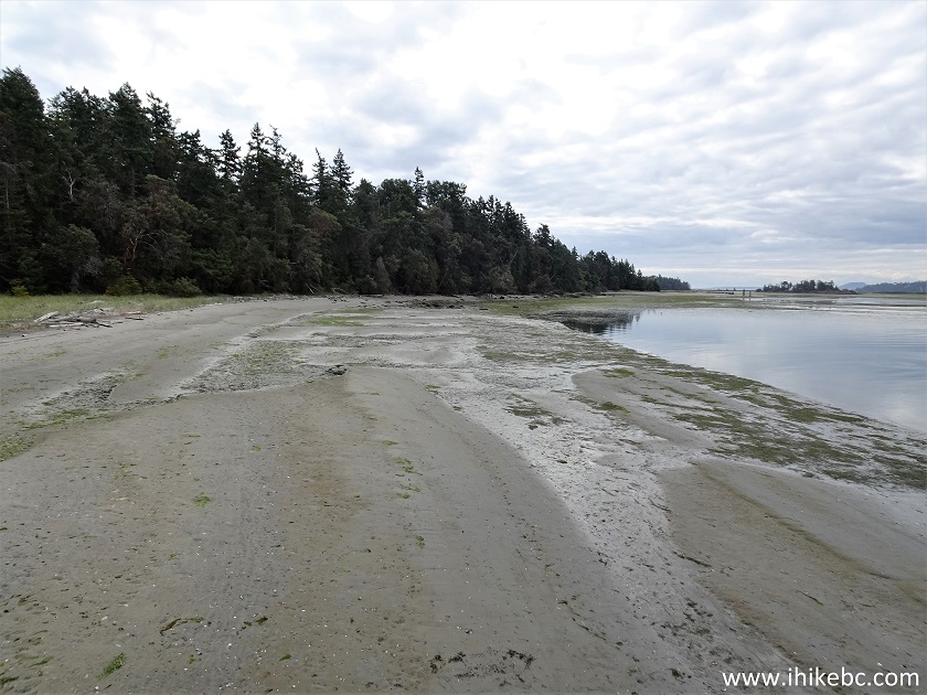
The trail in the woods actually runs along the lagoon, but you can't see it from the path. So, the only way to see interesting lagoon views is to hike on the lagoon itself, but it is quite muddy, so hiking boots would be essential there. Once you reach the southern end of the lagoon by a small Eagle Islet, the hike around the lagoon towards the northwestern tip of Sidney Island continues on the grassy shoreline, or you can cross over and hike along the beach - check out the attached map for a better understanding of the layout of the place.
* All hiking distances are based on a GPS odometer and are approximate.
1. Here is a Google Maps location of Sidney Island, BC.
2. As far as taking Sidney Island (Spit) ferry from Port Sidney Marina, if you are driving, the options are as follows: either pay parking at a rather small parking lot by the marina, or on-the-street parking (free for 24 hrs) about 200-300 meters away. The streets right by the marina have a 2 hour parking limit, which would certainly be insufficient. So, we parked on Third Avenue by Henry Street, and walked a few hundred meters to Port Sidney Marina. Here we are on the seawall, with marina straight ahead. You can see more of the seawall in our Town of Sidney BC Visit trip report.
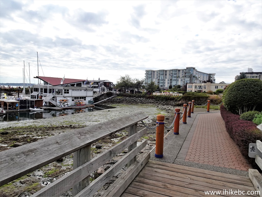
Sidney BC Seawall
3. Here is the marina.
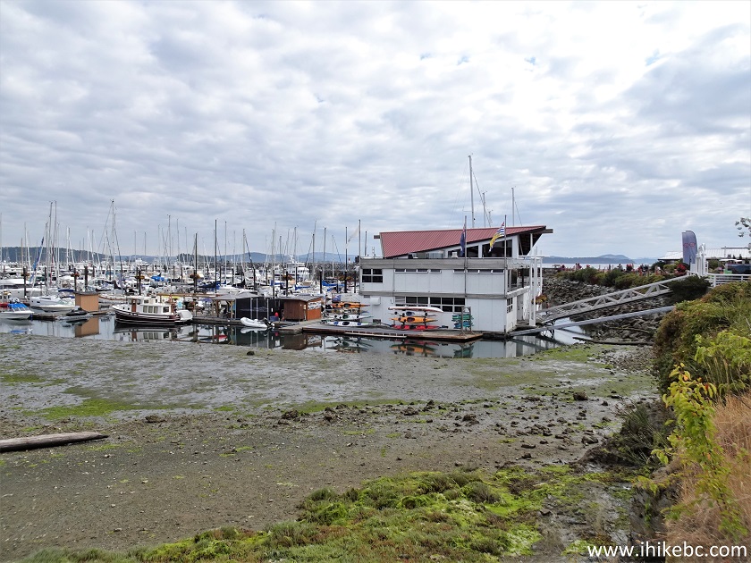
Port Sidney Marina
4. At the entrance to Port Sidney Marina.
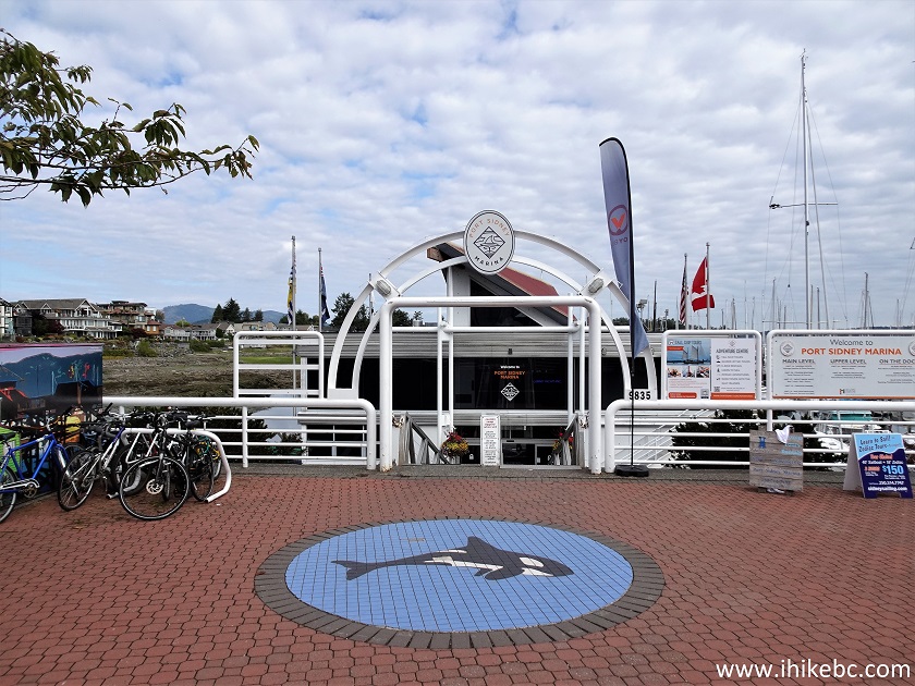
Entrance to Port Sidney Marina
6. Google Maps location of Port Sidney Marina.
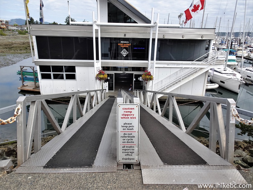
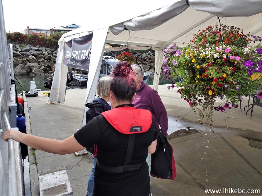
7. Go through the front doors, past the offices...
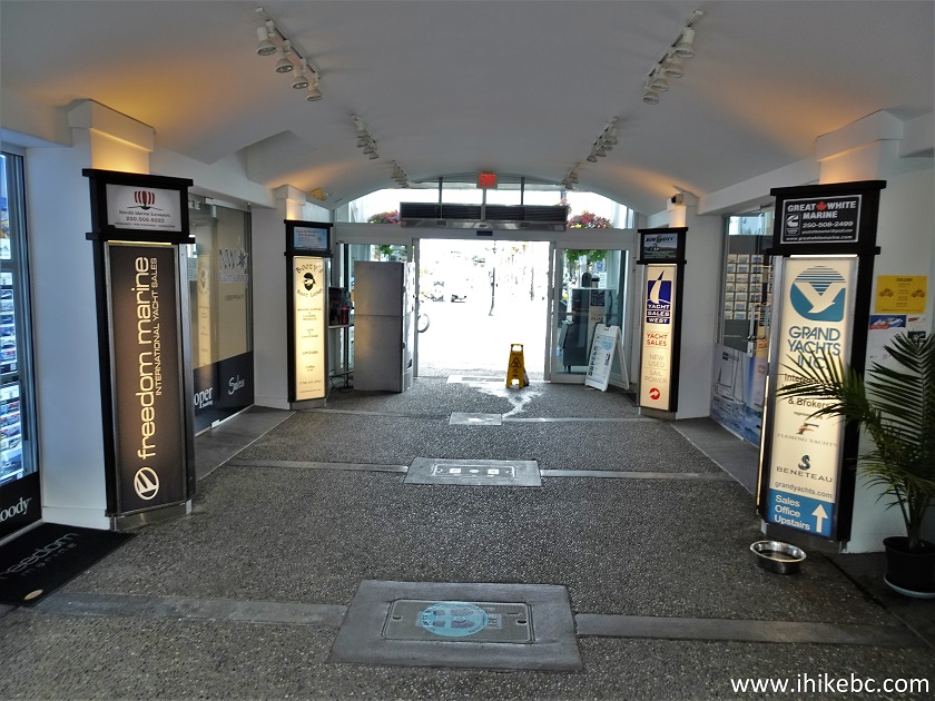
Port Sidney Marina offices
8...and make a right turn.
Inside Port Sidney Marina in Sidney BC Canada
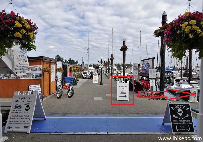
9. Walk for about 40 meters.
Sidney British Columbia Port Sidney Marina
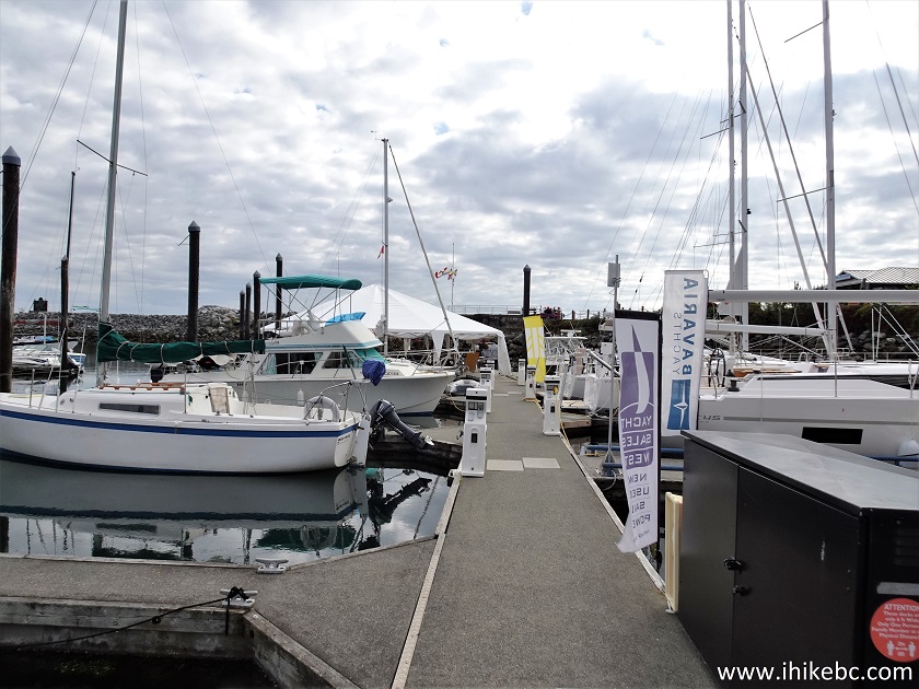
10-11. Arrive to Sidney Spit (Island) ferry dock.
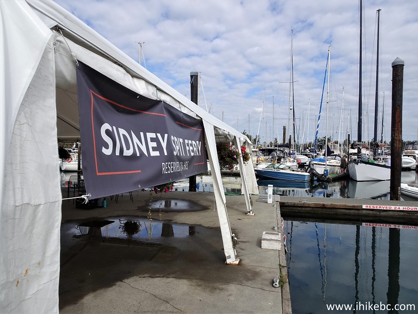
Sidney Spit Ferry dock in Port Sidney Marina in Sidney BC
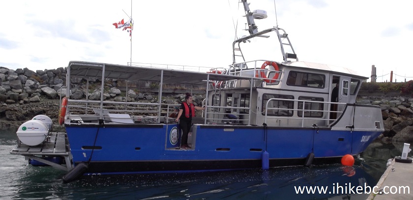
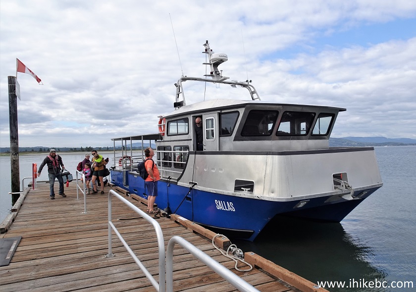
12-13. Ferry Sallas approaching the dock. Crew: 2. Capacity: 48 foot passengers. A small covered area is available in the front of the ferry. Online reservations are required. Don't forget to book a return trip, lest you be stuck on the island.
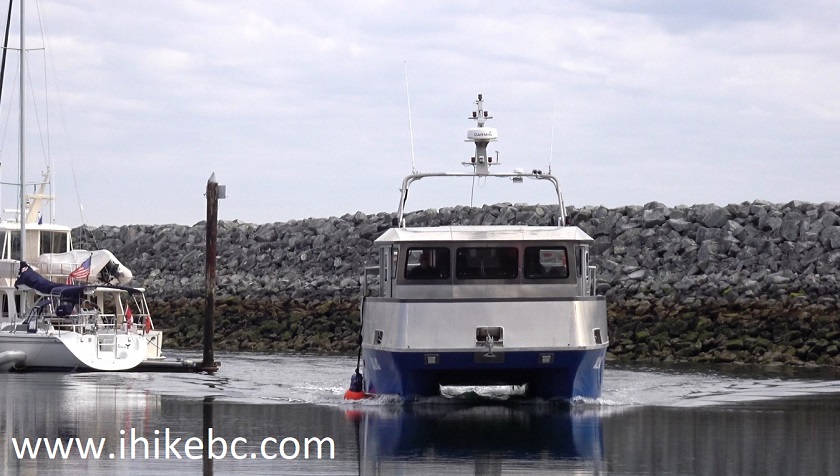
Ferry Sallas - Sidney BC to Sidney Island
14. Sallas ferry attendant - in charge of securing / untying the ferry and of communicating with passengers.
Sidney BC Port Sidney Marina - Sidney Spit ferry dock
15-16. Onboard the Sallas.
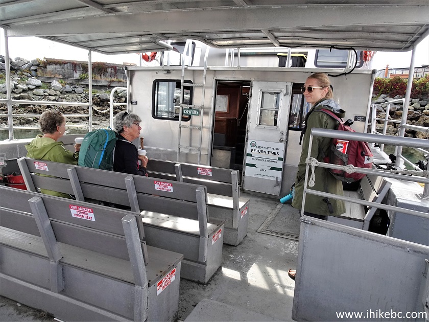
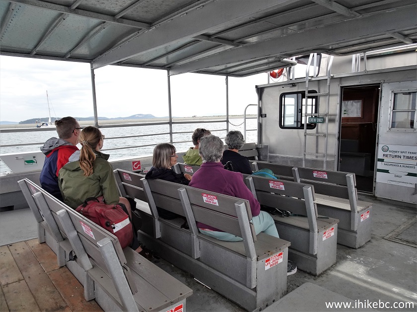
Ferry Sallas sitting area
17. Inside the covered passenger cabin.
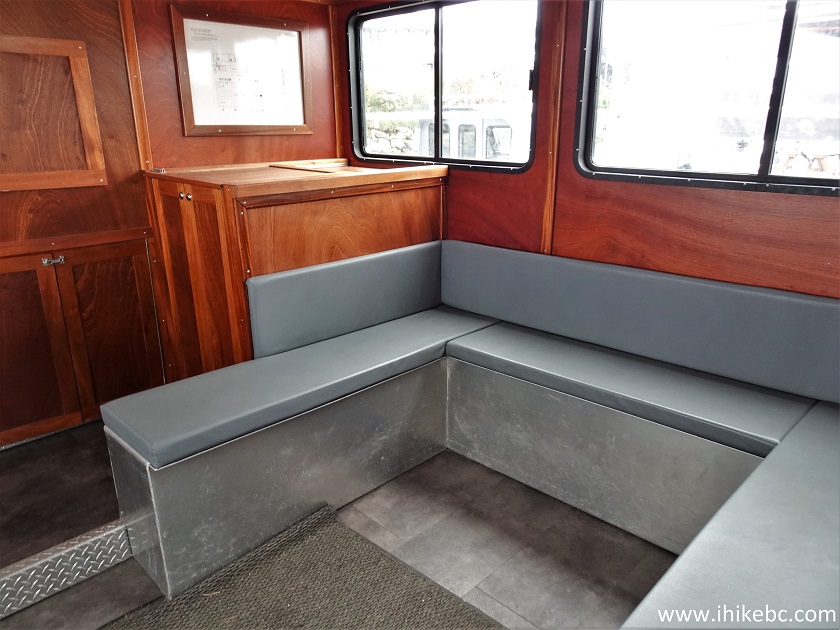
Ferry Sallas covered passenger cabin
18. Leaving Sidney, BC on Vancouver Island.
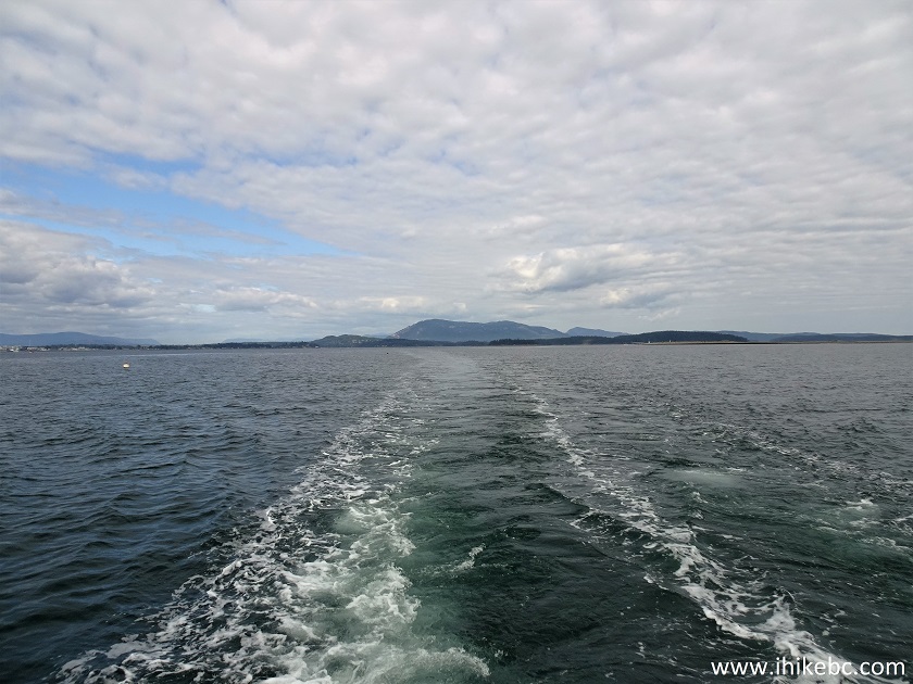
Vancouver Island
19. Approaching Sidney Island (Sidney Spit). The trip takes 25 minutes.
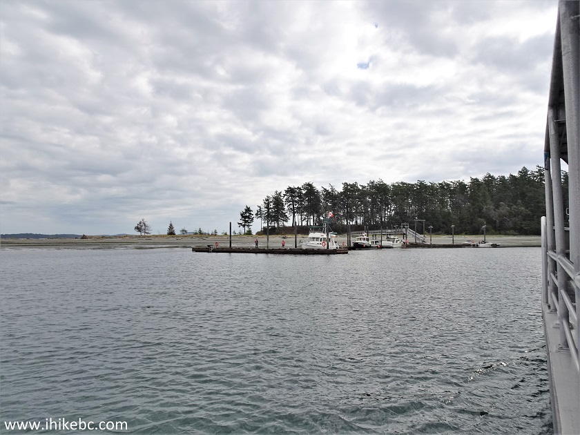
Approaching Sidney Island on Ferry "Sallas"
20. Arriving to Sidney Island.
Sidney Island BC dock
21. Ferry Sallas at Sidney Island, BC dock. Coordinates: N 48⁰38.515’ W 123⁰19.958’. Elevation: 5 meters.
Ferry Sallas at Sidney Island dock
Here is our video of sailing on Sallas.
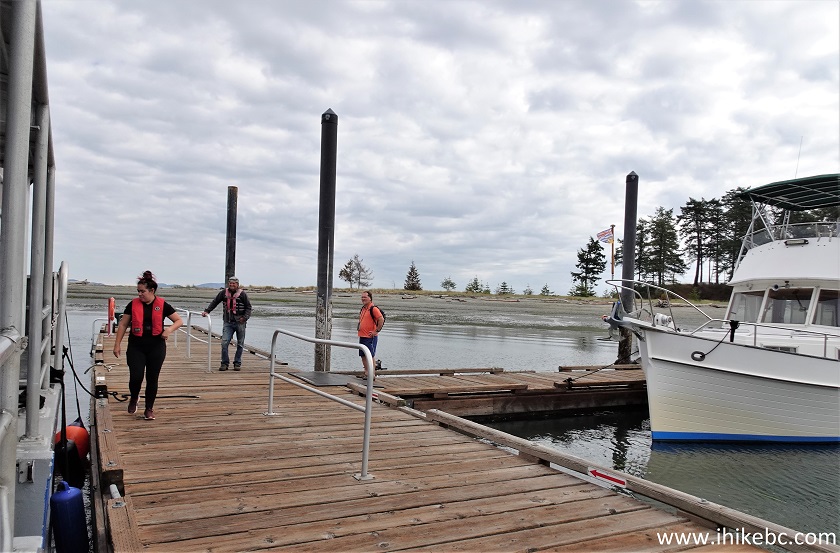
22. Heading to the island.
Boat dock Sidney Island British Columbia Canada
23-24. Welcome to Gulf Islands National Park Reserve. Mooring fees apply starting at 3 PM.
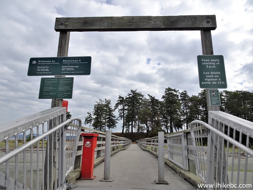
25. Looking left. This is the actual spit, and we went there first.
Sidney Spit
26. Looking right. This is the rest of Sydney Island's public access area, and we went there after visiting the spit. The campground is in that direction as well.
Sidney Island BC Canada
27. Still walking on the dock access bridge.
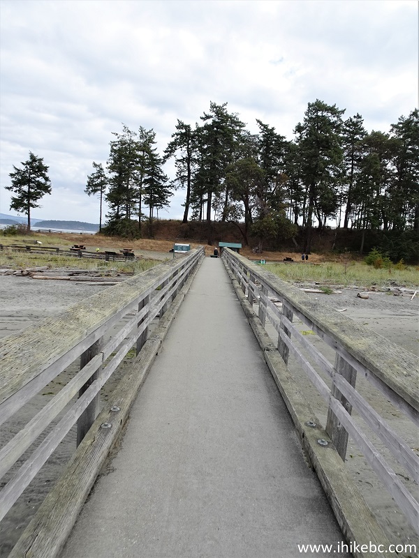
Sidney Island dock access
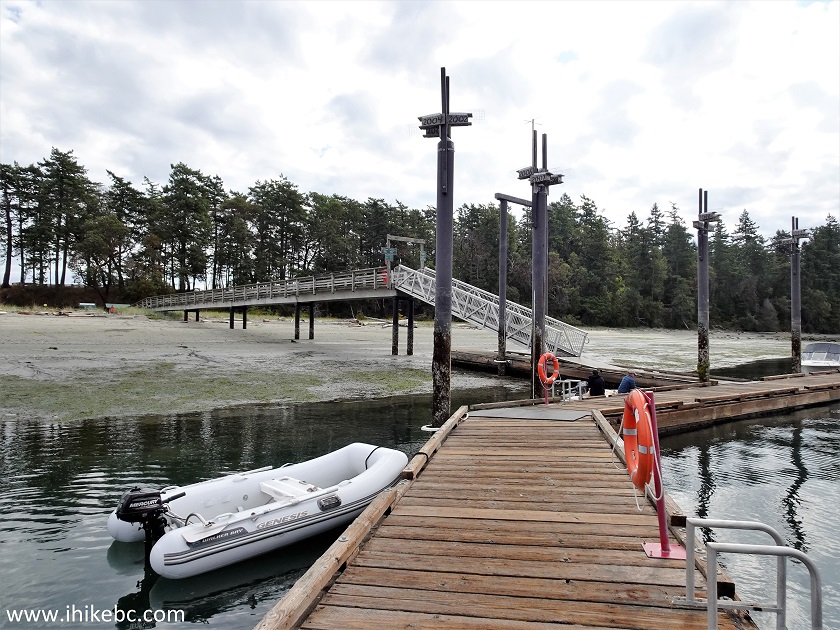
28. Approaching an info board, picnic tables, and wheelbarrows storage area.
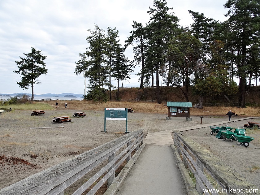
Sidney Island BC Canada
29. Here it is. If you have too much stuff, use a wheelbarrow to move your belongings to the campground about 800 meters away.
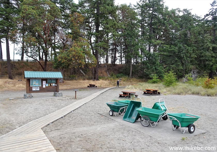
Wheelbarrows Sidney Island British Columbia
30. Now on Sidney Spit. 150 meters from the dock. Fine views all around, if sometimes noisy from passing airplanes.
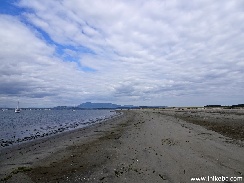
Sidney Spit
31. And here we are 1.3 km from the dock.
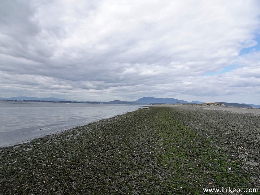
Sidney Spit on Sidney Island off Vancouver Island
32. This Spit is where a very strange thing is taking place. Random mini-geysers (up to 1 meter high) shoot up from the ground. Several times we got hit by the water blasts from below. Searched the Internet in vain for the explanation of this phenomenon. Here is a video screenshot of one such geyser.
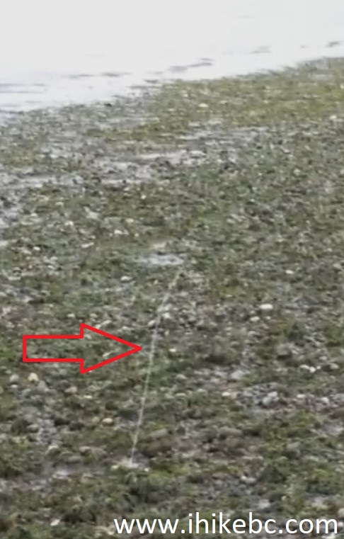
Sidney Spit geyser
Here is our video of mini-geysers.
More ihikebc videos are on our YouTube Channel.
33. Approaching a beacon at the tip of Sidney Island. At 1.75 km from the dock now.
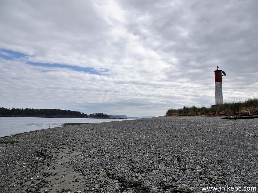
Sidney Spit British Columbia Canada
34. Here is that beacon. Coordinates: N 48⁰39.230’ W 123⁰20.759’. Elevation: 5 meters.
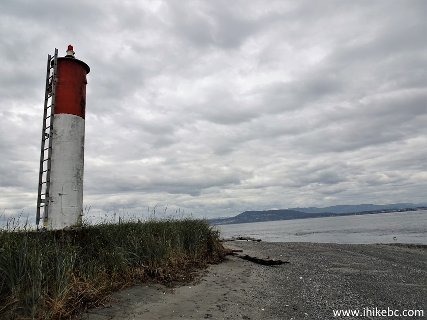
Sidney Island beacon
Our Sidney Island Visit trip report Continues on Page 2.


|
 |
![]()
![]()
![]()
ihikebc.com Trip 294 - Sidney Island Visit (Off Vancouver Island, BC) Page 1 of 3