![]()
![]()
![]()

Trip 222 - July 13 & August 31 2021 (Tuesday)
Wild Pacific Trail Hike
Ancient Cedars Loop to Rocky Bluffs (Eastern end of the trail)
Near Ucluelet BC Canada
Page 1 of 3
Liked:
Fine ocean and coast vistas, an easy trail with lots of shade, no bugs, numerous benches with views.
Of Note:
Tsunami hazard zone. Rock-hopping on Rocky Bluffs (beyond the end of the trail) is for experienced, well-equipped hikers only. The trail is very popular.Vancouver Island Backroad Mapbook (9th edition) Trailhead Coordinates: Page 6 (Ucluelet) B2.
Related Websites: Wild Pacific Trail - Official Website, Wiki - Ucluelet, Google Maps - Ucluelet.
Follow @ihikebc Tweet
Wild Pacific Trail is quite easy, with only a few small hills, and features numerous fine views of the rugged coastline of Western Vancouver Island. This trail is located by BC Highway 4, near the town of Ucluelet. Highway 4 starts near the East coast of the Island, goes through Port Alberni, and then, at Pacific Rim Visitor Centre, makes a right turn towards Tofino. At that same intersection / T-junction, a left turn leads to Ucluelet (pronounced You-CLUE-Let) in 8 kilometers, where the Lighthouse Loop of Wild Pacific Trail is located. A longer trail (also called Wild Pacific Trail), which is not connected to the Lighthouse Loop, goes from Ancient Cedars Loop (5.5 km from Pacific Rim Visitor Centre) to Brown's Beach / Big Beach (Western end) and Rocky Bluffs (Eastern end).
On July 13th, we started at Ancient Cedars Loop and hiked to Rocky Bluffs (eastern end of the trail) 1.2 km later. There is no parking or any further progress available at that end, so you need to double back. On August 31st, we returned to hike the remaining 2.8 km to the western end of this part of Wild Pacific Trail (to Brown's Beach / Big Beach). If you start at Big Beach or Brown's Beach parking lots, it's 4-5 km one way to Rocky Bluffs past Ancient Cedars Loop (you can bypass it, as there isn't much to see on that short trail, as it's a connector to the highway).
Also on August 31st we also hiked the Lighthouse Loop of Wild Pacific Trail, located even further West than Brown's Beach / Big Beach. It's actually a stand-alone trail separated from the Rocky Bluffs - Brown's Beach/Big Beach Trail by several kilometers of Ucluelet town streets, but it's also called Wild Pacific Trail, so we included the Lighthouse Loop into Wild Pacific Trail trip report on Page 3.
On July 13th, after hiking to Rocky Bluffs (eastern end) we planned on heading West from Ancient Cedars Loop towards Brown's Beach/Big Beach, and actually hiked for over a kilometer in that direction, but mist rolled in from the ocean, making the views rather unappealing. Considering the dark-coloured, gloomy rocks of the Vancouver Island coastline in this area, sunshine makes the views so much better. Do note that going West (towards Brown's Beach / Big Beach) from Ancient Cedars Loop is a but more challenging that going East (towards Rocky Bluffs), though not by much, and there are "Artists' Loops" (so called because there is an occasional small piece of art installed there) spurs through slightly more complicated parts of the trail, which lead to very fine views. Those with strollers or otherwise wishing to have an easier hike have an option to bypass the loops (and the views).
To summarize:
Page 1 (this page) of Wild Pacific Trail trip report covers Ancient Cedars Loop Trail to Rocky Bluffs (Eastern end of the trail).
Page 2 - Ancient Cedars Loop Trail to Brown's Beach/Big Beach (Western end of the trail).
Page 3 - Lighthouse Loop Trail even further West (it's technically a separate trail, but is also called Wild Pacific Trail, so we included it in this trip report).
1. We are on Vancouver Island, Westbound on BC Highway 4, with Port Alberni, Ucluelet and Tofino straight ahead.
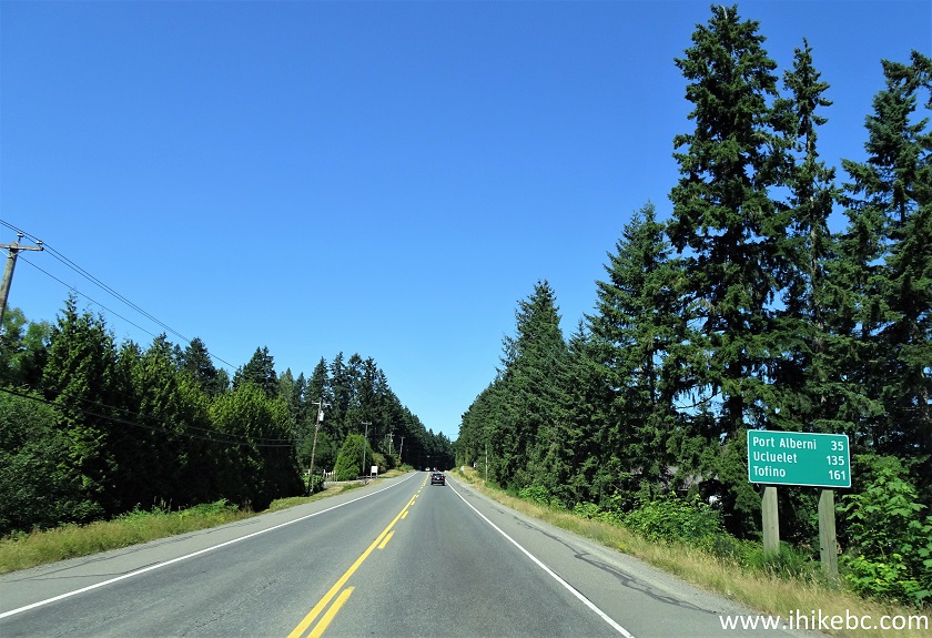
BC Highway 4 near Port Alberni
2. Passing through Kennedy Hill past Port Alberni. The highway is being made wider in this spot.
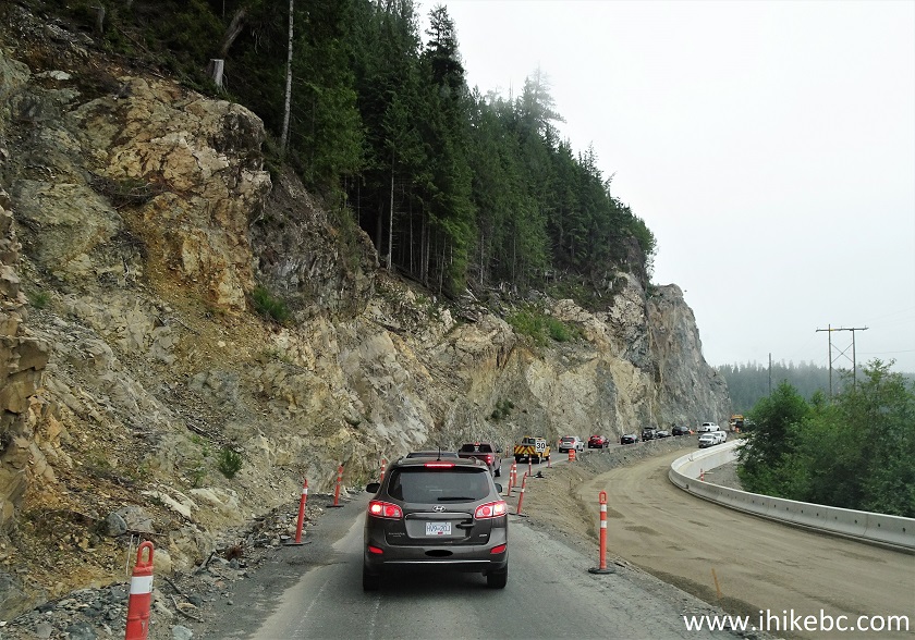
Kennedy Hill Construction Area Highway 4 British Columbia
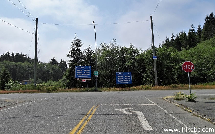
3-4. At the Pacific Rim Visitor Centre, Highway 4 reaches a T-Junction seen ahead. Turning right is the continuation of Highway 4 until it ends in Tofino 33 kilometers later. And, turning left, is Tofino-Ucluelet Highway, which reaches Ucluelet in 8 kilometers.
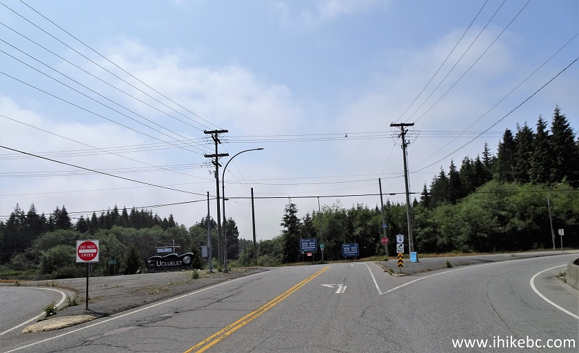
BC Highway 4 Junction at Pacific Rim Visitor Centre near Ucluelet and
Tofino
5. Turning left onto Tofino-Ucluelet Highway.
Tofino-Ucluelet Highway Start at Pacific Rim Visitor Centre
6. Tofino-Ucluelet Highway 1.5 km from the T-Junction.
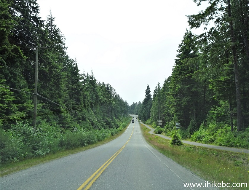
Tofino-Ucluelet Highway
7-8. At 4.8 km of Tofino-Ucluelet Highway past the T-Junction, you are entering Tsunami Hazard Zone. Basically, if you feel an earthquake, head as much uphill as you can, in case a tsunami shows up a while later. We took photos of the emergency information boards by the Lighthouse Loop. The upper photo also shows which areas (in orange) are likely to be affected by a tsunami, and that includes most of the Wild Pacific Trail (aside from a short stretch of the Lighthouse Loop).
In addition, in the first photograph we have indicated as follows:
Red Arrow - Ancient Cedars Loop trailhead (where we parked and then headed East to Rocky Bluffs 1.2 km later);
Yellow Circle - the point where Ancient Cedars Loop connects with Wild Pacific Trail 280 meters from the highway trailhead.
Blue Arrow - Rocky Bluffs (eastern end of Wild Pacific Trail - no exit - double back).
Red Square - Brown's Beach - you can start at Brown's Beach trailhead and hike 4 km to Rocky Bluffs (blue arrow), or head to Brown's Beach from Ancient Cedars Loop trailhead (red arrow), which is a short connector trail to Wild Pacific Trail;
Yellow Square - Big Beach - unlike Brown's Beach, which appears to be just a name, it's an actual beach with some sand, a gazebo, and a few interpretive signs. To continue from Brown's Beach to Big Beach one has to go through Black Rock Resort or walk down Marine Drive for a bit.
Blue Square - the Lighthouse Loop part of Wild Pacific Trail.
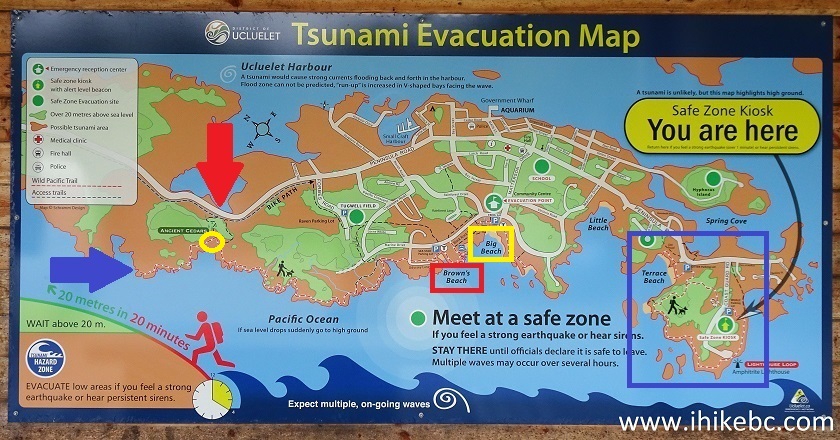
Ucluelet Tsunami Evacuation Map
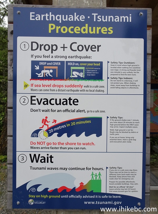
Earthquake and Tsunami Information Board
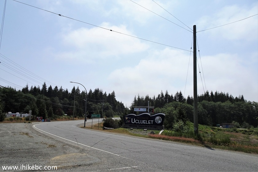
9. At 5.5 km from the T-junction, Ancient Cedars Loop trailhead is on the right side. Plenty of parking on the shoulder.
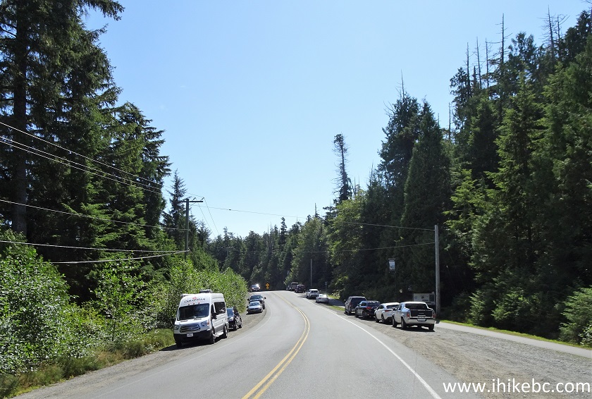
Tofino-Ucluelet Highway at Ancient Cedars Loop Trailhead
10. Ancient Cedars Loop trailhead. Coordinates:
N 48⁰56.883' W 125⁰34.457'. Elevation: 11 meters. This loop trail has two entrances, separated by about 30 meters. If you want to get to Rocky Bluffs quicker, take the trailhead on the right side, if facing from the highway. Here it is. A pit toilet and a trash can are located nearby.
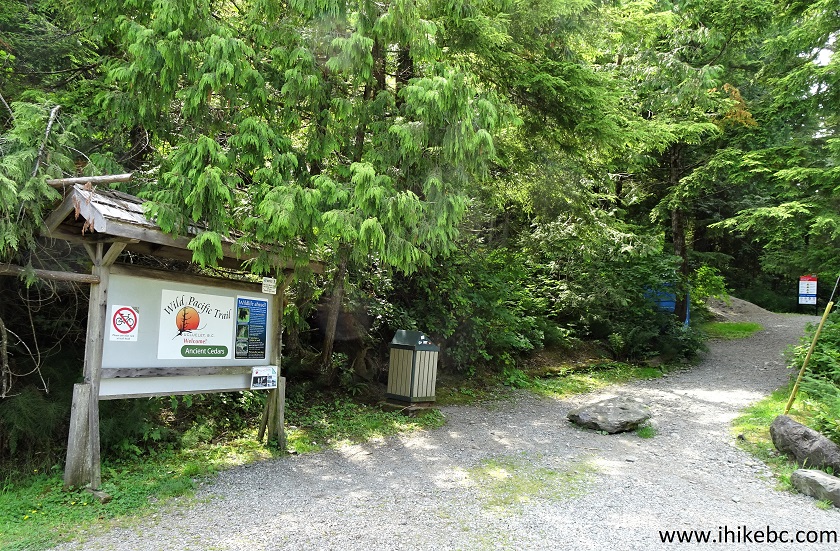
Ancient Cedars Loop Trailhead
11. Important safety messages. Beware of wildlife and unexpected waves.
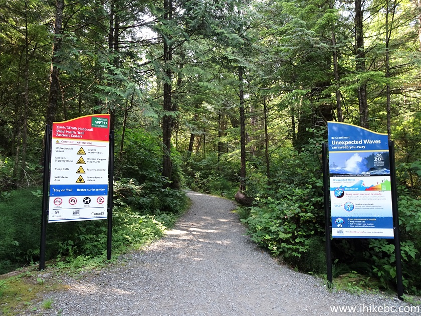
Ancient Cedars Loop Trail Safety Information Boards
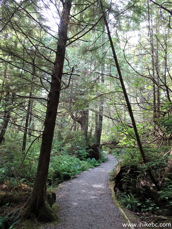
12. We are now on Ancient Cedars Loop Trail, en route to Wild Pacific Trail. At 80 meters here (all distances are based on a GPS odometer, and are approximate).
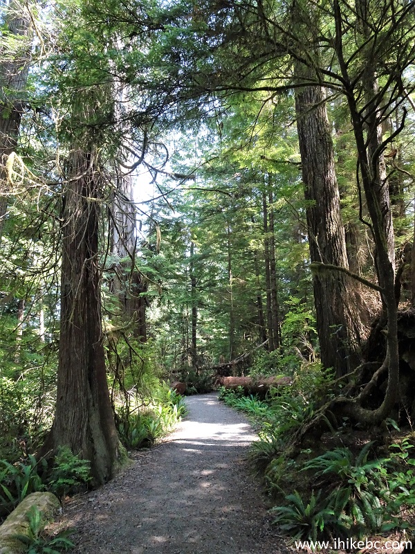
Ucluelet Hiking - Ancient Cedars Loop Trail
13. 40 meters later.
Ancient Cedars Loop Trail - Ucluelet Hike
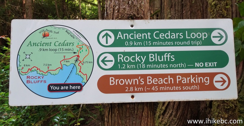
14-15. At 280 meters, we are at a junction with Wild Pacific Trail. To the right is the eastern end of the trail (Rocky Bluffs), which is where we went this time (Page 1 of the trip report). To the left is the way to the western end of the trail (Brown's Beach, or even further to Big Beach - covered on Page 2) and continuation of Ancient Cedars Loop. The distances in the second photograph (7 km, etc) are likely from the Lighthouse Loop (covered on Page 3), which requires walking down city streets or driving for several kilometers, in order to connect to the Brown Beach/Big Beach - Rocky Bluffs part of Wild Pacific Trail. Basically, Lighthouse Loop is a separate trail, but all these parts together are called Wild Pacific Trail.
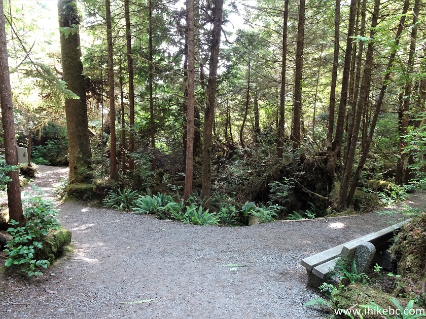
Ucluelet Trail - Wild Pacific Trail
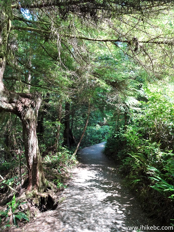
16. We made a right turn, and are now on Wild Pacific Trail, at 340 meters from the Ancient Cedars Loop trailhead.
Wild Pacific Trail in Ucluelet BC Canada Area
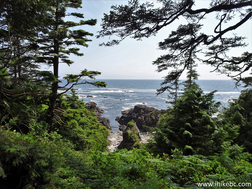
17. Great views start appearing in no time. There is usually a bench by a good viewpoint. Here we are at 650 meters from the trailhead.
View from Wild Pacific Trail Hike in Ucluelet Area
18-19. Speaking of benches, here is one at 880 meters, with a fine view as well.
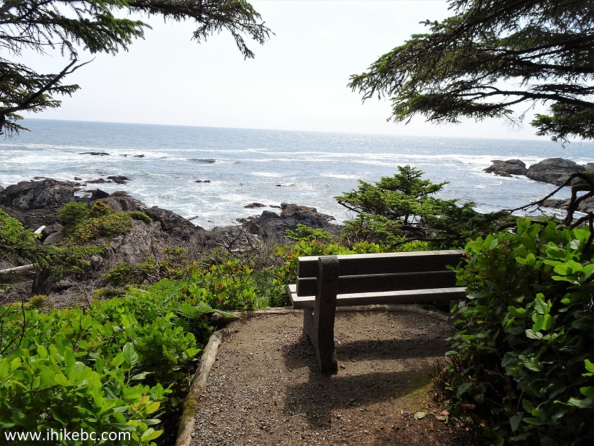
Vancouver Island Coastline seen from Wild Pacific Trail
20. Now at 960 meters from the trailhead. It's a smooth, wide path, with lots of shade and no bugs. Going in the opposite direction (West) towards Brown's Beach is slightly more challenging, with some short moderately steep stretches.
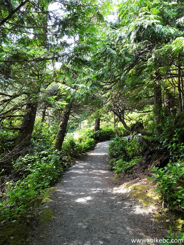
Hiking in Ucluelet Area - Wild Pacific Trail
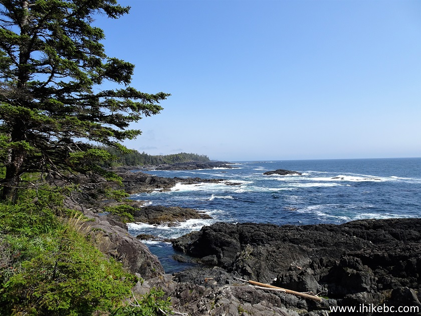
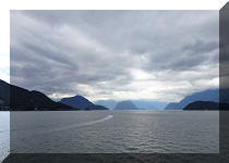
21-22. At 1.0 km, yet another fine view of Western Vancouver Island coastline (slightly zoomed in the bottom photograph).
View from Wild Pacific Trail near Ucluelet British Columbia Canada
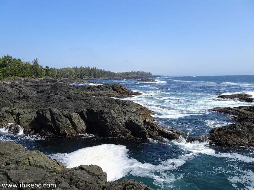
23. Very nice. At 1.06 km.
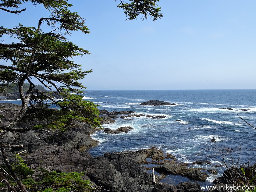
Vancouver Island Coastline View from Wild Pacific Trail near Ucluelet BC
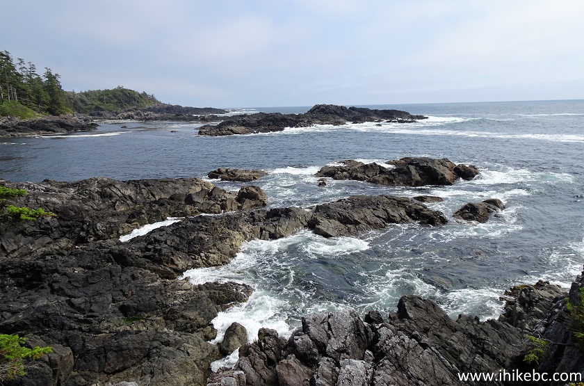
24. At 1.18 km, we are at Rocky Bluffs, the eastern end of Wild Pacific Trail. Coordinates:
N 48⁰56.827' W 125⁰35.005'. Elevation: 10 meters (1 meter elevation loss from the trailhead). There is a bench to sit down and check out all the fine views.
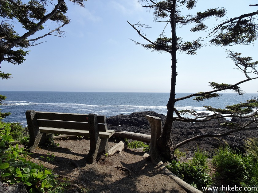
Wild Pacific Trail - Rocky Bluffs
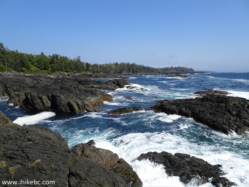
25. Similar to the view at 1.06 km, and quite impressive.
View from Rocky Bluffs Area of Wild Pacific Trail - Hiking in Ucluelet
Area
Here is our video of the views from this location.
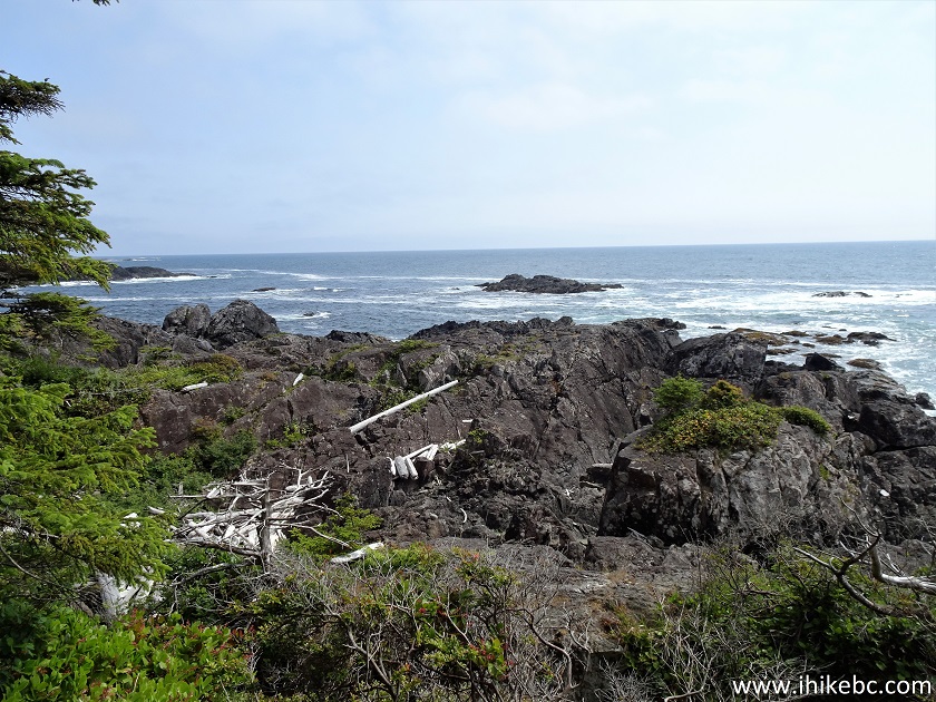
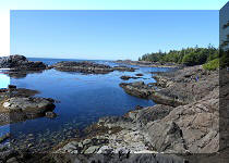
26. Rock-hopping on Rocky Bluffs is better left to experienced, well-equipped hikers. It may look easy, but it's quite a tricky area, with a high injury potential.
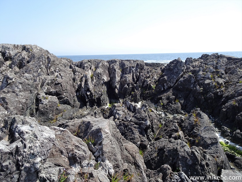
Rocky Bluffs near Wild Pacific Trail on West Coast of Vancouver Island
27-28. Good views from Rocky Bluffs.
View from Rocky Bluffs near Wild Pacific Trail on Vancouver Island
Here is our video of the views from Rocky Bluffs.
More ihikebc videos are on our YouTube Channel.
As there is no exit, you need to double back and return to Ancient Cedars Loop junction, where you have an option of heading back towards the highway, or proceeding further on Wild Pacific Trail to Brown's Beach and then Big Beach (western end of the trail). If the sun is out, the views along Wild Pacific Trail are bound to impress. Highly recommended.


|
 |
![]()
![]()
![]()
Follow @ihikebc Tweet
ihikebc.com Trip 222 - Wild Pacific Trail Hike (Ancient Cedars Loop to Rocky Bluffs) Page 1 of 3