![]()
![]()
![]()

Trip 072 - September 9, 2014 (Tuesday)
Mamquam Lake Trail Hike
Garibaldi Provincial Park (Diamond Head Entrance)
Page 3 of 3
Distance From Vancouver to the Trailhead: 83 kilometers.
Drive for 65 kilometers on Highway 99 North (Sea-to-Sky) to Squamish.
Follow signs to Garibaldi–Diamond Head by turning right from Highway
99 onto Mamquam Rd 3.5 km after Squamish Adventure Centre (which itself
is located on the right side of the road several hundred meters past the
intersection of Highway 99 with Cleveland Avenue), then left on
Highlands Way South 1 km later. Take first right onto University Blvd at
a roundabout 700 meters later. 1.7 km after that make first right at yet
another roundabout, and 100 meters later (7.0 km after Squamish
Adventure Centre) turn left onto Mamquam Road (again). 500 meters later
paved road would end and gravel road would begin. You would drive on
that fairly smooth road (aside from the last 1.5 fairly rough
kilometers) for 10.8 kilometers and would reach the parking lot for
Garibaldi–Diamond Head, 18.3 km after passing by Squamish Adventure
Centre. If this sounds complicated, there are signs to the park before
every turn, so the parking lot is easy to find.
Liked: Many great mountain and nature views, mostly gentle grades, easy to follow trail, bicycles permitted up to Elfin Lakes.
Of note: Remote wilderness area. No cell phone signal. This is a bear country. No tree cover beyond Red Heather shelter – sun protection essential on sunny days. Cloudy weather (like today) may obscure (most of) the views. Hiking poles and boots are recommended to Elfin Lakes, and are highly recommended beyond that area. There is a small but very treacherous trail washout between Opal Cone turnoff and Mamquam Lake – check out the photo in the trip report. Camping fees are required for anyone staying in the park overnight.
Vancouver, Coast & Mountains Backroad Mapbook (2010 edition) Trailhead Coordinates: Page 22 (Squamish) E5.
103 Hikes in Southwestern British Columbia (2008 edition): hikes #22 (Elfin Lakes) and #23 (Mamquam Lake).
Related Website: Garibaldi Provincial Park - BC Parks Official Site.
Follow @ihikebc Tweet
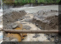
36. This is one of the main reasons that we would highly recommend hiking boots and poles beyond Elfin Lakes - the trail is washed out in this area and there is no easy way around due to the steepness of the terrain. You have to get creative or turn back, if this looks like too dangerous of a crossing.
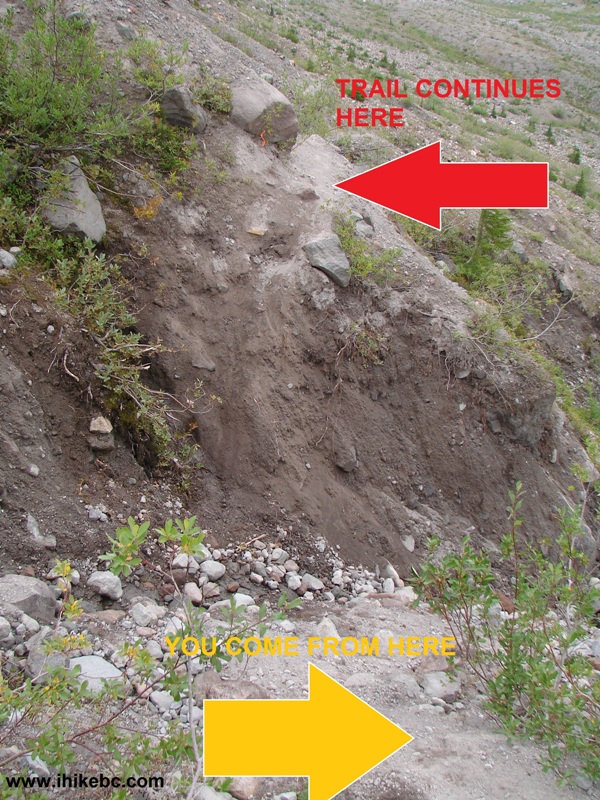
Dangerous Spot on Mamquam Lake Trail BC Canada
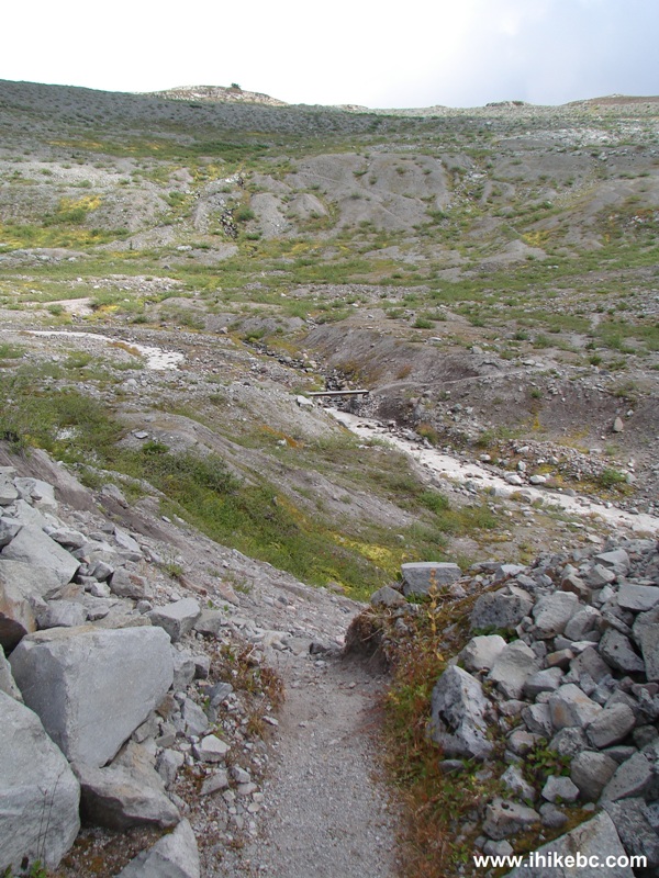
37. If you succeed in getting past the danger zone, Zig Zag Creek would soon be crossing the path.
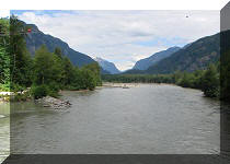
Squamish
Hiking - Mamquam Lake Trail Garibaldi Provincial Park - Diamond Head
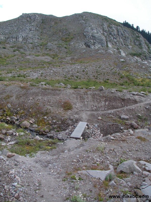
38. The bridge across the creek.
Hike in Squamish Area -
Bridge Across Zig Zag Creek Garibaldi Provincial Park
39. Zig Zag Creek itself. Very muddy.
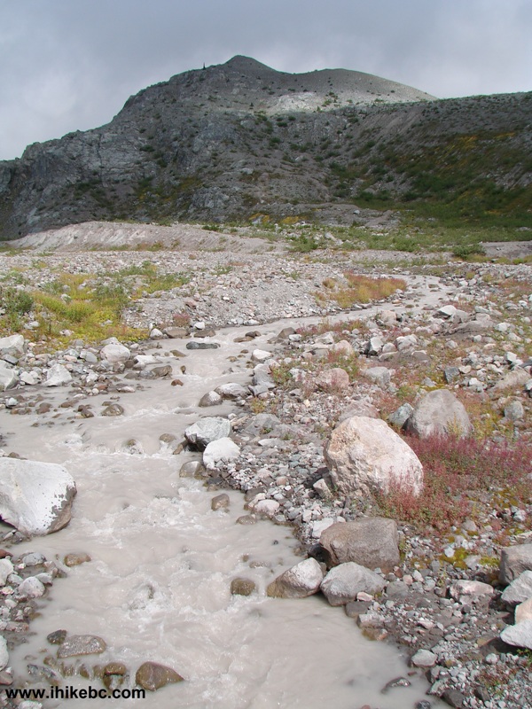
BC Hiking - Mamquam Lake Trail - Zig Zag Creek Garibaldi Provincial Park
40. Looking the other way. Still very muddy.
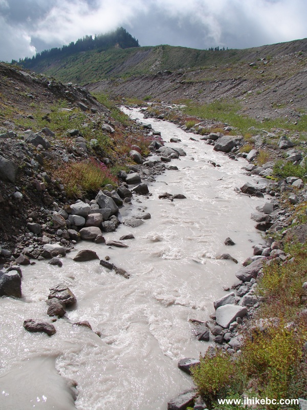
Zig Zag Creek Garibaldi Provincial Park
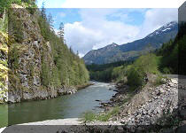
41. Mamquam Lake Trail continues.
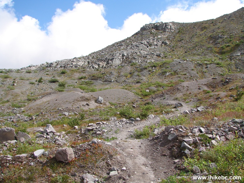
Mamquam Lake Trail Garibaldi Provincial Park - Squamish Hiking BC Canada
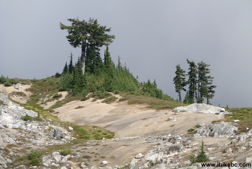
42. Approaching that tree we saw from far away.
BC Hiking -
Mamquam Lake Trail Garibaldi Provincial Park British Columbia Canada
43. Here it is.
Garibaldi - Diamond Head Provincial Park - Hiking in British Columbia
Canada
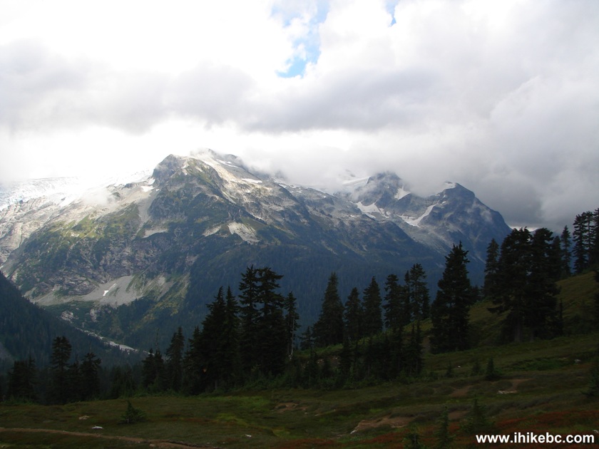
44. The clouds parted just enough to give a glimpse of the beauty one would see on a sunny day.
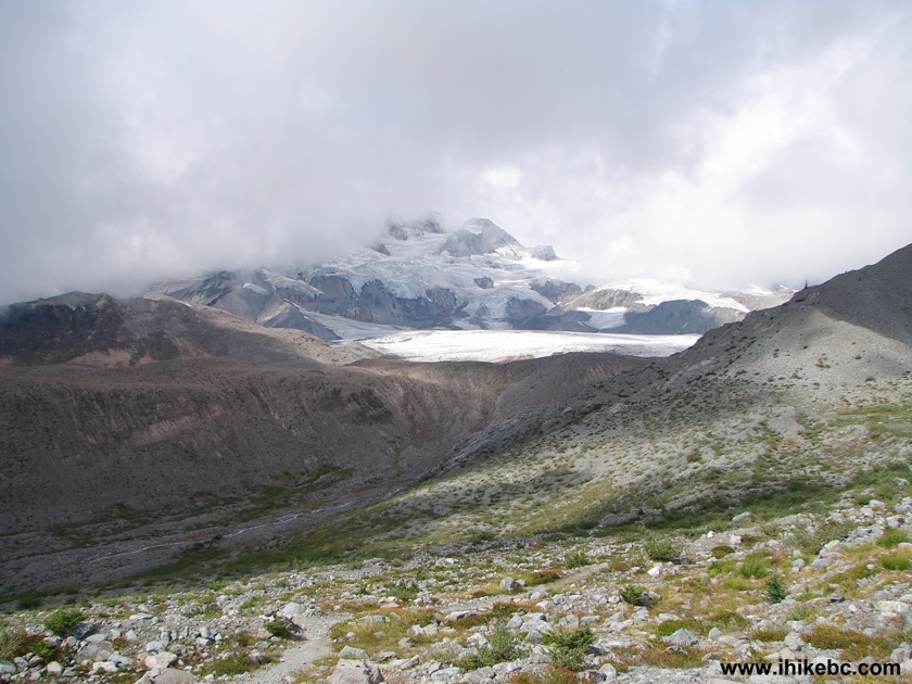
Picture of a View From Mamquam Lake Trail Garibaldi Provincial Park BC
Canada
45. A closer look.
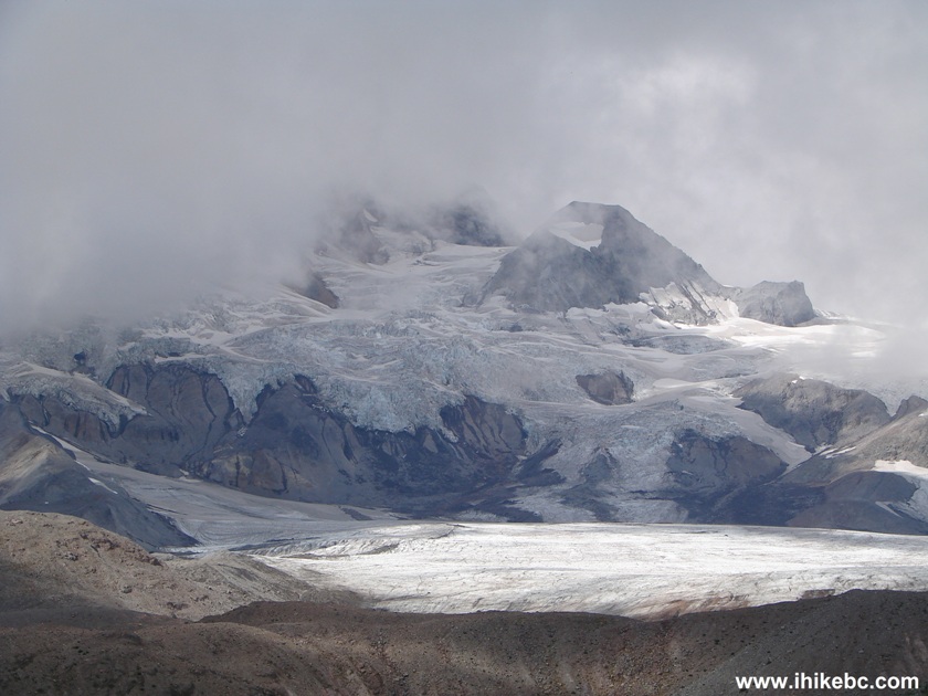
Glacier Seen From Mamquam Lake Trail Garibaldi Provincial Park BC Canada
46. Meanwhile, the descent to Mamquam Lake begins.
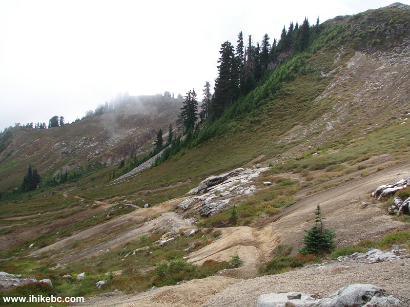
Descending Trail to Mamquam Lake in Garibaldi Provincial Park BC Canada
47. This descending trail weaves all the way to the lake.
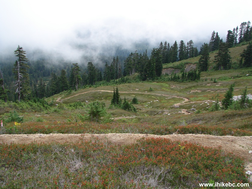
Mamquam Lake Trail Garibaldi Provincial Park Province of BC Canada
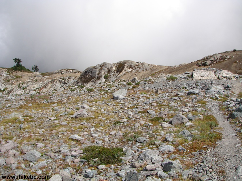
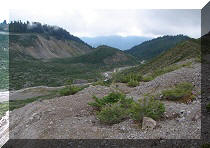
48. Passing by a rock field.
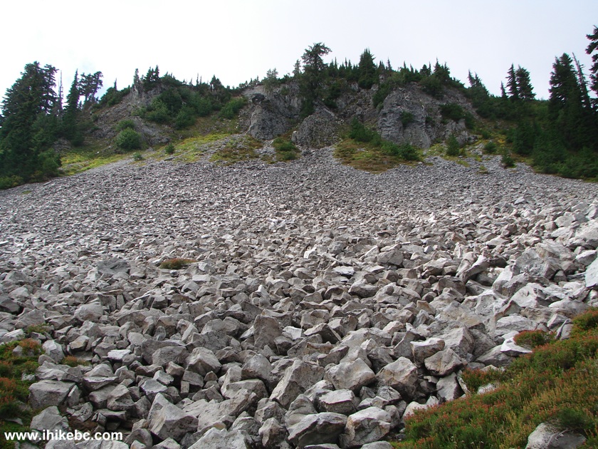
Rock Field by Mamquam Lake Trail Garibaldi Provincial Park BC Canada
49. It takes half an hour to reach Mamquam Lake once you start your descent. The grade is fairly gentle, but you would still need to hike it up on your way back, so plan accordingly. Mamquam Lake starts appearing about half way down.
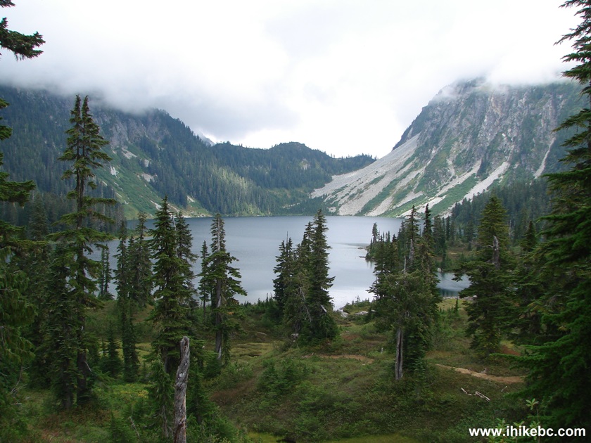
Mamquam Lake Garibaldi Provincial Park
50. Mamquam Lake, our final destination. Pyramid Mountain on the background. There are three tent pads by the lake (one of them is damaged), as well as a toilet sitting wide-open, since the toilet cabin fell to the side. Time from the start of the hike: 6 hours 20 minutes. We spent 25 minutes at the lake and went back, in order to beat the darkness.
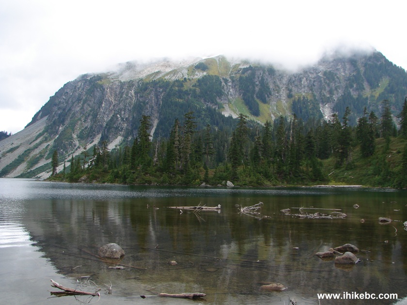
Mamquam Lake BC Canada
Here is our video of Mamquam Lake:
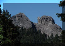
51. On our climb back up, the clouds somewhat disappeared and allowed good shots of Pyramid Mountain...
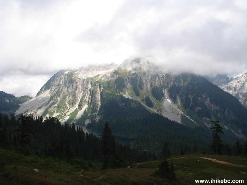
Pyramid Mountain British Columbia Canada
52... as well as a mountain to the right.
Mountains by Mamquam Lake BC Canada
Here is our video of these mountains:
More ihikebc videos are on our YouTube Channel
It took us just over five hours to get back to the parking lot, with about two hours (in total) saved by using a bicycle to and from Elfin Lakes, especially since the trail from the Red Heather shelter is all down. If you have no bicycle, to get to Mamquam Lake and back would be a monumental day hike, of about 14-15 hours in duration. Even with a bicycle it was an exhausting trip, but the great views were certainly worth it. This is one of the most spectacular trails near Metro Vancouver, and is greatly recommended.


|
 |
Other Trips in Squamish Area:
|
|
|
|
|
|
|
|
|
|
|
|
|
|
|
|
|
|
|
|
|
|
|


![]()
![]()
![]()
ihikebc.com Trip 072 - Mamquam Lake Trail Hike Page 3 of 3