![]()
![]()
![]()

Trip 049 - July 19 and 21, 2011 (Tuesday and Thursday)
Harrison East Forest Service Road Trip
To about 68 km mark, somewhat close to the end of the road
Page 3 of 3
Big changes for Harrison East - Click here for 2015 trip report
Distance From Vancouver:
About 130 km to the beginning of the FSR via
Highway 1 East (to Exit 135), then Highway 9 North (to
Harrison Hot Springs), and Lillooet Avenue / Rockwell Drive.
Liked: The smoothest road surface of all the FSRs visited, waterfalls, lake views, relatively few people (on a weekday).
Of note: Logging trucks in the area, no cell phone reception, brutal mosquitoes. Hiking poles and boots, and sun protection (if it is sunny) are highly recommended for the hiking part of Harrison East FSR.
Vancouver, Coast & Mountains Backroad Mapbook (2010 edition) Coordinates for the Beginning of the FSR: Page 14 (Harrison Lake) G7.
Related Website: Chilliwack District FSR Conditions.
Subsequent Trip: 077 - Harrison East FSR Second Trip.
Other Forest Service Roads Trips: Chehalis (by Harrison Mills), Chilliwack Bench, Chilliwack Foley, Chilliwack Lake, Chuchinka-Colbourne (North of Prince George), Florence Lake (access to Stave Lake by Mission), Harrison West, Jones Lake (near Hope), Lost Creek (by Mission), Mamquam River (by Squamish), Nahatlatch (near Boston Bar), Parsnip West (by Mackenzie), Scuzzy (by Boston Bar), Shovel Creek (off Harrison East), Sowaqua Creek (by Hope), Squamish River Main, Squamish River Ashlu, Squamish River E-Main, Squamish River FSR Washout, Windfall Creek (by Tumbler Ridge).
Follow @ihikebc Tweet
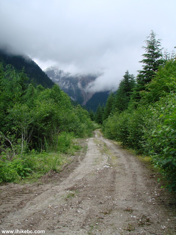
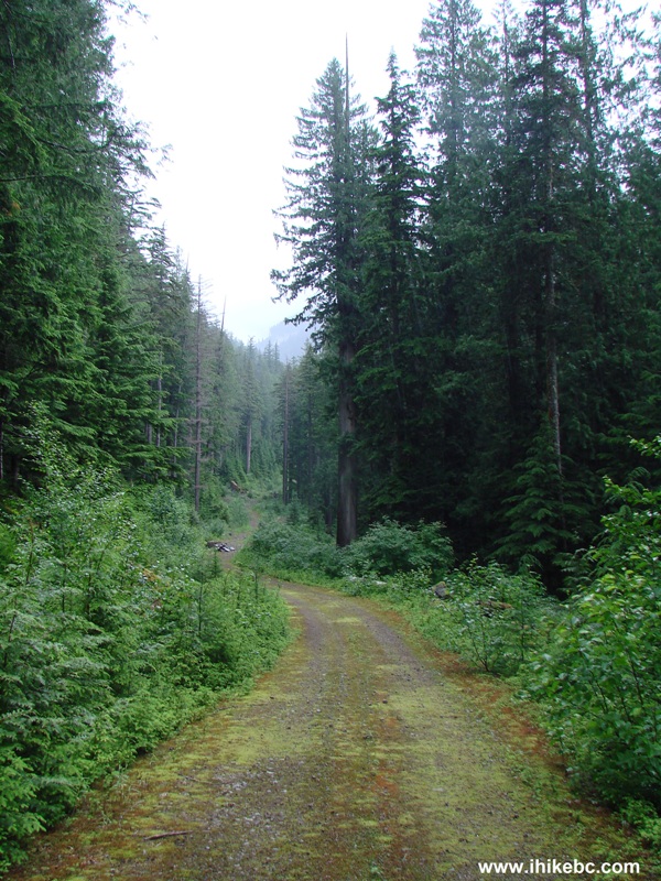
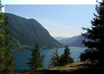
Harrison East Forest Service Road runs for about 22 kilometers along the East side of Harrison Lake, and then diverts into some of the finest Southwestern BC wilderness. We have driven to the split with Shovel Creek Forest Service Road (58.4 km mark), and decided to drive further on Harrison East. But that's where numerous cross ditches began to appear, and we got badly stuck far away from the nearest human being. Thank God for Tow Truck in a Box - we got out! We then drove on Shovel Creek FSR, hiked an unnamed FSR the next day (Wednesday), and then on Thursday returned to the split and hiked Harrison East close to the end, or about 70 km mark.
The first two pages of this trip report describe our Tuesday adventure, and this third page is dedicated to the Thursday hike. Shovel Creek FSR trip report follows Harrison East FSR trip report. During all of our trip, low-hanging clouds concealed much of the surrounding wilderness, plus the rain was fairly frequent. In sunny weather you are likely to see even more.
35. Having spent Wednesday exploring Shovel Creek FSR (described in the next trip report), we returned to Harrison East split with Shovel Creek (58.4 km mark of Harrison East FSR), and decided to hike on Harrison East past the cross ditches we did not cross in our vehicle two days earlier. Harrison East is on the left side in the photo below. If you have a high-clearance 4x4 or an ATV, you just might be able to drive this hike all the way to the end.
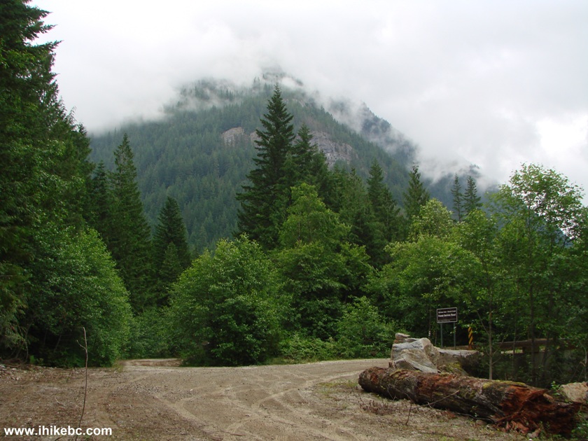
Harrison East Forest Service Road at Shovel Creek FSR Province of
British Columbia Canada
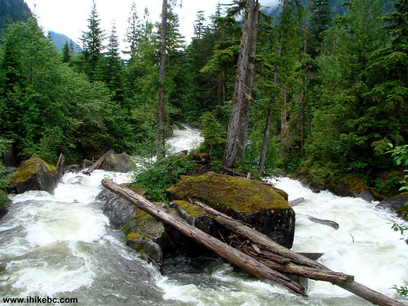
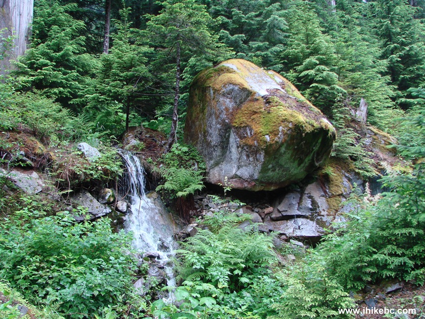
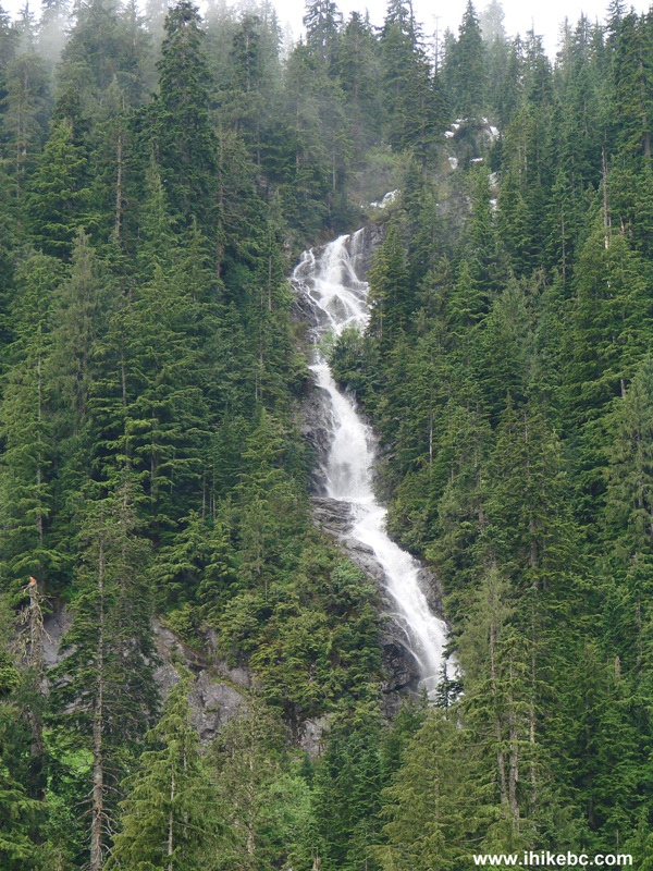
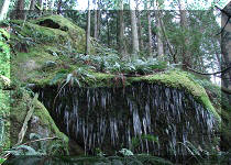
36. About fifteen minutes into the hike, there is this neat waterfall on the right side.
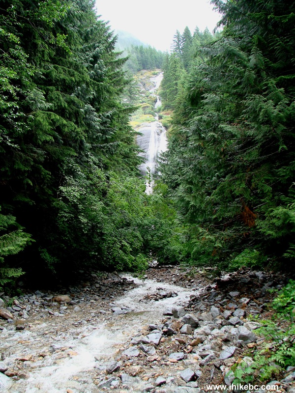
Harrison East FSR Waterfall BC Canada
37. The best part is that, if you have hiking poles and boots, it is quite possible to hop on the stones in and around the creek, and get to see this beauty up close and personal. This is Shannon Falls-light without the crowds.

Waterfall on Harrison East Forest Service Road Province of BC Canada
Here is our video of this waterfall:
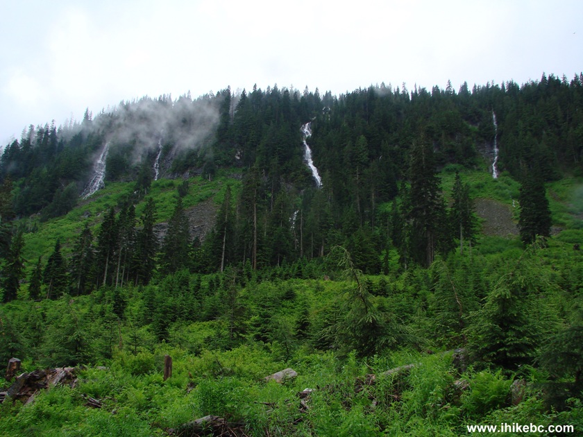
38. The clouds were hanging low on this day, and, in sunny weather, the views should be even better.
British Columbia Backroads - Harrison East FSR
39. But even with this cloud cover, large hills looked impressive.
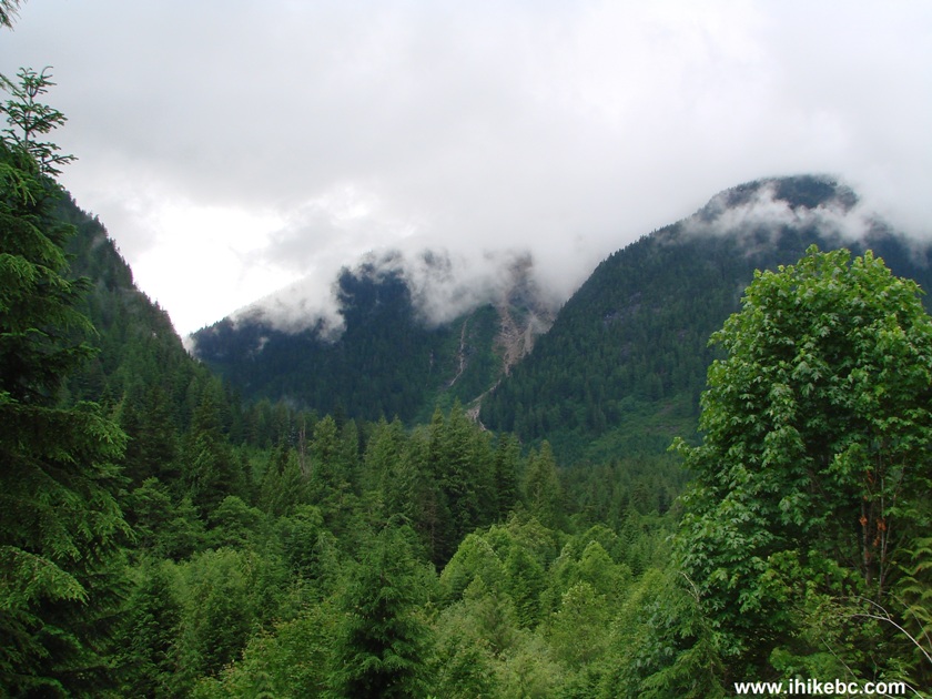
The view from Harrison East Forest Service Road in British Columbia
Canada
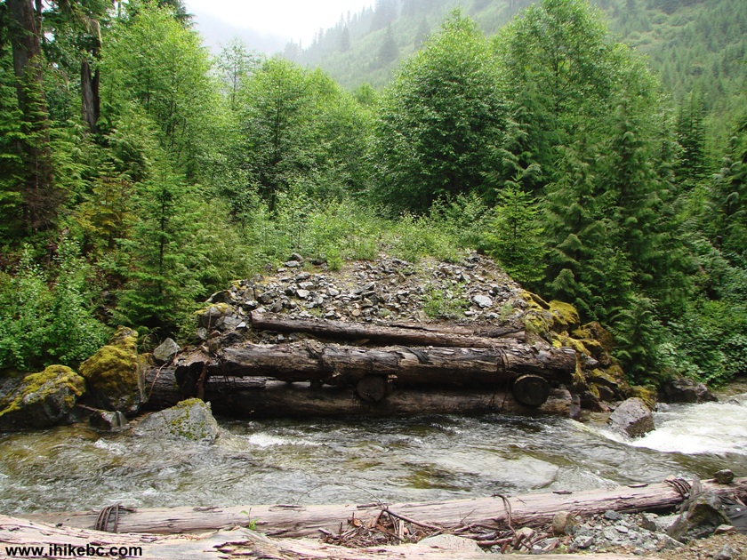
40. Just over an hour after the waterfall, there is a bridge over Big Silver Creek. The Backroad Mapbook actually calls this FSR "Big Silver Main FSR," but there is a sign after the split of Harrison East FSR with Shovel Creek FSR which says "Harrison East FSR," so we'll call it Harrison East, then. Here is a view from the bridge.
Big Silver Creek Harrison East Forest Service Road Province of BC Canada
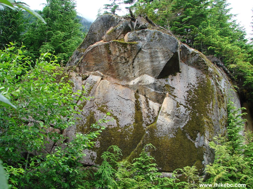
41. A few minutes after crossing Big Silver Creek there is a split. Stay right. This stone view is your reward less than 10 minutes later.
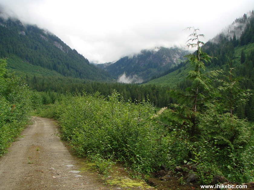
42. Soon after that, the area opens up, and we are no longer walking in a forest, but, rather, in a small valley of sorts.
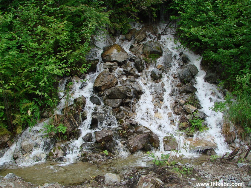
43. This is a very unusual small waterfall, in that you would expect the stones to fall down, but they don't.
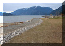
44. About 30 minutes after crossing Big Silver Creek, there is yet another split. Take the left road this time. But, if you turn right, you would not go far, and would discover a neat picnic/camping area.
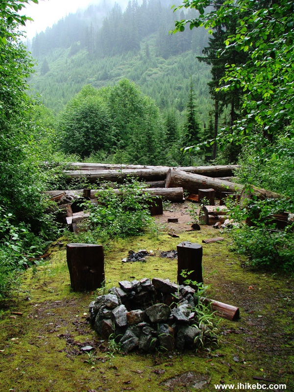
Exploring the area by Harrison East Forest Service Road Province of
British Columbia
45. Right behind that there is a creek, and what appears to be a missing bridge.
46. So, we returned to the split and took the left road. Back in the forest now.
Harrison East FSR
47. There are several small waterfalls on the left side of the road, this being one of them.
48. Approximately 25 minutes after taking the left road, we have reached the most impressive part of the hike - the mountains are all around and waterfalls are everywhere. Here is the best one.
49. The same waterfall from another angle.
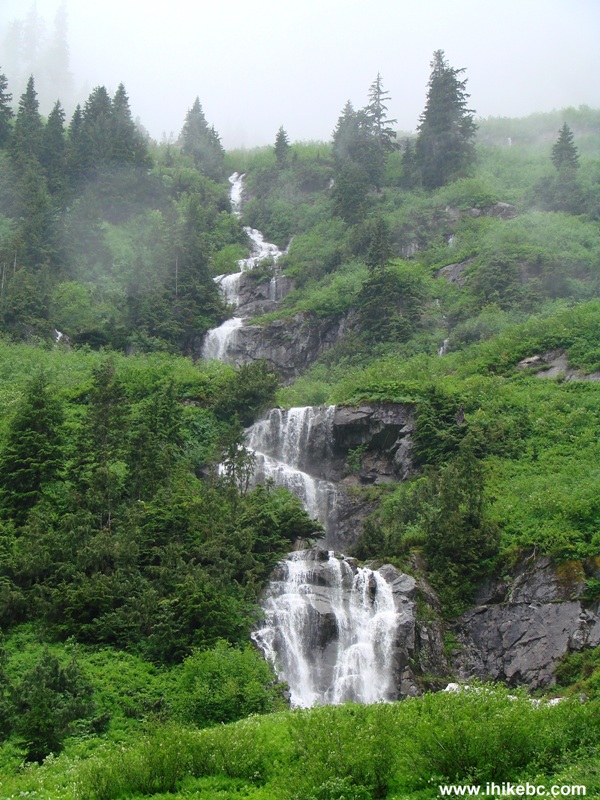
Here is our video of this long waterfall:
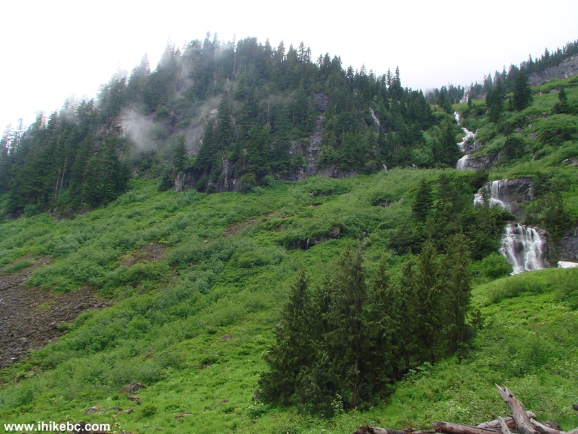
50. How about this mountain - four waterfalls next to each other.
51. One of the four waterfalls.
Here is our video of these four waterfalls:
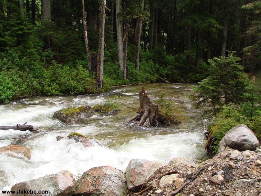
More ihikebc videos are on our YouTube Channel.
52. In this part of the hike, you would need to cross several fairly wide creeks, and, without hiking poles, this task would be very difficult. Eventually, though, you would reach this creek/river, which is too wide to cross without getting your feet wet. So, we stopped right here and went back. Backroad Mapbook showed less than a kilometer of Harrison East FSR remaining.
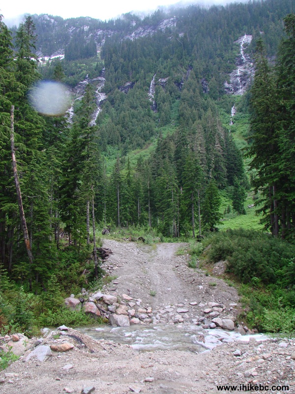
53. Yeah, too wide.

54. But a nice view.
It took us much longer to walk forward while taking all the photos, than to walk back, which took 2.5 hours. If you plan on repeating this hike, budget for 6-7 hours at a fairly brisk pace. This is one of the best hikes we have done, and it comes highly recommended due to an easy road lacking any major grades, and, especially, for the great views it offers.
Big changes for Harrison East - click here for 2015 trip report


|
 |
Other Trips in Harrison Hot Springs Area:
|
|
|
|
|
|
|
|
|
|
|
|


![]()
![]()
![]()
Follow @ihikebc Tweet
ihikebc.com Trip 049 - Harrison East FSR Page 3 of 3