![]()
![]()
![]()

Trip 019 - April 28, 2010 (Wednesday)
The Stawamus Chief Trail Hike
Near Squamish BC
Distance From Vancouver: About 75-80 km via Highway 1 West and Highway 99 North (Sea-To-Sky) - 3.5 km South of Squamish.
Liked: Pleasant hike, views of Shannon Creek along the way, excellent views from the top of the mountain, meeting friendly chipmunks.
Of note: Moderately challenging trail. Hiking poles and boots are recommended. The trail is very popular. Parking could be an issue on busy weekends.
Vancouver, Coast & Mountains Backroad Mapbook (2010 edition) Coordinates: Page 22 (Squamish) C7.
103 Hikes in Southwestern British Columbia (2008 edition): hike #28.
Related Website: Stawamus Chief Provincial Park - BC Parks.
Follow @ihikebc Tweet
The Stawamus Chief is a prominent landmark on BC Highway 99, and is located 3.5 kilometres South of the town of Squamish. The hike to the top of the mountain is moderately challenging, takes about 1.5 hours one way, and is well worth it. The forest itself is quite fine, and roaring Shannon Creek to your right during the first several minutes of the trip is quite picturesque as well. The views of the mountains, the valley, and Howe Sound from the top are simply great.
As this is a very
popular trail, expect numerous fellow hikers, especially on Summer
weekends.
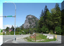
1. We are Southbound on BC Highway 99 (Sea-to-Sky) in Squamish
BC, driving South towards The Stawamus Chief mountain (seen straight ahead), located 3.5 km South of
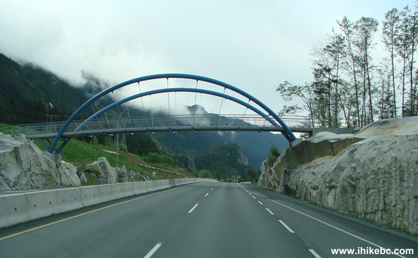
Squamish. 2. Just after this pedestrian bridge, prepare to turn
left. 3. At the entrance to Stawamus Chief Provincial Park. 4. Stawamus Chief Provincial Park has a campground.
The trail to the top of the mountain starts 400 metres from the parking
lots, which are not too big, so parking could be complicated on weekends
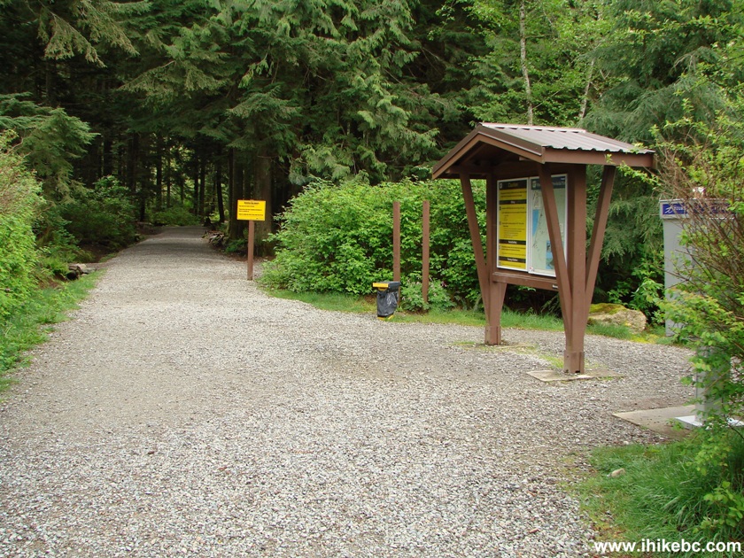
during the busy season. 5. You can check out the map of the park trails at the
information board, and then walk through the campground to the
trailhead. 6. Ahead of you is not a walk in the park. 7. And to ensure that the point above gets through, one has
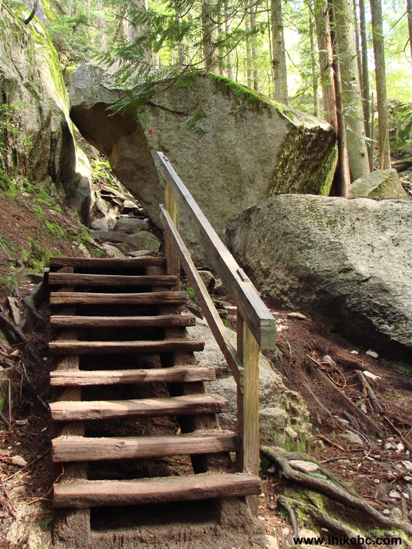
to climb this fairly challenging boulder to reach the stairs at the
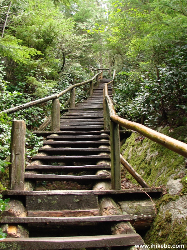
beginning of the trail. 8. Now it's time to climb some stairs. There are
several opportunities to take a few steps to the right and observe a
fine Shannon Creek. 9. Stone steps follow. 10. How about this log stairwell. 11. This is Shannon Creek, which keeps you company for
the first 15-20 minutes of the hike.
Here is our video of Shannon Creek:
More ihikebc.com videos are on
our YouTube Channel.
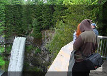
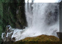
12. In about 30 minutes, you reach an intersection
where a trail to the UPPER Shannon Falls joins the trail you are on. Do
not confuse this trail with the trail to Shannon Falls itself, as the
trail to Shannon Falls itself is below us. If you so desire, you may go
to Shannon Falls on your way back using the Shannon Falls trail (not the
UPPER Shannon Falls trail, though), and then hike a few kilometers North
on Highway 99 to get to your vehicle parked at the Stawamus Chief Provincial
Park. 13. This map clarifies the situation. Look at three
letter P's on the map, referring to parking areas. The upper P is a
parking lot for those who want to climb The Stawamus Chief (this
mountain is very
popular with climbers). The middle P is where we parked at the Stawamus
Chief Provincial Park. And the lowest P is Shannon Falls parking lot.
Also, take a look at the "You Are Here" red dot. This is where the
undeveloped trail to UPPER Shannon Falls begins. The developed trail to
the Shannon Falls and its parking lot is below that (you can easily see
that on the map). You can also see that The Stawamus Chief has three
peaks. Most hikers go to the first peak. We went to the second peak
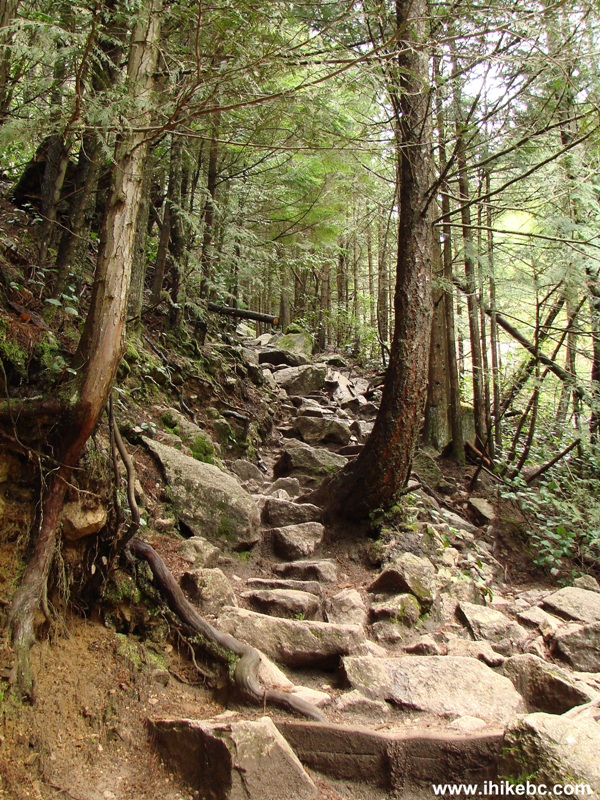
originally, but ended up climbing the first peak from the side. 14. We continued our hike through a fine forest,
meeting with fellow hikers every now and then. 15. Later, we skipped
the turn to the first peak and are now approaching the second peak. 16. At this point, we could not locate the
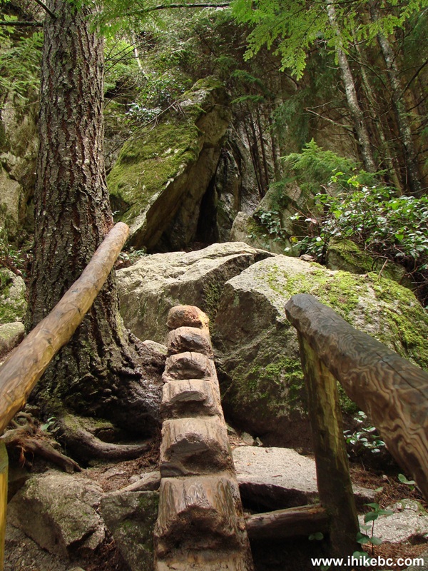
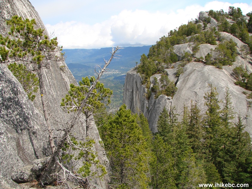
continuation of the trail to the second peak, but, instead, found a way to
climb to the first peak, as we were between these two peaks. 17. Before you climb, check out this warning. The
climb is not too difficult, but, indeed, treacherous. 18. Once you climb up those stairs, you need to
walk up the cliff by using the chains embedded into the rock. 19. A chipmunk was waiting to welcome us to the top of
The Stawamus Chief. 20. Here you can see the first peak on the left, and
the second peak on the right. It takes about 1.5 hours to get to the top
from the trailhead. 21. The views from the top are spectacular, especially
in clear weather. Here you can see downtown Squamish on the left, and
Highway 99 on the right. We are looking North in this photo. The only
unnatural noise at the top is a sound of a siren frequently coming from the
Port of Squamish (it appears). 22. If you decide to have a meal break on top of the
mountain, prepare to be pestered by at least two chipmunks and one
squirrel. This chipmunk jumped on a leg to beg for food.
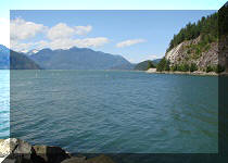
23. Looking South, we see Howe Sound and Highway 99. 24. And a bit to the right we see more of Howe Sound.
The Stawamus Chief is one of the best hikes near Metro Vancouver, and is highly
recommended for great views and a relatively easy path.
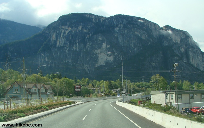
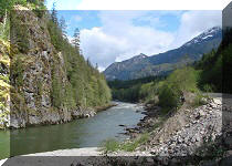
Highway 99 (Sea-to-Sky) near Squamish British Columbia Canada
BC Highway 99 near Stawamus Chief Provincial Park

Stawamus Chief Provincial Park British Columbia Canada
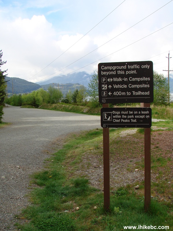
Directional sign to Stawamus Chief Provincial Park campsites - British
Columbia Canada
Stawamus Chief Provincial Park British Columbia Canada

Warning to Stawamus Chief hikers
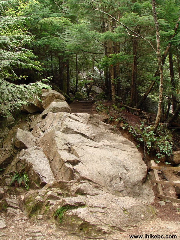
Stawamus Chief trailhead British Columbia Canada
BC Hiking - Stawamus Chief trail - near Squamish BC Canada
Stone steps Stawamus Chief Provincial Park - Hiking in British Columbia Canada
Hiking in BC -
Log stairwell on Stawamus Chief trail near Squamish BC Canada
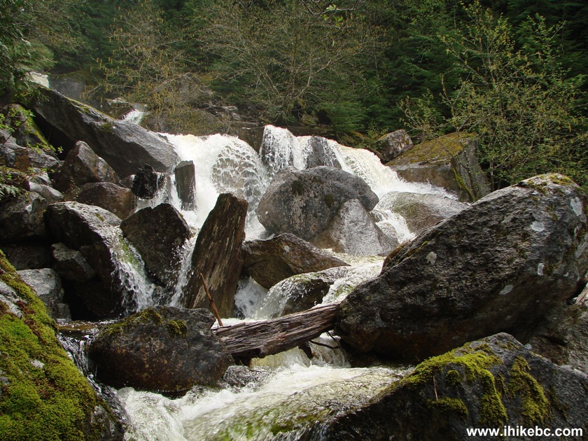
Shannon Creek near Stawamus Chief trail - Hiking in BC
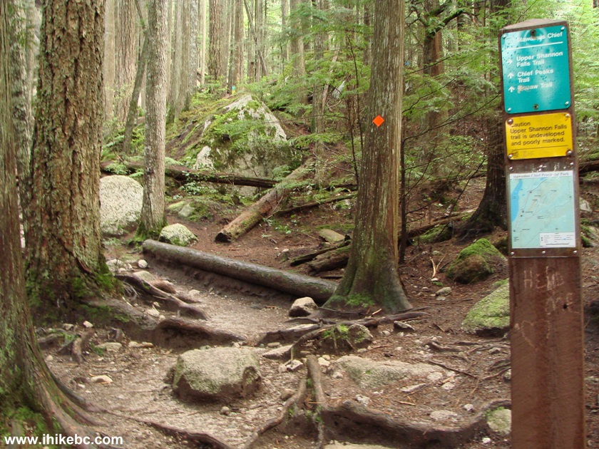
Upper Shannon Falls trailhead in Stawamus Chief Provincial Park British
Columbia Canada
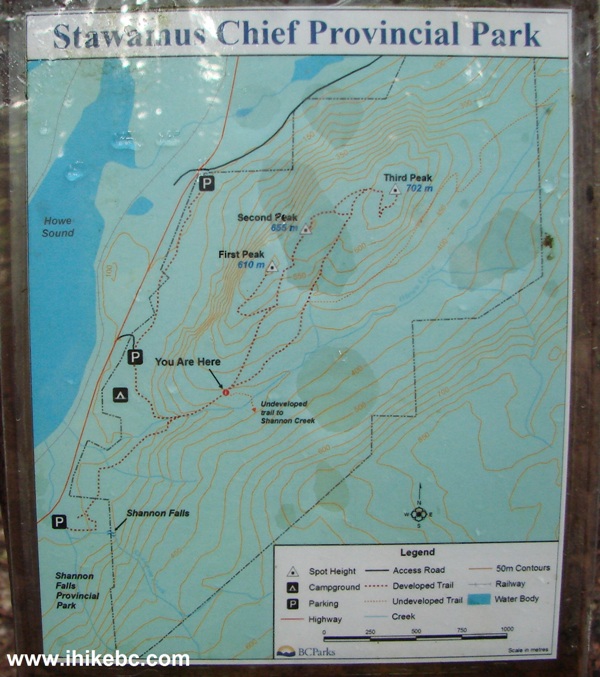
Stawamus Chief trail map
The Stawamus Chief hiking trail near Squamish British Columbia Canada
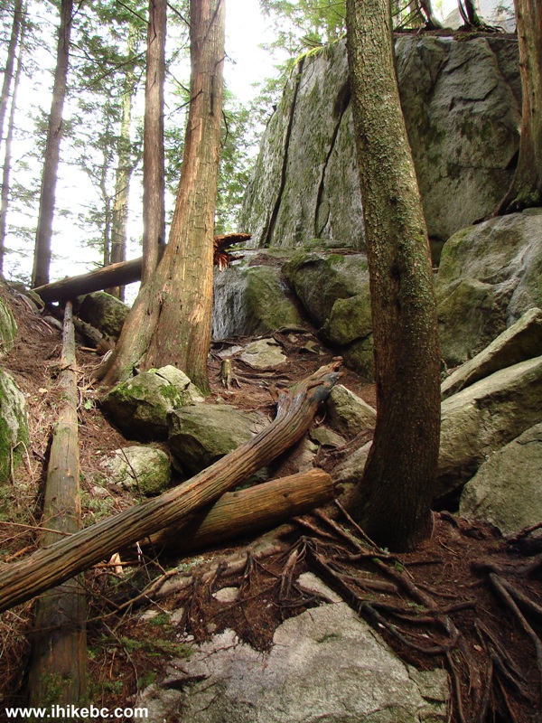
Between the first and second peaks of The Stawamus Chief - Hiking in
Squamish BC Area
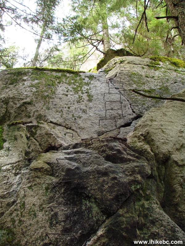
Stairs to climb to the first peak of The Stawamus Chief near Squamish
BC Canada

Climbing warning on the Stawamus Chief Mountain
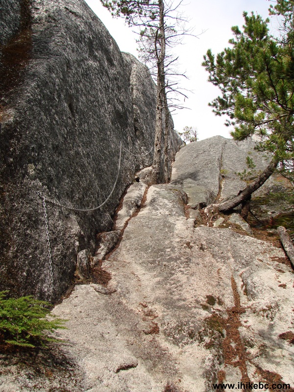
The chains on the Stawamus Chief hiking trail - Squamish BC Area Hiking
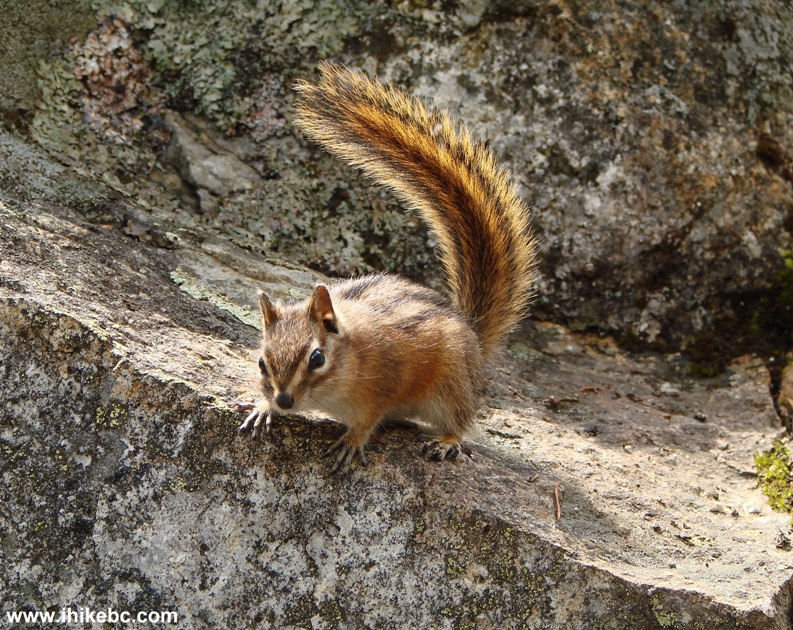
Chipmunk at The Stawamus Chief hiking trail near Squamish British
Columbia Canada
The view of the first and second peaks of The Stawamus Chief BC Canada
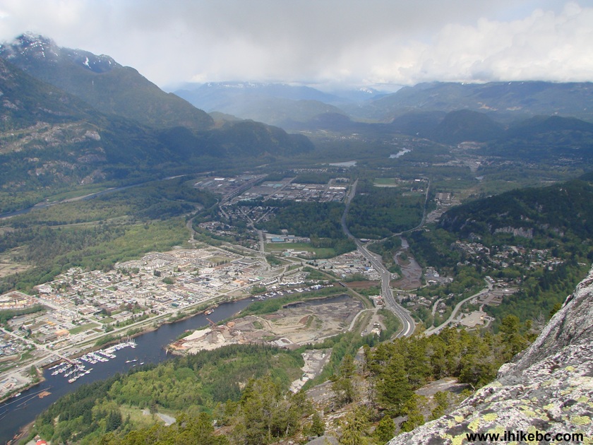
Downtown Squamish BC and Highway 99 seen from The Stawamus Chief
Mountain

Chipmunk begging for food at The Stawamus Chief near Squamish British
Columbia Canada
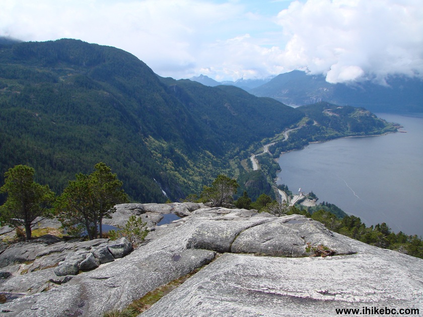
BC Highway 99 and Howe Sound seen from The Stawamus Chief
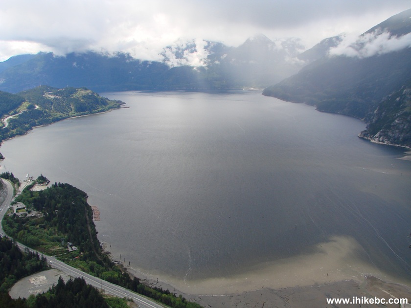
Howe Sound seen from The Stawamus Chief by Squamish BC Canada


|
 |
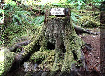
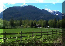
Other Trips in Squamish Area:
|
|
|
|
|
|
|
|
|
|
|
|
|
|
|
|
|
|
|
|
|
|
|


![]()
![]()
![]()
ihikebc.com Trip 019 - The Stawamus Chief Trail Hike (near Squamish BC)